dxstudybuddy✈
What is a flag operation?
[1/50]
[1/50]
Any flight to/from outside the continental (aka contiguous/lower 48) United States
[1/50]
[1/50]
What is a High Minimum Captain?
[2/50]
[2/50]
A captain with fewer than 100 hours in aircraft type
[2/50]
[2/50]
Per § 121.647, what is a dispatcher required to consider, when computing a flight's minimum fuel requirements?
[3/50]
[3/50]
• Wind and other weather conditions forecast
• Anticipated traffic delays
• One instrument approach and possible missed approach at destination
• Any other conditions that may delay landing of the aircraft
[3/50]
• Anticipated traffic delays
• One instrument approach and possible missed approach at destination
• Any other conditions that may delay landing of the aircraft
[3/50]
What is the "1-2-3" rule, per § 121.619?
[4/50]
[4/50]
• 1 hour before or after ETA
• < 2000' ceiling
• < 3 SM visibility
If at any point from 1 hour before ETA to 1 hour after ETA the ceiling is forecasted to be below 2000', or the visibility is forecasted to be below 3 SM, a destination alternate is required to be listed
[4/50]
• < 2000' ceiling
• < 3 SM visibility
If at any point from 1 hour before ETA to 1 hour after ETA the ceiling is forecasted to be below 2000', or the visibility is forecasted to be below 3 SM, a destination alternate is required to be listed
[4/50]
What is a provisional airport?
[5/50]
[5/50]
An airport that is near one that an airline uses as a regular airport, which can be used to continue serving the same community, in the event that the regular airport becomes temporarily unavailable
[5/50]
[5/50]
When is a takeoff/departure alternate required?
[6/50]
[6/50]
When the weather is below plate minimums at the departure airport
[6/50]
[6/50]
What are domestic fuel requirements?
[7/50]
[7/50]
• Trip fuel (origin to destination)
• Fuel to furthest alternate (if applicable)
• Reserve of 45 minutes at normal cruise fuel consumption
[7/50]
• Fuel to furthest alternate (if applicable)
• Reserve of 45 minutes at normal cruise fuel consumption
[7/50]
What are the 4 types of airports found in an airline's Ops Specs?
[8/50]
[8/50]
Regular, refueling, alternate, and provisional
[8/50]
[8/50]
How many consecutive hours must a dispatcher be relieved of all duty during any 7-consecutive-day period?
[9/50]
[9/50]
24
[9/50]
[9/50]
What is an adequate airport?
[10/50]
[10/50]
An airport with all the items needed to service an air carrier's flight, should it be required to land there (runway/taxiway, fueling, ground service equipment, etc.)
[10/50]
[10/50]
Are METAR/TAF winds true or magnetic?
[11/50]
[11/50]
True
[11/50]
[11/50]
What is an FDC NOTAM?
[12/50]
[12/50]
A NOTAM issued by the FAA's Flight Data Center, which identifies changes to published charts and/or procedures
[12/50]
[12/50]
If there are 4 weeks in a month, how many 24-consecutive-hour periods must a dispatcher be relieved of all duty during that month?
[13/50]
[13/50]
4
[13/50]
[13/50]
What is a supplemental operation?
[14/50]
[14/50]
Any unscheduled flight, or one between a city pair that is operated fewer than 5 times per week
[14/50]
[14/50]
Per § 121.189, in order to legally depart an airport, how much visibility is required for an aircraft with 2 engines?
[15/50]
[15/50]
1 SM
[15/50]
[15/50]
What is a suitable airport?
[16/50]
[16/50]
An adequate airport where the weather is at or above plate minimums for landing
[16/50]
[16/50]
Which 3 documents are required to be onboard the aircraft before it can legally depart?
[17/50]
[17/50]
The dispatch release, load manifest, and flight plan (route of flight)
[17/50]
[17/50]
What is a refueling airport?
[18/50]
[18/50]
An airport that an airline uses only for refueling purposes ("gas and go")
[18/50]
[18/50]
What do you do to the plate minimums for a High Minimum Captain at the departure and destination airports?
[19/50]
[19/50]
Add 100' and ½ SM
[19/50]
[19/50]
What are standard alternate minimums for precision approaches?
[20/50]
[20/50]
600-2
[20/50]
[20/50]
What is joint responsibility, and who shares it under § 121.533?
[21/50]
[21/50]
The pilot-in-command and the aircraft dispatcher are jointly responsible (50/50) for the preflight planning, delay, and dispatch release of a flight
[21/50]
[21/50]
Which type of NOTAM is depicted here?

[22/50]
[22/50]
D-NOTAM
[22/50]
When is a driftdown alternate required?
[23/50]
[23/50]
When an aircraft cannot maintain MOCA with one engine inoperative
[23/50]
[23/50]
What do you do to the plate minimums for a High Minimum Captain at any alternate airport?
[24/50]
[24/50]
Increase them to no less than 300-1
[24/50]
[24/50]
Scenario:
For an entire hour before and after ETA, the ceiling is forecasted to be exactly 2000', and the visibility is forecasted to be exactly 3 SM at the destination.
Do you require an alternate?
[25/50]
For an entire hour before and after ETA, the ceiling is forecasted to be exactly 2000', and the visibility is forecasted to be exactly 3 SM at the destination.
Do you require an alternate?
[25/50]
No
[25/50]
[25/50]
What are standard alternate minimums for non-precision approaches?
[26/50]
[26/50]
800-2
[26/50]
[26/50]
What is Operational Control?
[27/50]
[27/50]
Exercising the authority to initiate, conduct, or terminate a flight
[27/50]
[27/50]
Is a loss of communications between the dispatcher and the flightcrew an emergency?
[28/50]
[28/50]
Yes, and everything possible should be attempted to rectify the situation, and reestablish communications
[28/50]
[28/50]
How many consecutive hours can a dispatcher legally be scheduled to work?
[29/50]
[29/50]
10
[29/50]
[29/50]
When converting from true to magnetic, do you add or subtract an east variation?
[30/50]
[30/50]
Subtract
[30/50]
[30/50]
When converting from true to magnetic, do you add or subtract a west variation?
[31/50]
[31/50]
Add
[31/50]
[31/50]
Which type of NOTAM is depicted here?
[32/50]
[32/50]
FDC NOTAM
[32/50]
Are ATIS winds true or magnetic?
[33/50]
[33/50]
Magnetic
[33/50]
[33/50]
What is a domestic operation?
[34/50]
[34/50]
Any flight within the continental (aka contiguous/lower 48) United States
[34/50]
[34/50]
What are flag fuel requirements?
[35/50]
[35/50]
• Trip fuel (origin to destination) + 10%
• Fuel to furthest alternate (if applicable)
• Reserve of 30 minutes at holding speed, at 1500' AGL
[35/50]
• Fuel to furthest alternate (if applicable)
• Reserve of 30 minutes at holding speed, at 1500' AGL
[35/50]
What is a regular airport?
[36/50]
[36/50]
An airport that an airline uses as a regularly-scheduled destination
[36/50]
[36/50]
What information is required to be included in the dispatch release, per § 121.687?
[37/50]
[37/50]
• Minimum fuel
• Airports (origin, destination, alternates, intermediates)
• Trip (flight) and tail (A/C registration) numbers
• Weather package
• IFR flight plan or VFR flight plan
• Signatures of dispatcher and pilot-in-command
[37/50]
• Airports (origin, destination, alternates, intermediates)
• Trip (flight) and tail (A/C registration) numbers
• Weather package
• IFR flight plan or VFR flight plan
• Signatures of dispatcher and pilot-in-command
[37/50]
Can a dispatcher work more than 10 consecutive hours?
[38/50]
[38/50]
Yes, but they cannot be scheduled to work more than 10 consecutive hours
[38/50]
[38/50]
When converting from magnetic to true, do you add or subtract a west variation?
[39/50]
[39/50]
Subtract
[39/50]
[39/50]
What are the 4 stages of a jet engine?
[40/50]
[40/50]
Intake, compression, combustion, and exhaust
[40/50]
[40/50]
What is an alternate airport?
[41/50]
[41/50]
An airport, specified on a flight plan, to which a flight may proceed when a landing at the point of first intended landing becomes inadvisable.
[41/50]
[41/50]
How many hours of rest must a dispatcher receive after working a scheduled 10-hour shift, before they can be scheduled to work again?
[42/50]
[42/50]
8
[42/50]
[42/50]
How long can a flag operation be on the ground at an intermediate stop without requiring a new release?
[43/50]
[43/50]
Not more than 6 hours
[43/50]
[43/50]
How long can a domestic operation be on the ground at an intermediate stop without requiring a new release?
[44/50]
[44/50]
Not more than 1 hour
[44/50]
[44/50]
What is a D-NOTAM?
[45/50]
[45/50]
A distant NOTAM, which identifies issues with physical items located at the issuing airport, i.e., closed runways/taxiways, inoperative NAVAIDs, field lighting conditions, etc.
[45/50]
[45/50]
Per § 121.189, in order to legally depart an airport, how much visibility is required for an aircraft with 3 or more engines?
[46/50]
[46/50]
½ SM
[46/50]
[46/50]
Assuming that visibility is above minimums at the departure airport, when can I legally depart for my destination?
[47/50]
[47/50]
When the visibility at the destination is forecasted to be at or above plate minimums at ETA
[47/50]
[47/50]
What is the pilot-in-command solely responsible for, under § 121.533?
[48/50]
[48/50]
Command of the aircraft and crew, and the safety of the passengers, crewmembers, cargo, and airplane (safety of flight)
[48/50]
[48/50]
When converting from magnetic to true, do you add or subtract an east variation?
[49/50]
[49/50]
Add
[49/50]
[49/50]
What is the dispatcher solely responsible for, under § 121.533?
[50/50]
[50/50]
• Monitoring the progress of each flight
• Issuing necessary information for the safety of the flight
• Cancelling or redispatching a flight if, in his opinion or the opinion of the pilot-in-command, the flight cannot operate or continue to operate safely as planned or released
[50/50]
• Issuing necessary information for the safety of the flight
• Cancelling or redispatching a flight if, in his opinion or the opinion of the pilot-in-command, the flight cannot operate or continue to operate safely as planned or released
[50/50]
✈ ADVANCED » DX RELEASE
What cruise speed is planned after arriving at the DVC VOR, in the following ATC strip:
[1/55]
What cruise speed is planned after arriving at the DVC VOR, in the following ATC strip:
FF KZLAZQZX
(FLP-AL125-IS
-B737/M-SDE2E3GIJ4J7RWZ/LB1D1
-KLAS1315 KONT
-N0454F390 GIDGT1 TUKRR DCT DVC/N0435F390 DCT ICT/N0451F370 DCT YACKS RYYMN2
-KBNA0307 KCHA KBHM
-PBN/A1C1D1L1O1S2T1 NAV/RNVD1E1A1 RNP10 RNP4 DAT/1FANSE2P SUR/260B REG/N700AL EET/KZME0205)
(FLP-AL125-IS
-B737/M-SDE2E3GIJ4J7RWZ/LB1D1
-KLAS1315 KONT
-N0454F390 GIDGT1 TUKRR DCT DVC/N0435F390 DCT ICT/N0451F370 DCT YACKS RYYMN2
-KBNA0307 KCHA KBHM
-PBN/A1C1D1L1O1S2T1 NAV/RNVD1E1A1 RNP10 RNP4 DAT/1FANSE2P SUR/260B REG/N700AL EET/KZME0205)
[1/55]
✈ ADVANCED » DX RELEASE
435 kts
[1/55]
FF KZLAZQZX
(FLP-AL125-IS
-B737/M-SDE2E3GIJ4J7RWZ/LB1D1
-KLAS1315 KONT
-N0454F390 GIDGT1 TUKRR DCT DVC/N0435F390 DCT ICT/N0451F370 DCT YACKS RYYMN2
-KBNA0307 KCHA KBHM
-PBN/A1C1D1L1O1S2T1 NAV/RNVD1E1A1 RNP10 RNP4 DAT/1FANSE2P SUR/260B REG/N700AL EET/KZME0205)
(FLP-AL125-IS
-B737/M-SDE2E3GIJ4J7RWZ/LB1D1
-KLAS1315 KONT
-N0454F390 GIDGT1 TUKRR DCT DVC/N0435F390 DCT ICT/N0451F370 DCT YACKS RYYMN2
-KBNA0307 KCHA KBHM
-PBN/A1C1D1L1O1S2T1 NAV/RNVD1E1A1 RNP10 RNP4 DAT/1FANSE2P SUR/260B REG/N700AL EET/KZME0205)
435 kts
[1/55]
✈ ADVANCED » DX RELEASE
How much time is estimated to have elapsed by the time the flight reaches Memphis Center airspace, in the following ATC strip:
[2/55]
How much time is estimated to have elapsed by the time the flight reaches Memphis Center airspace, in the following ATC strip:
FF KZLAZQZX
(FLP-AL125-IS
-B737/M-SDE2E3GIJ4J7RWZ/LB1D1
-KLAS1315 KONT
-N0454F390 GIDGT1 TUKRR DCT DVC/N0435F390 DCT ICT/N0451F370 DCT YACKS RYYMN2
-KBNA0307 KCHA KBHM
-PBN/A1C1D1L1O1S2T1 NAV/RNVD1E1A1 RNP10 RNP4 DAT/1FANSE2P SUR/260B REG/N700AL EET/KZME0205)
(FLP-AL125-IS
-B737/M-SDE2E3GIJ4J7RWZ/LB1D1
-KLAS1315 KONT
-N0454F390 GIDGT1 TUKRR DCT DVC/N0435F390 DCT ICT/N0451F370 DCT YACKS RYYMN2
-KBNA0307 KCHA KBHM
-PBN/A1C1D1L1O1S2T1 NAV/RNVD1E1A1 RNP10 RNP4 DAT/1FANSE2P SUR/260B REG/N700AL EET/KZME0205)
[2/55]
✈ ADVANCED » DX RELEASE
2 hours, 5 minutes
[2/55]
FF KZLAZQZX
(FLP-AL125-IS
-B737/M-SDE2E3GIJ4J7RWZ/LB1D1
-KLAS1315 KONT
-N0454F390 GIDGT1 TUKRR DCT DVC/N0435F390 DCT ICT/N0451F370 DCT YACKS RYYMN2
-KBNA0307 KCHA KBHM
-PBN/A1C1D1L1O1S2T1 NAV/RNVD1E1A1 RNP10 RNP4 DAT/1FANSE2P SUR/260B REG/N700AL EET/KZME0205)
(FLP-AL125-IS
-B737/M-SDE2E3GIJ4J7RWZ/LB1D1
-KLAS1315 KONT
-N0454F390 GIDGT1 TUKRR DCT DVC/N0435F390 DCT ICT/N0451F370 DCT YACKS RYYMN2
-KBNA0307 KCHA KBHM
-PBN/A1C1D1L1O1S2T1 NAV/RNVD1E1A1 RNP10 RNP4 DAT/1FANSE2P SUR/260B REG/N700AL EET/KZME0205)
2 hours, 5 minutes
[2/55]
✈ ADVANCED » DX RELEASE
What is the aircraft's tail/registration number in the following ATC strip:
[3/55]
What is the aircraft's tail/registration number in the following ATC strip:
FF KZLAZQZX
(FLP-AL125-IS
-B737/M-SDE2E3GIJ4J7RWZ/LB1D1
-KLAS1315 KONT
-N0454F390 GIDGT1 TUKRR DCT DVC/N0435F390 DCT ICT/N0451F370 DCT YACKS RYYMN2
-KBNA0307 KCHA KBHM
-PBN/A1C1D1L1O1S2T1 NAV/RNVD1E1A1 RNP10 RNP4 DAT/1FANSE2P SUR/260B REG/N700AL EET/KZME0205)
(FLP-AL125-IS
-B737/M-SDE2E3GIJ4J7RWZ/LB1D1
-KLAS1315 KONT
-N0454F390 GIDGT1 TUKRR DCT DVC/N0435F390 DCT ICT/N0451F370 DCT YACKS RYYMN2
-KBNA0307 KCHA KBHM
-PBN/A1C1D1L1O1S2T1 NAV/RNVD1E1A1 RNP10 RNP4 DAT/1FANSE2P SUR/260B REG/N700AL EET/KZME0205)
[3/55]
✈ ADVANCED » DX RELEASE
N700AL
[3/55]
FF KZLAZQZX
(FLP-AL125-IS
-B737/M-SDE2E3GIJ4J7RWZ/LB1D1
-KLAS1315 KONT
-N0454F390 GIDGT1 TUKRR DCT DVC/N0435F390 DCT ICT/N0451F370 DCT YACKS RYYMN2
-KBNA0307 KCHA KBHM
-PBN/A1C1D1L1O1S2T1 NAV/RNVD1E1A1 RNP10 RNP4 DAT/1FANSE2P SUR/260B REG/N700AL EET/KZME0205)
(FLP-AL125-IS
-B737/M-SDE2E3GIJ4J7RWZ/LB1D1
-KLAS1315 KONT
-N0454F390 GIDGT1 TUKRR DCT DVC/N0435F390 DCT ICT/N0451F370 DCT YACKS RYYMN2
-KBNA0307 KCHA KBHM
-PBN/A1C1D1L1O1S2T1 NAV/RNVD1E1A1 RNP10 RNP4 DAT/1FANSE2P SUR/260B REG/N700AL EET/KZME0205)
N700AL
[3/55]
✈ ADVANCED » DX RELEASE
What is the trip/flight number in the following ATC strip:
[4/55]
What is the trip/flight number in the following ATC strip:
FF KZLAZQZX
(FLP-AL125-IS
-B737/M-SDE2E3GIJ4J7RWZ/LB1D1
-KLAS1315 KONT
-N0454F390 GIDGT1 TUKRR DCT DVC/N0435F390 DCT ICT/N0451F370 DCT YACKS RYYMN2
-KBNA0307 KCHA KBHM
-PBN/A1C1D1L1O1S2T1 NAV/RNVD1E1A1 RNP10 RNP4 DAT/1FANSE2P SUR/260B REG/N700AL EET/KZME0205)
(FLP-AL125-IS
-B737/M-SDE2E3GIJ4J7RWZ/LB1D1
-KLAS1315 KONT
-N0454F390 GIDGT1 TUKRR DCT DVC/N0435F390 DCT ICT/N0451F370 DCT YACKS RYYMN2
-KBNA0307 KCHA KBHM
-PBN/A1C1D1L1O1S2T1 NAV/RNVD1E1A1 RNP10 RNP4 DAT/1FANSE2P SUR/260B REG/N700AL EET/KZME0205)
[4/55]
✈ ADVANCED » DX RELEASE
AL125
[4/55]
FF KZLAZQZX
(FLP-AL125-IS
-B737/M-SDE2E3GIJ4J7RWZ/LB1D1
-KLAS1315 KONT
-N0454F390 GIDGT1 TUKRR DCT DVC/N0435F390 DCT ICT/N0451F370 DCT YACKS RYYMN2
-KBNA0307 KCHA KBHM
-PBN/A1C1D1L1O1S2T1 NAV/RNVD1E1A1 RNP10 RNP4 DAT/1FANSE2P SUR/260B REG/N700AL EET/KZME0205)
(FLP-AL125-IS
-B737/M-SDE2E3GIJ4J7RWZ/LB1D1
-KLAS1315 KONT
-N0454F390 GIDGT1 TUKRR DCT DVC/N0435F390 DCT ICT/N0451F370 DCT YACKS RYYMN2
-KBNA0307 KCHA KBHM
-PBN/A1C1D1L1O1S2T1 NAV/RNVD1E1A1 RNP10 RNP4 DAT/1FANSE2P SUR/260B REG/N700AL EET/KZME0205)
AL125
[4/55]
✈ ADVANCED » OP SPECS
What is a hard alternate?
[5/55]
What is a hard alternate?
[5/55]
✈ ADVANCED » OP SPECS
An alternate with weather at or above C055 minimums at ETA, with no conditional weather at ETA (or with conditional weather at ETA that is at or above plate minimums)
[5/55]
An alternate with weather at or above C055 minimums at ETA, with no conditional weather at ETA (or with conditional weather at ETA that is at or above plate minimums)
[5/55]
✈ ADVANCED » DX RELEASE
What is the initial cruise speed planned in the following ATC strip:
[6/55]
What is the initial cruise speed planned in the following ATC strip:
FF KZLAZQZX
(FLP-AL125-IS
-B737/M-SDE2E3GIJ4J7RWZ/LB1D1
-KLAS1315 KONT
-N0454F390 GIDGT1 TUKRR DCT DVC/N0435F390 DCT ICT/N0451F370 DCT YACKS RYYMN2
-KBNA0307 KCHA KBHM
-PBN/A1C1D1L1O1S2T1 NAV/RNVD1E1A1 RNP10 RNP4 DAT/1FANSE2P SUR/260B REG/N700AL EET/KZME0205)
(FLP-AL125-IS
-B737/M-SDE2E3GIJ4J7RWZ/LB1D1
-KLAS1315 KONT
-N0454F390 GIDGT1 TUKRR DCT DVC/N0435F390 DCT ICT/N0451F370 DCT YACKS RYYMN2
-KBNA0307 KCHA KBHM
-PBN/A1C1D1L1O1S2T1 NAV/RNVD1E1A1 RNP10 RNP4 DAT/1FANSE2P SUR/260B REG/N700AL EET/KZME0205)
[6/55]
✈ ADVANCED » DX RELEASE
454 kts
[6/55]
FF KZLAZQZX
(FLP-AL125-IS
-B737/M-SDE2E3GIJ4J7RWZ/LB1D1
-KLAS1315 KONT
-N0454F390 GIDGT1 TUKRR DCT DVC/N0435F390 DCT ICT/N0451F370 DCT YACKS RYYMN2
-KBNA0307 KCHA KBHM
-PBN/A1C1D1L1O1S2T1 NAV/RNVD1E1A1 RNP10 RNP4 DAT/1FANSE2P SUR/260B REG/N700AL EET/KZME0205)
(FLP-AL125-IS
-B737/M-SDE2E3GIJ4J7RWZ/LB1D1
-KLAS1315 KONT
-N0454F390 GIDGT1 TUKRR DCT DVC/N0435F390 DCT ICT/N0451F370 DCT YACKS RYYMN2
-KBNA0307 KCHA KBHM
-PBN/A1C1D1L1O1S2T1 NAV/RNVD1E1A1 RNP10 RNP4 DAT/1FANSE2P SUR/260B REG/N700AL EET/KZME0205)
454 kts
[6/55]
✈ ADVANCED » OP SPECS
Assuming you have authorization, what are the best minimums possible when listing an alternate with 1 usable CAT II ILS?
[7/55]
Assuming you have authorization, what are the best minimums possible when listing an alternate with 1 usable CAT II ILS?
[7/55]
✈ ADVANCED » OP SPECS
300-¾ (RVR 4000)
[7/55]
300-¾ (RVR 4000)
[7/55]
✈ ADVANCED » OP SPECS
Which section of an airline's Op Specs lays out the type or types of flights (domestic, flag, etc.) it is authorized to operate?
[8/55]
Which section of an airline's Op Specs lays out the type or types of flights (domestic, flag, etc.) it is authorized to operate?
[8/55]
✈ ADVANCED » OP SPECS
A001
[8/55]
A001
[8/55]
✈ ADVANCED » OP SPECS
Where can nonstandard/lower than standard takeoff minimums be found?
[9/55]
Where can nonstandard/lower than standard takeoff minimums be found?
[9/55]
✈ ADVANCED » OP SPECS
On the Jeppesen -9A (usually the reverse of the airport diagram)
[9/55]
On the Jeppesen -9A (usually the reverse of the airport diagram)
[9/55]
✈ ADVANCED » OP SPECS
At a mainline airline, what allows a dispatcher to send a flight to a destination (or list an alternate) when the conditional weather is below plate (or C055) minimums?
[10/55]
At a mainline airline, what allows a dispatcher to send a flight to a destination (or list an alternate) when the conditional weather is below plate (or C055) minimums?
[10/55]
✈ ADVANCED » OP SPECS
Exemption 20108
[10/55]
Exemption 20108
[10/55]
✈ ADVANCED » MISCELLANEOUS
To what does an RNP value of 4 correspond?
[11/55]
To what does an RNP value of 4 correspond?
[11/55]
✈ ADVANCED » MISCELLANEOUS
Oceanic
[11/55]
Oceanic
[11/55]
✈ ADVANCED » OP SPECS
What are the conditions that must be met to legally dispatch a flight under exemption 20108?
[12/55]
What are the conditions that must be met to legally dispatch a flight under exemption 20108?
[12/55]
✈ ADVANCED » OP SPECS
At the destination:
Prevailing weather must be at or above plate minimums, and conditional visibility must be no less than half of plate minimums
[12/55]
At the destination:
Prevailing weather must be at or above plate minimums, and conditional visibility must be no less than half of plate minimums
[12/55]
✈ ADVANCED » DX RELEASE
Which airports, if any, are listed as destination alternates in the following ATC strip:
[13/55]
Which airports, if any, are listed as destination alternates in the following ATC strip:
FF KZLAZQZX
(FLP-AL125-IS
-B737/M-SDE2E3GIJ4J7RWZ/LB1D1
-KLAS1315 KONT
-N0454F390 GIDGT1 TUKRR DCT DVC/N0435F390 DCT ICT/N0451F370 DCT YACKS RYYMN2
-KBNA0307 KCHA KBHM
-PBN/A1C1D1L1O1S2T1 NAV/RNVD1E1A1 RNP10 RNP4 DAT/1FANSE2P SUR/260B REG/N700AL EET/KZME0205)
(FLP-AL125-IS
-B737/M-SDE2E3GIJ4J7RWZ/LB1D1
-KLAS1315 KONT
-N0454F390 GIDGT1 TUKRR DCT DVC/N0435F390 DCT ICT/N0451F370 DCT YACKS RYYMN2
-KBNA0307 KCHA KBHM
-PBN/A1C1D1L1O1S2T1 NAV/RNVD1E1A1 RNP10 RNP4 DAT/1FANSE2P SUR/260B REG/N700AL EET/KZME0205)
[13/55]
✈ ADVANCED » DX RELEASE
KCHA & KBHM
[13/55]
FF KZLAZQZX
(FLP-AL125-IS
-B737/M-SDE2E3GIJ4J7RWZ/LB1D1
-KLAS1315 KONT
-N0454F390 GIDGT1 TUKRR DCT DVC/N0435F390 DCT ICT/N0451F370 DCT YACKS RYYMN2
-KBNA0307 KCHA KBHM
-PBN/A1C1D1L1O1S2T1 NAV/RNVD1E1A1 RNP10 RNP4 DAT/1FANSE2P SUR/260B REG/N700AL EET/KZME0205)
(FLP-AL125-IS
-B737/M-SDE2E3GIJ4J7RWZ/LB1D1
-KLAS1315 KONT
-N0454F390 GIDGT1 TUKRR DCT DVC/N0435F390 DCT ICT/N0451F370 DCT YACKS RYYMN2
-KBNA0307 KCHA KBHM
-PBN/A1C1D1L1O1S2T1 NAV/RNVD1E1A1 RNP10 RNP4 DAT/1FANSE2P SUR/260B REG/N700AL EET/KZME0205)
KCHA & KBHM
[13/55]
✈ ADVANCED » OP SPECS
Which section of an airline's Op Specs lists the airports to which it is authorized to operate?
[14/55]
Which section of an airline's Op Specs lists the airports to which it is authorized to operate?
[14/55]
✈ ADVANCED » OP SPECS
C070
[14/55]
C070
[14/55]
✈ ADVANCED » OP SPECS
What is another name for C055?
[15/55]
What is another name for C055?
[15/55]
✈ ADVANCED » OP SPECS
The derived alternate rule
[15/55]
The derived alternate rule
[15/55]
✈ ADVANCED » OP SPECS
If only one standard CAT I ILS approach is available and usable at an alternate, what are the best minimums possible, under C055?
[16/55]
If only one standard CAT I ILS approach is available and usable at an alternate, what are the best minimums possible, under C055?
[16/55]
✈ ADVANCED » OP SPECS
600-1½
[16/55]
600-1½
[16/55]
✈ ADVANCED » OP SPECS
What is a soft alternate?
[17/55]
What is a soft alternate?
[17/55]
✈ ADVANCED » OP SPECS
An alternate with prevailing weather at or above C055 minimums at ETA, but with conditional weather at ETA that is below C055 minimums (but not less than half of those minimums)
[17/55]
An alternate with prevailing weather at or above C055 minimums at ETA, but with conditional weather at ETA that is below C055 minimums (but not less than half of those minimums)
[17/55]
✈ ADVANCED » MISCELLANEOUS
To what does an RNP value of 1 correspond?
[18/55]
To what does an RNP value of 1 correspond?
[18/55]
✈ ADVANCED » MISCELLANEOUS
SIDs and STARs
[18/55]
SIDs and STARs
[18/55]
✈ ADVANCED » OP SPECS
Which section of an airline's Op Specs deals with derived alternate minimums?
[19/55]
Which section of an airline's Op Specs deals with derived alternate minimums?
[19/55]
✈ ADVANCED » OP SPECS
C055
[19/55]
C055
[19/55]
✈ ADVANCED » DX RELEASE
What altitude is planned after arriving at the ICT VOR, in the following ATC strip:
[20/55]
What altitude is planned after arriving at the ICT VOR, in the following ATC strip:
FF KZLAZQZX
(FLP-AL125-IS
-B737/M-SDE2E3GIJ4J7RWZ/LB1D1
-KLAS1315 KONT
-N0454F390 GIDGT1 TUKRR DCT DVC/N0435F390 DCT ICT/N0451F370 DCT YACKS RYYMN2
-KBNA0307 KCHA KBHM
-PBN/A1C1D1L1O1S2T1 NAV/RNVD1E1A1 RNP10 RNP4 DAT/1FANSE2P SUR/260B REG/N700AL EET/KZME0205)
(FLP-AL125-IS
-B737/M-SDE2E3GIJ4J7RWZ/LB1D1
-KLAS1315 KONT
-N0454F390 GIDGT1 TUKRR DCT DVC/N0435F390 DCT ICT/N0451F370 DCT YACKS RYYMN2
-KBNA0307 KCHA KBHM
-PBN/A1C1D1L1O1S2T1 NAV/RNVD1E1A1 RNP10 RNP4 DAT/1FANSE2P SUR/260B REG/N700AL EET/KZME0205)
[20/55]
✈ ADVANCED » DX RELEASE
FL370
[20/55]
FF KZLAZQZX
(FLP-AL125-IS
-B737/M-SDE2E3GIJ4J7RWZ/LB1D1
-KLAS1315 KONT
-N0454F390 GIDGT1 TUKRR DCT DVC/N0435F390 DCT ICT/N0451F370 DCT YACKS RYYMN2
-KBNA0307 KCHA KBHM
-PBN/A1C1D1L1O1S2T1 NAV/RNVD1E1A1 RNP10 RNP4 DAT/1FANSE2P SUR/260B REG/N700AL EET/KZME0205)
(FLP-AL125-IS
-B737/M-SDE2E3GIJ4J7RWZ/LB1D1
-KLAS1315 KONT
-N0454F390 GIDGT1 TUKRR DCT DVC/N0435F390 DCT ICT/N0451F370 DCT YACKS RYYMN2
-KBNA0307 KCHA KBHM
-PBN/A1C1D1L1O1S2T1 NAV/RNVD1E1A1 RNP10 RNP4 DAT/1FANSE2P SUR/260B REG/N700AL EET/KZME0205)
FL370
[20/55]
✈ ADVANCED » DX RELEASE
What does "SUR/" mean in the following ATC strip:
[21/55]
What does "SUR/" mean in the following ATC strip:
FF KZLAZQZX
(FLP-AL125-IS
-B737/M-SDE2E3GIJ4J7RWZ/LB1D1
-KLAS1315 KONT
-N0454F390 GIDGT1 TUKRR DCT DVC/N0435F390 DCT ICT/N0451F370 DCT YACKS RYYMN2
-KBNA0307 KCHA KBHM
-PBN/A1C1D1L1O1S2T1 NAV/RNVD1E1A1 RNP10 RNP4 DAT/1FANSE2P SUR/260B REG/N700AL EET/KZME0205)
(FLP-AL125-IS
-B737/M-SDE2E3GIJ4J7RWZ/LB1D1
-KLAS1315 KONT
-N0454F390 GIDGT1 TUKRR DCT DVC/N0435F390 DCT ICT/N0451F370 DCT YACKS RYYMN2
-KBNA0307 KCHA KBHM
-PBN/A1C1D1L1O1S2T1 NAV/RNVD1E1A1 RNP10 RNP4 DAT/1FANSE2P SUR/260B REG/N700AL EET/KZME0205)
[21/55]
✈ ADVANCED » DX RELEASE
The aircraft's additional surveillannce capabilities, not otherwise noted
[21/55]
FF KZLAZQZX
(FLP-AL125-IS
-B737/M-SDE2E3GIJ4J7RWZ/LB1D1
-KLAS1315 KONT
-N0454F390 GIDGT1 TUKRR DCT DVC/N0435F390 DCT ICT/N0451F370 DCT YACKS RYYMN2
-KBNA0307 KCHA KBHM
-PBN/A1C1D1L1O1S2T1 NAV/RNVD1E1A1 RNP10 RNP4 DAT/1FANSE2P SUR/260B REG/N700AL EET/KZME0205)
(FLP-AL125-IS
-B737/M-SDE2E3GIJ4J7RWZ/LB1D1
-KLAS1315 KONT
-N0454F390 GIDGT1 TUKRR DCT DVC/N0435F390 DCT ICT/N0451F370 DCT YACKS RYYMN2
-KBNA0307 KCHA KBHM
-PBN/A1C1D1L1O1S2T1 NAV/RNVD1E1A1 RNP10 RNP4 DAT/1FANSE2P SUR/260B REG/N700AL EET/KZME0205)
The aircraft's additional surveillannce capabilities, not otherwise noted
[21/55]
✈ ADVANCED » DX RELEASE
What is the initial cruise altitude being planned in the following ATC strip:
[22/55]
What is the initial cruise altitude being planned in the following ATC strip:
FF KZLAZQZX
(FLP-AL125-IS
-B737/M-SDE2E3GIJ4J7RWZ/LB1D1
-KLAS1315 KONT
-N0454F390 GIDGT1 TUKRR DCT DVC/N0435F390 DCT ICT/N0451F370 DCT YACKS RYYMN2
-KBNA0307 KCHA KBHM
-PBN/A1C1D1L1O1S2T1 NAV/RNVD1E1A1 RNP10 RNP4 DAT/1FANSE2P SUR/260B REG/N700AL EET/KZME0205)
(FLP-AL125-IS
-B737/M-SDE2E3GIJ4J7RWZ/LB1D1
-KLAS1315 KONT
-N0454F390 GIDGT1 TUKRR DCT DVC/N0435F390 DCT ICT/N0451F370 DCT YACKS RYYMN2
-KBNA0307 KCHA KBHM
-PBN/A1C1D1L1O1S2T1 NAV/RNVD1E1A1 RNP10 RNP4 DAT/1FANSE2P SUR/260B REG/N700AL EET/KZME0205)
[22/55]
✈ ADVANCED » DX RELEASE
FL390
[22/55]
FF KZLAZQZX
(FLP-AL125-IS
-B737/M-SDE2E3GIJ4J7RWZ/LB1D1
-KLAS1315 KONT
-N0454F390 GIDGT1 TUKRR DCT DVC/N0435F390 DCT ICT/N0451F370 DCT YACKS RYYMN2
-KBNA0307 KCHA KBHM
-PBN/A1C1D1L1O1S2T1 NAV/RNVD1E1A1 RNP10 RNP4 DAT/1FANSE2P SUR/260B REG/N700AL EET/KZME0205)
(FLP-AL125-IS
-B737/M-SDE2E3GIJ4J7RWZ/LB1D1
-KLAS1315 KONT
-N0454F390 GIDGT1 TUKRR DCT DVC/N0435F390 DCT ICT/N0451F370 DCT YACKS RYYMN2
-KBNA0307 KCHA KBHM
-PBN/A1C1D1L1O1S2T1 NAV/RNVD1E1A1 RNP10 RNP4 DAT/1FANSE2P SUR/260B REG/N700AL EET/KZME0205)
FL390
[22/55]
✈ ADVANCED » MISCELLANEOUS
To what does an RNP value of 10 correspond?
[23/55]
To what does an RNP value of 10 correspond?
[23/55]
✈ ADVANCED » MISCELLANEOUS
Oceanic
[23/55]
Oceanic
[23/55]
✈ ADVANCED » MISCELLANEOUS
To what does an RNP value of 0.1 to 1 correspond?
[24/55]
To what does an RNP value of 0.1 to 1 correspond?
[24/55]
✈ ADVANCED » MISCELLANEOUS
RNP AR approaches (plates)
[24/55]
RNP AR approaches (plates)
[24/55]
✈ ADVANCED » MISCELLANEOUS
To what does an RNP value of 2 correspond?
[25/55]
To what does an RNP value of 2 correspond?
[25/55]
✈ ADVANCED » MISCELLANEOUS
Enroute/cruise
[25/55]
Enroute/cruise
[25/55]
✈ ADVANCED » DX RELEASE
What does "/LB1D1" mean in the following ATC strip:
[26/55]
What does "/LB1D1" mean in the following ATC strip:
FF KZLAZQZX
(FLP-AL125-IS
-B737/M-SDE2E3GIJ4J7RWZ/LB1D1
-KLAS1315 KONT
-N0454F390 GIDGT1 TUKRR DCT DVC/N0435F390 DCT ICT/N0451F370 DCT YACKS RYYMN2
-KBNA0307 KCHA KBHM
-PBN/A1C1D1L1O1S2T1 NAV/RNVD1E1A1 RNP10 RNP4 DAT/1FANSE2P SUR/260B REG/N700AL EET/KZME0205)
(FLP-AL125-IS
-B737/M-SDE2E3GIJ4J7RWZ/LB1D1
-KLAS1315 KONT
-N0454F390 GIDGT1 TUKRR DCT DVC/N0435F390 DCT ICT/N0451F370 DCT YACKS RYYMN2
-KBNA0307 KCHA KBHM
-PBN/A1C1D1L1O1S2T1 NAV/RNVD1E1A1 RNP10 RNP4 DAT/1FANSE2P SUR/260B REG/N700AL EET/KZME0205)
[26/55]
✈ ADVANCED » DX RELEASE
L: ILS-equipped
B1 & D1: RNAV capabilities
[26/55]
FF KZLAZQZX
(FLP-AL125-IS
-B737/M-SDE2E3GIJ4J7RWZ/LB1D1
-KLAS1315 KONT
-N0454F390 GIDGT1 TUKRR DCT DVC/N0435F390 DCT ICT/N0451F370 DCT YACKS RYYMN2
-KBNA0307 KCHA KBHM
-PBN/A1C1D1L1O1S2T1 NAV/RNVD1E1A1 RNP10 RNP4 DAT/1FANSE2P SUR/260B REG/N700AL EET/KZME0205)
(FLP-AL125-IS
-B737/M-SDE2E3GIJ4J7RWZ/LB1D1
-KLAS1315 KONT
-N0454F390 GIDGT1 TUKRR DCT DVC/N0435F390 DCT ICT/N0451F370 DCT YACKS RYYMN2
-KBNA0307 KCHA KBHM
-PBN/A1C1D1L1O1S2T1 NAV/RNVD1E1A1 RNP10 RNP4 DAT/1FANSE2P SUR/260B REG/N700AL EET/KZME0205)
L: ILS-equipped
B1 & D1: RNAV capabilities
[26/55]
✈ ADVANCED » OP SPECS
Assuming you have authorization, what are the best minimums possible when listing an alternate with 1 usable CAT III ILS?
[27/55]
Assuming you have authorization, what are the best minimums possible when listing an alternate with 1 usable CAT III ILS?
[27/55]
✈ ADVANCED » OP SPECS
200-½ (RVR 1800)
[27/55]
200-½ (RVR 1800)
[27/55]
✈ ADVANCED » OP SPECS
If only one approach is available and/or usable at an alternate, what do you do to the plate minimums when using the derived alternate rule?
[28/55]
If only one approach is available and/or usable at an alternate, what do you do to the plate minimums when using the derived alternate rule?
[28/55]
✈ ADVANCED » OP SPECS
Add 400-1
[28/55]
Add 400-1
[28/55]
✈ ADVANCED » OP SPECS
As a rule of thumb, what ceiling and visibility values do most airlines consider to be "marginal?"
[29/55]
As a rule of thumb, what ceiling and visibility values do most airlines consider to be "marginal?"
[29/55]
✈ ADVANCED » OP SPECS
< 600-2 (below standard alternate minimums for precision approaches)
[29/55]
< 600-2 (below standard alternate minimums for precision approaches)
[29/55]
✈ ADVANCED » OP SPECS
If two approaches are available and usable at an alternate, what do you do to the plate minimums when using the derived alternate rule?
[30/55]
If two approaches are available and usable at an alternate, what do you do to the plate minimums when using the derived alternate rule?
[30/55]
✈ ADVANCED » OP SPECS
Add 200' to the higher DA/HAT, and ½ SM to the higher visibility
[30/55]
Add 200' to the higher DA/HAT, and ½ SM to the higher visibility
[30/55]
✈ ADVANCED » DX RELEASE
What is the aircraft's wake turbulence category, in the following ATC strip:
[31/55]
What is the aircraft's wake turbulence category, in the following ATC strip:
FF KZLAZQZX
(FLP-AL125-IS
-B737/M-SDE2E3GIJ4J7RWZ/LB1D1
-KLAS1315 KONT
-N0454F390 GIDGT1 TUKRR DCT DVC/N0435F390 DCT ICT/N0451F370 DCT YACKS RYYMN2
-KBNA0307 KCHA KBHM
-PBN/A1C1D1L1O1S2T1 NAV/RNVD1E1A1 RNP10 RNP4 DAT/1FANSE2P SUR/260B REG/N700AL EET/KZME0205)
(FLP-AL125-IS
-B737/M-SDE2E3GIJ4J7RWZ/LB1D1
-KLAS1315 KONT
-N0454F390 GIDGT1 TUKRR DCT DVC/N0435F390 DCT ICT/N0451F370 DCT YACKS RYYMN2
-KBNA0307 KCHA KBHM
-PBN/A1C1D1L1O1S2T1 NAV/RNVD1E1A1 RNP10 RNP4 DAT/1FANSE2P SUR/260B REG/N700AL EET/KZME0205)
[31/55]
✈ ADVANCED » DX RELEASE
Medium
[31/55]
FF KZLAZQZX
(FLP-AL125-IS
-B737/M-SDE2E3GIJ4J7RWZ/LB1D1
-KLAS1315 KONT
-N0454F390 GIDGT1 TUKRR DCT DVC/N0435F390 DCT ICT/N0451F370 DCT YACKS RYYMN2
-KBNA0307 KCHA KBHM
-PBN/A1C1D1L1O1S2T1 NAV/RNVD1E1A1 RNP10 RNP4 DAT/1FANSE2P SUR/260B REG/N700AL EET/KZME0205)
(FLP-AL125-IS
-B737/M-SDE2E3GIJ4J7RWZ/LB1D1
-KLAS1315 KONT
-N0454F390 GIDGT1 TUKRR DCT DVC/N0435F390 DCT ICT/N0451F370 DCT YACKS RYYMN2
-KBNA0307 KCHA KBHM
-PBN/A1C1D1L1O1S2T1 NAV/RNVD1E1A1 RNP10 RNP4 DAT/1FANSE2P SUR/260B REG/N700AL EET/KZME0205)
Medium
[31/55]
✈ ADVANCED » DX RELEASE
What is the AFTN address of the originating ARTCC, in the following ATC strip:
[32/55]
What is the AFTN address of the originating ARTCC, in the following ATC strip:
FF KZLAZQZX
(FLP-AL125-IS
-B737/M-SDE2E3GIJ4J7RWZ/LB1D1
-KLAS1315 KONT
-N0454F390 GIDGT1 TUKRR DCT DVC/N0435F390 DCT ICT/N0451F370 DCT YACKS RYYMN2
-KBNA0307 KCHA KBHM
-PBN/A1C1D1L1O1S2T1 NAV/RNVD1E1A1 RNP10 RNP4 DAT/1FANSE2P SUR/260B REG/N700AL EET/KZME0205)
(FLP-AL125-IS
-B737/M-SDE2E3GIJ4J7RWZ/LB1D1
-KLAS1315 KONT
-N0454F390 GIDGT1 TUKRR DCT DVC/N0435F390 DCT ICT/N0451F370 DCT YACKS RYYMN2
-KBNA0307 KCHA KBHM
-PBN/A1C1D1L1O1S2T1 NAV/RNVD1E1A1 RNP10 RNP4 DAT/1FANSE2P SUR/260B REG/N700AL EET/KZME0205)
[32/55]
✈ ADVANCED » DX RELEASE
KZLAZQZX (Los Angeles Center)
[32/55]
FF KZLAZQZX
(FLP-AL125-IS
-B737/M-SDE2E3GIJ4J7RWZ/LB1D1
-KLAS1315 KONT
-N0454F390 GIDGT1 TUKRR DCT DVC/N0435F390 DCT ICT/N0451F370 DCT YACKS RYYMN2
-KBNA0307 KCHA KBHM
-PBN/A1C1D1L1O1S2T1 NAV/RNVD1E1A1 RNP10 RNP4 DAT/1FANSE2P SUR/260B REG/N700AL EET/KZME0205)
(FLP-AL125-IS
-B737/M-SDE2E3GIJ4J7RWZ/LB1D1
-KLAS1315 KONT
-N0454F390 GIDGT1 TUKRR DCT DVC/N0435F390 DCT ICT/N0451F370 DCT YACKS RYYMN2
-KBNA0307 KCHA KBHM
-PBN/A1C1D1L1O1S2T1 NAV/RNVD1E1A1 RNP10 RNP4 DAT/1FANSE2P SUR/260B REG/N700AL EET/KZME0205)
KZLAZQZX (Los Angeles Center)
[32/55]
✈ ADVANCED » DX RELEASE
What cruise speed is planned after arriving at the ICT VOR, in the following ATC strip:
[33/55]
What cruise speed is planned after arriving at the ICT VOR, in the following ATC strip:
FF KZLAZQZX
(FLP-AL125-IS
-B737/M-SDE2E3GIJ4J7RWZ/LB1D1
-KLAS1315 KONT
-N0454F390 GIDGT1 TUKRR DCT DVC/N0435F390 DCT ICT/N0451F370 DCT YACKS RYYMN2
-KBNA0307 KCHA KBHM
-PBN/A1C1D1L1O1S2T1 NAV/RNVD1E1A1 RNP10 RNP4 DAT/1FANSE2P SUR/260B REG/N700AL EET/KZME0205)
(FLP-AL125-IS
-B737/M-SDE2E3GIJ4J7RWZ/LB1D1
-KLAS1315 KONT
-N0454F390 GIDGT1 TUKRR DCT DVC/N0435F390 DCT ICT/N0451F370 DCT YACKS RYYMN2
-KBNA0307 KCHA KBHM
-PBN/A1C1D1L1O1S2T1 NAV/RNVD1E1A1 RNP10 RNP4 DAT/1FANSE2P SUR/260B REG/N700AL EET/KZME0205)
[33/55]
✈ ADVANCED » DX RELEASE
451 kts
[33/55]
FF KZLAZQZX
(FLP-AL125-IS
-B737/M-SDE2E3GIJ4J7RWZ/LB1D1
-KLAS1315 KONT
-N0454F390 GIDGT1 TUKRR DCT DVC/N0435F390 DCT ICT/N0451F370 DCT YACKS RYYMN2
-KBNA0307 KCHA KBHM
-PBN/A1C1D1L1O1S2T1 NAV/RNVD1E1A1 RNP10 RNP4 DAT/1FANSE2P SUR/260B REG/N700AL EET/KZME0205)
(FLP-AL125-IS
-B737/M-SDE2E3GIJ4J7RWZ/LB1D1
-KLAS1315 KONT
-N0454F390 GIDGT1 TUKRR DCT DVC/N0435F390 DCT ICT/N0451F370 DCT YACKS RYYMN2
-KBNA0307 KCHA KBHM
-PBN/A1C1D1L1O1S2T1 NAV/RNVD1E1A1 RNP10 RNP4 DAT/1FANSE2P SUR/260B REG/N700AL EET/KZME0205)
451 kts
[33/55]
✈ ADVANCED » DX RELEASE
Is IFR or VFR being planned in the following ATC strip:
[34/55]
Is IFR or VFR being planned in the following ATC strip:
FF KZLAZQZX
(FLP-AL125-IS
-B737/M-SDE2E3GIJ4J7RWZ/LB1D1
-KLAS1315 KONT
-N0454F390 GIDGT1 TUKRR DCT DVC/N0435F390 DCT ICT/N0451F370 DCT YACKS RYYMN2
-KBNA0307 KCHA KBHM
-PBN/A1C1D1L1O1S2T1 NAV/RNVD1E1A1 RNP10 RNP4 DAT/1FANSE2P SUR/260B REG/N700AL EET/KZME0205)
(FLP-AL125-IS
-B737/M-SDE2E3GIJ4J7RWZ/LB1D1
-KLAS1315 KONT
-N0454F390 GIDGT1 TUKRR DCT DVC/N0435F390 DCT ICT/N0451F370 DCT YACKS RYYMN2
-KBNA0307 KCHA KBHM
-PBN/A1C1D1L1O1S2T1 NAV/RNVD1E1A1 RNP10 RNP4 DAT/1FANSE2P SUR/260B REG/N700AL EET/KZME0205)
[34/55]
✈ ADVANCED » DX RELEASE
IFR
[34/55]
FF KZLAZQZX
(FLP-AL125-IS
-B737/M-SDE2E3GIJ4J7RWZ/LB1D1
-KLAS1315 KONT
-N0454F390 GIDGT1 TUKRR DCT DVC/N0435F390 DCT ICT/N0451F370 DCT YACKS RYYMN2
-KBNA0307 KCHA KBHM
-PBN/A1C1D1L1O1S2T1 NAV/RNVD1E1A1 RNP10 RNP4 DAT/1FANSE2P SUR/260B REG/N700AL EET/KZME0205)
(FLP-AL125-IS
-B737/M-SDE2E3GIJ4J7RWZ/LB1D1
-KLAS1315 KONT
-N0454F390 GIDGT1 TUKRR DCT DVC/N0435F390 DCT ICT/N0451F370 DCT YACKS RYYMN2
-KBNA0307 KCHA KBHM
-PBN/A1C1D1L1O1S2T1 NAV/RNVD1E1A1 RNP10 RNP4 DAT/1FANSE2P SUR/260B REG/N700AL EET/KZME0205)
IFR
[34/55]
✈ ADVANCED » MISCELLANEOUS
To what does an RNP value of 0.3 to 1 correspond?
[35/55]
To what does an RNP value of 0.3 to 1 correspond?
[35/55]
✈ ADVANCED » MISCELLANEOUS
RNP approaches (plates)
[35/55]
RNP approaches (plates)
[35/55]
✈ ADVANCED » MISCELLANEOUS
When does a flight require 2 alternates?
[36/55]
When does a flight require 2 alternates?
[36/55]
✈ ADVANCED » MISCELLANEOUS
• When released under exemption 20108/17347
• When weather at destination and first alternate is marginal
• When first alternate is soft
[36/55]
• When released under exemption 20108/17347
• When weather at destination and first alternate is marginal
• When first alternate is soft
[36/55]
✈ ADVANCED » DX RELEASE
Which airports, if any, are listed as takeoff alternates in the following ATC strip:
[37/55]
Which airports, if any, are listed as takeoff alternates in the following ATC strip:
FF KZLAZQZX
(FLP-AL125-IS
-B737/M-SDE2E3GIJ4J7RWZ/LB1D1
-KLAS1315 KONT
-N0454F390 GIDGT1 TUKRR DCT DVC/N0435F390 DCT ICT/N0451F370 DCT YACKS RYYMN2
-KBNA0307 KCHA KBHM
-PBN/A1C1D1L1O1S2T1 NAV/RNVD1E1A1 RNP10 RNP4 DAT/1FANSE2P SUR/260B REG/N700AL EET/KZME0205)
(FLP-AL125-IS
-B737/M-SDE2E3GIJ4J7RWZ/LB1D1
-KLAS1315 KONT
-N0454F390 GIDGT1 TUKRR DCT DVC/N0435F390 DCT ICT/N0451F370 DCT YACKS RYYMN2
-KBNA0307 KCHA KBHM
-PBN/A1C1D1L1O1S2T1 NAV/RNVD1E1A1 RNP10 RNP4 DAT/1FANSE2P SUR/260B REG/N700AL EET/KZME0205)
[37/55]
✈ ADVANCED » DX RELEASE
KONT
[37/55]
FF KZLAZQZX
(FLP-AL125-IS
-B737/M-SDE2E3GIJ4J7RWZ/LB1D1
-KLAS1315 KONT
-N0454F390 GIDGT1 TUKRR DCT DVC/N0435F390 DCT ICT/N0451F370 DCT YACKS RYYMN2
-KBNA0307 KCHA KBHM
-PBN/A1C1D1L1O1S2T1 NAV/RNVD1E1A1 RNP10 RNP4 DAT/1FANSE2P SUR/260B REG/N700AL EET/KZME0205)
(FLP-AL125-IS
-B737/M-SDE2E3GIJ4J7RWZ/LB1D1
-KLAS1315 KONT
-N0454F390 GIDGT1 TUKRR DCT DVC/N0435F390 DCT ICT/N0451F370 DCT YACKS RYYMN2
-KBNA0307 KCHA KBHM
-PBN/A1C1D1L1O1S2T1 NAV/RNVD1E1A1 RNP10 RNP4 DAT/1FANSE2P SUR/260B REG/N700AL EET/KZME0205)
KONT
[37/55]
✈ ADVANCED » DX RELEASE
What does "DAT/" mean in the following ATC strip:
[38/55]
What does "DAT/" mean in the following ATC strip:
FF KZLAZQZX
(FLP-AL125-IS
-B737/M-SDE2E3GIJ4J7RWZ/LB1D1
-KLAS1315 KONT
-N0454F390 GIDGT1 TUKRR DCT DVC/N0435F390 DCT ICT/N0451F370 DCT YACKS RYYMN2
-KBNA0307 KCHA KBHM
-PBN/A1C1D1L1O1S2T1 NAV/RNVD1E1A1 RNP10 RNP4 DAT/1FANSE2P SUR/260B REG/N700AL EET/KZME0205)
(FLP-AL125-IS
-B737/M-SDE2E3GIJ4J7RWZ/LB1D1
-KLAS1315 KONT
-N0454F390 GIDGT1 TUKRR DCT DVC/N0435F390 DCT ICT/N0451F370 DCT YACKS RYYMN2
-KBNA0307 KCHA KBHM
-PBN/A1C1D1L1O1S2T1 NAV/RNVD1E1A1 RNP10 RNP4 DAT/1FANSE2P SUR/260B REG/N700AL EET/KZME0205)
[38/55]
✈ ADVANCED » DX RELEASE
The aircraft's additional data capabilities, not otherwise noted
[38/55]
FF KZLAZQZX
(FLP-AL125-IS
-B737/M-SDE2E3GIJ4J7RWZ/LB1D1
-KLAS1315 KONT
-N0454F390 GIDGT1 TUKRR DCT DVC/N0435F390 DCT ICT/N0451F370 DCT YACKS RYYMN2
-KBNA0307 KCHA KBHM
-PBN/A1C1D1L1O1S2T1 NAV/RNVD1E1A1 RNP10 RNP4 DAT/1FANSE2P SUR/260B REG/N700AL EET/KZME0205)
(FLP-AL125-IS
-B737/M-SDE2E3GIJ4J7RWZ/LB1D1
-KLAS1315 KONT
-N0454F390 GIDGT1 TUKRR DCT DVC/N0435F390 DCT ICT/N0451F370 DCT YACKS RYYMN2
-KBNA0307 KCHA KBHM
-PBN/A1C1D1L1O1S2T1 NAV/RNVD1E1A1 RNP10 RNP4 DAT/1FANSE2P SUR/260B REG/N700AL EET/KZME0205)
The aircraft's additional data capabilities, not otherwise noted
[38/55]
✈ ADVANCED » OP SPECS
When determining whether or not it is legal to dispatch a flight to the destination, which weather factor or factors are controlling?
[39/55]
When determining whether or not it is legal to dispatch a flight to the destination, which weather factor or factors are controlling?
[39/55]
✈ ADVANCED » OP SPECS
Visibility
[39/55]
Visibility
[39/55]
✈ ADVANCED » DX RELEASE
What does "NAV/RNVD1E1A1" mean in the following ATC strip:
[40/55]
What does "NAV/RNVD1E1A1" mean in the following ATC strip:
FF KZLAZQZX
(FLP-AL125-IS
-B737/M-SDE2E3GIJ4J7RWZ/LB1D1
-KLAS1315 KONT
-N0454F390 GIDGT1 TUKRR DCT DVC/N0435F390 DCT ICT/N0451F370 DCT YACKS RYYMN2
-KBNA0307 KCHA KBHM
-PBN/A1C1D1L1O1S2T1 NAV/RNVD1E1A1 RNP10 RNP4 DAT/1FANSE2P SUR/260B REG/N700AL EET/KZME0205)
(FLP-AL125-IS
-B737/M-SDE2E3GIJ4J7RWZ/LB1D1
-KLAS1315 KONT
-N0454F390 GIDGT1 TUKRR DCT DVC/N0435F390 DCT ICT/N0451F370 DCT YACKS RYYMN2
-KBNA0307 KCHA KBHM
-PBN/A1C1D1L1O1S2T1 NAV/RNVD1E1A1 RNP10 RNP4 DAT/1FANSE2P SUR/260B REG/N700AL EET/KZME0205)
[40/55]
✈ ADVANCED » DX RELEASE
The flight is planned with an RNAV SID, Q-routes and/or directs enroute, and an RNAV STAR
[40/55]
FF KZLAZQZX
(FLP-AL125-IS
-B737/M-SDE2E3GIJ4J7RWZ/LB1D1
-KLAS1315 KONT
-N0454F390 GIDGT1 TUKRR DCT DVC/N0435F390 DCT ICT/N0451F370 DCT YACKS RYYMN2
-KBNA0307 KCHA KBHM
-PBN/A1C1D1L1O1S2T1 NAV/RNVD1E1A1 RNP10 RNP4 DAT/1FANSE2P SUR/260B REG/N700AL EET/KZME0205)
(FLP-AL125-IS
-B737/M-SDE2E3GIJ4J7RWZ/LB1D1
-KLAS1315 KONT
-N0454F390 GIDGT1 TUKRR DCT DVC/N0435F390 DCT ICT/N0451F370 DCT YACKS RYYMN2
-KBNA0307 KCHA KBHM
-PBN/A1C1D1L1O1S2T1 NAV/RNVD1E1A1 RNP10 RNP4 DAT/1FANSE2P SUR/260B REG/N700AL EET/KZME0205)
The flight is planned with an RNAV SID, Q-routes and/or directs enroute, and an RNAV STAR
[40/55]
✈ ADVANCED » OP SPECS
Assuming all requirements are met, what is the lowest visibility in which a flight could still be legal to depart?
[41/55]
Assuming all requirements are met, what is the lowest visibility in which a flight could still be legal to depart?
[41/55]
✈ ADVANCED » OP SPECS
300 RVR
[41/55]
300 RVR
[41/55]
✈ ADVANCED » OP SPECS
Which 2 things are required for there to be 2 approaches at an alternate, under C055?
[42/55]
Which 2 things are required for there to be 2 approaches at an alternate, under C055?
[42/55]
✈ ADVANCED » OP SPECS
• 2 unique NAVAID IDs
• 2 runways (can be a single strip of pavement, with an approach to each end)
[42/55]
• 2 unique NAVAID IDs
• 2 runways (can be a single strip of pavement, with an approach to each end)
[42/55]
✈ ADVANCED » OP SPECS
What makes an approach usable, when using it to derive alternate minimums, under C055?
[43/55]
What makes an approach usable, when using it to derive alternate minimums, under C055?
[43/55]
✈ ADVANCED » OP SPECS
• Meets or exceeds performance requirements of the aircraft to be flying the approach
• Not precluded from use by any active NOTAM
[43/55]
• Meets or exceeds performance requirements of the aircraft to be flying the approach
• Not precluded from use by any active NOTAM
[43/55]
✈ ADVANCED » OP SPECS
When releasing a flight under exemption 20108/17347, how many alternates are required, and of what type?
[44/55]
When releasing a flight under exemption 20108/17347, how many alternates are required, and of what type?
[44/55]
✈ ADVANCED » OP SPECS
2:
2 hard alternates
or
1 hard alternate and 1 soft alternate
[44/55]
2:
2 hard alternates
or
1 hard alternate and 1 soft alternate
[44/55]
✈ ADVANCED » DX RELEASE
What does "SDE2E3GIJ4J7RWZ" mean in the following ATC strip:
[45/55]
What does "SDE2E3GIJ4J7RWZ" mean in the following ATC strip:
FF KZLAZQZX
(FLP-AL125-IS
-B737/M-SDE2E3GIJ4J7RWZ/LB1D1
-KLAS1315 KONT
-N0454F390 GIDGT1 TUKRR DCT DVC/N0435F390 DCT ICT/N0451F370 DCT YACKS RYYMN2
-KBNA0307 KCHA KBHM
-PBN/A1C1D1L1O1S2T1 NAV/RNVD1E1A1 RNP10 RNP4 DAT/1FANSE2P SUR/260B REG/N700AL EET/KZME0205)
(FLP-AL125-IS
-B737/M-SDE2E3GIJ4J7RWZ/LB1D1
-KLAS1315 KONT
-N0454F390 GIDGT1 TUKRR DCT DVC/N0435F390 DCT ICT/N0451F370 DCT YACKS RYYMN2
-KBNA0307 KCHA KBHM
-PBN/A1C1D1L1O1S2T1 NAV/RNVD1E1A1 RNP10 RNP4 DAT/1FANSE2P SUR/260B REG/N700AL EET/KZME0205)
[45/55]
✈ ADVANCED » DX RELEASE
S: transponder
D: DME
E2 & E3: ACARS
G: GNSS/GPS
I: INS
J4 & J7: CPDLC
R: PBN
W: RVSM
Z: additional equipment installed
[45/55]
FF KZLAZQZX
(FLP-AL125-IS
-B737/M-SDE2E3GIJ4J7RWZ/LB1D1
-KLAS1315 KONT
-N0454F390 GIDGT1 TUKRR DCT DVC/N0435F390 DCT ICT/N0451F370 DCT YACKS RYYMN2
-KBNA0307 KCHA KBHM
-PBN/A1C1D1L1O1S2T1 NAV/RNVD1E1A1 RNP10 RNP4 DAT/1FANSE2P SUR/260B REG/N700AL EET/KZME0205)
(FLP-AL125-IS
-B737/M-SDE2E3GIJ4J7RWZ/LB1D1
-KLAS1315 KONT
-N0454F390 GIDGT1 TUKRR DCT DVC/N0435F390 DCT ICT/N0451F370 DCT YACKS RYYMN2
-KBNA0307 KCHA KBHM
-PBN/A1C1D1L1O1S2T1 NAV/RNVD1E1A1 RNP10 RNP4 DAT/1FANSE2P SUR/260B REG/N700AL EET/KZME0205)
S: transponder
D: DME
E2 & E3: ACARS
G: GNSS/GPS
I: INS
J4 & J7: CPDLC
R: PBN
W: RVSM
Z: additional equipment installed
[45/55]
✈ ADVANCED » OP SPECS
When listing an airport as a soft alternate, which weather factor or factors must be no less than half of C055 minimums?
[46/55]
When listing an airport as a soft alternate, which weather factor or factors must be no less than half of C055 minimums?
[46/55]
✈ ADVANCED » OP SPECS
Conditional ceiling and visibility
[46/55]
Conditional ceiling and visibility
[46/55]
✈ ADVANCED » OP SPECS
At a regional airline, what allows a dispatcher to send a flight to a destination (or list an alternate) when the conditional weather is below plate (or C055) minimums?
[47/55]
At a regional airline, what allows a dispatcher to send a flight to a destination (or list an alternate) when the conditional weather is below plate (or C055) minimums?
[47/55]
✈ ADVANCED » OP SPECS
Exemption 17347
[47/55]
Exemption 17347
[47/55]
✈ ADVANCED » DX RELEASE
What is required to be noted at the top of a dispatch release for a flight dispatched under exemption 20108?
[48/55]
What is required to be noted at the top of a dispatch release for a flight dispatched under exemption 20108?
[48/55]
✈ ADVANCED » DX RELEASE
"RELEASED UNDER EXEMPTION 20108"
[48/55]
"RELEASED UNDER EXEMPTION 20108"
[48/55]
✈ ADVANCED » OP SPECS
What are the best CAT I alternate minimums possible, under C055?
[49/55]
What are the best CAT I alternate minimums possible, under C055?
[49/55]
✈ ADVANCED » OP SPECS
400-1
[49/55]
400-1
[49/55]
✈ ADVANCED » DX RELEASE
What is the estimated flight time between KLAS and KBNA, in the following ATC strip:
[50/55]
What is the estimated flight time between KLAS and KBNA, in the following ATC strip:
FF KZLAZQZX
(FLP-AL125-IS
-B737/M-SDE2E3GIJ4J7RWZ/LB1D1
-KLAS1315 KONT
-N0454F390 GIDGT1 TUKRR DCT DVC/N0435F390 DCT ICT/N0451F370 DCT YACKS RYYMN2
-KBNA0307 KCHA KBHM
-PBN/A1C1D1L1O1S2T1 NAV/RNVD1E1A1 RNP10 RNP4 DAT/1FANSE2P SUR/260B REG/N700AL EET/KZME0205)
(FLP-AL125-IS
-B737/M-SDE2E3GIJ4J7RWZ/LB1D1
-KLAS1315 KONT
-N0454F390 GIDGT1 TUKRR DCT DVC/N0435F390 DCT ICT/N0451F370 DCT YACKS RYYMN2
-KBNA0307 KCHA KBHM
-PBN/A1C1D1L1O1S2T1 NAV/RNVD1E1A1 RNP10 RNP4 DAT/1FANSE2P SUR/260B REG/N700AL EET/KZME0205)
[50/55]
✈ ADVANCED » DX RELEASE
3 hours, 7 minutes
[50/55]
FF KZLAZQZX
(FLP-AL125-IS
-B737/M-SDE2E3GIJ4J7RWZ/LB1D1
-KLAS1315 KONT
-N0454F390 GIDGT1 TUKRR DCT DVC/N0435F390 DCT ICT/N0451F370 DCT YACKS RYYMN2
-KBNA0307 KCHA KBHM
-PBN/A1C1D1L1O1S2T1 NAV/RNVD1E1A1 RNP10 RNP4 DAT/1FANSE2P SUR/260B REG/N700AL EET/KZME0205)
(FLP-AL125-IS
-B737/M-SDE2E3GIJ4J7RWZ/LB1D1
-KLAS1315 KONT
-N0454F390 GIDGT1 TUKRR DCT DVC/N0435F390 DCT ICT/N0451F370 DCT YACKS RYYMN2
-KBNA0307 KCHA KBHM
-PBN/A1C1D1L1O1S2T1 NAV/RNVD1E1A1 RNP10 RNP4 DAT/1FANSE2P SUR/260B REG/N700AL EET/KZME0205)
3 hours, 7 minutes
[50/55]
✈ ADVANCED » DX RELEASE
Is the flight listed in the following ATC strip scheduled or unscheduled?
[51/55]
Is the flight listed in the following ATC strip scheduled or unscheduled?
FF KZLAZQZX
(FLP-AL125-IS
-B737/M-SDE2E3GIJ4J7RWZ/LB1D1
-KLAS1315 KONT
-N0454F390 GIDGT1 TUKRR DCT DVC/N0435F390 DCT ICT/N0451F370 DCT YACKS RYYMN2
-KBNA0307 KCHA KBHM
-PBN/A1C1D1L1O1S2T1 NAV/RNVD1E1A1 RNP10 RNP4 DAT/1FANSE2P SUR/260B REG/N700AL EET/KZME0205)
(FLP-AL125-IS
-B737/M-SDE2E3GIJ4J7RWZ/LB1D1
-KLAS1315 KONT
-N0454F390 GIDGT1 TUKRR DCT DVC/N0435F390 DCT ICT/N0451F370 DCT YACKS RYYMN2
-KBNA0307 KCHA KBHM
-PBN/A1C1D1L1O1S2T1 NAV/RNVD1E1A1 RNP10 RNP4 DAT/1FANSE2P SUR/260B REG/N700AL EET/KZME0205)
[51/55]
✈ ADVANCED » DX RELEASE
Scheduled
[51/55]
FF KZLAZQZX
(FLP-AL125-IS
-B737/M-SDE2E3GIJ4J7RWZ/LB1D1
-KLAS1315 KONT
-N0454F390 GIDGT1 TUKRR DCT DVC/N0435F390 DCT ICT/N0451F370 DCT YACKS RYYMN2
-KBNA0307 KCHA KBHM
-PBN/A1C1D1L1O1S2T1 NAV/RNVD1E1A1 RNP10 RNP4 DAT/1FANSE2P SUR/260B REG/N700AL EET/KZME0205)
(FLP-AL125-IS
-B737/M-SDE2E3GIJ4J7RWZ/LB1D1
-KLAS1315 KONT
-N0454F390 GIDGT1 TUKRR DCT DVC/N0435F390 DCT ICT/N0451F370 DCT YACKS RYYMN2
-KBNA0307 KCHA KBHM
-PBN/A1C1D1L1O1S2T1 NAV/RNVD1E1A1 RNP10 RNP4 DAT/1FANSE2P SUR/260B REG/N700AL EET/KZME0205)
Scheduled
[51/55]
✈ ADVANCED » DX RELEASE
What is the ETD from KLAS in the following ATC strip:
[52/55]
What is the ETD from KLAS in the following ATC strip:
FF KZLAZQZX
(FLP-AL125-IS
-B737/M-SDE2E3GIJ4J7RWZ/LB1D1
-KLAS1315 KONT
-N0454F390 GIDGT1 TUKRR DCT DVC/N0435F390 DCT ICT/N0451F370 DCT YACKS RYYMN2
-KBNA0307 KCHA KBHM
-PBN/A1C1D1L1O1S2T1 NAV/RNVD1E1A1 RNP10 RNP4 DAT/1FANSE2P SUR/260B REG/N700AL EET/KZME0205)
(FLP-AL125-IS
-B737/M-SDE2E3GIJ4J7RWZ/LB1D1
-KLAS1315 KONT
-N0454F390 GIDGT1 TUKRR DCT DVC/N0435F390 DCT ICT/N0451F370 DCT YACKS RYYMN2
-KBNA0307 KCHA KBHM
-PBN/A1C1D1L1O1S2T1 NAV/RNVD1E1A1 RNP10 RNP4 DAT/1FANSE2P SUR/260B REG/N700AL EET/KZME0205)
[52/55]
✈ ADVANCED » DX RELEASE
13:15
[52/55]
FF KZLAZQZX
(FLP-AL125-IS
-B737/M-SDE2E3GIJ4J7RWZ/LB1D1
-KLAS1315 KONT
-N0454F390 GIDGT1 TUKRR DCT DVC/N0435F390 DCT ICT/N0451F370 DCT YACKS RYYMN2
-KBNA0307 KCHA KBHM
-PBN/A1C1D1L1O1S2T1 NAV/RNVD1E1A1 RNP10 RNP4 DAT/1FANSE2P SUR/260B REG/N700AL EET/KZME0205)
(FLP-AL125-IS
-B737/M-SDE2E3GIJ4J7RWZ/LB1D1
-KLAS1315 KONT
-N0454F390 GIDGT1 TUKRR DCT DVC/N0435F390 DCT ICT/N0451F370 DCT YACKS RYYMN2
-KBNA0307 KCHA KBHM
-PBN/A1C1D1L1O1S2T1 NAV/RNVD1E1A1 RNP10 RNP4 DAT/1FANSE2P SUR/260B REG/N700AL EET/KZME0205)
13:15
[52/55]
✈ ADVANCED » DX RELEASE
Which type of aircraft is planned in the following ATC strip:
[53/55]
Which type of aircraft is planned in the following ATC strip:
FF KZLAZQZX
(FLP-AL125-IS
-B737/M-SDE2E3GIJ4J7RWZ/LB1D1
-KLAS1315 KONT
-N0454F390 GIDGT1 TUKRR DCT DVC/N0435F390 DCT ICT/N0451F370 DCT YACKS RYYMN2
-KBNA0307 KCHA KBHM
-PBN/A1C1D1L1O1S2T1 NAV/RNVD1E1A1 RNP10 RNP4 DAT/1FANSE2P SUR/260B REG/N700AL EET/KZME0205)
(FLP-AL125-IS
-B737/M-SDE2E3GIJ4J7RWZ/LB1D1
-KLAS1315 KONT
-N0454F390 GIDGT1 TUKRR DCT DVC/N0435F390 DCT ICT/N0451F370 DCT YACKS RYYMN2
-KBNA0307 KCHA KBHM
-PBN/A1C1D1L1O1S2T1 NAV/RNVD1E1A1 RNP10 RNP4 DAT/1FANSE2P SUR/260B REG/N700AL EET/KZME0205)
[53/55]
✈ ADVANCED » DX RELEASE
Boeing 737-700
[53/55]
FF KZLAZQZX
(FLP-AL125-IS
-B737/M-SDE2E3GIJ4J7RWZ/LB1D1
-KLAS1315 KONT
-N0454F390 GIDGT1 TUKRR DCT DVC/N0435F390 DCT ICT/N0451F370 DCT YACKS RYYMN2
-KBNA0307 KCHA KBHM
-PBN/A1C1D1L1O1S2T1 NAV/RNVD1E1A1 RNP10 RNP4 DAT/1FANSE2P SUR/260B REG/N700AL EET/KZME0205)
(FLP-AL125-IS
-B737/M-SDE2E3GIJ4J7RWZ/LB1D1
-KLAS1315 KONT
-N0454F390 GIDGT1 TUKRR DCT DVC/N0435F390 DCT ICT/N0451F370 DCT YACKS RYYMN2
-KBNA0307 KCHA KBHM
-PBN/A1C1D1L1O1S2T1 NAV/RNVD1E1A1 RNP10 RNP4 DAT/1FANSE2P SUR/260B REG/N700AL EET/KZME0205)
Boeing 737-700
[53/55]
✈ ADVANCED » OP SPECS
Which two sections of an airline's Op Specs deal with nonstandard/lower than standard visibility minimums for departure?
[54/55]
Which two sections of an airline's Op Specs deal with nonstandard/lower than standard visibility minimums for departure?
[54/55]
✈ ADVANCED » OP SPECS
C056 and C078
[54/55]
C056 and C078
[54/55]
✈ ADVANCED » DX RELEASE
What does "PBN/A1C1D1L1O1S2T1" mean in the following ATC strip:
[55/55]
What does "PBN/A1C1D1L1O1S2T1" mean in the following ATC strip:
FF KZLAZQZX
(FLP-AL125-IS
-B737/M-SDE2E3GIJ4J7RWZ/LB1D1
-KLAS1315 KONT
-N0454F390 GIDGT1 TUKRR DCT DVC/N0435F390 DCT ICT/N0451F370 DCT YACKS RYYMN2
-KBNA0307 KCHA KBHM
-PBN/A1C1D1L1O1S2T1 NAV/RNVD1E1A1 RNP10 RNP4 DAT/1FANSE2P SUR/260B REG/N700AL EET/KZME0205)
(FLP-AL125-IS
-B737/M-SDE2E3GIJ4J7RWZ/LB1D1
-KLAS1315 KONT
-N0454F390 GIDGT1 TUKRR DCT DVC/N0435F390 DCT ICT/N0451F370 DCT YACKS RYYMN2
-KBNA0307 KCHA KBHM
-PBN/A1C1D1L1O1S2T1 NAV/RNVD1E1A1 RNP10 RNP4 DAT/1FANSE2P SUR/260B REG/N700AL EET/KZME0205)
[55/55]
✈ ADVANCED » DX RELEASE
Performance-based navigation:
Codes A through D refer to the aircraft's RNAV equipment and/or capabilities, and codes L, O, S, and T refer to its RNP capabilities and/or equipment
[55/55]
FF KZLAZQZX
(FLP-AL125-IS
-B737/M-SDE2E3GIJ4J7RWZ/LB1D1
-KLAS1315 KONT
-N0454F390 GIDGT1 TUKRR DCT DVC/N0435F390 DCT ICT/N0451F370 DCT YACKS RYYMN2
-KBNA0307 KCHA KBHM
-PBN/A1C1D1L1O1S2T1 NAV/RNVD1E1A1 RNP10 RNP4 DAT/1FANSE2P SUR/260B REG/N700AL EET/KZME0205)
(FLP-AL125-IS
-B737/M-SDE2E3GIJ4J7RWZ/LB1D1
-KLAS1315 KONT
-N0454F390 GIDGT1 TUKRR DCT DVC/N0435F390 DCT ICT/N0451F370 DCT YACKS RYYMN2
-KBNA0307 KCHA KBHM
-PBN/A1C1D1L1O1S2T1 NAV/RNVD1E1A1 RNP10 RNP4 DAT/1FANSE2P SUR/260B REG/N700AL EET/KZME0205)
Performance-based navigation:
Codes A through D refer to the aircraft's RNAV equipment and/or capabilities, and codes L, O, S, and T refer to its RNP capabilities and/or equipment
[55/55]
RO
[1/91]
[1/91]
Roll Out point
[1/91]
[1/91]
EWINS
[2/91]
[2/91]
Enhanced Weather Information Systems
[2/91]
[2/91]
RA
[3/91]
[3/91]
Radio Altimeter height
[3/91]
[3/91]
UDP
[4/91]
[4/91]
Unified Delay Program
[4/91]
[4/91]
DTGO
[5/91]
[5/91]
Distance to Go
[5/91]
[5/91]
PYLD
[6/91]
[6/91]
Payload
[6/91]
[6/91]
CPDLC
[7/91]
[7/91]
Controller-Pilot Datalink Communication
[7/91]
[7/91]
EET
[8/91]
[8/91]
Estimated Enroute Time
[8/91]
[8/91]
RCP
[9/91]
[9/91]
Required Communication Performance
[9/91]
[9/91]
WYPT
[10/91]
[10/91]
Waypoint
[10/91]
[10/91]
TWIP
[11/91]
[11/91]
Terminal Weather Information for Pilots
[11/91]
[11/91]
SEGD
[12/91]
[12/91]
Segment Distance
[12/91]
[12/91]
TOD
[13/91]
[13/91]
Top of Descent
[13/91]
[13/91]
RwyCC
[14/91]
[14/91]
Runway Condition Code
[14/91]
[14/91]
FICON
[15/91]
[15/91]
Field Conditions
[15/91]
[15/91]
GTG
[16/91]
[16/91]
Graphical Turbulence Guidance
[16/91]
[16/91]
ATP
[17/91]
[17/91]
Actual Temperature
[17/91]
[17/91]
SB
[18/91]
[18/91]
Segment Burn
[18/91]
[18/91]
RVV
[19/91]
[19/91]
Runway Visual Value
[19/91]
[19/91]
SD
[20/91]
[20/91]
Segment Distance
[20/91]
[20/91]
SEGT
[21/91]
[21/91]
Segment Time
[21/91]
[21/91]
TAA
[22/91]
[22/91]
Terminal Arrival Area
or
Terminal Area Altitude
[22/91]
or
Terminal Area Altitude
[22/91]
I
[23/91]
[23/91]
Turbulence
[23/91]
[23/91]
TMP
[24/91]
[24/91]
Temperature
[24/91]
[24/91]
PAR
[25/91]
[25/91]
Precision Approach Radar
[25/91]
[25/91]
TRR
[26/91]
[26/91]
Terrain
[26/91]
[26/91]
MZFW
[27/91]
[27/91]
Minimum Zero Fuel Weight
[27/91]
[27/91]
TTIME
[28/91]
[28/91]
Total Time Elapsed
[28/91]
[28/91]
TTREM
[29/91]
[29/91]
Total Time Remaining
[29/91]
[29/91]
N
[30/91]
[30/91]
Nautical miles per hour
[30/91]
[30/91]
VAPS
[31/91]
[31/91]
Visual Approaches
[31/91]
[31/91]
IS
[32/91]
[32/91]
IFR Scheduled
[32/91]
[32/91]
AFOB
[33/91]
[33/91]
Actual Fuel Onboard
[33/91]
[33/91]
ST
[34/91]
[34/91]
Segment Time
[34/91]
[34/91]
AFP
[35/91]
[35/91]
Airspace Flow Program
[35/91]
[35/91]
RSP
[36/91]
[36/91]
Required Surveillance Performance
[36/91]
[36/91]
MVA
[37/91]
[37/91]
Minimum Vectoring Altitude
[37/91]
[37/91]
FCA
[38/91]
[38/91]
Flow Constrained Area
[38/91]
[38/91]
WCP
[39/91]
[39/91]
Wind Component
[39/91]
[39/91]
SFAR
[40/91]
[40/91]
Special Federal Aviation Regulation
[40/91]
[40/91]
BRAN
[41/91]
[41/91]
Braking Action Nil
[41/91]
[41/91]
FOD
[42/91]
[42/91]
Fuel Over Destination
[42/91]
[42/91]
TC
[43/91]
[43/91]
True Course
[43/91]
[43/91]
/H
[44/91]
[44/91]
Heavy wake turbulence
[44/91]
[44/91]
MK
[45/91]
[45/91]
Mach speed
[45/91]
[45/91]
CID
[46/91]
[46/91]
Computer Identification number
[46/91]
[46/91]
^FLP
[47/91]
[47/91]
International Flight Plan
[47/91]
[47/91]
LIFR
[48/91]
[48/91]
Low Instrument Flight Rules
[48/91]
[48/91]
RNP
[49/91]
[49/91]
Required Navigation Performance
[49/91]
[49/91]
ATA
[50/91]
[50/91]
Actual Time of Arrival
[50/91]
[50/91]
TOC
[51/91]
[51/91]
Top of Climb
[51/91]
[51/91]
CMV
[52/91]
[52/91]
Converted Meteorological Visibility
[52/91]
[52/91]
TRP
[53/91]
[53/91]
Tropopause height
[53/91]
[53/91]
MH
[54/91]
[54/91]
Magnetic Heading
[54/91]
[54/91]
AWY
[55/91]
[55/91]
Airway
[55/91]
[55/91]
CDM
[56/91]
[56/91]
Collaborative Decision Making
[56/91]
[56/91]
ALQDS
[57/91]
[57/91]
All Quadrants
[57/91]
[57/91]
MVFR
[58/91]
[58/91]
Marginal Visual Flight Rules
[58/91]
[58/91]
MRA
[59/91]
[59/91]
Minimum Reception Altitude
[59/91]
[59/91]
RNAV AR
[60/91]
[60/91]
Area Navigation Authorization Required
[60/91]
[60/91]
FRMN
[61/91]
[61/91]
Fuel Remaining
[61/91]
[61/91]
MLGW
[62/91]
[62/91]
Maximum Landing Gross Weight
[62/91]
[62/91]
FLP
[63/91]
[63/91]
Flight Plan
[63/91]
[63/91]
PBCS
[64/91]
[64/91]
Performance-Based Communication and Surveillance
[64/91]
[64/91]
WEF
[65/91]
[65/91]
With Effect From
[65/91]
[65/91]
TLDR
[66/91]
[66/91]
Total Distance Remaining
[66/91]
[66/91]
/M
[67/91]
[67/91]
Medium wake turbulence
[67/91]
[67/91]
LPV
[68/91]
[68/91]
Localizer Performance with Vertical Guidance
[68/91]
[68/91]
TD
[69/91]
[69/91]
Total Distance
or
Touchdown point
[69/91]
or
Touchdown point
[69/91]
AFTN
[70/91]
[70/91]
Aeronautical Fixed Telecommunications Network
[70/91]
[70/91]
RAF
[71/91]
[71/91]
RAIM Availability Forecast
[71/91]
[71/91]
MQTW
[72/91]
[72/91]
Maximum Quick Turnaround Weight
[72/91]
[72/91]
CDFA
[73/91]
[73/91]
Continuous Descent Final Approach
[73/91]
[73/91]
RF
[74/91]
[74/91]
Radius to Fix
[74/91]
[74/91]
ANP
[75/91]
[75/91]
Actual Navigation Performance
[75/91]
[75/91]
MP
[76/91]
[76/91]
Midpoint
[76/91]
[76/91]
WNDALFT
[77/91]
[77/91]
Wind Aloft
[77/91]
[77/91]
TTLT
[78/91]
[78/91]
Total Time
[78/91]
[78/91]
ODP
[79/91]
[79/91]
Obstacle Departure Procedure
[79/91]
[79/91]
MC
[80/91]
[80/91]
Magnetic Course
[80/91]
[80/91]
PBN
[81/91]
[81/91]
Performance-Based Navigation
[81/91]
[81/91]
FSM
[82/91]
[82/91]
Flight Schedule Monitor
[82/91]
[82/91]
ETP
[83/91]
[83/91]
Equal Time Point
[83/91]
[83/91]
SEGF
[84/91]
[84/91]
Segment Fuel
[84/91]
[84/91]
EDCT
[85/91]
[85/91]
Estimated Departure Control Time
[85/91]
[85/91]
ASR
[86/91]
[86/91]
Airport Surveillance Radar
[86/91]
[86/91]
TTLB
[87/91]
[87/91]
Total Burn
[87/91]
[87/91]
IADOF
[88/91]
[88/91]
Inappropriate Altitude Direction of Flight
[88/91]
[88/91]
PDC
[89/91]
[89/91]
Pre-Departure Clearance
[89/91]
[89/91]
AWND
[90/91]
[90/91]
Actual Wind
[90/91]
[90/91]
F
[91/91]
[91/91]
Flight level
[91/91]
[91/91]
What do the ailerons provide for an aircraft?
[1/22]
[1/22]
Roll control, longitudinal rotation, and lateral stability
[1/22]
[1/22]
Which force must lift overcome in order for an airplane to fly?
[2/22]
[2/22]
Weight
[2/22]
[2/22]
What is the purpose of ground spoilers?
[3/22]
[3/22]
To kill lift after landing, thereby maximizing the wheel brakes' ability to slow the plane
[3/22]
[3/22]
What is an aircraft's chord?
[4/22]
[4/22]
The width of the wing, measured from leading edge to trailing edge
[4/22]
[4/22]
What are the primary flight controls?
[5/22]
[5/22]
Elevators, ailerons, and rudder
[5/22]
[5/22]
What are the two types of drag encountered by aircraft?
[6/22]
[6/22]
• Induced, which is caused by aircraft configuration (i.e., landing gear down or flaps extended, etc.)
• Parasitic, which is caused by air "clinging" to the aircraft as it passes through it
[6/22]
• Parasitic, which is caused by air "clinging" to the aircraft as it passes through it
[6/22]
What is critical mach number?
[7/22]
[7/22]
The speed at which the air traveling over the top of the wing will break the sound barrier
[7/22]
[7/22]
What must an aircraft produce more of than the amount of drag acting on it, in order to fly?
[8/22]
[8/22]
Thrust
[8/22]
[8/22]
What are the 4 primary forces at work on an airplane in motion?
[9/22]
[9/22]
Weight, lift, drag, and thrust
[9/22]
[9/22]
What must an aircraft produce more of than the amount of weight acting on it, in order to fly?
[10/22]
[10/22]
Lift
[10/22]
[10/22]
What is ground effect?
[11/22]
[11/22]
A cushion of air created by the increased lift and decreased drag of a wing that is close to a fixed surface, such as runway pavement
[11/22]
[11/22]
What is the purpose of flight spoilers?
[12/22]
[12/22]
To reduce lift during descent (descend more quickly) without increasing speed
[12/22]
[12/22]
What is an aircraft's camber?
[13/22]
[13/22]
The "thickness" of the wing (or the distance from leading edge to trailing edge, including extended leading edge devices and/or flaps, as measured along the wing's upper surface)
[13/22]
[13/22]
What is driftdown?
[14/22]
[14/22]
An aircraft's inability to maintain present altitude after losing one or more engines in-flight
[14/22]
[14/22]
How does an airplane fly?
[15/22]
[15/22]
Air flowing faster over the top of the wing than under it creates a pressure differential, with lower pressure above the wing and higher pressure under the wing, causing the air under the wing to push up on the wing as it attempts to equalize the pressure
[15/22]
[15/22]
What effect does ice have on aircraft wings?
[16/22]
[16/22]
• Increased stall speed
• Decreased stall angle of attack
• No stall warning (or delayed stall warning)
[16/22]
• Decreased stall angle of attack
• No stall warning (or delayed stall warning)
[16/22]
What is the purpose of balance tabs?
[17/22]
[17/22]
To lessen pressures on aircraft control surfaces when the crew is manipulating the flight controls
[17/22]
[17/22]
What is an aircraft's MAC?
[18/22]
[18/22]
Mean Aerodynamic Chord, which is the average width, measured from the leading edge to the trailing edge, along the full span of a tapered wing
[18/22]
[18/22]
What do the elevators provide for an aircraft?
[19/22]
[19/22]
Pitch control, lateral rotation, and longitudinal stability
[19/22]
[19/22]
What does the rudder provide for an aircraft?
[20/22]
[20/22]
Yaw control, vertical rotation, and directional stability
[20/22]
[20/22]
What happens at critical mach?
[21/22]
[21/22]
The air traveling over the top of the wing breaks the sound barrier and becomes turbulent, dramatically increasing drag, and potentially leading to a stall or loss of control
[21/22]
[21/22]
Which force must thrust overcome in order for an airplane to fly?
[22/22]
[22/22]
Drag
[22/22]
[22/22]
APU
[1/49]
[1/49]
Auxiliary Power Unit
[1/49]
[1/49]
TR
[2/49]
[2/49]
Thrust Reverser
[2/49]
[2/49]
PFD
[3/49]
[3/49]
Primary Flight Display
[3/49]
[3/49]
A/T
[4/49]
[4/49]
Autothrottle
[4/49]
[4/49]
FD
[5/49]
[5/49]
Flight Director
[5/49]
[5/49]
TCAS
[6/49]
[6/49]
Traffic Collision Avoidance System
[6/49]
[6/49]
ACARS
[7/49]
[7/49]
Aircraft Communications, Addressing, and Reporting System
[7/49]
[7/49]
EICAS
[8/49]
[8/49]
Engine-Indicating and Crew-Alerting System
[8/49]
[8/49]
FDR
[9/49]
[9/49]
Flight Data Recorder
[9/49]
[9/49]
MTOW
[10/49]
[10/49]
Maximum Takeoff Weight
[10/49]
[10/49]
HSI
[11/49]
[11/49]
Horizontal Situation Indicator
[11/49]
[11/49]
LED
[12/49]
[12/49]
Leading-edge Devices
[12/49]
[12/49]
A/C
[13/49]
[13/49]
Aircraft
[13/49]
[13/49]
EPR
[14/49]
[14/49]
Engine Pressure Ratio
[14/49]
[14/49]
GWT
[15/49]
[15/49]
Gross Weight
[15/49]
[15/49]
AFM
[16/49]
[16/49]
Aircraft Flight Manual
[16/49]
[16/49]
ECAM
[17/49]
[17/49]
Electronic Centralized Aircraft Monitor
[17/49]
[17/49]
QRH
[18/49]
[18/49]
Quick Reference Handbook
[18/49]
[18/49]
SATCOM
[19/49]
[19/49]
Satellite Communications
[19/49]
[19/49]
HGS
[20/49]
[20/49]
Head-Up Guidance System
[20/49]
[20/49]
IDG
[21/49]
[21/49]
Integrated Drive Generator
[21/49]
[21/49]
ZFW
[22/49]
[22/49]
Zero Fuel Weight
[22/49]
[22/49]
ASI
[23/49]
[23/49]
Airspeed Indicator
[23/49]
[23/49]
BOW
[24/49]
[24/49]
Basic Operating Weight
[24/49]
[24/49]
CVR
[25/49]
[25/49]
Cockpit Voice Recorder
[25/49]
[25/49]
AC PACK
[26/49]
[26/49]
Air Cycle Pressurization and Air Conditioning Kit
[26/49]
[26/49]
FMC
[27/49]
[27/49]
Flight Management Computer
[27/49]
[27/49]
ELT
[28/49]
[28/49]
Emergency Locator Transmitter
[28/49]
[28/49]
A/P
[29/49]
[29/49]
Autopilot
[29/49]
[29/49]
LW
[30/49]
[30/49]
Landing Weight
[30/49]
[30/49]
ATOG
[31/49]
[31/49]
Allowable Takeoff Gross
[31/49]
[31/49]
SELCAL
[32/49]
[32/49]
Selective Calling
[32/49]
[32/49]
EW
[33/49]
[33/49]
Empty Weight
[33/49]
[33/49]
TEMAC
[34/49]
[34/49]
Trailing-Edge Mean Aerodynamic Chord
[34/49]
[34/49]
AFDS
[35/49]
[35/49]
Autopilot Flight Director System
[35/49]
[35/49]
EGT
[36/49]
[36/49]
Exhaust Gas Temperature
[36/49]
[36/49]
EFIS
[37/49]
[37/49]
Electronic Flight Instrument System
[37/49]
[37/49]
MZFW
[38/49]
[38/49]
Maximum Zero Fuel Weight
[38/49]
[38/49]
CASS
[39/49]
[39/49]
Cockpit Access Security System
[39/49]
[39/49]
CL
[40/49]
[40/49]
Center of Lift
[40/49]
[40/49]
CG
[41/49]
[41/49]
Center of Gravity
[41/49]
[41/49]
AOA
[42/49]
[42/49]
Angle Of Attack
[42/49]
[42/49]
FMS
[43/49]
[43/49]
Flight Management System
[43/49]
[43/49]
FOD
[44/49]
[44/49]
Foreign Object Damage
or
Foreign Object Debris
[44/49]
or
Foreign Object Debris
[44/49]
VSI
[45/49]
[45/49]
Vertical Speed Indicator
[45/49]
[45/49]
LEMAC
[46/49]
[46/49]
Leading-Edge Mean Aerodynamic Chord
[46/49]
[46/49]
STAB
[47/49]
[47/49]
Stabilizer
[47/49]
[47/49]
ANU
[48/49]
[48/49]
Aircraft Nose Up
[48/49]
[48/49]
HUD
[49/49]
[49/49]
Head-up Display
[49/49]
[49/49]
What is V1?
[1/40]
[1/40]
Takeoff decision speed
[1/40]
[1/40]
What is VA?
[2/40]
[2/40]
Design maneuvering/maximum flight surface maneuvering speed
[2/40]
[2/40]
Is lower or higher atmospheric pressure better for aircraft takeoff performance?
[3/40]
[3/40]
Higher
[3/40]
[3/40]
How is liftoff speed defined?
[4/40]
[4/40]
VLOF is the speed at which the aircraft actually becomes airborne
[4/40]
[4/40]
What is VLOF?
[5/40]
[5/40]
Liftoff speed
[5/40]
[5/40]
How is minimum unstick speed defined?
[6/40]
[6/40]
VMU is the minimum speed at which the aircraft can become airborne
[6/40]
[6/40]
Is a headwind or tailwind better for aircraft takeoff performance?
[7/40]
[7/40]
Headwind
[7/40]
[7/40]
Which runway measure is V1 based on?
[8/40]
[8/40]
ASDA, or Accelerate Stop Distance Available
[8/40]
[8/40]
What is V2?
[9/40]
[9/40]
Takeoff safety speed
[9/40]
[9/40]
How much additional distance does an aircraft require to stop on a wet runway?
[10/40]
[10/40]
115% of the distance required on a dry runway
[10/40]
[10/40]
How is minimum controllable ground speed defined?
[11/40]
[11/40]
VMCG is the minimum speed at which an aircraft on the ground remains controllable with 1 engine inoperative
[11/40]
[11/40]
How is VREF related to VSO?
[12/40]
[12/40]
Reference speed is 130% of landing configuration stall speed
(VSO × 1.3 = VREF)
[12/40]
(VSO × 1.3 = VREF)
[12/40]
How is an aircraft with 1 engine inoperative, traveling at VMCG, controlled?
[13/40]
[13/40]
With the nosewheel steering (because rudder control is ineffective)
[13/40]
[13/40]
How is design maneuvering/maximum flight surface maneuvering speed defined?
[14/40]
[14/40]
VA is the speed above which full deflection of control surfaces may cause structural damage
[14/40]
[14/40]
How is takeoff decision speed defined?
[15/40]
[15/40]
V1 is the maximum speed at which enough runway remains to safely abort the takeoff
[15/40]
[15/40]
What is VMU?
[16/40]
[16/40]
Minimum unstick speed
[16/40]
[16/40]
What are some factors that affect aircraft takeoff performance?
[17/40]
[17/40]
• Wind (headwind or tailwind)
• Temperature
• Air pressure
• Airport elevation
• Runway slope
• Runway contaminants
• Anti-icing systems on or off
• AC PACKs on or off
• Configuration (flaps/slats extended or retracted)
[17/40]
• Temperature
• Air pressure
• Airport elevation
• Runway slope
• Runway contaminants
• Anti-icing systems on or off
• AC PACKs on or off
• Configuration (flaps/slats extended or retracted)
[17/40]
What is VFTO?
[18/40]
[18/40]
Final takeoff speed
[18/40]
[18/40]
What is VMCG?
[19/40]
[19/40]
Minimum controllable speed while on the ground (with 1 engine inoperative)
[19/40]
[19/40]
Is aircraft takeoff performance better with the engine anti-icing on or off?
[20/40]
[20/40]
Off
[20/40]
[20/40]
Is aircraft takeoff performance better with the AC PACKs on or off?
[21/40]
[21/40]
Off
[21/40]
[21/40]
Is a lower or higher field elevation better for aircraft takeoff performance?
[22/40]
[22/40]
Lower
[22/40]
[22/40]
Is a lower or higher temperature better for aircraft takeoff performance?
[23/40]
[23/40]
Lower
[23/40]
[23/40]
How is rotation speed defined?
[24/40]
[24/40]
VR is the speed at which the pilot begins lifting the nose of the aircraft off the ground by applying pitch up pressure on the control column
[24/40]
[24/40]
Is a wetter or drier runway better for aircraft takeoff performance?
[25/40]
[25/40]
Drier
[25/40]
[25/40]
What is VMCA?
[26/40]
[26/40]
Minimum controllable speed while airborne (with 1 engine inoperative)
[26/40]
[26/40]
Is an upslope or downslope better for aircraft takeoff performance?
[27/40]
[27/40]
Downslope
[27/40]
[27/40]
Which runway measure is V2 based on?
[28/40]
[28/40]
TODA, or Takeoff Distance Available
[28/40]
[28/40]
What is VREF?
[29/40]
[29/40]
Reference speed
[29/40]
[29/40]
How is final takeoff speed defined?
[30/40]
[30/40]
VFTO is the speed at which the aircraft is traveling after V2, in a clean configuration (flaps/slats and landing gear up)
[30/40]
[30/40]
How is reference speed defined?
[31/40]
[31/40]
VREF is the speed at which the aircraft is traveling on final approach and landing
[31/40]
[31/40]
What is VR?
[32/40]
[32/40]
Rotation speed
[32/40]
[32/40]
Is aircraft takeoff performance better with the flaps/slats extended or retracted?
[33/40]
[33/40]
Extended
[33/40]
[33/40]
How is minimum controllable airborne speed defined?
[34/40]
[34/40]
VMCA is the minimum speed at which an airborne aircraft remains controllable with 1 engine inoperative
[34/40]
[34/40]
What is VSO?
[35/40]
[35/40]
Landing configuration stall speed
[35/40]
[35/40]
How is takeoff safety speed defined?
[36/40]
[36/40]
V2 is the speed at which the aircraft can safely remain airborne after leaving ground effect
[36/40]
[36/40]
How is stall speed defined?
[37/40]
[37/40]
VS is the speed at which the aircraft's wings will stall in a clean configuration (flaps/slats and landing gear retracted)
[37/40]
[37/40]
How is landing configuration stall speed defined?
[38/40]
[38/40]
VSO is the speed at which the aircraft's wings will stall in a landing configuration (flaps/slats and landing gear extended)
[38/40]
[38/40]
What is VS?
[39/40]
[39/40]
Stall speed
[39/40]
[39/40]
What is EPR?
[40/40]
[40/40]
Engine Pressure Ratio, a measure of an engine's power output (a higher EPR equals more power)
[40/40]
[40/40]
YHZ / CYHZ
[1/337]
[1/337]
YHZ / CYHZ
Halifax, NS
[1/337]
Halifax, NS
[1/337]
BOI / KBOI
[2/337]
[2/337]
BOI / KBOI
Boise, ID
[2/337]
Boise, ID
[2/337]
DFW / KDFW
[3/337]
[3/337]
DFW / KDFW
Dallas-Fort Worth, TX
[3/337]
Dallas-Fort Worth, TX
[3/337]
ICT / KICT
[4/337]
[4/337]
ICT / KICT
Wichita, KS
[4/337]
Wichita, KS
[4/337]
FMN / KFMN
[5/337]
[5/337]
FMN / KFMN
Farmington, NM
[5/337]
Farmington, NM
[5/337]
YUL / CYUL
[6/337]
[6/337]
YUL / CYUL
Montreal (Trudeau), QC
[6/337]
Montreal (Trudeau), QC
[6/337]
GPT / KGPT
[7/337]
[7/337]
GPT / KGPT
Gulfport-Biloxi, MS
[7/337]
Gulfport-Biloxi, MS
[7/337]
LFT / KLFT
[8/337]
[8/337]
LFT / KLFT
Lafayette, LA
[8/337]
Lafayette, LA
[8/337]
LCK / KLCK
[9/337]
[9/337]
LCK / KLCK
Columbus (Rickenbacker),OH
[9/337]
Columbus (Rickenbacker),OH
[9/337]
FLG / KFLG
[10/337]
[10/337]
FLG / KFLG
Flagstaff, AZ
[10/337]
Flagstaff, AZ
[10/337]
BQN / TJBQ
[11/337]
[11/337]
BQN / TJBQ
Aguadilla, PR
[11/337]
Aguadilla, PR
[11/337]
AEX / KAEX
[12/337]
[12/337]
AEX / KAEX
Alexandria, LA
[12/337]
Alexandria, LA
[12/337]
PDX / KPDX
[13/337]
[13/337]
PDX / KPDX
Portland, OR
[13/337]
Portland, OR
[13/337]
PNS / KPNS
[14/337]
[14/337]
PNS / KPNS
Pensacola, FL
[14/337]
Pensacola, FL
[14/337]
PSM / KPSM
[15/337]
[15/337]
PSM / KPSM
Portsmouth, NH
[15/337]
Portsmouth, NH
[15/337]
BUF / KBUF
[16/337]
[16/337]
BUF / KBUF
Buffalo, NY
[16/337]
Buffalo, NY
[16/337]
TEB / KTEB
[17/337]
[17/337]
TEB / KTEB
Teterboro, NJ
[17/337]
Teterboro, NJ
[17/337]
EKO / KEKO
[18/337]
[18/337]
EKO / KEKO
Elko, NV
[18/337]
Elko, NV
[18/337]
ROA / KROA
[19/337]
[19/337]
ROA / KROA
Roanoke, VA
[19/337]
Roanoke, VA
[19/337]
PTY / MPTO
[20/337]
[20/337]
PTY / MPTO
Panama City, Panama
[20/337]
Panama City, Panama
[20/337]
BZE / MZBZ
[21/337]
[21/337]
BZE / MZBZ
Belize City, Belize
[21/337]
Belize City, Belize
[21/337]
AVL / KAVL
[22/337]
[22/337]
AVL / KAVL
Asheville, NC
[22/337]
Asheville, NC
[22/337]
HRL / KHRL
[23/337]
[23/337]
HRL / KHRL
Harlingen, TX
[23/337]
Harlingen, TX
[23/337]
EFD / KEFD
[24/337]
[24/337]
EFD / KEFD
Houston (Ellington), TX
[24/337]
Houston (Ellington), TX
[24/337]
BHM / KBHM
[25/337]
[25/337]
BHM / KBHM
Birmingham, AL
[25/337]
Birmingham, AL
[25/337]
EWR / KEWR
[26/337]
[26/337]
EWR / KEWR
Newark, NJ
[26/337]
Newark, NJ
[26/337]
MLI / KMLI
[27/337]
[27/337]
MLI / KMLI
Moline, IL
[27/337]
Moline, IL
[27/337]
SPI / KSPI
[28/337]
[28/337]
SPI / KSPI
Springfield, IL
[28/337]
Springfield, IL
[28/337]
SAL / MSLP
[29/337]
[29/337]
SAL / MSLP
San Salvador, El Salvador
[29/337]
San Salvador, El Salvador
[29/337]
SGF / KSGF
[30/337]
[30/337]
SGF / KSGF
Springfield, MO
[30/337]
Springfield, MO
[30/337]
TUL / KTUL
[31/337]
[31/337]
TUL / KTUL
Tulsa, OK
[31/337]
Tulsa, OK
[31/337]
RNO / KRNO
[32/337]
[32/337]
RNO / KRNO
Reno, NV
[32/337]
Reno, NV
[32/337]
OAJ / KOAJ
[33/337]
[33/337]
OAJ / KOAJ
Jacksonville, NC
[33/337]
Jacksonville, NC
[33/337]
JEF / KJEF
[34/337]
[34/337]
JEF / KJEF
Jefferson City, MO
[34/337]
Jefferson City, MO
[34/337]
CPR / KCPR
[35/337]
[35/337]
CPR / KCPR
Casper, WY
[35/337]
Casper, WY
[35/337]
ECP / KECP
[36/337]
[36/337]
ECP / KECP
Panama City, FL
[36/337]
Panama City, FL
[36/337]
MWH / KMWH
[37/337]
[37/337]
MWH / KMWH
Moses Lake, WA
[37/337]
Moses Lake, WA
[37/337]
LSE / KLSE
[38/337]
[38/337]
LSE / KLSE
La Crosse, WI
[38/337]
La Crosse, WI
[38/337]
STT / TIST
[39/337]
[39/337]
STT / TIST
Saint Thomas, U.S. Virgin Islands
[39/337]
Saint Thomas, U.S. Virgin Islands
[39/337]
SYR / KSYR
[40/337]
[40/337]
SYR / KSYR
Syracuse, NY
[40/337]
Syracuse, NY
[40/337]
EAU / KEAU
[41/337]
[41/337]
EAU / KEAU
Eau Claire, WI
[41/337]
Eau Claire, WI
[41/337]
PSP / KPSP
[42/337]
[42/337]
PSP / KPSP
Palm Springs, CA
[42/337]
Palm Springs, CA
[42/337]
MGM / KMGM
[43/337]
[43/337]
MGM / KMGM
Montgomery, AL
[43/337]
Montgomery, AL
[43/337]
LWS / KLWS
[44/337]
[44/337]
LWS / KLWS
Lewiston, ID
[44/337]
Lewiston, ID
[44/337]
KIN / MKJP
[45/337]
[45/337]
KIN / MKJP
Kingston, Jamaica
[45/337]
Kingston, Jamaica
[45/337]
BFF / KBFF
[46/337]
[46/337]
BFF / KBFF
Scottsbluff, NE
[46/337]
Scottsbluff, NE
[46/337]
CYB / MWCB
[47/337]
[47/337]
CYB / MWCB
Cayman Brac, Cayman Islands
[47/337]
Cayman Brac, Cayman Islands
[47/337]
MFE / KMFE
[48/337]
[48/337]
MFE / KMFE
McAllen, TX
[48/337]
McAllen, TX
[48/337]
YMX / CYMX
[49/337]
[49/337]
YMX / CYMX
Montreal (Mirabel), QC
[49/337]
Montreal (Mirabel), QC
[49/337]
SMO / KSMO
[50/337]
[50/337]
SMO / KSMO
Santa Monica, CA
[50/337]
Santa Monica, CA
[50/337]
CRW / KCRW
[51/337]
[51/337]
CRW / KCRW
Charleston, WV
[51/337]
Charleston, WV
[51/337]
SUX / KSUX
[52/337]
[52/337]
SUX / KSUX
Sioux City, IA
[52/337]
Sioux City, IA
[52/337]
MOT / KMOT
[53/337]
[53/337]
MOT / KMOT
Minot, ID
[53/337]
Minot, ID
[53/337]
AUA / TNCA
[54/337]
[54/337]
AUA / TNCA
Oranjestad, Aruba
[54/337]
Oranjestad, Aruba
[54/337]
MEM / KMEM
[55/337]
[55/337]
MEM / KMEM
Memphis, TN
[55/337]
Memphis, TN
[55/337]
FNL / KFNL
[56/337]
[56/337]
FNL / KFNL
Fort Collins, CO
[56/337]
Fort Collins, CO
[56/337]
CZM / MMCZ
[57/337]
[57/337]
CZM / MMCZ
Cozumel, Mexico
[57/337]
Cozumel, Mexico
[57/337]
DTW / KDTW
[58/337]
[58/337]
DTW / KDTW
Detroit, MI
[58/337]
Detroit, MI
[58/337]
TAM / MMTM
[59/337]
[59/337]
TAM / MMTM
Tampico, Mexico
[59/337]
Tampico, Mexico
[59/337]
RDM / KRDM
[60/337]
[60/337]
RDM / KRDM
Redmond, WA
[60/337]
Redmond, WA
[60/337]
CMI / KCMI
[61/337]
[61/337]
CMI / KCMI
Champaign-Urbana, IL
[61/337]
Champaign-Urbana, IL
[61/337]
LEX / KLEX
[62/337]
[62/337]
LEX / KLEX
Lexington, KY
[62/337]
Lexington, KY
[62/337]
RTB / MHRO
[63/337]
[63/337]
RTB / MHRO
Roatan, Honduras
[63/337]
Roatan, Honduras
[63/337]
YYR / CYYR
[64/337]
[64/337]
YYR / CYYR
Goose Bay, NL
[64/337]
Goose Bay, NL
[64/337]
PHX / KPHX
[65/337]
[65/337]
PHX / KPHX
Phoenix (Sky Harbor), AZ
[65/337]
Phoenix (Sky Harbor), AZ
[65/337]
ATL / KATL
[66/337]
[66/337]
ATL / KATL
Atlanta, GA
[66/337]
Atlanta, GA
[66/337]
SMF / KSMF
[67/337]
[67/337]
SMF / KSMF
Sacramento, CA
[67/337]
Sacramento, CA
[67/337]
STX / TISX
[68/337]
[68/337]
STX / TISX
Saint Croix, U.S. Virgin Islands
[68/337]
Saint Croix, U.S. Virgin Islands
[68/337]
ITO / PHTO
[69/337]
[69/337]
ITO / PHTO
Hilo, HI
[69/337]
Hilo, HI
[69/337]
JAC / KJAC
[70/337]
[70/337]
JAC / KJAC
Jackson Hole, WY
[70/337]
Jackson Hole, WY
[70/337]
LAR / KLAR
[71/337]
[71/337]
LAR / KLAR
Laramie, WY
[71/337]
Laramie, WY
[71/337]
OAK / KOAK
[72/337]
[72/337]
OAK / KOAK
Oakland, CA
[72/337]
Oakland, CA
[72/337]
SFB / KSFB
[73/337]
[73/337]
SFB / KSFB
Sanford, FL
[73/337]
Sanford, FL
[73/337]
GRB / KGRB
[74/337]
[74/337]
GRB / KGRB
Green Bay, WI
[74/337]
Green Bay, WI
[74/337]
VER / MMVR
[75/337]
[75/337]
VER / MMVR
Veracruz, Mexico
[75/337]
Veracruz, Mexico
[75/337]
GSO / KGSO
[76/337]
[76/337]
GSO / KGSO
Greensboro, NC
[76/337]
Greensboro, NC
[76/337]
YIP / KYIP
[77/337]
[77/337]
YIP / KYIP
Ypsilanti, MI
[77/337]
Ypsilanti, MI
[77/337]
PWM / KPWM
[78/337]
[78/337]
PWM / KPWM
Portland, ME
[78/337]
Portland, ME
[78/337]
EVV / KEVV
[79/337]
[79/337]
EVV / KEVV
Evansville, IN
[79/337]
Evansville, IN
[79/337]
JQF / KJQF
[80/337]
[80/337]
JQF / KJQF
Concord, NC
[80/337]
Concord, NC
[80/337]
MCN / KMCN
[81/337]
[81/337]
MCN / KMCN
Macon, GA
[81/337]
Macon, GA
[81/337]
FTW / KFTW
[82/337]
[82/337]
FTW / KFTW
Fort Worth (Meacham), TX
[82/337]
Fort Worth (Meacham), TX
[82/337]
SLN / KSLN
[83/337]
[83/337]
SLN / KSLN
Salina, KS
[83/337]
Salina, KS
[83/337]
ROC / KROC
[84/337]
[84/337]
ROC / KROC
Rochester, NY
[84/337]
Rochester, NY
[84/337]
TUP / KTUP
[85/337]
[85/337]
TUP / KTUP
Tupelo, MS
[85/337]
Tupelo, MS
[85/337]
LNK / KLNK
[86/337]
[86/337]
LNK / KLNK
Lincoln, NE
[86/337]
Lincoln, NE
[86/337]
DRO / KDRO
[87/337]
[87/337]
DRO / KDRO
Durango, CO
[87/337]
Durango, CO
[87/337]
RSW / KRSW
[88/337]
[88/337]
RSW / KRSW
Fort Myers, FL
[88/337]
Fort Myers, FL
[88/337]
VCV / KVCV
[89/337]
[89/337]
VCV / KVCV
Victorville, CA
[89/337]
Victorville, CA
[89/337]
PHF / KPHF
[90/337]
[90/337]
PHF / KPHF
Newport News, VA
[90/337]
Newport News, VA
[90/337]
ILM / KILM
[91/337]
[91/337]
ILM / KILM
Wilmington, NC
[91/337]
Wilmington, NC
[91/337]
GJT / KGJT
[92/337]
[92/337]
GJT / KGJT
Grand Junction, CO
[92/337]
Grand Junction, CO
[92/337]
ALO / KALO
[93/337]
[93/337]
ALO / KALO
Waterloo, IA
[93/337]
Waterloo, IA
[93/337]
SAT / KSAT
[94/337]
[94/337]
SAT / KSAT
San Antonio, TX
[94/337]
San Antonio, TX
[94/337]
SEA / KSEA
[95/337]
[95/337]
SEA / KSEA
Seattle (SeaTac), WA
[95/337]
Seattle (SeaTac), WA
[95/337]
MYR / KMYR
[96/337]
[96/337]
MYR / KMYR
Myrtle Beach, SC
[96/337]
Myrtle Beach, SC
[96/337]
IAH / KIAH
[97/337]
[97/337]
IAH / KIAH
Houston (Bush), TX
[97/337]
Houston (Bush), TX
[97/337]
SHV / KSHV
[98/337]
[98/337]
SHV / KSHV
Shreveport, LA
[98/337]
Shreveport, LA
[98/337]
YYZ / CYYZ
[99/337]
[99/337]
YYZ / CYYZ
Toronto, ON
[99/337]
Toronto, ON
[99/337]
CUN / MMUN
[100/337]
[100/337]
CUN / MMUN
Cancun, Mexico
[100/337]
Cancun, Mexico
[100/337]
MDT / KMDT
[101/337]
[101/337]
MDT / KMDT
Harrisburg, PA
[101/337]
Harrisburg, PA
[101/337]
ZLO / MMZO
[102/337]
[102/337]
ZLO / MMZO
Manzanillo, Mexico
[102/337]
Manzanillo, Mexico
[102/337]
ANB / KANB
[103/337]
[103/337]
ANB / KANB
Anniston, AL
[103/337]
Anniston, AL
[103/337]
IDA / KIDA
[104/337]
[104/337]
IDA / KIDA
Idaho Falls, ID
[104/337]
Idaho Falls, ID
[104/337]
TUS / KTUS
[105/337]
[105/337]
TUS / KTUS
Tucson, AZ
[105/337]
Tucson, AZ
[105/337]
LIH / PHLI
[106/337]
[106/337]
LIH / PHLI
Lihue, HI
[106/337]
Lihue, HI
[106/337]
MWA / KMWA
[107/337]
[107/337]
MWA / KMWA
Marion, IL
[107/337]
Marion, IL
[107/337]
CUL / MMCL
[108/337]
[108/337]
CUL / MMCL
Culiacan, Mexico
[108/337]
Culiacan, Mexico
[108/337]
YKM / KYKM
[109/337]
[109/337]
YKM / KYKM
Yakima, WA
[109/337]
Yakima, WA
[109/337]
SLE / KSLE
[110/337]
[110/337]
SLE / KSLE
Salem, OR
[110/337]
Salem, OR
[110/337]
SJC / KSJC
[111/337]
[111/337]
SJC / KSJC
San Jose, CA
[111/337]
San Jose, CA
[111/337]
DAL / KDAL
[112/337]
[112/337]
DAL / KDAL
Dallas (Love), TX
[112/337]
Dallas (Love), TX
[112/337]
GDL / MMGL
[113/337]
[113/337]
GDL / MMGL
Guadalajara, Mexico
[113/337]
Guadalajara, Mexico
[113/337]
PIE / KPIE
[114/337]
[114/337]
PIE / KPIE
Saint Petersburg, FL
[114/337]
Saint Petersburg, FL
[114/337]
MHK / KMHK
[115/337]
[115/337]
MHK / KMHK
Manhattan, KS
[115/337]
Manhattan, KS
[115/337]
FAT / KFAT
[116/337]
[116/337]
FAT / KFAT
Fresno, CA
[116/337]
Fresno, CA
[116/337]
MIA / KMIA
[117/337]
[117/337]
MIA / KMIA
Miami, FL
[117/337]
Miami, FL
[117/337]
ACY / KACY
[118/337]
[118/337]
ACY / KACY
Atlantic City, NJ
[118/337]
Atlantic City, NJ
[118/337]
SAN / KSAN
[119/337]
[119/337]
SAN / KSAN
San Diego, CA
[119/337]
San Diego, CA
[119/337]
ISP / KISP
[120/337]
[120/337]
ISP / KISP
Islip, NY
[120/337]
Islip, NY
[120/337]
CHA / KCHA
[121/337]
[121/337]
CHA / KCHA
Chattanooga, TN
[121/337]
Chattanooga, TN
[121/337]
PVD / KPVD
[122/337]
[122/337]
PVD / KPVD
Providence, RI
[122/337]
Providence, RI
[122/337]
MKE / KMKE
[123/337]
[123/337]
MKE / KMKE
Milwaukee, WI
[123/337]
Milwaukee, WI
[123/337]
GCM / MWCR
[124/337]
[124/337]
GCM / MWCR
Grand Cayman, Cayman Islands
[124/337]
Grand Cayman, Cayman Islands
[124/337]
SWO / KSWO
[125/337]
[125/337]
SWO / KSWO
Stillwater, OK
[125/337]
Stillwater, OK
[125/337]
ORH / KORH
[126/337]
[126/337]
ORH / KORH
Worcester, MA
[126/337]
Worcester, MA
[126/337]
LRU / KLRU
[127/337]
[127/337]
LRU / KLRU
Las Cruces, NM
[127/337]
Las Cruces, NM
[127/337]
LAP / MMLP
[128/337]
[128/337]
LAP / MMLP
La Paz, Mexico
[128/337]
La Paz, Mexico
[128/337]
COU / KCOU
[129/337]
[129/337]
COU / KCOU
Columbia, MO
[129/337]
Columbia, MO
[129/337]
DAY / KDAY
[130/337]
[130/337]
DAY / KDAY
Dayton, OH
[130/337]
Dayton, OH
[130/337]
BRO / KBRO
[131/337]
[131/337]
BRO / KBRO
Brownsville, TX
[131/337]
Brownsville, TX
[131/337]
ABI / KABI
[132/337]
[132/337]
ABI / KABI
Abilene, TX
[132/337]
Abilene, TX
[132/337]
MAF / KMAF
[133/337]
[133/337]
MAF / KMAF
Midland-Odessa, TX
[133/337]
Midland-Odessa, TX
[133/337]
MZT / MMMZ
[134/337]
[134/337]
MZT / MMMZ
Mazatlan, Mexico
[134/337]
Mazatlan, Mexico
[134/337]
STC / KSTC
[135/337]
[135/337]
STC / KSTC
Saint Cloud, MN
[135/337]
Saint Cloud, MN
[135/337]
OKC / KOKC
[136/337]
[136/337]
OKC / KOKC
Oklahoma City, OK
[136/337]
Oklahoma City, OK
[136/337]
RDU / KRDU
[137/337]
[137/337]
RDU / KRDU
Raleigh-Durham, NC
[137/337]
Raleigh-Durham, NC
[137/337]
YOW / CYOW
[138/337]
[138/337]
YOW / CYOW
Ottawa, ON
[138/337]
Ottawa, ON
[138/337]
FPO / MYGF
[139/337]
[139/337]
FPO / MYGF
Freeport, Bahamas
[139/337]
Freeport, Bahamas
[139/337]
ABE / KABE
[140/337]
[140/337]
ABE / KABE
Allentown, PA
[140/337]
Allentown, PA
[140/337]
MSN / KMSN
[141/337]
[141/337]
MSN / KMSN
Madison, WI
[141/337]
Madison, WI
[141/337]
PIT / KPIT
[142/337]
[142/337]
PIT / KPIT
Pittsburgh, PA
[142/337]
Pittsburgh, PA
[142/337]
SDF / KSDF
[143/337]
[143/337]
SDF / KSDF
Louisville, KY
[143/337]
Louisville, KY
[143/337]
BGR / KBGR
[144/337]
[144/337]
BGR / KBGR
Bangor, ME
[144/337]
Bangor, ME
[144/337]
TPA / KTPA
[145/337]
[145/337]
TPA / KTPA
Tampa, FL
[145/337]
Tampa, FL
[145/337]
ABQ / KABQ
[146/337]
[146/337]
ABQ / KABQ
Albuquerque, NM
[146/337]
Albuquerque, NM
[146/337]
FSD / KFSD
[147/337]
[147/337]
FSD / KFSD
Sioux Falls, SD
[147/337]
Sioux Falls, SD
[147/337]
CVG / KCVG
[148/337]
[148/337]
CVG / KCVG
Cincinnati, OH
[148/337]
Cincinnati, OH
[148/337]
OGG / PHOG
[149/337]
[149/337]
OGG / PHOG
Maui, HI
[149/337]
Maui, HI
[149/337]
JNU / PAJN
[150/337]
[150/337]
JNU / PAJN
Juneau, AK
[150/337]
Juneau, AK
[150/337]
FRS / MGMM
[151/337]
[151/337]
FRS / MGMM
Flores, Guatemala
[151/337]
Flores, Guatemala
[151/337]
CLL / KCLL
[152/337]
[152/337]
CLL / KCLL
College Station, TX
[152/337]
College Station, TX
[152/337]
TLH / KTLH
[153/337]
[153/337]
TLH / KTLH
Tallahassee, FL
[153/337]
Tallahassee, FL
[153/337]
BDL / KBDL
[154/337]
[154/337]
BDL / KBDL
Hartford, CT
[154/337]
Hartford, CT
[154/337]
ALB / KALB
[155/337]
[155/337]
ALB / KALB
Albany, NY
[155/337]
Albany, NY
[155/337]
CSG / KCSG
[156/337]
[156/337]
CSG / KCSG
Columbus, GA
[156/337]
Columbus, GA
[156/337]
BMI / KBMI
[157/337]
[157/337]
BMI / KBMI
Bloomington, IL
[157/337]
Bloomington, IL
[157/337]
HPN / KHPN
[158/337]
[158/337]
HPN / KHPN
White Plains, NY
[158/337]
White Plains, NY
[158/337]
CMH / KCMH
[159/337]
[159/337]
CMH / KCMH
Columbus (Glenn), OH
[159/337]
Columbus (Glenn), OH
[159/337]
BWI / KBWI
[160/337]
[160/337]
BWI / KBWI
Baltimore, MD
[160/337]
Baltimore, MD
[160/337]
TOL / KTOL
[161/337]
[161/337]
TOL / KTOL
Toledo, OH
[161/337]
Toledo, OH
[161/337]
FWA / KFWA
[162/337]
[162/337]
FWA / KFWA
Fort Wayne, IN
[162/337]
Fort Wayne, IN
[162/337]
LRD / KLRD
[163/337]
[163/337]
LRD / KLRD
Laredo, TX
[163/337]
Laredo, TX
[163/337]
ROW / KROW
[164/337]
[164/337]
ROW / KROW
Roswell, NM
[164/337]
Roswell, NM
[164/337]
AFW / KAFW
[165/337]
[165/337]
AFW / KAFW
Fort Worth (Alliance), TX
[165/337]
Fort Worth (Alliance), TX
[165/337]
STL / KSTL
[166/337]
[166/337]
STL / KSTL
Saint Louis, MO
[166/337]
Saint Louis, MO
[166/337]
LRM / MDLR
[167/337]
[167/337]
LRM / MDLR
La Romana, Dominican Republic
[167/337]
La Romana, Dominican Republic
[167/337]
DLH / KDLH
[168/337]
[168/337]
DLH / KDLH
Duluth, MN
[168/337]
Duluth, MN
[168/337]
GEG / KGEG
[169/337]
[169/337]
GEG / KGEG
Spokane, WA
[169/337]
Spokane, WA
[169/337]
NYL / KNYL
[170/337]
[170/337]
NYL / KNYL
Yuma, AZ
[170/337]
Yuma, AZ
[170/337]
BTR / KBTR
[171/337]
[171/337]
BTR / KBTR
Baton Rouge, LA
[171/337]
Baton Rouge, LA
[171/337]
GYY / KGYY
[172/337]
[172/337]
GYY / KGYY
Gary, IN
[172/337]
Gary, IN
[172/337]
HDN / KHDN
[173/337]
[173/337]
HDN / KHDN
Hayden, CO
[173/337]
Hayden, CO
[173/337]
ANC / PANC
[174/337]
[174/337]
ANC / PANC
Anchorage, AK
[174/337]
Anchorage, AK
[174/337]
HOB / KHOB
[175/337]
[175/337]
HOB / KHOB
Hobbs, NM
[175/337]
Hobbs, NM
[175/337]
AVP / KAVP
[176/337]
[176/337]
AVP / KAVP
Wilkes-Barre/Scranton, PA
[176/337]
Wilkes-Barre/Scranton, PA
[176/337]
IND / KIND
[177/337]
[177/337]
IND / KIND
Indianapolis, IN
[177/337]
Indianapolis, IN
[177/337]
PBI / KPBI
[178/337]
[178/337]
PBI / KPBI
West Palm Beach, FL
[178/337]
West Palm Beach, FL
[178/337]
ACT / KACT
[179/337]
[179/337]
ACT / KACT
Waco, TX
[179/337]
Waco, TX
[179/337]
LIR / MRLB
[180/337]
[180/337]
LIR / MRLB
Liberia, Costa Rica
[180/337]
Liberia, Costa Rica
[180/337]
VLD / KVLD
[181/337]
[181/337]
VLD / KVLD
Valdosta, GA
[181/337]
Valdosta, GA
[181/337]
FAI / PAFA
[182/337]
[182/337]
FAI / PAFA
Fairbanks, AK
[182/337]
Fairbanks, AK
[182/337]
PIA / KPIA
[183/337]
[183/337]
PIA / KPIA
Peoria, IL
[183/337]
Peoria, IL
[183/337]
VPS / KVPS
[184/337]
[184/337]
VPS / KVPS
Destin-Fort Walton, FL
[184/337]
Destin-Fort Walton, FL
[184/337]
IWA / KIWA
[185/337]
[185/337]
IWA / KIWA
Phoenix (Mesa Gateway), AZ
[185/337]
Phoenix (Mesa Gateway), AZ
[185/337]
FAY / KFAY
[186/337]
[186/337]
FAY / KFAY
Fayetteville, NC
[186/337]
Fayetteville, NC
[186/337]
BLI / KBLI
[187/337]
[187/337]
BLI / KBLI
Bellingham, WA
[187/337]
Bellingham, WA
[187/337]
TRI / KTRI
[188/337]
[188/337]
TRI / KTRI
Bristol, TN
[188/337]
Bristol, TN
[188/337]
BFL / KBFL
[189/337]
[189/337]
BFL / KBFL
Bakersfield, CA
[189/337]
Bakersfield, CA
[189/337]
SRQ / KSRQ
[190/337]
[190/337]
SRQ / KSRQ
Sarasota, FL
[190/337]
Sarasota, FL
[190/337]
SJU / TJSJ
[191/337]
[191/337]
SJU / TJSJ
San Juan, PR
[191/337]
San Juan, PR
[191/337]
RDD / KRDD
[192/337]
[192/337]
RDD / KRDD
Redding, CA
[192/337]
Redding, CA
[192/337]
GRR / KGRR
[193/337]
[193/337]
GRR / KGRR
Grand Rapids, MI
[193/337]
Grand Rapids, MI
[193/337]
AMA / KAMA
[194/337]
[194/337]
AMA / KAMA
Amarillo, TX
[194/337]
Amarillo, TX
[194/337]
PAE / KPAE
[195/337]
[195/337]
PAE / KPAE
Everett, WA
[195/337]
Everett, WA
[195/337]
HNL / PHNL
[196/337]
[196/337]
HNL / PHNL
Honolulu, HI
[196/337]
Honolulu, HI
[196/337]
RME / KRME
[197/337]
[197/337]
RME / KRME
Rome, NY
[197/337]
Rome, NY
[197/337]
FFT / KFFT
[198/337]
[198/337]
FFT / KFFT
Frankfort, KY
[198/337]
Frankfort, KY
[198/337]
BON / TNCB
[199/337]
[199/337]
BON / TNCB
Kralendijk, Bonaire
[199/337]
Kralendijk, Bonaire
[199/337]
PDT / KPDT
[200/337]
[200/337]
PDT / KPDT
Pendleton, OR
[200/337]
Pendleton, OR
[200/337]
CLT / KCLT
[201/337]
[201/337]
CLT / KCLT
Charlotte, NC
[201/337]
Charlotte, NC
[201/337]
NAS / MYNN
[202/337]
[202/337]
NAS / MYNN
Nassau, Bahamas
[202/337]
Nassau, Bahamas
[202/337]
YWG / CYWG
[203/337]
[203/337]
YWG / CYWG
Winnipeg, MB
[203/337]
Winnipeg, MB
[203/337]
DSM / KDSM
[204/337]
[204/337]
DSM / KDSM
Des Moines, IA
[204/337]
Des Moines, IA
[204/337]
PVR / MMPR
[205/337]
[205/337]
PVR / MMPR
Puerto Vallarta, Mexico
[205/337]
Puerto Vallarta, Mexico
[205/337]
ORF / KORF
[206/337]
[206/337]
ORF / KORF
Norfolk, VA
[206/337]
Norfolk, VA
[206/337]
SAV / KSAV
[207/337]
[207/337]
SAV / KSAV
Savannah, GA
[207/337]
Savannah, GA
[207/337]
MSO / KMSO
[208/337]
[208/337]
MSO / KMSO
Missoula, MT
[208/337]
Missoula, MT
[208/337]
MDW / KMDW
[209/337]
[209/337]
MDW / KMDW
Chicago (Midway), IL
[209/337]
Chicago (Midway), IL
[209/337]
RIV / KRIV
[210/337]
[210/337]
RIV / KRIV
Riverside, CA
[210/337]
Riverside, CA
[210/337]
SBD / KSBD
[211/337]
[211/337]
SBD / KSBD
San Bernardino, CA
[211/337]
San Bernardino, CA
[211/337]
SNA / KSNA
[212/337]
[212/337]
SNA / KSNA
Orange County, CA
[212/337]
Orange County, CA
[212/337]
BTV / KBTV
[213/337]
[213/337]
BTV / KBTV
Burlington, VT
[213/337]
Burlington, VT
[213/337]
YEG / CYEG
[214/337]
[214/337]
YEG / CYEG
Edmonton, AB
[214/337]
Edmonton, AB
[214/337]
ILG / KILG
[215/337]
[215/337]
ILG / KILG
Wilmington, DE
[215/337]
Wilmington, DE
[215/337]
FSM / KFSM
[216/337]
[216/337]
FSM / KFSM
Fort Smith, AR
[216/337]
Fort Smith, AR
[216/337]
HLN / KHLN
[217/337]
[217/337]
HLN / KHLN
Helena, MT
[217/337]
Helena, MT
[217/337]
GRK / KGRK
[218/337]
[218/337]
GRK / KGRK
Killeen, TX
[218/337]
Killeen, TX
[218/337]
DCA / KDCA
[219/337]
[219/337]
DCA / KDCA
Washington (Reagan National), DC
[219/337]
Washington (Reagan National), DC
[219/337]
MCI / KMCI
[220/337]
[220/337]
MCI / KMCI
Kansas City, MO
[220/337]
Kansas City, MO
[220/337]
YNG / KYNG
[221/337]
[221/337]
YNG / KYNG
Youngstown, OH
[221/337]
Youngstown, OH
[221/337]
PVU / KPVU
[222/337]
[222/337]
PVU / KPVU
Provo, UT
[222/337]
Provo, UT
[222/337]
RIC / KRIC
[223/337]
[223/337]
RIC / KRIC
Richmond, VA
[223/337]
Richmond, VA
[223/337]
SCK / KSCK
[224/337]
[224/337]
SCK / KSCK
Stockton, CA
[224/337]
Stockton, CA
[224/337]
PIR / KPIR
[225/337]
[225/337]
PIR / KPIR
Pierre, SD
[225/337]
Pierre, SD
[225/337]
AUS / KAUS
[226/337]
[226/337]
AUS / KAUS
Austin, TX
[226/337]
Austin, TX
[226/337]
ELP / KELP
[227/337]
[227/337]
ELP / KELP
El Paso, TX
[227/337]
El Paso, TX
[227/337]
KOA / PHKO
[228/337]
[228/337]
KOA / PHKO
Kailua-Kona, HI
[228/337]
Kailua-Kona, HI
[228/337]
ITH / KITH
[229/337]
[229/337]
ITH / KITH
Ithaca, NY
[229/337]
Ithaca, NY
[229/337]
HSV / KHSV
[230/337]
[230/337]
HSV / KHSV
Huntsville, AL
[230/337]
Huntsville, AL
[230/337]
MGA / MNMG
[231/337]
[231/337]
MGA / MNMG
Managua, Nicaragua
[231/337]
Managua, Nicaragua
[231/337]
PUB / KPUB
[232/337]
[232/337]
PUB / KPUB
Pueblo, CO
[232/337]
Pueblo, CO
[232/337]
BIS / KBIS
[233/337]
[233/337]
BIS / KBIS
Bismarck, ND
[233/337]
Bismarck, ND
[233/337]
LBB / KLBB
[234/337]
[234/337]
LBB / KLBB
Lubbock, TX
[234/337]
Lubbock, TX
[234/337]
OMA / KOMA
[235/337]
[235/337]
OMA / KOMA
Omaha, NE
[235/337]
Omaha, NE
[235/337]
MLU / KMLU
[236/337]
[236/337]
MLU / KMLU
Monroe, LA
[236/337]
Monroe, LA
[236/337]
LAS / KLAS
[237/337]
[237/337]
LAS / KLAS
Las Vegas, NV
[237/337]
Las Vegas, NV
[237/337]
BLV / KBLV
[238/337]
[238/337]
BLV / KBLV
Belleville, IL
[238/337]
Belleville, IL
[238/337]
MEX / MMMX
[239/337]
[239/337]
MEX / MMMX
Mexico City, Mexico
[239/337]
Mexico City, Mexico
[239/337]
SBA / KSBA
[240/337]
[240/337]
SBA / KSBA
Santa Barbara, CA
[240/337]
Santa Barbara, CA
[240/337]
RAP / KRAP
[241/337]
[241/337]
RAP / KRAP
Rapid City, SD
[241/337]
Rapid City, SD
[241/337]
GTF / KGTF
[242/337]
[242/337]
GTF / KGTF
Great Falls, MT
[242/337]
Great Falls, MT
[242/337]
DHN / KDHN
[243/337]
[243/337]
DHN / KDHN
Dothan, AL
[243/337]
Dothan, AL
[243/337]
YYC / CYYC
[244/337]
[244/337]
YYC / CYYC
Calgary, AB
[244/337]
Calgary, AB
[244/337]
CUR / TNCC
[245/337]
[245/337]
CUR / TNCC
Willemstad, Curacao
[245/337]
Willemstad, Curacao
[245/337]
BIL / KBIL
[246/337]
[246/337]
BIL / KBIL
Billings, MT
[246/337]
Billings, MT
[246/337]
MLB / KMLB
[247/337]
[247/337]
MLB / KMLB
Melbourne, FL
[247/337]
Melbourne, FL
[247/337]
ONT / KONT
[248/337]
[248/337]
ONT / KONT
Ontario, CA
[248/337]
Ontario, CA
[248/337]
GSP / KGSP
[249/337]
[249/337]
GSP / KGSP
Greenville-Spartanburg, SC
[249/337]
Greenville-Spartanburg, SC
[249/337]
OGD / KOGD
[250/337]
[250/337]
OGD / KOGD
Ogden, UT
[250/337]
Ogden, UT
[250/337]
YVR / CYVR
[251/337]
[251/337]
YVR / CYVR
Vancouver, BC
[251/337]
Vancouver, BC
[251/337]
HAV / MUHA
[252/337]
[252/337]
HAV / MUHA
Havana, Cuba
[252/337]
Havana, Cuba
[252/337]
GFK / KGFK
[253/337]
[253/337]
GFK / KGFK
Grand Forks, ND
[253/337]
Grand Forks, ND
[253/337]
LGB / KLGB
[254/337]
[254/337]
LGB / KLGB
Long Beach, CA
[254/337]
Long Beach, CA
[254/337]
HUF / KHUF
[255/337]
[255/337]
HUF / KHUF
Terre Haute, IN
[255/337]
Terre Haute, IN
[255/337]
GCK / KGCK
[256/337]
[256/337]
GCK / KGCK
Garden City, KS
[256/337]
Garden City, KS
[256/337]
SFO / KSFO
[257/337]
[257/337]
SFO / KSFO
San Francisco, CA
[257/337]
San Francisco, CA
[257/337]
SDQ / MDSD
[258/337]
[258/337]
SDQ / MDSD
Punta Caucedo, Dominican Republic
[258/337]
Punta Caucedo, Dominican Republic
[258/337]
YQX / CYQX
[259/337]
[259/337]
YQX / CYQX
Gander, NL
[259/337]
Gander, NL
[259/337]
MSY / KMSY
[260/337]
[260/337]
MSY / KMSY
New Orleans, LA
[260/337]
New Orleans, LA
[260/337]
CYS / KCYS
[261/337]
[261/337]
CYS / KCYS
Cheyenne, WY
[261/337]
Cheyenne, WY
[261/337]
EUG / KEUG
[262/337]
[262/337]
EUG / KEUG
Eugene, OR
[262/337]
Eugene, OR
[262/337]
LGA / KLGA
[263/337]
[263/337]
LGA / KLGA
New York (LaGuardia), NY
[263/337]
New York (LaGuardia), NY
[263/337]
IFP / KIFP
[264/337]
[264/337]
IFP / KIFP
Bullhead City, AZ
[264/337]
Bullhead City, AZ
[264/337]
SLC / KSLC
[265/337]
[265/337]
SLC / KSLC
Salt Lake City, UT
[265/337]
Salt Lake City, UT
[265/337]
PUJ / MDPC
[266/337]
[266/337]
PUJ / MDPC
Punta Cana, Dominican Republic
[266/337]
Punta Cana, Dominican Republic
[266/337]
COS / KCOS
[267/337]
[267/337]
COS / KCOS
Colorado Springs, CO
[267/337]
Colorado Springs, CO
[267/337]
PIH / KPIH
[268/337]
[268/337]
PIH / KPIH
Pocatello, ID
[268/337]
Pocatello, ID
[268/337]
JFK / KJFK
[269/337]
[269/337]
JFK / KJFK
New York (Kennedy), NY
[269/337]
New York (Kennedy), NY
[269/337]
CLE / KCLE
[270/337]
[270/337]
CLE / KCLE
Cleveland, OH
[270/337]
Cleveland, OH
[270/337]
MRY / KMRY
[271/337]
[271/337]
MRY / KMRY
Monterey, CA
[271/337]
Monterey, CA
[271/337]
ASE / KASE
[272/337]
[272/337]
ASE / KASE
Aspen, CO
[272/337]
Aspen, CO
[272/337]
CHS / KCHS
[273/337]
[273/337]
CHS / KCHS
Charleston, SC
[273/337]
Charleston, SC
[273/337]
MTJ / KMTJ
[274/337]
[274/337]
MTJ / KMTJ
Montrose, CO
[274/337]
Montrose, CO
[274/337]
CAK / KCAK
[275/337]
[275/337]
CAK / KCAK
Akron-Canton, OH
[275/337]
Akron-Canton, OH
[275/337]
JAN / KJAN
[276/337]
[276/337]
JAN / KJAN
Jackson, MS
[276/337]
Jackson, MS
[276/337]
MFR / KMFR
[277/337]
[277/337]
MFR / KMFR
Medford, OR
[277/337]
Medford, OR
[277/337]
IAG / KIAG
[278/337]
[278/337]
IAG / KIAG
Niagara Falls, NY
[278/337]
Niagara Falls, NY
[278/337]
CAE / KCAE
[279/337]
[279/337]
CAE / KCAE
Columbia, SC
[279/337]
Columbia, SC
[279/337]
BFI / KBFI
[280/337]
[280/337]
BFI / KBFI
Seattle (Boeing Field), WA
[280/337]
Seattle (Boeing Field), WA
[280/337]
JAX / KJAX
[281/337]
[281/337]
JAX / KJAX
Jacksonville, FL
[281/337]
Jacksonville, FL
[281/337]
BZN / KBZN
[282/337]
[282/337]
BZN / KBZN
Bozeman, MT
[282/337]
Bozeman, MT
[282/337]
MTY / MMMY
[283/337]
[283/337]
MTY / MMMY
Monterrey, Mexico
[283/337]
Monterrey, Mexico
[283/337]
SJD / MMSD
[284/337]
[284/337]
SJD / MMSD
Los Cabos, Mexico
[284/337]
Los Cabos, Mexico
[284/337]
MVY / KMVY
[285/337]
[285/337]
MVY / KMVY
Martha's Vineyard, MA
[285/337]
Martha's Vineyard, MA
[285/337]
SJO / MROC
[286/337]
[286/337]
SJO / MROC
Alajuela Province, Costa Rica
[286/337]
Alajuela Province, Costa Rica
[286/337]
VNY / KVNY
[287/337]
[287/337]
VNY / KVNY
Van Nuys, CA
[287/337]
Van Nuys, CA
[287/337]
CRP / KCRP
[288/337]
[288/337]
CRP / KCRP
Corpus Christi, TX
[288/337]
Corpus Christi, TX
[288/337]
CTM / MMCM
[289/337]
[289/337]
CTM / MMCM
Chetumal, Mexico
[289/337]
Chetumal, Mexico
[289/337]
DEN / KDEN
[290/337]
[290/337]
DEN / KDEN
Denver, CO
[290/337]
Denver, CO
[290/337]
FNT / KFNT
[291/337]
[291/337]
FNT / KFNT
Flint, MI
[291/337]
Flint, MI
[291/337]
SPS / KSPS
[292/337]
[292/337]
SPS / KSPS
Wichita Falls, TX
[292/337]
Wichita Falls, TX
[292/337]
BPT / KBPT
[293/337]
[293/337]
BPT / KBPT
Beaumont-Port Arthur, TX
[293/337]
Beaumont-Port Arthur, TX
[293/337]
BNA / KBNA
[294/337]
[294/337]
BNA / KBNA
Nashville, TN
[294/337]
Nashville, TN
[294/337]
INT / KINT
[295/337]
[295/337]
INT / KINT
Winston-Salem, NC
[295/337]
Winston-Salem, NC
[295/337]
RDG / KRDG
[296/337]
[296/337]
RDG / KRDG
Reading, PA
[296/337]
Reading, PA
[296/337]
PLS / MBPV
[297/337]
[297/337]
PLS / MBPV
Providenciales, Turks and Caicos
[297/337]
Providenciales, Turks and Caicos
[297/337]
VRA / MUVR
[298/337]
[298/337]
VRA / MUVR
Varadero, Cuba
[298/337]
Varadero, Cuba
[298/337]
CID / KCID
[299/337]
[299/337]
CID / KCID
Cedar Rapids, IA
[299/337]
Cedar Rapids, IA
[299/337]
SGU / KSGU
[300/337]
[300/337]
SGU / KSGU
Saint George, UT
[300/337]
Saint George, UT
[300/337]
MOB / KMOB
[301/337]
[301/337]
MOB / KMOB
Mobile, AL
[301/337]
Mobile, AL
[301/337]
IAD / KIAD
[302/337]
[302/337]
IAD / KIAD
Washington (Dulles), DC
[302/337]
Washington (Dulles), DC
[302/337]
TWF / KTWF
[303/337]
[303/337]
TWF / KTWF
Twin Falls, ID
[303/337]
Twin Falls, ID
[303/337]
ACA / MMAA
[304/337]
[304/337]
ACA / MMAA
Acapulco, Mexico
[304/337]
Acapulco, Mexico
[304/337]
SMX / TNCM
[305/337]
[305/337]
SMX / TNCM
Saint Martin, Netherlands Antilles
[305/337]
Saint Martin, Netherlands Antilles
[305/337]
MHT / KMHT
[306/337]
[306/337]
MHT / KMHT
Manchester, NH
[306/337]
Manchester, NH
[306/337]
FLL / KFLL
[307/337]
[307/337]
FLL / KFLL
Fort Lauderdale, FL
[307/337]
Fort Lauderdale, FL
[307/337]
RST / KRST
[308/337]
[308/337]
RST / KRST
Rochester, MN
[308/337]
Rochester, MN
[308/337]
LAX / KLAX
[309/337]
[309/337]
LAX / KLAX
Los Angeles, CA
[309/337]
Los Angeles, CA
[309/337]
TYS / KTYS
[310/337]
[310/337]
TYS / KTYS
Knoxville, TN
[310/337]
Knoxville, TN
[310/337]
PHL / KPHL
[311/337]
[311/337]
PHL / KPHL
Philadelphia, PA
[311/337]
Philadelphia, PA
[311/337]
TYR / KTYR
[312/337]
[312/337]
TYR / KTYR
Tyler, TX
[312/337]
Tyler, TX
[312/337]
MBJ / MKJS
[313/337]
[313/337]
MBJ / MKJS
Montego Bay, Jamaica
[313/337]
Montego Bay, Jamaica
[313/337]
AGS / KAGS
[314/337]
[314/337]
AGS / KAGS
Augusta, GA
[314/337]
Augusta, GA
[314/337]
FAR / KFAR
[315/337]
[315/337]
FAR / KFAR
Fargo, ND
[315/337]
Fargo, ND
[315/337]
MSP / KMSP
[316/337]
[316/337]
MSP / KMSP
Minneapolis-Saint Paul, MN
[316/337]
Minneapolis-Saint Paul, MN
[316/337]
POP / MDPP
[317/337]
[317/337]
POP / MDPP
Sosua, Dominican Republic
[317/337]
Sosua, Dominican Republic
[317/337]
IFP / KIFP
[318/337]
[318/337]
IFP / KIFP
Laughlin, NV
[318/337]
Laughlin, NV
[318/337]
SWF / KSWF
[319/337]
[319/337]
SWF / KSWF
Newburgh, NY
[319/337]
Newburgh, NY
[319/337]
BBG / KBBG
[320/337]
[320/337]
BBG / KBBG
Branson, MO
[320/337]
Branson, MO
[320/337]
GDT / MBGT
[321/337]
[321/337]
GDT / MBGT
Grand Turk, Turks and Caicos
[321/337]
Grand Turk, Turks and Caicos
[321/337]
SAF / KSAF
[322/337]
[322/337]
SAF / KSAF
Santa Fe, NM
[322/337]
Santa Fe, NM
[322/337]
ORD / KORD
[323/337]
[323/337]
ORD / KORD
Chicago (O'Hare), IL
[323/337]
Chicago (O'Hare), IL
[323/337]
DAB / KDAB
[324/337]
[324/337]
DAB / KDAB
Daytona Beach, FL
[324/337]
Daytona Beach, FL
[324/337]
HOU / KHOU
[325/337]
[325/337]
HOU / KHOU
Houston (Hobby), TX
[325/337]
Houston (Hobby), TX
[325/337]
LMT / KLMT
[326/337]
[326/337]
LMT / KLMT
Klamath Falls, OR
[326/337]
Klamath Falls, OR
[326/337]
LIT / KLIT
[327/337]
[327/337]
LIT / KLIT
Little Rock, AR
[327/337]
Little Rock, AR
[327/337]
LAN / KLAN
[328/337]
[328/337]
LAN / KLAN
Lansing, MI
[328/337]
Lansing, MI
[328/337]
BOS / KBOS
[329/337]
[329/337]
BOS / KBOS
Boston, MA
[329/337]
Boston, MA
[329/337]
FOE / KFOE
[330/337]
[330/337]
FOE / KFOE
Topeka, KS
[330/337]
Topeka, KS
[330/337]
YQB / CYQB
[331/337]
[331/337]
YQB / CYQB
Quebec City, QC
[331/337]
Quebec City, QC
[331/337]
YXE / CYXE
[332/337]
[332/337]
YXE / CYXE
Saskatoon, SK
[332/337]
Saskatoon, SK
[332/337]
RFD / KRFD
[333/337]
[333/337]
RFD / KRFD
Chicago (Rockford), IL
[333/337]
Chicago (Rockford), IL
[333/337]
BUR / KBUR
[334/337]
[334/337]
BUR / KBUR
Burbank, CA
[334/337]
Burbank, CA
[334/337]
ZIH / MMZH
[335/337]
[335/337]
ZIH / MMZH
Zihuatanejo, Mexico
[335/337]
Zihuatanejo, Mexico
[335/337]
MID / MMMD
[336/337]
[336/337]
MID / MMMD
Merida, Mexico
[336/337]
Merida, Mexico
[336/337]
MCO / KMCO
[337/337]
[337/337]
MCO / KMCO
Orlando, FL
[337/337]
Orlando, FL
[337/337]
Which ARTCC is depicted here?
[1/70]
[1/70]
Minneapolis Center / ZMP
[1/70]
[1/70]
ZUA?
[2/70]
[2/70]
Guam Center
[2/70]
[2/70]
Which ARTCC is depicted here?

[3/70]
[3/70]
Anchorage Center / ZAN
[3/70]
[3/70]
ZBW?
[4/70]
[4/70]
Boston Center
[4/70]
[4/70]
Albuquerque Center?
[5/70]
[5/70]
ZAB
[5/70]
[5/70]
Which ARTCC is depicted here?
[6/70]
[6/70]
Indianapolis Center / ZID
[6/70]
[6/70]
Which ARTCC is depicted here?
[7/70]
[7/70]
Kansas City Center / ZKC
[7/70]
[7/70]
Miami Center?
[8/70]
[8/70]
ZMA
[8/70]
[8/70]
Which ARTCC is depicted here?
[9/70]
[9/70]
Oakland Center / ZOA
[9/70]
[9/70]
Which ARTCC is depicted here?
[10/70]
[10/70]
Salt Lake Center / ZLC
[10/70]
[10/70]
Which ARTCC is depicted here?
[11/70]
[11/70]
Atlanta Center / ZTL
[11/70]
[11/70]
Minneapolis Center?
[12/70]
[12/70]
ZMP
[12/70]
[12/70]
ZNY?
[13/70]
[13/70]
New York Center
[13/70]
[13/70]
Los Angeles Center?
[14/70]
[14/70]
ZLA
[14/70]
[14/70]
ZOA?
[15/70]
[15/70]
Oakland Center
[15/70]
[15/70]
Kansas City Center?
[16/70]
[16/70]
ZKC
[16/70]
[16/70]
ZSU?
[17/70]
[17/70]
San Juan Center
[17/70]
[17/70]
ZFW?
[18/70]
[18/70]
Fort Worth Center
[18/70]
[18/70]
Guam Center?
[19/70]
[19/70]
ZUA
[19/70]
[19/70]
Which ARTCC is depicted here?
[20/70]
[20/70]
Jacksonville Center / ZJX
[20/70]
[20/70]
Which ARTCC is depicted here?
[21/70]
[21/70]
Albuquerque Center / ZAB
[21/70]
[21/70]
Which ARTCC is depicted here?
[22/70]
[22/70]
Los Angeles Center / ZLA
[22/70]
[22/70]
Which ARTCC is depicted here?
[23/70]
[23/70]
Honolulu Center / ZHN
[23/70]
[23/70]
San Juan Center?
[24/70]
[24/70]
ZSU
[24/70]
[24/70]
ZOB?
[25/70]
[25/70]
Cleveland Center
[25/70]
[25/70]
ZME?
[26/70]
[26/70]
Memphis Center
[26/70]
[26/70]
ZKC?
[27/70]
[27/70]
Kansas City Center
[27/70]
[27/70]
Fort Worth Center?
[28/70]
[28/70]
ZFW
[28/70]
[28/70]
Which ARTCC is depicted here?
[29/70]
[29/70]
Cleveland Center / ZOB
[29/70]
[29/70]
Which ARTCC is depicted here?
[30/70]
[30/70]
Miami Center / ZMA
[30/70]
[30/70]
Jacksonville Center?
[31/70]
[31/70]
ZJX
[31/70]
[31/70]
Chicago Center?
[32/70]
[32/70]
ZAU
[32/70]
[32/70]
Salt Lake Center?
[33/70]
[33/70]
ZLC
[33/70]
[33/70]
ZAB?
[34/70]
[34/70]
Albuquerque Center
[34/70]
[34/70]
ZAU?
[35/70]
[35/70]
Chicago Center
[35/70]
[35/70]
Washington Center?
[36/70]
[36/70]
ZDC
[36/70]
[36/70]
ZLA?
[37/70]
[37/70]
Los Angeles Center
[37/70]
[37/70]
Which ARTCC is depicted here?
[38/70]
[38/70]
Memphis Center / ZME
[38/70]
[38/70]
Which ARTCC is depicted here?
[39/70]
[39/70]
Chicago Center / ZAU
[39/70]
[39/70]
Cleveland Center?
[40/70]
[40/70]
ZOB
[40/70]
[40/70]
ZHN?
[41/70]
[41/70]
Honolulu Center
[41/70]
[41/70]
New York Center?
[42/70]
[42/70]
ZNY
[42/70]
[42/70]
Seattle Center?
[43/70]
[43/70]
ZSE
[43/70]
[43/70]
ZMA?
[44/70]
[44/70]
Miami Center
[44/70]
[44/70]
ZAN?
[45/70]
[45/70]
Anchorage Center
[45/70]
[45/70]
Which ARTCC is depicted here?
[46/70]
[46/70]
Boston Center / ZBW
[46/70]
[46/70]
ZJX?
[47/70]
[47/70]
Jacksonville Center
[47/70]
[47/70]
Denver Center?
[48/70]
[48/70]
ZDV
[48/70]
[48/70]
Atlanta Center?
[49/70]
[49/70]
ZTL
[49/70]
[49/70]
ZID?
[50/70]
[50/70]
Indianapolis Center
[50/70]
[50/70]
ZDC?
[51/70]
[51/70]
Washington Center
[51/70]
[51/70]
Honolulu Center?
[52/70]
[52/70]
ZHN
[52/70]
[52/70]
ZSE?
[53/70]
[53/70]
Seattle Center
[53/70]
[53/70]
Which ARTCC is depicted here?
[54/70]
[54/70]
Denver Center / ZDV
[54/70]
[54/70]
Which ARTCC is depicted here?
[55/70]
[55/70]
Seattle Center / ZSE
[55/70]
[55/70]
Which ARTCC is depicted here?
[56/70]
[56/70]
New York Center / ZNY
[56/70]
[56/70]
ZTL?
[57/70]
[57/70]
Atlanta Center
[57/70]
[57/70]
Anchorage Center?
[58/70]
[58/70]
ZAN
[58/70]
[58/70]
Which ARTCC is depicted here?
[59/70]
[59/70]
Washington Center / ZDC
[59/70]
[59/70]
ZDV?
[60/70]
[60/70]
Denver Center
[60/70]
[60/70]
Houston Center?
[61/70]
[61/70]
ZHU
[61/70]
[61/70]
Memphis Center?
[62/70]
[62/70]
ZME
[62/70]
[62/70]
ZHU?
[63/70]
[63/70]
Houston Center
[63/70]
[63/70]
Which ARTCC is depicted here?
[64/70]
[64/70]
Fort Worth Center / ZFW
[64/70]
[64/70]
ZLC?
[65/70]
[65/70]
Salt Lake Center
[65/70]
[65/70]
ZMP?
[66/70]
[66/70]
Minneapolis Center
[66/70]
[66/70]
Oakland Center?
[67/70]
[67/70]
ZOA
[67/70]
[67/70]
Which ARTCC is depicted here?
[68/70]
[68/70]
Houston Center / ZHU
[68/70]
[68/70]
Boston Center?
[69/70]
[69/70]
ZBW
[69/70]
[69/70]
Indianapolis Center?
[70/70]
[70/70]
ZID
[70/70]
[70/70]
What does the Ground Controller provide to the flightcrew?
[1/64]
[1/64]
Clearance between the ramp area and the runway, and vice versa
[1/64]
[1/64]
What does primary radar provide to ATC?
[2/64]
[2/64]
Aircraft position
[2/64]
[2/64]
What is the minimum speed required when arriving into Class B airspace?
[3/64]
[3/64]
210 kts
[3/64]
[3/64]
What are the requirements when crossing an ADIZ over land?
[4/64]
[4/64]
To cross within 5 minutes and 10 NM of where you planned/stated your intention to cross
[4/64]
[4/64]
What is the area highlighted in yellow called?
[5/64]
[5/64]
A shelf
[5/64]
What is the minimum speed required when departing Class B airspace?
[6/64]
[6/64]
230 kts
[6/64]
[6/64]
Is an overall heading of 180° considered eastbound or westbound?
[7/64]
[7/64]
Westbound
[7/64]
[7/64]
What is standard holding speed above 14000' MSL?
[8/64]
[8/64]
265 kts
[8/64]
[8/64]
What is the maximum speed permitted when traveling under a "shelf" in Class B airspace?
[9/64]
[9/64]
200 kts
[9/64]
[9/64]
What is the ATCSCC?
[10/64]
[10/64]
The Air Traffic Control System Command Center in Warrenton, VA is responsible for balancing traffic demand with National Airspace System capacity, as well as overseeing all TMUs
[10/64]
[10/64]
What is a TMU?
[11/64]
[11/64]
Traffic Management Units are located at ARTCCs (and some TRACONs), and institute ground stops and ground delay programs, referred to collectively as Traffic Management Initiatives
[11/64]
[11/64]
What is the height of Class C airspace?
[12/64]
[12/64]
4000' AGL
[12/64]
[12/64]
How long before ETD does ATC provide clearance for departure?
[13/64]
[13/64]
10 minutes
[13/64]
[13/64]
What is a TMI?
[14/64]
[14/64]
Traffic Management Initiatives are ground stops and ground delay programs instituted by the Traffic Management Units located at ARTCCs (and some TRACONs)
[14/64]
[14/64]
What is required for an aircraft to enter Class D airspace?
[15/64]
[15/64]
Two-way radio communications
[15/64]
[15/64]
Where can Class A airspace be found
[16/64]
[16/64]
FL180 to FL600
[16/64]
[16/64]
What are the 2 types of ATC radar?
[17/64]
[17/64]
Primary and secondary
[17/64]
[17/64]
Can a VFR flight operate in Class A airspace?
[18/64]
[18/64]
No, Class A airspace is IFR only
[18/64]
[18/64]
Where is Class B airspace found?
[19/64]
[19/64]
Around the country's largest and/or busiest airports
[19/64]
[19/64]
Are eastbound flights planned to cruise at odd- or even-numbered flight levels?
[20/64]
[20/64]
Odd-numbered
[20/64]
[20/64]
What is the maximum speed permitted in Class C airspace?
[21/64]
[21/64]
200 kts
[21/64]
[21/64]
What is required to enter an MOA on an IFR flightplan?
[22/64]
[22/64]
ATC clearance
[22/64]
[22/64]
What is the maximum speed permitted in Class D airspace?
[23/64]
[23/64]
200 kts
[23/64]
[23/64]
How long after ETD does ATC clearance expire?
[24/64]
[24/64]
2 hours
[24/64]
[24/64]
What is required for an aircraft to enter Class C airspace?
[25/64]
[25/64]
A transponder with mode-c and two-way radio communications
[25/64]
[25/64]
What is the height of Class D airspace?
[26/64]
[26/64]
2500' AGL
[26/64]
[26/64]
What is Class E airspace?
[27/64]
[27/64]
Any controlled airspace within the United States that is not Class A, B, C, or D
[27/64]
[27/64]
What is the standard squawk code for a VFR aircraft that does not wish to be contacted by ATC?
[28/64]
[28/64]
1200
[28/64]
[28/64]
What are the stages of Air Traffic Control?
[29/64]
[29/64]
1) Clearance Delivery
2) Ground Control
3) Tower
4) Departure Control (TRACON)
5) Enroute (Center/ARTCC)
6) Approach Control (TRACON)
7) Tower
8) Ground Control
[29/64]
2) Ground Control
3) Tower
4) Departure Control (TRACON)
5) Enroute (Center/ARTCC)
6) Approach Control (TRACON)
7) Tower
8) Ground Control
[29/64]
What does secondary radar provide to ATC?
[30/64]
[30/64]
Transponder information, i.e., position, altitude, and call sign
[30/64]
[30/64]
What is required to fly in RVSM airspace?
[31/64]
[31/64]
• Transponder with altitude-encoding (mode-c)
• 2 independent altimeters
• 1 altitude reporting system
• 1 altitude alerting system
• 1 automatic altitude control system (i.e., an autopilot)
[31/64]
• 2 independent altimeters
• 1 altitude reporting system
• 1 altitude alerting system
• 1 automatic altitude control system (i.e., an autopilot)
[31/64]
In which class of airspace is RVSM located?
[32/64]
[32/64]
Class A
[32/64]
[32/64]
What is the maximum speed permitted in Class B airspace?
[33/64]
[33/64]
250 kts
[33/64]
[33/64]
How long before ETD is a flight plan filed with ATC?
[34/64]
[34/64]
30 minutes
[34/64]
[34/64]
What does the Clearance Delivery controller provide to the flightcrew?
[35/64]
[35/64]
• Clearance limit (usually to destination)
• Route of flight
• Transponder ("squawk") code
[35/64]
• Route of flight
• Transponder ("squawk") code
[35/64]
How does ATC identify a specific aircraft via its transponder?
[36/64]
[36/64]
By issuing a four-digit "squawk" code unique to that aircraft, to which the pilot(s) set their transponder(s)
[36/64]
[36/64]
What is an ADIZ?
[37/64]
[37/64]
The Air Defense Identification Zone is airspace over land or water, within which the identification, location, and control of civil aircraft is performed in the interest of national security
[37/64]
[37/64]
What are the 3 non-discreet transponder codes?
[38/64]
[38/64]
7500: hijacking
7600: loss of radio communications
7700: all other emergencies
[38/64]
7600: loss of radio communications
7700: all other emergencies
[38/64]
Is an overall heading of 360° (or 000°) considered eastbound or westbound?
[39/64]
[39/64]
Eastbound
[39/64]
[39/64]
What is ASDE?
[40/64]
[40/64]
Airport Surface Detection Equipment, which allows ATC to track aircraft on the ground via their respective transponder(s)
[40/64]
[40/64]
What does the Tower controller provide to the flightcrew?
[41/64]
[41/64]
Takeoff and landing clearance
[41/64]
[41/64]
At which altitudes can Class E airspace be found
[42/64]
[42/64]
From 0' MSL to FL180, and above FL600
[42/64]
[42/64]
What is another name for ATC's secondary radar?
[43/64]
[43/64]
Interrogator
[43/64]
[43/64]
How many ARTCC "centers" are there in the United States?
[44/64]
[44/64]
20 in the continental U.S., plus 1 each in Hawaii, Alaska, Puerto Rico, and Guam
[44/64]
[44/64]
Where is RVSM airspace found?
[45/64]
[45/64]
Embedded within Class A airspace, from FL290 to FL410
[45/64]
[45/64]
What is a LAHSO?
[46/64]
[46/64]
A Land and Hold Short Operations line is the point by which a landing aircraft must come to a complete stop (during specific hours), generally before the intersection of 2 runways
[46/64]
[46/64]
What is RVSM airspace, and what does it provide?
[47/64]
[47/64]
Reduced Vertical Separation Minima reduces the required vertical separation between aircraft from 2000' to 1000'
[47/64]
[47/64]
Can you enter an MOA on a VFR flightplan?
[48/64]
[48/64]
Yes
[48/64]
[48/64]
Where is Class C airspace found?
[49/64]
[49/64]
Around relatively busy airports that are less busy than those found in Class B airspace
[49/64]
[49/64]
What is a TRACON?
[50/64]
[50/64]
Terminal Radar Approach Control provides approach and departure control services for aircraft entering and exiting busy terminal areas
[50/64]
[50/64]
Where is Class D airspace found?
[51/64]
[51/64]
Around the least busy airports that still necessitate a control tower
[51/64]
[51/64]
What are the universal emergency radio frequencies?
[52/64]
[52/64]
VHF: 121.5
UHF: 243
[52/64]
UHF: 243
[52/64]
Are westbound flights planned to cruise at odd- or even-numbered flight levels?
[53/64]
[53/64]
Even-numbered
[53/64]
[53/64]
What is required for an aircraft to enter Class B airspace?
[54/64]
[54/64]
A transponder with mode-c and ATC clearance
[54/64]
[54/64]
What is an MOA?
[55/64]
[55/64]
A Military Operations Area is airspace designated to separate military activities from IFR traffic, and to inform VFR traffic where these activities are being conducted
[55/64]
[55/64]
What is a warning area?
[56/64]
[56/64]
A type of restricted airspace similar to an alert area, but located over water
[56/64]
[56/64]
What is an alert area?
[57/64]
[57/64]
A type of restricted airspace, similar to a Military Operations Area
[57/64]
[57/64]
What is restricted airspace?
[58/64]
[58/64]
An area typically used by the military, within which authorities have restricted air traffic for safety and/or security reasons
[58/64]
[58/64]
What is standard holding speed between 7000' MSL and 14000' MSL?
[59/64]
[59/64]
230 kts
[59/64]
[59/64]
What is Class G airspace?
[60/64]
[60/64]
Uncontrolled airspace from ground-level to 700' AGL (for instrument approach procedures), or 1200' AGL (when adjacent B, C, or D airspace)
[60/64]
[60/64]
Which 2 classes of airspace require a mode-c transponder and ADS-B?
[61/64]
[61/64]
Class A and Class E
[61/64]
[61/64]
What is prohibited airspace?
[62/64]
[62/64]
Airspace within which aircraft are not allowed (more severe than restricted airspace)
[62/64]
[62/64]
What does the ARTCC ("center") controller provide to the flightcrew?
[63/64]
[63/64]
Enroute weather and traffic information
[63/64]
[63/64]
What are the requirements when crossing an ADIZ over water?
[64/64]
[64/64]
To cross within 5 minutes and 20 NM of where you planned/stated your intention to cross
[64/64]
[64/64]
Which type of airflow characterizes the building stage of a thunderstorm?
[1/137]
[1/137]
Updrafts only
[1/137]
[1/137]
Which type of cloud is seen here?
[2/137]
[2/137]
Stratus
[2/137]
Which type of cloud is seen here?

[3/137]
[3/137]
Towering Cumulus
[3/137]
What are IMC?
[4/137]
[4/137]
Instrument Meteorological Conditions, or, essentially, "flying in clouds"
[4/137]
[4/137]
What is another name for a low pressure system?
[5/137]
[5/137]
Cyclone, wave cyclone, or midlatitude cyclone
[5/137]
[5/137]
In which 2 locations is clear air turbulence often found?
[6/137]
[6/137]
Downwind of mountains and on the polar side of the jet stream
[6/137]
[6/137]
Which changes in weather indicate a frontal passage has occured?
[7/137]
[7/137]
• Temperature change (up or down)
• Pressure increase
• Wind shift (speed and direction)
• Humidity decrease (decrease in dew point and/or increase in temperature-dew point spread)
• Increased cloud cover (cumulonimbus or stratus)
[7/137]
• Pressure increase
• Wind shift (speed and direction)
• Humidity decrease (decrease in dew point and/or increase in temperature-dew point spread)
• Increased cloud cover (cumulonimbus or stratus)
[7/137]
What is turbulence?
[8/137]
[8/137]
Erratic bumpiness
[8/137]
[8/137]
What are the characteristics of light turbulence?
[9/137]
[9/137]
Momentary, slight, erratic changes in altitude and/or attitude
[9/137]
[9/137]
What are the characteristics of moderate turbulence?
[10/137]
[10/137]
Rougher than light, with possible changes in altitude, attitude, and/or indicated airspeed, while the aircraft remains in positive control at all times
[10/137]
[10/137]
If flying over a thunderstorm, how far above the cell's top should an aircraft always stay?
[11/137]
[11/137]
1000' feet for every 10 kts of surface wind
[11/137]
[11/137]
What is the tropopause?
[12/137]
[12/137]
The boundary between the troposphere and the stratosphere
[12/137]
[12/137]
What is atmospheric pressure?
[13/137]
[13/137]
The weight of the air above a particular point
[13/137]
[13/137]
How do raindrops form and grow?
[14/137]
[14/137]
Collision and coalescence
[14/137]
[14/137]
What is the standard sea-level temperature lapse rate for unsaturated air, according to ISA?
[15/137]
[15/137]
3°C for every 1000' increase in altitude
[15/137]
[15/137]
Why is a dew point front often unstable?
[16/137]
[16/137]
Frontal lifting of the (less dense) moist air on one side of the line
[16/137]
[16/137]
What is an isotherm?
[17/137]
[17/137]
A line connecting areas of equal temperature
[17/137]
[17/137]
Where is the jet stream found?
[18/137]
[18/137]
At gaps or breaks in the tropopause
[18/137]
[18/137]
Why are cold fronts generally faster moving?
[19/137]
[19/137]
Colder air is more dense than warmer air, causing the latter to offer little resistance to the advancing cold front
[19/137]
[19/137]
What are 2 other names for a dew point front?
[20/137]
[20/137]
Dry line and Marfa front
[20/137]
[20/137]
What is a front?
[21/137]
[21/137]
A boundary where 2 air masses meet
[21/137]
[21/137]
Which type of cloud is seen here?

[22/137]
[22/137]
Cumulus mammatus
[22/137]
What is clear ice?
[23/137]
[23/137]
Ice created by supercooled large droplets, which spread and freeze smoothly when they come into contact with a cold surface, such as an aircraft wing
[23/137]
[23/137]
What is advection?
[24/137]
[24/137]
The horizontal movement of air, i.e., wind
[24/137]
[24/137]
What is a dew point front often a sign of?
[25/137]
[25/137]
Severe instability
[25/137]
[25/137]
Why are cold fronts often turbulent?
[26/137]
[26/137]
Convective storms ahead of the front
[26/137]
[26/137]
Why is the jet stream often found following the boundary of a cold front?
[27/137]
[27/137]
A lower tropopause height next to a higher tropopause height
[27/137]
[27/137]
What is mixed icing?
[28/137]
[28/137]
A mixture of clear ice and rime ice
[28/137]
[28/137]
What is rime ice?
[29/137]
[29/137]
Ice created by small supercooled droplets, which quickly freeze into a rough, milky texture when they come into contact with a cold surface, such as an aircraft wing
[29/137]
[29/137]
What effect does the Coriolis force have in the northern hemisphere?
[30/137]
[30/137]
A tendency to "bend" wind to the right
[30/137]
[30/137]
What causes the height of the tropopause to vary from place to place?
[31/137]
[31/137]
Differences in temperature
[31/137]
[31/137]
What is aircraft icing?
[32/137]
[32/137]
Supercooled water striking a below-freezing aircraft surface
[32/137]
[32/137]
Where can the jet stream often be found?
[33/137]
[33/137]
Following the boundary of a cold front
[33/137]
[33/137]
What are icing conditions while in the air?
[34/137]
[34/137]
Visible moisture and a temperature of 10°C or lower
[34/137]
[34/137]
What are icing conditions while on the ground?
[35/137]
[35/137]
A temperature of 10°C or lower, and the risk of snow, ice, slush, or standing water being ingested into the engines
[35/137]
[35/137]
What is wind shear?
[36/137]
[36/137]
Sudden changes in wind speed and/or direction
[36/137]
[36/137]
What is weather?
[37/137]
[37/137]
The state of the atmosphere in a particular location, at a particular point in time
[37/137]
[37/137]
What is chop?
[38/137]
[38/137]
Rhythmic bumpiness
[38/137]
[38/137]
What is standard sea-level pressure according to ISA?
[39/137]
[39/137]
1013.25 mb
or
29.92" Hg
or
101,325 Pa
[39/137]
or
29.92" Hg
or
101,325 Pa
[39/137]
What is the cause of wind?
[40/137]
[40/137]
Variations in atmospheric pressure
[40/137]
[40/137]
What is a dew point front?
[41/137]
[41/137]
A boundary between 2 air masses of similar temperature, but different moisture content
[41/137]
[41/137]
Where can steady state thunderstorms commonly be found?
[42/137]
[42/137]
Ahead of a cold front
[42/137]
[42/137]
Which type of cloud is seen here?
[43/137]
[43/137]
Funnel cloud
[43/137]
Which direction do low pressure systems rotate in the southern hemisphere?
[44/137]
[44/137]
Clockwise
[44/137]
[44/137]
Does meteorology utilize true or magnetic direction (i.e., true north vs. magnetic north)?
[45/137]
[45/137]
True
[45/137]
[45/137]
What are the characteristics of severe turbulence?
[46/137]
[46/137]
Large, abrupt changes in altitude, attitude, and/or indicated airspeed, with the possibility of the aircraft becoming momentarily out of the crew's control
[46/137]
[46/137]
What is a stationary front?
[47/137]
[47/137]
A front with characteristics similar to those of a cold front, but with little or no movement
[47/137]
[47/137]
What are IFR conditions?
[48/137]
[48/137]
A ceiling of less than 1000' or fewer than 3 SM visibility
[48/137]
[48/137]
What is a trough?
[49/137]
[49/137]
An elongated area of low pressure
[49/137]
[49/137]
What is fog?
[50/137]
[50/137]
A cloud with its base at or near the ground
[50/137]
[50/137]
Does the temperature increase, decrease, or remain steady in the tropopause?
[51/137]
[51/137]
It remains steady
[51/137]
[51/137]
How long can a microburst last?
[52/137]
[52/137]
Seldom longer than 15 minutes
[52/137]
[52/137]
What is upslope fog?
[53/137]
[53/137]
Fog that forms in light breezes of < 15 kts, when warm, moist air is cooled by being pushed up a slope (orographic lifting)
[53/137]
[53/137]
What is a microburst?
[54/137]
[54/137]
An intense, concentrated, relatively narrow downburst wind expelled by a thunderstorm, which spreads out in all directions after reaching the ground
[54/137]
[54/137]
Which type of cloud is seen here?
[55/137]
[55/137]
Cumulonimbus
[55/137]
What is a ridge?
[56/137]
[56/137]
An elongated area of high pressure
[56/137]
[56/137]
Why is clear ice such a hazard to aviation?
[57/137]
[57/137]
Difficult to detect
[57/137]
[57/137]
What is advection fog?
[58/137]
[58/137]
Fog that forms in light breezes of < 15 kts, when warm, moist air is blown over a relatively cooler surface
[58/137]
[58/137]
What are VMC?
[59/137]
[59/137]
Visual Meteorological Conditions, or a ceiling of exactly 1000' and 3 SM visibility
[59/137]
[59/137]
What is a squall line?
[60/137]
[60/137]
A line of (frequently severe) steady state thunderstorms
[60/137]
[60/137]
What is a squall?
[61/137]
[61/137]
A minimum 15 kt increase in wind speed (bringing it up to at least 20 kts) that lasts for at least 1 minute
[61/137]
[61/137]
What is the standard sea-level temperature lapse rate, according to ISA?
[62/137]
[62/137]
2°C for every 1000' increase in altitude
[62/137]
[62/137]
What is an isodrosotherm?
[63/137]
[63/137]
A line connecting areas of equal dew point
[63/137]
[63/137]
Which 2 layers of the atmosphere are most important to aviation?
[64/137]
[64/137]
Troposphere and Stratosphere
[64/137]
[64/137]
Which direction do high pressure systems rotate in the northern hemisphere?
[65/137]
[65/137]
Clockwise
[65/137]
[65/137]
What is it called when the temperature in the troposphere increases with altitude?
[66/137]
[66/137]
Temperature inversion
[66/137]
[66/137]
Which type of cloud is seen here?

[67/137]
[67/137]
Cumulus
[67/137]
Which type of cloud is seen here?

[68/137]
[68/137]
Altocumulus castellanus
[68/137]
What is the troposphere?
[69/137]
[69/137]
The lowest layer of the earth's atmosphere, where almost all weather occurs
[69/137]
[69/137]
Which types of airflow characterize the mature stage of a thunderstorm?
[70/137]
[70/137]
Simultaneous updrafts and downdrafts
[70/137]
[70/137]
Why do warm fronts typically feature smoother air?
[71/137]
[71/137]
A lack of lift ahead of the front
[71/137]
[71/137]
What is the wind speed threshold for clear air turbulence?
[72/137]
[72/137]
110 kts
[72/137]
[72/137]
What is radiation fog?
[73/137]
[73/137]
Fog that forms on clear nights, when the surface cools quickly, while relatively warmer air above cools to the dew point and condenses
[73/137]
[73/137]
Which 3 phenomena can each make a thunderstorm "severe?"
[74/137]
[74/137]
¾" or larger hail
and/or
≥ 50 kt surface wind
and/or
a tornado or funnel cloud
[74/137]
and/or
≥ 50 kt surface wind
and/or
a tornado or funnel cloud
[74/137]
What are the characteristics of extreme turbulence?
[75/137]
[75/137]
Aircraft are violently tossed about and nearly impossible to control; structural damage may occur
[75/137]
[75/137]
Which type of cloud is seen here?
[76/137]
[76/137]
Rotor or roll
[76/137]
Fog of what depth or less is considered to be shallow?
[77/137]
[77/137]
6 feet
[77/137]
[77/137]
With a temperature inversion, is air typically more stable or less stable?
[78/137]
[78/137]
More stable
[78/137]
[78/137]
What causes air mass thunderstorms?
[79/137]
[79/137]
Surface heating
[79/137]
[79/137]
What is shown here?
[80/137]
[80/137]
Virga
[80/137]
What are VFR conditions?
[81/137]
[81/137]
As little as 1000' ceiling, and as little as 3 SM visibility (1000-3 or better)
[81/137]
[81/137]
What is the primary cause of all weather on earth?
[82/137]
[82/137]
The uneven heating of the planet's surface
[82/137]
[82/137]
What is an air mass?
[83/137]
[83/137]
A parcel of air with uniform temperature, dew point, temperature lapse rate, and pressure
[83/137]
[83/137]
What is an air mass thunderstorm?
[84/137]
[84/137]
A single storm cell, not associated with a larger weather system
[84/137]
[84/137]
Which type of cloud is seen here?

[85/137]
[85/137]
Cirrus
[85/137]
What is a cold front?
[86/137]
[86/137]
The leading-edge of a cold air mass pushing against and displacing warmer air ahead of it
[86/137]
[86/137]
Which direction do low pressure systems rotate in the northern hemisphere?
[87/137]
[87/137]
Counterclockwise
[87/137]
[87/137]
What is a surface obscuration with visibility of less than ¾ SM called?
[88/137]
[88/137]
Fog
[88/137]
[88/137]
Which type of cloud is seen here?
[89/137]
[89/137]
Wall cloud
[89/137]
What are steady state thunderstorms associated with?
[90/137]
[90/137]
Weather systems
[90/137]
[90/137]
In which direction does the wind blow in a low pressure system?
[91/137]
[91/137]
In and up
[91/137]
[91/137]
Above what wind speed is fog likely to be lifted into low stratus clouds?
[92/137]
[92/137]
15 kts
[92/137]
[92/137]
What are the 3 stages of a thunderstorm?
[93/137]
[93/137]
• Building (cumulus)
• Mature
• Dissipating
[93/137]
• Mature
• Dissipating
[93/137]
What is the standard sea-level temperature lapse rate for saturated air, according to ISA?
[94/137]
[94/137]
1°C for every 1000' increase in altitude
[94/137]
[94/137]
What are supercooled large droplets?
[95/137]
[95/137]
Large droplets of liquid water that have been cooled below the freezing point, without freezing
[95/137]
[95/137]
What happens to the warm air in an occluded front?
[96/137]
[96/137]
The cold air behind it and relatively cooler air ahead of it pinch it off from the ground ("occlude" it), forcing it up
[96/137]
[96/137]
What is a steady state thunderstorm?
[97/137]
[97/137]
A thunderstorm which is part of a weather system, where individual cells are continually being replaced, as they build, mature, and dissipate simultaneously
[97/137]
[97/137]
What is occasional turbulence?
[98/137]
[98/137]
Turbulence that occurs less than 1/3 of the time
[98/137]
[98/137]
On which side of the jet stream is the greatest jet stream turbulence found?
[99/137]
[99/137]
Polar
[99/137]
[99/137]
What time of day is radiation fog typically found?
[100/137]
[100/137]
In the early morning, just after sunrise
[100/137]
[100/137]
What is an isobar?
[101/137]
[101/137]
A line connecting areas of equal atmospheric pressure
[101/137]
[101/137]
What force acts to slow low-level winds?
[102/137]
[102/137]
Surface friction
[102/137]
[102/137]
In which direction does the wind blow in a high pressure system?
[103/137]
[103/137]
Down and out
[103/137]
[103/137]
What is an isotach?
[104/137]
[104/137]
A line connecting areas of equal wind speed
[104/137]
[104/137]
Where is tropopause height commonly the highest?
[105/137]
[105/137]
Over the equator
[105/137]
[105/137]
What is continuous turbulence?
[106/137]
[106/137]
Turbulence that occurs more than 2/3 of the time
[106/137]
[106/137]
Which type of cloud is seen here?

[107/137]
[107/137]
Standing lenticular
[107/137]
Which type of cloud is seen here?

[108/137]
[108/137]
Aircraft condensation trail ("contrail")
[108/137]
What is standard sea-level temperature according to ISA?
[109/137]
[109/137]
15°C or 59°F
[109/137]
[109/137]
Which type of airflow characterizes the dissipating stage of a thunderstorm?
[110/137]
[110/137]
Downdrafts only
[110/137]
[110/137]
What is an isohyet?
[111/137]
[111/137]
A line connecting areas of equal rainfall over a given period
[111/137]
[111/137]
In which direction do winds blow in relation to a stationary front?
[112/137]
[112/137]
Parallel to the front
[112/137]
[112/137]
Where is tropopause height commonly the lowest?
[113/137]
[113/137]
Over the poles
[113/137]
[113/137]
What are some characteristics of a cold front?
[114/137]
[114/137]
• Fast moving
• Turbulent air
• Good surface visibility
• Showery (stormy) precipitation
• Pressure increase
• Abundant lift
• Cumulus clouds
[114/137]
• Turbulent air
• Good surface visibility
• Showery (stormy) precipitation
• Pressure increase
• Abundant lift
• Cumulus clouds
[114/137]
What is an isohume?
[115/137]
[115/137]
A line connecting areas of equal relative humidity
[115/137]
[115/137]
What is an embedded thunderstorm?
[116/137]
[116/137]
A single thunderstorm cell surrounded by other cloud types
[116/137]
[116/137]
What is a surface obscuration with visibility of ≥ ¾ SM called?
[117/137]
[117/137]
Mist
[117/137]
[117/137]
What are the 3 causes of turbulence?
[118/137]
[118/137]
Convective currents, obstructions to wind flow (such as mountains), and wind shear
[118/137]
[118/137]
What effect does the Coriolis force have in the southern hemisphere?
[119/137]
[119/137]
A tendency to "bend" wind to the left
[119/137]
[119/137]
Why are microbursts such a hazard to aviation?
[120/137]
[120/137]
The sudden changes in wind speed and direction (wind shear) characteristic of a microburst may result in aerodynamic stall when encountered by an aircraft, especially during approach and landing
[120/137]
[120/137]
Where does most fog form?
[121/137]
[121/137]
In areas where warm, moist air flows over a relatively cooler surface
[121/137]
[121/137]
What is a jet stream?
[122/137]
[122/137]
A concentrated, elongated area (or "river") of upper-level wind blowing at ≥ 50 kts
[122/137]
[122/137]
What is a dew point?
[123/137]
[123/137]
The temperature to which a parcel of air would need to cool in order for it to become saturated
[123/137]
[123/137]
What are the 3 types of aircraft icing?
[124/137]
[124/137]
Clear, rime, and mixed
[124/137]
[124/137]
Which 2 intensities can "chop" be classified as?
[125/137]
[125/137]
Light and moderate
[125/137]
[125/137]
What is an occluded front?
[126/137]
[126/137]
An area where a cold front has caught up to a warm front
[126/137]
[126/137]
Which direction do high pressure systems rotate in the southern hemisphere?
[127/137]
[127/137]
Counterclockwise
[127/137]
[127/137]
What is another name for a high pressure system?
[128/137]
[128/137]
Anticyclone
[128/137]
[128/137]
What are some characteristics of a warm front?
[129/137]
[129/137]
• Slow moving
• Smooth air
• Poor surface visibility
• Steady precipitation, if any
• Pressure decrease
• Little to no lift
• Stratus clouds
[129/137]
• Smooth air
• Poor surface visibility
• Steady precipitation, if any
• Pressure decrease
• Little to no lift
• Stratus clouds
[129/137]
How far from a thunderstorm, horizontally, should aircraft always remain?
[130/137]
[130/137]
At least 20 NM
[130/137]
[130/137]
Why are embedded thunderstorms such a hazard to aviation?
[131/137]
[131/137]
They can be difficult for pilots to pick out among the surrounding clouds
[131/137]
[131/137]
How can volcanic ash affect aircraft?
[132/137]
[132/137]
High temperatures inside the engines melt particulate silica found in the ash into a thick, sticky substance, which can adhere to compression blades and fuel injectors, causing the engine to come to a slow, spinning stop, and eventually flameout
[132/137]
[132/137]
What is stability?
[133/137]
[133/137]
The tendency for a parcel of air to resist vertical movement
[133/137]
[133/137]
What is precipitation?
[134/137]
[134/137]
Moisture in the atmosphere changing from a gas to a liquid or solid, and falling to the ground
[134/137]
[134/137]
What are the 3 types of fog that are important to aviation?
[135/137]
[135/137]
Radiation, upslope, and advection
[135/137]
[135/137]
What are the 4 "ingredients" of a thunderstorm?
[136/137]
[136/137]
Heat, moisture, lift, and instability
[136/137]
[136/137]
What is intermittent turbulence?
[137/137]
[137/137]
Turbulence that occurs between 1/3 and 2/3 of the time
[137/137]
[137/137]
What is the maximum unplanned fuel imbalance between the Boeing 737-800's 2 wing tanks?
[1/29]
[1/29]
1,000 lbs
[1/29]
[1/29]
What is the minimum runway width for the Boeing 737-800?
[2/29]
[2/29]
148'
[2/29]
[2/29]
What is the maximum outside air temperature (in Celsius) in which the Boeing 737-800 can take off?
[3/29]
[3/29]
54°C
[3/29]
[3/29]
What is the Boeing 737-800's service ceiling?
[4/29]
[4/29]
41000' MSL
[4/29]
[4/29]
What is the Boeing 737-800's maximum landing weight?
[5/29]
[5/29]
144,000 lbs
[5/29]
[5/29]
What is the Boeing 737-800's left wing fuel tank capacity?
[6/29]
[6/29]
9,100 lbs
[6/29]
[6/29]
How many crash axes can be found on the Boeing 737-800, and where are they located?
[7/29]
[7/29]
1, in the cockpit
[7/29]
[7/29]
Is the Boeing 737-800 permitted to have a planned fuel imbalance between the wing tanks?
[8/29]
[8/29]
No
[8/29]
[8/29]
How many emergency exits can be found on the Boeing 737-800, and where are they located?
[9/29]
[9/29]
10:
• 2 cockpit windows
• 2 forward entry/service doors
• 4 overwing windows
• 2 aft entry/service doors
[9/29]
• 2 cockpit windows
• 2 forward entry/service doors
• 4 overwing windows
• 2 aft entry/service doors
[9/29]
What is the Boeing 737-800's center fuel tank capacity?
[10/29]
[10/29]
30,500 lbs
[10/29]
[10/29]
What is the Boeing 737-800's maximum operating altitude with both AC PACKS inoperative?
[11/29]
[11/29]
10000' MSL
[11/29]
[11/29]
What is the Boeing 737-800's maximum cruise speed (critical mach number)?
[12/29]
[12/29]
Mach 0.82
[12/29]
[12/29]
What is the Boeing 737-800's maximum allowable crosswind (without winglets)?
[13/29]
[13/29]
36 kts
[13/29]
[13/29]
To what altitude must the Boeing 737-800 descend after an in-flight pressure loss, and how quickly must it get there?
[14/29]
[14/29]
14000' MSL within 4 minutes
[14/29]
[14/29]
What is the maximum field elevation from which the Boeing 737-800 can take off?
[15/29]
[15/29]
8400' MSL
[15/29]
[15/29]
What is the Boeing 737-800's empty/basic operating weight?
[16/29]
[16/29]
96,100 lbs
[16/29]
[16/29]
What types and quantities of runway contaminants will prevent the Boeing 737-800 from safely taking off?
[17/29]
[17/29]
• > 3" of dry snow
• > ½" of wet snow, slush, or standing water
• chunks of hardened snow or ice
[17/29]
• > ½" of wet snow, slush, or standing water
• chunks of hardened snow or ice
[17/29]
What is the Boeing 737-800's right wing fuel tank capacity?
[18/29]
[18/29]
9,100 lbs
[18/29]
[18/29]
What is the Boeing 737-800's maximum allowable tailwind for landing?
[19/29]
[19/29]
10 kts
[19/29]
[19/29]
What is the maximum runway up/downslope permitted for the Boeing 737-800?
[20/29]
[20/29]
± 2%
[20/29]
[20/29]
What is the Boeing 737-800's maximum zero fuel weight?
[21/29]
[21/29]
136,000 lbs
[21/29]
[21/29]
What is the Boeing 737-800's allowable CG range, as a percentage of MAC?
[22/29]
[22/29]
6% to 32%
[22/29]
[22/29]
What is the maximum distance a Boeing 737-800's takeoff alternate can be from the departure airport?
[23/29]
[23/29]
330 NM
[23/29]
[23/29]
What is the Boeing 737-800's maximum takeoff weight (MTOW)?
[24/29]
[24/29]
174,200 lbs
[24/29]
[24/29]
What is the Boeing 737-800's maximum allowable crosswind (with winglets)?
[25/29]
[25/29]
33 kts
[25/29]
[25/29]
How much thrust does each of the Boeing 737-800's 2 engines produce?
[26/29]
[26/29]
26,400 ft/lbs
[26/29]
[26/29]
What is the minimum outside air temperature (in Celsius) in which the Boeing 737-800 can take off?
[27/29]
[27/29]
-54°C
[27/29]
[27/29]
What is the Boeing 737-800's maximum ramp/taxi weight?
[28/29]
[28/29]
174,700 lbs
[28/29]
[28/29]
To what pressure altitude is the Boeing 737-800 pressurized?
[29/29]
[29/29]
8000'
[29/29]
[29/29]
How many ADF receivers can be found on the Boeing 737-800, and what are they connected to?
[1/94]
[1/94]
2, which are connected to 2 Radio Magnetic Indicators (RMIs), used to display their input
[1/94]
[1/94]
How many pumps can be found on the "A" hydraulic system, and how are they powered?
[2/94]
[2/94]
2, which are driven by the #1 engine, and the #2 engine's electric generator
[2/94]
[2/94]
How many anti-icing systems are found on the Boeing 737-800, and what are they?
[3/94]
[3/94]
2, electrical and bleed air
[3/94]
[3/94]
Where are pitot tubes located on the Boeing 737-800?
[4/94]
[4/94]
On either side of the horizontal stabilizer (near where it meets the fuselage), and on the captain's side of the forward fuselage
[4/94]
[4/94]
What are the components of an FMS?
[5/94]
[5/94]
• Flight Management Computer (FMC)
• Autopilot Flight Director System (AFDS)
• Autothrottles (A/T)
• Inertial Navigation System (INS)
[5/94]
• Autopilot Flight Director System (AFDS)
• Autothrottles (A/T)
• Inertial Navigation System (INS)
[5/94]
Which parts of the Boeing 737-800 are electrically protected from icing?
[6/94]
[6/94]
Cockpit windshields, pitot tubes, external antennae, and lavatory drainage systems
[6/94]
[6/94]
Which aircraft systems may be affected by obstructed pitot tubes and/or static ports?
[7/94]
[7/94]
• Yaw damper
• FMC
• Autothrottles
• Airspeed indicator
• Altimeter
• Vertical Speed Indicator
• IRU
• Static air temperature
• Flight control computers
• GPWS
• Transponder altitude reporting
• Stall warning computers
[7/94]
• FMC
• Autothrottles
• Airspeed indicator
• Altimeter
• Vertical Speed Indicator
• IRU
• Static air temperature
• Flight control computers
• GPWS
• Transponder altitude reporting
• Stall warning computers
[7/94]
How does the pitot-static system work?
[8/94]
[8/94]
By utilizing ram-air from the pitot tubes and static air from the static ports to provide the flightcrew with airspeed, vertical speed, and altitude information
[8/94]
[8/94]
What can be used to remedy an unplanned, in-flight fuel imbalance between the Boeing 737-800's 2 wing tanks?
[9/94]
[9/94]
The cross-feed valve
[9/94]
[9/94]
How does the Boeing 737-800 convert DC power to AC power?
[10/94]
[10/94]
The static inverter converts 28V DC to 115V AC power
[10/94]
[10/94]
How many pumps can be found on the standby hydraulic system, and what provides it/them with power?
[11/94]
[11/94]
1, driven by the APU's electric generator
[11/94]
[11/94]
What is the constant operating speed the Boeing 737-800's integrated drive generators maintain on each electrical generator?
[12/94]
[12/94]
12,000 RPM
[12/94]
[12/94]
How does the INS work?
[13/94]
[13/94]
3 sets of gyros and accelerometers provide the flightcrew with information regarding altitude, heading, acceleration, vertical speed, ground speed, and present position
[13/94]
[13/94]
How many sources of electrical power can be found on the Boeing 737-800, and what are they?
[14/94]
[14/94]
5:
• 2 engine-driven generators
• 2 batteries
• 1 APU-driven generator
[14/94]
• 2 engine-driven generators
• 2 batteries
• 1 APU-driven generator
[14/94]
What can be controlled with the standby hydraulic system?
[15/94]
[15/94]
• Rudder
• Thrust reversers
• Autoslats
• Leading-edge flaps/slats
[15/94]
• Thrust reversers
• Autoslats
• Leading-edge flaps/slats
[15/94]
What is shown here?
[16/94]
[16/94]
Angle of attack sensor
[16/94]
What is shown here?

[17/94]
[17/94]
VHF radio 1 (captain's)
[17/94]
What is the most common cause of hydraulic failure on the Boeing 737-800?
[18/94]
[18/94]
A leak in a hydraulic line, or in the hydraulic reservoir
[18/94]
[18/94]
How many GPS antennae can be found on the Boeing 737-800, and where are they located?
[19/94]
[19/94]
1, on the upper fuselage, aft of the forward entry doors
[19/94]
[19/94]
What can a Boeing 737-800 pilot use to control the aircraft in the event of a total hydraulic failure?
[20/94]
[20/94]
Manual reversion, by which he or she attempts to control the aircraft using a mechanical system of cables connected to the control surfaces
[20/94]
[20/94]
Where are the Boeing 737-800's various external antennae located on the aft fuselage?
[21/94]
[21/94]

(see above)
[21/94]
How many marker beacon receivers can be found on the Boeing 737-800, and where are they located?
[22/94]
[22/94]
1, on the underside of the fuselage, forward of the landing gear
[22/94]
[22/94]
How many HF receivers can be found on the Boeing 737-800, and where are they located?
[23/94]
[23/94]
1, on the leading edge of the vertical stabilizer
[23/94]
[23/94]
Where is the Boeing 737-800's glideslope receiver located?
[24/94]
[24/94]
In the nose cone/radome, above the weather radar
[24/94]
[24/94]
What type of electrical power is provided by the Boeing 737-800's generators?
[25/94]
[25/94]
3-phase 115V, 400Hz alternating current (AC)
[25/94]
[25/94]
What information does the Boeing 737-800's weather radar provide to the flightcrew?
[26/94]
[26/94]
Precipitation location, precipitation intensity, and turbulence
[26/94]
[26/94]
Which parts of the Boeing 737-800 are protected from icing with bleed air?
[27/94]
[27/94]
Leading-edge slats and flaps, and engine cowlings
[27/94]
[27/94]
How many transponders are installed on the Boeing 737-800?
[28/94]
[28/94]
2:
1 for the captain, and 1 for the first officer
[28/94]
1 for the captain, and 1 for the first officer
[28/94]
How many VOR receivers can be found on the Boeing 737-800, and where are they located?
[29/94]
[29/94]
1, along the top of the vertical stabilizer
[29/94]
[29/94]
What does the Boeing 737-800's VHF antennae provide to the flightcrew?
[30/94]
[30/94]
VOR and ILS information
[30/94]
[30/94]
What is the APU, and what is it used for?
[31/94]
[31/94]
The Auxiliary Power Unit provides bleed air for engine start and air conditioning, and can be used for electrical power generation
[31/94]
[31/94]
How much thrust does the APU provide to the Boeing 737-800?
[32/94]
[32/94]
None
[32/94]
[32/94]
What is the normal operating pressure of the Boeing 737-800's hydraulic systems?
[33/94]
[33/94]
3,000 PSI
[33/94]
[33/94]
Is the APU considered to be an engine?
[34/94]
[34/94]
No
[34/94]
[34/94]
Where are overheat/smoke detectors located on the Boeing 737-800?
[35/94]
[35/94]
The engines, APU, main landing gear wheel well, and lavatories
[35/94]
[35/94]
Where is the Boeing 737-800's temperature probe located?
[36/94]
[36/94]
On the forward fuselage, captain's side
[36/94]
[36/94]
What kind of engine can be found on the Boeing 737-800?
[37/94]
[37/94]
CFM56 high-bypass turbofans
[37/94]
[37/94]
What are some advantages of a high-bypass engine?
[38/94]
[38/94]
• Helps cool engine
• Reduces engine noise
• Adds additional thrust
• Better fuel efficiency
[38/94]
• Reduces engine noise
• Adds additional thrust
• Better fuel efficiency
[38/94]
What are the Boeing 737-800's secondary flight controls?
[39/94]
[39/94]
Leading-edge slats and flaps ("leading-edge devices"), flaps, flight spoilers, and ground spoilers
[39/94]
[39/94]
What can be used to relieve cabin pressure and/or prevent over-pressurization?
[40/94]
[40/94]
• Pressure relief valves (2)
• Outboard exhaust
• Negative pressure relief valve
• Main outflow valve (the only method controllable from the flight deck)
[40/94]
• Outboard exhaust
• Negative pressure relief valve
• Main outflow valve (the only method controllable from the flight deck)
[40/94]
How many angle of attack sensors can be found on the Boeing 737-800, and where are they located?
[41/94]
[41/94]
2, on either side of the forward fuselage, near the cockpit
[41/94]
[41/94]
Into which part of the aircraft is the APU firefighting bottle capable of discharging?
[42/94]
[42/94]
Into the APU only
[42/94]
[42/94]
How many pumps can be found on the "B" hydraulic system, and how are they powered?
[43/94]
[43/94]
2, which are driven by the #2 engine, and the #1 engine's electric generator
[43/94]
[43/94]
What is shown here?
[44/94]
[44/94]
VHF radio 2 (first officer's)
[44/94]
What is shown here?
[45/94]
[45/94]
Static port
[45/94]
How does the Boeing 737-800 convert AC power to DC power?
[46/94]
[46/94]
The transformer rectifier converts 115V AC power to 28V DC power
[46/94]
[46/94]
How many ELTs can be found on the Boeing 737-800, and where are they located?
[47/94]
[47/94]
1, on the upper fuselage, toward the aft
[47/94]
[47/94]
How many engines can be found on the Boeing 737-800?
[48/94]
[48/94]
2
[48/94]
[48/94]
How would a pilot extinguish a fire in the Boeing 737-800's main gear wheel well, while in flight?
[49/94]
[49/94]
By extending the landing gear and allowing the wind to blow the fire out
[49/94]
[49/94]
How many ADF receivers can be found on the Boeing 737-800, and where are they located?
[50/94]
[50/94]
2, on the upper fuselage, toward the aft
[50/94]
[50/94]
Into where are the engine firefighting bottles capable of discharging?
[51/94]
[51/94]
Each engine bottle is capable of discharging into either engine
[51/94]
[51/94]
How is outside air allowed to enter the AC PACK system?
[52/94]
[52/94]
Through the ram-air intake
[52/94]
[52/94]
What happens if the INS loses power enroute?
[53/94]
[53/94]
It is considered to be inoperative for the remainder of the flight
[53/94]
[53/94]
How many fire discharge bottles can be found on the Boeing 737-800, and where are they located?
[54/94]
[54/94]
3:
• 2 near the main landing gear
• 1 near the APU
[54/94]
• 2 near the main landing gear
• 1 near the APU
[54/94]
How does INS mapping work?
[55/94]
[55/94]
3 sets of gyros and accelerometers plot the aircraft's present position onto onboard maps displayed on the FMS
[55/94]
[55/94]
What is shown here?
[56/94]
[56/94]
Pitot tube
[56/94]
How is turbulence information from the Boeing 737-800's onboard weather radar relayed to the flightcrew?
[57/94]
[57/94]
It's displayed in magenta
[57/94]
[57/94]
How many oxygen systems can be found on the Boeing 737-800?
[58/94]
[58/94]
2:
1 for the cabin, and 1 for the cockpit
[58/94]
1 for the cabin, and 1 for the cockpit
[58/94]
What is shown here?
[59/94]
[59/94]
EFIS screens
[59/94]
Who does the Boeing 737-800's VHF-1 antenna serve?
[60/94]
[60/94]
The captain
[60/94]
[60/94]
How long can each of the Boeing 737-800's 2 batteries provide power?
[61/94]
[61/94]
30 minutes each, up to a total of 1 hour
[61/94]
[61/94]
What is shown here?

[62/94]
[62/94]
High frequency receiver (located on the leading-edge of the vertical stabilizer)
[62/94]
How many pitot tubes and static ports make up the pitot-static system on the Boeing 737-800?
[63/94]
[63/94]
3 pitot tubes and 4 static ports
[63/94]
[63/94]
How does the Boeing 737-800's lavatory smoke detection/fire suppression system work?
[64/94]
[64/94]
Located under the sink, the heat-activated system automatically dispenses nontoxic freon gas into the lavatory
[64/94]
[64/94]
How many types of enroute communications are found on the Boeing 737-800, and what are they?
[65/94]
[65/94]
3: VHF radio, SELCAL/SATCOM, and ACARS
[65/94]
[65/94]
Who does the Boeing 737-800's VHF-2 antenna serve?
[66/94]
[66/94]
The first officer
[66/94]
[66/94]
What can be controlled with the "A" hydraulic system?
[67/94]
[67/94]
• Primary flight controls (rudder, elevators, and ailerons)
• #1 thrust reverser
• Alternate brakes
• Landing gear
• Autopilot A
• nosewheel steering
• Inboard flight spoilers
• Ground spoilers
[67/94]
• #1 thrust reverser
• Alternate brakes
• Landing gear
• Autopilot A
• nosewheel steering
• Inboard flight spoilers
• Ground spoilers
[67/94]
How does SELCAL/SATCOM work?
[68/94]
[68/94]
Each aircraft is assigned a unique 4-letter identification code, which ARINC can use to patch a call through to the cockpit telephone
[68/94]
[68/94]
What is the GPWS?
[69/94]
[69/94]
The Ground Proximity Warning System is an aural (sound-based) cockpit alert system, warning pilots when a collision with terrain is imminent
[69/94]
[69/94]
What is meant by "high-bypass," as it relates to the Boeing 737-800's engines?
[70/94]
[70/94]
[High-Bypass Engine]
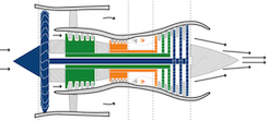
Much of the air entering the engine inlet simply blows past (bypasses) the engine core, rather than actually entering the compression and combustion system
[70/94]
Much of the air entering the engine inlet simply blows past (bypasses) the engine core, rather than actually entering the compression and combustion system
[70/94]
What is shown here?
[71/94]
[71/94]
Temperature probe
[71/94]
What is shown here?

[72/94]
[72/94]
VOR receiver (located on the top edge of the vertical stabilizer)
[72/94]
How many hydraulic systems can be found on the Boeing 737-800, and what are they?
[73/94]
[73/94]
3, the A, B, and standby systems
[73/94]
[73/94]
How many TCAS receivers can be found on the Boeing 737-800, and where are they located?
[74/94]
[74/94]
2, one each on the top and bottom of the forward fuselage
[74/94]
[74/94]
Where is the Boeing 737-800's APU located?
[75/94]
[75/94]
In the tail
[75/94]
[75/94]
Why are the Boeing 737-800's cockpit windshields always heated below 10000' MSL?
[76/94]
[76/94]
To make the glass more pliable, and thus minimize the impact of BASH
[76/94]
[76/94]
What is TCAS?
[77/94]
[77/94]
The Traffic Collision Avoidance System
[77/94]
[77/94]
What does TCAS II provide to the flightcrew?
[78/94]
[78/94]
Notification that a collision with another aircraft is imminent, and collision avoidance instructions via a resolution advisory (RA)
[78/94]
[78/94]
How does an AC PACK work?
[79/94]
[79/94]
Hot air is bled off the engines ("bleed air") before the combustion stage, after which it's mixed with cold outside air from the ram-air inlet, conditioned, and recirculated using the mix manifold
[79/94]
[79/94]
How is precipitation intensity information from the Boeing 737-800's onboard weather radar relayed to the flightcrew?
[80/94]
[80/94]
It's displayed in green, yellow, and red (with green being the least intense, and red being the most intense)
[80/94]
[80/94]
What is an FMC?
[81/94]
[81/94]
A Flight Management Computer is one part of an FMS, and receives NAVAID input to calculate the aircraft's position, which is then displayed on the EFIS
[81/94]
[81/94]
How long does it take to start the INS?
[82/94]
[82/94]
The gyros require approximately 10 minutes to get a fix on the aircraft's current position on the ground, before it can move (and subsequently have that movement tracked)
[82/94]
[82/94]
What does the Boeing 737-800 use to maintain a constant operating speed on each of its electrical generators?
[83/94]
[83/94]
The integrated drive generators
[83/94]
[83/94]
Where is the Boeing 737-800's weather radar located?
[84/94]
[84/94]
In the nose cone/radome, between the glideslope and localizer receivers
[84/94]
[84/94]
How many DME receivers can be found on the Boeing 737-800, and where are they located?
[85/94]
[85/94]
2, on the underside of the fuselage, forward of the landing gear
[85/94]
[85/94]
What methods/tools are used to protect cockpit windshields on the Boeing 737-800?
[86/94]
[86/94]
Electrical heating, windshield wipers, and rain repellant
[86/94]
[86/94]
What can be controlled with the "B" hydraulic system?
[87/94]
[87/94]
• Primary flight controls (rudder, elevators, and ailerons)
• #2 thrust reverser
• Outboard flight spoilers
• Brakes
• Autopilot B
• Yaw damper
• Alternate nosewheel steering
• Leading-edge flaps/slats
• Autoslats
• Flaps
[87/94]
• #2 thrust reverser
• Outboard flight spoilers
• Brakes
• Autopilot B
• Yaw damper
• Alternate nosewheel steering
• Leading-edge flaps/slats
• Autoslats
• Flaps
[87/94]
Where is the Boeing 737-800's localizer receiver located?
[88/94]
[88/94]
In the nose cone/radome, under the weather radar
[88/94]
[88/94]
How many VHF antennae can be found on the Boeing 737-800, and where are they located?
[89/94]
[89/94]
2:
1 mid-fuselage on the top, and 1 on the underside of the fuselage, aft of the landing gear
[89/94]
1 mid-fuselage on the top, and 1 on the underside of the fuselage, aft of the landing gear
[89/94]
Where are the Boeing 737-800's various external antennae located on the forward fuselage?
[90/94]
[90/94]

(see above)
[90/94]
How many deicing systems are found on the Boeing 737-800?
[91/94]
[91/94]
There are no deicing systems on the Boeing 737-800
[91/94]
[91/94]
Can fuel be transferred between tanks on the Boeing 737-800?
[92/94]
[92/94]
No, but any engine can draw fuel from any tank
[92/94]
[92/94]
How many Inertial Navigation Systems (INS) are installed on the Boeing 737-800?
[93/94]
[93/94]
2 self-contained systems
[93/94]
[93/94]
What does TCAS I provide to the flightcrew?
[94/94]
[94/94]
Notification that a collision with another aircraft is imminent
[94/94]
[94/94]
§ 121.687
[1/43]
[1/43]
Domestic and flag operations dispatch release: Required contents (FATWIVS)
[1/43]
[1/43]
§ 121.627
[2/43]
[2/43]
Continuing flight in unsafe conditions
[2/43]
[2/43]
14 CFR Part 121
[3/43]
[3/43]
Air carrier operations
[3/43]
[3/43]
§ 65.61
[4/43]
[4/43]
Aircraft dispatcher certification courses: Content and minimum hours
[4/43]
[4/43]
§ 121.693
[5/43]
[5/43]
Load manifest: Required contents
[5/43]
[5/43]
§ 121.631
[6/43]
[6/43]
Original dispatch or flight release, redispatch, or amendment of dispatch or flight release ("pen & ink")
[6/43]
[6/43]
§ 121.465
[7/43]
[7/43]
Domestic and flag operations: Aircraft dispatcher duty time limitations
[7/43]
[7/43]
14 CFR Part 61
[8/43]
[8/43]
Certification of pilots
[8/43]
[8/43]
§ 121.189
[9/43]
[9/43]
Turbine engine-powered airplanes: Takeoff limitations (visibility rules)
[9/43]
[9/43]
14 CFR Part 1
[10/43]
[10/43]
Definitions and abbreviations
[10/43]
[10/43]
§ 121.695
[11/43]
[11/43]
Domestic and flag operations: Requirement to prepare dispatch release, load manifest, and flight plan (route of flight)
[11/43]
[11/43]
§ 121.195
[12/43]
[12/43]
Turbine engine-powered airplanes: Landing limitations at destination airports
[12/43]
[12/43]
§ 121.647
[13/43]
[13/43]
Computing fuel required
[13/43]
[13/43]
14 CFR Part 135
[14/43]
[14/43]
Commuter operations
[14/43]
[14/43]
§ 121.625
[15/43]
[15/43]
Alternates: Weather minimums
[15/43]
[15/43]
14 CFR Part 91
[16/43]
[16/43]
General aviation
[16/43]
[16/43]
14 CFR Part 65
[17/43]
[17/43]
Certification of airmen other than flightcrew (DX, MX, ATC, etc.)
[17/43]
[17/43]
§ 121.663
[18/43]
[18/43]
Domestic and flag operations: Requirement to sign and issue dispatch release
[18/43]
[18/43]
§ 121.357
[19/43]
[19/43]
Airborne weather radar requirements
[19/43]
[19/43]
14 CFR Part 139
[20/43]
[20/43]
Certification of airports
[20/43]
[20/43]
§ 65.67
[21/43]
[21/43]
Aircraft dispatcher certification courses: Instructor requirements
[21/43]
[21/43]
§ 121.652
[22/43]
[22/43]
High Minimum Captains
[22/43]
[22/43]
§ 121.533
[23/43]
[23/43]
Domestic operations: Dispatcher/PIC joint responsibility, dispatcher sole responsibilities, and PIC sole responsibilities
[23/43]
[23/43]
§ 121.191
[24/43]
[24/43]
Turbine engine-powered airplanes: Driftdown requirements
[24/43]
[24/43]
14 CFR Part 63
[25/43]
[25/43]
Certification of non-pilot flightcrew (flight engineers, navigators, etc.)
[25/43]
[25/43]
§ 121.639
[26/43]
[26/43]
Domestic operations: Fuel requirements
[26/43]
[26/43]
§ 121.617
[27/43]
[27/43]
Departure/takeoff alternates
[27/43]
[27/43]
§ 121.621
[28/43]
[28/43]
Flag operations: Destination alternate requirements ("the "island rule")
[28/43]
[28/43]
§ 65.53
[29/43]
[29/43]
Aircraft dispatcher: General eligibility requirements
[29/43]
[29/43]
§ 121.665
[30/43]
[30/43]
Requirement to prepare/furnish load manifest
[30/43]
[30/43]
§ 121.309
[31/43]
[31/43]
Emergency equipment requirements
[31/43]
[31/43]
§ 121.97
[32/43]
[32/43]
Domestic and flag operations: Airport data requirements
[32/43]
[32/43]
§ 121.593
[33/43]
[33/43]
Domestic operations: Authority to dispatch (intermediate stop without redispatch rule)
[33/43]
[33/43]
§ 121.141
[34/43]
[34/43]
Airplane Flight Manual requirements
[34/43]
[34/43]
14 CFR Part 71
[35/43]
[35/43]
Classification of airspace
[35/43]
[35/43]
§ 121.619
[36/43]
[36/43]
Destination alternates: The "1-2-3" rule
[36/43]
[36/43]
§ 121.565
[37/43]
[37/43]
Losing an engine in-flight
[37/43]
[37/43]
§ 121.599
[38/43]
[38/43]
Weather conditions familiarity requirements
[38/43]
[38/43]
§ 121.601
[39/43]
[39/43]
Domestic and flag operations: Required information from dispatcher to PIC
[39/43]
[39/43]
§ 121.651
[40/43]
[40/43]
Takeoff and landing weather minimums
[40/43]
[40/43]
§ 121.609
[41/43]
[41/43]
Supplemental operations: Communications and navigation equipment/facilities requirements
[41/43]
[41/43]
§ 121.161
[42/43]
[42/43]
Flight route limitations
[42/43]
[42/43]
§ 121.643
[43/43]
[43/43]
Supplemental operations: Nonturbine and turbo-propeller-powered aircraft fuel requirements
[43/43]
[43/43]
Where is the lightning occurring in the following METAR:
KONT 090053Z 24016G22KT 10SM SCT041 SCT055 BKN095 12/03 A2976 RMK AO2 SLP076 OCNL LTGIC DSNT N CB DSNT N T01220028
[1/241]
KONT 090053Z 24016G22KT 10SM SCT041 SCT055 BKN095 12/03 A2976 RMK AO2 SLP076 OCNL LTGIC DSNT N CB DSNT N T01220028
[1/241]
KONT 090053Z 24016G22KT 10SM SCT041 SCT055 BKN095 12/03 A2976 RMK AO2 SLP076 OCNL LTGIC DSNT N CB DSNT N T01220028
Distant north
[1/241]
Distant north
[1/241]
When is the latest you could arrive, and not require an alternate?
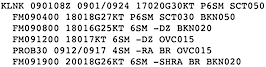
[2/241]
[2/241]
2300
[2/241]
What is the true dew point in the following METAR:
PHNL 090453Z 07009KT 10SM FEW025 FEW045 27/18 A2999 RMK AO2 SLP155 T02670183 $
[3/241]
PHNL 090453Z 07009KT 10SM FEW025 FEW045 27/18 A2999 RMK AO2 SLP155 T02670183 $
[3/241]
PHNL 090453Z 07009KT 10SM FEW025 FEW045 27/18 A2999 RMK AO2 SLP155 T02670183 $
18.3°C
[3/241]
18.3°C
[3/241]
What is the outside air temperature being reported in the following PIREP:
SEZ UUA /OV SEZ180010/TM 1645/FL110/TP S22T/TA OAT -9/IC LGT RIME
[4/241]
SEZ UUA /OV SEZ180010/TM 1645/FL110/TP S22T/TA OAT -9/IC LGT RIME
[4/241]
SEZ UUA /OV SEZ180010/TM 1645/FL110/TP S22T/TA OAT -9/IC LGT RIME
-9°
[4/241]
-9°
[4/241]
When is the earliest you could arrive, and not require an alternate?
[5/241]
[5/241]
0400
[5/241]
Do you require an alternate at 0100?
[6/241]
[6/241]
No
[6/241]
What is the 5 grouping on a METAR (e.g., 52003)?
[7/241]
[7/241]
Pressure tendency over the past 3 hours
[7/241]
[7/241]
What is the icing being reported, and what is the temperature in the following PIREP:
ABQ UA /OV ABQ360015/TM 1709/FL130/TP LJ35/SK BKN120-TOP140/TA UNKN/IC TRACE RIME
[8/241]
ABQ UA /OV ABQ360015/TM 1709/FL130/TP LJ35/SK BKN120-TOP140/TA UNKN/IC TRACE RIME
[8/241]
ABQ UA /OV ABQ360015/TM 1709/FL130/TP LJ35/SK BKN120-TOP140/TA UNKN/IC TRACE RIME
Trace rime, temperature unknown
[8/241]
Trace rime, temperature unknown
[8/241]
Do you require an alternate at 1755?
[9/241]
[9/241]
No
[9/241]
What does VCFG mean, when found on a METAR?
[10/241]
[10/241]
VCFG
Fog in the vicinity
[10/241]
Fog in the vicinity
[10/241]
At what altitude is the icing being reported in the following PIREP:
MSP UA /OV MSP280030/TM 1626/FL160/TP A319/TA M13/IC LGT-MOD RIME 160-200
[11/241]
MSP UA /OV MSP280030/TM 1626/FL160/TP A319/TA M13/IC LGT-MOD RIME 160-200
[11/241]
MSP UA /OV MSP280030/TM 1626/FL160/TP A319/TA M13/IC LGT-MOD RIME 160-200
Between 16000' and FL200
[11/241]
Between 16000' and FL200
[11/241]
What is the reporting station in the following METAR:
KSMF 090453Z 33013KT 10SM CLR 08/M05 A2991 RMK AO2 SLP127 T00781050
[12/241]
KSMF 090453Z 33013KT 10SM CLR 08/M05 A2991 RMK AO2 SLP127 T00781050
[12/241]
KSMF 090453Z 33013KT 10SM CLR 08/M05 A2991 RMK AO2 SLP127 T00781050
KSMF
[12/241]
KSMF
[12/241]
What is the temperature/dew point spread in the following METAR:
KRIC 081254Z 00000KT 7SM FEW002 13/12 A3039 RMK AO2 SLP295 T01330122
[13/241]
KRIC 081254Z 00000KT 7SM FEW002 13/12 A3039 RMK AO2 SLP295 T01330122
[13/241]
KRIC 081254Z 00000KT 7SM FEW002 13/12 A3039 RMK AO2 SLP295 T01330122
1 degree
[13/241]
1 degree
[13/241]
Do you require an alternate at 1710?
[14/241]
[14/241]
No
[14/241]
What is the weather between 1200 and 1900?
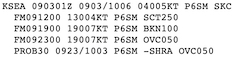
[15/241]
[15/241]
Wind 130 at 4, visibility greater than 6, scattered at 25,000
[15/241]
What is the observation date and time in the following METAR:
KDAL 090453Z 12008KT 10SM CLR 19/16 A2999 RMK AO2 SLP150 T01890161 $
[16/241]
KDAL 090453Z 12008KT 10SM CLR 19/16 A2999 RMK AO2 SLP150 T01890161 $
[16/241]
KDAL 090453Z 12008KT 10SM CLR 19/16 A2999 RMK AO2 SLP150 T01890161 $
The 9th at 0453
[16/241]
The 9th at 0453
[16/241]
Do you require an alternate at 1920?
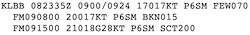
[17/241]
[17/241]
No
[17/241]
Which type of precipitation is noted, and where is it occurring in the following METAR:
KRNO 090455Z 00000KT 10SM FEW042 BKN055 BKN080 OVC130 M01/M06 A2989 RMK AO2 SLP137 SH DSNT E T10111061 $
[18/241]
KRNO 090455Z 00000KT 10SM FEW042 BKN055 BKN080 OVC130 M01/M06 A2989 RMK AO2 SLP137 SH DSNT E T10111061 $
[18/241]
KRNO 090455Z 00000KT 10SM FEW042 BKN055 BKN080 OVC130 M01/M06 A2989 RMK AO2 SLP137 SH DSNT E T10111061 $
Distant showers to the east
[18/241]
Distant showers to the east
[18/241]
What is the turbulence noted in the following PIREP:
BOI UA /OV REO210025/TM 1625/FL340/TP E75L/TB CONT LGT OCNL MOD/ZLC
[19/241]
BOI UA /OV REO210025/TM 1625/FL340/TP E75L/TB CONT LGT OCNL MOD/ZLC
[19/241]
BOI UA /OV REO210025/TM 1625/FL340/TP E75L/TB CONT LGT OCNL MOD/ZLC
Continuous light and occasional moderate
[19/241]
Continuous light and occasional moderate
[19/241]
Do you require an alternate at 0100?
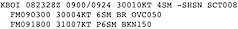
[20/241]
[20/241]
No
[20/241]
What does 60000 mean, when found on a METAR?
[21/241]
[21/241]
60000
Trace precipitation over the past 3 or 6 hours
[21/241]
Trace precipitation over the past 3 or 6 hours
[21/241]
Is FEW001 a ceiling?
[22/241]
[22/241]
No
[22/241]
[22/241]
What is the reporting point in the following PIREP:
SJC UA /OV SJC001001/TM 1626/FL155/TP B737/TB MOD
[23/241]
SJC UA /OV SJC001001/TM 1626/FL155/TP B737/TB MOD
[23/241]
SJC UA /OV SJC001001/TM 1626/FL155/TP B737/TB MOD
1 NM north of SJC
[23/241]
1 NM north of SJC
[23/241]
What does WSHFT 1715 indicate on a METAR?
[24/241]
[24/241]
WSHFT 1715
The wind shifted at 1715Z
[24/241]
The wind shifted at 1715Z
[24/241]
Do you require an alternate at 2300?
[25/241]
[25/241]
No
[25/241]
What does A2994 indicate, when found on a METAR?
[26/241]
[26/241]
A2994
Local altimeter setting (in this case, 29.94)
[26/241]
Local altimeter setting (in this case, 29.94)
[26/241]
In eighths, how much of the sky is obscured by clouds when a METAR or TAF indicates FEW?
[27/241]
[27/241]
1/8 to 2/8
[27/241]
[27/241]
What is the location noted in the following PIREP:
IEN UA /OV IEN/TM 1614/FL070/TP PC12/SK BASES 070/RM SCT LAYERS BELOW 070 BROKE OUT AT 048 RNAV 30 VIA IROVE
[28/241]
IEN UA /OV IEN/TM 1614/FL070/TP PC12/SK BASES 070/RM SCT LAYERS BELOW 070 BROKE OUT AT 048 RNAV 30 VIA IROVE
[28/241]
IEN UA /OV IEN/TM 1614/FL070/TP PC12/SK BASES 070/RM SCT LAYERS BELOW 070 BROKE OUT AT 048 RNAV 30 VIA IROVE
Over IEN
[28/241]
Over IEN
[28/241]
What does SLP104 indicate, when found on a METAR?
[29/241]
[29/241]
SLP104
Sea-level pressure (in this case, 1010.4 mb)
[29/241]
Sea-level pressure (in this case, 1010.4 mb)
[29/241]
When did the rain begin in the following METAR:
KSAV 081802Z 07009G17KT 3/4SM R10/3000VP6000FT +RA BR SCT008 BKN025 OVC047 23/21 A3018 RMK AO2 RAB1754 P0004 T02280211
[30/241]
KSAV 081802Z 07009G17KT 3/4SM R10/3000VP6000FT +RA BR SCT008 BKN025 OVC047 23/21 A3018 RMK AO2 RAB1754 P0004 T02280211
[30/241]
KSAV 081802Z 07009G17KT 3/4SM R10/3000VP6000FT +RA BR SCT008 BKN025 OVC047 23/21 A3018 RMK AO2 RAB1754 P0004 T02280211
1754
[30/241]
1754
[30/241]
Do you require an alternate at 1000?
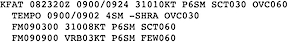
[31/241]
[31/241]
No
[31/241]
Is OVC010 a ceiling?
[32/241]
[32/241]
Yes
[32/241]
[32/241]
What is the 7 grouping on a METAR (e.g., 70015)?
[33/241]
[33/241]
Precipitation over the past 24 hours, in hundredths of an inch
[33/241]
[33/241]
When is the earliest you could arrive, and not require an alternate?
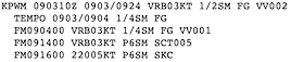
[34/241]
[34/241]
1500
[34/241]
What is the obscuration noted in the following METAR:
KBWI 081154Z 26003KT 6SM MIFG BR FEW003 07/05 A3036 RMK AO2 SLP282 T00670050 10089 20061 53012
[35/241]
KBWI 081154Z 26003KT 6SM MIFG BR FEW003 07/05 A3036 RMK AO2 SLP282 T00670050 10089 20061 53012
[35/241]
KBWI 081154Z 26003KT 6SM MIFG BR FEW003 07/05 A3036 RMK AO2 SLP282 T00670050 10089 20061 53012
Shallow fog and mist
[35/241]
Shallow fog and mist
[35/241]
Do you require an alternate at 1520?
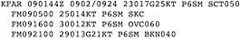
[36/241]
[36/241]
No
[36/241]
When is the earliest you could arrive, and not require an alternate?
[37/241]
[37/241]
0400
[37/241]
Do you require an alternate at 2145?
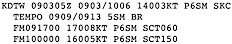
[38/241]
[38/241]
No
[38/241]
What does AUTO mean, when found in a METAR?
[39/241]
[39/241]
The observation was obtained automatically, and has not been verified by a human observer
[39/241]
[39/241]
Do you require an alternate at 1650?
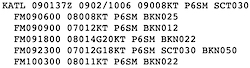
[40/241]
[40/241]
Yes
[40/241]
What is the 2 grouping on a METAR (e.g., 21035)?
[41/241]
[41/241]
Minimum temperature recorded over the past 6 hours
[41/241]
[41/241]
What does P6000FT mean on a METAR?
[42/241]
[42/241]
P6000FT
RVR greater than 6000'
[42/241]
RVR greater than 6000'
[42/241]
Do you require an alternate at 1810?
[43/241]
[43/241]
No
[43/241]
Which aircraft type is noted in the following PIREP:
ITO UA /OV ITO3500013/TM 1617/FL020/TP B712/SK BKN025
[44/241]
ITO UA /OV ITO3500013/TM 1617/FL020/TP B712/SK BKN025
[44/241]
ITO UA /OV ITO3500013/TM 1617/FL020/TP B712/SK BKN025
Boeing 717-200
[44/241]
Boeing 717-200
[44/241]
When is the earliest you could arrive, and not require an alternate?
[45/241]
[45/241]
0100
[45/241]
Do you require an alternate at 1420?
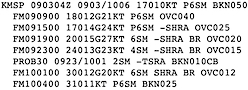
[46/241]
[46/241]
No
[46/241]
What is the wind being reported in the following PIREP:
XSA UA /OV XSA350012/TM 1701/FL015/TP C172/SK SKC/TA 12/WV 15527KT
[47/241]
XSA UA /OV XSA350012/TM 1701/FL015/TP C172/SK SKC/TA 12/WV 15527KT
[47/241]
XSA UA /OV XSA350012/TM 1701/FL015/TP C172/SK SKC/TA 12/WV 15527KT
155 at 27
[47/241]
155 at 27
[47/241]
What is the sea-level pressure in the following METAR:
KMHT 090453Z 36003KT 9SM CLR 08/06 A3031 RMK AO2 SLP276 T00780056 402330056
[48/241]
KMHT 090453Z 36003KT 9SM CLR 08/06 A3031 RMK AO2 SLP276 T00780056 402330056
[48/241]
KMHT 090453Z 36003KT 9SM CLR 08/06 A3031 RMK AO2 SLP276 T00780056 402330056
1027.6
[48/241]
1027.6
[48/241]
When is the earliest you could arrive, and not require an alternate?
[49/241]
[49/241]
0400
[49/241]
What does RAE10SNB11 indicate, when found on a METAR?
[50/241]
[50/241]
RAE10SNB11
Precipitation beginning and end times (in this case, rain ended at 10 after the hour, and snow began at 11 after the hour)
[50/241]
Precipitation beginning and end times (in this case, rain ended at 10 after the hour, and snow began at 11 after the hour)
[50/241]
What does 18/14 indicate, when found on a METAR?
[51/241]
[51/241]
18/14
Temperature and dew point (in this case, 18°C and 14°C, respectively)
[51/241]
Temperature and dew point (in this case, 18°C and 14°C, respectively)
[51/241]
What is the wind in the following METAR:
KELP 090451Z 19016KT 10SM CLR 20/06 A2984 RMK AO2 SLP048 T02000056 $
[52/241]
KELP 090451Z 19016KT 10SM CLR 20/06 A2984 RMK AO2 SLP048 T02000056 $
[52/241]
KELP 090451Z 19016KT 10SM CLR 20/06 A2984 RMK AO2 SLP048 T02000056 $
190 at 16
[52/241]
190 at 16
[52/241]
What is the sky cover being reported in the following PIREP:
DAB UA /OV DAB250003/TM 1706/FL011/TP C72R/SK OVC011
[53/241]
DAB UA /OV DAB250003/TM 1706/FL011/TP C72R/SK OVC011
[53/241]
DAB UA /OV DAB250003/TM 1706/FL011/TP C72R/SK OVC011
Ceiling overcast 1100
[53/241]
Ceiling overcast 1100
[53/241]
When is the latest you could arrive, and not require an alternate?
[54/241]
[54/241]
The 10th at 0500
[54/241]
Do you require an alternate at 1555?
[55/241]
[55/241]
No
[55/241]
Do you require an alternate at 1845?
[56/241]
[56/241]
No
[56/241]
What is the temperature/dew point spread in the following METAR:
KHRL 081325Z 00000KT 9SM FEW021 FEW055 17/17 A2992 RMK AO2 T01720172
[57/241]
KHRL 081325Z 00000KT 9SM FEW021 FEW055 17/17 A2992 RMK AO2 T01720172
[57/241]
KHRL 081325Z 00000KT 9SM FEW021 FEW055 17/17 A2992 RMK AO2 T01720172
0 degrees
[57/241]
0 degrees
[57/241]
What is the controlling measure in a METAR/TAF, RVR or visibility?
[58/241]
[58/241]
RVR (but only if it is specified for your particular runway)
[58/241]
[58/241]
What is the aircraft type in the following PIREP:
JAX UA /OV GNV/TM 1612/FL000/TP CRJ9/SK BASE015
[59/241]
JAX UA /OV GNV/TM 1612/FL000/TP CRJ9/SK BASE015
[59/241]
JAX UA /OV GNV/TM 1612/FL000/TP CRJ9/SK BASE015
CRJ9
[59/241]
CRJ9
[59/241]
What does BKN V SCT mean, when found on a METAR?
[60/241]
[60/241]
BKN V SCT
Cloud layer is broken variable scattered
[60/241]
Cloud layer is broken variable scattered
[60/241]
Do you require an alternate at 0955?
[61/241]
[61/241]
No
[61/241]
What is the wind in the following METAR:
KIAG 090453Z AUTO 00000KT 8SM CLR 07/04 A3031 RMK AO2 SLP270 T00670044 402170033 $
[62/241]
KIAG 090453Z AUTO 00000KT 8SM CLR 07/04 A3031 RMK AO2 SLP270 T00670044 402170033 $
[62/241]
KIAG 090453Z AUTO 00000KT 8SM CLR 07/04 A3031 RMK AO2 SLP270 T00670044 402170033 $
Calm
[62/241]
Calm
[62/241]
What does the "0" following the "T" indicate in T01260055?
[63/241]
[63/241]
T01260055
A temperature above 0°C (in this case, 12.6°C)
[63/241]
A temperature above 0°C (in this case, 12.6°C)
[63/241]
What is the reporting point in the following PIREP:
MEM UA /OV OLV180003/TM 1714/FLDURC/TP C172/SK TOPS 030
[64/241]
MEM UA /OV OLV180003/TM 1714/FLDURC/TP C172/SK TOPS 030
[64/241]
MEM UA /OV OLV180003/TM 1714/FLDURC/TP C172/SK TOPS 030
3 NM south of OLV
[64/241]
3 NM south of OLV
[64/241]
Do you require an alternate at 1405?
[65/241]
[65/241]
Yes
[65/241]
Do you require an alternate at 1005?
[66/241]
[66/241]
No
[66/241]
What is the aircraft type in the following PIREP:
PHX UUA /OV PXR120045/TM 1713/FL120/TP F2TH/TA 03/IC LGT RIME
[67/241]
PHX UUA /OV PXR120045/TM 1713/FL120/TP F2TH/TA 03/IC LGT RIME
[67/241]
PHX UUA /OV PXR120045/TM 1713/FL120/TP F2TH/TA 03/IC LGT RIME
F2TH
[67/241]
F2TH
[67/241]
When is the earliest you could arrive, and not require an alternate?
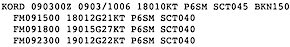
[68/241]
[68/241]
0400
[68/241]
Do you require an alternate at 1830?
[69/241]
[69/241]
No
[69/241]
Do you require an alternate at 2110?
[70/241]
[70/241]
No
[70/241]
What is the temperature/dew point spread in the following METAR:
KCLE 081751Z 00000KT 10SM CLR 23/07 A3033 RMK AO2 SLP285 T02280067 10233 20050 58008
[71/241]
KCLE 081751Z 00000KT 10SM CLR 23/07 A3033 RMK AO2 SLP285 T02280067 10233 20050 58008
[71/241]
KCLE 081751Z 00000KT 10SM CLR 23/07 A3033 RMK AO2 SLP285 T02280067 10233 20050 58008
16 degrees
[71/241]
16 degrees
[71/241]
In eighths, how much of the sky is obscured by clouds when a METAR or TAF indicates BKN?
[72/241]
[72/241]
5/8 to 7/8
[72/241]
[72/241]
What does 32018G32KT indicate, when found on a METAR?
[73/241]
[73/241]
32018G32KT
Wind direction, speed, and gusts (in this case, 320 at 18, gust 32)
[73/241]
Wind direction, speed, and gusts (in this case, 320 at 18, gust 32)
[73/241]
What does $ indicate in the following METAR:
KSDF 090356Z 00000KT 10SM CLR 16/11 A3023 RMK AO2 SLP234 T01560111 $
[74/241]
KSDF 090356Z 00000KT 10SM CLR 16/11 A3023 RMK AO2 SLP234 T01560111 $
[74/241]
KSDF 090356Z 00000KT 10SM CLR 16/11 A3023 RMK AO2 SLP234 T01560111 $
Maintenance needed
[74/241]
Maintenance needed
[74/241]
What is the ceiling in the following METAR:
KCOS 090454Z 15009KT 10SM FEW050 BKN100 08/M08 A2968 RMK AO2 SLP017 T00781083
[75/241]
KCOS 090454Z 15009KT 10SM FEW050 BKN100 08/M08 A2968 RMK AO2 SLP017 T00781083
[75/241]
KCOS 090454Z 15009KT 10SM FEW050 BKN100 08/M08 A2968 RMK AO2 SLP017 T00781083
Broken 10000
[75/241]
Broken 10000
[75/241]
Which phase of flight is being reported from in the following PIREP:
IAH UA /OV IAH135003/TM 1644/FL017/TP E75L/SK BASES BKN017/RM DURC
[76/241]
IAH UA /OV IAH135003/TM 1644/FL017/TP E75L/SK BASES BKN017/RM DURC
[76/241]
IAH UA /OV IAH135003/TM 1644/FL017/TP E75L/SK BASES BKN017/RM DURC
Climb
[76/241]
Climb
[76/241]
What altitude is being reported from in the following PIREP:
TYR UA /OV TYR310014/TM 1715/FLUNKN/TP P28A/SK BKN027-TOP047/RM DURD RWY 13 TYR
[77/241]
TYR UA /OV TYR310014/TM 1715/FLUNKN/TP P28A/SK BKN027-TOP047/RM DURD RWY 13 TYR
[77/241]
TYR UA /OV TYR310014/TM 1715/FLUNKN/TP P28A/SK BKN027-TOP047/RM DURD RWY 13 TYR
Flight level unknown
[77/241]
Flight level unknown
[77/241]
What is the visibility in the following METAR:
KACY 090418Z 00000KT 1 1/2SM BR CLR 09/07 A3036 RMK AO2 T00890072
[78/241]
KACY 090418Z 00000KT 1 1/2SM BR CLR 09/07 A3036 RMK AO2 T00890072
[78/241]
KACY 090418Z 00000KT 1 1/2SM BR CLR 09/07 A3036 RMK AO2 T00890072
1 ½
[78/241]
1 ½
[78/241]
Do you require an alternate at 2005?
[79/241]
[79/241]
No
[79/241]
Do you require an alternate at 1715?
[80/241]
[80/241]
No
[80/241]
What does SLP987 indicate, when found on a METAR?
[81/241]
[81/241]
SLP987
Sea-level pressure (in this case, 998.7 mb)
[81/241]
Sea-level pressure (in this case, 998.7 mb)
[81/241]
Do you require an alternate at 0550?
[82/241]
[82/241]
No
[82/241]
What does PK WND 17032/0256 indicate, when found on a METAR?
[83/241]
[83/241]
PK WND 17032/0256
Peak wind direction and speed, and when it was observed (in this case, 170 at 32, observed at 0256)
[83/241]
Peak wind direction and speed, and when it was observed (in this case, 170 at 32, observed at 0256)
[83/241]
Do you require an alternate at 1215?
[84/241]
[84/241]
No
[84/241]
When is the latest you could arrive, and not require an alternate?
[85/241]
[85/241]
The 10th at 0500
[85/241]
If VCTS is noted in a TAF, how far from the airport are the thunderstorms located?
[86/241]
[86/241]
5 to 10 SM from the center of the runway complex
[86/241]
[86/241]
Is OVC450 a ceiling?
[87/241]
[87/241]
Yes
[87/241]
[87/241]
Which phase of flight is being reported from in the following PIREP:
TYR UA /OV TYR310014/TM 1715/FLUNKN/TP P28A/SK BKN027-TOP047/RM DURD RWY 13 TYR
[88/241]
TYR UA /OV TYR310014/TM 1715/FLUNKN/TP P28A/SK BKN027-TOP047/RM DURD RWY 13 TYR
[88/241]
TYR UA /OV TYR310014/TM 1715/FLUNKN/TP P28A/SK BKN027-TOP047/RM DURD RWY 13 TYR
Descent
[88/241]
Descent
[88/241]
Do you require an alternate at 1325?
[89/241]
[89/241]
No
[89/241]
When is the earliest you could arrive, and not require an alternate?
[90/241]
[90/241]
0300
[90/241]
Do you require an alternate at 0705?
[91/241]
[91/241]
Yes
[91/241]
What is the PIREP type in the following PIREP:
FLG UA /OV FLG/TM 1700/FL300/TP B738/TB CONS LGT CHOP/RM S ZAB/FDCS
[92/241]
FLG UA /OV FLG/TM 1700/FL300/TP B738/TB CONS LGT CHOP/RM S ZAB/FDCS
[92/241]
FLG UA /OV FLG/TM 1700/FL300/TP B738/TB CONS LGT CHOP/RM S ZAB/FDCS
Routine
[92/241]
Routine
[92/241]
What does R07L/5500VP6000FT indicate, when found on a METAR?
[93/241]
[93/241]
R07L/5500VP6000FT
Visibility in RVR (in this case, RVR for runway 7L is variable between 5500' and greater than 6000')
[93/241]
Visibility in RVR (in this case, RVR for runway 7L is variable between 5500' and greater than 6000')
[93/241]
Do you require an alternate at 0955?
[94/241]
[94/241]
No
[94/241]
Do you require an alternate at 2105?
[95/241]
[95/241]
No
[95/241]
What is being reported in the following PIREP:
FLL UA /OV FLL275007/TM 1723/FL020/TP B737/SK BKN015/RM FINAL RY 10R
[96/241]
FLL UA /OV FLL275007/TM 1723/FL020/TP B737/SK BKN015/RM FINAL RY 10R
[96/241]
FLL UA /OV FLL275007/TM 1723/FL020/TP B737/SK BKN015/RM FINAL RY 10R
A Boeing 737-700 on final to runway 10R at KFLL broke out of the ceiling at 1500'
[96/241]
A Boeing 737-700 on final to runway 10R at KFLL broke out of the ceiling at 1500'
[96/241]
What does FM mean on a TAF?
[97/241]
[97/241]
"From," as in "from the following date and time..."
[97/241]
[97/241]
When is the latest you could arrive, and not require an alternate?
[98/241]
[98/241]
2300
[98/241]
Do you require an alternate at 1100?
[99/241]
[99/241]
No
[99/241]
What is the 6 grouping on a METAR (e.g., 60005)?
[100/241]
[100/241]
Precipitation total over the past 3 or 6 hours, in hundredths of an inch
[100/241]
[100/241]
Who is submitting the information in the following PIREP:
ARP UAL527 4537N 11903W 1731 F350 MS57 352/067KT
[101/241]
ARP UAL527 4537N 11903W 1731 F350 MS57 352/067KT
[101/241]
ARP UAL527 4537N 11903W 1731 F350 MS57 352/067KT
United Airlines flight 527
[101/241]
United Airlines flight 527
[101/241]
What is the visibility in the following METAR:
KLAX 090453Z 28015KT 10SM FEW030 FEW060 12/04 A2986 RMK AO2 PK WND 26029/0410 SLP109 T01220044
[102/241]
KLAX 090453Z 28015KT 10SM FEW030 FEW060 12/04 A2986 RMK AO2 PK WND 26029/0410 SLP109 T01220044
[102/241]
KLAX 090453Z 28015KT 10SM FEW030 FEW060 12/04 A2986 RMK AO2 PK WND 26029/0410 SLP109 T01220044
10
[102/241]
10
[102/241]
What are the SK in the following METAR:
KMDW 090453Z 17006KT 10SM FEW170 BKN250 19/13 A3015 RMK AO2 SLP202 T01940133
[103/241]
KMDW 090453Z 17006KT 10SM FEW170 BKN250 19/13 A3015 RMK AO2 SLP202 T01940133
[103/241]
KMDW 090453Z 17006KT 10SM FEW170 BKN250 19/13 A3015 RMK AO2 SLP202 T01940133
Few 17000, ceiling broken 25000
[103/241]
Few 17000, ceiling broken 25000
[103/241]
Do you require an alternate at 1235?
[104/241]
[104/241]
No
[104/241]
Do you require an alternate at 0945?
[105/241]
[105/241]
Yes
[105/241]
What does VV002 indicate, when found on a METAR?
[106/241]
[106/241]
VV002
Vertical visibility (in this case, an indefinite ceiling of 200')
[106/241]
Vertical visibility (in this case, an indefinite ceiling of 200')
[106/241]
Do you require an alternate at 1240?
[107/241]
[107/241]
Yes
[107/241]
What is the altitude being reported from in the following PIREP:
GSP UA /OV SPA/TM 1724/FL038/TP C172/SK BASES 038 MSL
[108/241]
GSP UA /OV SPA/TM 1724/FL038/TP C172/SK BASES 038 MSL
[108/241]
GSP UA /OV SPA/TM 1724/FL038/TP C172/SK BASES 038 MSL
3800'
[108/241]
3800'
[108/241]
What does R07R/P6000FT indicate, when found on a METAR?
[109/241]
[109/241]
R07R/P6000FT
Visibility in RVR (in this case, RVR for runway 7R is greater than 6000')
[109/241]
Visibility in RVR (in this case, RVR for runway 7R is greater than 6000')
[109/241]
When is the latest you could arrive, and not require an alternate?
[110/241]
[110/241]
The 10th at 0500
[110/241]
Do you require an alternate at 0200?
[111/241]
[111/241]
No
[111/241]
What is the sea-level pressure in the following METAR:
KPDX 090353Z 00000KT 10SM CLR 03/M01 A3019 RMK AO2 SLP222 T00281006
[112/241]
KPDX 090353Z 00000KT 10SM CLR 03/M01 A3019 RMK AO2 SLP222 T00281006
[112/241]
KPDX 090353Z 00000KT 10SM CLR 03/M01 A3019 RMK AO2 SLP222 T00281006
1022.2
[112/241]
1022.2
[112/241]
What is the peak wind in the following METAR:
KRDD 082253Z 04016G23KT 10SM SCT085 13/M09 A2982 RMK AO2 PK WND 36028/2209 SLP099 T01281094
[113/241]
KRDD 082253Z 04016G23KT 10SM SCT085 13/M09 A2982 RMK AO2 PK WND 36028/2209 SLP099 T01281094
[113/241]
KRDD 082253Z 04016G23KT 10SM SCT085 13/M09 A2982 RMK AO2 PK WND 36028/2209 SLP099 T01281094
360 at 28
[113/241]
360 at 28
[113/241]
Do you require an alternate at 0205?
[114/241]
[114/241]
No
[114/241]
How much precipitation has been recorded over the past hour in the following METAR:
KEYW 090153Z AUTO 01012KT 5SM -RA BR BKN006 OVC012 24/23 A2961 RMK AO2 PK WND 02027/0055 RAB23 SLP027 P0000 T02390233
[115/241]
KEYW 090153Z AUTO 01012KT 5SM -RA BR BKN006 OVC012 24/23 A2961 RMK AO2 PK WND 02027/0055 RAB23 SLP027 P0000 T02390233
[115/241]
KEYW 090153Z AUTO 01012KT 5SM -RA BR BKN006 OVC012 24/23 A2961 RMK AO2 PK WND 02027/0055 RAB23 SLP027 P0000 T02390233
Trace
[115/241]
Trace
[115/241]
When is the latest you could arrive, and not require an alternate?
[116/241]
[116/241]
The 10th at 0500
[116/241]
What does PNO indicate in the following METAR:
KMIA 090458Z 09026G34KT 5SM RA BR BKN016 BKN025 OVC040 24/23 A2964 RMK AO2 PK WND 09034/0455 T02440233 PNO $
[117/241]
KMIA 090458Z 09026G34KT 5SM RA BR BKN016 BKN025 OVC040 24/23 A2964 RMK AO2 PK WND 09034/0455 T02440233 PNO $
[117/241]
KMIA 090458Z 09026G34KT 5SM RA BR BKN016 BKN025 OVC040 24/23 A2964 RMK AO2 PK WND 09034/0455 T02440233 PNO $
Precipitation amount not available
[117/241]
Precipitation amount not available
[117/241]
In eighths, how much of the sky is obscured by clouds when a METAR or TAF indicates OVC?
[118/241]
[118/241]
8/8
[118/241]
[118/241]
Do you require an alternate at 1315?
[119/241]
[119/241]
No
[119/241]
Do you require an alternate at 0500?
[120/241]
[120/241]
No
[120/241]
Do you require an alternate at 1615?
[121/241]
[121/241]
No
[121/241]
What does 090354Z indicate, when found on a METAR?
[122/241]
[122/241]
090354Z
When the observation was made (in this case, the 9th at 0354)
[122/241]
When the observation was made (in this case, the 9th at 0354)
[122/241]
Do you require an alternate at 1200?
[123/241]
[123/241]
No
[123/241]
When is the latest you could arrive, and not require an alternate?
[124/241]
[124/241]
The 10th at 0500
[124/241]
When is the earliest you could arrive, and not require an alternate?
[125/241]
[125/241]
0200
[125/241]
Is SCT150 a ceiling?
[126/241]
[126/241]
No
[126/241]
[126/241]
What does WS025/01045KT in the following METAR:
KLAS 090253Z 28029KT 250V310 10SM SCT042 BKN100 14/04 A2985 RMK AO2 SLP106 T01390044 53014 WS025/01045KT
[127/241]
KLAS 090253Z 28029KT 250V310 10SM SCT042 BKN100 14/04 A2985 RMK AO2 SLP106 T01390044 53014 WS025/01045KT
[127/241]
KLAS 090253Z 28029KT 250V310 10SM SCT042 BKN100 14/04 A2985 RMK AO2 SLP106 T01390044 53014 WS025/01045KT
Wind shear at FL025, 010 at 45
[127/241]
Wind shear at FL025, 010 at 45
[127/241]
Do you require an alternate at 0630?
[128/241]
[128/241]
No
[128/241]
What is the temperature in the following METAR:
KBDL 090451Z 00000KT 10SM CLR 06/04 A3033 RMK AO2 SLP270 T00610039 402390044
[129/241]
KBDL 090451Z 00000KT 10SM CLR 06/04 A3033 RMK AO2 SLP270 T00610039 402390044
[129/241]
KBDL 090451Z 00000KT 10SM CLR 06/04 A3033 RMK AO2 SLP270 T00610039 402390044
6°C
[129/241]
6°C
[129/241]
What is the sea-level pressure in the following METAR:
KDSM 090454Z 16013KT 10SM CLR 18/14 A2994 RMK AO2 SLP134 T01780139
[130/241]
KDSM 090454Z 16013KT 10SM CLR 18/14 A2994 RMK AO2 SLP134 T01780139
[130/241]
KDSM 090454Z 16013KT 10SM CLR 18/14 A2994 RMK AO2 SLP134 T01780139
1013.4
[130/241]
1013.4
[130/241]
Is FEW100 a ceiling?
[131/241]
[131/241]
No
[131/241]
[131/241]
Do you require an alternate at 1145?
[132/241]
[132/241]
No
[132/241]
What is the reporting station in the following METAR:
KMCI 090253Z 16016KT 10SM SCT140 20/15 A2995 RMK AO2 SLP135 T02000150 53002
[133/241]
KMCI 090253Z 16016KT 10SM SCT140 20/15 A2995 RMK AO2 SLP135 T02000150 53002
[133/241]
KMCI 090253Z 16016KT 10SM SCT140 20/15 A2995 RMK AO2 SLP135 T02000150 53002
KMCI
[133/241]
KMCI
[133/241]
What does M0600FT mean on a METAR?
[134/241]
[134/241]
M0600FT
RVR less than 600'
[134/241]
RVR less than 600'
[134/241]
When is the latest you could arrive, and not require an alternate?
[135/241]
[135/241]
2300
[135/241]
What does 9999 indicate, when found on a METAR?
[136/241]
[136/241]
Visibility unlimited
[136/241]
[136/241]
What does 16014KT indicate, when found on a METAR?
[137/241]
[137/241]
16014KT
Wind direction and speed (in this case, 160 at 14)
[137/241]
Wind direction and speed (in this case, 160 at 14)
[137/241]
Do you require an alternate at 0500?
[138/241]
[138/241]
No
[138/241]
What is a SPECI?
[139/241]
[139/241]
An unscheduled METAR, issued when something significant occurs between normal METAR issuances
[139/241]
[139/241]
Where is the turbulence reported in the following PIREP:
DEN UUA /OV DEN230072/TM 1705/FL250/TP CRJ2/TB MOD TO SEV/RM SSKII ARRIVAL ZDV
[140/241]
DEN UUA /OV DEN230072/TM 1705/FL250/TP CRJ2/TB MOD TO SEV/RM SSKII ARRIVAL ZDV
[140/241]
DEN UUA /OV DEN230072/TM 1705/FL250/TP CRJ2/TB MOD TO SEV/RM SSKII ARRIVAL ZDV
On the SSKII STAR
[140/241]
On the SSKII STAR
[140/241]
What is the dew point in the following METAR:
KSAF 090453Z AUTO 21006KT 10SM OVC090 09/M02 A2978 RMK AO2 SLP032 T00941017
[141/241]
KSAF 090453Z AUTO 21006KT 10SM OVC090 09/M02 A2978 RMK AO2 SLP032 T00941017
[141/241]
KSAF 090453Z AUTO 21006KT 10SM OVC090 09/M02 A2978 RMK AO2 SLP032 T00941017
-2°C
[141/241]
-2°C
[141/241]
Do you require an alternate at 0135?
[142/241]
[142/241]
No
[142/241]
When is the latest you could arrive, and not require an alternate?
[143/241]
[143/241]
2300
[143/241]
Do you require an alternate at 2100?
[144/241]
[144/241]
No
[144/241]
Do you require an alternate at 1610?
[145/241]
[145/241]
Yes
[145/241]
When is the earliest you could arrive, and not require an alternate?
[146/241]
[146/241]
0100
[146/241]
Which type of precipitation is occurring in the following METAR:
KCHS 081424Z 05009KT 10SM -RA BKN008 OVC044 22/20 A3024 RMK AO2 RAB08 P0000 T02170200
[147/241]
KCHS 081424Z 05009KT 10SM -RA BKN008 OVC044 22/20 A3024 RMK AO2 RAB08 P0000 T02170200
[147/241]
KCHS 081424Z 05009KT 10SM -RA BKN008 OVC044 22/20 A3024 RMK AO2 RAB08 P0000 T02170200
Light rain
[147/241]
Light rain
[147/241]
Do you require an alternate at 0155 on the 10th?
[148/241]
[148/241]
No
[148/241]
What is the maximum temperature recorded in the past 24 hours in the following METAR:
KCVG 081751Z 04007KT 10SM CLR 23/07 A3033 RMK AO2 SLP285 T02280067 10233 20050
[149/241]
KCVG 081751Z 04007KT 10SM CLR 23/07 A3033 RMK AO2 SLP285 T02280067 10233 20050
[149/241]
KCVG 081751Z 04007KT 10SM CLR 23/07 A3033 RMK AO2 SLP285 T02280067 10233 20050
23.3°C
[149/241]
23.3°C
[149/241]
What is the turbulence noted in the following PIREP:
ABQ UA /OV FTI/TM 1629/FL370/TP GALX/TB CONS MOD/LGT -MDT AT FL410/RM ZAB/FDCS
[150/241]
ABQ UA /OV FTI/TM 1629/FL370/TP GALX/TB CONS MOD/LGT -MDT AT FL410/RM ZAB/FDCS
[150/241]
ABQ UA /OV FTI/TM 1629/FL370/TP GALX/TB CONS MOD/LGT -MDT AT FL410/RM ZAB/FDCS
Continuous light to moderate
[150/241]
Continuous light to moderate
[150/241]
Do you require an alternate at 1200?
[151/241]
[151/241]
Yes
[151/241]
What does FZRAE16 indicate, when found on a METAR?
[152/241]
[152/241]
FZRAE16
Precipitation end time (in this case, freezing rain ended at 16 after the hour)
[152/241]
Precipitation end time (in this case, freezing rain ended at 16 after the hour)
[152/241]
How thick are the clouds in the following PIREP:
UAO UA /OV UAO/TM 1648/FL006/TP C172/SK BKN006-TOP008/RM DURC RY 35
[153/241]
UAO UA /OV UAO/TM 1648/FL006/TP C172/SK BKN006-TOP008/RM DURC RY 35
[153/241]
UAO UA /OV UAO/TM 1648/FL006/TP C172/SK BKN006-TOP008/RM DURC RY 35
200'
[153/241]
200'
[153/241]
Do you require an alternate at 2350?
[154/241]
[154/241]
No
[154/241]
What is the true dew point in the following METAR:
KDCA 081352Z 16003KT 6SM BR CLR 13/11 A3041 RMK AO2 SLP297 T01280106
[155/241]
KDCA 081352Z 16003KT 6SM BR CLR 13/11 A3041 RMK AO2 SLP297 T01280106
[155/241]
KDCA 081352Z 16003KT 6SM BR CLR 13/11 A3041 RMK AO2 SLP297 T01280106
10.6°C
[155/241]
10.6°C
[155/241]
What does 2SM indicate, when found on a METAR?
[156/241]
[156/241]
2SM
Visibility (in this case, 2 statute miles)
[156/241]
Visibility (in this case, 2 statute miles)
[156/241]
What does TWR VIS 2 indicate, when found on a METAR?
[157/241]
[157/241]
TWR VIS 2
Visibility as observed from the control tower (in this case, 2 statute miles)
[157/241]
Visibility as observed from the control tower (in this case, 2 statute miles)
[157/241]
How are PIREPs obtained?
[158/241]
[158/241]
They may be given freely by pilots, or solicited from pilots by ATC
[158/241]
[158/241]
What is the visibility in the following METAR:
KTUL 090453Z 15010KT P6SM SCT021 20/17 A2995 RMK AO2 SLP135 T02000172
[159/241]
KTUL 090453Z 15010KT P6SM SCT021 20/17 A2995 RMK AO2 SLP135 T02000172
[159/241]
KTUL 090453Z 15010KT P6SM SCT021 20/17 A2995 RMK AO2 SLP135 T02000172
Greater than 6
[159/241]
Greater than 6
[159/241]
Do you require an alternate at 0425?
[160/241]
[160/241]
No
[160/241]
What does T10061017 indicate, when found on a METAR?
[161/241]
[161/241]
T10061017
True temperature and dew point (in this case, -0.6°C and -1.7°C, respectively)
[161/241]
True temperature and dew point (in this case, -0.6°C and -1.7°C, respectively)
[161/241]
Do you require an alternate at 0720?
[162/241]
[162/241]
No
[162/241]
What does BKN050TCU mean in the following METAR:
KSJC 082317Z 31016KT 10SM -RA FEW001 SCT030TCU BKN050TCU 14/02 A2980 RMK AO2 RAB01 TCU OHD TCU NW-S TCU DSNT N-S P0000 T01390017
[163/241]
KSJC 082317Z 31016KT 10SM -RA FEW001 SCT030TCU BKN050TCU 14/02 A2980 RMK AO2 RAB01 TCU OHD TCU NW-S TCU DSNT N-S P0000 T01390017
[163/241]
KSJC 082317Z 31016KT 10SM -RA FEW001 SCT030TCU BKN050TCU 14/02 A2980 RMK AO2 RAB01 TCU OHD TCU NW-S TCU DSNT N-S P0000 T01390017
Ceiling broken 5000, towering cumulus
[163/241]
Ceiling broken 5000, towering cumulus
[163/241]
In eighths, how much of the sky is obscured by clouds when a METAR or TAF indicates SCT?
[164/241]
[164/241]
3/8 to 4/8
[164/241]
[164/241]
What does COR mean in the following METAR:
KMOB 090456Z COR 03007KT 10SM CLR 19/18 A3007 RMK AO2 SLP180 T01940178
[165/241]
KMOB 090456Z COR 03007KT 10SM CLR 19/18 A3007 RMK AO2 SLP180 T01940178
[165/241]
KMOB 090456Z COR 03007KT 10SM CLR 19/18 A3007 RMK AO2 SLP180 T01940178
Correction
[165/241]
Correction
[165/241]
Do you require an alternate at 1930?
[166/241]
[166/241]
No
[166/241]
What does CIG 006V012 mean, when found on a METAR?
[167/241]
[167/241]
CIG 006V012
Ceiling is variable between 600' and 1200'
[167/241]
Ceiling is variable between 600' and 1200'
[167/241]
Do you require an alternate at 0705?
[168/241]
[168/241]
Yes
[168/241]
When is the earliest you could arrive, and not require an alternate?
[169/241]
[169/241]
0400
[169/241]
What is the wind in the following METAR:
KIAD 090052Z 00000KT 10SM FEW250 13/11 A3036 RMK AO2 SLP281 T01330111
[170/241]
KIAD 090052Z 00000KT 10SM FEW250 13/11 A3036 RMK AO2 SLP281 T01330111
[170/241]
KIAD 090052Z 00000KT 10SM FEW250 13/11 A3036 RMK AO2 SLP281 T01330111
Calm
[170/241]
Calm
[170/241]
What is the temperature in the following METAR:
KBAN 081952Z AUTO 04007KT 1/2SM SN M05/M09 A2953 RMK AO2 SNB33 SLP010 P0000 T10501094 FZRANO $
[171/241]
KBAN 081952Z AUTO 04007KT 1/2SM SN M05/M09 A2953 RMK AO2 SNB33 SLP010 P0000 T10501094 FZRANO $
[171/241]
KBAN 081952Z AUTO 04007KT 1/2SM SN M05/M09 A2953 RMK AO2 SNB33 SLP010 P0000 T10501094 FZRANO $
-5°C
[171/241]
-5°C
[171/241]
What is the minimum temperature recorded in the past 24 hours in the following METAR:
KCLE 081751Z 25018G29KT 10SM CLR 23/07 A3033 RMK AO2 SLP285 10233 20050
[172/241]
KCLE 081751Z 25018G29KT 10SM CLR 23/07 A3033 RMK AO2 SLP285 10233 20050
[172/241]
KCLE 081751Z 25018G29KT 10SM CLR 23/07 A3033 RMK AO2 SLP285 10233 20050
5.0°C
[172/241]
5.0°C
[172/241]
What is the P grouping on a METAR (e.g., P0004)?
[173/241]
[173/241]
Precipitation over the past hour, in hundredths of an inch
[173/241]
[173/241]
What is the braking action being reported in the following PIREP:
OTZ UA /OV OTZ/TM 1718/FL000/TP B737/RM /BA RWY 27 BA GOOD /AKFSS/
[174/241]
OTZ UA /OV OTZ/TM 1718/FL000/TP B737/RM /BA RWY 27 BA GOOD /AKFSS/
[174/241]
OTZ UA /OV OTZ/TM 1718/FL000/TP B737/RM /BA RWY 27 BA GOOD /AKFSS/
Good on runway 27
[174/241]
Good on runway 27
[174/241]
What is the pressure tendency in the following METAR:
KPSP 082053Z 35015G27KT 10SM SCT075 BKN095 18/02 A2971 RMK AO2 SLP059 T01780022 58020
[175/241]
KPSP 082053Z 35015G27KT 10SM SCT075 BKN095 18/02 A2971 RMK AO2 SLP059 T01780022 58020
[175/241]
KPSP 082053Z 35015G27KT 10SM SCT075 BKN095 18/02 A2971 RMK AO2 SLP059 T01780022 58020
Decreasing
[175/241]
Decreasing
[175/241]
What is the reporting time in the following PIREP:
RWF UA /OV RWF010020/TM 1646/FL160/TP BE20/TA M03/IC MOD RIME 130-160
[176/241]
RWF UA /OV RWF010020/TM 1646/FL160/TP BE20/TA M03/IC MOD RIME 130-160
[176/241]
RWF UA /OV RWF010020/TM 1646/FL160/TP BE20/TA M03/IC MOD RIME 130-160
1646
[176/241]
1646
[176/241]
Over which ARTCC is the turbulence being reported in the following PIREP:
GUP UA /OV GUO060020/TM 1619/FL350/TP A320/TB OCNL LGT CHOP/RM ZAB/FDCS
[177/241]
GUP UA /OV GUO060020/TM 1619/FL350/TP A320/TB OCNL LGT CHOP/RM ZAB/FDCS
[177/241]
GUP UA /OV GUO060020/TM 1619/FL350/TP A320/TB OCNL LGT CHOP/RM ZAB/FDCS
Albuquerque Center
[177/241]
Albuquerque Center
[177/241]
What are the SK in the following METAR:
KBUR 090453Z 33004KT 10SM CLR 10/02 A2985 RMK AO2 SLP102 T01000017
[178/241]
KBUR 090453Z 33004KT 10SM CLR 10/02 A2985 RMK AO2 SLP102 T01000017
[178/241]
KBUR 090453Z 33004KT 10SM CLR 10/02 A2985 RMK AO2 SLP102 T01000017
Clear
[178/241]
Clear
[178/241]
When is the earliest you could arrive, and not require an alternate?
[179/241]
[179/241]
0300
[179/241]
What does $ indicate, when found on a METAR?
[180/241]
[180/241]
Maintenance needed at observing station
[180/241]
[180/241]
Do you require an alternate at 0450?
[181/241]
[181/241]
No
[181/241]
Do you require an alternate at 1105?
[182/241]
[182/241]
Yes
[182/241]
What does 06/M11 indicate, when found on a METAR?
[183/241]
[183/241]
06/M11
Temperature and dew point (in this case, 6°C and -11°C, respectively)
[183/241]
Temperature and dew point (in this case, 6°C and -11°C, respectively)
[183/241]
Do you require an alternate at 1930?
[184/241]
[184/241]
Yes
[184/241]
If your ETA is during a TEMPO, but the weather is better during the FM line the TEMPO falls within, should you use the better weather for planning purposes?
[185/241]
[185/241]
No, you should use the worse of the two
[185/241]
[185/241]
Do you require an alternate at 1350?
[186/241]
[186/241]
No
[186/241]
What does T01830139 indicate, when found on a METAR?
[187/241]
[187/241]
T01830139
True temperature and dew point (in this case, 18.3°C and 13.9°C, respectively)
[187/241]
True temperature and dew point (in this case, 18.3°C and 13.9°C, respectively)
[187/241]
What does VV000 indicate, when found on a TAF?
[188/241]
[188/241]
Indefinite ceiling
[188/241]
[188/241]
What does P0000 indicate, when found on a METAR?
[189/241]
[189/241]
P0000
Trace precipitation over the past hour
[189/241]
Trace precipitation over the past hour
[189/241]
What does AO2 mean, when found in a METAR?
[190/241]
[190/241]
The observing station has equipment capable of automatically discerning the type of precipitation falling, i.e., rain, snow, or sleet, etc.
[190/241]
[190/241]
When is the latest you could arrive, and not require an alternate?
[191/241]
[191/241]
2300
[191/241]
Do you require an alternate at 0925?
[192/241]
[192/241]
No
[192/241]
When was the peak wind observed in the following METAR:
KOMA 090152Z 16016KT 10SM FEW080 20/12 A2984 RMK AO2 PK WND 16030/0112 SLP100 T02000117
[193/241]
KOMA 090152Z 16016KT 10SM FEW080 20/12 A2984 RMK AO2 PK WND 16030/0112 SLP100 T02000117
[193/241]
KOMA 090152Z 16016KT 10SM FEW080 20/12 A2984 RMK AO2 PK WND 16030/0112 SLP100 T02000117
At 0112, 40 minutes before the METAR was issued
[193/241]
At 0112, 40 minutes before the METAR was issued
[193/241]
When does this TAF begin and end?
[194/241]
[194/241]
Begins on the 9th at 0000, and ends on the 10th at 0600
[194/241]
When does the last line of this TAF end?
[195/241]
[195/241]
On the 9th at 2400 (aka, the 10th at 0000)
[195/241]
What is the ceiling in the following METAR:
KRDU 090151Z 07006KT 10SM SCT035 BKN250 19/16 A3035 RMK AO2 SLP276 T01890161
[196/241]
KRDU 090151Z 07006KT 10SM SCT035 BKN250 19/16 A3035 RMK AO2 SLP276 T01890161
[196/241]
KRDU 090151Z 07006KT 10SM SCT035 BKN250 19/16 A3035 RMK AO2 SLP276 T01890161
Broken 25000
[196/241]
Broken 25000
[196/241]
Who is submitting the information in the following PIREP:
ARP AAL2528 3610N 6927W 1652 F390 TB CONT LT CHOP F390
[197/241]
ARP AAL2528 3610N 6927W 1652 F390 TB CONT LT CHOP F390
[197/241]
ARP AAL2528 3610N 6927W 1652 F390 TB CONT LT CHOP F390
American Airlines flight 2528
[197/241]
American Airlines flight 2528
[197/241]
Do you require an alternate at 0200?
[198/241]
[198/241]
No
[198/241]
What is the wind in the following METAR:
KSAN 082151Z 28015G25KT 6SM R09/6000VP6000FT RA FEW015 BKN029 OVC045 14/10 A2989 RMK AO2 SLP122 P0007 T01390100
[199/241]
KSAN 082151Z 28015G25KT 6SM R09/6000VP6000FT RA FEW015 BKN029 OVC045 14/10 A2989 RMK AO2 SLP122 P0007 T01390100
[199/241]
KSAN 082151Z 28015G25KT 6SM R09/6000VP6000FT RA FEW015 BKN029 OVC045 14/10 A2989 RMK AO2 SLP122 P0007 T01390100
280 at 15, gust 25
[199/241]
280 at 15, gust 25
[199/241]
Is BKN002 a ceiling?
[200/241]
[200/241]
Yes
[200/241]
[200/241]
What is the altimeter setting in the following METAR:
KLGA 081351Z 00000KT 10SM FEW210 17/08 A3037 RMK AO2 SLP282 T01720078
[201/241]
KLGA 081351Z 00000KT 10SM FEW210 17/08 A3037 RMK AO2 SLP282 T01720078
[201/241]
KLGA 081351Z 00000KT 10SM FEW210 17/08 A3037 RMK AO2 SLP282 T01720078
3037
[201/241]
3037
[201/241]
When is the latest you could arrive, and not require an alternate?
[202/241]
[202/241]
The 10th at 0500
[202/241]
Where is the aircraft located in the following PIREP:
ARP AAL2528 3124N 6814W 1730 F390 TB CONT LIGHT CHOP
[203/241]
ARP AAL2528 3124N 6814W 1730 F390 TB CONT LIGHT CHOP
[203/241]
ARP AAL2528 3124N 6814W 1730 F390 TB CONT LIGHT CHOP
31.24°N and 68.13°W
[203/241]
31.24°N and 68.13°W
[203/241]
What do PROB30 and PROB40 mean, when found on a TAF?
[204/241]
[204/241]
There's a 30% chance and a 40% chance, respectively, of these conditions during the specified timeframe
[204/241]
[204/241]
What does RAB45 indicate, when found on a METAR?
[205/241]
[205/241]
RAB45
Precipitation beginning time (in this case, rain began at 45 after the hour)
[205/241]
Precipitation beginning time (in this case, rain began at 45 after the hour)
[205/241]
What type of weather is being reported in the following PIREP:
RSW UA /OV RSW310025/TM 1622/FL060/TP B737/SK IMC/WX RA/TB LT CHOP
[206/241]
RSW UA /OV RSW310025/TM 1622/FL060/TP B737/SK IMC/WX RA/TB LT CHOP
[206/241]
RSW UA /OV RSW310025/TM 1622/FL060/TP B737/SK IMC/WX RA/TB LT CHOP
Rain
[206/241]
Rain
[206/241]
When is the earliest you could arrive, and not require an alternate?
[207/241]
[207/241]
0100
[207/241]
What does TEMPO mean, when found on a TAF?
[208/241]
[208/241]
The TEMPO's conditions are possible during the specified hours, but the active FM line's conditions are equally possible
[208/241]
[208/241]
Is SCT020 a ceiling?
[209/241]
[209/241]
No
[209/241]
[209/241]
Which 2 sky conditions indicate a ceiling on TAFs and METARs?
[210/241]
[210/241]
BKN and OVC
[210/241]
[210/241]
What is the true temperature in the following METAR:
KPHL 090509Z 18003KT 7SM CLR 11/09 A3036 RMK AO2 T01060094
[211/241]
KPHL 090509Z 18003KT 7SM CLR 11/09 A3036 RMK AO2 T01060094
[211/241]
KPHL 090509Z 18003KT 7SM CLR 11/09 A3036 RMK AO2 T01060094
10.6°C
[211/241]
10.6°C
[211/241]
What does AUTO mean in the following METAR:
KBAN 081952Z AUTO 04007KT 1/2SM SN M05/M09 A2953 RMK AO2 SNB33 SLP010 P0000 T10501094 FZRANO $
[212/241]
KBAN 081952Z AUTO 04007KT 1/2SM SN M05/M09 A2953 RMK AO2 SNB33 SLP010 P0000 T10501094 FZRANO $
[212/241]
KBAN 081952Z AUTO 04007KT 1/2SM SN M05/M09 A2953 RMK AO2 SNB33 SLP010 P0000 T10501094 FZRANO $
Automated observation
[212/241]
Automated observation
[212/241]
What is the wind in the following METAR:
KJAN 090454Z 10008KT 10SM CLR 19/17 A3010 RMK AO2 SLP187 T01940172
[213/241]
KJAN 090454Z 10008KT 10SM CLR 19/17 A3010 RMK AO2 SLP187 T01940172
[213/241]
KJAN 090454Z 10008KT 10SM CLR 19/17 A3010 RMK AO2 SLP187 T01940172
100 at 8
[213/241]
100 at 8
[213/241]
What is the wind in the following METAR:
KMEM 090054Z 13008KT 10SM FEW055 23/16 A3012 RMK AO2 SLP196 T02330161 $
[214/241]
KMEM 090054Z 13008KT 10SM FEW055 23/16 A3012 RMK AO2 SLP196 T02330161 $
[214/241]
KMEM 090054Z 13008KT 10SM FEW055 23/16 A3012 RMK AO2 SLP196 T02330161 $
130 at 8
[214/241]
130 at 8
[214/241]
Do you require an alternate at 0900?
[215/241]
[215/241]
Yes
[215/241]
Do you require an alternate at 1735?
[216/241]
[216/241]
No
[216/241]
Do you require an alternate at 0400?
[217/241]
[217/241]
No
[217/241]
Is BKN185 a ceiling?
[218/241]
[218/241]
Yes
[218/241]
[218/241]
What is the ceiling in the following METAR:
KHOU 090517Z 10006KT 10SM SCT009 SCT014 22/20 A2998 RMK AO2 T02170200 $
[219/241]
KHOU 090517Z 10006KT 10SM SCT009 SCT014 22/20 A2998 RMK AO2 T02170200 $
[219/241]
KHOU 090517Z 10006KT 10SM SCT009 SCT014 22/20 A2998 RMK AO2 T02170200 $
No ceiling
[219/241]
No ceiling
[219/241]
What is the tower visibility in the following METAR:
KSLC 090532Z 00000KT 2 1/2SM R16L/4500VP6000FT BR SCT002 SCT018 BKN023 M01/M02 A2974 RMK AO2 TWR VIS 3 VIS 1/2 NW RNWY T10061017 $
[220/241]
KSLC 090532Z 00000KT 2 1/2SM R16L/4500VP6000FT BR SCT002 SCT018 BKN023 M01/M02 A2974 RMK AO2 TWR VIS 3 VIS 1/2 NW RNWY T10061017 $
[220/241]
KSLC 090532Z 00000KT 2 1/2SM R16L/4500VP6000FT BR SCT002 SCT018 BKN023 M01/M02 A2974 RMK AO2 TWR VIS 3 VIS 1/2 NW RNWY T10061017 $
3 SM at ½ mile northwest of the runway
[220/241]
3 SM at ½ mile northwest of the runway
[220/241]
Do you require an alternate at 2220?
[221/241]
[221/241]
No
[221/241]
What is the time noted in the following PIREP:
FSD UA /OV FSD170020/TM 1645/FL180/TP SW4/SK TOP180/TA M06/IC LGT RIME 160-175
[222/241]
FSD UA /OV FSD170020/TM 1645/FL180/TP SW4/SK TOP180/TA M06/IC LGT RIME 160-175
[222/241]
FSD UA /OV FSD170020/TM 1645/FL180/TP SW4/SK TOP180/TA M06/IC LGT RIME 160-175
1645
[222/241]
1645
[222/241]
When is the earliest you could arrive, and not require an alternate?
[223/241]
[223/241]
0100
[223/241]
Do you require an alternate at 0830?
[224/241]
[224/241]
No
[224/241]
When is the latest you could arrive, and not require an alternate?
[225/241]
[225/241]
2300
[225/241]
What is the altimeter setting in the following METAR:
KOAK 090453Z 36004KT 10SM CLR 11/03 A2994 RMK AO2 SLP138 T01060028
[226/241]
KOAK 090453Z 36004KT 10SM CLR 11/03 A2994 RMK AO2 SLP138 T01060028
[226/241]
KOAK 090453Z 36004KT 10SM CLR 11/03 A2994 RMK AO2 SLP138 T01060028
2994
[226/241]
2994
[226/241]
What does the "1" following the "T" indicate in T10671155?
[227/241]
[227/241]
T10671155
A temperature below 0°C (in this case, -6.7°C)
[227/241]
A temperature below 0°C (in this case, -6.7°C)
[227/241]
What is the turbulence noted in the following PIREP:
GUP UA /OV GUO060020/TM 1619/FL350/TP A320/TB OCNL LGT CHOP/RM ZAB/FDCS
[228/241]
GUP UA /OV GUO060020/TM 1619/FL350/TP A320/TB OCNL LGT CHOP/RM ZAB/FDCS
[228/241]
GUP UA /OV GUO060020/TM 1619/FL350/TP A320/TB OCNL LGT CHOP/RM ZAB/FDCS
Occasional light chop
[228/241]
Occasional light chop
[228/241]
Do you require an alternate at 2230?
[229/241]
[229/241]
No
[229/241]
What is the ceiling in the following METAR:
KCRP 081151Z 05003KT 2SM BR SCT000 SCT014 18/18 A2991 RMK VIS W 5 FG SCT000 PRFG SLP127
[230/241]
KCRP 081151Z 05003KT 2SM BR SCT000 SCT014 18/18 A2991 RMK VIS W 5 FG SCT000 PRFG SLP127
[230/241]
KCRP 081151Z 05003KT 2SM BR SCT000 SCT014 18/18 A2991 RMK VIS W 5 FG SCT000 PRFG SLP127
No ceiling
[230/241]
No ceiling
[230/241]
What is the true temperature in the following METAR:
KICT 090412Z 15015KT 10SM SCT028 17/14 A2989 RMK AO2 T01720144
[231/241]
KICT 090412Z 15015KT 10SM SCT028 17/14 A2989 RMK AO2 T01720144
[231/241]
KICT 090412Z 15015KT 10SM SCT028 17/14 A2989 RMK AO2 T01720144
17.2°C
[231/241]
17.2°C
[231/241]
What is the 1 grouping on a METAR (e.g., 10051)?
[232/241]
[232/241]
Maximum temperature recorded over the past 6 hours
[232/241]
[232/241]
Do you require an alternate at 2000?
[233/241]
[233/241]
No
[233/241]
What is the altimeter setting in the following METAR:
KGRR 090453Z 14005KT 10SM SCT250 14/10 A3020 RMK AO2 SLP226 LAST T01440100 402330089
[234/241]
KGRR 090453Z 14005KT 10SM SCT250 14/10 A3020 RMK AO2 SLP226 LAST T01440100 402330089
[234/241]
KGRR 090453Z 14005KT 10SM SCT250 14/10 A3020 RMK AO2 SLP226 LAST T01440100 402330089
3020
[234/241]
3020
[234/241]
Do you require an alternate at 0655?
[235/241]
[235/241]
No
[235/241]
What is the reporting point in the following PIREP:
ABR UA /OV ABR165015/TM 1613/FL130/TP C441/SK TOP145/TA M07/IC LGT RIME 130-145/RM DURC
[236/241]
ABR UA /OV ABR165015/TM 1613/FL130/TP C441/SK TOP145/TA M07/IC LGT RIME 130-145/RM DURC
[236/241]
ABR UA /OV ABR165015/TM 1613/FL130/TP C441/SK TOP145/TA M07/IC LGT RIME 130-145/RM DURC
15 NM south-southeast of ABR
[236/241]
15 NM south-southeast of ABR
[236/241]
When was this TAF issued?
[237/241]
[237/241]
On the 8th at 2335
[237/241]
What is the wind in the following METAR:
KSTL 082151Z 15011G19KT 10SM FEW032 BKN150 23/17 A3012 RMK AO2 SLP195 T02330167 $
[238/241]
KSTL 082151Z 15011G19KT 10SM FEW032 BKN150 23/17 A3012 RMK AO2 SLP195 T02330167 $
[238/241]
KSTL 082151Z 15011G19KT 10SM FEW032 BKN150 23/17 A3012 RMK AO2 SLP195 T02330167 $
150 at 11, gust 19
[238/241]
150 at 11, gust 19
[238/241]
What is the PIREP type in the following PIREP:
LAF UUA /OV KLAF36003/TM 1700/FL030/TP C172/TB MOD-SEV CHOP BLO 030
[239/241]
LAF UUA /OV KLAF36003/TM 1700/FL030/TP C172/TB MOD-SEV CHOP BLO 030
[239/241]
LAF UUA /OV KLAF36003/TM 1700/FL030/TP C172/TB MOD-SEV CHOP BLO 030
Urgent
[239/241]
Urgent
[239/241]
What does 250V310 mean in the following METAR:
KSNA 090253Z 28009KT 250V310 10SM SCT042 BKN100 14/04 A2985 RMK AO2 SLP106 T01390044 53014
[240/241]
KSNA 090253Z 28009KT 250V310 10SM SCT042 BKN100 14/04 A2985 RMK AO2 SLP106 T01390044 53014
[240/241]
KSNA 090253Z 28009KT 250V310 10SM SCT042 BKN100 14/04 A2985 RMK AO2 SLP106 T01390044 53014
Wind from 250, variable from 310
[240/241]
Wind from 250, variable from 310
[240/241]
Do you require an alternate at 2110?
[241/241]
[241/241]
No
[241/241]
Is Type-1 deicing fluid heated or cooled?
[1/49]
[1/49]
Heated
[1/49]
[1/49]
Which category (or categories) of ILS approaches is a High Minimum Captain authorized to execute?
[2/49]
[2/49]
CAT I only
[2/49]
[2/49]
When must an MEL item be repaired under repair category B?
[3/49]
[3/49]
Within 3 calendar days
[3/49]
[3/49]
What are the minimums for a CAT I ILS approach?
[4/49]
[4/49]
200' and RVR 2400
[4/49]
[4/49]
What are the minimums for a CAT IIIb ILS approach?
[5/49]
[5/49]
50' and RVR 150
[5/49]
[5/49]
Which reference is used when aircraft equipment becomes inoperative while in flight?
[6/49]
[6/49]
The Aircraft Flight Manual, or AFM
[6/49]
[6/49]
Is Type-2 deicing fluid heated or cooled?
[7/49]
[7/49]
Cooled to 20°F below the outside air temperature (OAT)
[7/49]
[7/49]
What is Type-1 deicing fluid composed of?
[8/49]
[8/49]
80% glycol/20% water
[8/49]
[8/49]
What are the minimums for a CAT IIIc ILS approach?
[9/49]
[9/49]
0' and RVR 0 (NA anywhere in the United States)
[9/49]
[9/49]
Per § 91.205, at and above what altitude is DME required?
[10/49]
[10/49]
FL240
[10/49]
[10/49]
What is TODA?
[11/49]
[11/49]
Takeoff Distance Available, or the full paved length of the runway, including any displaced thresholds, plus the clearway (if available)
[11/49]
[11/49]
What are the minimums for a CAT IIIa ILS approach?
[12/49]
[12/49]
100' and RVR 700
[12/49]
[12/49]
Can you plan a flight through known or forecasted icing conditions?
[13/49]
[13/49]
Only with the concurrence of the pilot-in-command, and never through severe icing
[13/49]
[13/49]
What is TORA?
[14/49]
[14/49]
Takeoff Runway Available, or the full paved length of the runway, including any displaced thresholds, but not including the stopway
[14/49]
[14/49]
What are the minimums for a CAT II ILS approach?
[15/49]
[15/49]
100' and RVR 1200
[15/49]
[15/49]
Who delegates operational control?
[16/49]
[16/49]
Certificate holder
[16/49]
[16/49]
What is the "island rule"?
[17/49]
[17/49]
A special authorization allowing flag operations to destination airports which have no viable alternates
[17/49]
[17/49]
What is Type-2 deicing fluid composed of?
[18/49]
[18/49]
50% glycol/50% water
[18/49]
[18/49]
What is a restricted captain?
[19/49]
[19/49]
A captain who is qualified, but not current
[19/49]
[19/49]
When must an MEL item be repaired under repair category C?
[20/49]
[20/49]
Within 10 calendar days
[20/49]
[20/49]
What is a clearway?
[21/49]
[21/49]
An area beyond the departure end of a runway, which is guaranteed to be free of obstacles
[21/49]
[21/49]
Can you plan a flight through known or forecasted convective conditions?
[22/49]
[22/49]
Only with the concurrence of the pilot-in-command, and never through severe storms
[22/49]
[22/49]
If density altitude is higher than standard, will an aircraft be higher or lower than indicated by the altimeter?
[23/49]
[23/49]
Higher
[23/49]
[23/49]
When must an MEL item be repaired under repair category D?
[24/49]
[24/49]
Within 120 calendar days
[24/49]
[24/49]
Are there over-land routes that require ETOPS certification?
[25/49]
[25/49]
Yes, some remote regions (the poles, parts of Africa and Asia, etc.) are more than 60 minutes from the nearest airport
[25/49]
[25/49]
What is a discreet transponder code?
[26/49]
[26/49]
Any 4-digit code below 7000, not associated with emergencies
[26/49]
[26/49]
When would RVR 1800 be permitted for a CAT I ILS approach?
[27/49]
[27/49]
When the approach includes Touchdown Zone Lighting (TDZL) and a Runway Centerline Lighting System (RCLS)
[27/49]
[27/49]
What should a pilot do if he or she loses an engine in flight?
[28/49]
[28/49]
Plan to land at the suitable airport that will be nearest following descent (the nearest suitable airport "in point of time")
[28/49]
[28/49]
Who is authorized to execute a CAT I ILS approach?
[29/49]
[29/49]
Anyone on an IFR flight plan
[29/49]
[29/49]
What are the departure minimums for an airport not listed in an airline's Op Specs?
[30/49]
[30/49]
800-2
900-1½
1000-½
[30/49]
900-1½
1000-½
[30/49]
How quickly must a pilot don his or her oxygen mask after a sudden cabin depressurization?
[31/49]
[31/49]
5 seconds
[31/49]
[31/49]
What is a transponder?
[32/49]
[32/49]
A signal-transmitting device installed on an aircraft which gives ATC information regarding that aircraft's position and altitude (and in some cases speed)
[32/49]
[32/49]
What is an MEL?
[33/49]
[33/49]
Minimum Equipment List, which outlines the interior components and systems of an aircraft that may or may not be permitted to be missing or inoperative during flight
[33/49]
[33/49]
What is LDA?
[34/49]
[34/49]
Landing Distance Available is the length of the runway, less any displaced threshold and/or stopway
[34/49]
[34/49]
What is ETOPS?
[35/49]
[35/49]
Extended Range Operations (formerly Extended Twin-Engine Operations) is a program under which specific aircraft can be certified to fly more than 60 minutes from the nearest suitable airport
[35/49]
[35/49]
If density altitude is lower than standard, will an aircraft be higher or lower than indicated by the altimeter?
[36/49]
[36/49]
Lower
[36/49]
[36/49]
When must an MEL item be repaired under repair category A?
[37/49]
[37/49]
Within the timeframe specified in the remarks
[37/49]
[37/49]
What is RVR?
[38/49]
[38/49]
Runway Visual Range, or the distance, in feet, that a pilot can see down the runway
[38/49]
[38/49]
What is Zero Fuel Weight?
[39/49]
[39/49]
The Basic Operating Weight of an aircraft, plus its payload (passengers and cargo), but not including the weight of any fuel onboard
[39/49]
[39/49]
What is a flight level?
[40/49]
[40/49]
An altitude at which all aircraft have their altimeters set to the standard atmospheric pressure of 29.92" Hg
[40/49]
[40/49]
How many landings by a High Minimum Captain may be logged as the equivalent of 1 hour of flight time?
[41/49]
[41/49]
Up to 50
[41/49]
[41/49]
Who holds a carrier's operating certificate?
[42/49]
[42/49]
Director of Operations
[42/49]
[42/49]
What are SA (Restricted Captain) CAT I ILS approach minimums?
[43/49]
[43/49]
150' and RVR 1400
[43/49]
[43/49]
What is a non-ETOPS flight that operates more than 50 NM from the nearest coast known as?
[44/49]
[44/49]
An extended over-water operation
[44/49]
[44/49]
Who is "the administrator"?
[45/49]
[45/49]
The FAA
[45/49]
[45/49]
At and above what altitude are all aircraft required to have their altimeters set to 29.92?
[46/49]
[46/49]
18000' (FL180)
[46/49]
[46/49]
What is ASDA?
[47/49]
[47/49]
Accelerate Stop Distance Available is the full paved length of a runway, including displaced thresholds and stopways, but not clearways
[47/49]
[47/49]
What is a CDL?
[48/49]
[48/49]
Configuration Deviation List, which outlines the exterior components of an aircraft that may be permitted to be missing or inoperative during flight
[48/49]
[48/49]
Who and/or what requires FAA approval in order to perform CAT II and CAT III ILS approaches?
[49/49]
[49/49]
The dispatcher, flight crew, aircraft, and airline
[49/49]
[49/49]
GA
[1/123]
[1/123]
General Aviation
[1/123]
[1/123]
U/S
[2/123]
[2/123]
Unserviceable
[2/123]
[2/123]
ASDA
[3/123]
[3/123]
Accelerate Stop Distance Available
[3/123]
[3/123]
INT
[4/123]
[4/123]
Interior
[4/123]
[4/123]
TFC
[5/123]
[5/123]
Traffic
[5/123]
[5/123]
KIAS
[6/123]
[6/123]
Knots of Indicated Airspeed
[6/123]
[6/123]
OBST
[7/123]
[7/123]
Obstruction
[7/123]
[7/123]
SA
[8/123]
[8/123]
Special Authorization
[8/123]
[8/123]
GPU
[9/123]
[9/123]
Ground Power Unit
[9/123]
[9/123]
LF
[10/123]
[10/123]
Low Frequency
[10/123]
[10/123]
GND
[11/123]
[11/123]
Ground
[11/123]
[11/123]
W&B
[12/123]
[12/123]
Weight & Balance
[12/123]
[12/123]
EXT
[13/123]
[13/123]
Exterior
[13/123]
[13/123]
ASDE-X
[14/123]
[14/123]
Airport Surface Detection Equipment-Model X
[14/123]
[14/123]
ETE
[15/123]
[15/123]
Estimated Time Enroute
[15/123]
[15/123]
Z
[16/123]
[16/123]
Zulu
[16/123]
[16/123]
SIC
[17/123]
[17/123]
Second-in-Command
[17/123]
[17/123]
CPDLC
[18/123]
[18/123]
Controller-Pilot Datalink Communication
[18/123]
[18/123]
EMAS
[19/123]
[19/123]
Engineered Materials Arresting System
[19/123]
[19/123]
CAA
[20/123]
[20/123]
Civil Aviation Authority
[20/123]
[20/123]
FO
[21/123]
[21/123]
First Officer
[21/123]
[21/123]
FAR
[22/123]
[22/123]
Federal Aviation Regulation
[22/123]
[22/123]
RWY
[23/123]
[23/123]
Runway
[23/123]
[23/123]
MF
[24/123]
[24/123]
Medium Frequency
[24/123]
[24/123]
LDA
[25/123]
[25/123]
Landing Distance Available
[25/123]
[25/123]
NAT
[26/123]
[26/123]
North Atlantic Tracks
[26/123]
[26/123]
FAA
[27/123]
[27/123]
Federal Aviation Administration
[27/123]
[27/123]
KCAS
[28/123]
[28/123]
Knots of Calibrated Airspeed
[28/123]
[28/123]
DA
[29/123]
[29/123]
Decision Altitude
[29/123]
[29/123]
ATCT
[30/123]
[30/123]
Air Traffic Control Tower
[30/123]
[30/123]
FWD
[31/123]
[31/123]
Forward
[31/123]
[31/123]
LAHSO
[32/123]
[32/123]
Land and Hold Short Operations
[32/123]
[32/123]
TAS
[33/123]
[33/123]
True Airspeed
[33/123]
[33/123]
WILCO
[34/123]
[34/123]
Will Comply
[34/123]
[34/123]
F/O
[35/123]
[35/123]
First Officer
[35/123]
[35/123]
HF
[36/123]
[36/123]
High Frequency
[36/123]
[36/123]
ALT
[37/123]
[37/123]
Altitude
or
Alternate
[37/123]
or
Alternate
[37/123]
SOP
[38/123]
[38/123]
Standard Operating Procedure
[38/123]
[38/123]
TODA
[39/123]
[39/123]
Takeoff Distance Available
[39/123]
[39/123]
APT
[40/123]
[40/123]
Airport
[40/123]
[40/123]
ARPT
[41/123]
[41/123]
Airport
[41/123]
[41/123]
ARTCC
[42/123]
[42/123]
Air Route Traffic Control Center
[42/123]
[42/123]
FC
[43/123]
[43/123]
Flight Crew
[43/123]
[43/123]
D-NOTAM
[44/123]
[44/123]
Distant-Notice to Airmen
[44/123]
[44/123]
HLD
[45/123]
[45/123]
Hold
[45/123]
[45/123]
NM
[46/123]
[46/123]
Nautical Mile
[46/123]
[46/123]
AFE
[47/123]
[47/123]
Above Field Elevation
[47/123]
[47/123]
RPM
[48/123]
[48/123]
Revolutions Per Minute
[48/123]
[48/123]
ALFT
[49/123]
[49/123]
Aloft
[49/123]
[49/123]
FPM
[50/123]
[50/123]
Feet Per Minute
[50/123]
[50/123]
DURC
[51/123]
[51/123]
During Climb
[51/123]
[51/123]
BASH
[52/123]
[52/123]
Bird and Animal Strike Hazard
[52/123]
[52/123]
MX
[53/123]
[53/123]
Maintenance
[53/123]
[53/123]
Op Specs
[54/123]
[54/123]
Operating Specifications
[54/123]
[54/123]
SVC
[55/123]
[55/123]
Service
[55/123]
[55/123]
UHF
[56/123]
[56/123]
Ultra High Frequency
[56/123]
[56/123]
SLPNO
[57/123]
[57/123]
Sea-Level Pressure Not Operable
[57/123]
[57/123]
ETA
[58/123]
[58/123]
Estimated Time of Arrival
[58/123]
[58/123]
DX
[59/123]
[59/123]
Dispatch
[59/123]
[59/123]
AIM
[60/123]
[60/123]
Aeronautical Information Manual
[60/123]
[60/123]
AC
[61/123]
[61/123]
Alternating Current
or
Advisory Circular
or
Aircraft
[61/123]
or
Advisory Circular
or
Aircraft
[61/123]
CRM
[62/123]
[62/123]
Crew Resource Management
[62/123]
[62/123]
DC
[63/123]
[63/123]
Direct Current
[63/123]
[63/123]
KTS
[64/123]
[64/123]
Knots
[64/123]
[64/123]
TMI
[65/123]
[65/123]
Traffic Management Initiative
[65/123]
[65/123]
FATWIVS
[66/123]
[66/123]
Fuel Airports Trip/Tail Weather IFR VFR Signatures
(§ 121.687)
[66/123]
(§ 121.687)
[66/123]
MEL
[67/123]
[67/123]
Minimum Equipment List
[67/123]
[67/123]
CA
[68/123]
[68/123]
Captain
[68/123]
[68/123]
D-ATIS
[69/123]
[69/123]
Digital-Airport Terminal Information Service
[69/123]
[69/123]
AAR
[70/123]
[70/123]
Airport Arrival Rate
[70/123]
[70/123]
SUA
[71/123]
[71/123]
Special Use Area
[71/123]
[71/123]
TWR
[72/123]
[72/123]
Tower
[72/123]
[72/123]
FBO
[73/123]
[73/123]
Fixed Base Operator
[73/123]
[73/123]
ARP
[74/123]
[74/123]
Airport Reference Point
[74/123]
[74/123]
GDP
[75/123]
[75/123]
Ground Delay Program
[75/123]
[75/123]
NTSB
[76/123]
[76/123]
National Transportation Safety Board
[76/123]
[76/123]
DEP
[77/123]
[77/123]
Departure Control
[77/123]
[77/123]
AOA
[78/123]
[78/123]
Air Operations Area
[78/123]
[78/123]
SM
[79/123]
[79/123]
Statute Mile
[79/123]
[79/123]
CAS
[80/123]
[80/123]
Calibrated Airspeed
[80/123]
[80/123]
SYS
[81/123]
[81/123]
System
[81/123]
[81/123]
OTS
[82/123]
[82/123]
Out of Service
[82/123]
[82/123]
AFD
[83/123]
[83/123]
Airport/Facility Directory
[83/123]
[83/123]
RA
[84/123]
[84/123]
Resolution Advisory
[84/123]
[84/123]
PSI
[85/123]
[85/123]
Pounds per Square Inch
[85/123]
[85/123]
FDC NOTAM
[86/123]
[86/123]
Flight Data Center Notice to Airmen
[86/123]
[86/123]
CFR
[87/123]
[87/123]
Code of Federal Regulations
[87/123]
[87/123]
DURD
[88/123]
[88/123]
During Descent
[88/123]
[88/123]
N/A
[89/123]
[89/123]
Not Applicable
[89/123]
[89/123]
ACFT
[90/123]
[90/123]
Aircraft
[90/123]
[90/123]
HS
[91/123]
[91/123]
Hot Spot
[91/123]
[91/123]
NAS
[92/123]
[92/123]
National Airspace System
[92/123]
[92/123]
FL
[93/123]
[93/123]
Flight Level
[93/123]
[93/123]
ARR
[94/123]
[94/123]
Arrival
[94/123]
[94/123]
TORA
[95/123]
[95/123]
Takeoff Runway Available
[95/123]
[95/123]
KT
[96/123]
[96/123]
Knot
[96/123]
[96/123]
POE
[97/123]
[97/123]
Possibility of Extention
[97/123]
[97/123]
ATIS
[98/123]
[98/123]
Airport Terminal Information Service
[98/123]
[98/123]
AD
[99/123]
[99/123]
Aerodrome
[99/123]
[99/123]
IATA
[100/123]
[100/123]
International Air Transport Association
[100/123]
[100/123]
NA
[101/123]
[101/123]
Not Authorized
[101/123]
[101/123]
DOT
[102/123]
[102/123]
Department of Transportation
[102/123]
[102/123]
TWY
[103/123]
[103/123]
Taxiway
[103/123]
[103/123]
GS
[104/123]
[104/123]
Ground Stop
or
Ground Speed
[104/123]
or
Ground Speed
[104/123]
TMU
[105/123]
[105/123]
Traffic Management Unit
[105/123]
[105/123]
NOTAM
[106/123]
[106/123]
Notice to Airmen
[106/123]
[106/123]
ETOPS
[107/123]
[107/123]
Extended Range Operations
or
Extended Twin-Engine Operations
[107/123]
or
Extended Twin-Engine Operations
[107/123]
UTC
[108/123]
[108/123]
Universal Time Coordinated
or
Coordinated Universal Time
[108/123]
or
Coordinated Universal Time
[108/123]
IAS
[109/123]
[109/123]
Indicated Airspeed
[109/123]
[109/123]
ARFF
[110/123]
[110/123]
Aircraft Rescue and Firefighting
[110/123]
[110/123]
ICAO
[111/123]
[111/123]
International Civil Aviation Organization
[111/123]
[111/123]
PAX
[112/123]
[112/123]
Passengers
[112/123]
[112/123]
APP
[113/123]
[113/123]
Approach Control
[113/123]
[113/123]
VHF
[114/123]
[114/123]
Very High Frequency
[114/123]
[114/123]
HAZMAT
[115/123]
[115/123]
Hazardous Material
[115/123]
[115/123]
PIREP
[116/123]
[116/123]
Pilot Report
[116/123]
[116/123]
ETD
[117/123]
[117/123]
Estimated Time of Departure
[117/123]
[117/123]
ARINC
[118/123]
[118/123]
Aeronautical Radio, Inc.
[118/123]
[118/123]
CDL
[119/123]
[119/123]
Configuration Deviation List
[119/123]
[119/123]
KTAS
[120/123]
[120/123]
Knots of True Airspeed
[120/123]
[120/123]
ATC
[121/123]
[121/123]
Air Traffic Control
[121/123]
[121/123]
FA
[122/123]
[122/123]
Flight Attendant
[122/123]
[122/123]
PIC
[123/123]
[123/123]
Pilot-in-Command
[123/123]
[123/123]
What is an NDB?
[1/72]
[1/72]
A Nondirectional Beacon is a NAVAID that provides range information, via the aircraft's Automatic Direction Finder
[1/72]
[1/72]
What latitude is considered to be north polar?
[2/72]
[2/72]
78°N
[2/72]
[2/72]
How does a VOR determine an aircraft's position?
[3/72]
[3/72]
Radials
[3/72]
[3/72]
What is a Q-route?
[4/72]
[4/72]
A high-altitude RNAV airway
[4/72]
[4/72]
What is the purpose of RAIM?
[5/72]
[5/72]
Receiver Autonomous Integrity Monitoring helps to ensure the accuracy of satellite-based navigational information, by cross-checking it against other sources
[5/72]
[5/72]
Which type of NAVAID has a 3-digit identifier?
[6/72]
[6/72]
VOR
[6/72]
[6/72]
What is a tango route?
[7/72]
[7/72]
A low-altitude RNAV airway
[7/72]
[7/72]
What is WAAS?
[8/72]
[8/72]
A type of RAIM, a Wide Area Augmentation System is a ground-based GPS "satellite," employed to improve the accuracy of GPS data
[8/72]
[8/72]
What does RNAV provide, and how does it work?
[9/72]
[9/72]
Area Navigation allows for direct flight between any two sets of coordinates, using a combination of data compiled by individual GPS, DME, INS, and/or VOR sources, which is used to plot and display the aircraft's present position on the EFIS
[9/72]
[9/72]
What is shown here?
[10/72]
[10/72]
A glideslope antenna
[10/72]
What does the blue lighting seen here indicate?
[11/72]
[11/72]
Taxiway edges
[11/72]
Do fixes and waypoints signify the presence of physical objects, facilities, etc.?
[12/72]
[12/72]
No, they're just points in space
[12/72]
[12/72]
Which 2 types of NAVAIDs have 5-digit identifiers?
[13/72]
[13/72]
Fixes and waypoints
[13/72]
[13/72]
Which type of NAVAID has a 2-digit identifier?
[14/72]
[14/72]
NDB
[14/72]
[14/72]
To which non-RNAV approach type is an LPV approach similar?
[15/72]
[15/72]
CAT I ILS
[15/72]
[15/72]
Which type of lighting is shown here?

[16/72]
[16/72]
Runway Centerline Lighting System (RCLS), and Touchdown Zone Lighting (TDZL)
[16/72]
To which non-RNAV approach type is an LNAV approach similar?
[17/72]
[17/72]
Localizer (LOC)
[17/72]
[17/72]
What is a victor route?
[18/72]
[18/72]
A low-altitude airway connecting VORs
[18/72]
[18/72]
What is "course"?
[19/72]
[19/72]
The direction the aircraft is actually traveling over the ground, regardless of its heading
[19/72]
[19/72]
Why might an aircraft's heading differ from its course?
[20/72]
[20/72]
Crosswinds pushing the nose to one side or the other
[20/72]
[20/72]
Which type of lighting is shown here?

[21/72]
[21/72]
Approach Lighting System
[21/72]
What is OROCA?
[22/72]
[22/72]
Off-Route Obstruction Clearance Altitude is another name for MORA
[22/72]
[22/72]
What are the components of an Instrument Landing System?
[23/72]
[23/72]
• Glideslope (vertical guidance)
• Localizer (horizontal/lateral guidance)
• Approach Lighting System (visual guidance)
• Marker Beacons (range/distance information)
[23/72]
• Localizer (horizontal/lateral guidance)
• Approach Lighting System (visual guidance)
• Marker Beacons (range/distance information)
[23/72]
What latitude is considered to be south polar?
[24/72]
[24/72]
60°S
[24/72]
[24/72]
What is shown here?
[25/72]
[25/72]
A rotating beacon light
[25/72]
What does the Automatic Direction Finder (ADF) do?
[26/72]
[26/72]
ADFs provide a relative bearing to the selected NDB
[26/72]
[26/72]
What is a compass locator (LOM)?
[27/72]
[27/72]
An NDB co-located with a marker beacon (often an outer marker)
[27/72]
[27/72]
Which type of lighting is shown here?
[28/72]
[28/72]
Precision Approach Path Indicator (PAPI)
[28/72]
What does the Global Positioning System consist of?
[29/72]
[29/72]
Orbiting satellites
[29/72]
[29/72]
Does aviation utilize true or magnetic heading?
[30/72]
[30/72]
Magnetic
[30/72]
[30/72]
To which non-RNAV approach type is an LNAV/VNAV approach similar?
[31/72]
[31/72]
ILS
[31/72]
[31/72]
What is meant by "service volume," in relation to a VOR?
[32/72]
[32/72]
The range, in nautical miles, that the VOR's signal is guaranteed to be broadcast
[32/72]
[32/72]
What is "heading"?
[33/72]
[33/72]
The direction the aircraft's nose is pointing
[33/72]
[33/72]
Which type of lighting is shown here?

[34/72]
[34/72]
Runway End Identifier Lights (REIL)
[34/72]
What is MORA, and what does it guarantee?
[35/72]
[35/72]
Minimum Off-Route Altitude is the minimum altitude at which an aircraft can fly, while not on a victor route or jet route, and still be guaranteed minimum obstacle clearance (MOCA)
[35/72]
[35/72]
What is MEA, and what does it guarantee?
[36/72]
[36/72]
Minimum Enroute Altitude is the minimum altitude at which an aircraft can fly, while being guaranteed both obstacle clearance and NAVAID reception
[36/72]
[36/72]
What is shown here?
[37/72]
[37/72]
A nondirectional beacon (NDB)
[37/72]
What is a visual descent point (VDP)?
[38/72]
[38/72]
The point after which a pilot is permitted to descend below his or her MDA, if they have the runway in sight
[38/72]
[38/72]
Can you plan to use an RNAV approach?
[39/72]
[39/72]
Yes, for the destination or alternate, but not for both
[39/72]
[39/72]
What is an MEA gap?
[40/72]
[40/72]
An area within which an aircraft may lose NAVAID reception, even when flying at or above the Minimum Enroute Altitude
[40/72]
[40/72]
What is the range of a terminal service volume VOR?
[41/72]
[41/72]
25 NM
[41/72]
[41/72]
What is a SID?
[42/72]
[42/72]
A Standard Instrument Departure procedure
[42/72]
[42/72]
Is an RNAV approach considered precision or non-precision?
[43/72]
[43/72]
Non-precision
[43/72]
[43/72]
Which type of lighting is shown here?

[44/72]
[44/72]
Threshold lights
[44/72]
What is an air route that's built on NDBs called?
[45/72]
[45/72]
Colored route
[45/72]
[45/72]
What is a jet route?
[46/72]
[46/72]
A high-altitude airway connecting VORs
[46/72]
[46/72]
What does the Radio Magnetic Indicator (RMI) do?
[47/72]
[47/72]
The RMI interprets and displays input from the Automatic Direction Finder (ADF)
[47/72]
[47/72]
What is slant range?
[48/72]
[48/72]
The distance measured directly through the air from the aircraft to the NAVAID (in other words, not the distance along the ground)
[48/72]
[48/72]
How much vertical clearance does MOCA provide over non-mountainous terrain?
[49/72]
[49/72]
1000'
[49/72]
[49/72]
What is DME?
[50/72]
[50/72]
Distance Measuring Equipment measures the slant range distance, in nautical miles, between itself and an aircraft
[50/72]
[50/72]
What is MOCA, and what does it guarantee?
[51/72]
[51/72]
Minimum Obstacle Clearance Altitude is the minimum altitude at which an aircraft can fly, while maintaining acceptable clearance above ground-based obstacles
[51/72]
[51/72]
What are some locations where waypoints can be found?
[52/72]
[52/72]
• At the intersection of radials from 2 VORs
• At the intersection of a radial and a localizer
• At the intersection of any 2 points of longitude and latitude
[52/72]
• At the intersection of a radial and a localizer
• At the intersection of any 2 points of longitude and latitude
[52/72]
What is shown here?
[53/72]
[53/72]
A VOR station
[53/72]
What does a VOR with DME provide to the flightcrew?
[54/72]
[54/72]
Distance from the VOR on the selected radial
[54/72]
[54/72]
Which type of NAVAID has a 4-digit identifier, beginning with the letter "I"?
[55/72]
[55/72]
Localizer
[55/72]
[55/72]
What is a VORTAC?
[56/72]
[56/72]
A VOR that is co-located with a military TACAN
[56/72]
[56/72]
What is MAA?
[57/72]
[57/72]
Maximum Authorized Altitude, or the altitude above which an aircraft may encounter NAVAID interference
[57/72]
[57/72]
How many satellites are required for the Global Positioning System to locate an aircraft in the air?
[58/72]
[58/72]
4
[58/72]
[58/72]
What is shown here?
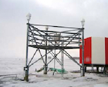
[59/72]
[59/72]
A WAAS station
[59/72]
What does flying at or below MAA help to prevent?
[60/72]
[60/72]
NAVAID interference
[60/72]
[60/72]
What is shown here?
[61/72]
[61/72]
A localizer array
[61/72]
What are some locations where fixes can be found?
[62/72]
[62/72]
• At the intersection of radials from 2 VORs
• At the intersection of a radial and a localizer
[62/72]
• At the intersection of a radial and a localizer
[62/72]
What is the range of a high service volume VOR?
[63/72]
[63/72]
130 NM
[63/72]
[63/72]
What is a VOR?
[64/72]
[64/72]
An aviation NAVAID that serves as the basis for low- and high-altitude air routes
[64/72]
[64/72]
What is the range of a low service volume VOR?
[65/72]
[65/72]
40 NM
[65/72]
[65/72]
In a word, how does the Global Positioning System determine an aircraft's position?
[66/72]
[66/72]
Triangulation
[66/72]
[66/72]
How much vertical clearance does MOCA provide over mountainous terrain?
[67/72]
[67/72]
2000'
[67/72]
[67/72]
What is a fix/waypoint?
[68/72]
[68/72]
A point in space, deemed important for navigation
[68/72]
[68/72]
How many satellites are required for the Global Positioning System to locate an aircraft on the ground?
[69/72]
[69/72]
3
[69/72]
[69/72]
What does the green lighting seen here indicate?
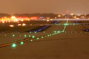
[70/72]
[70/72]
A taxiway centerline
[70/72]
What is a STAR?
[71/72]
[71/72]
A Standard Terminal Arrival Route (or Standard Arrival) procedure
[71/72]
[71/72]
What is shown here?
[72/72]
[72/72]
A marker beacon
[72/72]
GPWS
[1/103]
[1/103]
Ground Proximity Warning System
[1/103]
[1/103]
CRP
[2/103]
[2/103]
Compulsory Reporting Point
[2/103]
[2/103]
AGL
[3/103]
[3/103]
Above Ground Level
[3/103]
[3/103]
PAPI-R
[4/103]
[4/103]
Precision Approach Path Indicator-Right
[4/103]
[4/103]
SID
[5/103]
[5/103]
Standard Instrument Departure
[5/103]
[5/103]
GNSS
[6/103]
[6/103]
Global Navigation Satellite System
[6/103]
[6/103]
MSL
[7/103]
[7/103]
Mean Sea Level
[7/103]
[7/103]
ILS
[8/103]
[8/103]
Instrument Landing System
[8/103]
[8/103]
STAR
[9/103]
[9/103]
Standard Terminal Arrival Route
or
Standard Arrival procedure
[9/103]
or
Standard Arrival procedure
[9/103]
MOCA
[10/103]
[10/103]
Minimum Obstacle Clearance Altitude
[10/103]
[10/103]
ADIZ
[11/103]
[11/103]
Air Defense Identification Zone
[11/103]
[11/103]
VDP
[12/103]
[12/103]
Visual Descent Point
[12/103]
[12/103]
HAA
[13/103]
[13/103]
Height Above Airport
[13/103]
[13/103]
CRS
[14/103]
[14/103]
Course
[14/103]
[14/103]
FSS
[15/103]
[15/103]
Flight Service Station
[15/103]
[15/103]
RW
[16/103]
[16/103]
Runway
[16/103]
[16/103]
LNDG
[17/103]
[17/103]
Landing
[17/103]
[17/103]
INS
[18/103]
[18/103]
Inertial Navigation System
[18/103]
[18/103]
HIALS
[19/103]
[19/103]
High Intensity Approach Lighting System
[19/103]
[19/103]
PAPI-L
[20/103]
[20/103]
Precision Approach Path Indicator-Left
[20/103]
[20/103]
MAA
[21/103]
[21/103]
Maximum Authorized Altitude
[21/103]
[21/103]
MDA
[22/103]
[22/103]
Minimum Descent Altitude
[22/103]
[22/103]
LLWAS
[23/103]
[23/103]
Low-Level Wind Shear Alert System
[23/103]
[23/103]
REIL
[24/103]
[24/103]
Runway End Identifier Lights
[24/103]
[24/103]
FAF
[25/103]
[25/103]
Final Approach Fix
[25/103]
[25/103]
NAVAID
[26/103]
[26/103]
Navigational Aid
[26/103]
[26/103]
OROCA
[27/103]
[27/103]
Off-Route Obstruction Clearance Altitude
(also known as MORA)
[27/103]
(also known as MORA)
[27/103]
LDIN
[28/103]
[28/103]
Lead-in
[28/103]
[28/103]
RLLS
[29/103]
[29/103]
Runway Lead-in Lighting System
[29/103]
[29/103]
BCN
[30/103]
[30/103]
Beacon
[30/103]
[30/103]
AMSL
[31/103]
[31/103]
Above Mean Sea Level
[31/103]
[31/103]
WAAS
[32/103]
[32/103]
Wide Area Augmentation System
[32/103]
[32/103]
LPV
[33/103]
[33/103]
Localizer Performance with Vertical Guidance
[33/103]
[33/103]
IAP
[34/103]
[34/103]
Instrument Approach Procedure
[34/103]
[34/103]
DA(H)
[35/103]
[35/103]
Decision Altitude(Height)
[35/103]
[35/103]
RMI
[36/103]
[36/103]
Radio Magnetic Indicator
[36/103]
[36/103]
LNAV
[37/103]
[37/103]
Lateral Navigation
[37/103]
[37/103]
LOC
[38/103]
[38/103]
Localizer
[38/103]
[38/103]
VORTAC
[39/103]
[39/103]
Very High Frequency Omnidirectional Range TACAN
[39/103]
[39/103]
MM
[40/103]
[40/103]
Middle Marker
[40/103]
[40/103]
MEA
[41/103]
[41/103]
Minimum Enroute Altitude
[41/103]
[41/103]
MAG
[42/103]
[42/103]
Magnetic
[42/103]
[42/103]
CTAF
[43/103]
[43/103]
Common Traffic Advisory Frequency
[43/103]
[43/103]
PAPI
[44/103]
[44/103]
Precision Approach Path Indicator
[44/103]
[44/103]
MOA
[45/103]
[45/103]
Military Operations Area
[45/103]
[45/103]
TCH
[46/103]
[46/103]
Threshold Crossing Height
[46/103]
[46/103]
LOM
[47/103]
[47/103]
Compass Locator Outer Marker
[47/103]
[47/103]
VNAV
[48/103]
[48/103]
Vertical Navigation
[48/103]
[48/103]
TAC
[49/103]
[49/103]
TACAN
[49/103]
[49/103]
IAF
[50/103]
[50/103]
Initial Approach Fix
[50/103]
[50/103]
VGSI
[51/103]
[51/103]
Visual Glideslope Indicator
[51/103]
[51/103]
RAIL
[52/103]
[52/103]
Runway Alignment Indicator Lights
[52/103]
[52/103]
LGTH
[53/103]
[53/103]
Length
[53/103]
[53/103]
MSA
[54/103]
[54/103]
Minimum Safety Altitude
[54/103]
[54/103]
MIRL
[55/103]
[55/103]
Medium-Intensity Runway Lighting
[55/103]
[55/103]
ALSF
[56/103]
[56/103]
Approach Lighting System with Sequenced Flashers
[56/103]
[56/103]
TRACON
[57/103]
[57/103]
Terminal Radar Approach Control
[57/103]
[57/103]
RNAV
[58/103]
[58/103]
Area Navigation
or
Radio Navigation
[58/103]
or
Radio Navigation
[58/103]
MALSR
[59/103]
[59/103]
Medium-Intensity Approach Lighting System with RAIL
[59/103]
[59/103]
NDB
[60/103]
[60/103]
Nondirectional Beacon
[60/103]
[60/103]
RNP
[61/103]
[61/103]
Required Navigation Performance
[61/103]
[61/103]
ADS-B
[62/103]
[62/103]
Automatic Dependent Surveillance-Broadcast
[62/103]
[62/103]
LDA
[63/103]
[63/103]
Localizer-Type Directional Aid
[63/103]
[63/103]
TOD
[64/103]
[64/103]
Top of Descent
[64/103]
[64/103]
TDZE
[65/103]
[65/103]
Touchdown Zone Elevation
[65/103]
[65/103]
CAT
[66/103]
[66/103]
Category
[66/103]
[66/103]
TERPS
[67/103]
[67/103]
Terminal Procedures
[67/103]
[67/103]
RVSM
[68/103]
[68/103]
Reduced Vertical Separation Minima
[68/103]
[68/103]
ADF
[69/103]
[69/103]
Automatic Direction Finder
[69/103]
[69/103]
EFF
[70/103]
[70/103]
Effective date
[70/103]
[70/103]
IM
[71/103]
[71/103]
Inner Marker
[71/103]
[71/103]
GPS
[72/103]
[72/103]
Global Positioning System
[72/103]
[72/103]
PT
[73/103]
[73/103]
Procedure Turn
[73/103]
[73/103]
RCO
[74/103]
[74/103]
Radio Communications Outlet
[74/103]
[74/103]
IF
[75/103]
[75/103]
Intermediate Fix
[75/103]
[75/103]
BC
[76/103]
[76/103]
Localizer Back Course
[76/103]
[76/103]
TOC
[77/103]
[77/103]
Top of Climb
[77/103]
[77/103]
RCLS
[78/103]
[78/103]
Runway Centerline Lighting System
[78/103]
[78/103]
NoPT
[79/103]
[79/103]
No Procedure Turn
[79/103]
[79/103]
GS
[80/103]
[80/103]
Glideslope
[80/103]
[80/103]
HAT
[81/103]
[81/103]
Height Above Touchdown
[81/103]
[81/103]
VASI-L
[82/103]
[82/103]
Visual Approach Slope Indicator-Left
[82/103]
[82/103]
VOR
[83/103]
[83/103]
Very High Frequency Omnidirectional Range
[83/103]
[83/103]
TDZL
[84/103]
[84/103]
Touchdown Zone Lighting
[84/103]
[84/103]
HIRL
[85/103]
[85/103]
High-Intensity Runway Lighting
[85/103]
[85/103]
TACAN
[86/103]
[86/103]
Tactical Air Navigation
[86/103]
[86/103]
HDG
[87/103]
[87/103]
Heading
[87/103]
[87/103]
GP
[88/103]
[88/103]
Glidepath
[88/103]
[88/103]
MORA
[89/103]
[89/103]
Minimum Off-Route Altitude
(also known as OROCA)
[89/103]
(also known as OROCA)
[89/103]
RAIM
[90/103]
[90/103]
Receiver Autonomous Integrity Monitoring
[90/103]
[90/103]
VASI
[91/103]
[91/103]
Visual Approach Slope Indicator
[91/103]
[91/103]
DME
[92/103]
[92/103]
Distance Measuring Equipment
[92/103]
[92/103]
LIRL
[93/103]
[93/103]
Low Intensity Runway Lights
[93/103]
[93/103]
OM
[94/103]
[94/103]
Outer Marker
[94/103]
[94/103]
VASI-R
[95/103]
[95/103]
Visual Approach Slope Indicator-Right
[95/103]
[95/103]
RTE
[96/103]
[96/103]
Route
[96/103]
[96/103]
ELEV
[97/103]
[97/103]
Elevation
[97/103]
[97/103]
INOP
[98/103]
[98/103]
Inoperative
[98/103]
[98/103]
APCH
[99/103]
[99/103]
Approach
[99/103]
[99/103]
IRU
[100/103]
[100/103]
Inertial Reference Unit
[100/103]
[100/103]
FREQ
[101/103]
[101/103]
Frequency
[101/103]
[101/103]
MAP
[102/103]
[102/103]
Missed Approach Point
[102/103]
[102/103]
ALS
[103/103]
[103/103]
Approach Lighting System
[103/103]
[103/103]
What does "!DFW" indicate, in the following NOTAM:
[1/24]
!DFW 07/060 DFW TWY E2 BTN RWY 18L/36R AND RWY 18R/36L CLSD 2107270149-2107271200
[1/24]
!DFW 07/060 DFW TWY E2 BTN RWY 18L/36R AND RWY 18R/36L CLSD 2107270149-2107271200
The NOTAM was issued by an airport known by the IATA code "DFW"
[1/24]
What does "AIRSPACE" indicate, in the following NOTAM:
[2/24]
!EWR 10/234 EWR AIRSPACE UAS WI AN AREA DEFINED AS 2NM RADIUS OF 404405.90N0741019.90W (2.6NM N EWR) SFC-125FT AGL 2010280000-2109202359
[2/24]
!EWR 10/234 EWR AIRSPACE UAS WI AN AREA DEFINED AS 2NM RADIUS OF 404405.90N0741019.90W (2.6NM N EWR) SFC-125FT AGL 2010280000-2109202359
The NOTAM is in reference to airspace (in this case, unmanned aircraft systems are operating within a defined area north of EWR)
[2/24]
What does "NAV" indicate, in the following NOTAM:
[3/24]
!DFW 07/057 DFW NAV ILS RWY 35L DME U/S 2107271400-2107271700
[3/24]
!DFW 07/057 DFW NAV ILS RWY 35L DME U/S 2107271400-2107271700
The NOTAM is in reference to navigation equipment, such as an ILS (in this case, the DME for RWY 35L)
[3/24]
What does "APRON" indicate, in the following NOTAM:
[4/24]
!DAL 04/280 DAL APRON JET AVIATION RAMP NORTH ACCESS CLSD 2104282314-2109302359
[4/24]
!DAL 04/280 DAL APRON JET AVIATION RAMP NORTH ACCESS CLSD 2104282314-2109302359
The NOTAM is in reference to the airport apron (in this case, a partial ramp closure)
[4/24]
What does "RWY 36C RVRM U/S" indicate, in the following NOTAM:
[5/24]
!MEM 08/318 MEM RWY 36C RVRM U/S 2108272000-2108272300
[5/24]
!MEM 08/318 MEM RWY 36C RVRM U/S 2108272000-2108272300
The NOTAM states that the midpoint transmissometer for runway 36C is out of service
[5/24]
What does "SVC" indicate, in the following NOTAM:
[6/24]
!LAX 07/160 LAX SVC MBST/WS DETECTION SYSTEM NOT AVBL 2107271430-2107272200
[6/24]
!LAX 07/160 LAX SVC MBST/WS DETECTION SYSTEM NOT AVBL 2107271430-2107272200
The NOTAM is in reference to airport services (in this case, a microburst/wind shear detection system)
[6/24]
What does "TWY" indicate, in the following NOTAM:
[7/24]
!DFW 07/060 DFW TWY E2 BTN RWY 18L/36R AND RWY 18R/36L CLSD 2107270149-2107271200
[7/24]
!DFW 07/060 DFW TWY E2 BTN RWY 18L/36R AND RWY 18R/36L CLSD 2107270149-2107271200
The NOTAM is in reference to a taxiway or taxiways (in this case, TWY E2)
[7/24]
What does "!FDC" indicate, in the following NOTAM:
[8/24]
!FDC 1/2720 DCA IAP RONALD REAGAN WASHINGTON NTL,
WASHINGTON, DC.
COPTER ILS OR LOC/DME RWY 1, AMDT 1A...
MISSED APPROACH: CLIMB TO 420 THEN CLIMBING LEFT TURN TO 2200 ON
DCA VOR/DME R-325 TO GTN NDB/INT/DCA 5.9 DME AND HOLD.
2103311329-2303311329EST
WASHINGTON, DC.
COPTER ILS OR LOC/DME RWY 1, AMDT 1A...
MISSED APPROACH: CLIMB TO 420 THEN CLIMBING LEFT TURN TO 2200 ON
DCA VOR/DME R-325 TO GTN NDB/INT/DCA 5.9 DME AND HOLD.
2103311329-2303311329EST
The NOTAM is an FDC NOTAM, issued by the Flight Data Center, rather than by an airport itself
[8/24]
What does "COM" indicate, in the following NOTAM:
[9/24]
!MIA 06/007 MIA COM GRAND BAHAMA REMOTE OUTLET 126.9 U/S 2106011119-2108022000EST
[9/24]
!MIA 06/007 MIA COM GRAND BAHAMA REMOTE OUTLET 126.9 U/S 2106011119-2108022000EST
The NOTAM is in reference to communications equipment (in this case, an unserviceable RCO)
[9/24]
What does "2107270149-2107271200" indicate, in the following NOTAM:
[10/24]
!DFW 07/060 DFW TWY E2 BTN RWY 18L/36R AND RWY 18R/36L CLSD 2107270149-2107271200
[10/24]
!DFW 07/060 DFW TWY E2 BTN RWY 18L/36R AND RWY 18R/36L CLSD 2107270149-2107271200
The NOTAM takes effect on July 27, 2021 at 0149Z, and remains in effect until July 27, 2021 at 1200Z
[10/24]
What does "1/5893" indicate, in the following NOTAM:
[11/24]
!FDC 1/5893 BOS SID GENERAL EDWARD LAWRENCE LOGAN
INTL, BOSTON, MA.
LOGAN TWO DEPARTURE...
DEPARTURE PROCEDURE TAKEOFF RWYS RWY 4L, 4R, 14, 15R, 27, 33L NA
EXCEPT FOR AIRCRAFT EQUIPPED WITH SUITABLE RNAV SYSTEM WITH GPS,
BOS VOR/DME OUT OF SERVICE. 2107281900-2108041531EST
INTL, BOSTON, MA.
LOGAN TWO DEPARTURE...
DEPARTURE PROCEDURE TAKEOFF RWYS RWY 4L, 4R, 14, 15R, 27, 33L NA
EXCEPT FOR AIRCRAFT EQUIPPED WITH SUITABLE RNAV SYSTEM WITH GPS,
BOS VOR/DME OUT OF SERVICE. 2107281900-2108041531EST
The NOTAM was the 5,893rd NOTAM to be issued in the year 2021 (with the first number being the fourth digit of the year in which it was issued)
[11/24]
What does "DAL" indicate, in the following NOTAM:
[12/24]
!DAL 04/092 DAL TWY G CLSD 2104091430-PERM
[12/24]
!DAL 04/092 DAL TWY G CLSD 2104091430-PERM
The NOTAM affects an airport known by the IATA code "DAL"
[12/24]
What does "2104091430-PERM" indicate, in the following NOTAM:
[13/24]
!DAL 04/092 DAL TWY G CLSD 2104091430-PERM
[13/24]
!DAL 04/092 DAL TWY G CLSD 2104091430-PERM
The NOTAM takes effect on April 9, 2021 at 1430Z, and is permanent
[13/24]
What does "IAP" indicate, in the following NOTAM:
[14/24]
!FDC 1/2720 DCA IAP RONALD REAGAN WASHINGTON NTL,
WASHINGTON, DC.
COPTER ILS OR LOC/DME RWY 1, AMDT 1A...
MISSED APPROACH: CLIMB TO 420 THEN CLIMBING LEFT TURN TO 2200 ON
DCA VOR/DME R-325 TO GTN NDB/INT/DCA 5.9 DME AND HOLD.
2103311329-2303311329EST
WASHINGTON, DC.
COPTER ILS OR LOC/DME RWY 1, AMDT 1A...
MISSED APPROACH: CLIMB TO 420 THEN CLIMBING LEFT TURN TO 2200 ON
DCA VOR/DME R-325 TO GTN NDB/INT/DCA 5.9 DME AND HOLD.
2103311329-2303311329EST
The NOTAM is in reference to an Instrument Approach Procedure (in this case, the ILS or LOC/DME to RWY 1 at DCA)
[14/24]
What does "AD" indicate, in the following NOTAM:
[15/24]
!VCV 07/015 VCV AD AP WINDCONE LGT FOR RWY 35 U/S 2107151739-2112312300
[15/24]
!VCV 07/015 VCV AD AP WINDCONE LGT FOR RWY 35 U/S 2107151739-2112312300
The NOTAM is in reference to the aerodrome (in this case, an unserviceable windcone light)
[15/24]
What does "RWY" indicate, in the following NOTAM:
[16/24]
!DFW 07/053 DFW RWY 35L ALS U/S 2107270430-2107271100
[16/24]
!DFW 07/053 DFW RWY 35L ALS U/S 2107270430-2107271100
The NOTAM is in reference to a runway or runways (in this case, RWY 35L)
[16/24]
What does "SID" indicate, in the following NOTAM:
[17/24]
!FDC 1/5893 BOS SID GENERAL EDWARD LAWRENCE LOGAN
INTL, BOSTON, MA.
LOGAN TWO DEPARTURE...
DEPARTURE PROCEDURE TAKEOFF RWYS RWY 4L, 4R, 14, 15R, 27, 33L NA
EXCEPT FOR AIRCRAFT EQUIPPED WITH SUITABLE RNAV SYSTEM WITH GPS,
BOS VOR/DME OUT OF SERVICE. 2107281900-2108041531EST
INTL, BOSTON, MA.
LOGAN TWO DEPARTURE...
DEPARTURE PROCEDURE TAKEOFF RWYS RWY 4L, 4R, 14, 15R, 27, 33L NA
EXCEPT FOR AIRCRAFT EQUIPPED WITH SUITABLE RNAV SYSTEM WITH GPS,
BOS VOR/DME OUT OF SERVICE. 2107281900-2108041531EST
The NOTAM is in reference to a Standard Instrument Departure (in this case, the LOGAN2 departure from BOS)
[17/24]
What does "2107271430-2107271700EST" indicate, in the following NOTAM:
[18/24]
!AFW 07/030 AFW RWY 16L RVR U/S 2107271430-2107271700EST
[18/24]
!AFW 07/030 AFW RWY 16L RVR U/S 2107271430-2107271700EST
The NOTAM takes effect on July 27, 2021 at 1430Z, and is estimated to remain in effect until July 27, 2021 at 1700Z
[18/24]
What does "07/060" indicate, in the following NOTAM:
[19/24]
!DFW 07/060 DFW TWY E2 BTN RWY 18L/36R AND RWY 18R/36L CLSD 2107270149-2107271200
[19/24]
!DFW 07/060 DFW TWY E2 BTN RWY 18L/36R AND RWY 18R/36L CLSD 2107270149-2107271200
The NOTAM was the 60th NOTAM to be issued in the 7th month
[19/24]
What does "ODP" indicate, in the following NOTAM:
[20/24]
!FDC 1/7624 DCA ODP RONALD REAGAN WASHINGTON NTL,
WASHINGTON, DC.
TAKEOFF MINIMUMS AND (OBSTACLE) DEPARTURE PROCEDURES AMDT 8B...
TAKEOFF MINIMUMS: RWY 22, 500-2 3/4.
RWY 4, 400-2 1/2 OR STANDARD WITH MINIMUM CLIMB OF 290FT PER NM TO
600.
ALL OTHER DATA REMAINS AS PUBLISHED. 2104091217-2201151217EST
WASHINGTON, DC.
TAKEOFF MINIMUMS AND (OBSTACLE) DEPARTURE PROCEDURES AMDT 8B...
TAKEOFF MINIMUMS: RWY 22, 500-2 3/4.
RWY 4, 400-2 1/2 OR STANDARD WITH MINIMUM CLIMB OF 290FT PER NM TO
600.
ALL OTHER DATA REMAINS AS PUBLISHED. 2104091217-2201151217EST
The NOTAM is in reference to an Obstacle Departure Procedure (in this case, Amendment 8B for DCA)
[20/24]
What does "STAR" indicate, in the following NOTAM:
[21/24]
!FDC 1/2058 MCO STAR ORLANDO INTL, ORLANDO, FL.
PRICY ONE RNAV ARRIVAL.. ATC ASSIGNED ONLY.
2104220900-2108120900
PRICY ONE RNAV ARRIVAL.. ATC ASSIGNED ONLY.
2104220900-2108120900
[21/24]
!FDC 1/2058 MCO STAR ORLANDO INTL, ORLANDO, FL.
PRICY ONE RNAV ARRIVAL.. ATC ASSIGNED ONLY.
2104220900-2108120900
PRICY ONE RNAV ARRIVAL.. ATC ASSIGNED ONLY.
2104220900-2108120900
The NOTAM is in reference to a Standard Terminal Arrival (in this case, the PRICY1 arrival into MCO)
[21/24]
What does "RWY 35 RVRT U/S" indicate, in the following NOTAM:
[22/24]
!MSP 08/281 MSP RWY 35 RVRT U/S 2108271700-2108272000
[22/24]
!MSP 08/281 MSP RWY 35 RVRT U/S 2108271700-2108272000
The NOTAM states that the touchdown zone transmissometer for runway 35 is out of service
[22/24]
What does "RWY 20R RVRR U/S" indicate, in the following NOTAM:
[23/24]
!BNA 08/552 BNA RWY 20R RVRR U/S 2108261753-2108312000EST
[23/24]
!BNA 08/552 BNA RWY 20R RVRR U/S 2108261753-2108312000EST
The NOTAM states that the rollout (far-end) transmissometer for runway 20R is out of service
[23/24]
What does "OBST" indicate, in the following NOTAM:
[24/24]
!LAX 07/218 LAX OBST CRANE (ASN 2019-AWP-4047-NRA) 335702N1182222W (1.8NM ENE LAX) 244FT (145FT AGL) FLAGGED AND LGTD MON-SAT 1300-0100 2107261300-2201010100
[24/24]
!LAX 07/218 LAX OBST CRANE (ASN 2019-AWP-4047-NRA) 335702N1182222W (1.8NM ENE LAX) 244FT (145FT AGL) FLAGGED AND LGTD MON-SAT 1300-0100 2107261300-2201010100
The NOTAM is in reference to an obstruction to aircraft (in this case, a temporary construction crane)
[24/24]
AVBL
[1/86]
[1/86]
Available
[1/86]
[1/86]
CMB
[2/86]
[2/86]
Climb
[2/86]
[2/86]
ACC
[3/86]
[3/86]
Area Control Center (ARTCC)
[3/86]
[3/86]
PTN
[4/86]
[4/86]
Procedure Turn
[4/86]
[4/86]
CNL
[5/86]
[5/86]
Cancel
[5/86]
[5/86]
EXC
[6/86]
[6/86]
Except
[6/86]
[6/86]
BCN
[7/86]
[7/86]
Beacon
[7/86]
[7/86]
VICE
[8/86]
[8/86]
Versus/instead of
[8/86]
[8/86]
RVRT
[9/86]
[9/86]
RVR Touchdown
[9/86]
[9/86]
TRSN
[10/86]
[10/86]
Transition
[10/86]
[10/86]
UFN
[11/86]
[11/86]
Until Further Notice
[11/86]
[11/86]
BYD
[12/86]
[12/86]
Beyond
[12/86]
[12/86]
NGT
[13/86]
[13/86]
Night
[13/86]
[13/86]
HP
[14/86]
[14/86]
Holding Pattern
[14/86]
[14/86]
UAS
[15/86]
[15/86]
Unmanned Aircraft System
[15/86]
[15/86]
DLY
[16/86]
[16/86]
Daily
[16/86]
[16/86]
TFR
[17/86]
[17/86]
Temporary Flight Restriction
[17/86]
[17/86]
BTN
[18/86]
[18/86]
Between
[18/86]
[18/86]
OBSC
[19/86]
[19/86]
Obscured
[19/86]
[19/86]
PSN
[20/86]
[20/86]
Position
[20/86]
[20/86]
SB
[21/86]
[21/86]
Southbound
[21/86]
[21/86]
WB
[22/86]
[22/86]
Westbound
[22/86]
[22/86]
SKED
[23/86]
[23/86]
Scheduled
[23/86]
[23/86]
LGTD
[24/86]
[24/86]
Lighted
[24/86]
[24/86]
ABV
[25/86]
[25/86]
Above
[25/86]
[25/86]
DALGT
[26/86]
[26/86]
Daylight
[26/86]
[26/86]
AP
[27/86]
[27/86]
Airport
[27/86]
[27/86]
BLW
[28/86]
[28/86]
Below
[28/86]
[28/86]
LLZ
[29/86]
[29/86]
Localizer
[29/86]
[29/86]
PAT
[30/86]
[30/86]
Pattern
[30/86]
[30/86]
BC
[31/86]
[31/86]
Backcourse
[31/86]
[31/86]
ACR
[32/86]
[32/86]
Air Carrier
[32/86]
[32/86]
ACT
[33/86]
[33/86]
Active
[33/86]
[33/86]
RVRR
[34/86]
[34/86]
RVR Rollout
[34/86]
[34/86]
NB
[35/86]
[35/86]
Northbound
[35/86]
[35/86]
NR
[36/86]
[36/86]
Number
[36/86]
[36/86]
CLSD
[37/86]
[37/86]
Closed
[37/86]
[37/86]
RTHL
[38/86]
[38/86]
Runway Threshold Lights
[38/86]
[38/86]
U/S
[39/86]
[39/86]
Unserviceable
[39/86]
[39/86]
UNAVBL
[40/86]
[40/86]
Unavailable
[40/86]
[40/86]
EB
[41/86]
[41/86]
Eastbound
[41/86]
[41/86]
PERM
[42/86]
[42/86]
Permanent
[42/86]
[42/86]
DCMSND
[43/86]
[43/86]
Decomissioned
[43/86]
[43/86]
CTC
[44/86]
[44/86]
Contact
[44/86]
[44/86]
TFC
[45/86]
[45/86]
Trafic
[45/86]
[45/86]
MBST
[46/86]
[46/86]
Microburst
[46/86]
[46/86]
LGT
[47/86]
[47/86]
Light
[47/86]
[47/86]
THR
[48/86]
[48/86]
Threshold
[48/86]
[48/86]
ADZD
[49/86]
[49/86]
Advised
[49/86]
[49/86]
TIL
[50/86]
[50/86]
Until
[50/86]
[50/86]
EXC TAX
[51/86]
[51/86]
Except for Taxi
[51/86]
[51/86]
TRML
[52/86]
[52/86]
Terminal
[52/86]
[52/86]
VOL
[53/86]
[53/86]
Volume
[53/86]
[53/86]
PPR
[54/86]
[54/86]
Prior Permission Required
[54/86]
[54/86]
BA
[55/86]
[55/86]
Braking Action (FAIR, NIL, POOR, etc.)
[55/86]
[55/86]
PARL
[56/86]
[56/86]
Parallel
[56/86]
[56/86]
RMNDR
[57/86]
[57/86]
Remainder
[57/86]
[57/86]
PCL
[58/86]
[58/86]
Pilot-Controlled Lights
[58/86]
[58/86]
NMR
[59/86]
[59/86]
Nautical Mile Radius
[59/86]
[59/86]
CBAS
[60/86]
[60/86]
Class B Airspace
[60/86]
[60/86]
RVRM
[61/86]
[61/86]
RVR Midpoint
[61/86]
[61/86]
RCL
[62/86]
[62/86]
Runway Centerline
[62/86]
[62/86]
CDAS
[63/86]
[63/86]
Class D Airspace
[63/86]
[63/86]
WI
[64/86]
[64/86]
Within
[64/86]
[64/86]
AP LGT
[65/86]
[65/86]
Airport Light
[65/86]
[65/86]
ADJ
[66/86]
[66/86]
Adjacent
[66/86]
[66/86]
MIN
[67/86]
[67/86]
Minute
[67/86]
[67/86]
CGAS
[68/86]
[68/86]
Class G Airspace
[68/86]
[68/86]
AMDT
[69/86]
[69/86]
Amendment
[69/86]
[69/86]
UNMNT
[70/86]
[70/86]
Unmonitored
[70/86]
[70/86]
WIE
[71/86]
[71/86]
With Immediate Effect
[71/86]
[71/86]
CCAS
[72/86]
[72/86]
Class C Airspace
[72/86]
[72/86]
IR
[73/86]
[73/86]
Ice on Runway
[73/86]
[73/86]
INT
[74/86]
[74/86]
Intersection
[74/86]
[74/86]
CL
[75/86]
[75/86]
Centerline
[75/86]
[75/86]
CEAS
[76/86]
[76/86]
Class E Airspace
[76/86]
[76/86]
WEF
[77/86]
[77/86]
With Effect From
[77/86]
[77/86]
CK
[78/86]
[78/86]
Check
[78/86]
[78/86]
DLA
[79/86]
[79/86]
Delay
[79/86]
[79/86]
RCLL
[80/86]
[80/86]
Runway Centerline Light System
[80/86]
[80/86]
NA
[81/86]
[81/86]
Not Authorized
[81/86]
[81/86]
ABN
[82/86]
[82/86]
Airport Beacon
[82/86]
[82/86]
FNA
[83/86]
[83/86]
Final Approach
[83/86]
[83/86]
TDZ LG
[84/86]
[84/86]
Touchdown Zone Lighting
[84/86]
[84/86]
CAAS
[85/86]
[85/86]
Class A Airspace
[85/86]
[85/86]
PAEW
[86/86]
[86/86]
Personnel and Equipment Working
[86/86]
[86/86]
Z
[1/26]
[1/26]
ZULU
[1/26]
[1/26]
O
[2/26]
[2/26]
OSCAR
[2/26]
[2/26]
X
[3/26]
[3/26]
XRAY
[3/26]
[3/26]
I
[4/26]
[4/26]
INDIA
[4/26]
[4/26]
M
[5/26]
[5/26]
MIKE
[5/26]
[5/26]
G
[6/26]
[6/26]
GOLF
[6/26]
[6/26]
S
[7/26]
[7/26]
SIERRA
[7/26]
[7/26]
E
[8/26]
[8/26]
ECHO
[8/26]
[8/26]
W
[9/26]
[9/26]
WHISKEY
[9/26]
[9/26]
N
[10/26]
[10/26]
NOVEMBER
[10/26]
[10/26]
J
[11/26]
[11/26]
JULIET
[11/26]
[11/26]
P
[12/26]
[12/26]
PAPA
[12/26]
[12/26]
U
[13/26]
[13/26]
UNIFORM
[13/26]
[13/26]
V
[14/26]
[14/26]
VICTOR
[14/26]
[14/26]
T
[15/26]
[15/26]
TANGO
[15/26]
[15/26]
B
[16/26]
[16/26]
BRAVO
[16/26]
[16/26]
C
[17/26]
[17/26]
CHARLIE
[17/26]
[17/26]
K
[18/26]
[18/26]
KILO
[18/26]
[18/26]
R
[19/26]
[19/26]
ROMEO
[19/26]
[19/26]
Q
[20/26]
[20/26]
QUEBEC
[20/26]
[20/26]
D
[21/26]
[21/26]
DELTA
[21/26]
[21/26]
Y
[22/26]
[22/26]
YANKEE
[22/26]
[22/26]
H
[23/26]
[23/26]
HOTEL
[23/26]
[23/26]
A
[24/26]
[24/26]
ALPHA
[24/26]
[24/26]
L
[25/26]
[25/26]
LIMA
[25/26]
[25/26]
F
[26/26]
[26/26]
FOXTROT
[26/26]
[26/26]
What is shown here?

[1/156]
[1/156]
[Enroute High Altitude Chart]
Warning area or alert area
[1/156]
Warning area or alert area
[1/156]
What is Minimum Descent Altitude?
[2/156]
[2/156]
MDA is the minimum altitude to which a pilot on a non-precision approach may descend, prior to seeing the runway (or arriving at the Visual Descent Point)
[2/156]
[2/156]
What is shown here?

[3/156]
[3/156]
[Enroute High Altitude Chart]
A line of longitude (in this case, 106°W)
[3/156]
A line of longitude (in this case, 106°W)
[3/156]
What is shown here?

[4/156]
[4/156]
[Enroute High Altitude Chart]
VOR radial
[4/156]
VOR radial
[4/156]
Which type of NAVAID is being noted here?

[5/156]
[5/156]
A VOR
[5/156]
What does the thick blue line seen here indicate
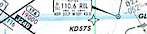
[6/156]
[6/156]
[Enroute High Altitude Chart]
A place where 2 charts overlap
[6/156]
A place where 2 charts overlap
[6/156]
What is shown here?

[7/156]
[7/156]
[Enroute High Altitude Chart]
Maximum Authorized Altitude (MAA)
[7/156]
Maximum Authorized Altitude (MAA)
[7/156]
What is shown here?
[8/156]
[8/156]
[Airport Diagram]
Magnetic variation (in this case, 9°E)
[8/156]
Magnetic variation (in this case, 9°E)
[8/156]
What is shown here?

[9/156]
[9/156]
[Enroute Low Altitude Chart]
One-way air route
[9/156]
One-way air route
[9/156]
What is shown here?
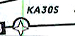
[10/156]
[10/156]
[Enroute High Altitude Chart]
A waypoint that is not part of this jet route (airway bypass)
[10/156]
A waypoint that is not part of this jet route (airway bypass)
[10/156]
What is shown here?
[11/156]
[11/156]
[Approach Plate]
Tower frequencies
[11/156]
Tower frequencies
[11/156]
What is shown here?
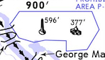
[12/156]
[12/156]
[Approach Plate]
Prohibited airspace
[12/156]
Prohibited airspace
[12/156]
What is shown here?

[13/156]
[13/156]
[Approach Plate]
A point that must be crossed at or below 7000'
[13/156]
A point that must be crossed at or below 7000'
[13/156]
What is shown here?
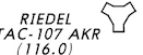
[14/156]
[14/156]
[Enroute High Altitude Chart]
TACAN
[14/156]
TACAN
[14/156]
What does the (200') seen here indicate?
[15/156]
[15/156]
[Approach Plate]
The height above touchdown for this precision approach
[15/156]
The height above touchdown for this precision approach
[15/156]
What does CTAF mean?
[16/156]
[16/156]
[Approach Plate]
Common Traffic Advisory Frequency is a frequency used by pilots to coordinate with one another when the tower is not operating
[16/156]
Common Traffic Advisory Frequency is a frequency used by pilots to coordinate with one another when the tower is not operating
[16/156]
What does the 600' seen here indicate?
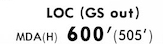
[17/156]
[17/156]
[Approach Plate]
The minimum descent altitude for this non-precision approach
[17/156]
The minimum descent altitude for this non-precision approach
[17/156]
Which type of NAVAID is being noted here?

[18/156]
[18/156]
A fix or a waypoint
[18/156]
What is shown here?
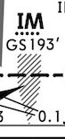
[19/156]
[19/156]
[Approach Plate]
Marker beacon (in this case, an inner marker)
[19/156]
Marker beacon (in this case, an inner marker)
[19/156]
What is shown here?
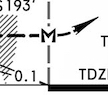
[20/156]
[20/156]
[Approach Plate]
Missed approach point for non-precision approach
[20/156]
Missed approach point for non-precision approach
[20/156]
What is shown here?
[21/156]
[21/156]
[Approach Plate]
Plate amendment number and date
[21/156]
Plate amendment number and date
[21/156]
What is shown here?

[22/156]
[22/156]
[Airport Diagram]
Runway identifier and magnetic heading
[22/156]
Runway identifier and magnetic heading
[22/156]
What is shown here?
[23/156]
[23/156]
[Airport Diagram]
Taxiway (in this case, taxiway Papa)
[23/156]
Taxiway (in this case, taxiway Papa)
[23/156]
What is shown here?

[24/156]
[24/156]
[Enroute High Altitude Chart]
MEA gap (possible loss of NAVAID reception here, even when flying at or above MEA)
[24/156]
MEA gap (possible loss of NAVAID reception here, even when flying at or above MEA)
[24/156]
Which altitudes are included in a high altitude chart?
[25/156]
[25/156]
FL180 to FL450
[25/156]
[25/156]
What is shown here?
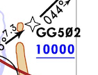
[26/156]
[26/156]
[RNAV STAR]
A waypoint that must be crossed at or above 10000'
[26/156]
A waypoint that must be crossed at or above 10000'
[26/156]
What does the wavy double-line seen here indicate?
[27/156]
[27/156]
[FAA/NACO Chart]
Not to scale
[27/156]
Not to scale
[27/156]
What does the "(R)" shown here indicate?

[28/156]
[28/156]
[Approach Plate]
This ATC facility has radar capabilities
[28/156]
This ATC facility has radar capabilities
[28/156]
What is shown here?

[29/156]
[29/156]
[Approach Plate]
The highest point AMSL anywhere on the airfield, and the highest point AMSL within the first 3000' of the runway depicted on this plate, respectively (in this case, both are below sea level)
[29/156]
The highest point AMSL anywhere on the airfield, and the highest point AMSL within the first 3000' of the runway depicted on this plate, respectively (in this case, both are below sea level)
[29/156]
What is shown here?
[30/156]
[30/156]
[Approach Plate]
A missed approach fix
[30/156]
A missed approach fix
[30/156]
What is shown here?
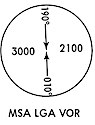
[31/156]
[31/156]
[Approach Plate]
Minimum Safe Altitude
[31/156]
Minimum Safe Altitude
[31/156]
What is shown here?
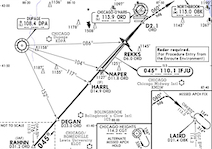
[32/156]
[32/156]
[Approach Plate]
Plan view
[32/156]
Plan view
[32/156]
What is shown here?

[33/156]
[33/156]
[RNAV STAR]
An international border
[33/156]
An international border
[33/156]
What is shown here?

[34/156]
[34/156]
[Enroute High Altitude Chart]
Restricted airspace
[34/156]
Restricted airspace
[34/156]
What is shown here?

[35/156]
[35/156]
[Approach Plate]
Final approach fix (GS intercept at 2000' MSL, 1905' AGL)
[35/156]
Final approach fix (GS intercept at 2000' MSL, 1905' AGL)
[35/156]
Where is this MSA centered?
[36/156]
[36/156]
[Approach Plate]
On the LGA VOR
[36/156]
On the LGA VOR
[36/156]
What is shown here?
[37/156]
[37/156]
[Approach Plate]
RVR minimums across all categories for full ILS approach
[37/156]
RVR minimums across all categories for full ILS approach
[37/156]
What is shown here?
[38/156]
[38/156]
[Approach Plate]
Missed approach (go around) procedure
[38/156]
Missed approach (go around) procedure
[38/156]
What is shown here?

[39/156]
[39/156]
[Approach Plate]
ICAO and IATA airport codes, respectively
[39/156]
ICAO and IATA airport codes, respectively
[39/156]
What is shown here?
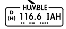
[40/156]
[40/156]
[Approach Plate]
VOR information box (name, DME, service volume, frequency, identifier, and identifier in Morse code)
[40/156]
VOR information box (name, DME, service volume, frequency, identifier, and identifier in Morse code)
[40/156]
What is shown here?
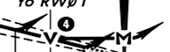
[41/156]
[41/156]
[RNAV Approach Plate]
Missed approach points for LNAV, LNAV/VNAV, and LPV approaches
[41/156]
Missed approach points for LNAV, LNAV/VNAV, and LPV approaches
[41/156]
What is shown here?
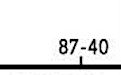
[42/156]
[42/156]
[Approach Plate]
Line of longitude (in this case, 87°W)
[42/156]
Line of longitude (in this case, 87°W)
[42/156]
What is shown here?

[43/156]
[43/156]
[Approach Plate]
A fix that must be crossed at exactly 9000'
[43/156]
A fix that must be crossed at exactly 9000'
[43/156]
What is shown here?
[44/156]
[44/156]
[Airport Diagram]
Wind sock (in this case, unlighted)
[44/156]
Wind sock (in this case, unlighted)
[44/156]
What is shown here?

[45/156]
[45/156]
[Approach Plate]
The type of approach lighting system available on this approach
[45/156]
The type of approach lighting system available on this approach
[45/156]
What is shown here?
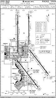
[46/156]
[46/156]
Airport diagram
[46/156]
What is shown here?
[47/156]
[47/156]
[Enroute High Altitude Chart]
Fix
[47/156]
Fix
[47/156]
Which type of NAVAID is being noted here?
[48/156]
[48/156]
An NDB
[48/156]
What is shown here?
[49/156]
[49/156]
[RNAV Approach Plate]
Descent/timing conversion table for an RNAV approach
[49/156]
Descent/timing conversion table for an RNAV approach
[49/156]
What is shown here?

[50/156]
[50/156]
[Enroute Low Altitude Chart]
Civilian airport without a rotating beacon
[50/156]
Civilian airport without a rotating beacon
[50/156]
What is threshold crossing height?
[51/156]
[51/156]
TCH is the height the aircraft is above the ground when crossing the runway threshold, while centered on the glideslope
[51/156]
[51/156]
What is shown here?
[52/156]
[52/156]
[Enroute High Altitude Chart]
Minimum Off-Route Altitude (MORA)
[52/156]
Minimum Off-Route Altitude (MORA)
[52/156]
What is shown here?
[53/156]
[53/156]
[RNAV STAR]
MORA of FL182
[53/156]
MORA of FL182
[53/156]
What is shown here?

[54/156]
[54/156]
[SID]
The name of this SID
[54/156]
The name of this SID
[54/156]
What is shown here?
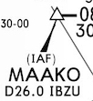
[55/156]
[55/156]
[Approach Plate]
Initial approach fix (ILS/LOC)
[55/156]
Initial approach fix (ILS/LOC)
[55/156]
What is shown here?

[56/156]
[56/156]
[Approach Plate]
Localizer information box (course, frequency, identifier, and identifier in Morse code)
[56/156]
Localizer information box (course, frequency, identifier, and identifier in Morse code)
[56/156]
What is shown here?

[57/156]
[57/156]
[Enroute High Altitude Chart]
Air Defense Identification Zone (ADIZ)
[57/156]
Air Defense Identification Zone (ADIZ)
[57/156]
What is shown here?
[58/156]
[58/156]
[Enroute High Altitude Chart]
NDB
[58/156]
NDB
[58/156]
What is shown here?
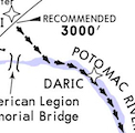
[59/156]
[59/156]
[Approach Plate]
Path for a visual approach ("visual track")
[59/156]
Path for a visual approach ("visual track")
[59/156]
What is shown here?

[60/156]
[60/156]
[Enroute High Altitude Chart]
Distance scale
[60/156]
Distance scale
[60/156]
What is shown here?
[61/156]
[61/156]
[Approach Plate]
Radial 141 (R-141) from the TNV VOR
[61/156]
Radial 141 (R-141) from the TNV VOR
[61/156]
What is shown here?
[62/156]
[62/156]
[Approach Plate]
Visual descent point
[62/156]
Visual descent point
[62/156]
What is shown here?
[63/156]
[63/156]
[SID]
A fix where this SID can be exited
[63/156]
A fix where this SID can be exited
[63/156]
What is shown here?
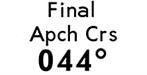
[64/156]
[64/156]
[Approach Plate]
Final approach course in magnetic degrees (in this case, to the northeast)
[64/156]
Final approach course in magnetic degrees (in this case, to the northeast)
[64/156]
What is shown here?
[65/156]
[65/156]
[Airport Diagram]
Hot spot
[65/156]
Hot spot
[65/156]
What is shown here?

[66/156]
[66/156]
[Enroute High Altitude Chart]
Segment distance
[66/156]
Segment distance
[66/156]
What is shown here?
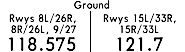
[67/156]
[67/156]
[Approach Plate]
Ground control frequencies
[67/156]
Ground control frequencies
[67/156]
What is Touchdown Zone Elevation?
[68/156]
[68/156]
The highest point AMSL in the first 3000' of the approach end of a given runway
[68/156]
[68/156]
What is shown here?
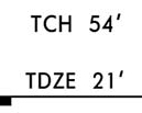
[69/156]
[69/156]
[Approach Plate]
Threshold crossing height of 54' AGL, and touchdown zone elevation of 21' AMSL, respectively
[69/156]
Threshold crossing height of 54' AGL, and touchdown zone elevation of 21' AMSL, respectively
[69/156]
What is shown here?

[70/156]
[70/156]
[Airport Diagram]
Wind sock (in this case, lighted)
[70/156]
Wind sock (in this case, lighted)
[70/156]
What is the radius of an MSA?
[71/156]
[71/156]
25 NM
[71/156]
[71/156]
What is shown here?
[72/156]
[72/156]
[Approach Plate]
The highest natural (non-man-made) point on this chart
[72/156]
The highest natural (non-man-made) point on this chart
[72/156]
What is shown here?
[73/156]
[73/156]
[Approach Plate]
RVR minimums across all categories, if the TDZL or RCLS is out of service
[73/156]
RVR minimums across all categories, if the TDZL or RCLS is out of service
[73/156]
What is shown here?
[74/156]
[74/156]
[Approach Plate]
Landing minimums
[74/156]
Landing minimums
[74/156]
What is shown here?

[75/156]
[75/156]
[Airport Diagram]
Unidentified beacon
[75/156]
Unidentified beacon
[75/156]
What is shown here?
[76/156]
[76/156]
[Enroute High Altitude Chart]
Magnetic variation line (in this case, 10°E)
[76/156]
Magnetic variation line (in this case, 10°E)
[76/156]
What is shown here?
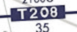
[77/156]
[77/156]
[Enroute Low Altitude Chart]
Tango route (RNAV victor route)
[77/156]
Tango route (RNAV victor route)
[77/156]
What is shown here?

[78/156]
[78/156]
[Approach Plate]
Local altimeter setting is in inches of mercury (as opposed to millibars)
[78/156]
Local altimeter setting is in inches of mercury (as opposed to millibars)
[78/156]
What is shown here?

[79/156]
[79/156]
[Approach Plate]
ATIS frequency
[79/156]
ATIS frequency
[79/156]
What is shown here?
[80/156]
[80/156]
[Approach Plate]
Descent/timing conversion table
[80/156]
Descent/timing conversion table
[80/156]
What is shown here?
[81/156]
[81/156]
[Enroute High Altitude Chart]
Center boundary line
[81/156]
Center boundary line
[81/156]
What is shown here?
[82/156]
[82/156]
[Enroute High Altitude Chart]
State boundary
[82/156]
State boundary
[82/156]
What does the (505') seen here indicate?
[83/156]
[83/156]
[Approach Plate]
The height above touchdown for this non-precision approach
[83/156]
The height above touchdown for this non-precision approach
[83/156]
What is shown here?
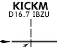
[84/156]
[84/156]
[Approach Plate]
A point 16.7 DME from the localizer IBZU
[84/156]
A point 16.7 DME from the localizer IBZU
[84/156]
What is shown here?
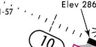
[85/156]
[85/156]
[Airport Diagram]
Approach lighting system
[85/156]
Approach lighting system
[85/156]
What is shown here?
[86/156]
[86/156]
[Approach Plate]
Final approach fix for a non-precision approach
[86/156]
Final approach fix for a non-precision approach
[86/156]
What is shown here?
[87/156]
[87/156]
[Airport Diagram]
Runway length, in feet and meters
[87/156]
Runway length, in feet and meters
[87/156]
What is shown here?
[88/156]
[88/156]
[Enroute High Altitude Chart]
A compulsory reporting point, or CRP (in this case, a VOR)
[88/156]
A compulsory reporting point, or CRP (in this case, a VOR)
[88/156]
What is shown here?
[89/156]
[89/156]
[RNAV STAR]
A waypoint at which this STAR can be joined
[89/156]
A waypoint at which this STAR can be joined
[89/156]
What is shown here?
[90/156]
[90/156]
[Enroute High Altitude Chart]
Q-route (RNAV jet route)
[90/156]
Q-route (RNAV jet route)
[90/156]
What is shown here?
[91/156]
[91/156]
[Approach Plate]
Briefing strip
[91/156]
Briefing strip
[91/156]
What is shown here?
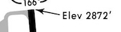
[92/156]
[92/156]
[Airport Diagram]
Runway elevation
[92/156]
Runway elevation
[92/156]
What is shown here?

[93/156]
[93/156]
[Approach Plate]
Localizer frequency
[93/156]
Localizer frequency
[93/156]
What is shown here?
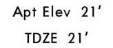
[94/156]
[94/156]
[Approach Plate]
The highest point AMSL anywhere on the airfield, and the highest point AMSL within the first 3000' of the runway depicted on this plate, respectively
[94/156]
The highest point AMSL anywhere on the airfield, and the highest point AMSL within the first 3000' of the runway depicted on this plate, respectively
[94/156]
How high is the tallest obstacle on the left side of this MSA?
[95/156]
[95/156]
[Approach Plate]
2000' MSL
[95/156]
2000' MSL
[95/156]
What is shown here?
[96/156]
[96/156]
[RNAV STAR]
A civilian airport without a rotating beacon
[96/156]
A civilian airport without a rotating beacon
[96/156]
What is shown here?
[97/156]
[97/156]
[Enroute High Altitude Chart]
A fix that is not part of this jet route (airway bypass)
[97/156]
A fix that is not part of this jet route (airway bypass)
[97/156]
What is shown here?

[98/156]
[98/156]
[Approach Plate]
"Terminal procedures" (certifies that this non-FAA chart contains accurate, verified information)
[98/156]
"Terminal procedures" (certifies that this non-FAA chart contains accurate, verified information)
[98/156]
What is shown here?
[99/156]
[99/156]
[Enroute High Altitude Chart]
International border
[99/156]
International border
[99/156]
What is shown here?
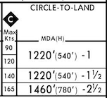
[100/156]
[100/156]
[Approach Plate]
Landing minimums for a circling approach
[100/156]
Landing minimums for a circling approach
[100/156]
What is shown here?
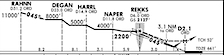
[101/156]
[101/156]
[Approach Plate]
Profile view
[101/156]
Profile view
[101/156]
What is shown here?

[102/156]
[102/156]
[Approach Plate]
A man-made obstacle, and its height AMSL
[102/156]
A man-made obstacle, and its height AMSL
[102/156]
What is shown here?

[103/156]
[103/156]
[Enroute High Altitude Chart]
Changeover point
[103/156]
Changeover point
[103/156]
What is shown here?

[104/156]
[104/156]
[Airport Diagram]
Displaced threshold
[104/156]
Displaced threshold
[104/156]
What is shown here?
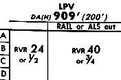
[105/156]
[105/156]
[RNAV Approach Plate]
Landing minimums for an LPV approach
[105/156]
Landing minimums for an LPV approach
[105/156]
What is shown here?

[106/156]
[106/156]
[Enroute High Altitude Chart]
Waypoint
[106/156]
Waypoint
[106/156]
What is shown here?
[107/156]
[107/156]
[Approach Plate]
Arrival control (TRACON) frequency
[107/156]
Arrival control (TRACON) frequency
[107/156]
What is shown here?
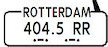
[108/156]
[108/156]
[Approach Plate]
NDB information box (name, frequency, identifier, and identifier in Morse code)
[108/156]
NDB information box (name, frequency, identifier, and identifier in Morse code)
[108/156]
What is shown here?

[109/156]
[109/156]
[Enroute High Altitude Chart]
Jet route
[109/156]
Jet route
[109/156]
What is shown here?
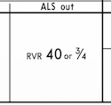
[110/156]
[110/156]
[Approach Plate]
RVR minimums across all categories, if ALS is out of service
[110/156]
RVR minimums across all categories, if ALS is out of service
[110/156]
Which altitudes are included in a low altitude chart?
[111/156]
[111/156]
All below FL180
[111/156]
[111/156]
What is shown here?
[112/156]
[112/156]
[Approach Plate]
A distance scale (in NM)
[112/156]
A distance scale (in NM)
[112/156]
What is shown here?

[113/156]
[113/156]
[Approach Plate]
Plate's issuance and effective dates
[113/156]
Plate's issuance and effective dates
[113/156]
What is shown here?

[114/156]
[114/156]
[Approach Plate]
Rotating beacon
[114/156]
Rotating beacon
[114/156]
What is shown here?
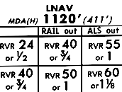
[115/156]
[115/156]
[RNAV Approach Plate]
Landing minimums for an LNAV approach
[115/156]
Landing minimums for an LNAV approach
[115/156]
What is shown here?
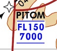
[116/156]
[116/156]
[RNAV STAR]
A waypoint that must be crossed between 7000' and FL150
[116/156]
A waypoint that must be crossed between 7000' and FL150
[116/156]
Which type of NAVAID is being noted here?

[117/156]
[117/156]
A localizer
[117/156]
What is shown here?
[118/156]
[118/156]
[RNAV Approach Plate]
An MSA centered over a point on runway 1
[118/156]
An MSA centered over a point on runway 1
[118/156]
What does the 295' seen here indicate?
[119/156]
[119/156]
[Approach Plate]
The missed approach point for this precision approach (aka, decision altitude)
[119/156]
The missed approach point for this precision approach (aka, decision altitude)
[119/156]
What is shown here?
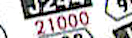
[120/156]
[120/156]
[Enroute High Altitude Chart]
Minimum Enroute Altitude (MEA)
[120/156]
Minimum Enroute Altitude (MEA)
[120/156]
What is shown here?
[121/156]
[121/156]
[Approach Plate]
The highest point AMSL anywhere on this plate
[121/156]
The highest point AMSL anywhere on this plate
[121/156]
What is shown here?

[122/156]
[122/156]
[Enroute High Altitude Chart]
Military airport without a rotating beacon
[122/156]
Military airport without a rotating beacon
[122/156]
What is shown here?
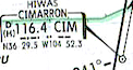
[123/156]
[123/156]
[Enroute High Altitude Chart]
VOR
[123/156]
VOR
[123/156]
What is shown here?

[124/156]
[124/156]
[Approach Plate]
Marker beacon in plan view
[124/156]
Marker beacon in plan view
[124/156]
What is shown here?

[125/156]
[125/156]
[RNAV STAR]
The name of this RNAV STAR
[125/156]
The name of this RNAV STAR
[125/156]
What is shown here?
[126/156]
[126/156]
[Enroute High Altitude Chart]
Shared jet route (a segment shared by 2 or more distinct jet routes)
[126/156]
Shared jet route (a segment shared by 2 or more distinct jet routes)
[126/156]
What is shown here?
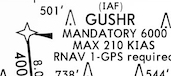
[127/156]
[127/156]
[RNAV Approach Plate]
An initial approach fix for this RNAV approach, which must be crossed at 6000', and no more than 210 kts
[127/156]
An initial approach fix for this RNAV approach, which must be crossed at 6000', and no more than 210 kts
[127/156]
What is shown here?
[128/156]
[128/156]
[Airport Diagram]
Airport reference point
[128/156]
Airport reference point
[128/156]
What is shown here?

[129/156]
[129/156]
[Approach Plate]
The type of approach depicted in this plate, and which runway it's for
[129/156]
The type of approach depicted in this plate, and which runway it's for
[129/156]
What is shown here?
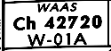
[130/156]
[130/156]
[RNAV Approach Plate]
WAAS frequency
[130/156]
WAAS frequency
[130/156]
What is shown here?
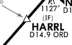
[131/156]
[131/156]
[Approach Plate]
Intermediate fix
[131/156]
Intermediate fix
[131/156]
What is shown here?

[132/156]
[132/156]
[Enroute Low Altitude Chart]
Victor route
[132/156]
Victor route
[132/156]
What is shown here?

[133/156]
[133/156]
[Approach Plate]
A line of latitude (in this case, 40°N)
[133/156]
A line of latitude (in this case, 40°N)
[133/156]
What is shown here?
[134/156]
[134/156]
[Approach Plate]
Tower frequency
[134/156]
Tower frequency
[134/156]
What is shown here?
[135/156]
[135/156]
[Approach Plate]
The flight level after which a descending aircraft must have its altimeter set to the local altimeter setting
[135/156]
The flight level after which a descending aircraft must have its altimeter set to the local altimeter setting
[135/156]
What is shown here?

[136/156]
[136/156]
[Approach Plate]
A note about this approach
[136/156]
A note about this approach
[136/156]
What is shown here?

[137/156]
[137/156]
[Enroute High Altitude Chart]
Course from a VOR (in this case, 333°)
[137/156]
Course from a VOR (in this case, 333°)
[137/156]
What is shown here?
[138/156]
[138/156]
[Enroute High Altitude Chart]
VORTAC
[138/156]
VORTAC
[138/156]
What is shown here?

[139/156]
[139/156]
[Approach Plate]
A civilian airport with a rotating beacon
[139/156]
A civilian airport with a rotating beacon
[139/156]
How high is the tallest obstacle on the right side of this MSA?
[140/156]
[140/156]
[Approach Plate]
1100' MSL (MSAs provide 1000' of obstacle clearance, so an MSA of 2100' suggests an obstacle 1000' below that)
[140/156]
1100' MSL (MSAs provide 1000' of obstacle clearance, so an MSA of 2100' suggests an obstacle 1000' below that)
[140/156]
What is shown here?
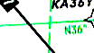
[141/156]
[141/156]
[Enroute High Altitude Chart]
A line of latitude (in this case, 36°N)
[141/156]
A line of latitude (in this case, 36°N)
[141/156]
What does the "D" seen here indicate?
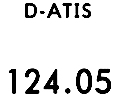
[142/156]
[142/156]
[Approach Plate]
Digital (this ATIS's information is available digitally, i.e., via ACARS)
[142/156]
Digital (this ATIS's information is available digitally, i.e., via ACARS)
[142/156]
How much vertical obstacle clearance is guaranteed inside an MSA?
[143/156]
[143/156]
1000', regardless of terrain type
[143/156]
[143/156]
What is shown here?
[144/156]
[144/156]
[Approach Plate]
The altitude at which an ascending aircraft must have its altimeter set to the standard altimeter setting of 29.92
[144/156]
The altitude at which an ascending aircraft must have its altimeter set to the standard altimeter setting of 29.92
[144/156]
What is shown here?
[145/156]
[145/156]
[Enroute High Altitude Chart]
VOR/DME (VOR with DME)
[145/156]
VOR/DME (VOR with DME)
[145/156]
What is shown here?

[146/156]
[146/156]
[Enroute High Altitude Chart]
Civilian airport with a rotating beacon
[146/156]
Civilian airport with a rotating beacon
[146/156]
What is shown here?

[147/156]
[147/156]
[Airport Diagram]
Permanently closed taxiway
[147/156]
Permanently closed taxiway
[147/156]
What is shown here?

[148/156]
[148/156]
[Enroute Low Altitude Chart]
Shared victor route (a segment shared by 2 or more distinct victor routes)
[148/156]
Shared victor route (a segment shared by 2 or more distinct victor routes)
[148/156]
What is shown here?

[149/156]
[149/156]
[Approach Plate]
VOR
[149/156]
VOR
[149/156]
What is shown here?

[150/156]
[150/156]
[STAR]
The name of this STAR
[150/156]
The name of this STAR
[150/156]
What is shown here?
[151/156]
[151/156]
[Enroute High Altitude Chart]
Time zone boundary
[151/156]
Time zone boundary
[151/156]
What is shown here?

[152/156]
[152/156]
[Approach Plate]
A man-made obstacle 620' AMSL (in this case, a building)
[152/156]
A man-made obstacle 620' AMSL (in this case, a building)
[152/156]
What is shown here?

[153/156]
[153/156]
[Enroute High Altitude Chart]
Military airport with a rotating beacon
[153/156]
Military airport with a rotating beacon
[153/156]
What does the star/asterisk seen here indicate?
[154/156]
[154/156]
[Approach Plate]
This is a part-time tower
[154/156]
This is a part-time tower
[154/156]
What is shown here?
[155/156]
[155/156]
[Approach Plate]
Final approach fix for a precision approach (GS intercept at 2000' MSL)
[155/156]
Final approach fix for a precision approach (GS intercept at 2000' MSL)
[155/156]
What is shown here?
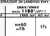
[156/156]
[156/156]
[RNAV Approach Plate]
Landing minimums for an LNAV/VNAV approach
[156/156]
Landing minimums for an LNAV/VNAV approach
[156/156]
ATIS wind is from 210, with a 9°E variation
[1/60]
[1/60]
TRUE: 219
MAGNETIC: 210
[1/60]
MAGNETIC: 210
[1/60]
METAR wind is from 300, with an 8°W variation
[2/60]
[2/60]
TRUE: 300
MAGNETIC: 308
[2/60]
MAGNETIC: 308
[2/60]
METAR wind is from 325, with a 12°E variation
[3/60]
[3/60]
TRUE: 325
MAGNETIC: 313
[3/60]
MAGNETIC: 313
[3/60]
ATIS wind is from 300, with a 10°E variation
[4/60]
[4/60]
TRUE: 310
MAGNETIC: 300
[4/60]
MAGNETIC: 300
[4/60]
ATIS wind is from 000, with a 3°W variation
[5/60]
[5/60]
TRUE: 357
MAGNETIC: 000
[5/60]
MAGNETIC: 000
[5/60]
ATIS wind is from 020, with a 9°W variation
[6/60]
[6/60]
TRUE: 011
MAGNETIC: 020
[6/60]
MAGNETIC: 020
[6/60]
Runway heading is 093, with an 11°W variation
[7/60]
[7/60]
TRUE: 082
MAGNETIC: 093
[7/60]
MAGNETIC: 093
[7/60]
METAR wind is from 355, with a 12°W variation
[8/60]
[8/60]
TRUE: 355
MAGNETIC: 007
[8/60]
MAGNETIC: 007
[8/60]
Runway heading is 117, with a 2°W variation
[9/60]
[9/60]
TRUE: 115
MAGNETIC: 117
[9/60]
MAGNETIC: 117
[9/60]
Runway heading is 071, with a 5°E variation
[10/60]
[10/60]
TRUE: 076
MAGNETIC: 071
[10/60]
MAGNETIC: 071
[10/60]
METAR wind is from 310, with an 11°W variation
[11/60]
[11/60]
TRUE: 310
MAGNETIC: 321
[11/60]
MAGNETIC: 321
[11/60]
METAR wind is from 005, with a 5°W variation
[12/60]
[12/60]
TRUE: 005
MAGNETIC: 010
[12/60]
MAGNETIC: 010
[12/60]
METAR wind is from 100, with a 14°E variation
[13/60]
[13/60]
TRUE: 100
MAGNETIC: 086
[13/60]
MAGNETIC: 086
[13/60]
METAR wind is from 330, with a 9°E variation
[14/60]
[14/60]
TRUE: 330
MAGNETIC: 321
[14/60]
MAGNETIC: 321
[14/60]
METAR wind is from 110, with an 8°E variation
[15/60]
[15/60]
TRUE: 110
MAGNETIC: 102
[15/60]
MAGNETIC: 102
[15/60]
Runway heading is 301, with a 12°E variation
[16/60]
[16/60]
TRUE: 313
MAGNETIC: 301
[16/60]
MAGNETIC: 301
[16/60]
METAR wind is from 070, with a 10°E variation
[17/60]
[17/60]
TRUE: 070
MAGNETIC: 060
[17/60]
MAGNETIC: 060
[17/60]
Runway heading is 242, with a 12°E variation
[18/60]
[18/60]
TRUE: 254
MAGNETIC: 242
[18/60]
MAGNETIC: 242
[18/60]
METAR wind is from 180, with a 13°W variation
[19/60]
[19/60]
TRUE: 180
MAGNETIC: 193
[19/60]
MAGNETIC: 193
[19/60]
ATIS wind is from 120, with a 7°W variation
[20/60]
[20/60]
TRUE: 113
MAGNETIC: 120
[20/60]
MAGNETIC: 120
[20/60]
ATIS wind is from 020, with an 11°W variation
[21/60]
[21/60]
TRUE: 009
MAGNETIC: 020
[21/60]
MAGNETIC: 020
[21/60]
ATIS wind is from 350, with a 5°E variation
[22/60]
[22/60]
TRUE: 355
MAGNETIC: 350
[22/60]
MAGNETIC: 350
[22/60]
ATIS wind is from 180, with an 11°W variation
[23/60]
[23/60]
TRUE: 169
MAGNETIC: 180
[23/60]
MAGNETIC: 180
[23/60]
Runway heading is 102, with a 10°W variation
[24/60]
[24/60]
TRUE: 092
MAGNETIC: 102
[24/60]
MAGNETIC: 102
[24/60]
ATIS wind is from 110, with a 7°E variation
[25/60]
[25/60]
TRUE: 117
MAGNETIC: 110
[25/60]
MAGNETIC: 110
[25/60]
ATIS wind is from 340, with a 10°W variation
[26/60]
[26/60]
TRUE: 330
MAGNETIC: 340
[26/60]
MAGNETIC: 340
[26/60]
METAR wind is from 290, with a 2°W variation
[27/60]
[27/60]
TRUE: 290
MAGNETIC: 292
[27/60]
MAGNETIC: 292
[27/60]
Runway heading is 255, with a 9°E variation
[28/60]
[28/60]
TRUE: 264
MAGNETIC: 255
[28/60]
MAGNETIC: 255
[28/60]
METAR wind is from 290, with an 8°E variation
[29/60]
[29/60]
TRUE: 290
MAGNETIC: 282
[29/60]
MAGNETIC: 282
[29/60]
ATIS wind is from 010, with a 5°W variation
[30/60]
[30/60]
TRUE: 005
MAGNETIC: 010
[30/60]
MAGNETIC: 010
[30/60]
Runway heading is 011, with an 8°E variation
[31/60]
[31/60]
TRUE: 019
MAGNETIC: 011
[31/60]
MAGNETIC: 011
[31/60]
METAR wind is from 055, with a 5°E variation
[32/60]
[32/60]
TRUE: 055
MAGNETIC: 050
[32/60]
MAGNETIC: 050
[32/60]
METAR wind is from 210, with an 11°E variation
[33/60]
[33/60]
TRUE: 210
MAGNETIC: 199
[33/60]
MAGNETIC: 199
[33/60]
Runway heading is 325, with a 6°W variation
[34/60]
[34/60]
TRUE: 319
MAGNETIC: 325
[34/60]
MAGNETIC: 325
[34/60]
ATIS wind is from 100, with a 6°W variation
[35/60]
[35/60]
TRUE: 094
MAGNETIC: 100
[35/60]
MAGNETIC: 100
[35/60]
Runway heading is 084, with a 4°E variation
[36/60]
[36/60]
TRUE: 088
MAGNETIC: 084
[36/60]
MAGNETIC: 084
[36/60]
Runway heading is 332, with an 8°W variation
[37/60]
[37/60]
TRUE: 324
MAGNETIC: 332
[37/60]
MAGNETIC: 332
[37/60]
ATIS wind is from 180, with a 12°E variation
[38/60]
[38/60]
TRUE: 192
MAGNETIC: 180
[38/60]
MAGNETIC: 180
[38/60]
Runway heading is 051, with an 8°W variation
[39/60]
[39/60]
TRUE: 043
MAGNETIC: 051
[39/60]
MAGNETIC: 051
[39/60]
ATIS wind is from 310, with a 12°E variation
[40/60]
[40/60]
TRUE: 322
MAGNETIC: 310
[40/60]
MAGNETIC: 310
[40/60]
Runway heading is 351, with a 12°W variation
[41/60]
[41/60]
TRUE: 339
MAGNETIC: 351
[41/60]
MAGNETIC: 351
[41/60]
Runway heading is 139, with a 7°W variation
[42/60]
[42/60]
TRUE: 132
MAGNETIC: 139
[42/60]
MAGNETIC: 139
[42/60]
Runway heading is 154, with a 9°E variation
[43/60]
[43/60]
TRUE: 163
MAGNETIC: 154
[43/60]
MAGNETIC: 154
[43/60]
ATIS wind is from 270, with an 11°W variation
[44/60]
[44/60]
TRUE: 259
MAGNETIC: 270
[44/60]
MAGNETIC: 270
[44/60]
METAR wind is from 200, with a 12°W variation
[45/60]
[45/60]
TRUE: 200
MAGNETIC: 212
[45/60]
MAGNETIC: 212
[45/60]
METAR wind is from 285, with a 10°W variation
[46/60]
[46/60]
TRUE: 285
MAGNETIC: 295
[46/60]
MAGNETIC: 295
[46/60]
ATIS wind is from 320, with a 7°W variation
[47/60]
[47/60]
TRUE: 313
MAGNETIC: 320
[47/60]
MAGNETIC: 320
[47/60]
ATIS wind is from 050, with a 10°W variation
[48/60]
[48/60]
TRUE: 040
MAGNETIC: 050
[48/60]
MAGNETIC: 050
[48/60]
METAR wind is from 280, with a 7°E variation
[49/60]
[49/60]
TRUE: 280
MAGNETIC: 273
[49/60]
MAGNETIC: 273
[49/60]
METAR wind is from 120, with a 6°W variation
[50/60]
[50/60]
TRUE: 120
MAGNETIC: 126
[50/60]
MAGNETIC: 126
[50/60]
Runway heading is 222, with a 4°E variation
[51/60]
[51/60]
TRUE: 226
MAGNETIC: 222
[51/60]
MAGNETIC: 222
[51/60]
ATIS wind is from 030, with a 14°E variation
[52/60]
[52/60]
TRUE: 044
MAGNETIC: 030
[52/60]
MAGNETIC: 030
[52/60]
Runway heading is 004, with a 5°W variation
[53/60]
[53/60]
TRUE: 359
MAGNETIC: 004
[53/60]
MAGNETIC: 004
[53/60]
ATIS wind is from 080, with an 8°E variation
[54/60]
[54/60]
TRUE: 088
MAGNETIC: 080
[54/60]
MAGNETIC: 080
[54/60]
Runway heading is 299, with a 10°W variation
[55/60]
[55/60]
TRUE: 289
MAGNETIC: 299
[55/60]
MAGNETIC: 299
[55/60]
Runway heading is 207, with a 10°E variation
[56/60]
[56/60]
TRUE: 217
MAGNETIC: 207
[56/60]
MAGNETIC: 207
[56/60]
Runway heading is 308, with a 7°E variation
[57/60]
[57/60]
TRUE: 315
MAGNETIC: 308
[57/60]
MAGNETIC: 308
[57/60]
ATIS wind is from 090, with an 8°E variation
[58/60]
[58/60]
TRUE: 098
MAGNETIC: 090
[58/60]
MAGNETIC: 090
[58/60]
METAR wind is from 060, with a 9°E variation
[59/60]
[59/60]
TRUE: 060
MAGNETIC: 051
[59/60]
MAGNETIC: 051
[59/60]
METAR wind is from 030, with a 10°W variation
[60/60]
[60/60]
TRUE: 030
MAGNETIC: 040
[60/60]
MAGNETIC: 040
[60/60]
Which city is marked with a red dot?
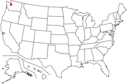
[1/320]
[1/320]
Seattle, WA
[1/320]
Which city is marked with a red dot?
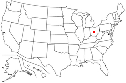
[2/320]
[2/320]
Columbus, OH
[2/320]
Which city is marked with a red dot?
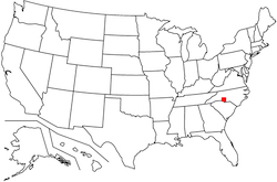
[3/320]
[3/320]
Charlotte, NC
[3/320]
Over which state is the aircraft below flying?

[4/320]
[4/320]
Nebraska
[4/320]
Which city is marked with a red dot?
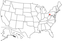
[5/320]
[5/320]
Pittsburgh, PA
[5/320]
In which state would you find Puget Sound?
[6/320]
[6/320]
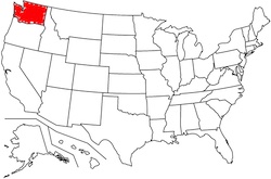
Washington
[6/320]
Which geographical feature is highlighted in red below?
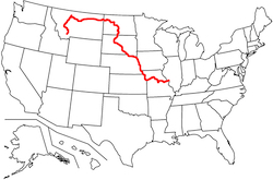
[7/320]
[7/320]
The Missouri River
[7/320]
Which state is highlighted below?
[8/320]
[8/320]
Indiana
[8/320]
Which state is highlighted below?
[9/320]
[9/320]
Colorado
[9/320]
Which geographical feature is highlighted in red below?
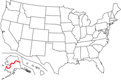
[10/320]
[10/320]
The Yukon River
[10/320]
Which city is marked with a red dot?
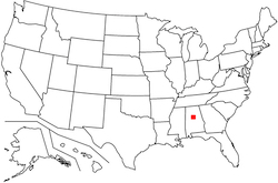
[11/320]
[11/320]
Birmingham, AL
[11/320]
Which city is marked with a red dot?
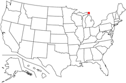
[12/320]
[12/320]
Sault Ste. Marie, MI
[12/320]
Over which state is the aircraft below flying?

[13/320]
[13/320]
North Dakota
[13/320]
Over which state is the aircraft below flying?

[14/320]
[14/320]
New Mexico
[14/320]
Over which state is the aircraft below flying?

[15/320]
[15/320]
Florida
[15/320]
Over which state is the aircraft below flying?

[16/320]
[16/320]
Arizona
[16/320]
Which city is marked with a red dot?
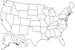
[17/320]
[17/320]
Hartford, CT
[17/320]
Which city is marked with a red dot?
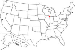
[18/320]
[18/320]
Chicago, IL
[18/320]
Which of the five Great Lakes is highlighted in orange below?
[19/320]
[19/320]
Lake Michigan
[19/320]
Which city is marked with a red dot?
[20/320]
[20/320]
Las Vegas, NV
[20/320]
Which state is highlighted below?
[21/320]
[21/320]
Pennsylvania
[21/320]
Which geographical feature is highlighted in red below?
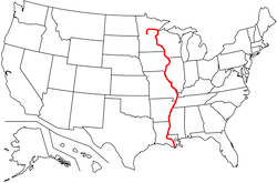
[22/320]
[22/320]
The Mississippi River
[22/320]
Which geographical feature is highlighted in red below?
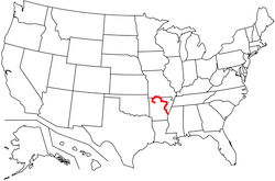
[23/320]
[23/320]
The White River
[23/320]
Which city is marked with a red dot?
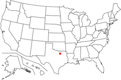
[24/320]
[24/320]
Dallas, TX
[24/320]
Where would you find the Aleutian Islands?
[25/320]
[25/320]
Alaska
[25/320]
What is the name of the region highlighted in red?
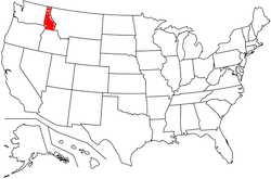
[26/320]
[26/320]
The Idaho Panhandle
[26/320]
Which city is marked with a red dot?
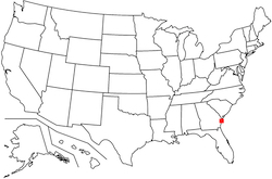
[27/320]
[27/320]
Savannah, GA
[27/320]
Which geographical feature is highlighted in red below?
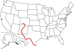
[28/320]
[28/320]
The Rio Grande
[28/320]
Which of the five Great Lakes is highlighted in orange below?
[29/320]
[29/320]
Lake Ontario
[29/320]
Which city is marked with a red dot?

[30/320]
[30/320]
Omaha, NE
[30/320]
Which state is highlighted below?

[31/320]
[31/320]
Delaware
[31/320]
Which city is marked with a red dot?

[32/320]
[32/320]
Washington, DC
[32/320]
Which city is marked with a red dot?
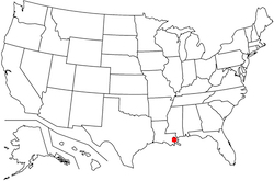
[33/320]
[33/320]
New Orleans, LA
[33/320]
Which 5 large airports serve the Greater Los Angeles area?
[34/320]
[34/320]
• Los Angeles International (LAX)
• Long Beach-Daugherty (LGB)
• John Wayne-Orange County (SNA)
• Hollywood Burbank (BUR)
• Ontario International (ONT)
[34/320]
• Long Beach-Daugherty (LGB)
• John Wayne-Orange County (SNA)
• Hollywood Burbank (BUR)
• Ontario International (ONT)
[34/320]
Which geographical feature is highlighted in red below?
[35/320]
[35/320]
The Columbia River
[35/320]
Which city is marked with a red dot?
[36/320]
[36/320]
Boise, ID
[36/320]
Which city is marked with a red dot?

[37/320]
[37/320]
Buffalo, NY
[37/320]
Which city is marked with a red dot?
[38/320]
[38/320]
San Francisco, CA
[38/320]
Which city is marked with a red dot?

[39/320]
[39/320]
Wilmington, NC
[39/320]
Which state is highlighted below?
[40/320]
[40/320]
Rhode Island
[40/320]
Over which state is the aircraft below flying?

[41/320]
[41/320]
Vermont
[41/320]
Over which state is the aircraft below flying?

[42/320]
[42/320]
Pennsylvania
[42/320]
Over which state is the aircraft below flying?

[43/320]
[43/320]
South Carolina
[43/320]
Over which state is the aircraft below flying?

[44/320]
[44/320]
Virginia
[44/320]
Over which state is the aircraft below flying?

[45/320]
[45/320]
Kentucky
[45/320]
Which state is highlighted below?
[46/320]
[46/320]
South Dakota
[46/320]
Which of the five Great Lakes is not highlighted in orange below?
[47/320]
[47/320]
Lake Superior
[47/320]
Which 3 large airports serve the Greater New York area?
[48/320]
[48/320]
• John F. Kennedy International (JFK)
• LaGuardia (LGA)
• Newark-Liberty International (EWR)
[48/320]
• LaGuardia (LGA)
• Newark-Liberty International (EWR)
[48/320]
If flying direct from Santa Barbara to Seattle, which 3 states would you be over at some point along the way?
[49/320]
[49/320]
California, Oregon, and Washington
[49/320]
Which city is marked with a red dot?
[50/320]
[50/320]
Denver, CO
[50/320]
In which state would you find Niagara Falls?
[51/320]
[51/320]
New York
[51/320]
Which state is highlighted below?
[52/320]
[52/320]
West Virginia
[52/320]
Which geographical feature is highlighted in red below?
[53/320]
[53/320]
The Pecos River
[53/320]
If flying direct from Wichita to Reno, which 4 states would you be over at some point along the way?
[54/320]
[54/320]
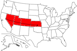
Kansas, Colorado, Utah, and Nevada
[54/320]
In which 12 states can you find active volcanoes?
[55/320]
[55/320]
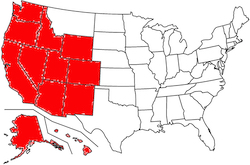
Washington, Oregon, California, Idaho, Wyoming, Utah, Colorado, Nevada, New Mexico, Arizona, Hawaii, and Alaska
[55/320]
In which 2 states would you find the Black Hills?
[56/320]
[56/320]
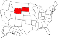
South Dakota and Wyoming
[56/320]
Over which state is the aircraft below flying?
[57/320]
[57/320]
Wyoming
[57/320]
In which state would you find Old Faithful?
[58/320]
[58/320]
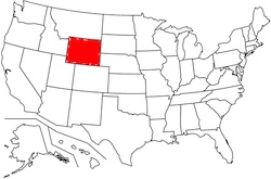
Wyoming
[58/320]
In which state would you find the Grand Canyon?
[59/320]
[59/320]
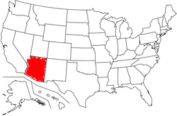
Arizona
[59/320]
Which city is marked with a red dot?
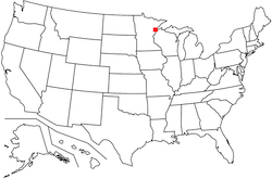
[60/320]
[60/320]
Duluth, MN
[60/320]
The New York City boroughs of Queens and Brooklyn (as well as JFK and LGA airports) can be found at the western end of what island?
[61/320]
[61/320]
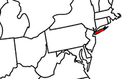
Long Island
[61/320]
Which 2 large airports serve the Greater Houston area?
[62/320]
[62/320]
• George Bush Intercontinental (IAH)
• Houston-Hobby (HOU)
[62/320]
• Houston-Hobby (HOU)
[62/320]
In which 3 states would you find the Cascade Range?
[63/320]
[63/320]

Washington, Oregon, and California
[63/320]
Which geographical feature is highlighted in red below?

[64/320]
[64/320]
The Potomac River
[64/320]
Which city is marked with a red dot?
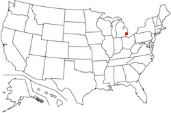
[65/320]
[65/320]
Detroit, MI
[65/320]
Which geographical feature is highlighted in red below?
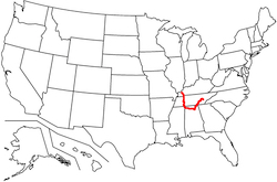
[66/320]
[66/320]
The Tennessee River
[66/320]
Over which state is the aircraft below flying?

[67/320]
[67/320]
Mississippi
[67/320]
Over which state is the aircraft below flying?

[68/320]
[68/320]
Illinois
[68/320]
Which state is highlighted below?
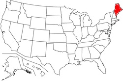
[69/320]
[69/320]
Maine
[69/320]
Which city is marked with a red dot?
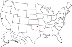
[70/320]
[70/320]
Tulsa, OK
[70/320]
Which state is highlighted below?
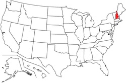
[71/320]
[71/320]
New Hampshire
[71/320]
Which 4 large airports serve the Greater Boston area?
[72/320]
[72/320]
• Boston-Logan (BOS)
• Providence-T.F. Green (PVD)
• Manchester-Boston (MHT)
• Hartford-Bradley (BDL)
[72/320]
• Providence-T.F. Green (PVD)
• Manchester-Boston (MHT)
• Hartford-Bradley (BDL)
[72/320]
The Great Basin makes up portions of which 6 states?
[73/320]
[73/320]
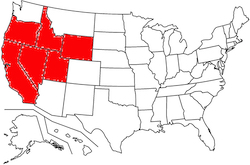
Nevada, Utah, Oregon, California, Wyoming, and Idaho
[73/320]
In which 2 states would you find the Great Smoky Mountains?
[74/320]
[74/320]
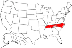
Tennessee and North Carolina
[74/320]
Which city is marked with a red dot?

[75/320]
[75/320]
Jacksonville, FL
[75/320]
Which state is highlighted below?
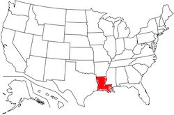
[76/320]
[76/320]
Louisiana
[76/320]
Over which state is the aircraft below flying?

[77/320]
[77/320]
West Virginia
[77/320]
If flying direct from Shreveport to Savannah, which 4 states would you be over at some point along the way?
[78/320]
[78/320]
Louisiana, Mississippi, Alabama, and Georgia
[78/320]
In which state would you find the Great Salt Lake?
[79/320]
[79/320]
Utah
[79/320]
Which city is marked with a red dot?

[80/320]
[80/320]
Providence, RI
[80/320]
Over which state is the aircraft below flying?

[81/320]
[81/320]
Kansas
[81/320]
Which city is marked with a red dot?
[82/320]
[82/320]
Spokane, WA
[82/320]
If flying direct from Austin to Fargo, which 6 states would you be over at some point along the way?
[83/320]
[83/320]
Texas, Oklahoma, Kansas, Nebraska, South Dakota, and North Dakota
[83/320]
Over which state is the aircraft below flying?

[84/320]
[84/320]
Oklahoma
[84/320]
Which city is marked with a red dot?
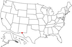
[85/320]
[85/320]
El Paso, TX
[85/320]
Which state is highlighted below?

[86/320]
[86/320]
New Jersey
[86/320]
Which city is marked with a red dot?
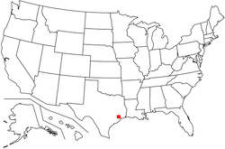
[87/320]
[87/320]
Houston, TX
[87/320]
Which state is highlighted below?
[88/320]
[88/320]
Arizona
[88/320]
Which 3 large airports serve the San Francisco Bay area?
[89/320]
[89/320]
• San Francisco International (SFO)
• Oakland International (OAK)
• San Jose-Mineta (SJC)
[89/320]
• Oakland International (OAK)
• San Jose-Mineta (SJC)
[89/320]
Which city is marked with a red dot?
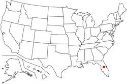
[90/320]
[90/320]
Orlando, FL
[90/320]
Which city is marked with a red dot?
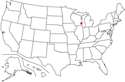
[91/320]
[91/320]
Milwaukee, WI
[91/320]
Which city is marked with a red dot?
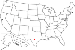
[92/320]
[92/320]
San Antonio, TX
[92/320]
If flying direct from Detroit to Birmingham, which 5 states would you be over at some point along the way?
[93/320]
[93/320]
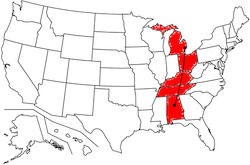
Michigan, Ohio, Kentucky, Tennessee, and Alabama
[93/320]
Which city is marked with a red dot?
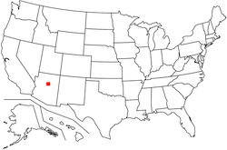
[94/320]
[94/320]
Flagstaff, AZ
[94/320]
Which geographical feature is highlighted in red below?
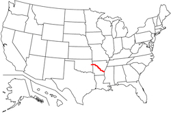
[95/320]
[95/320]
The Arkansas River
[95/320]
Over which state is the aircraft below flying?

[96/320]
[96/320]
South Dakota
[96/320]
Which city is marked with a red dot?
[97/320]
[97/320]
Charleston, WV
[97/320]
Which city is marked with a red dot?
[98/320]
[98/320]
Jefferson City, MO
[98/320]
Which of the five Great Lakes is not highlighted in orange below?
[99/320]
[99/320]
Lake Huron
[99/320]
Which city is marked with a red dot?

[100/320]
[100/320]
Harlingen, TX
[100/320]
Over which state is the aircraft below flying?

[101/320]
[101/320]
Minnesota
[101/320]
Which state is highlighted below?
[102/320]
[102/320]
Ohio
[102/320]
Which geographical feature is highlighted in red below?
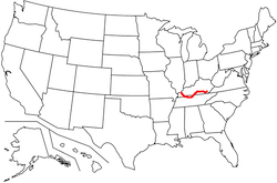
[103/320]
[103/320]
The Cumberland River
[103/320]
Over which state is the aircraft below flying?

[104/320]
[104/320]
Delaware
[104/320]
Which city is marked with a red dot?

[105/320]
[105/320]
Los Angeles, CA
[105/320]
Which city is marked with a red dot?

[106/320]
[106/320]
New York, NY
[106/320]
Adjacent which 2 states would you find the Chesapeake Bay?
[107/320]
[107/320]
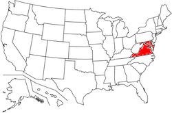
Maryland and Virginia
[107/320]
Which city is marked with a red dot?

[108/320]
[108/320]
Kansas City, MO
[108/320]
What is the name of the region highlighted in red?
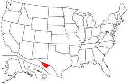
[109/320]
[109/320]
Big Bend
[109/320]
Which state is highlighted below?
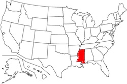
[110/320]
[110/320]
Mississippi
[110/320]
Over which state is the aircraft below flying?

[111/320]
[111/320]
New York
[111/320]
Which state is highlighted below?
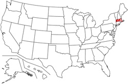
[112/320]
[112/320]
Massachusetts
[112/320]
Which city is marked with a red dot?
[113/320]
[113/320]
Indianapolis, IN
[113/320]
Which city is marked with a red dot?

[114/320]
[114/320]
Philadelphia, PA
[114/320]
Where would you find the Salton Sea?
[115/320]
[115/320]
California
[115/320]
Which city is marked with a red dot?
[116/320]
[116/320]
Anchorage, AK
[116/320]
Over which state is the aircraft below flying?

[117/320]
[117/320]
Montana
[117/320]
Which city is marked with a red dot?

[118/320]
[118/320]
Atlantic City, NJ
[118/320]
Which city is further north, Seattle or Boston?
[119/320]
[119/320]
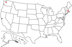
Seattle
[119/320]
Which city is marked with a red dot?
[120/320]
[120/320]
Cleveland, OH
[120/320]
If flying direct from Baltimore to Tampa, which 5 states would you be over at some point along the way?
[121/320]
[121/320]
Maryland, Virginia, North Carolina, South Carolina, and Florida
[121/320]
Which state is highlighted below?
[122/320]
[122/320]
Missouri
[122/320]
Which state is highlighted below?
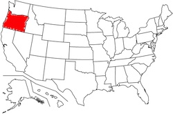
[123/320]
[123/320]
Oregon
[123/320]
Which city is marked with a red dot?
[124/320]
[124/320]
Oklahoma City, OK
[124/320]
Which city is marked with a red dot?
[125/320]
[125/320]
Louisville, KY
[125/320]
Which city is marked with a red dot?
[126/320]
[126/320]
Fresno, CA
[126/320]
The Ohio Valley makes up portions of which 11 states?
[127/320]
[127/320]
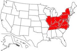
Illinois, Indiana, Ohio, Pennsylvania, New York, Maryland, West Virginia, Virginia, North Carolina, Tennessee, and Kentucky
[127/320]
Which state is known as "The Land of 10,000 Lakes?"
[128/320]
[128/320]
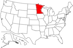
Minnesota
[128/320]
Which city is marked with a red dot?
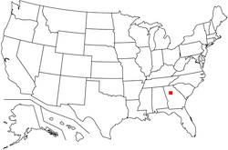
[129/320]
[129/320]
Atlanta, GA
[129/320]
Which state is highlighted below?
[130/320]
[130/320]
California
[130/320]
Which state is highlighted below?

[131/320]
[131/320]
Texas
[131/320]
Which state is highlighted below?
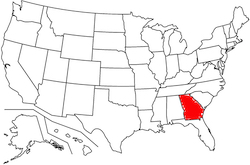
[132/320]
[132/320]
Georgia
[132/320]
Which city is marked with a red dot?

[133/320]
[133/320]
Grand Junction, CO
[133/320]
Which geographical feature is highlighted in red below?
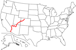
[134/320]
[134/320]
The Colorado River
[134/320]
Which city is marked with a red dot?

[135/320]
[135/320]
Albuquerque, NM
[135/320]
Over which state is the aircraft below flying?

[136/320]
[136/320]
California
[136/320]
Which 4 states share a border with Mexico?
[137/320]
[137/320]
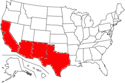
California, Arizona, New Mexico, and Texas
[137/320]
Over which state is the aircraft below flying?

[138/320]
[138/320]
Washington
[138/320]
Which of the five Great Lakes is highlighted in orange below?
[139/320]
[139/320]
Lake Huron
[139/320]
If flying direct from Boise to Houston, which 5 states would you be over at some point along the way?
[140/320]
[140/320]
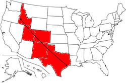
Idaho, Utah, Colorado, New Mexico, and Texas
[140/320]
Which city is marked with a red dot?
[141/320]
[141/320]
Nashville, TN
[141/320]
If flying direct from Syracuse to Bangor, which 4 states would you be over at some point along the way?
[142/320]
[142/320]
New York, Vermont, New Hampshire, and Maine
[142/320]
Which city is marked with a red dot?

[143/320]
[143/320]
Manchester, NH
[143/320]
Which city is marked with a red dot?
[144/320]
[144/320]
Bangor, ME
[144/320]
If flying direct from Charleston, SC to Buffalo, which 7 states would you be over at some point along the way?
[145/320]
[145/320]
South Carolina, North Carolina, Virginia, West Virginia, Maryland, Pennsylvania, and New York
[145/320]
Which city is marked with a red dot?
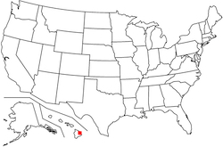
[146/320]
[146/320]
Hilo, HI
[146/320]
Which state is highlighted below?
[147/320]
[147/320]
Minnesota
[147/320]
Which state is highlighted below?
[148/320]
[148/320]
Utah
[148/320]
Which 3 large airports serve the Greater Washington, DC area?
[149/320]
[149/320]
• Baltimore/Washington International (BWI)
• Washington-Dulles (IAD)
• Reagan National (DCA)
[149/320]
• Washington-Dulles (IAD)
• Reagan National (DCA)
[149/320]
Which state is highlighted below?
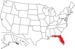
[150/320]
[150/320]
Florida
[150/320]
Which city is marked with a red dot?
[151/320]
[151/320]
Portland, OR
[151/320]
Which city is marked with a red dot?
[152/320]
[152/320]
Reno, NV
[152/320]
Over which state is the aircraft below flying?

[153/320]
[153/320]
Alabama
[153/320]
Which state is highlighted below?
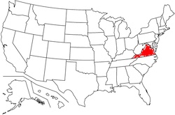
[154/320]
[154/320]
Virginia
[154/320]
Which city is marked with a red dot?
[155/320]
[155/320]
Montgomery, AL
[155/320]
Which geographical feature is highlighted in red below?
[156/320]
[156/320]
The Yellowstone River
[156/320]
Which city is marked with a red dot?
[157/320]
[157/320]
Baltimore, MD
[157/320]
Which geographical feature is highlighted in red below?
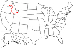
[158/320]
[158/320]
The Snake River
[158/320]
Over which state is the aircraft below flying?

[159/320]
[159/320]
Utah
[159/320]
Which of these 5 cities along the eastern seaboard is situated midway between the other 4: New York, Boston, Washington, Philadelphia, or Baltimore?
[160/320]
[160/320]
Philadelphia
[160/320]
Which two cities are known as "The Twin Cities?"
[161/320]
[161/320]
Minneapolis and Saint Paul, MN
[161/320]
[161/320]
Which state is highlighted below?
[162/320]
[162/320]
Illinois
[162/320]
Which state is highlighted below?
[163/320]
[163/320]
Arkansas
[163/320]
Which city is marked with a red dot?
[164/320]
[164/320]
Wichita, KS
[164/320]
Over which state is the aircraft below flying?

[165/320]
[165/320]
New Hampshire
[165/320]
In which state would you find Bryce Canyon?
[166/320]
[166/320]
Utah
[166/320]
Which city is marked with a red dot?
[167/320]
[167/320]
Little Rock, AR
[167/320]
Which city is marked with a red dot?
[168/320]
[168/320]
Amarillo, TX
[168/320]
Which city is marked with a red dot?
[169/320]
[169/320]
Boston, MA
[169/320]
Which city is marked with a red dot?
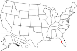
[170/320]
[170/320]
Tampa, FL
[170/320]
Which city is marked with a red dot?
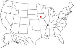
[171/320]
[171/320]
Des Moines, IA
[171/320]
Which geographical feature is highlighted in red below?
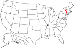
[172/320]
[172/320]
The Hudson River
[172/320]
Which 14 states make up the Atlantic coast?
[173/320]
[173/320]
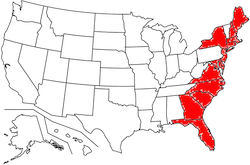
Florida, Georgia, South Carolina, North Carolina, Virginia, Maryland, Delaware, New Jersey, New York, Connecticut, Rhode Island, Massachusetts, New Hampshire, and Maine
[173/320]
Which city is marked with a red dot?
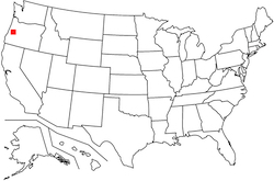
[174/320]
[174/320]
Eugene, OR
[174/320]
Which city is marked with a red dot?
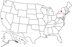
[175/320]
[175/320]
Syracuse, NY
[175/320]
In which state would you find Mt. Washington, one of the windiest places on earth?
[176/320]
[176/320]
New Hampshire
[176/320]
Which city is marked with a red dot?
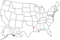
[177/320]
[177/320]
Shreveport, LA
[177/320]
Which geographical feature is highlighted in red below?
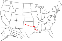
[178/320]
[178/320]
The Red River
[178/320]
Over which state is the aircraft below flying?

[179/320]
[179/320]
Texas
[179/320]
Which city is marked with a red dot?
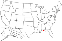
[180/320]
[180/320]
Pensacola, FL
[180/320]
Which city is marked with a red dot?
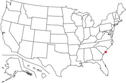
[181/320]
[181/320]
Charleston, SC
[181/320]
Which 6 states make up New England?
[182/320]
[182/320]
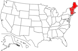
Maine, New Hampshire, Vermont, Massachusetts, Connecticut, and Rhode Island
[182/320]
In which state would you find the Bay Area?
[183/320]
[183/320]
California
[183/320]
Which city is marked with a red dot?
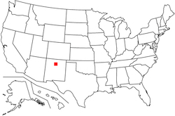
[184/320]
[184/320]
Santa Fe, NM
[184/320]
Which city is marked with a red dot?
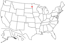
[185/320]
[185/320]
Fargo, ND
[185/320]
Which of the five Great Lakes is not highlighted in orange below?
[186/320]
[186/320]
Lake Erie
[186/320]
Which city is marked with a red dot?

[187/320]
[187/320]
Bozeman, MT
[187/320]
Where would you find the lowest point in the continental United States?
[188/320]
[188/320]
California (Death Valley)
[188/320]
Which state is highlighted below?
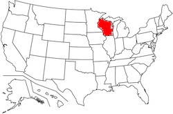
[189/320]
[189/320]
Wisconsin
[189/320]
In which state would you find the city of East Saint Louis?
[190/320]
[190/320]
Illinois (across the Mississippi River from Saint Louis, MO)
[190/320]
Which of the five Great Lakes is not highlighted in orange below?
[191/320]
[191/320]
Lake Michigan
[191/320]
Which city is marked with a red dot?
[192/320]
[192/320]
Fairbanks, AK
[192/320]
Over which state is the aircraft below flying?

[193/320]
[193/320]
Maryland
[193/320]
What is the name of the region highlighted in red?
[194/320]
[194/320]
The Texas Panhandle
[194/320]
In which state would you find Mauna Loa?
[195/320]
[195/320]
Hawaii
[195/320]
In which 2 states would you find the Sierra Nevada mountains?
[196/320]
[196/320]
California and Nevada
[196/320]
Which state is highlighted below?
[197/320]
[197/320]
Hawaii
[197/320]
Over which state is the aircraft below flying?

[198/320]
[198/320]
Colorado
[198/320]
Which state is highlighted below?
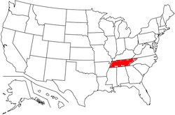
[199/320]
[199/320]
Tennessee
[199/320]
In which state would you find the Upper Peninsula?
[200/320]
[200/320]
Michigan
[200/320]
Which city is marked with a red dot?
[201/320]
[201/320]
Fort Myers, FL
[201/320]
Which city is marked with a red dot?
[202/320]
[202/320]
Burlington, VT
[202/320]
Which city is marked with a red dot?
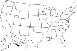
[203/320]
[203/320]
Minneapolis, MN
[203/320]
Which geographical feature is highlighted in red below?
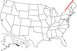
[204/320]
[204/320]
The Saint Lawrence River
[204/320]
Over which state is the aircraft below flying?

[205/320]
[205/320]
Connecticut
[205/320]
Which geographical feature is highlighted in red below?
[206/320]
[206/320]
The Canadian River
[206/320]
Which state is highlighted below?
[207/320]
[207/320]
Alabama
[207/320]
Where would you find the Poconos?
[208/320]
[208/320]
Pennsylvania
[208/320]
In which state would you find the Everglades?
[209/320]
[209/320]
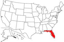
Florida
[209/320]
In which 6 states would you find the Rocky Mountains?
[210/320]
[210/320]
Montana, Idaho, Wyoming, Utah, Colorado, and New Mexico
[210/320]
Which city is marked with a red dot?
[211/320]
[211/320]
Miami, FL
[211/320]
Which state is highlighted below?
[212/320]
[212/320]
New York
[212/320]
In which 2 states would you find the Sonoran Desert?
[213/320]
[213/320]
Arizona and California
[213/320]
Which city is marked with a red dot?

[214/320]
[214/320]
Saint Louis, MO
[214/320]
Off the coast of which state would you find the Bering Strait?
[215/320]
[215/320]
Alaska
[215/320]
Which city is marked with a red dot?
[216/320]
[216/320]
Lihue, HI
[216/320]
Which state is highlighted below?
[217/320]
[217/320]
Michigan
[217/320]
Which state is highlighted below?
[218/320]
[218/320]
Idaho
[218/320]
Which state is highlighted below?
[219/320]
[219/320]
Nebraska
[219/320]
Which state is highlighted below?
[220/320]
[220/320]
South Carolina
[220/320]
Which state is highlighted below?
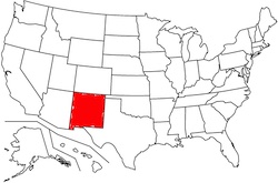
[221/320]
[221/320]
New Mexico
[221/320]
Which city is marked with a red dot?
[222/320]
[222/320]
Aspen, CO
[222/320]
If flying direct from San Francisco to Indianapolis, which 8 states would you be over at some point along the way?
[223/320]
[223/320]
California, Nevada, Utah, Colorado, Kansas, Missouri, Illinois, and Indiana
[223/320]
Which city is marked with a red dot?
[224/320]
[224/320]
Las Cruces, NM
[224/320]
In which state would you find the Mississippi River delta?
[225/320]
[225/320]
Louisiana
[225/320]
Which city is marked with a red dot?
[226/320]
[226/320]
Mobile, AL
[226/320]
Which geographical feature is highlighted in red below?
[227/320]
[227/320]
The Green River
[227/320]
Which geographical feature is highlighted in red below?
[228/320]
[228/320]
The Delaware River
[228/320]
Over which state is the aircraft below flying?

[229/320]
[229/320]
North Carolina
[229/320]
In which state would you find Crater Lake?
[230/320]
[230/320]
Oregon
[230/320]
Which state is highlighted below?
[231/320]
[231/320]
Connecticut
[231/320]
Over which state is the aircraft below flying?

[232/320]
[232/320]
Maine
[232/320]
In which state would you find the Adirondacks?
[233/320]
[233/320]
New York
[233/320]
Which of the five Great Lakes is highlighted in orange below?
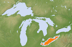
[234/320]
[234/320]
Lake Erie
[234/320]
If flying direct from Pittsburgh to Omaha, which 6 states would you be over at some point along the way?
[235/320]
[235/320]
Pennsylvania, Ohio, Indiana, Illinois, Iowa, and Nebraska
[235/320]
Which geographical feature is highlighted in red below?
[236/320]
[236/320]
The Susquehanna River
[236/320]
If flying direct from Little Rock to Minneapolis, which 4 states would you be over at some point along the way?
[237/320]
[237/320]
Arkansas, Missouri, Iowa, and Minnesota
[237/320]
Which states make up the Four Corners region?
[238/320]
[238/320]
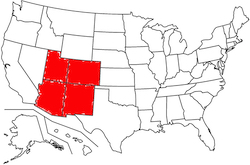
Utah, Colorado, New Mexico, and Arizona
[238/320]
Over which state is the aircraft below flying?

[239/320]
[239/320]
Arkansas
[239/320]
Which of the five Great Lakes is not highlighted in orange below?
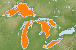
[240/320]
[240/320]
Lake Ontario
[240/320]
Which city is marked with a red dot?
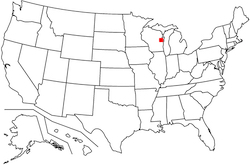
[241/320]
[241/320]
Green Bay, WI
[241/320]
Which city is marked with a red dot?

[242/320]
[242/320]
Rapid City, SD
[242/320]
Which geographical feature is highlighted in red below?
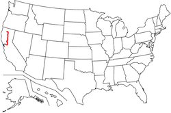
[243/320]
[243/320]
The Sacramento River
[243/320]
Which city is marked with a red dot?

[244/320]
[244/320]
Dover, DE
[244/320]
If flying direct from Denver to Green Bay, which 5 states would you be over at some point along the way?
[245/320]
[245/320]
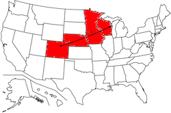
Colorado, Nebraska, Iowa, Minnesota, and Wisconsin
[245/320]
What is the name of the region highlighted in red?
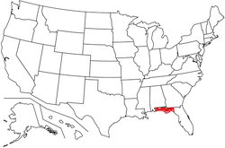
[246/320]
[246/320]
The Florida Panhandle
[246/320]
Which city is marked with a red dot?
[247/320]
[247/320]
Bismarck, ND
[247/320]
Which city is further east, Buffalo or Miami?
[248/320]
[248/320]
Buffalo
[248/320]
Which geographical feature is highlighted in red below?

[249/320]
[249/320]
The Willamette River
[249/320]
Which city is further south, Atlanta or Phoenix?
[250/320]
[250/320]
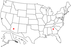
Phoenix
[250/320]
Which geographical feature is highlighted in red below?
[251/320]
[251/320]
The Illinois River
[251/320]
Over which state is the aircraft below flying?

[252/320]
[252/320]
Oregon
[252/320]
Over which state is the aircraft below flying?

[253/320]
[253/320]
Georgia
[253/320]
Which state is highlighted below?
[254/320]
[254/320]
Vermont
[254/320]
Over which state is the aircraft below flying?

[255/320]
[255/320]
Michigan
[255/320]
Which geographical feature is highlighted in red below?
[256/320]
[256/320]
The Ohio River
[256/320]
Which state is highlighted below?
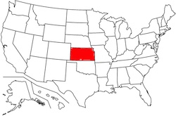
[257/320]
[257/320]
Kansas
[257/320]
Which city is marked with a red dot?
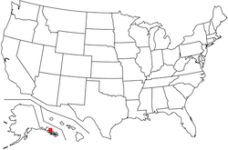
[258/320]
[258/320]
Juneau, AK
[258/320]
In which 13 states would you find the Appalachian Mountains?
[259/320]
[259/320]
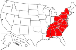
Mississippi, Alabama, Georgia, Tennessee, Kentucky, South Carolina, North Carolina, Virgina, West Virginia, Maryland, Ohio, Pennsylvania, and New York
[259/320]
Which 5 states make up the Gulf coast?
[260/320]
[260/320]
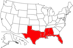
Texas, Louisiana, Mississippi, Alabama, and Florida
[260/320]
In which state would you find Lake Pontchartrain?
[261/320]
[261/320]
Louisiana
[261/320]
In which 2 states would you find Monument Valley?
[262/320]
[262/320]
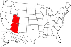
Utah and Arizona
[262/320]
Which city is marked with a red dot?

[263/320]
[263/320]
Coeur d'Alene, ID
[263/320]
In which state would you find Denali (Mt. McKinley)?
[264/320]
[264/320]
Alaska
[264/320]
In which state would you find Cincinnati, Ohio's international airport (CVG)?
[265/320]
[265/320]
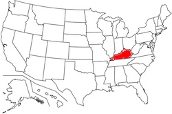
Kentucky (located across the Ohio River from Cincinnati, near Covington, KY)
[265/320]
Which state is highlighted below?
[266/320]
[266/320]
Alaska
[266/320]
Where would you find the Colorado Desert?
[267/320]
[267/320]
California
[267/320]
Which of the five Great Lakes is highlighted in orange below?
[268/320]
[268/320]
Lake Superior
[268/320]
The Great Plains make up all or part of which 13 states?
[269/320]
[269/320]
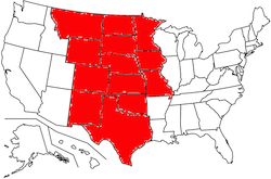
North Dakota, South Dakota, Nebraska, Kansas, Montana, Wyoming, Colorado, Minnesota, Iowa, Missouri, Oklahoma, Texas, and New Mexico
[269/320]
Which city is marked with a red dot?
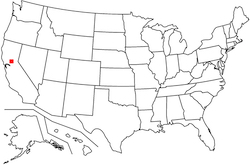
[270/320]
[270/320]
Sacramento, CA
[270/320]
Over which state is the aircraft below flying?

[271/320]
[271/320]
Indiana
[271/320]
Which city is further west, Reno or San Diego?
[272/320]
[272/320]
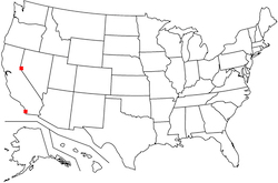
Reno
[272/320]
Which 3 states make up the Pacific coast?
[273/320]
[273/320]
California, Oregon, and Washington
[273/320]
Which city is marked with a red dot?
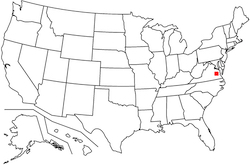
[274/320]
[274/320]
Richmond, VA
[274/320]
In which 4 states would you find the Mojave Desert?
[275/320]
[275/320]
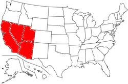
California, Nevada, Arizona, and Utah
[275/320]
Over which state is the aircraft below flying?

[276/320]
[276/320]
Iowa
[276/320]
Over which state is the aircraft below flying?

[277/320]
[277/320]
Idaho
[277/320]
Over which state is the aircraft below flying?

[278/320]
[278/320]
New Jersey
[278/320]
Where would you find the highest point in the continental United States?
[279/320]
[279/320]
California (Mt. Whitney)
[279/320]
What is the name of the region highlighted in red?
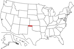
[280/320]
[280/320]
The Oklahoma Panhandle
[280/320]
Which state is highlighted below?
[281/320]
[281/320]
Wyoming
[281/320]
Which state is highlighted below?
[282/320]
[282/320]
North Carolina
[282/320]
Over which state is the aircraft below flying?

[283/320]
[283/320]
Ohio
[283/320]
Over which state is the aircraft below flying?

[284/320]
[284/320]
Missouri
[284/320]
Which state is highlighted below?
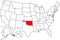
[285/320]
[285/320]
Oklahoma
[285/320]
Over which state is the aircraft below flying?

[286/320]
[286/320]
Wisconsin
[286/320]
In which state would you find Lake Okeechobee?
[287/320]
[287/320]
Florida
[287/320]
Which city is marked with a red dot?
[288/320]
[288/320]
Cheyenne, WY
[288/320]
Which state is highlighted below?
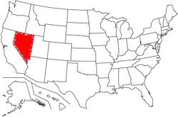
[289/320]
[289/320]
Nevada
[289/320]
In which state would you find the Badlands?
[290/320]
[290/320]
South Dakota
[290/320]
Which city is marked with a red dot?
[291/320]
[291/320]
Phoenix, AZ
[291/320]
If flying direct from Duluth to Spokane, which 5 states would you be over at some point along the way?
[292/320]
[292/320]
Minnesota, North Dakota, Montana, Idaho, and Washington
[292/320]
Which 3 large airports serve the Greater Miami area?
[293/320]
[293/320]
• Miami International (MIA)
• Fort Lauderdale-Hollywood (FLL)
• Palm Beach International (PBI)
[293/320]
• Fort Lauderdale-Hollywood (FLL)
• Palm Beach International (PBI)
[293/320]
Off the coast of which state would you find Nantucket?
[294/320]
[294/320]
Massachusetts
[294/320]
Which city is marked with a red dot?
[295/320]
[295/320]
Jackson, MS
[295/320]
Which state is highlighted below?
[296/320]
[296/320]
Kentucky
[296/320]
Over which state is the aircraft below flying?

[297/320]
[297/320]
Louisiana
[297/320]
Which city is marked with a red dot?
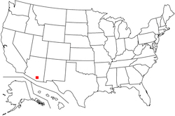
[298/320]
[298/320]
Tucson, AZ
[298/320]
Over which state is the aircraft below flying?
[299/320]
[299/320]
Tennessee
[299/320]
Which city is marked with a red dot?
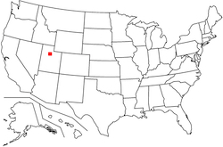
[300/320]
[300/320]
Salt Lake City, UT
[300/320]
Which city is marked with a red dot?
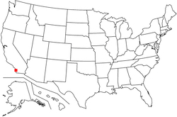
[301/320]
[301/320]
San Diego, CA
[301/320]
Which city is marked with a red dot?
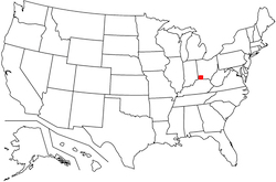
[302/320]
[302/320]
Cincinnati, OH
[302/320]
Which 8 states border a Great Lake?
[303/320]
[303/320]
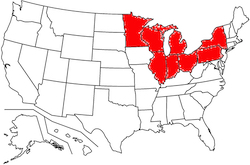
Minnesota, Wisconsin, Illinois, Indiana, Michigan, Ohio, Pennsylvania, and New York
[303/320]
Over which state is the aircraft below flying?

[304/320]
[304/320]
Massachusetts
[304/320]
If flying direct from Cheyenne to El Paso, which 4 states would you be over at some point along the way?
[305/320]
[305/320]
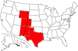
Wyoming, Colorado, New Mexico, and Texas
[305/320]
Which state is highlighted below?
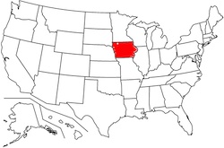
[306/320]
[306/320]
Iowa
[306/320]
Which city is marked with a red dot?
[307/320]
[307/320]
Jackson Hole, WY
[307/320]
Over which state is the aircraft below flying?

[308/320]
[308/320]
Nevada
[308/320]
Which city is marked with a red dot?

[309/320]
[309/320]
Topeka, KS
[309/320]
Which state is highlighted below?
[310/320]
[310/320]
Washington
[310/320]
Which 2 large airports serve the Dallas-Fort Worth Metroplex?
[311/320]
[311/320]
• Dallas-Fort Worth International (DFW)
• Dallas-Love (DAL)
[311/320]
• Dallas-Love (DAL)
[311/320]
Which city is marked with a red dot?
[312/320]
[312/320]
Honolulu, HI
[312/320]
Which state is highlighted below?
[313/320]
[313/320]
Maryland
[313/320]
Which city is marked with a red dot?
[314/320]
[314/320]
Raleigh, NC
[314/320]
Which state is highlighted below?
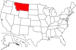
[315/320]
[315/320]
Montana
[315/320]
Which city is marked with a red dot?
[316/320]
[316/320]
Memphis, TN
[316/320]
Which 2 large airports serve the Greater Chicago area?
[317/320]
[317/320]
• O'Hare International (ORD)
• Midway International (MDW)
[317/320]
• Midway International (MDW)
[317/320]
Which state is highlighted below?
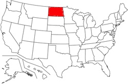
[318/320]
[318/320]
North Dakota
[318/320]
Which 10 states share a border with Canada?
[319/320]
[319/320]
Washington, Idaho, Montana, North Dakota, Minnesota, Michigan, New York, Vermont, New Hampshire, and Maine
[319/320]
In which 4 states would you find the Ozarks?
[320/320]
[320/320]
Missouri, Arkansas, Oklahoma, and Kansas
[320/320]
SKC
[1/143]
[1/143]
Sky Clear
[1/143]
[1/143]
CB
[2/143]
[2/143]
Cumulonimbus
[2/143]
[2/143]
INCRG
[3/143]
[3/143]
Increasing
[3/143]
[3/143]
SW
[4/143]
[4/143]
Snow Shower
[4/143]
[4/143]
ISA
[5/143]
[5/143]
International Standard Atmosphere
[5/143]
[5/143]
+SN
[6/143]
[6/143]
Heavy snow
[6/143]
[6/143]
CC
[7/143]
[7/143]
Cloud-to-cloud lightning
[7/143]
[7/143]
FG
[8/143]
[8/143]
Fog
[8/143]
[8/143]
TB
[9/143]
[9/143]
Turbulence
[9/143]
[9/143]
QLCS
[10/143]
[10/143]
Quasi-Linear Convective System
[10/143]
[10/143]
PL
[11/143]
[11/143]
Ice pellets
[11/143]
[11/143]
SCT
[12/143]
[12/143]
Scattered clouds
[12/143]
[12/143]
PRES
[13/143]
[13/143]
Pressure
[13/143]
[13/143]
ADVY
[14/143]
[14/143]
Advisory
[14/143]
[14/143]
-SN
[15/143]
[15/143]
Light snow
[15/143]
[15/143]
MCS
[16/143]
[16/143]
Mesoscale Convective System
[16/143]
[16/143]
hPa
[17/143]
[17/143]
Hectopascal
[17/143]
[17/143]
UNL
[18/143]
[18/143]
Unlimited
[18/143]
[18/143]
BLO
[19/143]
[19/143]
Below
[19/143]
[19/143]
AIREP
[20/143]
[20/143]
Aircraft Report
[20/143]
[20/143]
RMK
[21/143]
[21/143]
Remarks
[21/143]
[21/143]
RY
[22/143]
[22/143]
Runway
[22/143]
[22/143]
MI
[23/143]
[23/143]
Shallow
[23/143]
[23/143]
DSIPTG
[24/143]
[24/143]
Dissipating
[24/143]
[24/143]
CA
[25/143]
[25/143]
Cloud-to-air lightning
[25/143]
[25/143]
MOV
[26/143]
[26/143]
Moved
or
Moving
or
Movement
[26/143]
or
Moving
or
Movement
[26/143]
TS
[27/143]
[27/143]
Thunderstorm
[27/143]
[27/143]
FZ
[28/143]
[28/143]
Freezing
[28/143]
[28/143]
UUA
[29/143]
[29/143]
Urgent PIREP
[29/143]
[29/143]
PRESRR
[30/143]
[30/143]
Pressure Rising Rapidly
[30/143]
[30/143]
TAF
[31/143]
[31/143]
Terminal Aerodrome Forecast
[31/143]
[31/143]
APRNT
[32/143]
[32/143]
Apparent
[32/143]
[32/143]
-
[33/143]
[33/143]
Light
[33/143]
[33/143]
-RA
[34/143]
[34/143]
Light Rain
[34/143]
[34/143]
SA
[35/143]
[35/143]
Sand
[35/143]
[35/143]
DU
[36/143]
[36/143]
Widespread dust
[36/143]
[36/143]
AIRMET
[37/143]
[37/143]
Airmen's Meteorological Information
[37/143]
[37/143]
TW
[38/143]
[38/143]
Tailwind
[38/143]
[38/143]
CONS
[39/143]
[39/143]
Continuous
[39/143]
[39/143]
FEW
[40/143]
[40/143]
Few clouds
[40/143]
[40/143]
BECMG
[41/143]
[41/143]
Becoming
[41/143]
[41/143]
SS
[42/143]
[42/143]
Sandstorm
[42/143]
[42/143]
COR
[43/143]
[43/143]
Correction
[43/143]
[43/143]
SQ
[44/143]
[44/143]
Squalls
[44/143]
[44/143]
TP
[45/143]
[45/143]
Type
[45/143]
[45/143]
DR
[46/143]
[46/143]
Low drifting
[46/143]
[46/143]
WX
[47/143]
[47/143]
Weather
[47/143]
[47/143]
PR
[48/143]
[48/143]
Partial
[48/143]
[48/143]
Pa
[49/143]
[49/143]
Pascal
[49/143]
[49/143]
B
[50/143]
[50/143]
Began
[50/143]
[50/143]
ASOS
[51/143]
[51/143]
Automated Surface Observing System
[51/143]
[51/143]
DS
[52/143]
[52/143]
Duststorm
[52/143]
[52/143]
VA
[53/143]
[53/143]
Volcanic Ash
[53/143]
[53/143]
DZ
[54/143]
[54/143]
Drizzle
[54/143]
[54/143]
TCU
[55/143]
[55/143]
Towering Cumulous
[55/143]
[55/143]
HIWAS
[56/143]
[56/143]
Hazardous Inflight Weather Advisory Service
[56/143]
[56/143]
E
[57/143]
[57/143]
Ended
[57/143]
[57/143]
OHD
[58/143]
[58/143]
Overhead
[58/143]
[58/143]
V
[59/143]
[59/143]
Variable
[59/143]
[59/143]
FT
[60/143]
[60/143]
Feet
[60/143]
[60/143]
FC
[61/143]
[61/143]
Funnel Cloud
[61/143]
[61/143]
SPECI
[62/143]
[62/143]
Special METAR
[62/143]
[62/143]
RM
[63/143]
[63/143]
Remarks
[63/143]
[63/143]
OVC
[64/143]
[64/143]
Overcast
[64/143]
[64/143]
+RA
[65/143]
[65/143]
Heavy rain
[65/143]
[65/143]
CEIL
[66/143]
[66/143]
Ceiling
[66/143]
[66/143]
UNKN
[67/143]
[67/143]
Unknown
[67/143]
[67/143]
BC
[68/143]
[68/143]
Patchy
[68/143]
[68/143]
AUTO
[69/143]
[69/143]
Automated
[69/143]
[69/143]
HW
[70/143]
[70/143]
Headwind
[70/143]
[70/143]
GS
[71/143]
[71/143]
Snow grains
[71/143]
[71/143]
BKN
[72/143]
[72/143]
Broken clouds
[72/143]
[72/143]
P
[73/143]
[73/143]
Greater than
[73/143]
[73/143]
SN
[74/143]
[74/143]
Snow
[74/143]
[74/143]
OCNL
[75/143]
[75/143]
Occasional
[75/143]
[75/143]
UP
[76/143]
[76/143]
Unknown Precipitation
[76/143]
[76/143]
DA
[77/143]
[77/143]
Density Altitude
[77/143]
[77/143]
+FC
[78/143]
[78/143]
Tornado
[78/143]
[78/143]
METAR
[79/143]
[79/143]
Meteorological Aerodrome Report
[79/143]
[79/143]
IC
[80/143]
[80/143]
Ice crystals
or
In-cloud lightning
or
Icing
[80/143]
or
In-cloud lightning
or
Icing
[80/143]
BL
[81/143]
[81/143]
Blowing
[81/143]
[81/143]
SLP
[82/143]
[82/143]
Sea-Level Pressure
[82/143]
[82/143]
VIS
[83/143]
[83/143]
Visibility
[83/143]
[83/143]
M
[84/143]
[84/143]
Minus
[84/143]
[84/143]
CLR
[85/143]
[85/143]
Clear
[85/143]
[85/143]
PRESFR
[86/143]
[86/143]
Pressure Falling Rapidly
[86/143]
[86/143]
NOAA
[87/143]
[87/143]
National Oceanic and Atmospheric Administration
[87/143]
[87/143]
VV
[88/143]
[88/143]
Vertical Visibility
[88/143]
[88/143]
DSNT
[89/143]
[89/143]
Distant
[89/143]
[89/143]
VC
[90/143]
[90/143]
Vicinity
[90/143]
[90/143]
OVR
[91/143]
[91/143]
Over
[91/143]
[91/143]
INTMT
[92/143]
[92/143]
Intermittent
[92/143]
[92/143]
PO
[93/143]
[93/143]
Dust/sand whirl
[93/143]
[93/143]
TEMPO
[94/143]
[94/143]
Temporary
[94/143]
[94/143]
RVR
[95/143]
[95/143]
Runway Visual Range
[95/143]
[95/143]
CIG
[96/143]
[96/143]
Ceiling
[96/143]
[96/143]
OHD
[97/143]
[97/143]
Overhead
[97/143]
[97/143]
SP
[98/143]
[98/143]
Snow Pellets
[98/143]
[98/143]
CG
[99/143]
[99/143]
Cloud-to-ground lightning
[99/143]
[99/143]
ACC
[100/143]
[100/143]
Altocumulus Castellanus
[100/143]
[100/143]
SFC
[101/143]
[101/143]
Surface
[101/143]
[101/143]
SK
[102/143]
[102/143]
Sky Cover
[102/143]
[102/143]
WV
[103/143]
[103/143]
Wind Vector
[103/143]
[103/143]
RV
[104/143]
[104/143]
Reportable Value
[104/143]
[104/143]
NWS
[105/143]
[105/143]
National Weather Service
[105/143]
[105/143]
WND
[106/143]
[106/143]
Wind
[106/143]
[106/143]
FLUNKN
[107/143]
[107/143]
Flight Level Unknown
[107/143]
[107/143]
SNINCR
[108/143]
[108/143]
Snow Increasing Rapidly
[108/143]
[108/143]
CBMAM
[109/143]
[109/143]
Cumulonimbus Mammatus
[109/143]
[109/143]
FU
[110/143]
[110/143]
Smoke
[110/143]
[110/143]
PCPN
[111/143]
[111/143]
Precipitation
[111/143]
[111/143]
TM
[112/143]
[112/143]
Time
[112/143]
[112/143]
SLD
[113/143]
[113/143]
Supercooled Large Droplets
or
Solid
[113/143]
or
Solid
[113/143]
PNO
[114/143]
[114/143]
Precipitation amount not available
[114/143]
[114/143]
BINOVC
[115/143]
[115/143]
Breaks In Overcast
[115/143]
[115/143]
AWOS
[116/143]
[116/143]
Automated Weather Observing System
[116/143]
[116/143]
UA
[117/143]
[117/143]
Routine PIREP
[117/143]
[117/143]
AO2
[118/143]
[118/143]
Automated observation with precipitation discriminator
[118/143]
[118/143]
SPC
[119/143]
[119/143]
Storm Prediction Center
[119/143]
[119/143]
mb
[120/143]
[120/143]
millibar
[120/143]
[120/143]
OAT
[121/143]
[121/143]
Outside Air Temperature
[121/143]
[121/143]
PK WND
[122/143]
[122/143]
Peak Wind
[122/143]
[122/143]
VRB
[123/143]
[123/143]
Variable
[123/143]
[123/143]
FROPA
[124/143]
[124/143]
Frontal Passage
[124/143]
[124/143]
GR
[125/143]
[125/143]
Hail
[125/143]
[125/143]
LLWS
[126/143]
[126/143]
Low-Level Wind Shear
[126/143]
[126/143]
LGT
[127/143]
[127/143]
Light
[127/143]
[127/143]
STN
[128/143]
[128/143]
Station
[128/143]
[128/143]
G
[129/143]
[129/143]
Gust
[129/143]
[129/143]
FRQ
[130/143]
[130/143]
Frequent
[130/143]
[130/143]
APRX
[131/143]
[131/143]
Approximately
[131/143]
[131/143]
FM
[132/143]
[132/143]
From
[132/143]
[132/143]
BR
[133/143]
[133/143]
Mist
[133/143]
[133/143]
+
[134/143]
[134/143]
Heavy
[134/143]
[134/143]
LTG
[135/143]
[135/143]
Lightning
[135/143]
[135/143]
TA
[136/143]
[136/143]
Temperature Ambient
[136/143]
[136/143]
XW
[137/143]
[137/143]
Crosswind
[137/143]
[137/143]
SH
[138/143]
[138/143]
Showers
[138/143]
[138/143]
WSHFT
[139/143]
[139/143]
Wind Shift
[139/143]
[139/143]
PY
[140/143]
[140/143]
Spray
[140/143]
[140/143]
SIGMET
[141/143]
[141/143]
Significant Meteorological Information
[141/143]
[141/143]
RA
[142/143]
[142/143]
Rain
[142/143]
[142/143]
VR
[143/143]
[143/143]
Visual Range
[143/143]
[143/143]
What is shown here?

[1/117]
[1/117]
[High-Level Prognostic Chart]
Frequent cumulonimbi from below chart level to FL530
[1/117]
Frequent cumulonimbi from below chart level to FL530
[1/117]
Which weather product is depicted here?
[2/117]
[2/117]
High-Level Prognostic Chart
[2/117]
About what types of weather does a Convective SIGMET provide information?
[3/117]
[3/117]
• Embedded thunderstorms
• Severe thunderstorms
• Squall lines
[3/117]
• Severe thunderstorms
• Squall lines
[3/117]
What is shown here?
[4/117]
[4/117]
[High-Level Prognostic Chart]
A tropical storm named "Odalys"
[4/117]
A tropical storm named "Odalys"
[4/117]
Approximately what altitude does a 300 mb constant pressure chart depict?
[5/117]
[5/117]
FL300
[5/117]
[5/117]
What would a jagged orange line indicate on a Surface Analysis Chart?
[6/117]
[6/117]
A ridge
[6/117]
[6/117]
What is the wind and temperature forecasted to be on the last line, at 6000'?
[7/117]
[7/117]
[Winds/Temps Aloft]
Wind 300 at 27 kts, temperature 3°C
[7/117]
Wind 300 at 27 kts, temperature 3°C
[7/117]
What is shown here?
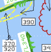
[8/117]
[8/117]
[High-Level Prognostic Chart]
Severe turbulence between FL320 and FL370
[8/117]
Severe turbulence between FL320 and FL370
[8/117]
How long is a SIGMET valid?
[9/117]
[9/117]
4 hours
[9/117]
[9/117]
What is shown here?
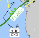
[10/117]
[10/117]
[High-Level Prognostic Chart]
Moderate to severe turbulence from below chart level to FL440
[10/117]
Moderate to severe turbulence from below chart level to FL440
[10/117]
An area of what type of pressure is being depicted here?
[11/117]
[11/117]
[Surface Analysis Chart]
Low
[11/117]
Low
[11/117]
Which type of front is depicted here?
[12/117]
[12/117]
[Surface Analysis Chart]
Cold
[12/117]
Cold
[12/117]
What is shown here?
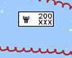
[13/117]
[13/117]
[Prognostic Chart]
Severe icing from below chart level to FL200
[13/117]
Severe icing from below chart level to FL200
[13/117]
What is being reported at this station?

[14/117]
[14/117]
[Surface Analysis Chart]
Temperature 52°F, dew point 43°F, clear skies, and wind calm
[14/117]
Temperature 52°F, dew point 43°F, clear skies, and wind calm
[14/117]
How long is a TAF valid?
[15/117]
[15/117]
24 hours
[15/117]
[15/117]
How often are SIGMETs issued?
[16/117]
[16/117]
Every 4 hours (as needed)
[16/117]
[16/117]
What is shown here?
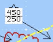
[17/117]
[17/117]
[High-Level Prognostic Chart]
Moderate turbulence between FL250 and FL450
[17/117]
Moderate turbulence between FL250 and FL450
[17/117]
On which weather product (or products) are temperatures and dew points given in degrees Fahrenheit?
[18/117]
[18/117]
Surface Analysis Charts only
[18/117]
[18/117]
What does an AIRMET Tango pertain to?
[19/117]
[19/117]
Turbulence
[19/117]
[19/117]
What is shown here?
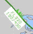
[20/117]
[20/117]
[High-Level Prognostic Chart]
A jet stream of 120 kts at FL320, with jet stream winds (≥ 50 kts) extending from FL190 to FL430
[20/117]
A jet stream of 120 kts at FL320, with jet stream winds (≥ 50 kts) extending from FL190 to FL430
[20/117]
What do the 3 pink dots seen here indicate?
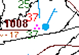
[21/117]
[21/117]
[Surface Analysis Chart]
Moderate rain
[21/117]
Moderate rain
[21/117]
What is shown here?
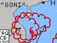
[22/117]
[22/117]
[High-Level Prognostic Chart]
A hurricane (typhoon) named "Goni"
[22/117]
A hurricane (typhoon) named "Goni"
[22/117]
How much area is covered by a SIGMET?
[23/117]
[23/117]
≥ 3,000 miles²
[23/117]
[23/117]
What does the pink hatched area seen here indicate?
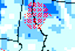
[24/117]
[24/117]
[Icing Chart]
A risk of encountering supercooled large droplets in this area
[24/117]
A risk of encountering supercooled large droplets in this area
[24/117]
How long is a Volcanic Ash SIGMET valid?
[25/117]
[25/117]
6 hours
[25/117]
[25/117]
What does the pink symbol seen here indicate?

[26/117]
[26/117]
[Surface Analysis Chart]
Freezing fog
[26/117]
Freezing fog
[26/117]
What is shown here?
[27/117]
[27/117]
[Prognostic Chart]
Moderate icing from below chart level to FL200
[27/117]
Moderate icing from below chart level to FL200
[27/117]
How often are Surface Analysis charts issued?
[28/117]
[28/117]
Every 3 hours, beginning at 0000Z
[28/117]
[28/117]
What is shown here?
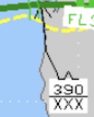
[29/117]
[29/117]
[High-Level Prognostic Chart]
Moderate turbulence from below chart level to FL390
[29/117]
Moderate turbulence from below chart level to FL390
[29/117]
What is the wind and temperature forecasted to be on the last line, at FL390?
[30/117]
[30/117]
[Winds/Temps Aloft]
Wind 270 at ≥ 200 kts, temperature -50°C
[30/117]
Wind 270 at ≥ 200 kts, temperature -50°C
[30/117]
What is the pressure indicated for this high?
[31/117]
[31/117]
[Surface Analysis Chart]
1022 mb
[31/117]
1022 mb
[31/117]
What information does a Radar Summary provide?
[32/117]
[32/117]
• Precipitation location and intensity
• Cell (thunderstorm) tops and movement
[32/117]
• Cell (thunderstorm) tops and movement
[32/117]
Which type of front is depicted here?
[33/117]
[33/117]
[Surface Analysis Chart]
Stationary
[33/117]
Stationary
[33/117]
How often is a METAR issued?
[34/117]
[34/117]
Hourly
[34/117]
[34/117]
Is a TAF a forecast or an observation?
[35/117]
[35/117]
Forecast
[35/117]
[35/117]
What is shown here?

[36/117]
[36/117]
[High-Level Prognostic Chart]
A tropopause height of FL450
[36/117]
A tropopause height of FL450
[36/117]
Which weather product is depicted here?
[37/117]
[37/117]
Winds/Temps Aloft
[37/117]
What is shown here?
[38/117]
[38/117]
[High-Level Prognostic Chart]
Eruption of a volcano at 0.1°S latitude and 77.7°W longitude
[38/117]
Eruption of a volcano at 0.1°S latitude and 77.7°W longitude
[38/117]
Is a Surface Analysis chart an observation or a forecast?
[39/117]
[39/117]
Observation
[39/117]
[39/117]
Which weather product is depicted here?
[40/117]
[40/117]
Icing Chart
[40/117]
What do the 2 pink dots seen here indicate?

[41/117]
[41/117]
[Surface Analysis Chart]
Light rain
[41/117]
Light rain
[41/117]
What is the direction and speed of the wind seen here?

[42/117]
[42/117]
[Surface Analysis Chart]
From the east-southeast at 5 kts
[42/117]
From the east-southeast at 5 kts
[42/117]
What information does a Surface Analysis chart provide?
[43/117]
[43/117]
• Fronts
• Areas of high and low pressure
• Isobars
• Ridges and troughs
• Temperatures
• Dew points
• Wind speed and direction
• Sea-level pressure
[43/117]
• Areas of high and low pressure
• Isobars
• Ridges and troughs
• Temperatures
• Dew points
• Wind speed and direction
• Sea-level pressure
[43/117]
Is a METAR an observation or a forecast?
[44/117]
[44/117]
Observation
[44/117]
[44/117]
Which type of front is depicted here?
[45/117]
[45/117]
[Surface Analysis Chart]
Occluded
[45/117]
Occluded
[45/117]
Approximately what altitude does a 200 mb constant pressure chart depict?
[46/117]
[46/117]
FL390
[46/117]
[46/117]
Which type of front is depicted here?

[47/117]
[47/117]
[Surface Analysis Chart]
Dew point, or "dry line"
[47/117]
Dew point, or "dry line"
[47/117]
What do the "-31" and small squiggle to its left indicate?
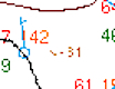
[48/117]
[48/117]
[Surface Analysis Chart]
Pressure showing an overall tendency to decrease (in this case, currently down 3.1 millibars, or .0031 bars)
[48/117]
Pressure showing an overall tendency to decrease (in this case, currently down 3.1 millibars, or .0031 bars)
[48/117]
How long is an AIRMET valid?
[49/117]
[49/117]
6 hours
[49/117]
[49/117]
How often are PIREPs issued?
[50/117]
[50/117]
As needed
[50/117]
[50/117]
How many types of AIRMETs are there, and what are they?
[51/117]
[51/117]
3:
Tango, Zulu, and Sierra
[51/117]
Tango, Zulu, and Sierra
[51/117]
What is the pressure indicated for this low?
[52/117]
[52/117]
[Surface Analysis Chart]
1013 mb
[52/117]
1013 mb
[52/117]
About which types of weather does a PIREP provide information?
[53/117]
[53/117]
• Turbulence
• Wind shear
• Icing
• Convective activity
• Visibility
• Precipitation
• Runway braking action
• Cloud height and thickness
[53/117]
• Wind shear
• Icing
• Convective activity
• Visibility
• Precipitation
• Runway braking action
• Cloud height and thickness
[53/117]
What does the pink "infinity symbol" seen here indicate?

[54/117]
[54/117]
[Surface Analysis Chart]
Haze
[54/117]
Haze
[54/117]
What does the dashed orange line seen here indicate?
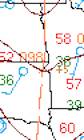
[55/117]
[55/117]
[Surface Analysis Chart]
A trough
[55/117]
A trough
[55/117]
What is the wind and temperature forecasted to be on the last line, at FL300?
[56/117]
[56/117]
[Winds/Temps Aloft]
Wind 320 at 102 kts, temperature -45°C
[56/117]
Wind 320 at 102 kts, temperature -45°C
[56/117]
What information does the Winds/Temps Aloft chart provide?
[57/117]
[57/117]
Wind direction, wind speed, and air temperature (at various altitudes)
[57/117]
[57/117]
How often are AIRMETs issued?
[58/117]
[58/117]
Every 6 hours
[58/117]
[58/117]
What is the approximate pressure altitude (as a flight level) depicted here?
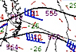
[59/117]
[59/117]
[Constant Pressure Chart]
FL180
[59/117]
FL180
[59/117]
What is being depicted by the orange "260"?

[60/117]
[60/117]
[Surface Analysis Chart]
Sea-level pressure of 1026.0 mb
[60/117]
Sea-level pressure of 1026.0 mb
[60/117]
What does the "U" shape seen here indicate?
[61/117]
[61/117]
[Icing Chart]
Trace icing
[61/117]
Trace icing
[61/117]
How long is a Convective SIGMET valid?
[62/117]
[62/117]
2 hours
[62/117]
[62/117]
What is shown here?
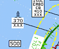
[63/117]
[63/117]
[High-Level Prognostic Chart]
Extreme turbulence from below chart level to FL370
[63/117]
Extreme turbulence from below chart level to FL370
[63/117]
What information does a High-Level Prognostic chart provide?
[64/117]
[64/117]
• Jet stream location/speed
• Tropopause heights (as flight levels)
• Convective activity
• Turbulence (moderate and greater)
• Volcanic activity
• Tropical cyclones (tropical storms, hurricanes, typhoons)
[64/117]
• Tropopause heights (as flight levels)
• Convective activity
• Turbulence (moderate and greater)
• Volcanic activity
• Tropical cyclones (tropical storms, hurricanes, typhoons)
[64/117]
Which type of SIGMET is depicted here?
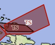
[65/117]
[65/117]
Convective
[65/117]
How often are High-Level Prognostic charts issued?
[66/117]
[66/117]
4 times daily
[66/117]
[66/117]
Which weather product is depicted here?
[67/117]
[67/117]
Surface Analysis Chart
[67/117]
What is shown here?

[68/117]
[68/117]
[High-Level Prognostic Chart]
Occasional cumulonimbi from below chart level to FL530
[68/117]
Occasional cumulonimbi from below chart level to FL530
[68/117]
Approximately what altitude does a 400 mb constant pressure chart depict?
[69/117]
[69/117]
FL240
[69/117]
[69/117]
Which type of SIGMET is depicted here?
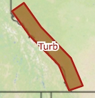
[70/117]
[70/117]
Tango
[70/117]
How long is a METAR valid?
[71/117]
[71/117]
Valid only at the moment observed
[71/117]
[71/117]
On which weather product (or products) are temperatures and dew points given in degrees Celsius?
[72/117]
[72/117]
All except for the Surface Analysis Chart
[72/117]
[72/117]
What is shown here?
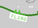
[73/117]
[73/117]
[High-Level Prognostic Chart]
A jet stream of 100 kts at FL280
[73/117]
A jet stream of 100 kts at FL280
[73/117]
How long is a Radar Summary valid?
[74/117]
[74/117]
Valid only at the moment observed
[74/117]
[74/117]
What are the forecast altitudes on a High-Level Prognostic chart?
[75/117]
[75/117]
FL250 to FL630
[75/117]
[75/117]
What is shown here?

[76/117]
[76/117]
[High-Level Prognostic Chart]
A low tropopause height of FL220
[76/117]
A low tropopause height of FL220
[76/117]
What do the 4 pink dots seen here indicate?

[77/117]
[77/117]
[Surface Analysis Chart]
Heavy rain
[77/117]
Heavy rain
[77/117]
What does the "SLD" seen here indicate?
[78/117]
[78/117]
[Radar Summary Report]
A solid line of radar echoes (in other words, a solid line of thunderstorms)
[78/117]
A solid line of radar echoes (in other words, a solid line of thunderstorms)
[78/117]
What is the pressure along the isobar seen here?
[79/117]
[79/117]
[Surface Analysis Chart]
1020 mb
[79/117]
1020 mb
[79/117]
What does an AIRMET Sierra pertain to?
[80/117]
[80/117]
Instrument Meteorological Conditions
[80/117]
[80/117]
Is a PIREP an observation or a forecast?
[81/117]
[81/117]
Observation
[81/117]
[81/117]
What do the 3 pink lines seen here indicate?
[82/117]
[82/117]
[Surface Analysis Chart]
Dense fog
[82/117]
Dense fog
[82/117]
How often are Radar Summaries issued?
[83/117]
[83/117]
Twice per hour, at :15 and :45 after
[83/117]
[83/117]
What is shown here?
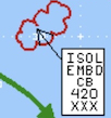
[84/117]
[84/117]
[High-Level Prognostic Chart]
Isolated embedded cumulonimbi from below chart level to FL420
[84/117]
Isolated embedded cumulonimbi from below chart level to FL420
[84/117]
What does an AIRMET Zulu pertain to?
[85/117]
[85/117]
Icing
[85/117]
[85/117]
What is shown here?

[86/117]
[86/117]
[High-Level Prognostic Chart]
A high tropopause height of FL550
[86/117]
A high tropopause height of FL550
[86/117]
What is shown here?

[87/117]
[87/117]
[High-Level Prognostic Chart]
Occasional embedded cumulonimbi from below chart level to FL520
[87/117]
Occasional embedded cumulonimbi from below chart level to FL520
[87/117]
How long is the Winds/Temps Aloft chart valid?
[88/117]
[88/117]
24 hours
[88/117]
[88/117]
Which weather product is depicted here?
[89/117]
[89/117]
Radar Summary
[89/117]
How long is a High-Level Prognostic chart valid?
[90/117]
[90/117]
Valid at forecast time
[90/117]
[90/117]
What is the wind and temperature forecasted to be on the last line, at 9000'?
[91/117]
[91/117]
[Winds/Temps Aloft]
Wind 280 at 36 kts, temperature 0°C
[91/117]
Wind 280 at 36 kts, temperature 0°C
[91/117]
What is the wind and temperature forecasted to be on the last line, at FL300?
[92/117]
[92/117]
[Winds/Temps Aloft]
Wind calm, temperature -44°C
[92/117]
Wind calm, temperature -44°C
[92/117]
Which type of front is depicted here?

[93/117]
[93/117]
[Surface Analysis Chart]
Warm
[93/117]
Warm
[93/117]
What is a SIGMET?
[94/117]
[94/117]
The same as an AIRMET, but for severe turbulence, icing, or IMC
[94/117]
[94/117]
What is shown here?

[95/117]
[95/117]
[Radar Summary Report]
Thunderstorms with tops at FL250, moving to the east-northeast at 45 kts
[95/117]
Thunderstorms with tops at FL250, moving to the east-northeast at 45 kts
[95/117]
How often are Volcanic Ash SIGMETs issued?
[96/117]
[96/117]
Every 4 hours
[96/117]
[96/117]
How often are Constant Pressure Analysis Charts issued?
[97/117]
[97/117]
4 times daily
[97/117]
[97/117]
How often are TAFs issued?
[98/117]
[98/117]
4 times daily
[98/117]
[98/117]
How long is a Constant Pressure Analysis Chart valid?
[99/117]
[99/117]
Valid at forecast time
[99/117]
[99/117]
What is the height, in meters, of the contour line shown here?
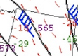
[100/117]
[100/117]
[Constant Pressure Chart]
5,650 meters
[100/117]
5,650 meters
[100/117]
Which type of SIGMET is depicted here?
[101/117]
[101/117]
Zulu
[101/117]
Which weather product is depicted here?
[102/117]
[102/117]
Constant Pressure Analysis Chart
[102/117]
Approximately what altitude does a 500 mb constant pressure chart depict?
[103/117]
[103/117]
FL180
[103/117]
[103/117]
Is the Winds/Temps Aloft chart a forecast or an observation?
[104/117]
[104/117]
Forecast
[104/117]
[104/117]
How long is a Surface Analysis chart valid?
[105/117]
[105/117]
Valid only at the moment observed
[105/117]
[105/117]
Is a Radar Summary an observation or a forecast?
[106/117]
[106/117]
Observation
[106/117]
[106/117]
How often is the Winds/Temps Aloft chart issued?
[107/117]
[107/117]
4 times daily
[107/117]
[107/117]
An area of what type of pressure is being depicted here?
[108/117]
[108/117]
[Surface Analysis Chart]
High
[108/117]
High
[108/117]
What is the wind and temperature forecasted to be on the first line, at FL180?
[109/117]
[109/117]
[Winds/Temps Aloft]
Wind 250 at 29 kts, temperature -21°C
[109/117]
Wind 250 at 29 kts, temperature -21°C
[109/117]
Is an AIRMET an observation or a forecast?
[110/117]
[110/117]
Forecast
[110/117]
[110/117]
Is a Constant Pressure Analysis Chart an observation or a forecast?
[111/117]
[111/117]
Forecast
[111/117]
[111/117]
What information does a Constant Pressure Analysis Chart provide?
[112/117]
[112/117]
• Isotachs
• Height contour lines
• Wind speed
[112/117]
• Height contour lines
• Wind speed
[112/117]
Is a High-Level Prognostic chart an observation or a forecast?
[113/117]
[113/117]
Forecast
[113/117]
[113/117]
How often are Convective SIGMETs issued?
[114/117]
[114/117]
Every 2 hours (as needed)
[114/117]
[114/117]
What does the pink "equal sign" seen here indicate?
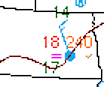
[115/117]
[115/117]
[Surface Analysis Chart]
Light fog/mist
[115/117]
Light fog/mist
[115/117]
How long is a PIREP valid?
[116/117]
[116/117]
Valid only at the moment observed
[116/117]
[116/117]
What is shown here?

[117/117]
[117/117]
[High-Level Prognostic Chart]
Severe turbulence from below chart level to FL320
[117/117]
Severe turbulence from below chart level to FL320
[117/117]
What is the angle between the following heading and wind values?
Do they result in a HW, or a TW?
Do they result in a right XW, or a left XW?
HDG: 050
WND: 310
[1/50]
Do they result in a HW, or a TW?
Do they result in a right XW, or a left XW?
HDG: 050
WND: 310
[1/50]
ANGLE: 80°
HDG: 050
WND: 310
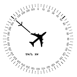
[1/50]
HDG: 050
WND: 310
[1/50]
What is the angle between the following heading and wind values?
HDG: 020
WND: 120
And how would you graph it on the following chart, if the wind speed was 20 kts?
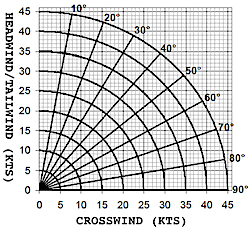
[2/50]
HDG: 020
WND: 120
And how would you graph it on the following chart, if the wind speed was 20 kts?
[2/50]
HDG: 020 / WND: 120
ANGLE: 80°
SPEED: 20 kts
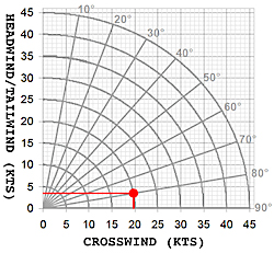
[2/50]
ANGLE: 80°
SPEED: 20 kts
[2/50]
What is the angle between the following heading and wind values?
Do they result in a HW, or a TW?
Do they result in a right XW, or a left XW?
HDG: 300
WND: 090
[3/50]
Do they result in a HW, or a TW?
Do they result in a right XW, or a left XW?
HDG: 300
WND: 090
[3/50]
ANGLE: 30°
HDG: 300
WND: 090
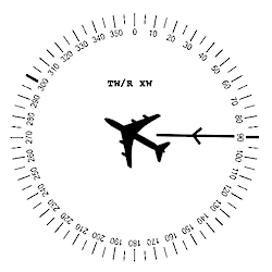
[3/50]
HDG: 300
WND: 090
[3/50]
What is the angle between the following heading and wind values?
Do they result in a HW, or a TW?
Do they result in a left XW, or a right XW?
HDG: 270
WND: 100
[4/50]
Do they result in a HW, or a TW?
Do they result in a left XW, or a right XW?
HDG: 270
WND: 100
[4/50]
ANGLE: 10°
HDG: 270
WND: 100

[4/50]
HDG: 270
WND: 100
[4/50]
What is the angle between the following heading and wind values?
Do they result in a TW, or a HW?
Do they result in a left XW, or a right XW?
HDG: 230
WND: 010
[5/50]
Do they result in a TW, or a HW?
Do they result in a left XW, or a right XW?
HDG: 230
WND: 010
[5/50]
ANGLE: 40°
HDG: 230
WND: 010
[5/50]
HDG: 230
WND: 010
[5/50]
What is the angle between the following heading and wind values?
Do they result in a HW, or a TW?
Do they result in a right XW, or a left XW?
HDG: 110
WND: 100
[6/50]
Do they result in a HW, or a TW?
Do they result in a right XW, or a left XW?
HDG: 110
WND: 100
[6/50]
ANGLE: 10°
HDG: 110
WND: 100
[6/50]
HDG: 110
WND: 100
[6/50]
What is the angle between the following heading and wind values?
HDG: 210
WND: 200
And how would you graph it on the following chart, if the wind speed was 20 kts?
[7/50]
HDG: 210
WND: 200
And how would you graph it on the following chart, if the wind speed was 20 kts?
[7/50]
HDG: 210 / WND: 200
ANGLE: 10°
SPEED: 20 kts

[7/50]
ANGLE: 10°
SPEED: 20 kts
[7/50]
What is the angle between the following heading and wind values?
HDG: 350
WND: 300
And how would you graph it on the following chart, if the wind speed was 30 kts?
[8/50]
HDG: 350
WND: 300
And how would you graph it on the following chart, if the wind speed was 30 kts?
[8/50]
HDG: 350 / WND: 300
ANGLE: 50°
SPEED: 30 kts

[8/50]
ANGLE: 50°
SPEED: 30 kts
[8/50]
What is the angle between the following heading and wind values?
Do they result in a HW, or a TW?
Do they result in a left XW, or a right XW?
HDG: 230
WND: 250
[9/50]
Do they result in a HW, or a TW?
Do they result in a left XW, or a right XW?
HDG: 230
WND: 250
[9/50]
ANGLE: 20°
HDG: 230
WND: 250
[9/50]
HDG: 230
WND: 250
[9/50]
What is the angle between the following heading and wind values?
Do they result in a TW, or a HW?
Do they result in a left XW, or a right XW?
HDG: 010
WND: 170
[10/50]
Do they result in a TW, or a HW?
Do they result in a left XW, or a right XW?
HDG: 010
WND: 170
[10/50]
ANGLE: 20°
HDG: 010
WND: 170
[10/50]
HDG: 010
WND: 170
[10/50]
What is the angle between the following heading and wind values?
HDG: 190
WND: 020
And how would you graph it on the following chart, if the wind speed was 20 kts?
[11/50]
HDG: 190
WND: 020
And how would you graph it on the following chart, if the wind speed was 20 kts?
[11/50]
HDG: 190 / WND: 020
ANGLE: 10°
SPEED: 20 kts
[11/50]
ANGLE: 10°
SPEED: 20 kts
[11/50]
What is the angle between the following heading and wind values?
Do they result in a HW, or a TW?
Do they result in a left XW, or a right XW?
HDG: 220
WND: 280
[12/50]
Do they result in a HW, or a TW?
Do they result in a left XW, or a right XW?
HDG: 220
WND: 280
[12/50]
ANGLE: 60°
HDG: 220
WND: 280
[12/50]
HDG: 220
WND: 280
[12/50]
What is the angle between the following heading and wind values?
HDG: 130
WND: 100
And how would you graph it on the following chart, if the wind speed was 10 kts?
[13/50]
HDG: 130
WND: 100
And how would you graph it on the following chart, if the wind speed was 10 kts?
[13/50]
HDG: 130 / WND: 100
ANGLE: 30°
SPEED: 10 kts
[13/50]
ANGLE: 30°
SPEED: 10 kts
[13/50]
What is the angle between the following heading and wind values?
Do they result in a TW, or a HW?
Do they result in a left XW, or a right XW?
HDG: 260
WND: 200
[14/50]
Do they result in a TW, or a HW?
Do they result in a left XW, or a right XW?
HDG: 260
WND: 200
[14/50]
ANGLE: 60°
HDG: 260
WND: 200
[14/50]
HDG: 260
WND: 200
[14/50]
What is the angle between the following heading and wind values?
HDG: 320
WND: 220
And how would you graph it on the following chart, if the wind speed was 20 kts?
[15/50]
HDG: 320
WND: 220
And how would you graph it on the following chart, if the wind speed was 20 kts?
[15/50]
HDG: 320 / WND: 220
ANGLE: 80°
SPEED: 20 kts

[15/50]
ANGLE: 80°
SPEED: 20 kts
[15/50]
What is the angle between the following heading and wind values?
HDG: 010
WND: 330
And how would you graph it on the following chart, if the wind speed was 40 kts?
[16/50]
HDG: 010
WND: 330
And how would you graph it on the following chart, if the wind speed was 40 kts?
[16/50]
HDG: 010 / WND: 330
ANGLE: 40°
SPEED: 40 kts

[16/50]
ANGLE: 40°
SPEED: 40 kts
[16/50]
What is the angle between the following heading and wind values?
Do they result in a TW, or a HW?
Do they result in a left XW, or a right XW?
HDG: 250
WND: 220
[17/50]
Do they result in a TW, or a HW?
Do they result in a left XW, or a right XW?
HDG: 250
WND: 220
[17/50]
ANGLE: 30°
HDG: 250
WND: 220
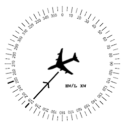
[17/50]
HDG: 250
WND: 220
[17/50]
What is the angle between the following heading and wind values?
HDG: 120
WND: 190
And how would you graph it on the following chart, if the wind speed was 10 kts?
[18/50]
HDG: 120
WND: 190
And how would you graph it on the following chart, if the wind speed was 10 kts?
[18/50]
HDG: 120 / WND: 190
ANGLE: 70°
SPEED: 10 kts
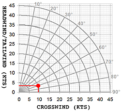
[18/50]
ANGLE: 70°
SPEED: 10 kts
[18/50]
What is the angle between the following heading and wind values?
Do they result in a TW, or a HW?
Do they result in a left XW, or a right XW?
HDG: 140
WND: 270
[19/50]
Do they result in a TW, or a HW?
Do they result in a left XW, or a right XW?
HDG: 140
WND: 270
[19/50]
ANGLE: 50°
HDG: 140
WND: 270
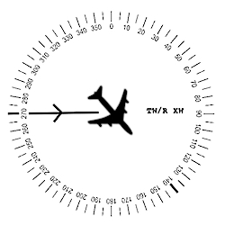
[19/50]
HDG: 140
WND: 270
[19/50]
What is the angle between the following heading and wind values?
HDG: 110
WND: 020
And how would you graph it on the following chart, if the wind speed was 30 kts?
[20/50]
HDG: 110
WND: 020
And how would you graph it on the following chart, if the wind speed was 30 kts?
[20/50]
HDG: 110 / WND: 020
ANGLE: 90°
SPEED: 30 kts
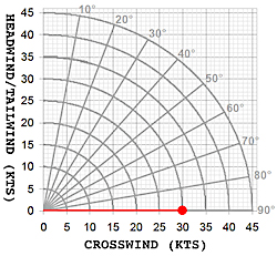
[20/50]
ANGLE: 90°
SPEED: 30 kts
[20/50]
What is the angle between the following heading and wind values?
Do they result in a TW, or a HW?
Do they result in a right XW, or a left XW?
HDG: 120
WND: 020
[21/50]
Do they result in a TW, or a HW?
Do they result in a right XW, or a left XW?
HDG: 120
WND: 020
[21/50]
ANGLE: 80°
HDG: 120
WND: 020
[21/50]
HDG: 120
WND: 020
[21/50]
What is the angle between the following heading and wind values?
HDG: 140
WND: 260
And how would you graph it on the following chart, if the wind speed was 40 kts?
[22/50]
HDG: 140
WND: 260
And how would you graph it on the following chart, if the wind speed was 40 kts?
[22/50]
HDG: 140 / WND: 260
ANGLE: 60°
SPEED: 40 kts
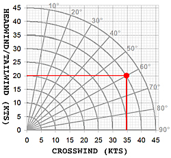
[22/50]
ANGLE: 60°
SPEED: 40 kts
[22/50]
What is the angle between the following heading and wind values?
Do they result in a HW, or a TW?
Do they result in a right XW, or a left XW?
HDG: 340
WND: 080
[23/50]
Do they result in a HW, or a TW?
Do they result in a right XW, or a left XW?
HDG: 340
WND: 080
[23/50]
ANGLE: 80°
HDG: 340
WND: 080
[23/50]
HDG: 340
WND: 080
[23/50]
What is the angle between the following heading and wind values?
Do they result in a HW, or a TW?
Do they result in a left XW, or a right XW?
HDG: 360
WND: 100
[24/50]
Do they result in a HW, or a TW?
Do they result in a left XW, or a right XW?
HDG: 360
WND: 100
[24/50]
ANGLE: 80°
HDG: 360
WND: 100
[24/50]
HDG: 360
WND: 100
[24/50]
What is the angle between the following heading and wind values?
Do they result in a TW, or a HW?
Do they result in a left XW, or a right XW?
HDG: 200
WND: 300
[25/50]
Do they result in a TW, or a HW?
Do they result in a left XW, or a right XW?
HDG: 200
WND: 300
[25/50]
ANGLE: 80°
HDG: 200
WND: 300
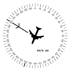
[25/50]
HDG: 200
WND: 300
[25/50]
What is the angle between the following heading and wind values?
Do they result in a TW, or a HW?
Do they result in a right XW, or a left XW?
HDG: 190
WND: 310
[26/50]
Do they result in a TW, or a HW?
Do they result in a right XW, or a left XW?
HDG: 190
WND: 310
[26/50]
ANGLE: 60°
HDG: 190
WND: 310
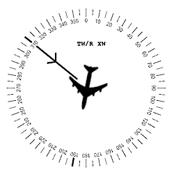
[26/50]
HDG: 190
WND: 310
[26/50]
What is the angle between the following heading and wind values?
HDG: 050
WND: 130
And how would you graph it on the following chart, if the wind speed was 20 kts?
[27/50]
HDG: 050
WND: 130
And how would you graph it on the following chart, if the wind speed was 20 kts?
[27/50]
HDG: 050 / WND: 130
ANGLE: 80°
SPEED: 20 kts
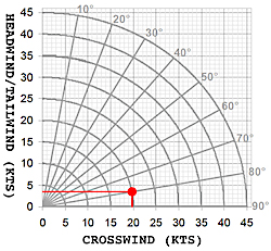
[27/50]
ANGLE: 80°
SPEED: 20 kts
[27/50]
What is the angle between the following heading and wind values?
Do they result in a HW, or a TW?
Do they result in a right XW, or a left XW?
HDG: 080
WND: 360
[28/50]
Do they result in a HW, or a TW?
Do they result in a right XW, or a left XW?
HDG: 080
WND: 360
[28/50]
ANGLE: 80°
HDG: 080
WND: 360
[28/50]
HDG: 080
WND: 360
[28/50]
What is the angle between the following heading and wind values?
HDG: 270
WND: 080
And how would you graph it on the following chart, if the wind speed was 40 kts?
[29/50]
HDG: 270
WND: 080
And how would you graph it on the following chart, if the wind speed was 40 kts?
[29/50]
HDG: 270 / WND: 080
ANGLE: 10°
SPEED: 40 kts
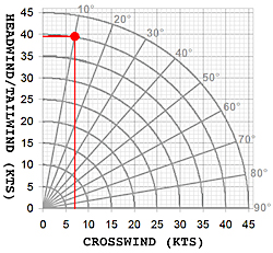
[29/50]
ANGLE: 10°
SPEED: 40 kts
[29/50]
What is the angle between the following heading and wind values?
Do they result in a TW, or a HW?
Do they result in a left XW, or a right XW?
HDG: 140
WND: 230
[30/50]
Do they result in a TW, or a HW?
Do they result in a left XW, or a right XW?
HDG: 140
WND: 230
[30/50]
ANGLE: 90°
HDG: 140
WND: 230
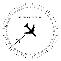
[30/50]
HDG: 140
WND: 230
[30/50]
What is the angle between the following heading and wind values?
Do they result in a HW, or a TW?
Do they result in a left XW, or a right XW?
HDG: 140
WND: 060
[31/50]
Do they result in a HW, or a TW?
Do they result in a left XW, or a right XW?
HDG: 140
WND: 060
[31/50]
ANGLE: 80°
HDG: 140
WND: 060
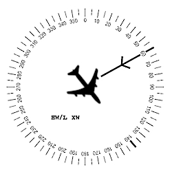
[31/50]
HDG: 140
WND: 060
[31/50]
What is the angle between the following heading and wind values?
Do they result in a TW, or a HW?
Do they result in a left XW, or a right XW?
HDG: 020
WND: 240
[32/50]
Do they result in a TW, or a HW?
Do they result in a left XW, or a right XW?
HDG: 020
WND: 240
[32/50]
ANGLE: 40°
HDG: 020
WND: 240
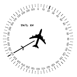
[32/50]
HDG: 020
WND: 240
[32/50]
What is the angle between the following heading and wind values?
Do they result in a TW, or a HW?
Do they result in a right XW, or a left XW?
HDG: 030
WND: 150
[33/50]
Do they result in a TW, or a HW?
Do they result in a right XW, or a left XW?
HDG: 030
WND: 150
[33/50]
ANGLE: 60°
HDG: 030
WND: 150
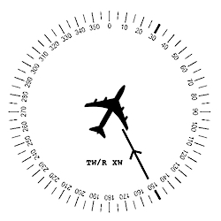
[33/50]
HDG: 030
WND: 150
[33/50]
What is the angle between the following heading and wind values?
HDG: 070
WND: 110
And how would you graph it on the following chart, if the wind speed was 30 kts?
[34/50]
HDG: 070
WND: 110
And how would you graph it on the following chart, if the wind speed was 30 kts?
[34/50]
HDG: 070 / WND: 110
ANGLE: 40°
SPEED: 30 kts
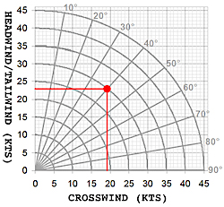
[34/50]
ANGLE: 40°
SPEED: 30 kts
[34/50]
What is the angle between the following heading and wind values?
HDG: 340
WND: 210
And how would you graph it on the following chart, if the wind speed was 30 kts?
[35/50]
HDG: 340
WND: 210
And how would you graph it on the following chart, if the wind speed was 30 kts?
[35/50]
HDG: 340 / WND: 210
ANGLE: 50°
SPEED: 30 kts
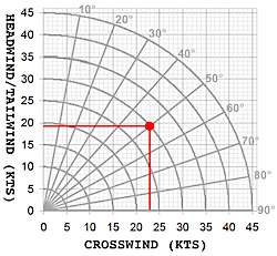
[35/50]
ANGLE: 50°
SPEED: 30 kts
[35/50]
What is the angle between the following heading and wind values?
HDG: 170
WND: 320
And how would you graph it on the following chart, if the wind speed was 10 kts?
[36/50]
HDG: 170
WND: 320
And how would you graph it on the following chart, if the wind speed was 10 kts?
[36/50]
HDG: 170 / WND: 320
ANGLE: 30°
SPEED: 10 kts
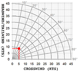
[36/50]
ANGLE: 30°
SPEED: 10 kts
[36/50]
What is the angle between the following heading and wind values?
HDG: 220
WND: 180
And how would you graph it on the following chart, if the wind speed was 40 kts?
[37/50]
HDG: 220
WND: 180
And how would you graph it on the following chart, if the wind speed was 40 kts?
[37/50]
HDG: 220 / WND: 180
ANGLE: 40°
SPEED: 40 kts
[37/50]
ANGLE: 40°
SPEED: 40 kts
[37/50]
What is the angle between the following heading and wind values?
Do they result in a TW, or a HW?
Do they result in a right XW, or a left XW?
HDG: 330
WND: 300
[38/50]
Do they result in a TW, or a HW?
Do they result in a right XW, or a left XW?
HDG: 330
WND: 300
[38/50]
ANGLE: 30°
HDG: 330
WND: 300
[38/50]
HDG: 330
WND: 300
[38/50]
What is the angle between the following heading and wind values?
HDG: 060
WND: 360
And how would you graph it on the following chart, if the wind speed was 20 kts?
[39/50]
HDG: 060
WND: 360
And how would you graph it on the following chart, if the wind speed was 20 kts?
[39/50]
HDG: 060 / WND: 360
ANGLE: 60°
SPEED: 20 kts
[39/50]
ANGLE: 60°
SPEED: 20 kts
[39/50]
What is the angle between the following heading and wind values?
Do they result in a HW, or a TW?
Do they result in a right XW, or a left XW?
HDG: 280
WND: 230
[40/50]
Do they result in a HW, or a TW?
Do they result in a right XW, or a left XW?
HDG: 280
WND: 230
[40/50]
ANGLE: 50°
HDG: 280
WND: 230
[40/50]
HDG: 280
WND: 230
[40/50]
What is the angle between the following heading and wind values?
Do they result in a HW, or a TW?
Do they result in a right XW, or a left XW?
HDG: 070
WND: 350
[41/50]
Do they result in a HW, or a TW?
Do they result in a right XW, or a left XW?
HDG: 070
WND: 350
[41/50]
ANGLE: 80°
HDG: 070
WND: 350
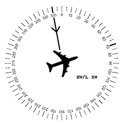
[41/50]
HDG: 070
WND: 350
[41/50]
What is the angle between the following heading and wind values?
Do they result in a HW, or a TW?
Do they result in a right XW, or a left XW?
HDG: 100
WND: 340
[42/50]
Do they result in a HW, or a TW?
Do they result in a right XW, or a left XW?
HDG: 100
WND: 340
[42/50]
ANGLE: 60°
HDG: 100
WND: 340
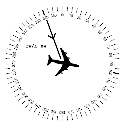
[42/50]
HDG: 100
WND: 340
[42/50]
What is the angle between the following heading and wind values?
Do they result in a TW, or a HW?
Do they result in a left XW, or a right XW?
HDG: 180
WND: 120
[43/50]
Do they result in a TW, or a HW?
Do they result in a left XW, or a right XW?
HDG: 180
WND: 120
[43/50]
ANGLE: 60°
HDG: 180
WND: 120
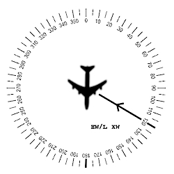
[43/50]
HDG: 180
WND: 120
[43/50]
What is the angle between the following heading and wind values?
HDG: 230
WND: 030
And how would you graph it on the following chart, if the wind speed was 10 kts?
[44/50]
HDG: 230
WND: 030
And how would you graph it on the following chart, if the wind speed was 10 kts?
[44/50]
HDG: 230 / WND: 030
ANGLE: 20°
SPEED: 10 kts
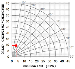
[44/50]
ANGLE: 20°
SPEED: 10 kts
[44/50]
What is the angle between the following heading and wind values?
Do they result in a TW, or a HW?
Do they result in a left XW, or a right XW?
HDG: 310
WND: 140
[45/50]
Do they result in a TW, or a HW?
Do they result in a left XW, or a right XW?
HDG: 310
WND: 140
[45/50]
ANGLE: 10°
HDG: 310
WND: 140
[45/50]
HDG: 310
WND: 140
[45/50]
What is the angle between the following heading and wind values?
Do they result in a HW, or a TW?
Do they result in a right XW, or a left XW?
HDG: 200
WND: 080
[46/50]
Do they result in a HW, or a TW?
Do they result in a right XW, or a left XW?
HDG: 200
WND: 080
[46/50]
ANGLE: 60°
HDG: 200
WND: 080
[46/50]
HDG: 200
WND: 080
[46/50]
What is the angle between the following heading and wind values?
HDG: 090
WND: 300
And how would you graph it on the following chart, if the wind speed was 20 kts?
[47/50]
HDG: 090
WND: 300
And how would you graph it on the following chart, if the wind speed was 20 kts?
[47/50]
HDG: 090 / WND: 300
ANGLE: 30°
SPEED: 20 kts
[47/50]
ANGLE: 30°
SPEED: 20 kts
[47/50]
What is the angle between the following heading and wind values?
Do they result in a HW, or a TW?
Do they result in a right XW, or a left XW?
HDG: 330
WND: 080
[48/50]
Do they result in a HW, or a TW?
Do they result in a right XW, or a left XW?
HDG: 330
WND: 080
[48/50]
ANGLE: 70°
HDG: 330
WND: 080
[48/50]
HDG: 330
WND: 080
[48/50]
What is the angle between the following heading and wind values?
HDG: 200
WND: 070
And how would you graph it on the following chart, if the wind speed was 30 kts?
[49/50]
HDG: 200
WND: 070
And how would you graph it on the following chart, if the wind speed was 30 kts?
[49/50]
HDG: 200 / WND: 070
ANGLE: 50°
SPEED: 30 kts

[49/50]
ANGLE: 50°
SPEED: 30 kts
[49/50]
What is the angle between the following heading and wind values?
Do they result in a HW, or a TW?
Do they result in a right XW, or a left XW?
HDG: 240
WND: 130
[50/50]
Do they result in a HW, or a TW?
Do they result in a right XW, or a left XW?
HDG: 240
WND: 130
[50/50]
ANGLE: 70°
HDG: 240
WND: 130
[50/50]
HDG: 240
WND: 130
[50/50]
✈ AIRPORT CODES
MCN / KMCN
[1/2,651]
MCN / KMCN
[1/2,651]
✈ AIRPORT CODES
MCN / KMCN
Macon, GA
[1/2,651]
MCN / KMCN
Macon, GA
[1/2,651]
✈ WX ABRV/ACRONYMS
AIRMET
[2/2,651]
AIRMET
[2/2,651]
✈ WX ABRV/ACRONYMS
Airmen's Meteorological Information
[2/2,651]
Airmen's Meteorological Information
[2/2,651]
✈ 100% NEED TO KNOW
What is a regular airport?
[3/2,651]
What is a regular airport?
[3/2,651]
✈ 100% NEED TO KNOW
An airport that an airline uses as a regularly-scheduled destination
[3/2,651]
An airport that an airline uses as a regularly-scheduled destination
[3/2,651]
✈ METARs/PIREPs/TAFs
What does M0600FT mean on a METAR?
[4/2,651]
What does M0600FT mean on a METAR?
[4/2,651]
✈ METARs/PIREPs/TAFs
M0600FT
RVR less than 600'
[4/2,651]
M0600FT
RVR less than 600'
[4/2,651]
✈ NOTAMs
What does "RWY 35 RVRT U/S" indicate, in the following NOTAM:
[5/2,651]
What does "RWY 35 RVRT U/S" indicate, in the following NOTAM:
!MSP 08/281 MSP RWY 35 RVRT U/S 2108271700-2108272000
[5/2,651]
✈ NOTAMs
The NOTAM states that the touchdown zone transmissometer for runway 35 is out of service
[5/2,651]
!MSP 08/281 MSP RWY 35 RVRT U/S 2108271700-2108272000
The NOTAM states that the touchdown zone transmissometer for runway 35 is out of service
[5/2,651]
✈ WX ABRV/ACRONYMS
VC
[6/2,651]
VC
[6/2,651]
✈ WX ABRV/ACRONYMS
Vicinity
[6/2,651]
Vicinity
[6/2,651]
✈ METARs/PIREPs/TAFs
What does AO2 mean, when found in a METAR?
[7/2,651]
What does AO2 mean, when found in a METAR?
[7/2,651]
✈ METARs/PIREPs/TAFs
The observing station has equipment capable of automatically discerning the type of precipitation falling, i.e., rain, snow, or sleet, etc.
[7/2,651]
The observing station has equipment capable of automatically discerning the type of precipitation falling, i.e., rain, snow, or sleet, etc.
[7/2,651]
✈ U.S. GEOGRAPHY
Which city is further west, Reno or San Diego?
[8/2,651]
Which city is further west, Reno or San Diego?
[8/2,651]
✈ U.S. GEOGRAPHY
Reno
[8/2,651]
Reno
[8/2,651]
✈ AVIATION WX
What is the primary cause of all weather on earth?
[9/2,651]
What is the primary cause of all weather on earth?
[9/2,651]
✈ AVIATION WX
The uneven heating of the planet's surface
[9/2,651]
The uneven heating of the planet's surface
[9/2,651]
✈ NAVIGATION
What latitude is considered to be south polar?
[10/2,651]
What latitude is considered to be south polar?
[10/2,651]
✈ NAVIGATION
60°S
[10/2,651]
60°S
[10/2,651]
✈ METARs/PIREPs/TAFs
When is the earliest you could arrive, and not require an alternate?
[11/2,651]
When is the earliest you could arrive, and not require an alternate?
[11/2,651]
✈ METARs/PIREPs/TAFs
0100
[11/2,651]
0100
[11/2,651]
✈ AVIATION WX
With a temperature inversion, is air typically more stable or less stable?
[12/2,651]
With a temperature inversion, is air typically more stable or less stable?
[12/2,651]
✈ AVIATION WX
More stable
[12/2,651]
More stable
[12/2,651]
✈ NAV ABRV/ACRONYMS
IF
[13/2,651]
IF
[13/2,651]
✈ NAV ABRV/ACRONYMS
Intermediate Fix
[13/2,651]
Intermediate Fix
[13/2,651]
✈ WX PRODUCTS
What is the wind and temperature forecasted to be on the last line, at FL300?
[14/2,651]
What is the wind and temperature forecasted to be on the last line, at FL300?
[14/2,651]
✈ WX PRODUCTS
[Winds/Temps Aloft]
Wind 320 at 102 kts, temperature -45°C
[14/2,651]
[Winds/Temps Aloft]
Wind 320 at 102 kts, temperature -45°C
[14/2,651]
✈ MISC ABRV/ACRONYMS
HS
[15/2,651]
HS
[15/2,651]
✈ MISC ABRV/ACRONYMS
Hot Spot
[15/2,651]
Hot Spot
[15/2,651]
✈ NAV ABRV/ACRONYMS
IAF
[16/2,651]
IAF
[16/2,651]
✈ NAV ABRV/ACRONYMS
Initial Approach Fix
[16/2,651]
Initial Approach Fix
[16/2,651]
✈ PHONETIC ALPHABET
D
[17/2,651]
D
[17/2,651]
✈ PHONETIC ALPHABET
DELTA
[17/2,651]
DELTA
[17/2,651]
✈ B738 SYSTEMS/EXT
How many Inertial Navigation Systems (INS) are installed on the Boeing 737-800?
[18/2,651]
How many Inertial Navigation Systems (INS) are installed on the Boeing 737-800?
[18/2,651]
✈ B738 SYSTEMS/EXT
2 self-contained systems
[18/2,651]
2 self-contained systems
[18/2,651]
✈ WX PRODUCTS
Is a TAF a forecast or an observation?
[19/2,651]
Is a TAF a forecast or an observation?
[19/2,651]
✈ WX PRODUCTS
Forecast
[19/2,651]
Forecast
[19/2,651]
✈ AVIATION WX
What is a stationary front?
[20/2,651]
What is a stationary front?
[20/2,651]
✈ AVIATION WX
A front with characteristics similar to those of a cold front, but with little or no movement
[20/2,651]
A front with characteristics similar to those of a cold front, but with little or no movement
[20/2,651]
✈ PLATES/CHARTS
What is shown here?
[21/2,651]
What is shown here?
[21/2,651]
✈ PLATES/CHARTS
[Enroute High Altitude Chart]
Air Defense Identification Zone (ADIZ)
[21/2,651]
[Enroute High Altitude Chart]
Air Defense Identification Zone (ADIZ)
[21/2,651]
✈ U.S. GEOGRAPHY
Which city is marked with a red dot?
[22/2,651]
Which city is marked with a red dot?
[22/2,651]
✈ U.S. GEOGRAPHY
Burlington, VT
[22/2,651]
Burlington, VT
[22/2,651]
✈ ADVANCED » MISCELLANEOUS
To what does an RNP value of 2 correspond?
[23/2,651]
To what does an RNP value of 2 correspond?
[23/2,651]
✈ ADVANCED » MISCELLANEOUS
Enroute/cruise
[23/2,651]
Enroute/cruise
[23/2,651]
✈ METARs/PIREPs/TAFs
When was this TAF issued?
[24/2,651]
When was this TAF issued?
[24/2,651]
✈ METARs/PIREPs/TAFs
On the 8th at 2335
[24/2,651]
On the 8th at 2335
[24/2,651]
✈ ADVANCED » DX RELEASE
Which airports, if any, are listed as destination alternates in the following ATC strip:
[25/2,651]
Which airports, if any, are listed as destination alternates in the following ATC strip:
FF KZLAZQZX
(FLP-AL125-IS
-B737/M-SDE2E3GIJ4J7RWZ/LB1D1
-KLAS1315 KONT
-N0454F390 GIDGT1 TUKRR DCT DVC/N0435F390 DCT ICT/N0451F370 DCT YACKS RYYMN2
-KBNA0307 KCHA KBHM
-PBN/A1C1D1L1O1S2T1 NAV/RNVD1E1A1 RNP10 RNP4 DAT/1FANSE2P SUR/260B REG/N700AL EET/KZME0205)
(FLP-AL125-IS
-B737/M-SDE2E3GIJ4J7RWZ/LB1D1
-KLAS1315 KONT
-N0454F390 GIDGT1 TUKRR DCT DVC/N0435F390 DCT ICT/N0451F370 DCT YACKS RYYMN2
-KBNA0307 KCHA KBHM
-PBN/A1C1D1L1O1S2T1 NAV/RNVD1E1A1 RNP10 RNP4 DAT/1FANSE2P SUR/260B REG/N700AL EET/KZME0205)
[25/2,651]
✈ ADVANCED » DX RELEASE
KCHA & KBHM
[25/2,651]
FF KZLAZQZX
(FLP-AL125-IS
-B737/M-SDE2E3GIJ4J7RWZ/LB1D1
-KLAS1315 KONT
-N0454F390 GIDGT1 TUKRR DCT DVC/N0435F390 DCT ICT/N0451F370 DCT YACKS RYYMN2
-KBNA0307 KCHA KBHM
-PBN/A1C1D1L1O1S2T1 NAV/RNVD1E1A1 RNP10 RNP4 DAT/1FANSE2P SUR/260B REG/N700AL EET/KZME0205)
(FLP-AL125-IS
-B737/M-SDE2E3GIJ4J7RWZ/LB1D1
-KLAS1315 KONT
-N0454F390 GIDGT1 TUKRR DCT DVC/N0435F390 DCT ICT/N0451F370 DCT YACKS RYYMN2
-KBNA0307 KCHA KBHM
-PBN/A1C1D1L1O1S2T1 NAV/RNVD1E1A1 RNP10 RNP4 DAT/1FANSE2P SUR/260B REG/N700AL EET/KZME0205)
KCHA & KBHM
[25/2,651]
✈ AIRPORT CODES
SMO / KSMO
[26/2,651]
SMO / KSMO
[26/2,651]
✈ AIRPORT CODES
SMO / KSMO
Santa Monica, CA
[26/2,651]
SMO / KSMO
Santa Monica, CA
[26/2,651]
✈ U.S. GEOGRAPHY
Over which state is the aircraft below flying?
[27/2,651]
Over which state is the aircraft below flying?
[27/2,651]
✈ U.S. GEOGRAPHY
California
[27/2,651]
California
[27/2,651]
✈ NOTAMs ABRV/ACRONYMS
PAEW
[28/2,651]
PAEW
[28/2,651]
✈ NOTAMs ABRV/ACRONYMS
Personnel and Equipment Working
[28/2,651]
Personnel and Equipment Working
[28/2,651]
✈ NAVIGATION
What is shown here?
[29/2,651]
What is shown here?
[29/2,651]
✈ NAVIGATION
A VOR station
[29/2,651]
A VOR station
[29/2,651]
✈ U.S. GEOGRAPHY
Over which state is the aircraft below flying?
[30/2,651]
Over which state is the aircraft below flying?
[30/2,651]
✈ U.S. GEOGRAPHY
Delaware
[30/2,651]
Delaware
[30/2,651]
✈ WX ABRV/ACRONYMS
RV
[31/2,651]
RV
[31/2,651]
✈ WX ABRV/ACRONYMS
Reportable Value
[31/2,651]
Reportable Value
[31/2,651]
✈ METARs/PIREPs/TAFs
When is the earliest you could arrive, and not require an alternate?
[32/2,651]
When is the earliest you could arrive, and not require an alternate?
[32/2,651]
✈ METARs/PIREPs/TAFs
0100
[32/2,651]
0100
[32/2,651]
✈ NAV ABRV/ACRONYMS
RW
[33/2,651]
RW
[33/2,651]
✈ NAV ABRV/ACRONYMS
Runway
[33/2,651]
Runway
[33/2,651]
✈ NOTAMs ABRV/ACRONYMS
CL
[34/2,651]
CL
[34/2,651]
✈ NOTAMs ABRV/ACRONYMS
Centerline
[34/2,651]
Centerline
[34/2,651]
✈ AVIATION WX
What is advection?
[35/2,651]
What is advection?
[35/2,651]
✈ AVIATION WX
The horizontal movement of air, i.e., wind
[35/2,651]
The horizontal movement of air, i.e., wind
[35/2,651]
✈ ARTCC CODES
Which ARTCC is depicted here?
[36/2,651]
Which ARTCC is depicted here?
[36/2,651]
✈ ARTCC CODES
Indianapolis Center / ZID
[36/2,651]
Indianapolis Center / ZID
[36/2,651]
✈ ADVANCED » DX RELEASE
What is the ETD from KLAS in the following ATC strip:
[37/2,651]
What is the ETD from KLAS in the following ATC strip:
FF KZLAZQZX
(FLP-AL125-IS
-B737/M-SDE2E3GIJ4J7RWZ/LB1D1
-KLAS1315 KONT
-N0454F390 GIDGT1 TUKRR DCT DVC/N0435F390 DCT ICT/N0451F370 DCT YACKS RYYMN2
-KBNA0307 KCHA KBHM
-PBN/A1C1D1L1O1S2T1 NAV/RNVD1E1A1 RNP10 RNP4 DAT/1FANSE2P SUR/260B REG/N700AL EET/KZME0205)
(FLP-AL125-IS
-B737/M-SDE2E3GIJ4J7RWZ/LB1D1
-KLAS1315 KONT
-N0454F390 GIDGT1 TUKRR DCT DVC/N0435F390 DCT ICT/N0451F370 DCT YACKS RYYMN2
-KBNA0307 KCHA KBHM
-PBN/A1C1D1L1O1S2T1 NAV/RNVD1E1A1 RNP10 RNP4 DAT/1FANSE2P SUR/260B REG/N700AL EET/KZME0205)
[37/2,651]
✈ ADVANCED » DX RELEASE
13:15
[37/2,651]
FF KZLAZQZX
(FLP-AL125-IS
-B737/M-SDE2E3GIJ4J7RWZ/LB1D1
-KLAS1315 KONT
-N0454F390 GIDGT1 TUKRR DCT DVC/N0435F390 DCT ICT/N0451F370 DCT YACKS RYYMN2
-KBNA0307 KCHA KBHM
-PBN/A1C1D1L1O1S2T1 NAV/RNVD1E1A1 RNP10 RNP4 DAT/1FANSE2P SUR/260B REG/N700AL EET/KZME0205)
(FLP-AL125-IS
-B737/M-SDE2E3GIJ4J7RWZ/LB1D1
-KLAS1315 KONT
-N0454F390 GIDGT1 TUKRR DCT DVC/N0435F390 DCT ICT/N0451F370 DCT YACKS RYYMN2
-KBNA0307 KCHA KBHM
-PBN/A1C1D1L1O1S2T1 NAV/RNVD1E1A1 RNP10 RNP4 DAT/1FANSE2P SUR/260B REG/N700AL EET/KZME0205)
13:15
[37/2,651]
✈ AIRPORT CODES
PIH / KPIH
[38/2,651]
PIH / KPIH
[38/2,651]
✈ AIRPORT CODES
PIH / KPIH
Pocatello, ID
[38/2,651]
PIH / KPIH
Pocatello, ID
[38/2,651]
✈ WX PRODUCTS
What is shown here?
[39/2,651]
What is shown here?
[39/2,651]
✈ WX PRODUCTS
[High-Level Prognostic Chart]
A jet stream of 120 kts at FL320, with jet stream winds (≥ 50 kts) extending from FL190 to FL430
[39/2,651]
[High-Level Prognostic Chart]
A jet stream of 120 kts at FL320, with jet stream winds (≥ 50 kts) extending from FL190 to FL430
[39/2,651]
✈ 100% NEED TO KNOW
Is a loss of communications between the dispatcher and the flightcrew an emergency?
[40/2,651]
Is a loss of communications between the dispatcher and the flightcrew an emergency?
[40/2,651]
✈ 100% NEED TO KNOW
Yes, and everything possible should be attempted to rectify the situation, and reestablish communications
[40/2,651]
Yes, and everything possible should be attempted to rectify the situation, and reestablish communications
[40/2,651]
✈ AIRPORT CODES
ORH / KORH
[41/2,651]
ORH / KORH
[41/2,651]
✈ AIRPORT CODES
ORH / KORH
Worcester, MA
[41/2,651]
ORH / KORH
Worcester, MA
[41/2,651]
✈ AIRPORT CODES
PSP / KPSP
[42/2,651]
PSP / KPSP
[42/2,651]
✈ AIRPORT CODES
PSP / KPSP
Palm Springs, CA
[42/2,651]
PSP / KPSP
Palm Springs, CA
[42/2,651]
✈ TRUE/MAG CONVERSION
METAR wind is from 330, with a 9°E variation
[43/2,651]
METAR wind is from 330, with a 9°E variation
[43/2,651]
✈ TRUE/MAG CONVERSION
TRUE: 330
MAGNETIC: 321
[43/2,651]
TRUE: 330
MAGNETIC: 321
[43/2,651]
✈ FARs
§ 121.309
[44/2,651]
§ 121.309
[44/2,651]
✈ FARs
Emergency equipment requirements
[44/2,651]
Emergency equipment requirements
[44/2,651]
✈ AIRPORT CODES
LFT / KLFT
[45/2,651]
LFT / KLFT
[45/2,651]
✈ AIRPORT CODES
LFT / KLFT
Lafayette, LA
[45/2,651]
LFT / KLFT
Lafayette, LA
[45/2,651]
✈ AVIATION WX
What is rime ice?
[46/2,651]
What is rime ice?
[46/2,651]
✈ AVIATION WX
Ice created by small supercooled droplets, which quickly freeze into a rough, milky texture when they come into contact with a cold surface, such as an aircraft wing
[46/2,651]
Ice created by small supercooled droplets, which quickly freeze into a rough, milky texture when they come into contact with a cold surface, such as an aircraft wing
[46/2,651]
✈ WX PRODUCTS
On which weather product (or products) are temperatures and dew points given in degrees Celsius?
[47/2,651]
On which weather product (or products) are temperatures and dew points given in degrees Celsius?
[47/2,651]
✈ WX PRODUCTS
All except for the Surface Analysis Chart
[47/2,651]
All except for the Surface Analysis Chart
[47/2,651]
✈ NAV ABRV/ACRONYMS
BC
[48/2,651]
BC
[48/2,651]
✈ NAV ABRV/ACRONYMS
Localizer Back Course
[48/2,651]
Localizer Back Course
[48/2,651]
✈ NAVIGATION
What is a jet route?
[49/2,651]
What is a jet route?
[49/2,651]
✈ NAVIGATION
A high-altitude airway connecting VORs
[49/2,651]
A high-altitude airway connecting VORs
[49/2,651]
✈ WX ABRV/ACRONYMS
mb
[50/2,651]
mb
[50/2,651]
✈ WX ABRV/ACRONYMS
millibar
[50/2,651]
millibar
[50/2,651]
✈ METARs/PIREPs/TAFs
What is the visibility in the following METAR:
KLAX 090453Z 28015KT 10SM FEW030 FEW060 12/04 A2986 RMK AO2 PK WND 26029/0410 SLP109 T01220044
[51/2,651]
What is the visibility in the following METAR:
KLAX 090453Z 28015KT 10SM FEW030 FEW060 12/04 A2986 RMK AO2 PK WND 26029/0410 SLP109 T01220044
[51/2,651]
✈ METARs/PIREPs/TAFs
KLAX 090453Z 28015KT 10SM FEW030 FEW060 12/04 A2986 RMK AO2 PK WND 26029/0410 SLP109 T01220044
10
[51/2,651]
KLAX 090453Z 28015KT 10SM FEW030 FEW060 12/04 A2986 RMK AO2 PK WND 26029/0410 SLP109 T01220044
10
[51/2,651]
✈ MISC ABRV/ACRONYMS
CRM
[52/2,651]
CRM
[52/2,651]
✈ MISC ABRV/ACRONYMS
Crew Resource Management
[52/2,651]
Crew Resource Management
[52/2,651]
✈ U.S. GEOGRAPHY
What is the name of the region highlighted in red?
[53/2,651]
What is the name of the region highlighted in red?
[53/2,651]
✈ U.S. GEOGRAPHY
Big Bend
[53/2,651]
Big Bend
[53/2,651]
✈ PHONETIC ALPHABET
N
[54/2,651]
N
[54/2,651]
✈ PHONETIC ALPHABET
NOVEMBER
[54/2,651]
NOVEMBER
[54/2,651]
✈ AC PERFORMANCE
Which runway measure is V2 based on?
[55/2,651]
Which runway measure is V2 based on?
[55/2,651]
✈ AC PERFORMANCE
TODA, or Takeoff Distance Available
[55/2,651]
TODA, or Takeoff Distance Available
[55/2,651]
✈ AC ABRV/ACRONYMS
HGS
[56/2,651]
HGS
[56/2,651]
✈ AC ABRV/ACRONYMS
Head-Up Guidance System
[56/2,651]
Head-Up Guidance System
[56/2,651]
✈ WIND COMPONENTS
What is the angle between the following heading and wind values?
Do they result in a HW, or a TW?
Do they result in a right XW, or a left XW?
HDG: 340
WND: 080
[57/2,651]
What is the angle between the following heading and wind values?
Do they result in a HW, or a TW?
Do they result in a right XW, or a left XW?
HDG: 340
WND: 080
[57/2,651]
✈ WIND COMPONENTS
ANGLE: 80°
HDG: 340
WND: 080
[57/2,651]
ANGLE: 80°
HDG: 340
WND: 080
[57/2,651]
✈ AIRPORT CODES
COU / KCOU
[58/2,651]
COU / KCOU
[58/2,651]
✈ AIRPORT CODES
COU / KCOU
Columbia, MO
[58/2,651]
COU / KCOU
Columbia, MO
[58/2,651]
✈ AVIATION WX
What is it called when the temperature in the troposphere increases with altitude?
[59/2,651]
What is it called when the temperature in the troposphere increases with altitude?
[59/2,651]
✈ AVIATION WX
Temperature inversion
[59/2,651]
Temperature inversion
[59/2,651]
✈ MISC ABRV/ACRONYMS
NTSB
[60/2,651]
NTSB
[60/2,651]
✈ MISC ABRV/ACRONYMS
National Transportation Safety Board
[60/2,651]
National Transportation Safety Board
[60/2,651]
✈ B738 SYSTEMS/EXT
What is the most common cause of hydraulic failure on the Boeing 737-800?
[61/2,651]
What is the most common cause of hydraulic failure on the Boeing 737-800?
[61/2,651]
✈ B738 SYSTEMS/EXT
A leak in a hydraulic line, or in the hydraulic reservoir
[61/2,651]
A leak in a hydraulic line, or in the hydraulic reservoir
[61/2,651]
✈ AIRPORT CODES
FNT / KFNT
[62/2,651]
FNT / KFNT
[62/2,651]
✈ AIRPORT CODES
FNT / KFNT
Flint, MI
[62/2,651]
FNT / KFNT
Flint, MI
[62/2,651]
✈ WX ABRV/ACRONYMS
UP
[63/2,651]
UP
[63/2,651]
✈ WX ABRV/ACRONYMS
Unknown Precipitation
[63/2,651]
Unknown Precipitation
[63/2,651]
✈ NOTAMs ABRV/ACRONYMS
CMB
[64/2,651]
CMB
[64/2,651]
✈ NOTAMs ABRV/ACRONYMS
Climb
[64/2,651]
Climb
[64/2,651]
✈ MISC ABRV/ACRONYMS
LF
[65/2,651]
LF
[65/2,651]
✈ MISC ABRV/ACRONYMS
Low Frequency
[65/2,651]
Low Frequency
[65/2,651]
✈ WX PRODUCTS
How often are Convective SIGMETs issued?
[66/2,651]
How often are Convective SIGMETs issued?
[66/2,651]
✈ WX PRODUCTS
Every 2 hours (as needed)
[66/2,651]
Every 2 hours (as needed)
[66/2,651]
✈ METARs/PIREPs/TAFs
Do you require an alternate at 0135?
[67/2,651]
Do you require an alternate at 0135?
[67/2,651]
✈ METARs/PIREPs/TAFs
No
[67/2,651]
No
[67/2,651]
✈ METARs/PIREPs/TAFs
What does AUTO mean, when found in a METAR?
[68/2,651]
What does AUTO mean, when found in a METAR?
[68/2,651]
✈ METARs/PIREPs/TAFs
The observation was obtained automatically, and has not been verified by a human observer
[68/2,651]
The observation was obtained automatically, and has not been verified by a human observer
[68/2,651]
✈ NAV ABRV/ACRONYMS
VASI
[69/2,651]
VASI
[69/2,651]
✈ NAV ABRV/ACRONYMS
Visual Approach Slope Indicator
[69/2,651]
Visual Approach Slope Indicator
[69/2,651]
✈ U.S. GEOGRAPHY
Which city is marked with a red dot?
[70/2,651]
Which city is marked with a red dot?
[70/2,651]
✈ U.S. GEOGRAPHY
Jackson Hole, WY
[70/2,651]
Jackson Hole, WY
[70/2,651]
✈ WX PRODUCTS
How long is a Volcanic Ash SIGMET valid?
[71/2,651]
How long is a Volcanic Ash SIGMET valid?
[71/2,651]
✈ WX PRODUCTS
6 hours
[71/2,651]
6 hours
[71/2,651]
✈ AVIATION WX
What are icing conditions while on the ground?
[72/2,651]
What are icing conditions while on the ground?
[72/2,651]
✈ AVIATION WX
A temperature of 10°C or lower, and the risk of snow, ice, slush, or standing water being ingested into the engines
[72/2,651]
A temperature of 10°C or lower, and the risk of snow, ice, slush, or standing water being ingested into the engines
[72/2,651]
✈ NOTAMs ABRV/ACRONYMS
TFC
[73/2,651]
TFC
[73/2,651]
✈ NOTAMs ABRV/ACRONYMS
Trafic
[73/2,651]
Trafic
[73/2,651]
✈ ATC/AIRSPACE
What is Class G airspace?
[74/2,651]
What is Class G airspace?
[74/2,651]
✈ ATC/AIRSPACE
Uncontrolled airspace from ground-level to 700' AGL (for instrument approach procedures), or 1200' AGL (when adjacent B, C, or D airspace)
[74/2,651]
Uncontrolled airspace from ground-level to 700' AGL (for instrument approach procedures), or 1200' AGL (when adjacent B, C, or D airspace)
[74/2,651]
✈ NAV ABRV/ACRONYMS
BCN
[75/2,651]
BCN
[75/2,651]
✈ NAV ABRV/ACRONYMS
Beacon
[75/2,651]
Beacon
[75/2,651]
✈ NOTAMs ABRV/ACRONYMS
WEF
[76/2,651]
WEF
[76/2,651]
✈ NOTAMs ABRV/ACRONYMS
With Effect From
[76/2,651]
With Effect From
[76/2,651]
✈ NOTAMs ABRV/ACRONYMS
UNMNT
[77/2,651]
UNMNT
[77/2,651]
✈ NOTAMs ABRV/ACRONYMS
Unmonitored
[77/2,651]
Unmonitored
[77/2,651]
✈ AIRPORT CODES
BZN / KBZN
[78/2,651]
BZN / KBZN
[78/2,651]
✈ AIRPORT CODES
BZN / KBZN
Bozeman, MT
[78/2,651]
BZN / KBZN
Bozeman, MT
[78/2,651]
✈ U.S. GEOGRAPHY
Which city is marked with a red dot?
[79/2,651]
Which city is marked with a red dot?
[79/2,651]
✈ U.S. GEOGRAPHY
Montgomery, AL
[79/2,651]
Montgomery, AL
[79/2,651]
✈ ADV ABRV/ACRONYMS
IS
[80/2,651]
IS
[80/2,651]
✈ ADV ABRV/ACRONYMS
IFR Scheduled
[80/2,651]
IFR Scheduled
[80/2,651]
✈ AIRPORT CODES
SJD / MMSD
[81/2,651]
SJD / MMSD
[81/2,651]
✈ AIRPORT CODES
SJD / MMSD
Los Cabos, Mexico
[81/2,651]
SJD / MMSD
Los Cabos, Mexico
[81/2,651]
✈ NOTAMs ABRV/ACRONYMS
CTC
[82/2,651]
CTC
[82/2,651]
✈ NOTAMs ABRV/ACRONYMS
Contact
[82/2,651]
Contact
[82/2,651]
✈ NOTAMs
What does "COM" indicate, in the following NOTAM:
[83/2,651]
What does "COM" indicate, in the following NOTAM:
!MIA 06/007 MIA COM GRAND BAHAMA REMOTE OUTLET 126.9 U/S 2106011119-2108022000EST
[83/2,651]
✈ NOTAMs
The NOTAM is in reference to communications equipment (in this case, an unserviceable RCO)
[83/2,651]
!MIA 06/007 MIA COM GRAND BAHAMA REMOTE OUTLET 126.9 U/S 2106011119-2108022000EST
The NOTAM is in reference to communications equipment (in this case, an unserviceable RCO)
[83/2,651]
✈ ARTCC CODES
Salt Lake Center?
[84/2,651]
Salt Lake Center?
[84/2,651]
✈ ARTCC CODES
ZLC
[84/2,651]
ZLC
[84/2,651]
✈ NAVIGATION
What is a visual descent point (VDP)?
[85/2,651]
What is a visual descent point (VDP)?
[85/2,651]
✈ NAVIGATION
The point after which a pilot is permitted to descend below his or her MDA, if they have the runway in sight
[85/2,651]
The point after which a pilot is permitted to descend below his or her MDA, if they have the runway in sight
[85/2,651]
✈ B738 SPECS/LIMS
What is the maximum unplanned fuel imbalance between the Boeing 737-800's 2 wing tanks?
[86/2,651]
What is the maximum unplanned fuel imbalance between the Boeing 737-800's 2 wing tanks?
[86/2,651]
✈ B738 SPECS/LIMS
1,000 lbs
[86/2,651]
1,000 lbs
[86/2,651]
✈ METARs/PIREPs/TAFs
What type of weather is being reported in the following PIREP:
RSW UA /OV RSW310025/TM 1622/FL060/TP B737/SK IMC/WX RA/TB LT CHOP
[87/2,651]
What type of weather is being reported in the following PIREP:
RSW UA /OV RSW310025/TM 1622/FL060/TP B737/SK IMC/WX RA/TB LT CHOP
[87/2,651]
✈ METARs/PIREPs/TAFs
RSW UA /OV RSW310025/TM 1622/FL060/TP B737/SK IMC/WX RA/TB LT CHOP
Rain
[87/2,651]
RSW UA /OV RSW310025/TM 1622/FL060/TP B737/SK IMC/WX RA/TB LT CHOP
Rain
[87/2,651]
✈ METARs/PIREPs/TAFs
Do you require an alternate at 2000?
[88/2,651]
Do you require an alternate at 2000?
[88/2,651]
✈ METARs/PIREPs/TAFs
No
[88/2,651]
No
[88/2,651]
✈ AVIATION WX
Does the temperature increase, decrease, or remain steady in the tropopause?
[89/2,651]
Does the temperature increase, decrease, or remain steady in the tropopause?
[89/2,651]
✈ AVIATION WX
It remains steady
[89/2,651]
It remains steady
[89/2,651]
✈ AIRPORT CODES
DHN / KDHN
[90/2,651]
DHN / KDHN
[90/2,651]
✈ AIRPORT CODES
DHN / KDHN
Dothan, AL
[90/2,651]
DHN / KDHN
Dothan, AL
[90/2,651]
✈ U.S. GEOGRAPHY
Which geographical feature is highlighted in red below?
[91/2,651]
Which geographical feature is highlighted in red below?
[91/2,651]
✈ U.S. GEOGRAPHY
The Potomac River
[91/2,651]
The Potomac River
[91/2,651]
✈ AVIATION WX
What are IMC?
[92/2,651]
What are IMC?
[92/2,651]
✈ AVIATION WX
Instrument Meteorological Conditions, or, essentially, "flying in clouds"
[92/2,651]
Instrument Meteorological Conditions, or, essentially, "flying in clouds"
[92/2,651]
✈ PLATES/CHARTS
What is shown here?
[93/2,651]
What is shown here?
[93/2,651]
✈ PLATES/CHARTS
[Approach Plate]
A note about this approach
[93/2,651]
[Approach Plate]
A note about this approach
[93/2,651]
✈ MISC ABRV/ACRONYMS
GDP
[94/2,651]
GDP
[94/2,651]
✈ MISC ABRV/ACRONYMS
Ground Delay Program
[94/2,651]
Ground Delay Program
[94/2,651]
✈ PLATES/CHARTS
What is shown here?
[95/2,651]
What is shown here?
[95/2,651]
✈ PLATES/CHARTS
[Approach Plate]
Marker beacon (in this case, an inner marker)
[95/2,651]
[Approach Plate]
Marker beacon (in this case, an inner marker)
[95/2,651]
✈ U.S. GEOGRAPHY
Which city is marked with a red dot?
[96/2,651]
Which city is marked with a red dot?
[96/2,651]
✈ U.S. GEOGRAPHY
San Diego, CA
[96/2,651]
San Diego, CA
[96/2,651]
✈ B738 SYSTEMS/EXT
What is shown here?
[97/2,651]
What is shown here?
[97/2,651]
✈ B738 SYSTEMS/EXT
Angle of attack sensor
[97/2,651]
Angle of attack sensor
[97/2,651]
✈ AIRPORT CODES
MYR / KMYR
[98/2,651]
MYR / KMYR
[98/2,651]
✈ AIRPORT CODES
MYR / KMYR
Myrtle Beach, SC
[98/2,651]
MYR / KMYR
Myrtle Beach, SC
[98/2,651]
✈ MISCELLANEOUS
What is Zero Fuel Weight?
[99/2,651]
What is Zero Fuel Weight?
[99/2,651]
✈ MISCELLANEOUS
The Basic Operating Weight of an aircraft, plus its payload (passengers and cargo), but not including the weight of any fuel onboard
[99/2,651]
The Basic Operating Weight of an aircraft, plus its payload (passengers and cargo), but not including the weight of any fuel onboard
[99/2,651]
✈ NAVIGATION
What does RNAV provide, and how does it work?
[100/2,651]
What does RNAV provide, and how does it work?
[100/2,651]
✈ NAVIGATION
Area Navigation allows for direct flight between any two sets of coordinates, using a combination of data compiled by individual GPS, DME, INS, and/or VOR sources, which is used to plot and display the aircraft's present position on the EFIS
[100/2,651]
Area Navigation allows for direct flight between any two sets of coordinates, using a combination of data compiled by individual GPS, DME, INS, and/or VOR sources, which is used to plot and display the aircraft's present position on the EFIS
[100/2,651]
✈ MISCELLANEOUS
Are there over-land routes that require ETOPS certification?
[101/2,651]
Are there over-land routes that require ETOPS certification?
[101/2,651]
✈ MISCELLANEOUS
Yes, some remote regions (the poles, parts of Africa and Asia, etc.) are more than 60 minutes from the nearest airport
[101/2,651]
Yes, some remote regions (the poles, parts of Africa and Asia, etc.) are more than 60 minutes from the nearest airport
[101/2,651]
✈ NOTAMs ABRV/ACRONYMS
BA
[102/2,651]
BA
[102/2,651]
✈ NOTAMs ABRV/ACRONYMS
Braking Action (FAIR, NIL, POOR, etc.)
[102/2,651]
Braking Action (FAIR, NIL, POOR, etc.)
[102/2,651]
✈ AVIATION WX
How far from a thunderstorm, horizontally, should aircraft always remain?
[103/2,651]
How far from a thunderstorm, horizontally, should aircraft always remain?
[103/2,651]
✈ AVIATION WX
At least 20 NM
[103/2,651]
At least 20 NM
[103/2,651]
✈ NAV ABRV/ACRONYMS
LLWAS
[104/2,651]
LLWAS
[104/2,651]
✈ NAV ABRV/ACRONYMS
Low-Level Wind Shear Alert System
[104/2,651]
Low-Level Wind Shear Alert System
[104/2,651]
✈ ADV ABRV/ACRONYMS
PYLD
[105/2,651]
PYLD
[105/2,651]
✈ ADV ABRV/ACRONYMS
Payload
[105/2,651]
Payload
[105/2,651]
✈ METARs/PIREPs/TAFs
What is a SPECI?
[106/2,651]
What is a SPECI?
[106/2,651]
✈ METARs/PIREPs/TAFs
An unscheduled METAR, issued when something significant occurs between normal METAR issuances
[106/2,651]
An unscheduled METAR, issued when something significant occurs between normal METAR issuances
[106/2,651]
✈ MISC ABRV/ACRONYMS
LDA
[107/2,651]
LDA
[107/2,651]
✈ MISC ABRV/ACRONYMS
Landing Distance Available
[107/2,651]
Landing Distance Available
[107/2,651]
✈ NAVIGATION
Which type of NAVAID has a 3-digit identifier?
[108/2,651]
Which type of NAVAID has a 3-digit identifier?
[108/2,651]
✈ NAVIGATION
VOR
[108/2,651]
VOR
[108/2,651]
✈ MISCELLANEOUS
What is a CDL?
[109/2,651]
What is a CDL?
[109/2,651]
✈ MISCELLANEOUS
Configuration Deviation List, which outlines the exterior components of an aircraft that may be permitted to be missing or inoperative during flight
[109/2,651]
Configuration Deviation List, which outlines the exterior components of an aircraft that may be permitted to be missing or inoperative during flight
[109/2,651]
✈ AIRPORT CODES
AGS / KAGS
[110/2,651]
AGS / KAGS
[110/2,651]
✈ AIRPORT CODES
AGS / KAGS
Augusta, GA
[110/2,651]
AGS / KAGS
Augusta, GA
[110/2,651]
✈ ARTCC CODES
Which ARTCC is depicted here?
[111/2,651]
Which ARTCC is depicted here?
[111/2,651]
✈ ARTCC CODES
Houston Center / ZHU
[111/2,651]
Houston Center / ZHU
[111/2,651]
✈ B738 SPECS/LIMS
What is the Boeing 737-800's allowable CG range, as a percentage of MAC?
[112/2,651]
What is the Boeing 737-800's allowable CG range, as a percentage of MAC?
[112/2,651]
✈ B738 SPECS/LIMS
6% to 32%
[112/2,651]
6% to 32%
[112/2,651]
✈ NAV ABRV/ACRONYMS
VASI-L
[113/2,651]
VASI-L
[113/2,651]
✈ NAV ABRV/ACRONYMS
Visual Approach Slope Indicator-Left
[113/2,651]
Visual Approach Slope Indicator-Left
[113/2,651]
✈ TRUE/MAG CONVERSION
ATIS wind is from 210, with a 9°E variation
[114/2,651]
ATIS wind is from 210, with a 9°E variation
[114/2,651]
✈ TRUE/MAG CONVERSION
TRUE: 219
MAGNETIC: 210
[114/2,651]
TRUE: 219
MAGNETIC: 210
[114/2,651]
✈ ADV ABRV/ACRONYMS
RF
[115/2,651]
RF
[115/2,651]
✈ ADV ABRV/ACRONYMS
Radius to Fix
[115/2,651]
Radius to Fix
[115/2,651]
✈ PHONETIC ALPHABET
Y
[116/2,651]
Y
[116/2,651]
✈ PHONETIC ALPHABET
YANKEE
[116/2,651]
YANKEE
[116/2,651]
✈ WIND COMPONENTS
What is the angle between the following heading and wind values?
Do they result in a TW, or a HW?
Do they result in a left XW, or a right XW?
HDG: 200
WND: 300
[117/2,651]
What is the angle between the following heading and wind values?
Do they result in a TW, or a HW?
Do they result in a left XW, or a right XW?
HDG: 200
WND: 300
[117/2,651]
✈ WIND COMPONENTS
ANGLE: 80°
HDG: 200
WND: 300
[117/2,651]
ANGLE: 80°
HDG: 200
WND: 300
[117/2,651]
✈ 100% NEED TO KNOW
When converting from magnetic to true, do you add or subtract an east variation?
[118/2,651]
When converting from magnetic to true, do you add or subtract an east variation?
[118/2,651]
✈ 100% NEED TO KNOW
Add
[118/2,651]
Add
[118/2,651]
✈ AC ABRV/ACRONYMS
CASS
[119/2,651]
CASS
[119/2,651]
✈ AC ABRV/ACRONYMS
Cockpit Access Security System
[119/2,651]
Cockpit Access Security System
[119/2,651]
✈ FARs
§ 121.599
[120/2,651]
§ 121.599
[120/2,651]
✈ FARs
Weather conditions familiarity requirements
[120/2,651]
Weather conditions familiarity requirements
[120/2,651]
✈ METARs/PIREPs/TAFs
When is the earliest you could arrive, and not require an alternate?
[121/2,651]
When is the earliest you could arrive, and not require an alternate?
[121/2,651]
✈ METARs/PIREPs/TAFs
0400
[121/2,651]
0400
[121/2,651]
✈ U.S. GEOGRAPHY
Which city is marked with a red dot?
[122/2,651]
Which city is marked with a red dot?
[122/2,651]
✈ U.S. GEOGRAPHY
Sault Ste. Marie, MI
[122/2,651]
Sault Ste. Marie, MI
[122/2,651]
✈ B738 SYSTEMS/EXT
Where are pitot tubes located on the Boeing 737-800?
[123/2,651]
Where are pitot tubes located on the Boeing 737-800?
[123/2,651]
✈ B738 SYSTEMS/EXT
On either side of the horizontal stabilizer (near where it meets the fuselage), and on the captain's side of the forward fuselage
[123/2,651]
On either side of the horizontal stabilizer (near where it meets the fuselage), and on the captain's side of the forward fuselage
[123/2,651]
✈ B738 SYSTEMS/EXT
What does the Boeing 737-800's VHF antennae provide to the flightcrew?
[124/2,651]
What does the Boeing 737-800's VHF antennae provide to the flightcrew?
[124/2,651]
✈ B738 SYSTEMS/EXT
VOR and ILS information
[124/2,651]
VOR and ILS information
[124/2,651]
✈ AIRPORT CODES
RIV / KRIV
[125/2,651]
RIV / KRIV
[125/2,651]
✈ AIRPORT CODES
RIV / KRIV
Riverside, CA
[125/2,651]
RIV / KRIV
Riverside, CA
[125/2,651]
✈ AIRPORT CODES
AVP / KAVP
[126/2,651]
AVP / KAVP
[126/2,651]
✈ AIRPORT CODES
AVP / KAVP
Wilkes-Barre/Scranton, PA
[126/2,651]
AVP / KAVP
Wilkes-Barre/Scranton, PA
[126/2,651]
✈ WX PRODUCTS
What is being depicted by the orange "260"?
[127/2,651]
What is being depicted by the orange "260"?
[127/2,651]
✈ WX PRODUCTS
[Surface Analysis Chart]
Sea-level pressure of 1026.0 mb
[127/2,651]
[Surface Analysis Chart]
Sea-level pressure of 1026.0 mb
[127/2,651]
✈ NAV ABRV/ACRONYMS
MAP
[128/2,651]
MAP
[128/2,651]
✈ NAV ABRV/ACRONYMS
Missed Approach Point
[128/2,651]
Missed Approach Point
[128/2,651]
✈ NAV ABRV/ACRONYMS
TACAN
[129/2,651]
TACAN
[129/2,651]
✈ NAV ABRV/ACRONYMS
Tactical Air Navigation
[129/2,651]
Tactical Air Navigation
[129/2,651]
✈ WIND COMPONENTS
What is the angle between the following heading and wind values?
Do they result in a TW, or a HW?
Do they result in a left XW, or a right XW?
HDG: 010
WND: 170
[130/2,651]
What is the angle between the following heading and wind values?
Do they result in a TW, or a HW?
Do they result in a left XW, or a right XW?
HDG: 010
WND: 170
[130/2,651]
✈ WIND COMPONENTS
ANGLE: 20°
HDG: 010
WND: 170
[130/2,651]
ANGLE: 20°
HDG: 010
WND: 170
[130/2,651]
✈ U.S. GEOGRAPHY
If flying direct from Duluth to Spokane, which 5 states would you be over at some point along the way?
[131/2,651]
If flying direct from Duluth to Spokane, which 5 states would you be over at some point along the way?
[131/2,651]
✈ U.S. GEOGRAPHY
Minnesota, North Dakota, Montana, Idaho, and Washington
[131/2,651]
Minnesota, North Dakota, Montana, Idaho, and Washington
[131/2,651]
✈ U.S. GEOGRAPHY
Which city is marked with a red dot?
[132/2,651]
Which city is marked with a red dot?
[132/2,651]
✈ U.S. GEOGRAPHY
Indianapolis, IN
[132/2,651]
Indianapolis, IN
[132/2,651]
✈ B738 SYSTEMS/EXT
Who does the Boeing 737-800's VHF-2 antenna serve?
[133/2,651]
Who does the Boeing 737-800's VHF-2 antenna serve?
[133/2,651]
✈ B738 SYSTEMS/EXT
The first officer
[133/2,651]
The first officer
[133/2,651]
✈ B738 SYSTEMS/EXT
Can fuel be transferred between tanks on the Boeing 737-800?
[134/2,651]
Can fuel be transferred between tanks on the Boeing 737-800?
[134/2,651]
✈ B738 SYSTEMS/EXT
No, but any engine can draw fuel from any tank
[134/2,651]
No, but any engine can draw fuel from any tank
[134/2,651]
✈ WX ABRV/ACRONYMS
BC
[135/2,651]
BC
[135/2,651]
✈ WX ABRV/ACRONYMS
Patchy
[135/2,651]
Patchy
[135/2,651]
✈ MISC ABRV/ACRONYMS
IAS
[136/2,651]
IAS
[136/2,651]
✈ MISC ABRV/ACRONYMS
Indicated Airspeed
[136/2,651]
Indicated Airspeed
[136/2,651]
✈ TRUE/MAG CONVERSION
ATIS wind is from 020, with a 9°W variation
[137/2,651]
ATIS wind is from 020, with a 9°W variation
[137/2,651]
✈ TRUE/MAG CONVERSION
TRUE: 011
MAGNETIC: 020
[137/2,651]
TRUE: 011
MAGNETIC: 020
[137/2,651]
✈ AVIATION WX
What is advection fog?
[138/2,651]
What is advection fog?
[138/2,651]
✈ AVIATION WX
Fog that forms in light breezes of < 15 kts, when warm, moist air is blown over a relatively cooler surface
[138/2,651]
Fog that forms in light breezes of < 15 kts, when warm, moist air is blown over a relatively cooler surface
[138/2,651]
✈ ATC/AIRSPACE
What is the standard squawk code for a VFR aircraft that does not wish to be contacted by ATC?
[139/2,651]
What is the standard squawk code for a VFR aircraft that does not wish to be contacted by ATC?
[139/2,651]
✈ ATC/AIRSPACE
1200
[139/2,651]
1200
[139/2,651]
✈ MISC ABRV/ACRONYMS
KT
[140/2,651]
KT
[140/2,651]
✈ MISC ABRV/ACRONYMS
Knot
[140/2,651]
Knot
[140/2,651]
✈ FARs
§ 121.609
[141/2,651]
§ 121.609
[141/2,651]
✈ FARs
Supplemental operations: Communications and navigation equipment/facilities requirements
[141/2,651]
Supplemental operations: Communications and navigation equipment/facilities requirements
[141/2,651]
✈ ARTCC CODES
ZOB?
[142/2,651]
ZOB?
[142/2,651]
✈ ARTCC CODES
Cleveland Center
[142/2,651]
Cleveland Center
[142/2,651]
✈ NAV ABRV/ACRONYMS
AMSL
[143/2,651]
AMSL
[143/2,651]
✈ NAV ABRV/ACRONYMS
Above Mean Sea Level
[143/2,651]
Above Mean Sea Level
[143/2,651]
✈ ADVANCED » DX RELEASE
What is the trip/flight number in the following ATC strip:
[144/2,651]
What is the trip/flight number in the following ATC strip:
FF KZLAZQZX
(FLP-AL125-IS
-B737/M-SDE2E3GIJ4J7RWZ/LB1D1
-KLAS1315 KONT
-N0454F390 GIDGT1 TUKRR DCT DVC/N0435F390 DCT ICT/N0451F370 DCT YACKS RYYMN2
-KBNA0307 KCHA KBHM
-PBN/A1C1D1L1O1S2T1 NAV/RNVD1E1A1 RNP10 RNP4 DAT/1FANSE2P SUR/260B REG/N700AL EET/KZME0205)
(FLP-AL125-IS
-B737/M-SDE2E3GIJ4J7RWZ/LB1D1
-KLAS1315 KONT
-N0454F390 GIDGT1 TUKRR DCT DVC/N0435F390 DCT ICT/N0451F370 DCT YACKS RYYMN2
-KBNA0307 KCHA KBHM
-PBN/A1C1D1L1O1S2T1 NAV/RNVD1E1A1 RNP10 RNP4 DAT/1FANSE2P SUR/260B REG/N700AL EET/KZME0205)
[144/2,651]
✈ ADVANCED » DX RELEASE
AL125
[144/2,651]
FF KZLAZQZX
(FLP-AL125-IS
-B737/M-SDE2E3GIJ4J7RWZ/LB1D1
-KLAS1315 KONT
-N0454F390 GIDGT1 TUKRR DCT DVC/N0435F390 DCT ICT/N0451F370 DCT YACKS RYYMN2
-KBNA0307 KCHA KBHM
-PBN/A1C1D1L1O1S2T1 NAV/RNVD1E1A1 RNP10 RNP4 DAT/1FANSE2P SUR/260B REG/N700AL EET/KZME0205)
(FLP-AL125-IS
-B737/M-SDE2E3GIJ4J7RWZ/LB1D1
-KLAS1315 KONT
-N0454F390 GIDGT1 TUKRR DCT DVC/N0435F390 DCT ICT/N0451F370 DCT YACKS RYYMN2
-KBNA0307 KCHA KBHM
-PBN/A1C1D1L1O1S2T1 NAV/RNVD1E1A1 RNP10 RNP4 DAT/1FANSE2P SUR/260B REG/N700AL EET/KZME0205)
AL125
[144/2,651]
✈ METARs/PIREPs/TAFs
Do you require an alternate at 1755?
[145/2,651]
Do you require an alternate at 1755?
[145/2,651]
✈ METARs/PIREPs/TAFs
No
[145/2,651]
No
[145/2,651]
✈ AIRPORT CODES
BGR / KBGR
[146/2,651]
BGR / KBGR
[146/2,651]
✈ AIRPORT CODES
BGR / KBGR
Bangor, ME
[146/2,651]
BGR / KBGR
Bangor, ME
[146/2,651]
✈ AERODYNAMICS
How does an airplane fly?
[147/2,651]
How does an airplane fly?
[147/2,651]
✈ AERODYNAMICS
Air flowing faster over the top of the wing than under it creates a pressure differential, with lower pressure above the wing and higher pressure under the wing, causing the air under the wing to push up on the wing as it attempts to equalize the pressure
[147/2,651]
Air flowing faster over the top of the wing than under it creates a pressure differential, with lower pressure above the wing and higher pressure under the wing, causing the air under the wing to push up on the wing as it attempts to equalize the pressure
[147/2,651]
✈ U.S. GEOGRAPHY
Which of these 5 cities along the eastern seaboard is situated midway between the other 4: New York, Boston, Washington, Philadelphia, or Baltimore?
[148/2,651]
Which of these 5 cities along the eastern seaboard is situated midway between the other 4: New York, Boston, Washington, Philadelphia, or Baltimore?
[148/2,651]
✈ U.S. GEOGRAPHY
Philadelphia
[148/2,651]
Philadelphia
[148/2,651]
✈ NAVIGATION
What is the range of a terminal service volume VOR?
[149/2,651]
What is the range of a terminal service volume VOR?
[149/2,651]
✈ NAVIGATION
25 NM
[149/2,651]
25 NM
[149/2,651]
✈ METARs/PIREPs/TAFs
Which aircraft type is noted in the following PIREP:
ITO UA /OV ITO3500013/TM 1617/FL020/TP B712/SK BKN025
[150/2,651]
Which aircraft type is noted in the following PIREP:
ITO UA /OV ITO3500013/TM 1617/FL020/TP B712/SK BKN025
[150/2,651]
✈ METARs/PIREPs/TAFs
ITO UA /OV ITO3500013/TM 1617/FL020/TP B712/SK BKN025
Boeing 717-200
[150/2,651]
ITO UA /OV ITO3500013/TM 1617/FL020/TP B712/SK BKN025
Boeing 717-200
[150/2,651]
✈ B738 SYSTEMS/EXT
How does SELCAL/SATCOM work?
[151/2,651]
How does SELCAL/SATCOM work?
[151/2,651]
✈ B738 SYSTEMS/EXT
Each aircraft is assigned a unique 4-letter identification code, which ARINC can use to patch a call through to the cockpit telephone
[151/2,651]
Each aircraft is assigned a unique 4-letter identification code, which ARINC can use to patch a call through to the cockpit telephone
[151/2,651]
✈ NAV ABRV/ACRONYMS
MIRL
[152/2,651]
MIRL
[152/2,651]
✈ NAV ABRV/ACRONYMS
Medium-Intensity Runway Lighting
[152/2,651]
Medium-Intensity Runway Lighting
[152/2,651]
✈ MISC ABRV/ACRONYMS
DX
[153/2,651]
DX
[153/2,651]
✈ MISC ABRV/ACRONYMS
Dispatch
[153/2,651]
Dispatch
[153/2,651]
✈ ADV ABRV/ACRONYMS
MLGW
[154/2,651]
MLGW
[154/2,651]
✈ ADV ABRV/ACRONYMS
Maximum Landing Gross Weight
[154/2,651]
Maximum Landing Gross Weight
[154/2,651]
✈ AIRPORT CODES
HDN / KHDN
[155/2,651]
HDN / KHDN
[155/2,651]
✈ AIRPORT CODES
HDN / KHDN
Hayden, CO
[155/2,651]
HDN / KHDN
Hayden, CO
[155/2,651]
✈ ATC/AIRSPACE
What is required to enter an MOA on an IFR flightplan?
[156/2,651]
What is required to enter an MOA on an IFR flightplan?
[156/2,651]
✈ ATC/AIRSPACE
ATC clearance
[156/2,651]
ATC clearance
[156/2,651]
✈ ARTCC CODES
Which ARTCC is depicted here?
[157/2,651]
Which ARTCC is depicted here?
[157/2,651]
✈ ARTCC CODES
Albuquerque Center / ZAB
[157/2,651]
Albuquerque Center / ZAB
[157/2,651]
✈ AVIATION WX
What is stability?
[158/2,651]
What is stability?
[158/2,651]
✈ AVIATION WX
The tendency for a parcel of air to resist vertical movement
[158/2,651]
The tendency for a parcel of air to resist vertical movement
[158/2,651]
✈ AERODYNAMICS
What are the primary flight controls?
[159/2,651]
What are the primary flight controls?
[159/2,651]
✈ AERODYNAMICS
Elevators, ailerons, and rudder
[159/2,651]
Elevators, ailerons, and rudder
[159/2,651]
✈ METARs/PIREPs/TAFs
If your ETA is during a TEMPO, but the weather is better during the FM line the TEMPO falls within, should you use the better weather for planning purposes?
[160/2,651]
If your ETA is during a TEMPO, but the weather is better during the FM line the TEMPO falls within, should you use the better weather for planning purposes?
[160/2,651]
✈ METARs/PIREPs/TAFs
No, you should use the worse of the two
[160/2,651]
No, you should use the worse of the two
[160/2,651]
✈ WX ABRV/ACRONYMS
RY
[161/2,651]
RY
[161/2,651]
✈ WX ABRV/ACRONYMS
Runway
[161/2,651]
Runway
[161/2,651]
✈ U.S. GEOGRAPHY
Which state is highlighted below?
[162/2,651]
Which state is highlighted below?
[162/2,651]
✈ U.S. GEOGRAPHY
New York
[162/2,651]
New York
[162/2,651]
✈ WX ABRV/ACRONYMS
ASOS
[163/2,651]
ASOS
[163/2,651]
✈ WX ABRV/ACRONYMS
Automated Surface Observing System
[163/2,651]
Automated Surface Observing System
[163/2,651]
✈ AIRPORT CODES
GPT / KGPT
[164/2,651]
GPT / KGPT
[164/2,651]
✈ AIRPORT CODES
GPT / KGPT
Gulfport-Biloxi, MS
[164/2,651]
GPT / KGPT
Gulfport-Biloxi, MS
[164/2,651]
✈ AIRPORT CODES
BON / TNCB
[165/2,651]
BON / TNCB
[165/2,651]
✈ AIRPORT CODES
BON / TNCB
Kralendijk, Bonaire
[165/2,651]
BON / TNCB
Kralendijk, Bonaire
[165/2,651]
✈ ATC/AIRSPACE
What does the ARTCC ("center") controller provide to the flightcrew?
[166/2,651]
What does the ARTCC ("center") controller provide to the flightcrew?
[166/2,651]
✈ ATC/AIRSPACE
Enroute weather and traffic information
[166/2,651]
Enroute weather and traffic information
[166/2,651]
✈ NAVIGATION
How many satellites are required for the Global Positioning System to locate an aircraft on the ground?
[167/2,651]
How many satellites are required for the Global Positioning System to locate an aircraft on the ground?
[167/2,651]
✈ NAVIGATION
3
[167/2,651]
3
[167/2,651]
✈ NAV ABRV/ACRONYMS
MDA
[168/2,651]
MDA
[168/2,651]
✈ NAV ABRV/ACRONYMS
Minimum Descent Altitude
[168/2,651]
Minimum Descent Altitude
[168/2,651]
✈ WX PRODUCTS
Which type of front is depicted here?
[169/2,651]
Which type of front is depicted here?
[169/2,651]
✈ WX PRODUCTS
[Surface Analysis Chart]
Warm
[169/2,651]
[Surface Analysis Chart]
Warm
[169/2,651]
✈ AIRPORT CODES
MBJ / MKJS
[170/2,651]
MBJ / MKJS
[170/2,651]
✈ AIRPORT CODES
MBJ / MKJS
Montego Bay, Jamaica
[170/2,651]
MBJ / MKJS
Montego Bay, Jamaica
[170/2,651]
✈ AIRPORT CODES
PHL / KPHL
[171/2,651]
PHL / KPHL
[171/2,651]
✈ AIRPORT CODES
PHL / KPHL
Philadelphia, PA
[171/2,651]
PHL / KPHL
Philadelphia, PA
[171/2,651]
✈ AVIATION WX
Which type of cloud is seen here?
[172/2,651]
Which type of cloud is seen here?
[172/2,651]
✈ AVIATION WX
Stratus
[172/2,651]
Stratus
[172/2,651]
✈ WX ABRV/ACRONYMS
-
[173/2,651]
-
[173/2,651]
✈ WX ABRV/ACRONYMS
Light
[173/2,651]
Light
[173/2,651]
✈ U.S. GEOGRAPHY
Which state is highlighted below?
[174/2,651]
Which state is highlighted below?
[174/2,651]
✈ U.S. GEOGRAPHY
Kentucky
[174/2,651]
Kentucky
[174/2,651]
✈ U.S. GEOGRAPHY
Over which state is the aircraft below flying?
[175/2,651]
Over which state is the aircraft below flying?
[175/2,651]
✈ U.S. GEOGRAPHY
North Carolina
[175/2,651]
North Carolina
[175/2,651]
✈ AIRPORT CODES
MSY / KMSY
[176/2,651]
MSY / KMSY
[176/2,651]
✈ AIRPORT CODES
MSY / KMSY
New Orleans, LA
[176/2,651]
MSY / KMSY
New Orleans, LA
[176/2,651]
✈ U.S. GEOGRAPHY
Which city is marked with a red dot?
[177/2,651]
Which city is marked with a red dot?
[177/2,651]
✈ U.S. GEOGRAPHY
Tampa, FL
[177/2,651]
Tampa, FL
[177/2,651]
✈ NOTAMs ABRV/ACRONYMS
WI
[178/2,651]
WI
[178/2,651]
✈ NOTAMs ABRV/ACRONYMS
Within
[178/2,651]
Within
[178/2,651]
✈ AIRPORT CODES
MDT / KMDT
[179/2,651]
MDT / KMDT
[179/2,651]
✈ AIRPORT CODES
MDT / KMDT
Harrisburg, PA
[179/2,651]
MDT / KMDT
Harrisburg, PA
[179/2,651]
✈ ADV ABRV/ACRONYMS
MH
[180/2,651]
MH
[180/2,651]
✈ ADV ABRV/ACRONYMS
Magnetic Heading
[180/2,651]
Magnetic Heading
[180/2,651]
✈ AIRPORT CODES
ABQ / KABQ
[181/2,651]
ABQ / KABQ
[181/2,651]
✈ AIRPORT CODES
ABQ / KABQ
Albuquerque, NM
[181/2,651]
ABQ / KABQ
Albuquerque, NM
[181/2,651]
✈ METARs/PIREPs/TAFs
What is the aircraft type in the following PIREP:
PHX UUA /OV PXR120045/TM 1713/FL120/TP F2TH/TA 03/IC LGT RIME
[182/2,651]
What is the aircraft type in the following PIREP:
PHX UUA /OV PXR120045/TM 1713/FL120/TP F2TH/TA 03/IC LGT RIME
[182/2,651]
✈ METARs/PIREPs/TAFs
PHX UUA /OV PXR120045/TM 1713/FL120/TP F2TH/TA 03/IC LGT RIME
F2TH
[182/2,651]
PHX UUA /OV PXR120045/TM 1713/FL120/TP F2TH/TA 03/IC LGT RIME
F2TH
[182/2,651]
✈ AIRPORT CODES
EFD / KEFD
[183/2,651]
EFD / KEFD
[183/2,651]
✈ AIRPORT CODES
EFD / KEFD
Houston (Ellington), TX
[183/2,651]
EFD / KEFD
Houston (Ellington), TX
[183/2,651]
✈ U.S. GEOGRAPHY
Which city is marked with a red dot?
[184/2,651]
Which city is marked with a red dot?
[184/2,651]
✈ U.S. GEOGRAPHY
Nashville, TN
[184/2,651]
Nashville, TN
[184/2,651]
✈ AIRPORT CODES
IWA / KIWA
[185/2,651]
IWA / KIWA
[185/2,651]
✈ AIRPORT CODES
IWA / KIWA
Phoenix (Mesa Gateway), AZ
[185/2,651]
IWA / KIWA
Phoenix (Mesa Gateway), AZ
[185/2,651]
✈ AC ABRV/ACRONYMS
CG
[186/2,651]
CG
[186/2,651]
✈ AC ABRV/ACRONYMS
Center of Gravity
[186/2,651]
Center of Gravity
[186/2,651]
✈ FARs
§ 121.693
[187/2,651]
§ 121.693
[187/2,651]
✈ FARs
Load manifest: Required contents
[187/2,651]
Load manifest: Required contents
[187/2,651]
✈ NAVIGATION
How much vertical clearance does MOCA provide over non-mountainous terrain?
[188/2,651]
How much vertical clearance does MOCA provide over non-mountainous terrain?
[188/2,651]
✈ NAVIGATION
1000'
[188/2,651]
1000'
[188/2,651]
✈ METARs/PIREPs/TAFs
What is the 7 grouping on a METAR (e.g., 70015)?
[189/2,651]
What is the 7 grouping on a METAR (e.g., 70015)?
[189/2,651]
✈ METARs/PIREPs/TAFs
Precipitation over the past 24 hours, in hundredths of an inch
[189/2,651]
Precipitation over the past 24 hours, in hundredths of an inch
[189/2,651]
✈ PHONETIC ALPHABET
W
[190/2,651]
W
[190/2,651]
✈ PHONETIC ALPHABET
WHISKEY
[190/2,651]
WHISKEY
[190/2,651]
✈ WIND COMPONENTS
What is the angle between the following heading and wind values?
HDG: 010
WND: 330
And how would you graph it on the following chart, if the wind speed was 40 kts?
[191/2,651]
What is the angle between the following heading and wind values?
HDG: 010
WND: 330
And how would you graph it on the following chart, if the wind speed was 40 kts?
[191/2,651]
✈ WIND COMPONENTS
HDG: 010 / WND: 330
ANGLE: 40°
SPEED: 40 kts
[191/2,651]
HDG: 010 / WND: 330
ANGLE: 40°
SPEED: 40 kts
[191/2,651]
✈ WX PRODUCTS
What does the pink symbol seen here indicate?
[192/2,651]
What does the pink symbol seen here indicate?
[192/2,651]
✈ WX PRODUCTS
[Surface Analysis Chart]
Freezing fog
[192/2,651]
[Surface Analysis Chart]
Freezing fog
[192/2,651]
✈ WIND COMPONENTS
What is the angle between the following heading and wind values?
Do they result in a HW, or a TW?
Do they result in a right XW, or a left XW?
HDG: 240
WND: 130
[193/2,651]
What is the angle between the following heading and wind values?
Do they result in a HW, or a TW?
Do they result in a right XW, or a left XW?
HDG: 240
WND: 130
[193/2,651]
✈ WIND COMPONENTS
ANGLE: 70°
HDG: 240
WND: 130
[193/2,651]
ANGLE: 70°
HDG: 240
WND: 130
[193/2,651]
✈ U.S. GEOGRAPHY
Which city is marked with a red dot?
[194/2,651]
Which city is marked with a red dot?
[194/2,651]
✈ U.S. GEOGRAPHY
Bozeman, MT
[194/2,651]
Bozeman, MT
[194/2,651]
✈ AIRPORT CODES
BOS / KBOS
[195/2,651]
BOS / KBOS
[195/2,651]
✈ AIRPORT CODES
BOS / KBOS
Boston, MA
[195/2,651]
BOS / KBOS
Boston, MA
[195/2,651]
✈ NOTAMs ABRV/ACRONYMS
CNL
[196/2,651]
CNL
[196/2,651]
✈ NOTAMs ABRV/ACRONYMS
Cancel
[196/2,651]
Cancel
[196/2,651]
✈ NOTAMs ABRV/ACRONYMS
SB
[197/2,651]
SB
[197/2,651]
✈ NOTAMs ABRV/ACRONYMS
Southbound
[197/2,651]
Southbound
[197/2,651]
✈ METARs/PIREPs/TAFs
What is the sea-level pressure in the following METAR:
KDSM 090454Z 16013KT 10SM CLR 18/14 A2994 RMK AO2 SLP134 T01780139
[198/2,651]
What is the sea-level pressure in the following METAR:
KDSM 090454Z 16013KT 10SM CLR 18/14 A2994 RMK AO2 SLP134 T01780139
[198/2,651]
✈ METARs/PIREPs/TAFs
KDSM 090454Z 16013KT 10SM CLR 18/14 A2994 RMK AO2 SLP134 T01780139
1013.4
[198/2,651]
KDSM 090454Z 16013KT 10SM CLR 18/14 A2994 RMK AO2 SLP134 T01780139
1013.4
[198/2,651]
✈ U.S. GEOGRAPHY
Which state is highlighted below?
[199/2,651]
Which state is highlighted below?
[199/2,651]
✈ U.S. GEOGRAPHY
Idaho
[199/2,651]
Idaho
[199/2,651]
✈ 100% NEED TO KNOW
What is an alternate airport?
[200/2,651]
What is an alternate airport?
[200/2,651]
✈ 100% NEED TO KNOW
An airport, specified on a flight plan, to which a flight may proceed when a landing at the point of first intended landing becomes inadvisable.
[200/2,651]
An airport, specified on a flight plan, to which a flight may proceed when a landing at the point of first intended landing becomes inadvisable.
[200/2,651]
✈ PLATES/CHARTS
What is shown here?
[201/2,651]
What is shown here?
[201/2,651]
✈ PLATES/CHARTS
[RNAV Approach Plate]
An MSA centered over a point on runway 1
[201/2,651]
[RNAV Approach Plate]
An MSA centered over a point on runway 1
[201/2,651]
✈ NOTAMs ABRV/ACRONYMS
PAT
[202/2,651]
PAT
[202/2,651]
✈ NOTAMs ABRV/ACRONYMS
Pattern
[202/2,651]
Pattern
[202/2,651]
✈ MISC ABRV/ACRONYMS
ATC
[203/2,651]
ATC
[203/2,651]
✈ MISC ABRV/ACRONYMS
Air Traffic Control
[203/2,651]
Air Traffic Control
[203/2,651]
✈ AC ABRV/ACRONYMS
SELCAL
[204/2,651]
SELCAL
[204/2,651]
✈ AC ABRV/ACRONYMS
Selective Calling
[204/2,651]
Selective Calling
[204/2,651]
✈ AIRPORT CODES
CUR / TNCC
[205/2,651]
CUR / TNCC
[205/2,651]
✈ AIRPORT CODES
CUR / TNCC
Willemstad, Curacao
[205/2,651]
CUR / TNCC
Willemstad, Curacao
[205/2,651]
✈ ADV ABRV/ACRONYMS
TTLB
[206/2,651]
TTLB
[206/2,651]
✈ ADV ABRV/ACRONYMS
Total Burn
[206/2,651]
Total Burn
[206/2,651]
✈ U.S. GEOGRAPHY
Which state is highlighted below?
[207/2,651]
Which state is highlighted below?
[207/2,651]
✈ U.S. GEOGRAPHY
Washington
[207/2,651]
Washington
[207/2,651]
✈ U.S. GEOGRAPHY
Where would you find the Aleutian Islands?
[208/2,651]
Where would you find the Aleutian Islands?
[208/2,651]
✈ U.S. GEOGRAPHY
Alaska
[208/2,651]
Alaska
[208/2,651]
✈ PLATES/CHARTS
What is shown here?
[209/2,651]
What is shown here?
[209/2,651]
✈ PLATES/CHARTS
[Approach Plate]
A man-made obstacle 620' AMSL (in this case, a building)
[209/2,651]
[Approach Plate]
A man-made obstacle 620' AMSL (in this case, a building)
[209/2,651]
✈ FARs
§ 121.631
[210/2,651]
§ 121.631
[210/2,651]
✈ FARs
Original dispatch or flight release, redispatch, or amendment of dispatch or flight release ("pen & ink")
[210/2,651]
Original dispatch or flight release, redispatch, or amendment of dispatch or flight release ("pen & ink")
[210/2,651]
✈ NOTAMs ABRV/ACRONYMS
CK
[211/2,651]
CK
[211/2,651]
✈ NOTAMs ABRV/ACRONYMS
Check
[211/2,651]
Check
[211/2,651]
✈ METARs/PIREPs/TAFs
What do PROB30 and PROB40 mean, when found on a TAF?
[212/2,651]
What do PROB30 and PROB40 mean, when found on a TAF?
[212/2,651]
✈ METARs/PIREPs/TAFs
There's a 30% chance and a 40% chance, respectively, of these conditions during the specified timeframe
[212/2,651]
There's a 30% chance and a 40% chance, respectively, of these conditions during the specified timeframe
[212/2,651]
✈ AIRPORT CODES
OAK / KOAK
[213/2,651]
OAK / KOAK
[213/2,651]
✈ AIRPORT CODES
OAK / KOAK
Oakland, CA
[213/2,651]
OAK / KOAK
Oakland, CA
[213/2,651]
✈ U.S. GEOGRAPHY
In which 12 states can you find active volcanoes?
[214/2,651]
In which 12 states can you find active volcanoes?
[214/2,651]
✈ U.S. GEOGRAPHY
Washington, Oregon, California, Idaho, Wyoming, Utah, Colorado, Nevada, New Mexico, Arizona, Hawaii, and Alaska
[214/2,651]
Washington, Oregon, California, Idaho, Wyoming, Utah, Colorado, Nevada, New Mexico, Arizona, Hawaii, and Alaska
[214/2,651]
✈ AC PERFORMANCE
How is minimum controllable ground speed defined?
[215/2,651]
How is minimum controllable ground speed defined?
[215/2,651]
✈ AC PERFORMANCE
VMCG is the minimum speed at which an aircraft on the ground remains controllable with 1 engine inoperative
[215/2,651]
VMCG is the minimum speed at which an aircraft on the ground remains controllable with 1 engine inoperative
[215/2,651]
✈ AVIATION WX
Which type of cloud is seen here?
[216/2,651]
Which type of cloud is seen here?
[216/2,651]
✈ AVIATION WX
Funnel cloud
[216/2,651]
Funnel cloud
[216/2,651]
✈ AIRPORT CODES
ALB / KALB
[217/2,651]
ALB / KALB
[217/2,651]
✈ AIRPORT CODES
ALB / KALB
Albany, NY
[217/2,651]
ALB / KALB
Albany, NY
[217/2,651]
✈ PLATES/CHARTS
What is shown here?
[218/2,651]
What is shown here?
[218/2,651]
✈ PLATES/CHARTS
[Approach Plate]
RVR minimums across all categories, if ALS is out of service
[218/2,651]
[Approach Plate]
RVR minimums across all categories, if ALS is out of service
[218/2,651]
✈ ARTCC CODES
Minneapolis Center?
[219/2,651]
Minneapolis Center?
[219/2,651]
✈ ARTCC CODES
ZMP
[219/2,651]
ZMP
[219/2,651]
✈ NOTAMs ABRV/ACRONYMS
VICE
[220/2,651]
VICE
[220/2,651]
✈ NOTAMs ABRV/ACRONYMS
Versus/instead of
[220/2,651]
Versus/instead of
[220/2,651]
✈ ADV ABRV/ACRONYMS
RVV
[221/2,651]
RVV
[221/2,651]
✈ ADV ABRV/ACRONYMS
Runway Visual Value
[221/2,651]
Runway Visual Value
[221/2,651]
✈ METARs/PIREPs/TAFs
Do you require an alternate at 1735?
[222/2,651]
Do you require an alternate at 1735?
[222/2,651]
✈ METARs/PIREPs/TAFs
No
[222/2,651]
No
[222/2,651]
✈ ADV ABRV/ACRONYMS
TOC
[223/2,651]
TOC
[223/2,651]
✈ ADV ABRV/ACRONYMS
Top of Climb
[223/2,651]
Top of Climb
[223/2,651]
✈ PLATES/CHARTS
What does CTAF mean?
[224/2,651]
What does CTAF mean?
[224/2,651]
✈ PLATES/CHARTS
[Approach Plate]
Common Traffic Advisory Frequency is a frequency used by pilots to coordinate with one another when the tower is not operating
[224/2,651]
[Approach Plate]
Common Traffic Advisory Frequency is a frequency used by pilots to coordinate with one another when the tower is not operating
[224/2,651]
✈ U.S. GEOGRAPHY
Which city is marked with a red dot?
[225/2,651]
Which city is marked with a red dot?
[225/2,651]
✈ U.S. GEOGRAPHY
Des Moines, IA
[225/2,651]
Des Moines, IA
[225/2,651]
✈ U.S. GEOGRAPHY
In which state would you find the city of East Saint Louis?
[226/2,651]
In which state would you find the city of East Saint Louis?
[226/2,651]
✈ U.S. GEOGRAPHY
Illinois (across the Mississippi River from Saint Louis, MO)
[226/2,651]
Illinois (across the Mississippi River from Saint Louis, MO)
[226/2,651]
✈ B738 SYSTEMS/EXT
Where are overheat/smoke detectors located on the Boeing 737-800?
[227/2,651]
Where are overheat/smoke detectors located on the Boeing 737-800?
[227/2,651]
✈ B738 SYSTEMS/EXT
The engines, APU, main landing gear wheel well, and lavatories
[227/2,651]
The engines, APU, main landing gear wheel well, and lavatories
[227/2,651]
✈ AIRPORT CODES
ICT / KICT
[228/2,651]
ICT / KICT
[228/2,651]
✈ AIRPORT CODES
ICT / KICT
Wichita, KS
[228/2,651]
ICT / KICT
Wichita, KS
[228/2,651]
✈ WX PRODUCTS
What does the pink hatched area seen here indicate?
[229/2,651]
What does the pink hatched area seen here indicate?
[229/2,651]
✈ WX PRODUCTS
[Icing Chart]
A risk of encountering supercooled large droplets in this area
[229/2,651]
[Icing Chart]
A risk of encountering supercooled large droplets in this area
[229/2,651]
✈ NAVIGATION
What is shown here?
[230/2,651]
What is shown here?
[230/2,651]
✈ NAVIGATION
A WAAS station
[230/2,651]
A WAAS station
[230/2,651]
✈ U.S. GEOGRAPHY
Which state is highlighted below?
[231/2,651]
Which state is highlighted below?
[231/2,651]
✈ U.S. GEOGRAPHY
Iowa
[231/2,651]
Iowa
[231/2,651]
✈ AIRPORT CODES
IFP / KIFP
[232/2,651]
IFP / KIFP
[232/2,651]
✈ AIRPORT CODES
IFP / KIFP
Laughlin, NV
[232/2,651]
IFP / KIFP
Laughlin, NV
[232/2,651]
✈ ARTCC CODES
Anchorage Center?
[233/2,651]
Anchorage Center?
[233/2,651]
✈ ARTCC CODES
ZAN
[233/2,651]
ZAN
[233/2,651]
✈ TRUE/MAG CONVERSION
ATIS wind is from 340, with a 10°W variation
[234/2,651]
ATIS wind is from 340, with a 10°W variation
[234/2,651]
✈ TRUE/MAG CONVERSION
TRUE: 330
MAGNETIC: 340
[234/2,651]
TRUE: 330
MAGNETIC: 340
[234/2,651]
✈ PLATES/CHARTS
What is shown here?
[235/2,651]
What is shown here?
[235/2,651]
✈ PLATES/CHARTS
[Approach Plate]
VOR information box (name, DME, service volume, frequency, identifier, and identifier in Morse code)
[235/2,651]
[Approach Plate]
VOR information box (name, DME, service volume, frequency, identifier, and identifier in Morse code)
[235/2,651]
✈ MISCELLANEOUS
Which reference is used when aircraft equipment becomes inoperative while in flight?
[236/2,651]
Which reference is used when aircraft equipment becomes inoperative while in flight?
[236/2,651]
✈ MISCELLANEOUS
The Aircraft Flight Manual, or AFM
[236/2,651]
The Aircraft Flight Manual, or AFM
[236/2,651]
✈ U.S. GEOGRAPHY
Over which state is the aircraft below flying?
[237/2,651]
Over which state is the aircraft below flying?
[237/2,651]
✈ U.S. GEOGRAPHY
Indiana
[237/2,651]
Indiana
[237/2,651]
✈ AIRPORT CODES
ELP / KELP
[238/2,651]
ELP / KELP
[238/2,651]
✈ AIRPORT CODES
ELP / KELP
El Paso, TX
[238/2,651]
ELP / KELP
El Paso, TX
[238/2,651]
✈ ARTCC CODES
ZTL?
[239/2,651]
ZTL?
[239/2,651]
✈ ARTCC CODES
Atlanta Center
[239/2,651]
Atlanta Center
[239/2,651]
✈ AIRPORT CODES
AUS / KAUS
[240/2,651]
AUS / KAUS
[240/2,651]
✈ AIRPORT CODES
AUS / KAUS
Austin, TX
[240/2,651]
AUS / KAUS
Austin, TX
[240/2,651]
✈ AIRPORT CODES
CUL / MMCL
[241/2,651]
CUL / MMCL
[241/2,651]
✈ AIRPORT CODES
CUL / MMCL
Culiacan, Mexico
[241/2,651]
CUL / MMCL
Culiacan, Mexico
[241/2,651]
✈ ARTCC CODES
Which ARTCC is depicted here?
[242/2,651]
Which ARTCC is depicted here?
[242/2,651]
✈ ARTCC CODES
Cleveland Center / ZOB
[242/2,651]
Cleveland Center / ZOB
[242/2,651]
✈ AC PERFORMANCE
What is EPR?
[243/2,651]
What is EPR?
[243/2,651]
✈ AC PERFORMANCE
Engine Pressure Ratio, a measure of an engine's power output (a higher EPR equals more power)
[243/2,651]
Engine Pressure Ratio, a measure of an engine's power output (a higher EPR equals more power)
[243/2,651]
✈ ATC/AIRSPACE
What is the area highlighted in yellow called?
[244/2,651]
What is the area highlighted in yellow called?
[244/2,651]
✈ ATC/AIRSPACE
A shelf
[244/2,651]
A shelf
[244/2,651]
✈ U.S. GEOGRAPHY
Which 4 large airports serve the Greater Boston area?
[245/2,651]
Which 4 large airports serve the Greater Boston area?
[245/2,651]
✈ U.S. GEOGRAPHY
• Boston-Logan (BOS)
• Providence-T.F. Green (PVD)
• Manchester-Boston (MHT)
• Hartford-Bradley (BDL)
[245/2,651]
• Boston-Logan (BOS)
• Providence-T.F. Green (PVD)
• Manchester-Boston (MHT)
• Hartford-Bradley (BDL)
[245/2,651]
✈ AERODYNAMICS
What is ground effect?
[246/2,651]
What is ground effect?
[246/2,651]
✈ AERODYNAMICS
A cushion of air created by the increased lift and decreased drag of a wing that is close to a fixed surface, such as runway pavement
[246/2,651]
A cushion of air created by the increased lift and decreased drag of a wing that is close to a fixed surface, such as runway pavement
[246/2,651]
✈ AVIATION WX
What is mixed icing?
[247/2,651]
What is mixed icing?
[247/2,651]
✈ AVIATION WX
A mixture of clear ice and rime ice
[247/2,651]
A mixture of clear ice and rime ice
[247/2,651]
✈ PLATES/CHARTS
What is shown here?
[248/2,651]
What is shown here?
[248/2,651]
✈ PLATES/CHARTS
[Enroute High Altitude Chart]
Changeover point
[248/2,651]
[Enroute High Altitude Chart]
Changeover point
[248/2,651]
✈ ADV ABRV/ACRONYMS
MRA
[249/2,651]
MRA
[249/2,651]
✈ ADV ABRV/ACRONYMS
Minimum Reception Altitude
[249/2,651]
Minimum Reception Altitude
[249/2,651]
✈ AIRPORT CODES
ISP / KISP
[250/2,651]
ISP / KISP
[250/2,651]
✈ AIRPORT CODES
ISP / KISP
Islip, NY
[250/2,651]
ISP / KISP
Islip, NY
[250/2,651]
✈ AIRPORT CODES
DRO / KDRO
[251/2,651]
DRO / KDRO
[251/2,651]
✈ AIRPORT CODES
DRO / KDRO
Durango, CO
[251/2,651]
DRO / KDRO
Durango, CO
[251/2,651]
✈ WX ABRV/ACRONYMS
FC
[252/2,651]
FC
[252/2,651]
✈ WX ABRV/ACRONYMS
Funnel Cloud
[252/2,651]
Funnel Cloud
[252/2,651]
✈ WX PRODUCTS
How long is a Surface Analysis chart valid?
[253/2,651]
How long is a Surface Analysis chart valid?
[253/2,651]
✈ WX PRODUCTS
Valid only at the moment observed
[253/2,651]
Valid only at the moment observed
[253/2,651]
✈ ARTCC CODES
Jacksonville Center?
[254/2,651]
Jacksonville Center?
[254/2,651]
✈ ARTCC CODES
ZJX
[254/2,651]
ZJX
[254/2,651]
✈ ADV ABRV/ACRONYMS
MVFR
[255/2,651]
MVFR
[255/2,651]
✈ ADV ABRV/ACRONYMS
Marginal Visual Flight Rules
[255/2,651]
Marginal Visual Flight Rules
[255/2,651]
✈ U.S. GEOGRAPHY
Which city is marked with a red dot?
[256/2,651]
Which city is marked with a red dot?
[256/2,651]
✈ U.S. GEOGRAPHY
Dover, DE
[256/2,651]
Dover, DE
[256/2,651]
✈ U.S. GEOGRAPHY
Which state is highlighted below?
[257/2,651]
Which state is highlighted below?
[257/2,651]
✈ U.S. GEOGRAPHY
Oregon
[257/2,651]
Oregon
[257/2,651]
✈ U.S. GEOGRAPHY
In which state would you find the Bay Area?
[258/2,651]
In which state would you find the Bay Area?
[258/2,651]
✈ U.S. GEOGRAPHY
California
[258/2,651]
California
[258/2,651]
✈ U.S. GEOGRAPHY
Over which state is the aircraft below flying?
[259/2,651]
Over which state is the aircraft below flying?
[259/2,651]
✈ U.S. GEOGRAPHY
Georgia
[259/2,651]
Georgia
[259/2,651]
✈ MISC ABRV/ACRONYMS
Z
[260/2,651]
Z
[260/2,651]
✈ MISC ABRV/ACRONYMS
Zulu
[260/2,651]
Zulu
[260/2,651]
✈ AIRPORT CODES
STX / TISX
[261/2,651]
STX / TISX
[261/2,651]
✈ AIRPORT CODES
STX / TISX
Saint Croix, U.S. Virgin Islands
[261/2,651]
STX / TISX
Saint Croix, U.S. Virgin Islands
[261/2,651]
✈ B738 SYSTEMS/EXT
How many pumps can be found on the standby hydraulic system, and what provides it/them with power?
[262/2,651]
How many pumps can be found on the standby hydraulic system, and what provides it/them with power?
[262/2,651]
✈ B738 SYSTEMS/EXT
1, driven by the APU's electric generator
[262/2,651]
1, driven by the APU's electric generator
[262/2,651]
✈ NAV ABRV/ACRONYMS
MALSR
[263/2,651]
MALSR
[263/2,651]
✈ NAV ABRV/ACRONYMS
Medium-Intensity Approach Lighting System with RAIL
[263/2,651]
Medium-Intensity Approach Lighting System with RAIL
[263/2,651]
✈ AVIATION WX
What is a dew point front often a sign of?
[264/2,651]
What is a dew point front often a sign of?
[264/2,651]
✈ AVIATION WX
Severe instability
[264/2,651]
Severe instability
[264/2,651]
✈ AIRPORT CODES
ILM / KILM
[265/2,651]
ILM / KILM
[265/2,651]
✈ AIRPORT CODES
ILM / KILM
Wilmington, NC
[265/2,651]
ILM / KILM
Wilmington, NC
[265/2,651]
✈ AIRPORT CODES
SAN / KSAN
[266/2,651]
SAN / KSAN
[266/2,651]
✈ AIRPORT CODES
SAN / KSAN
San Diego, CA
[266/2,651]
SAN / KSAN
San Diego, CA
[266/2,651]
✈ PLATES/CHARTS
What is shown here?
[267/2,651]
What is shown here?
[267/2,651]
✈ PLATES/CHARTS
[Enroute High Altitude Chart]
A waypoint that is not part of this jet route (airway bypass)
[267/2,651]
[Enroute High Altitude Chart]
A waypoint that is not part of this jet route (airway bypass)
[267/2,651]
✈ METARs/PIREPs/TAFs
What is the wind in the following METAR:
KSTL 082151Z 15011G19KT 10SM FEW032 BKN150 23/17 A3012 RMK AO2 SLP195 T02330167 $
[268/2,651]
What is the wind in the following METAR:
KSTL 082151Z 15011G19KT 10SM FEW032 BKN150 23/17 A3012 RMK AO2 SLP195 T02330167 $
[268/2,651]
✈ METARs/PIREPs/TAFs
KSTL 082151Z 15011G19KT 10SM FEW032 BKN150 23/17 A3012 RMK AO2 SLP195 T02330167 $
150 at 11, gust 19
[268/2,651]
KSTL 082151Z 15011G19KT 10SM FEW032 BKN150 23/17 A3012 RMK AO2 SLP195 T02330167 $
150 at 11, gust 19
[268/2,651]
✈ U.S. GEOGRAPHY
In which state would you find Niagara Falls?
[269/2,651]
In which state would you find Niagara Falls?
[269/2,651]
✈ U.S. GEOGRAPHY
New York
[269/2,651]
New York
[269/2,651]
✈ ATC/AIRSPACE
What is the maximum speed permitted in Class D airspace?
[270/2,651]
What is the maximum speed permitted in Class D airspace?
[270/2,651]
✈ ATC/AIRSPACE
200 kts
[270/2,651]
200 kts
[270/2,651]
✈ ADVANCED » MISCELLANEOUS
To what does an RNP value of 4 correspond?
[271/2,651]
To what does an RNP value of 4 correspond?
[271/2,651]
✈ ADVANCED » MISCELLANEOUS
Oceanic
[271/2,651]
Oceanic
[271/2,651]
✈ NOTAMs ABRV/ACRONYMS
PPR
[272/2,651]
PPR
[272/2,651]
✈ NOTAMs ABRV/ACRONYMS
Prior Permission Required
[272/2,651]
Prior Permission Required
[272/2,651]
✈ MISC ABRV/ACRONYMS
AD
[273/2,651]
AD
[273/2,651]
✈ MISC ABRV/ACRONYMS
Aerodrome
[273/2,651]
Aerodrome
[273/2,651]
✈ U.S. GEOGRAPHY
Which geographical feature is highlighted in red below?
[274/2,651]
Which geographical feature is highlighted in red below?
[274/2,651]
✈ U.S. GEOGRAPHY
The Susquehanna River
[274/2,651]
The Susquehanna River
[274/2,651]
✈ AVIATION WX
In which direction does the wind blow in a low pressure system?
[275/2,651]
In which direction does the wind blow in a low pressure system?
[275/2,651]
✈ AVIATION WX
In and up
[275/2,651]
In and up
[275/2,651]
✈ METARs/PIREPs/TAFs
Do you require an alternate at 0450?
[276/2,651]
Do you require an alternate at 0450?
[276/2,651]
✈ METARs/PIREPs/TAFs
No
[276/2,651]
No
[276/2,651]
✈ AVIATION WX
Which type of airflow characterizes the building stage of a thunderstorm?
[277/2,651]
Which type of airflow characterizes the building stage of a thunderstorm?
[277/2,651]
✈ AVIATION WX
Updrafts only
[277/2,651]
Updrafts only
[277/2,651]
✈ PLATES/CHARTS
What does the 600' seen here indicate?
[278/2,651]
What does the 600' seen here indicate?
[278/2,651]
✈ PLATES/CHARTS
[Approach Plate]
The minimum descent altitude for this non-precision approach
[278/2,651]
[Approach Plate]
The minimum descent altitude for this non-precision approach
[278/2,651]
✈ U.S. GEOGRAPHY
Which city is marked with a red dot?
[279/2,651]
Which city is marked with a red dot?
[279/2,651]
✈ U.S. GEOGRAPHY
Eugene, OR
[279/2,651]
Eugene, OR
[279/2,651]
✈ WX PRODUCTS
Which weather product is depicted here?
[280/2,651]
Which weather product is depicted here?
[280/2,651]
✈ WX PRODUCTS
Winds/Temps Aloft
[280/2,651]
Winds/Temps Aloft
[280/2,651]
✈ AVIATION WX
Which types of airflow characterize the mature stage of a thunderstorm?
[281/2,651]
Which types of airflow characterize the mature stage of a thunderstorm?
[281/2,651]
✈ AVIATION WX
Simultaneous updrafts and downdrafts
[281/2,651]
Simultaneous updrafts and downdrafts
[281/2,651]
✈ FARs
§ 121.639
[282/2,651]
§ 121.639
[282/2,651]
✈ FARs
Domestic operations: Fuel requirements
[282/2,651]
Domestic operations: Fuel requirements
[282/2,651]
✈ ARTCC CODES
ZAN?
[283/2,651]
ZAN?
[283/2,651]
✈ ARTCC CODES
Anchorage Center
[283/2,651]
Anchorage Center
[283/2,651]
✈ ATC/AIRSPACE
What does the Ground Controller provide to the flightcrew?
[284/2,651]
What does the Ground Controller provide to the flightcrew?
[284/2,651]
✈ ATC/AIRSPACE
Clearance between the ramp area and the runway, and vice versa
[284/2,651]
Clearance between the ramp area and the runway, and vice versa
[284/2,651]
✈ U.S. GEOGRAPHY
Over which state is the aircraft below flying?
[285/2,651]
Over which state is the aircraft below flying?
[285/2,651]
✈ U.S. GEOGRAPHY
Minnesota
[285/2,651]
Minnesota
[285/2,651]
✈ U.S. GEOGRAPHY
Which geographical feature is highlighted in red below?
[286/2,651]
Which geographical feature is highlighted in red below?
[286/2,651]
✈ U.S. GEOGRAPHY
The Snake River
[286/2,651]
The Snake River
[286/2,651]
✈ MISC ABRV/ACRONYMS
ASDA
[287/2,651]
ASDA
[287/2,651]
✈ MISC ABRV/ACRONYMS
Accelerate Stop Distance Available
[287/2,651]
Accelerate Stop Distance Available
[287/2,651]
✈ WX PRODUCTS
What do the 3 pink dots seen here indicate?
[288/2,651]
What do the 3 pink dots seen here indicate?
[288/2,651]
✈ WX PRODUCTS
[Surface Analysis Chart]
Moderate rain
[288/2,651]
[Surface Analysis Chart]
Moderate rain
[288/2,651]
✈ U.S. GEOGRAPHY
Which state is highlighted below?
[289/2,651]
Which state is highlighted below?
[289/2,651]
✈ U.S. GEOGRAPHY
Tennessee
[289/2,651]
Tennessee
[289/2,651]
✈ U.S. GEOGRAPHY
Over which state is the aircraft below flying?
[290/2,651]
Over which state is the aircraft below flying?
[290/2,651]
✈ U.S. GEOGRAPHY
Massachusetts
[290/2,651]
Massachusetts
[290/2,651]
✈ METARs/PIREPs/TAFs
What is the wind being reported in the following PIREP:
XSA UA /OV XSA350012/TM 1701/FL015/TP C172/SK SKC/TA 12/WV 15527KT
[291/2,651]
What is the wind being reported in the following PIREP:
XSA UA /OV XSA350012/TM 1701/FL015/TP C172/SK SKC/TA 12/WV 15527KT
[291/2,651]
✈ METARs/PIREPs/TAFs
XSA UA /OV XSA350012/TM 1701/FL015/TP C172/SK SKC/TA 12/WV 15527KT
155 at 27
[291/2,651]
XSA UA /OV XSA350012/TM 1701/FL015/TP C172/SK SKC/TA 12/WV 15527KT
155 at 27
[291/2,651]
✈ U.S. GEOGRAPHY
Which city is marked with a red dot?
[292/2,651]
Which city is marked with a red dot?
[292/2,651]
✈ U.S. GEOGRAPHY
Topeka, KS
[292/2,651]
Topeka, KS
[292/2,651]
✈ METARs/PIREPs/TAFs
If VCTS is noted in a TAF, how far from the airport are the thunderstorms located?
[293/2,651]
If VCTS is noted in a TAF, how far from the airport are the thunderstorms located?
[293/2,651]
✈ METARs/PIREPs/TAFs
5 to 10 SM from the center of the runway complex
[293/2,651]
5 to 10 SM from the center of the runway complex
[293/2,651]
✈ AC PERFORMANCE
What is VMCG?
[294/2,651]
What is VMCG?
[294/2,651]
✈ AC PERFORMANCE
Minimum controllable speed while on the ground (with 1 engine inoperative)
[294/2,651]
Minimum controllable speed while on the ground (with 1 engine inoperative)
[294/2,651]
✈ ADV ABRV/ACRONYMS
TLDR
[295/2,651]
TLDR
[295/2,651]
✈ ADV ABRV/ACRONYMS
Total Distance Remaining
[295/2,651]
Total Distance Remaining
[295/2,651]
✈ WX PRODUCTS
Is an AIRMET an observation or a forecast?
[296/2,651]
Is an AIRMET an observation or a forecast?
[296/2,651]
✈ WX PRODUCTS
Forecast
[296/2,651]
Forecast
[296/2,651]
✈ METARs/PIREPs/TAFs
Do you require an alternate at 0155 on the 10th?
[297/2,651]
Do you require an alternate at 0155 on the 10th?
[297/2,651]
✈ METARs/PIREPs/TAFs
No
[297/2,651]
No
[297/2,651]
✈ AIRPORT CODES
HAV / MUHA
[298/2,651]
HAV / MUHA
[298/2,651]
✈ AIRPORT CODES
HAV / MUHA
Havana, Cuba
[298/2,651]
HAV / MUHA
Havana, Cuba
[298/2,651]
✈ NOTAMs ABRV/ACRONYMS
AP
[299/2,651]
AP
[299/2,651]
✈ NOTAMs ABRV/ACRONYMS
Airport
[299/2,651]
Airport
[299/2,651]
✈ U.S. GEOGRAPHY
In which state would you find the Upper Peninsula?
[300/2,651]
In which state would you find the Upper Peninsula?
[300/2,651]
✈ U.S. GEOGRAPHY
Michigan
[300/2,651]
Michigan
[300/2,651]
✈ AC ABRV/ACRONYMS
BOW
[301/2,651]
BOW
[301/2,651]
✈ AC ABRV/ACRONYMS
Basic Operating Weight
[301/2,651]
Basic Operating Weight
[301/2,651]
✈ AC PERFORMANCE
How much additional distance does an aircraft require to stop on a wet runway?
[302/2,651]
How much additional distance does an aircraft require to stop on a wet runway?
[302/2,651]
✈ AC PERFORMANCE
115% of the distance required on a dry runway
[302/2,651]
115% of the distance required on a dry runway
[302/2,651]
✈ MISC ABRV/ACRONYMS
ARR
[303/2,651]
ARR
[303/2,651]
✈ MISC ABRV/ACRONYMS
Arrival
[303/2,651]
Arrival
[303/2,651]
✈ NAV ABRV/ACRONYMS
MOCA
[304/2,651]
MOCA
[304/2,651]
✈ NAV ABRV/ACRONYMS
Minimum Obstacle Clearance Altitude
[304/2,651]
Minimum Obstacle Clearance Altitude
[304/2,651]
✈ ADV ABRV/ACRONYMS
FOD
[305/2,651]
FOD
[305/2,651]
✈ ADV ABRV/ACRONYMS
Fuel Over Destination
[305/2,651]
Fuel Over Destination
[305/2,651]
✈ PLATES/CHARTS
What is shown here?
[306/2,651]
What is shown here?
[306/2,651]
✈ PLATES/CHARTS
[Approach Plate]
Visual descent point
[306/2,651]
[Approach Plate]
Visual descent point
[306/2,651]
✈ METARs/PIREPs/TAFs
When is the latest you could arrive, and not require an alternate?
[307/2,651]
When is the latest you could arrive, and not require an alternate?
[307/2,651]
✈ METARs/PIREPs/TAFs
The 10th at 0500
[307/2,651]
The 10th at 0500
[307/2,651]
✈ U.S. GEOGRAPHY
Which state is highlighted below?
[308/2,651]
Which state is highlighted below?
[308/2,651]
✈ U.S. GEOGRAPHY
New Jersey
[308/2,651]
New Jersey
[308/2,651]
✈ AVIATION WX
Which type of cloud is seen here?
[309/2,651]
Which type of cloud is seen here?
[309/2,651]
✈ AVIATION WX
Rotor or roll
[309/2,651]
Rotor or roll
[309/2,651]
✈ MISC ABRV/ACRONYMS
W&B
[310/2,651]
W&B
[310/2,651]
✈ MISC ABRV/ACRONYMS
Weight & Balance
[310/2,651]
Weight & Balance
[310/2,651]
✈ WX PRODUCTS
About what types of weather does a Convective SIGMET provide information?
[311/2,651]
About what types of weather does a Convective SIGMET provide information?
[311/2,651]
✈ WX PRODUCTS
• Embedded thunderstorms
• Severe thunderstorms
• Squall lines
[311/2,651]
• Embedded thunderstorms
• Severe thunderstorms
• Squall lines
[311/2,651]
✈ AIRPORT CODES
BUF / KBUF
[312/2,651]
BUF / KBUF
[312/2,651]
✈ AIRPORT CODES
BUF / KBUF
Buffalo, NY
[312/2,651]
BUF / KBUF
Buffalo, NY
[312/2,651]
✈ AVIATION WX
Why is the jet stream often found following the boundary of a cold front?
[313/2,651]
Why is the jet stream often found following the boundary of a cold front?
[313/2,651]
✈ AVIATION WX
A lower tropopause height next to a higher tropopause height
[313/2,651]
A lower tropopause height next to a higher tropopause height
[313/2,651]
✈ U.S. GEOGRAPHY
The Great Plains make up all or part of which 13 states?
[314/2,651]
The Great Plains make up all or part of which 13 states?
[314/2,651]
✈ U.S. GEOGRAPHY
North Dakota, South Dakota, Nebraska, Kansas, Montana, Wyoming, Colorado, Minnesota, Iowa, Missouri, Oklahoma, Texas, and New Mexico
[314/2,651]
North Dakota, South Dakota, Nebraska, Kansas, Montana, Wyoming, Colorado, Minnesota, Iowa, Missouri, Oklahoma, Texas, and New Mexico
[314/2,651]
✈ PHONETIC ALPHABET
O
[315/2,651]
O
[315/2,651]
✈ PHONETIC ALPHABET
OSCAR
[315/2,651]
OSCAR
[315/2,651]
✈ WX PRODUCTS
Which type of SIGMET is depicted here?
[316/2,651]
Which type of SIGMET is depicted here?
[316/2,651]
✈ WX PRODUCTS
Zulu
[316/2,651]
Zulu
[316/2,651]
✈ ADVANCED » OP SPECS
When releasing a flight under exemption 20108/17347, how many alternates are required, and of what type?
[317/2,651]
When releasing a flight under exemption 20108/17347, how many alternates are required, and of what type?
[317/2,651]
✈ ADVANCED » OP SPECS
2:
2 hard alternates
or
1 hard alternate and 1 soft alternate
[317/2,651]
2:
2 hard alternates
or
1 hard alternate and 1 soft alternate
[317/2,651]
✈ AIRPORT CODES
SAF / KSAF
[318/2,651]
SAF / KSAF
[318/2,651]
✈ AIRPORT CODES
SAF / KSAF
Santa Fe, NM
[318/2,651]
SAF / KSAF
Santa Fe, NM
[318/2,651]
✈ MISC ABRV/ACRONYMS
ARFF
[319/2,651]
ARFF
[319/2,651]
✈ MISC ABRV/ACRONYMS
Aircraft Rescue and Firefighting
[319/2,651]
Aircraft Rescue and Firefighting
[319/2,651]
✈ ATC/AIRSPACE
Where is Class D airspace found?
[320/2,651]
Where is Class D airspace found?
[320/2,651]
✈ ATC/AIRSPACE
Around the least busy airports that still necessitate a control tower
[320/2,651]
Around the least busy airports that still necessitate a control tower
[320/2,651]
✈ AVIATION WX
What is a squall?
[321/2,651]
What is a squall?
[321/2,651]
✈ AVIATION WX
A minimum 15 kt increase in wind speed (bringing it up to at least 20 kts) that lasts for at least 1 minute
[321/2,651]
A minimum 15 kt increase in wind speed (bringing it up to at least 20 kts) that lasts for at least 1 minute
[321/2,651]
✈ AVIATION WX
Which 3 phenomena can each make a thunderstorm "severe?"
[322/2,651]
Which 3 phenomena can each make a thunderstorm "severe?"
[322/2,651]
✈ AVIATION WX
¾" or larger hail
and/or
≥ 50 kt surface wind
and/or
a tornado or funnel cloud
[322/2,651]
¾" or larger hail
and/or
≥ 50 kt surface wind
and/or
a tornado or funnel cloud
[322/2,651]
✈ U.S. GEOGRAPHY
Which geographical feature is highlighted in red below?
[323/2,651]
Which geographical feature is highlighted in red below?
[323/2,651]
✈ U.S. GEOGRAPHY
The Missouri River
[323/2,651]
The Missouri River
[323/2,651]
✈ METARs/PIREPs/TAFs
Over which ARTCC is the turbulence being reported in the following PIREP:
GUP UA /OV GUO060020/TM 1619/FL350/TP A320/TB OCNL LGT CHOP/RM ZAB/FDCS
[324/2,651]
Over which ARTCC is the turbulence being reported in the following PIREP:
GUP UA /OV GUO060020/TM 1619/FL350/TP A320/TB OCNL LGT CHOP/RM ZAB/FDCS
[324/2,651]
✈ METARs/PIREPs/TAFs
GUP UA /OV GUO060020/TM 1619/FL350/TP A320/TB OCNL LGT CHOP/RM ZAB/FDCS
Albuquerque Center
[324/2,651]
GUP UA /OV GUO060020/TM 1619/FL350/TP A320/TB OCNL LGT CHOP/RM ZAB/FDCS
Albuquerque Center
[324/2,651]
✈ AIRPORT CODES
RDM / KRDM
[325/2,651]
RDM / KRDM
[325/2,651]
✈ AIRPORT CODES
RDM / KRDM
Redmond, WA
[325/2,651]
RDM / KRDM
Redmond, WA
[325/2,651]
✈ B738 SYSTEMS/EXT
Is the APU considered to be an engine?
[326/2,651]
Is the APU considered to be an engine?
[326/2,651]
✈ B738 SYSTEMS/EXT
No
[326/2,651]
No
[326/2,651]
✈ PHONETIC ALPHABET
K
[327/2,651]
K
[327/2,651]
✈ PHONETIC ALPHABET
KILO
[327/2,651]
KILO
[327/2,651]
✈ METARs/PIREPs/TAFs
When is the latest you could arrive, and not require an alternate?
[328/2,651]
When is the latest you could arrive, and not require an alternate?
[328/2,651]
✈ METARs/PIREPs/TAFs
The 10th at 0500
[328/2,651]
The 10th at 0500
[328/2,651]
✈ NAV ABRV/ACRONYMS
TAC
[329/2,651]
TAC
[329/2,651]
✈ NAV ABRV/ACRONYMS
TACAN
[329/2,651]
TACAN
[329/2,651]
✈ ADVANCED » OP SPECS
Which section of an airline's Op Specs lays out the type or types of flights (domestic, flag, etc.) it is authorized to operate?
[330/2,651]
Which section of an airline's Op Specs lays out the type or types of flights (domestic, flag, etc.) it is authorized to operate?
[330/2,651]
✈ ADVANCED » OP SPECS
A001
[330/2,651]
A001
[330/2,651]
✈ TRUE/MAG CONVERSION
METAR wind is from 210, with an 11°E variation
[331/2,651]
METAR wind is from 210, with an 11°E variation
[331/2,651]
✈ TRUE/MAG CONVERSION
TRUE: 210
MAGNETIC: 199
[331/2,651]
TRUE: 210
MAGNETIC: 199
[331/2,651]
✈ AVIATION WX
What is an isobar?
[332/2,651]
What is an isobar?
[332/2,651]
✈ AVIATION WX
A line connecting areas of equal atmospheric pressure
[332/2,651]
A line connecting areas of equal atmospheric pressure
[332/2,651]
✈ WIND COMPONENTS
What is the angle between the following heading and wind values?
Do they result in a HW, or a TW?
Do they result in a right XW, or a left XW?
HDG: 070
WND: 350
[333/2,651]
What is the angle between the following heading and wind values?
Do they result in a HW, or a TW?
Do they result in a right XW, or a left XW?
HDG: 070
WND: 350
[333/2,651]
✈ WIND COMPONENTS
ANGLE: 80°
HDG: 070
WND: 350
[333/2,651]
ANGLE: 80°
HDG: 070
WND: 350
[333/2,651]
✈ AVIATION WX
What is a front?
[334/2,651]
What is a front?
[334/2,651]
✈ AVIATION WX
A boundary where 2 air masses meet
[334/2,651]
A boundary where 2 air masses meet
[334/2,651]
✈ NAVIGATION
What does flying at or below MAA help to prevent?
[335/2,651]
What does flying at or below MAA help to prevent?
[335/2,651]
✈ NAVIGATION
NAVAID interference
[335/2,651]
NAVAID interference
[335/2,651]
✈ U.S. GEOGRAPHY
Which 2 large airports serve the Dallas-Fort Worth Metroplex?
[336/2,651]
Which 2 large airports serve the Dallas-Fort Worth Metroplex?
[336/2,651]
✈ U.S. GEOGRAPHY
• Dallas-Fort Worth International (DFW)
• Dallas-Love (DAL)
[336/2,651]
• Dallas-Fort Worth International (DFW)
• Dallas-Love (DAL)
[336/2,651]
✈ U.S. GEOGRAPHY
Which geographical feature is highlighted in red below?
[337/2,651]
Which geographical feature is highlighted in red below?
[337/2,651]
✈ U.S. GEOGRAPHY
The Yukon River
[337/2,651]
The Yukon River
[337/2,651]
✈ METARs/PIREPs/TAFs
Do you require an alternate at 1000?
[338/2,651]
Do you require an alternate at 1000?
[338/2,651]
✈ METARs/PIREPs/TAFs
No
[338/2,651]
No
[338/2,651]
✈ PLATES/CHARTS
What is shown here?
[339/2,651]
What is shown here?
[339/2,651]
✈ PLATES/CHARTS
[Approach Plate]
Ground control frequencies
[339/2,651]
[Approach Plate]
Ground control frequencies
[339/2,651]
✈ WX ABRV/ACRONYMS
APRX
[340/2,651]
APRX
[340/2,651]
✈ WX ABRV/ACRONYMS
Approximately
[340/2,651]
Approximately
[340/2,651]
✈ AIRPORT CODES
CTM / MMCM
[341/2,651]
CTM / MMCM
[341/2,651]
✈ AIRPORT CODES
CTM / MMCM
Chetumal, Mexico
[341/2,651]
CTM / MMCM
Chetumal, Mexico
[341/2,651]
✈ U.S. GEOGRAPHY
Which geographical feature is highlighted in red below?
[342/2,651]
Which geographical feature is highlighted in red below?
[342/2,651]
✈ U.S. GEOGRAPHY
The Saint Lawrence River
[342/2,651]
The Saint Lawrence River
[342/2,651]
✈ U.S. GEOGRAPHY
Which city is marked with a red dot?
[343/2,651]
Which city is marked with a red dot?
[343/2,651]
✈ U.S. GEOGRAPHY
Fairbanks, AK
[343/2,651]
Fairbanks, AK
[343/2,651]
✈ WX PRODUCTS
What is shown here?
[344/2,651]
What is shown here?
[344/2,651]
✈ WX PRODUCTS
[High-Level Prognostic Chart]
A high tropopause height of FL550
[344/2,651]
[High-Level Prognostic Chart]
A high tropopause height of FL550
[344/2,651]
✈ AERODYNAMICS
What happens at critical mach?
[345/2,651]
What happens at critical mach?
[345/2,651]
✈ AERODYNAMICS
The air traveling over the top of the wing breaks the sound barrier and becomes turbulent, dramatically increasing drag, and potentially leading to a stall or loss of control
[345/2,651]
The air traveling over the top of the wing breaks the sound barrier and becomes turbulent, dramatically increasing drag, and potentially leading to a stall or loss of control
[345/2,651]
✈ AVIATION WX
Fog of what depth or less is considered to be shallow?
[346/2,651]
Fog of what depth or less is considered to be shallow?
[346/2,651]
✈ AVIATION WX
6 feet
[346/2,651]
6 feet
[346/2,651]
✈ AIRPORT CODES
PBI / KPBI
[347/2,651]
PBI / KPBI
[347/2,651]
✈ AIRPORT CODES
PBI / KPBI
West Palm Beach, FL
[347/2,651]
PBI / KPBI
West Palm Beach, FL
[347/2,651]
✈ PLATES/CHARTS
What is shown here?
[348/2,651]
What is shown here?
[348/2,651]
✈ PLATES/CHARTS
[Enroute High Altitude Chart]
A compulsory reporting point, or CRP (in this case, a VOR)
[348/2,651]
[Enroute High Altitude Chart]
A compulsory reporting point, or CRP (in this case, a VOR)
[348/2,651]
✈ B738 SYSTEMS/EXT
What does TCAS II provide to the flightcrew?
[349/2,651]
What does TCAS II provide to the flightcrew?
[349/2,651]
✈ B738 SYSTEMS/EXT
Notification that a collision with another aircraft is imminent, and collision avoidance instructions via a resolution advisory (RA)
[349/2,651]
Notification that a collision with another aircraft is imminent, and collision avoidance instructions via a resolution advisory (RA)
[349/2,651]
✈ AIRPORT CODES
SMF / KSMF
[350/2,651]
SMF / KSMF
[350/2,651]
✈ AIRPORT CODES
SMF / KSMF
Sacramento, CA
[350/2,651]
SMF / KSMF
Sacramento, CA
[350/2,651]
✈ WX PRODUCTS
Is a Radar Summary an observation or a forecast?
[351/2,651]
Is a Radar Summary an observation or a forecast?
[351/2,651]
✈ WX PRODUCTS
Observation
[351/2,651]
Observation
[351/2,651]
✈ AVIATION WX
What is continuous turbulence?
[352/2,651]
What is continuous turbulence?
[352/2,651]
✈ AVIATION WX
Turbulence that occurs more than 2/3 of the time
[352/2,651]
Turbulence that occurs more than 2/3 of the time
[352/2,651]
✈ NAVIGATION
What is a STAR?
[353/2,651]
What is a STAR?
[353/2,651]
✈ NAVIGATION
A Standard Terminal Arrival Route (or Standard Arrival) procedure
[353/2,651]
A Standard Terminal Arrival Route (or Standard Arrival) procedure
[353/2,651]
✈ ATC/AIRSPACE
Is an overall heading of 360° (or 000°) considered eastbound or westbound?
[354/2,651]
Is an overall heading of 360° (or 000°) considered eastbound or westbound?
[354/2,651]
✈ ATC/AIRSPACE
Eastbound
[354/2,651]
Eastbound
[354/2,651]
✈ AIRPORT CODES
YXE / CYXE
[355/2,651]
YXE / CYXE
[355/2,651]
✈ AIRPORT CODES
YXE / CYXE
Saskatoon, SK
[355/2,651]
YXE / CYXE
Saskatoon, SK
[355/2,651]
✈ U.S. GEOGRAPHY
Over which state is the aircraft below flying?
[356/2,651]
Over which state is the aircraft below flying?
[356/2,651]
✈ U.S. GEOGRAPHY
Maryland
[356/2,651]
Maryland
[356/2,651]
✈ U.S. GEOGRAPHY
Which 5 large airports serve the Greater Los Angeles area?
[357/2,651]
Which 5 large airports serve the Greater Los Angeles area?
[357/2,651]
✈ U.S. GEOGRAPHY
• Los Angeles International (LAX)
• Long Beach-Daugherty (LGB)
• John Wayne-Orange County (SNA)
• Hollywood Burbank (BUR)
• Ontario International (ONT)
[357/2,651]
• Los Angeles International (LAX)
• Long Beach-Daugherty (LGB)
• John Wayne-Orange County (SNA)
• Hollywood Burbank (BUR)
• Ontario International (ONT)
[357/2,651]
✈ WX ABRV/ACRONYMS
M
[358/2,651]
M
[358/2,651]
✈ WX ABRV/ACRONYMS
Minus
[358/2,651]
Minus
[358/2,651]
✈ WX PRODUCTS
Which type of SIGMET is depicted here?
[359/2,651]
Which type of SIGMET is depicted here?
[359/2,651]
✈ WX PRODUCTS
Tango
[359/2,651]
Tango
[359/2,651]
✈ WX ABRV/ACRONYMS
RM
[360/2,651]
RM
[360/2,651]
✈ WX ABRV/ACRONYMS
Remarks
[360/2,651]
Remarks
[360/2,651]
✈ AIRPORT CODES
DSM / KDSM
[361/2,651]
DSM / KDSM
[361/2,651]
✈ AIRPORT CODES
DSM / KDSM
Des Moines, IA
[361/2,651]
DSM / KDSM
Des Moines, IA
[361/2,651]
✈ MISC ABRV/ACRONYMS
ETE
[362/2,651]
ETE
[362/2,651]
✈ MISC ABRV/ACRONYMS
Estimated Time Enroute
[362/2,651]
Estimated Time Enroute
[362/2,651]
✈ B738 SYSTEMS/EXT
What is the GPWS?
[363/2,651]
What is the GPWS?
[363/2,651]
✈ B738 SYSTEMS/EXT
The Ground Proximity Warning System is an aural (sound-based) cockpit alert system, warning pilots when a collision with terrain is imminent
[363/2,651]
The Ground Proximity Warning System is an aural (sound-based) cockpit alert system, warning pilots when a collision with terrain is imminent
[363/2,651]
✈ U.S. GEOGRAPHY
Which state is highlighted below?
[364/2,651]
Which state is highlighted below?
[364/2,651]
✈ U.S. GEOGRAPHY
Ohio
[364/2,651]
Ohio
[364/2,651]
✈ B738 SYSTEMS/EXT
How many ADF receivers can be found on the Boeing 737-800, and where are they located?
[365/2,651]
How many ADF receivers can be found on the Boeing 737-800, and where are they located?
[365/2,651]
✈ B738 SYSTEMS/EXT
2, on the upper fuselage, toward the aft
[365/2,651]
2, on the upper fuselage, toward the aft
[365/2,651]
✈ METARs/PIREPs/TAFs
What does VCFG mean, when found on a METAR?
[366/2,651]
What does VCFG mean, when found on a METAR?
[366/2,651]
✈ METARs/PIREPs/TAFs
VCFG
Fog in the vicinity
[366/2,651]
VCFG
Fog in the vicinity
[366/2,651]
✈ PLATES/CHARTS
What is shown here?
[367/2,651]
What is shown here?
[367/2,651]
✈ PLATES/CHARTS
[Enroute High Altitude Chart]
A fix that is not part of this jet route (airway bypass)
[367/2,651]
[Enroute High Altitude Chart]
A fix that is not part of this jet route (airway bypass)
[367/2,651]
✈ U.S. GEOGRAPHY
In which state would you find the Mississippi River delta?
[368/2,651]
In which state would you find the Mississippi River delta?
[368/2,651]
✈ U.S. GEOGRAPHY
Louisiana
[368/2,651]
Louisiana
[368/2,651]
✈ ARTCC CODES
Which ARTCC is depicted here?
[369/2,651]
Which ARTCC is depicted here?
[369/2,651]
✈ ARTCC CODES
New York Center / ZNY
[369/2,651]
New York Center / ZNY
[369/2,651]
✈ AIRPORT CODES
PWM / KPWM
[370/2,651]
PWM / KPWM
[370/2,651]
✈ AIRPORT CODES
PWM / KPWM
Portland, ME
[370/2,651]
PWM / KPWM
Portland, ME
[370/2,651]
✈ NOTAMs ABRV/ACRONYMS
TRSN
[371/2,651]
TRSN
[371/2,651]
✈ NOTAMs ABRV/ACRONYMS
Transition
[371/2,651]
Transition
[371/2,651]
✈ B738 SYSTEMS/EXT
Where is the Boeing 737-800's localizer receiver located?
[372/2,651]
Where is the Boeing 737-800's localizer receiver located?
[372/2,651]
✈ B738 SYSTEMS/EXT
In the nose cone/radome, under the weather radar
[372/2,651]
In the nose cone/radome, under the weather radar
[372/2,651]
✈ AIRPORT CODES
KIN / MKJP
[373/2,651]
KIN / MKJP
[373/2,651]
✈ AIRPORT CODES
KIN / MKJP
Kingston, Jamaica
[373/2,651]
KIN / MKJP
Kingston, Jamaica
[373/2,651]
✈ WX ABRV/ACRONYMS
FLUNKN
[374/2,651]
FLUNKN
[374/2,651]
✈ WX ABRV/ACRONYMS
Flight Level Unknown
[374/2,651]
Flight Level Unknown
[374/2,651]
✈ PLATES/CHARTS
What is shown here?
[375/2,651]
What is shown here?
[375/2,651]
✈ PLATES/CHARTS
[Enroute High Altitude Chart]
A line of longitude (in this case, 106°W)
[375/2,651]
[Enroute High Altitude Chart]
A line of longitude (in this case, 106°W)
[375/2,651]
✈ U.S. GEOGRAPHY
Which city is marked with a red dot?
[376/2,651]
Which city is marked with a red dot?
[376/2,651]
✈ U.S. GEOGRAPHY
Aspen, CO
[376/2,651]
Aspen, CO
[376/2,651]
✈ AVIATION WX
What is an isotach?
[377/2,651]
What is an isotach?
[377/2,651]
✈ AVIATION WX
A line connecting areas of equal wind speed
[377/2,651]
A line connecting areas of equal wind speed
[377/2,651]
✈ TRUE/MAG CONVERSION
ATIS wind is from 000, with a 3°W variation
[378/2,651]
ATIS wind is from 000, with a 3°W variation
[378/2,651]
✈ TRUE/MAG CONVERSION
TRUE: 357
MAGNETIC: 000
[378/2,651]
TRUE: 357
MAGNETIC: 000
[378/2,651]
✈ WX PRODUCTS
What information does a High-Level Prognostic chart provide?
[379/2,651]
What information does a High-Level Prognostic chart provide?
[379/2,651]
✈ WX PRODUCTS
• Jet stream location/speed
• Tropopause heights (as flight levels)
• Convective activity
• Turbulence (moderate and greater)
• Volcanic activity
• Tropical cyclones (tropical storms, hurricanes, typhoons)
[379/2,651]
• Jet stream location/speed
• Tropopause heights (as flight levels)
• Convective activity
• Turbulence (moderate and greater)
• Volcanic activity
• Tropical cyclones (tropical storms, hurricanes, typhoons)
[379/2,651]
✈ ADV ABRV/ACRONYMS
PDC
[380/2,651]
PDC
[380/2,651]
✈ ADV ABRV/ACRONYMS
Pre-Departure Clearance
[380/2,651]
Pre-Departure Clearance
[380/2,651]
✈ AC ABRV/ACRONYMS
EICAS
[381/2,651]
EICAS
[381/2,651]
✈ AC ABRV/ACRONYMS
Engine-Indicating and Crew-Alerting System
[381/2,651]
Engine-Indicating and Crew-Alerting System
[381/2,651]
✈ ARTCC CODES
Which ARTCC is depicted here?
[382/2,651]
Which ARTCC is depicted here?
[382/2,651]
✈ ARTCC CODES
Honolulu Center / ZHN
[382/2,651]
Honolulu Center / ZHN
[382/2,651]
✈ ATC/AIRSPACE
What is the minimum speed required when arriving into Class B airspace?
[383/2,651]
What is the minimum speed required when arriving into Class B airspace?
[383/2,651]
✈ ATC/AIRSPACE
210 kts
[383/2,651]
210 kts
[383/2,651]
✈ NAVIGATION
How many satellites are required for the Global Positioning System to locate an aircraft in the air?
[384/2,651]
How many satellites are required for the Global Positioning System to locate an aircraft in the air?
[384/2,651]
✈ NAVIGATION
4
[384/2,651]
4
[384/2,651]
✈ NAVIGATION
What is an air route that's built on NDBs called?
[385/2,651]
What is an air route that's built on NDBs called?
[385/2,651]
✈ NAVIGATION
Colored route
[385/2,651]
Colored route
[385/2,651]
✈ MISCELLANEOUS
What is a clearway?
[386/2,651]
What is a clearway?
[386/2,651]
✈ MISCELLANEOUS
An area beyond the departure end of a runway, which is guaranteed to be free of obstacles
[386/2,651]
An area beyond the departure end of a runway, which is guaranteed to be free of obstacles
[386/2,651]
✈ U.S. GEOGRAPHY
In which 3 states would you find the Cascade Range?
[387/2,651]
In which 3 states would you find the Cascade Range?
[387/2,651]
✈ U.S. GEOGRAPHY
Washington, Oregon, and California
[387/2,651]
Washington, Oregon, and California
[387/2,651]
✈ AIRPORT CODES
FOE / KFOE
[388/2,651]
FOE / KFOE
[388/2,651]
✈ AIRPORT CODES
FOE / KFOE
Topeka, KS
[388/2,651]
FOE / KFOE
Topeka, KS
[388/2,651]
✈ TRUE/MAG CONVERSION
METAR wind is from 100, with a 14°E variation
[389/2,651]
METAR wind is from 100, with a 14°E variation
[389/2,651]
✈ TRUE/MAG CONVERSION
TRUE: 100
MAGNETIC: 086
[389/2,651]
TRUE: 100
MAGNETIC: 086
[389/2,651]
✈ NAV ABRV/ACRONYMS
VORTAC
[390/2,651]
VORTAC
[390/2,651]
✈ NAV ABRV/ACRONYMS
Very High Frequency Omnidirectional Range TACAN
[390/2,651]
Very High Frequency Omnidirectional Range TACAN
[390/2,651]
✈ MISC ABRV/ACRONYMS
GPU
[391/2,651]
GPU
[391/2,651]
✈ MISC ABRV/ACRONYMS
Ground Power Unit
[391/2,651]
Ground Power Unit
[391/2,651]
✈ ATC/AIRSPACE
What is the maximum speed permitted when traveling under a "shelf" in Class B airspace?
[392/2,651]
What is the maximum speed permitted when traveling under a "shelf" in Class B airspace?
[392/2,651]
✈ ATC/AIRSPACE
200 kts
[392/2,651]
200 kts
[392/2,651]
✈ U.S. GEOGRAPHY
Which states make up the Four Corners region?
[393/2,651]
Which states make up the Four Corners region?
[393/2,651]
✈ U.S. GEOGRAPHY
Utah, Colorado, New Mexico, and Arizona
[393/2,651]
Utah, Colorado, New Mexico, and Arizona
[393/2,651]
✈ WX PRODUCTS
How long is a Constant Pressure Analysis Chart valid?
[394/2,651]
How long is a Constant Pressure Analysis Chart valid?
[394/2,651]
✈ WX PRODUCTS
Valid at forecast time
[394/2,651]
Valid at forecast time
[394/2,651]
✈ U.S. GEOGRAPHY
In which state would you find the Adirondacks?
[395/2,651]
In which state would you find the Adirondacks?
[395/2,651]
✈ U.S. GEOGRAPHY
New York
[395/2,651]
New York
[395/2,651]
✈ AIRPORT CODES
CUN / MMUN
[396/2,651]
CUN / MMUN
[396/2,651]
✈ AIRPORT CODES
CUN / MMUN
Cancun, Mexico
[396/2,651]
CUN / MMUN
Cancun, Mexico
[396/2,651]
✈ NOTAMs ABRV/ACRONYMS
AVBL
[397/2,651]
AVBL
[397/2,651]
✈ NOTAMs ABRV/ACRONYMS
Available
[397/2,651]
Available
[397/2,651]
✈ U.S. GEOGRAPHY
Which city is marked with a red dot?
[398/2,651]
Which city is marked with a red dot?
[398/2,651]
✈ U.S. GEOGRAPHY
Portland, OR
[398/2,651]
Portland, OR
[398/2,651]
✈ AC PERFORMANCE
What is VS?
[399/2,651]
What is VS?
[399/2,651]
✈ AC PERFORMANCE
Stall speed
[399/2,651]
Stall speed
[399/2,651]
✈ WX ABRV/ACRONYMS
G
[400/2,651]
G
[400/2,651]
✈ WX ABRV/ACRONYMS
Gust
[400/2,651]
Gust
[400/2,651]
✈ WX PRODUCTS
What is shown here?
[401/2,651]
What is shown here?
[401/2,651]
✈ WX PRODUCTS
[High-Level Prognostic Chart]
Moderate to severe turbulence from below chart level to FL440
[401/2,651]
[High-Level Prognostic Chart]
Moderate to severe turbulence from below chart level to FL440
[401/2,651]
✈ AVIATION WX
What are the 3 stages of a thunderstorm?
[402/2,651]
What are the 3 stages of a thunderstorm?
[402/2,651]
✈ AVIATION WX
• Building (cumulus)
• Mature
• Dissipating
[402/2,651]
• Building (cumulus)
• Mature
• Dissipating
[402/2,651]
✈ ARTCC CODES
Atlanta Center?
[403/2,651]
Atlanta Center?
[403/2,651]
✈ ARTCC CODES
ZTL
[403/2,651]
ZTL
[403/2,651]
✈ NOTAMs
What does "2107271430-2107271700EST" indicate, in the following NOTAM:
[404/2,651]
What does "2107271430-2107271700EST" indicate, in the following NOTAM:
!AFW 07/030 AFW RWY 16L RVR U/S 2107271430-2107271700EST
[404/2,651]
✈ NOTAMs
The NOTAM takes effect on July 27, 2021 at 1430Z, and is estimated to remain in effect until July 27, 2021 at 1700Z
[404/2,651]
!AFW 07/030 AFW RWY 16L RVR U/S 2107271430-2107271700EST
The NOTAM takes effect on July 27, 2021 at 1430Z, and is estimated to remain in effect until July 27, 2021 at 1700Z
[404/2,651]
✈ ATC/AIRSPACE
How does ATC identify a specific aircraft via its transponder?
[405/2,651]
How does ATC identify a specific aircraft via its transponder?
[405/2,651]
✈ ATC/AIRSPACE
By issuing a four-digit "squawk" code unique to that aircraft, to which the pilot(s) set their transponder(s)
[405/2,651]
By issuing a four-digit "squawk" code unique to that aircraft, to which the pilot(s) set their transponder(s)
[405/2,651]
✈ U.S. GEOGRAPHY
The Ohio Valley makes up portions of which 11 states?
[406/2,651]
The Ohio Valley makes up portions of which 11 states?
[406/2,651]
✈ U.S. GEOGRAPHY
Illinois, Indiana, Ohio, Pennsylvania, New York, Maryland, West Virginia, Virginia, North Carolina, Tennessee, and Kentucky
[406/2,651]
Illinois, Indiana, Ohio, Pennsylvania, New York, Maryland, West Virginia, Virginia, North Carolina, Tennessee, and Kentucky
[406/2,651]
✈ TRUE/MAG CONVERSION
Runway heading is 255, with a 9°E variation
[407/2,651]
Runway heading is 255, with a 9°E variation
[407/2,651]
✈ TRUE/MAG CONVERSION
TRUE: 264
MAGNETIC: 255
[407/2,651]
TRUE: 264
MAGNETIC: 255
[407/2,651]
✈ METARs/PIREPs/TAFs
What is the altimeter setting in the following METAR:
KLGA 081351Z 00000KT 10SM FEW210 17/08 A3037 RMK AO2 SLP282 T01720078
[408/2,651]
What is the altimeter setting in the following METAR:
KLGA 081351Z 00000KT 10SM FEW210 17/08 A3037 RMK AO2 SLP282 T01720078
[408/2,651]
✈ METARs/PIREPs/TAFs
KLGA 081351Z 00000KT 10SM FEW210 17/08 A3037 RMK AO2 SLP282 T01720078
3037
[408/2,651]
KLGA 081351Z 00000KT 10SM FEW210 17/08 A3037 RMK AO2 SLP282 T01720078
3037
[408/2,651]
✈ MISC ABRV/ACRONYMS
AAR
[409/2,651]
AAR
[409/2,651]
✈ MISC ABRV/ACRONYMS
Airport Arrival Rate
[409/2,651]
Airport Arrival Rate
[409/2,651]
✈ TRUE/MAG CONVERSION
ATIS wind is from 030, with a 14°E variation
[410/2,651]
ATIS wind is from 030, with a 14°E variation
[410/2,651]
✈ TRUE/MAG CONVERSION
TRUE: 044
MAGNETIC: 030
[410/2,651]
TRUE: 044
MAGNETIC: 030
[410/2,651]
✈ B738 SPECS/LIMS
How many crash axes can be found on the Boeing 737-800, and where are they located?
[411/2,651]
How many crash axes can be found on the Boeing 737-800, and where are they located?
[411/2,651]
✈ B738 SPECS/LIMS
1, in the cockpit
[411/2,651]
1, in the cockpit
[411/2,651]
✈ PLATES/CHARTS
What is shown here?
[412/2,651]
What is shown here?
[412/2,651]
✈ PLATES/CHARTS
[Enroute High Altitude Chart]
Time zone boundary
[412/2,651]
[Enroute High Altitude Chart]
Time zone boundary
[412/2,651]
✈ AVIATION WX
What effect does the Coriolis force have in the northern hemisphere?
[413/2,651]
What effect does the Coriolis force have in the northern hemisphere?
[413/2,651]
✈ AVIATION WX
A tendency to "bend" wind to the right
[413/2,651]
A tendency to "bend" wind to the right
[413/2,651]
✈ AVIATION WX
What is an embedded thunderstorm?
[414/2,651]
What is an embedded thunderstorm?
[414/2,651]
✈ AVIATION WX
A single thunderstorm cell surrounded by other cloud types
[414/2,651]
A single thunderstorm cell surrounded by other cloud types
[414/2,651]
✈ WX PRODUCTS
What is the wind and temperature forecasted to be on the first line, at FL180?
[415/2,651]
What is the wind and temperature forecasted to be on the first line, at FL180?
[415/2,651]
✈ WX PRODUCTS
[Winds/Temps Aloft]
Wind 250 at 29 kts, temperature -21°C
[415/2,651]
[Winds/Temps Aloft]
Wind 250 at 29 kts, temperature -21°C
[415/2,651]
✈ MISC ABRV/ACRONYMS
GA
[416/2,651]
GA
[416/2,651]
✈ MISC ABRV/ACRONYMS
General Aviation
[416/2,651]
General Aviation
[416/2,651]
✈ METARs/PIREPs/TAFs
What are the SK in the following METAR:
KMDW 090453Z 17006KT 10SM FEW170 BKN250 19/13 A3015 RMK AO2 SLP202 T01940133
[417/2,651]
What are the SK in the following METAR:
KMDW 090453Z 17006KT 10SM FEW170 BKN250 19/13 A3015 RMK AO2 SLP202 T01940133
[417/2,651]
✈ METARs/PIREPs/TAFs
KMDW 090453Z 17006KT 10SM FEW170 BKN250 19/13 A3015 RMK AO2 SLP202 T01940133
Few 17000, ceiling broken 25000
[417/2,651]
KMDW 090453Z 17006KT 10SM FEW170 BKN250 19/13 A3015 RMK AO2 SLP202 T01940133
Few 17000, ceiling broken 25000
[417/2,651]
✈ MISC ABRV/ACRONYMS
SIC
[418/2,651]
SIC
[418/2,651]
✈ MISC ABRV/ACRONYMS
Second-in-Command
[418/2,651]
Second-in-Command
[418/2,651]
✈ AIRPORT CODES
LRM / MDLR
[419/2,651]
LRM / MDLR
[419/2,651]
✈ AIRPORT CODES
LRM / MDLR
La Romana, Dominican Republic
[419/2,651]
LRM / MDLR
La Romana, Dominican Republic
[419/2,651]
✈ FARs
14 CFR Part 61
[420/2,651]
14 CFR Part 61
[420/2,651]
✈ FARs
Certification of pilots
[420/2,651]
Certification of pilots
[420/2,651]
✈ ATC/AIRSPACE
What does the Clearance Delivery controller provide to the flightcrew?
[421/2,651]
What does the Clearance Delivery controller provide to the flightcrew?
[421/2,651]
✈ ATC/AIRSPACE
• Clearance limit (usually to destination)
• Route of flight
• Transponder ("squawk") code
[421/2,651]
• Clearance limit (usually to destination)
• Route of flight
• Transponder ("squawk") code
[421/2,651]
✈ AVIATION WX
What are VMC?
[422/2,651]
What are VMC?
[422/2,651]
✈ AVIATION WX
Visual Meteorological Conditions, or a ceiling of exactly 1000' and 3 SM visibility
[422/2,651]
Visual Meteorological Conditions, or a ceiling of exactly 1000' and 3 SM visibility
[422/2,651]
✈ AIRPORT CODES
TUL / KTUL
[423/2,651]
TUL / KTUL
[423/2,651]
✈ AIRPORT CODES
TUL / KTUL
Tulsa, OK
[423/2,651]
TUL / KTUL
Tulsa, OK
[423/2,651]
✈ U.S. GEOGRAPHY
Over which state is the aircraft below flying?
[424/2,651]
Over which state is the aircraft below flying?
[424/2,651]
✈ U.S. GEOGRAPHY
Vermont
[424/2,651]
Vermont
[424/2,651]
✈ ARTCC CODES
ZSE?
[425/2,651]
ZSE?
[425/2,651]
✈ ARTCC CODES
Seattle Center
[425/2,651]
Seattle Center
[425/2,651]
✈ METARs/PIREPs/TAFs
When is the earliest you could arrive, and not require an alternate?
[426/2,651]
When is the earliest you could arrive, and not require an alternate?
[426/2,651]
✈ METARs/PIREPs/TAFs
0400
[426/2,651]
0400
[426/2,651]
✈ MISC ABRV/ACRONYMS
ACFT
[427/2,651]
ACFT
[427/2,651]
✈ MISC ABRV/ACRONYMS
Aircraft
[427/2,651]
Aircraft
[427/2,651]
✈ MISC ABRV/ACRONYMS
SYS
[428/2,651]
SYS
[428/2,651]
✈ MISC ABRV/ACRONYMS
System
[428/2,651]
System
[428/2,651]
✈ U.S. GEOGRAPHY
Which city is marked with a red dot?
[429/2,651]
Which city is marked with a red dot?
[429/2,651]
✈ U.S. GEOGRAPHY
Omaha, NE
[429/2,651]
Omaha, NE
[429/2,651]
✈ ARTCC CODES
ZDC?
[430/2,651]
ZDC?
[430/2,651]
✈ ARTCC CODES
Washington Center
[430/2,651]
Washington Center
[430/2,651]
✈ AIRPORT CODES
CAE / KCAE
[431/2,651]
CAE / KCAE
[431/2,651]
✈ AIRPORT CODES
CAE / KCAE
Columbia, SC
[431/2,651]
CAE / KCAE
Columbia, SC
[431/2,651]
✈ PHONETIC ALPHABET
R
[432/2,651]
R
[432/2,651]
✈ PHONETIC ALPHABET
ROMEO
[432/2,651]
ROMEO
[432/2,651]
✈ PHONETIC ALPHABET
C
[433/2,651]
C
[433/2,651]
✈ PHONETIC ALPHABET
CHARLIE
[433/2,651]
CHARLIE
[433/2,651]
✈ MISCELLANEOUS
What is a discreet transponder code?
[434/2,651]
What is a discreet transponder code?
[434/2,651]
✈ MISCELLANEOUS
Any 4-digit code below 7000, not associated with emergencies
[434/2,651]
Any 4-digit code below 7000, not associated with emergencies
[434/2,651]
✈ AIRPORT CODES
ECP / KECP
[435/2,651]
ECP / KECP
[435/2,651]
✈ AIRPORT CODES
ECP / KECP
Panama City, FL
[435/2,651]
ECP / KECP
Panama City, FL
[435/2,651]
✈ METARs/PIREPs/TAFs
When is the latest you could arrive, and not require an alternate?
[436/2,651]
When is the latest you could arrive, and not require an alternate?
[436/2,651]
✈ METARs/PIREPs/TAFs
2300
[436/2,651]
2300
[436/2,651]
✈ NOTAMs
What does "APRON" indicate, in the following NOTAM:
[437/2,651]
What does "APRON" indicate, in the following NOTAM:
!DAL 04/280 DAL APRON JET AVIATION RAMP NORTH ACCESS CLSD 2104282314-2109302359
[437/2,651]
✈ NOTAMs
The NOTAM is in reference to the airport apron (in this case, a partial ramp closure)
[437/2,651]
!DAL 04/280 DAL APRON JET AVIATION RAMP NORTH ACCESS CLSD 2104282314-2109302359
The NOTAM is in reference to the airport apron (in this case, a partial ramp closure)
[437/2,651]
✈ ARTCC CODES
San Juan Center?
[438/2,651]
San Juan Center?
[438/2,651]
✈ ARTCC CODES
ZSU
[438/2,651]
ZSU
[438/2,651]
✈ U.S. GEOGRAPHY
In which state would you find Old Faithful?
[439/2,651]
In which state would you find Old Faithful?
[439/2,651]
✈ U.S. GEOGRAPHY
Wyoming
[439/2,651]
Wyoming
[439/2,651]
✈ U.S. GEOGRAPHY
Which city is marked with a red dot?
[440/2,651]
Which city is marked with a red dot?
[440/2,651]
✈ U.S. GEOGRAPHY
Denver, CO
[440/2,651]
Denver, CO
[440/2,651]
✈ AC ABRV/ACRONYMS
EGT
[441/2,651]
EGT
[441/2,651]
✈ AC ABRV/ACRONYMS
Exhaust Gas Temperature
[441/2,651]
Exhaust Gas Temperature
[441/2,651]
✈ AC PERFORMANCE
How is rotation speed defined?
[442/2,651]
How is rotation speed defined?
[442/2,651]
✈ AC PERFORMANCE
VR is the speed at which the pilot begins lifting the nose of the aircraft off the ground by applying pitch up pressure on the control column
[442/2,651]
VR is the speed at which the pilot begins lifting the nose of the aircraft off the ground by applying pitch up pressure on the control column
[442/2,651]
✈ WX ABRV/ACRONYMS
PRESRR
[443/2,651]
PRESRR
[443/2,651]
✈ WX ABRV/ACRONYMS
Pressure Rising Rapidly
[443/2,651]
Pressure Rising Rapidly
[443/2,651]
✈ WX ABRV/ACRONYMS
ADVY
[444/2,651]
ADVY
[444/2,651]
✈ WX ABRV/ACRONYMS
Advisory
[444/2,651]
Advisory
[444/2,651]
✈ ADV ABRV/ACRONYMS
AFTN
[445/2,651]
AFTN
[445/2,651]
✈ ADV ABRV/ACRONYMS
Aeronautical Fixed Telecommunications Network
[445/2,651]
Aeronautical Fixed Telecommunications Network
[445/2,651]
✈ METARs/PIREPs/TAFs
What does VV002 indicate, when found on a METAR?
[446/2,651]
What does VV002 indicate, when found on a METAR?
[446/2,651]
✈ METARs/PIREPs/TAFs
VV002
Vertical visibility (in this case, an indefinite ceiling of 200')
[446/2,651]
VV002
Vertical visibility (in this case, an indefinite ceiling of 200')
[446/2,651]
✈ NAV ABRV/ACRONYMS
VNAV
[447/2,651]
VNAV
[447/2,651]
✈ NAV ABRV/ACRONYMS
Vertical Navigation
[447/2,651]
Vertical Navigation
[447/2,651]
✈ NAVIGATION
What does the green lighting seen here indicate?
[448/2,651]
What does the green lighting seen here indicate?
[448/2,651]
✈ NAVIGATION
A taxiway centerline
[448/2,651]
A taxiway centerline
[448/2,651]
✈ AVIATION WX
What is the tropopause?
[449/2,651]
What is the tropopause?
[449/2,651]
✈ AVIATION WX
The boundary between the troposphere and the stratosphere
[449/2,651]
The boundary between the troposphere and the stratosphere
[449/2,651]
✈ NAV ABRV/ACRONYMS
LNDG
[450/2,651]
LNDG
[450/2,651]
✈ NAV ABRV/ACRONYMS
Landing
[450/2,651]
Landing
[450/2,651]
✈ AVIATION WX
What is another name for a high pressure system?
[451/2,651]
What is another name for a high pressure system?
[451/2,651]
✈ AVIATION WX
Anticyclone
[451/2,651]
Anticyclone
[451/2,651]
✈ WX ABRV/ACRONYMS
AUTO
[452/2,651]
AUTO
[452/2,651]
✈ WX ABRV/ACRONYMS
Automated
[452/2,651]
Automated
[452/2,651]
✈ ADV ABRV/ACRONYMS
MQTW
[453/2,651]
MQTW
[453/2,651]
✈ ADV ABRV/ACRONYMS
Maximum Quick Turnaround Weight
[453/2,651]
Maximum Quick Turnaround Weight
[453/2,651]
✈ WX ABRV/ACRONYMS
ISA
[454/2,651]
ISA
[454/2,651]
✈ WX ABRV/ACRONYMS
International Standard Atmosphere
[454/2,651]
International Standard Atmosphere
[454/2,651]
✈ 100% NEED TO KNOW
How many consecutive hours can a dispatcher legally be scheduled to work?
[455/2,651]
How many consecutive hours can a dispatcher legally be scheduled to work?
[455/2,651]
✈ 100% NEED TO KNOW
10
[455/2,651]
10
[455/2,651]
✈ ADV ABRV/ACRONYMS
SEGD
[456/2,651]
SEGD
[456/2,651]
✈ ADV ABRV/ACRONYMS
Segment Distance
[456/2,651]
Segment Distance
[456/2,651]
✈ NOTAMs ABRV/ACRONYMS
CGAS
[457/2,651]
CGAS
[457/2,651]
✈ NOTAMs ABRV/ACRONYMS
Class G Airspace
[457/2,651]
Class G Airspace
[457/2,651]
✈ AIRPORT CODES
VNY / KVNY
[458/2,651]
VNY / KVNY
[458/2,651]
✈ AIRPORT CODES
VNY / KVNY
Van Nuys, CA
[458/2,651]
VNY / KVNY
Van Nuys, CA
[458/2,651]
✈ FARs
§ 121.97
[459/2,651]
§ 121.97
[459/2,651]
✈ FARs
Domestic and flag operations: Airport data requirements
[459/2,651]
Domestic and flag operations: Airport data requirements
[459/2,651]
✈ WX ABRV/ACRONYMS
LGT
[460/2,651]
LGT
[460/2,651]
✈ WX ABRV/ACRONYMS
Light
[460/2,651]
Light
[460/2,651]
✈ ADV ABRV/ACRONYMS
UDP
[461/2,651]
UDP
[461/2,651]
✈ ADV ABRV/ACRONYMS
Unified Delay Program
[461/2,651]
Unified Delay Program
[461/2,651]
✈ NOTAMs ABRV/ACRONYMS
EB
[462/2,651]
EB
[462/2,651]
✈ NOTAMs ABRV/ACRONYMS
Eastbound
[462/2,651]
Eastbound
[462/2,651]
✈ AIRPORT CODES
SAT / KSAT
[463/2,651]
SAT / KSAT
[463/2,651]
✈ AIRPORT CODES
SAT / KSAT
San Antonio, TX
[463/2,651]
SAT / KSAT
San Antonio, TX
[463/2,651]
✈ AIRPORT CODES
YVR / CYVR
[464/2,651]
YVR / CYVR
[464/2,651]
✈ AIRPORT CODES
YVR / CYVR
Vancouver, BC
[464/2,651]
YVR / CYVR
Vancouver, BC
[464/2,651]
✈ U.S. GEOGRAPHY
Which city is marked with a red dot?
[465/2,651]
Which city is marked with a red dot?
[465/2,651]
✈ U.S. GEOGRAPHY
Atlanta, GA
[465/2,651]
Atlanta, GA
[465/2,651]
✈ U.S. GEOGRAPHY
Which state is highlighted below?
[466/2,651]
Which state is highlighted below?
[466/2,651]
✈ U.S. GEOGRAPHY
Wyoming
[466/2,651]
Wyoming
[466/2,651]
✈ U.S. GEOGRAPHY
Where would you find the lowest point in the continental United States?
[467/2,651]
Where would you find the lowest point in the continental United States?
[467/2,651]
✈ U.S. GEOGRAPHY
California (Death Valley)
[467/2,651]
California (Death Valley)
[467/2,651]
✈ PLATES/CHARTS
What is shown here?
[468/2,651]
What is shown here?
[468/2,651]
✈ PLATES/CHARTS
[Approach Plate]
Final approach fix for a non-precision approach
[468/2,651]
[Approach Plate]
Final approach fix for a non-precision approach
[468/2,651]
✈ WX PRODUCTS
How often are AIRMETs issued?
[469/2,651]
How often are AIRMETs issued?
[469/2,651]
✈ WX PRODUCTS
Every 6 hours
[469/2,651]
Every 6 hours
[469/2,651]
✈ AVIATION WX
What is another name for a low pressure system?
[470/2,651]
What is another name for a low pressure system?
[470/2,651]
✈ AVIATION WX
Cyclone, wave cyclone, or midlatitude cyclone
[470/2,651]
Cyclone, wave cyclone, or midlatitude cyclone
[470/2,651]
✈ MISC ABRV/ACRONYMS
EXT
[471/2,651]
EXT
[471/2,651]
✈ MISC ABRV/ACRONYMS
Exterior
[471/2,651]
Exterior
[471/2,651]
✈ U.S. GEOGRAPHY
Which city is marked with a red dot?
[472/2,651]
Which city is marked with a red dot?
[472/2,651]
✈ U.S. GEOGRAPHY
San Antonio, TX
[472/2,651]
San Antonio, TX
[472/2,651]
✈ AIRPORT CODES
LAS / KLAS
[473/2,651]
LAS / KLAS
[473/2,651]
✈ AIRPORT CODES
LAS / KLAS
Las Vegas, NV
[473/2,651]
LAS / KLAS
Las Vegas, NV
[473/2,651]
✈ METARs/PIREPs/TAFs
What are the SK in the following METAR:
KBUR 090453Z 33004KT 10SM CLR 10/02 A2985 RMK AO2 SLP102 T01000017
[474/2,651]
What are the SK in the following METAR:
KBUR 090453Z 33004KT 10SM CLR 10/02 A2985 RMK AO2 SLP102 T01000017
[474/2,651]
✈ METARs/PIREPs/TAFs
KBUR 090453Z 33004KT 10SM CLR 10/02 A2985 RMK AO2 SLP102 T01000017
Clear
[474/2,651]
KBUR 090453Z 33004KT 10SM CLR 10/02 A2985 RMK AO2 SLP102 T01000017
Clear
[474/2,651]
✈ PLATES/CHARTS
What is shown here?
[475/2,651]
What is shown here?
[475/2,651]
✈ PLATES/CHARTS
[Enroute High Altitude Chart]
State boundary
[475/2,651]
[Enroute High Altitude Chart]
State boundary
[475/2,651]
✈ AIRPORT CODES
BBG / KBBG
[476/2,651]
BBG / KBBG
[476/2,651]
✈ AIRPORT CODES
BBG / KBBG
Branson, MO
[476/2,651]
BBG / KBBG
Branson, MO
[476/2,651]
✈ AIRPORT CODES
FAT / KFAT
[477/2,651]
FAT / KFAT
[477/2,651]
✈ AIRPORT CODES
FAT / KFAT
Fresno, CA
[477/2,651]
FAT / KFAT
Fresno, CA
[477/2,651]
✈ PLATES/CHARTS
What is shown here?
[478/2,651]
What is shown here?
[478/2,651]
✈ PLATES/CHARTS
[Approach Plate]
Landing minimums for a circling approach
[478/2,651]
[Approach Plate]
Landing minimums for a circling approach
[478/2,651]
✈ MISC ABRV/ACRONYMS
DURD
[479/2,651]
DURD
[479/2,651]
✈ MISC ABRV/ACRONYMS
During Descent
[479/2,651]
During Descent
[479/2,651]
✈ METARs/PIREPs/TAFs
In eighths, how much of the sky is obscured by clouds when a METAR or TAF indicates BKN?
[480/2,651]
In eighths, how much of the sky is obscured by clouds when a METAR or TAF indicates BKN?
[480/2,651]
✈ METARs/PIREPs/TAFs
5/8 to 7/8
[480/2,651]
5/8 to 7/8
[480/2,651]
✈ AIRPORT CODES
RIC / KRIC
[481/2,651]
RIC / KRIC
[481/2,651]
✈ AIRPORT CODES
RIC / KRIC
Richmond, VA
[481/2,651]
RIC / KRIC
Richmond, VA
[481/2,651]
✈ 100% NEED TO KNOW
Per § 121.189, in order to legally depart an airport, how much visibility is required for an aircraft with 3 or more engines?
[482/2,651]
Per § 121.189, in order to legally depart an airport, how much visibility is required for an aircraft with 3 or more engines?
[482/2,651]
✈ 100% NEED TO KNOW
½ SM
[482/2,651]
½ SM
[482/2,651]
✈ U.S. GEOGRAPHY
Which geographical feature is highlighted in red below?
[483/2,651]
Which geographical feature is highlighted in red below?
[483/2,651]
✈ U.S. GEOGRAPHY
The Canadian River
[483/2,651]
The Canadian River
[483/2,651]
✈ AC ABRV/ACRONYMS
HUD
[484/2,651]
HUD
[484/2,651]
✈ AC ABRV/ACRONYMS
Head-up Display
[484/2,651]
Head-up Display
[484/2,651]
✈ NAV ABRV/ACRONYMS
GPWS
[485/2,651]
GPWS
[485/2,651]
✈ NAV ABRV/ACRONYMS
Ground Proximity Warning System
[485/2,651]
Ground Proximity Warning System
[485/2,651]
✈ NOTAMs ABRV/ACRONYMS
WB
[486/2,651]
WB
[486/2,651]
✈ NOTAMs ABRV/ACRONYMS
Westbound
[486/2,651]
Westbound
[486/2,651]
✈ AIRPORT CODES
PSM / KPSM
[487/2,651]
PSM / KPSM
[487/2,651]
✈ AIRPORT CODES
PSM / KPSM
Portsmouth, NH
[487/2,651]
PSM / KPSM
Portsmouth, NH
[487/2,651]
✈ AIRPORT CODES
LSE / KLSE
[488/2,651]
LSE / KLSE
[488/2,651]
✈ AIRPORT CODES
LSE / KLSE
La Crosse, WI
[488/2,651]
LSE / KLSE
La Crosse, WI
[488/2,651]
✈ METARs/PIREPs/TAFs
What is the true temperature in the following METAR:
KICT 090412Z 15015KT 10SM SCT028 17/14 A2989 RMK AO2 T01720144
[489/2,651]
What is the true temperature in the following METAR:
KICT 090412Z 15015KT 10SM SCT028 17/14 A2989 RMK AO2 T01720144
[489/2,651]
✈ METARs/PIREPs/TAFs
KICT 090412Z 15015KT 10SM SCT028 17/14 A2989 RMK AO2 T01720144
17.2°C
[489/2,651]
KICT 090412Z 15015KT 10SM SCT028 17/14 A2989 RMK AO2 T01720144
17.2°C
[489/2,651]
✈ NAV ABRV/ACRONYMS
LNAV
[490/2,651]
LNAV
[490/2,651]
✈ NAV ABRV/ACRONYMS
Lateral Navigation
[490/2,651]
Lateral Navigation
[490/2,651]
✈ ATC/AIRSPACE
Are westbound flights planned to cruise at odd- or even-numbered flight levels?
[491/2,651]
Are westbound flights planned to cruise at odd- or even-numbered flight levels?
[491/2,651]
✈ ATC/AIRSPACE
Even-numbered
[491/2,651]
Even-numbered
[491/2,651]
✈ NAV ABRV/ACRONYMS
DA(H)
[492/2,651]
DA(H)
[492/2,651]
✈ NAV ABRV/ACRONYMS
Decision Altitude(Height)
[492/2,651]
Decision Altitude(Height)
[492/2,651]
✈ FARs
§ 121.663
[493/2,651]
§ 121.663
[493/2,651]
✈ FARs
Domestic and flag operations: Requirement to sign and issue dispatch release
[493/2,651]
Domestic and flag operations: Requirement to sign and issue dispatch release
[493/2,651]
✈ ADV ABRV/ACRONYMS
WYPT
[494/2,651]
WYPT
[494/2,651]
✈ ADV ABRV/ACRONYMS
Waypoint
[494/2,651]
Waypoint
[494/2,651]
✈ NOTAMs ABRV/ACRONYMS
NGT
[495/2,651]
NGT
[495/2,651]
✈ NOTAMs ABRV/ACRONYMS
Night
[495/2,651]
Night
[495/2,651]
✈ METARs/PIREPs/TAFs
What is the maximum temperature recorded in the past 24 hours in the following METAR:
KCVG 081751Z 04007KT 10SM CLR 23/07 A3033 RMK AO2 SLP285 T02280067 10233 20050
[496/2,651]
What is the maximum temperature recorded in the past 24 hours in the following METAR:
KCVG 081751Z 04007KT 10SM CLR 23/07 A3033 RMK AO2 SLP285 T02280067 10233 20050
[496/2,651]
✈ METARs/PIREPs/TAFs
KCVG 081751Z 04007KT 10SM CLR 23/07 A3033 RMK AO2 SLP285 T02280067 10233 20050
23.3°C
[496/2,651]
KCVG 081751Z 04007KT 10SM CLR 23/07 A3033 RMK AO2 SLP285 T02280067 10233 20050
23.3°C
[496/2,651]
✈ WX PRODUCTS
How often are Volcanic Ash SIGMETs issued?
[497/2,651]
How often are Volcanic Ash SIGMETs issued?
[497/2,651]
✈ WX PRODUCTS
Every 4 hours
[497/2,651]
Every 4 hours
[497/2,651]
✈ PLATES/CHARTS
What is shown here?
[498/2,651]
What is shown here?
[498/2,651]
✈ PLATES/CHARTS
[Approach Plate]
Rotating beacon
[498/2,651]
[Approach Plate]
Rotating beacon
[498/2,651]
✈ METARs/PIREPs/TAFs
In eighths, how much of the sky is obscured by clouds when a METAR or TAF indicates FEW?
[499/2,651]
In eighths, how much of the sky is obscured by clouds when a METAR or TAF indicates FEW?
[499/2,651]
✈ METARs/PIREPs/TAFs
1/8 to 2/8
[499/2,651]
1/8 to 2/8
[499/2,651]
✈ NOTAMs ABRV/ACRONYMS
PTN
[500/2,651]
PTN
[500/2,651]
✈ NOTAMs ABRV/ACRONYMS
Procedure Turn
[500/2,651]
Procedure Turn
[500/2,651]
✈ METARs/PIREPs/TAFs
Do you require an alternate at 1105?
[501/2,651]
Do you require an alternate at 1105?
[501/2,651]
✈ METARs/PIREPs/TAFs
Yes
[501/2,651]
Yes
[501/2,651]
✈ U.S. GEOGRAPHY
Over which state is the aircraft below flying?
[502/2,651]
Over which state is the aircraft below flying?
[502/2,651]
✈ U.S. GEOGRAPHY
Arkansas
[502/2,651]
Arkansas
[502/2,651]
✈ NAV ABRV/ACRONYMS
RVSM
[503/2,651]
RVSM
[503/2,651]
✈ NAV ABRV/ACRONYMS
Reduced Vertical Separation Minima
[503/2,651]
Reduced Vertical Separation Minima
[503/2,651]
✈ AIRPORT CODES
GRK / KGRK
[504/2,651]
GRK / KGRK
[504/2,651]
✈ AIRPORT CODES
GRK / KGRK
Killeen, TX
[504/2,651]
GRK / KGRK
Killeen, TX
[504/2,651]
✈ WX PRODUCTS
What is shown here?
[505/2,651]
What is shown here?
[505/2,651]
✈ WX PRODUCTS
[High-Level Prognostic Chart]
A tropopause height of FL450
[505/2,651]
[High-Level Prognostic Chart]
A tropopause height of FL450
[505/2,651]
✈ METARs/PIREPs/TAFs
Do you require an alternate at 0955?
[506/2,651]
Do you require an alternate at 0955?
[506/2,651]
✈ METARs/PIREPs/TAFs
No
[506/2,651]
No
[506/2,651]
✈ TRUE/MAG CONVERSION
METAR wind is from 030, with a 10°W variation
[507/2,651]
METAR wind is from 030, with a 10°W variation
[507/2,651]
✈ TRUE/MAG CONVERSION
TRUE: 030
MAGNETIC: 040
[507/2,651]
TRUE: 030
MAGNETIC: 040
[507/2,651]
✈ U.S. GEOGRAPHY
Which city is marked with a red dot?
[508/2,651]
Which city is marked with a red dot?
[508/2,651]
✈ U.S. GEOGRAPHY
Charleston, WV
[508/2,651]
Charleston, WV
[508/2,651]
✈ METARs/PIREPs/TAFs
When is the latest you could arrive, and not require an alternate?
[509/2,651]
When is the latest you could arrive, and not require an alternate?
[509/2,651]
✈ METARs/PIREPs/TAFs
The 10th at 0500
[509/2,651]
The 10th at 0500
[509/2,651]
✈ METARs/PIREPs/TAFs
What is the wind in the following METAR:
KMEM 090054Z 13008KT 10SM FEW055 23/16 A3012 RMK AO2 SLP196 T02330161 $
[510/2,651]
What is the wind in the following METAR:
KMEM 090054Z 13008KT 10SM FEW055 23/16 A3012 RMK AO2 SLP196 T02330161 $
[510/2,651]
✈ METARs/PIREPs/TAFs
KMEM 090054Z 13008KT 10SM FEW055 23/16 A3012 RMK AO2 SLP196 T02330161 $
130 at 8
[510/2,651]
KMEM 090054Z 13008KT 10SM FEW055 23/16 A3012 RMK AO2 SLP196 T02330161 $
130 at 8
[510/2,651]
✈ AERODYNAMICS
What must an aircraft produce more of than the amount of weight acting on it, in order to fly?
[511/2,651]
What must an aircraft produce more of than the amount of weight acting on it, in order to fly?
[511/2,651]
✈ AERODYNAMICS
Lift
[511/2,651]
Lift
[511/2,651]
✈ AIRPORT CODES
LWS / KLWS
[512/2,651]
LWS / KLWS
[512/2,651]
✈ AIRPORT CODES
LWS / KLWS
Lewiston, ID
[512/2,651]
LWS / KLWS
Lewiston, ID
[512/2,651]
✈ ADVANCED » OP SPECS
If only one approach is available and/or usable at an alternate, what do you do to the plate minimums when using the derived alternate rule?
[513/2,651]
If only one approach is available and/or usable at an alternate, what do you do to the plate minimums when using the derived alternate rule?
[513/2,651]
✈ ADVANCED » OP SPECS
Add 400-1
[513/2,651]
Add 400-1
[513/2,651]
✈ AC ABRV/ACRONYMS
STAB
[514/2,651]
STAB
[514/2,651]
✈ AC ABRV/ACRONYMS
Stabilizer
[514/2,651]
Stabilizer
[514/2,651]
✈ AIRPORT CODES
ZIH / MMZH
[515/2,651]
ZIH / MMZH
[515/2,651]
✈ AIRPORT CODES
ZIH / MMZH
Zihuatanejo, Mexico
[515/2,651]
ZIH / MMZH
Zihuatanejo, Mexico
[515/2,651]
✈ WX ABRV/ACRONYMS
SW
[516/2,651]
SW
[516/2,651]
✈ WX ABRV/ACRONYMS
Snow Shower
[516/2,651]
Snow Shower
[516/2,651]
✈ U.S. GEOGRAPHY
In which state would you find the Everglades?
[517/2,651]
In which state would you find the Everglades?
[517/2,651]
✈ U.S. GEOGRAPHY
Florida
[517/2,651]
Florida
[517/2,651]
✈ WX ABRV/ACRONYMS
SIGMET
[518/2,651]
SIGMET
[518/2,651]
✈ WX ABRV/ACRONYMS
Significant Meteorological Information
[518/2,651]
Significant Meteorological Information
[518/2,651]
✈ NAV ABRV/ACRONYMS
RAIL
[519/2,651]
RAIL
[519/2,651]
✈ NAV ABRV/ACRONYMS
Runway Alignment Indicator Lights
[519/2,651]
Runway Alignment Indicator Lights
[519/2,651]
✈ NAV ABRV/ACRONYMS
HAT
[520/2,651]
HAT
[520/2,651]
✈ NAV ABRV/ACRONYMS
Height Above Touchdown
[520/2,651]
Height Above Touchdown
[520/2,651]
✈ NAVIGATION
What is the range of a low service volume VOR?
[521/2,651]
What is the range of a low service volume VOR?
[521/2,651]
✈ NAVIGATION
40 NM
[521/2,651]
40 NM
[521/2,651]
✈ METARs/PIREPs/TAFs
What does R07L/5500VP6000FT indicate, when found on a METAR?
[522/2,651]
What does R07L/5500VP6000FT indicate, when found on a METAR?
[522/2,651]
✈ METARs/PIREPs/TAFs
R07L/5500VP6000FT
Visibility in RVR (in this case, RVR for runway 7L is variable between 5500' and greater than 6000')
[522/2,651]
R07L/5500VP6000FT
Visibility in RVR (in this case, RVR for runway 7L is variable between 5500' and greater than 6000')
[522/2,651]
✈ MISC ABRV/ACRONYMS
MF
[523/2,651]
MF
[523/2,651]
✈ MISC ABRV/ACRONYMS
Medium Frequency
[523/2,651]
Medium Frequency
[523/2,651]
✈ NAV ABRV/ACRONYMS
RLLS
[524/2,651]
RLLS
[524/2,651]
✈ NAV ABRV/ACRONYMS
Runway Lead-in Lighting System
[524/2,651]
Runway Lead-in Lighting System
[524/2,651]
✈ AIRPORT CODES
YKM / KYKM
[525/2,651]
YKM / KYKM
[525/2,651]
✈ AIRPORT CODES
YKM / KYKM
Yakima, WA
[525/2,651]
YKM / KYKM
Yakima, WA
[525/2,651]
✈ B738 SYSTEMS/EXT
What is an FMC?
[526/2,651]
What is an FMC?
[526/2,651]
✈ B738 SYSTEMS/EXT
A Flight Management Computer is one part of an FMS, and receives NAVAID input to calculate the aircraft's position, which is then displayed on the EFIS
[526/2,651]
A Flight Management Computer is one part of an FMS, and receives NAVAID input to calculate the aircraft's position, which is then displayed on the EFIS
[526/2,651]
✈ AERODYNAMICS
What is the purpose of ground spoilers?
[527/2,651]
What is the purpose of ground spoilers?
[527/2,651]
✈ AERODYNAMICS
To kill lift after landing, thereby maximizing the wheel brakes' ability to slow the plane
[527/2,651]
To kill lift after landing, thereby maximizing the wheel brakes' ability to slow the plane
[527/2,651]
✈ NAVIGATION
Do fixes and waypoints signify the presence of physical objects, facilities, etc.?
[528/2,651]
Do fixes and waypoints signify the presence of physical objects, facilities, etc.?
[528/2,651]
✈ NAVIGATION
No, they're just points in space
[528/2,651]
No, they're just points in space
[528/2,651]
✈ PHONETIC ALPHABET
V
[529/2,651]
V
[529/2,651]
✈ PHONETIC ALPHABET
VICTOR
[529/2,651]
VICTOR
[529/2,651]
✈ AIRPORT CODES
LGA / KLGA
[530/2,651]
LGA / KLGA
[530/2,651]
✈ AIRPORT CODES
LGA / KLGA
New York (LaGuardia), NY
[530/2,651]
LGA / KLGA
New York (LaGuardia), NY
[530/2,651]
✈ NAV ABRV/ACRONYMS
APCH
[531/2,651]
APCH
[531/2,651]
✈ NAV ABRV/ACRONYMS
Approach
[531/2,651]
Approach
[531/2,651]
✈ MISCELLANEOUS
Who is "the administrator"?
[532/2,651]
Who is "the administrator"?
[532/2,651]
✈ MISCELLANEOUS
The FAA
[532/2,651]
The FAA
[532/2,651]
✈ WX PRODUCTS
How often are Constant Pressure Analysis Charts issued?
[533/2,651]
How often are Constant Pressure Analysis Charts issued?
[533/2,651]
✈ WX PRODUCTS
4 times daily
[533/2,651]
4 times daily
[533/2,651]
✈ AC ABRV/ACRONYMS
EPR
[534/2,651]
EPR
[534/2,651]
✈ AC ABRV/ACRONYMS
Engine Pressure Ratio
[534/2,651]
Engine Pressure Ratio
[534/2,651]
✈ B738 SYSTEMS/EXT
How long does it take to start the INS?
[535/2,651]
How long does it take to start the INS?
[535/2,651]
✈ B738 SYSTEMS/EXT
The gyros require approximately 10 minutes to get a fix on the aircraft's current position on the ground, before it can move (and subsequently have that movement tracked)
[535/2,651]
The gyros require approximately 10 minutes to get a fix on the aircraft's current position on the ground, before it can move (and subsequently have that movement tracked)
[535/2,651]
✈ B738 SYSTEMS/EXT
How many oxygen systems can be found on the Boeing 737-800?
[536/2,651]
How many oxygen systems can be found on the Boeing 737-800?
[536/2,651]
✈ B738 SYSTEMS/EXT
2:
1 for the cabin, and 1 for the cockpit
[536/2,651]
2:
1 for the cabin, and 1 for the cockpit
[536/2,651]
✈ WIND COMPONENTS
What is the angle between the following heading and wind values?
Do they result in a TW, or a HW?
Do they result in a left XW, or a right XW?
HDG: 230
WND: 010
[537/2,651]
What is the angle between the following heading and wind values?
Do they result in a TW, or a HW?
Do they result in a left XW, or a right XW?
HDG: 230
WND: 010
[537/2,651]
✈ WIND COMPONENTS
ANGLE: 40°
HDG: 230
WND: 010
[537/2,651]
ANGLE: 40°
HDG: 230
WND: 010
[537/2,651]
✈ METARs/PIREPs/TAFs
Do you require an alternate at 0655?
[538/2,651]
Do you require an alternate at 0655?
[538/2,651]
✈ METARs/PIREPs/TAFs
No
[538/2,651]
No
[538/2,651]
✈ NAV ABRV/ACRONYMS
LOM
[539/2,651]
LOM
[539/2,651]
✈ NAV ABRV/ACRONYMS
Compass Locator Outer Marker
[539/2,651]
Compass Locator Outer Marker
[539/2,651]
✈ AIRPORT CODES
BOI / KBOI
[540/2,651]
BOI / KBOI
[540/2,651]
✈ AIRPORT CODES
BOI / KBOI
Boise, ID
[540/2,651]
BOI / KBOI
Boise, ID
[540/2,651]
✈ 100% NEED TO KNOW
Assuming that visibility is above minimums at the departure airport, when can I legally depart for my destination?
[541/2,651]
Assuming that visibility is above minimums at the departure airport, when can I legally depart for my destination?
[541/2,651]
✈ 100% NEED TO KNOW
When the visibility at the destination is forecasted to be at or above plate minimums at ETA
[541/2,651]
When the visibility at the destination is forecasted to be at or above plate minimums at ETA
[541/2,651]
✈ MISCELLANEOUS
Which category (or categories) of ILS approaches is a High Minimum Captain authorized to execute?
[542/2,651]
Which category (or categories) of ILS approaches is a High Minimum Captain authorized to execute?
[542/2,651]
✈ MISCELLANEOUS
CAT I only
[542/2,651]
CAT I only
[542/2,651]
✈ TRUE/MAG CONVERSION
ATIS wind is from 270, with an 11°W variation
[543/2,651]
ATIS wind is from 270, with an 11°W variation
[543/2,651]
✈ TRUE/MAG CONVERSION
TRUE: 259
MAGNETIC: 270
[543/2,651]
TRUE: 259
MAGNETIC: 270
[543/2,651]
✈ AIRPORT CODES
CHS / KCHS
[544/2,651]
CHS / KCHS
[544/2,651]
✈ AIRPORT CODES
CHS / KCHS
Charleston, SC
[544/2,651]
CHS / KCHS
Charleston, SC
[544/2,651]
✈ NAV ABRV/ACRONYMS
TOD
[545/2,651]
TOD
[545/2,651]
✈ NAV ABRV/ACRONYMS
Top of Descent
[545/2,651]
Top of Descent
[545/2,651]
✈ AC ABRV/ACRONYMS
MTOW
[546/2,651]
MTOW
[546/2,651]
✈ AC ABRV/ACRONYMS
Maximum Takeoff Weight
[546/2,651]
Maximum Takeoff Weight
[546/2,651]
✈ WX ABRV/ACRONYMS
VV
[547/2,651]
VV
[547/2,651]
✈ WX ABRV/ACRONYMS
Vertical Visibility
[547/2,651]
Vertical Visibility
[547/2,651]
✈ B738 SPECS/LIMS
What is the maximum outside air temperature (in Celsius) in which the Boeing 737-800 can take off?
[548/2,651]
What is the maximum outside air temperature (in Celsius) in which the Boeing 737-800 can take off?
[548/2,651]
✈ B738 SPECS/LIMS
54°C
[548/2,651]
54°C
[548/2,651]
✈ METARs/PIREPs/TAFs
What altitude is being reported from in the following PIREP:
TYR UA /OV TYR310014/TM 1715/FLUNKN/TP P28A/SK BKN027-TOP047/RM DURD RWY 13 TYR
[549/2,651]
What altitude is being reported from in the following PIREP:
TYR UA /OV TYR310014/TM 1715/FLUNKN/TP P28A/SK BKN027-TOP047/RM DURD RWY 13 TYR
[549/2,651]
✈ METARs/PIREPs/TAFs
TYR UA /OV TYR310014/TM 1715/FLUNKN/TP P28A/SK BKN027-TOP047/RM DURD RWY 13 TYR
Flight level unknown
[549/2,651]
TYR UA /OV TYR310014/TM 1715/FLUNKN/TP P28A/SK BKN027-TOP047/RM DURD RWY 13 TYR
Flight level unknown
[549/2,651]
✈ ADV ABRV/ACRONYMS
EWINS
[550/2,651]
EWINS
[550/2,651]
✈ ADV ABRV/ACRONYMS
Enhanced Weather Information Systems
[550/2,651]
Enhanced Weather Information Systems
[550/2,651]
✈ WIND COMPONENTS
What is the angle between the following heading and wind values?
HDG: 090
WND: 300
And how would you graph it on the following chart, if the wind speed was 20 kts?
[551/2,651]
What is the angle between the following heading and wind values?
HDG: 090
WND: 300
And how would you graph it on the following chart, if the wind speed was 20 kts?
[551/2,651]
✈ WIND COMPONENTS
HDG: 090 / WND: 300
ANGLE: 30°
SPEED: 20 kts
[551/2,651]
HDG: 090 / WND: 300
ANGLE: 30°
SPEED: 20 kts
[551/2,651]
✈ U.S. GEOGRAPHY
Which of the five Great Lakes is highlighted in orange below?
[552/2,651]
Which of the five Great Lakes is highlighted in orange below?
[552/2,651]
✈ U.S. GEOGRAPHY
Lake Huron
[552/2,651]
Lake Huron
[552/2,651]
✈ WX ABRV/ACRONYMS
PR
[553/2,651]
PR
[553/2,651]
✈ WX ABRV/ACRONYMS
Partial
[553/2,651]
Partial
[553/2,651]
✈ B738 SYSTEMS/EXT
What is the constant operating speed the Boeing 737-800's integrated drive generators maintain on each electrical generator?
[554/2,651]
What is the constant operating speed the Boeing 737-800's integrated drive generators maintain on each electrical generator?
[554/2,651]
✈ B738 SYSTEMS/EXT
12,000 RPM
[554/2,651]
12,000 RPM
[554/2,651]
✈ AC ABRV/ACRONYMS
FOD
[555/2,651]
FOD
[555/2,651]
✈ AC ABRV/ACRONYMS
Foreign Object Damage
or
Foreign Object Debris
[555/2,651]
Foreign Object Damage
or
Foreign Object Debris
[555/2,651]
✈ ADV ABRV/ACRONYMS
RNAV AR
[556/2,651]
RNAV AR
[556/2,651]
✈ ADV ABRV/ACRONYMS
Area Navigation Authorization Required
[556/2,651]
Area Navigation Authorization Required
[556/2,651]
✈ ATC/AIRSPACE
What is standard holding speed above 14000' MSL?
[557/2,651]
What is standard holding speed above 14000' MSL?
[557/2,651]
✈ ATC/AIRSPACE
265 kts
[557/2,651]
265 kts
[557/2,651]
✈ AIRPORT CODES
STC / KSTC
[558/2,651]
STC / KSTC
[558/2,651]
✈ AIRPORT CODES
STC / KSTC
Saint Cloud, MN
[558/2,651]
STC / KSTC
Saint Cloud, MN
[558/2,651]
✈ WX ABRV/ACRONYMS
QLCS
[559/2,651]
QLCS
[559/2,651]
✈ WX ABRV/ACRONYMS
Quasi-Linear Convective System
[559/2,651]
Quasi-Linear Convective System
[559/2,651]
✈ AVIATION WX
What are 2 other names for a dew point front?
[560/2,651]
What are 2 other names for a dew point front?
[560/2,651]
✈ AVIATION WX
Dry line and Marfa front
[560/2,651]
Dry line and Marfa front
[560/2,651]
✈ WX ABRV/ACRONYMS
MCS
[561/2,651]
MCS
[561/2,651]
✈ WX ABRV/ACRONYMS
Mesoscale Convective System
[561/2,651]
Mesoscale Convective System
[561/2,651]
✈ TRUE/MAG CONVERSION
METAR wind is from 055, with a 5°E variation
[562/2,651]
METAR wind is from 055, with a 5°E variation
[562/2,651]
✈ TRUE/MAG CONVERSION
TRUE: 055
MAGNETIC: 050
[562/2,651]
TRUE: 055
MAGNETIC: 050
[562/2,651]
✈ AIRPORT CODES
LAP / MMLP
[563/2,651]
LAP / MMLP
[563/2,651]
✈ AIRPORT CODES
LAP / MMLP
La Paz, Mexico
[563/2,651]
LAP / MMLP
La Paz, Mexico
[563/2,651]
✈ PHONETIC ALPHABET
Z
[564/2,651]
Z
[564/2,651]
✈ PHONETIC ALPHABET
ZULU
[564/2,651]
ZULU
[564/2,651]
✈ ATC/AIRSPACE
Where is Class C airspace found?
[565/2,651]
Where is Class C airspace found?
[565/2,651]
✈ ATC/AIRSPACE
Around relatively busy airports that are less busy than those found in Class B airspace
[565/2,651]
Around relatively busy airports that are less busy than those found in Class B airspace
[565/2,651]
✈ AIRPORT CODES
LAN / KLAN
[566/2,651]
LAN / KLAN
[566/2,651]
✈ AIRPORT CODES
LAN / KLAN
Lansing, MI
[566/2,651]
LAN / KLAN
Lansing, MI
[566/2,651]
✈ B738 SYSTEMS/EXT
What are the components of an FMS?
[567/2,651]
What are the components of an FMS?
[567/2,651]
✈ B738 SYSTEMS/EXT
• Flight Management Computer (FMC)
• Autopilot Flight Director System (AFDS)
• Autothrottles (A/T)
• Inertial Navigation System (INS)
[567/2,651]
• Flight Management Computer (FMC)
• Autopilot Flight Director System (AFDS)
• Autothrottles (A/T)
• Inertial Navigation System (INS)
[567/2,651]
✈ MISC ABRV/ACRONYMS
TFC
[568/2,651]
TFC
[568/2,651]
✈ MISC ABRV/ACRONYMS
Traffic
[568/2,651]
Traffic
[568/2,651]
✈ NOTAMs
What does "SID" indicate, in the following NOTAM:
[569/2,651]
What does "SID" indicate, in the following NOTAM:
!FDC 1/5893 BOS SID GENERAL EDWARD LAWRENCE LOGAN
INTL, BOSTON, MA.
LOGAN TWO DEPARTURE...
DEPARTURE PROCEDURE TAKEOFF RWYS RWY 4L, 4R, 14, 15R, 27, 33L NA
EXCEPT FOR AIRCRAFT EQUIPPED WITH SUITABLE RNAV SYSTEM WITH GPS,
BOS VOR/DME OUT OF SERVICE. 2107281900-2108041531EST
INTL, BOSTON, MA.
LOGAN TWO DEPARTURE...
DEPARTURE PROCEDURE TAKEOFF RWYS RWY 4L, 4R, 14, 15R, 27, 33L NA
EXCEPT FOR AIRCRAFT EQUIPPED WITH SUITABLE RNAV SYSTEM WITH GPS,
BOS VOR/DME OUT OF SERVICE. 2107281900-2108041531EST
[569/2,651]
✈ NOTAMs
The NOTAM is in reference to a Standard Instrument Departure (in this case, the LOGAN2 departure from BOS)
[569/2,651]
!FDC 1/5893 BOS SID GENERAL EDWARD LAWRENCE LOGAN
INTL, BOSTON, MA.
LOGAN TWO DEPARTURE...
DEPARTURE PROCEDURE TAKEOFF RWYS RWY 4L, 4R, 14, 15R, 27, 33L NA
EXCEPT FOR AIRCRAFT EQUIPPED WITH SUITABLE RNAV SYSTEM WITH GPS,
BOS VOR/DME OUT OF SERVICE. 2107281900-2108041531EST
INTL, BOSTON, MA.
LOGAN TWO DEPARTURE...
DEPARTURE PROCEDURE TAKEOFF RWYS RWY 4L, 4R, 14, 15R, 27, 33L NA
EXCEPT FOR AIRCRAFT EQUIPPED WITH SUITABLE RNAV SYSTEM WITH GPS,
BOS VOR/DME OUT OF SERVICE. 2107281900-2108041531EST
The NOTAM is in reference to a Standard Instrument Departure (in this case, the LOGAN2 departure from BOS)
[569/2,651]
✈ METARs/PIREPs/TAFs
What does PNO indicate in the following METAR:
KMIA 090458Z 09026G34KT 5SM RA BR BKN016 BKN025 OVC040 24/23 A2964 RMK AO2 PK WND 09034/0455 T02440233 PNO $
[570/2,651]
What does PNO indicate in the following METAR:
KMIA 090458Z 09026G34KT 5SM RA BR BKN016 BKN025 OVC040 24/23 A2964 RMK AO2 PK WND 09034/0455 T02440233 PNO $
[570/2,651]
✈ METARs/PIREPs/TAFs
KMIA 090458Z 09026G34KT 5SM RA BR BKN016 BKN025 OVC040 24/23 A2964 RMK AO2 PK WND 09034/0455 T02440233 PNO $
Precipitation amount not available
[570/2,651]
KMIA 090458Z 09026G34KT 5SM RA BR BKN016 BKN025 OVC040 24/23 A2964 RMK AO2 PK WND 09034/0455 T02440233 PNO $
Precipitation amount not available
[570/2,651]
✈ ADV ABRV/ACRONYMS
MC
[571/2,651]
MC
[571/2,651]
✈ ADV ABRV/ACRONYMS
Magnetic Course
[571/2,651]
Magnetic Course
[571/2,651]
✈ AIRPORT CODES
MFE / KMFE
[572/2,651]
MFE / KMFE
[572/2,651]
✈ AIRPORT CODES
MFE / KMFE
McAllen, TX
[572/2,651]
MFE / KMFE
McAllen, TX
[572/2,651]
✈ 100% NEED TO KNOW
What are flag fuel requirements?
[573/2,651]
What are flag fuel requirements?
[573/2,651]
✈ 100% NEED TO KNOW
• Trip fuel (origin to destination) + 10%
• Fuel to furthest alternate (if applicable)
• Reserve of 30 minutes at holding speed, at 1500' AGL
[573/2,651]
• Trip fuel (origin to destination) + 10%
• Fuel to furthest alternate (if applicable)
• Reserve of 30 minutes at holding speed, at 1500' AGL
[573/2,651]
✈ AIRPORT CODES
SCK / KSCK
[574/2,651]
SCK / KSCK
[574/2,651]
✈ AIRPORT CODES
SCK / KSCK
Stockton, CA
[574/2,651]
SCK / KSCK
Stockton, CA
[574/2,651]
✈ WX PRODUCTS
How often are Radar Summaries issued?
[575/2,651]
How often are Radar Summaries issued?
[575/2,651]
✈ WX PRODUCTS
Twice per hour, at :15 and :45 after
[575/2,651]
Twice per hour, at :15 and :45 after
[575/2,651]
✈ METARs/PIREPs/TAFs
What is the time noted in the following PIREP:
FSD UA /OV FSD170020/TM 1645/FL180/TP SW4/SK TOP180/TA M06/IC LGT RIME 160-175
[576/2,651]
What is the time noted in the following PIREP:
FSD UA /OV FSD170020/TM 1645/FL180/TP SW4/SK TOP180/TA M06/IC LGT RIME 160-175
[576/2,651]
✈ METARs/PIREPs/TAFs
FSD UA /OV FSD170020/TM 1645/FL180/TP SW4/SK TOP180/TA M06/IC LGT RIME 160-175
1645
[576/2,651]
FSD UA /OV FSD170020/TM 1645/FL180/TP SW4/SK TOP180/TA M06/IC LGT RIME 160-175
1645
[576/2,651]
✈ METARs/PIREPs/TAFs
What is the peak wind in the following METAR:
KRDD 082253Z 04016G23KT 10SM SCT085 13/M09 A2982 RMK AO2 PK WND 36028/2209 SLP099 T01281094
[577/2,651]
What is the peak wind in the following METAR:
KRDD 082253Z 04016G23KT 10SM SCT085 13/M09 A2982 RMK AO2 PK WND 36028/2209 SLP099 T01281094
[577/2,651]
✈ METARs/PIREPs/TAFs
KRDD 082253Z 04016G23KT 10SM SCT085 13/M09 A2982 RMK AO2 PK WND 36028/2209 SLP099 T01281094
360 at 28
[577/2,651]
KRDD 082253Z 04016G23KT 10SM SCT085 13/M09 A2982 RMK AO2 PK WND 36028/2209 SLP099 T01281094
360 at 28
[577/2,651]
✈ NAV ABRV/ACRONYMS
CRS
[578/2,651]
CRS
[578/2,651]
✈ NAV ABRV/ACRONYMS
Course
[578/2,651]
Course
[578/2,651]
✈ NAVIGATION
What is shown here?
[579/2,651]
What is shown here?
[579/2,651]
✈ NAVIGATION
A localizer array
[579/2,651]
A localizer array
[579/2,651]
✈ NAV ABRV/ACRONYMS
LPV
[580/2,651]
LPV
[580/2,651]
✈ NAV ABRV/ACRONYMS
Localizer Performance with Vertical Guidance
[580/2,651]
Localizer Performance with Vertical Guidance
[580/2,651]
✈ AIRPORT CODES
BFI / KBFI
[581/2,651]
BFI / KBFI
[581/2,651]
✈ AIRPORT CODES
BFI / KBFI
Seattle (Boeing Field), WA
[581/2,651]
BFI / KBFI
Seattle (Boeing Field), WA
[581/2,651]
✈ METARs/PIREPs/TAFs
What is the temperature/dew point spread in the following METAR:
KCLE 081751Z 00000KT 10SM CLR 23/07 A3033 RMK AO2 SLP285 T02280067 10233 20050 58008
[582/2,651]
What is the temperature/dew point spread in the following METAR:
KCLE 081751Z 00000KT 10SM CLR 23/07 A3033 RMK AO2 SLP285 T02280067 10233 20050 58008
[582/2,651]
✈ METARs/PIREPs/TAFs
KCLE 081751Z 00000KT 10SM CLR 23/07 A3033 RMK AO2 SLP285 T02280067 10233 20050 58008
16 degrees
[582/2,651]
KCLE 081751Z 00000KT 10SM CLR 23/07 A3033 RMK AO2 SLP285 T02280067 10233 20050 58008
16 degrees
[582/2,651]
✈ AIRPORT CODES
JAX / KJAX
[583/2,651]
JAX / KJAX
[583/2,651]
✈ AIRPORT CODES
JAX / KJAX
Jacksonville, FL
[583/2,651]
JAX / KJAX
Jacksonville, FL
[583/2,651]
✈ NAV ABRV/ACRONYMS
ADF
[584/2,651]
ADF
[584/2,651]
✈ NAV ABRV/ACRONYMS
Automatic Direction Finder
[584/2,651]
Automatic Direction Finder
[584/2,651]
✈ PLATES/CHARTS
What is shown here?
[585/2,651]
What is shown here?
[585/2,651]
✈ PLATES/CHARTS
[RNAV Approach Plate]
An initial approach fix for this RNAV approach, which must be crossed at 6000', and no more than 210 kts
[585/2,651]
[RNAV Approach Plate]
An initial approach fix for this RNAV approach, which must be crossed at 6000', and no more than 210 kts
[585/2,651]
✈ NAVIGATION
What is an NDB?
[586/2,651]
What is an NDB?
[586/2,651]
✈ NAVIGATION
A Nondirectional Beacon is a NAVAID that provides range information, via the aircraft's Automatic Direction Finder
[586/2,651]
A Nondirectional Beacon is a NAVAID that provides range information, via the aircraft's Automatic Direction Finder
[586/2,651]
✈ METARs/PIREPs/TAFs
What is the reporting time in the following PIREP:
RWF UA /OV RWF010020/TM 1646/FL160/TP BE20/TA M03/IC MOD RIME 130-160
[587/2,651]
What is the reporting time in the following PIREP:
RWF UA /OV RWF010020/TM 1646/FL160/TP BE20/TA M03/IC MOD RIME 130-160
[587/2,651]
✈ METARs/PIREPs/TAFs
RWF UA /OV RWF010020/TM 1646/FL160/TP BE20/TA M03/IC MOD RIME 130-160
1646
[587/2,651]
RWF UA /OV RWF010020/TM 1646/FL160/TP BE20/TA M03/IC MOD RIME 130-160
1646
[587/2,651]
✈ ADV ABRV/ACRONYMS
ATP
[588/2,651]
ATP
[588/2,651]
✈ ADV ABRV/ACRONYMS
Actual Temperature
[588/2,651]
Actual Temperature
[588/2,651]
✈ MISC ABRV/ACRONYMS
OTS
[589/2,651]
OTS
[589/2,651]
✈ MISC ABRV/ACRONYMS
Out of Service
[589/2,651]
Out of Service
[589/2,651]
✈ WX ABRV/ACRONYMS
+RA
[590/2,651]
+RA
[590/2,651]
✈ WX ABRV/ACRONYMS
Heavy rain
[590/2,651]
Heavy rain
[590/2,651]
✈ NOTAMs ABRV/ACRONYMS
ACR
[591/2,651]
ACR
[591/2,651]
✈ NOTAMs ABRV/ACRONYMS
Air Carrier
[591/2,651]
Air Carrier
[591/2,651]
✈ WX PRODUCTS
Is a Constant Pressure Analysis Chart an observation or a forecast?
[592/2,651]
Is a Constant Pressure Analysis Chart an observation or a forecast?
[592/2,651]
✈ WX PRODUCTS
Forecast
[592/2,651]
Forecast
[592/2,651]
✈ U.S. GEOGRAPHY
Which city is marked with a red dot?
[593/2,651]
Which city is marked with a red dot?
[593/2,651]
✈ U.S. GEOGRAPHY
Baltimore, MD
[593/2,651]
Baltimore, MD
[593/2,651]
✈ NAV ABRV/ACRONYMS
NoPT
[594/2,651]
NoPT
[594/2,651]
✈ NAV ABRV/ACRONYMS
No Procedure Turn
[594/2,651]
No Procedure Turn
[594/2,651]
✈ ADV ABRV/ACRONYMS
RAF
[595/2,651]
RAF
[595/2,651]
✈ ADV ABRV/ACRONYMS
RAIM Availability Forecast
[595/2,651]
RAIM Availability Forecast
[595/2,651]
✈ B738 SYSTEMS/EXT
How does INS mapping work?
[596/2,651]
How does INS mapping work?
[596/2,651]
✈ B738 SYSTEMS/EXT
3 sets of gyros and accelerometers plot the aircraft's present position onto onboard maps displayed on the FMS
[596/2,651]
3 sets of gyros and accelerometers plot the aircraft's present position onto onboard maps displayed on the FMS
[596/2,651]
✈ MISC ABRV/ACRONYMS
F/O
[597/2,651]
F/O
[597/2,651]
✈ MISC ABRV/ACRONYMS
First Officer
[597/2,651]
First Officer
[597/2,651]
✈ WIND COMPONENTS
What is the angle between the following heading and wind values?
HDG: 130
WND: 100
And how would you graph it on the following chart, if the wind speed was 10 kts?
[598/2,651]
What is the angle between the following heading and wind values?
HDG: 130
WND: 100
And how would you graph it on the following chart, if the wind speed was 10 kts?
[598/2,651]
✈ WIND COMPONENTS
HDG: 130 / WND: 100
ANGLE: 30°
SPEED: 10 kts
[598/2,651]
HDG: 130 / WND: 100
ANGLE: 30°
SPEED: 10 kts
[598/2,651]
✈ AVIATION WX
What is turbulence?
[599/2,651]
What is turbulence?
[599/2,651]
✈ AVIATION WX
Erratic bumpiness
[599/2,651]
Erratic bumpiness
[599/2,651]
✈ U.S. GEOGRAPHY
Adjacent which 2 states would you find the Chesapeake Bay?
[600/2,651]
Adjacent which 2 states would you find the Chesapeake Bay?
[600/2,651]
✈ U.S. GEOGRAPHY
Maryland and Virginia
[600/2,651]
Maryland and Virginia
[600/2,651]
✈ WIND COMPONENTS
What is the angle between the following heading and wind values?
Do they result in a HW, or a TW?
Do they result in a right XW, or a left XW?
HDG: 100
WND: 340
[601/2,651]
What is the angle between the following heading and wind values?
Do they result in a HW, or a TW?
Do they result in a right XW, or a left XW?
HDG: 100
WND: 340
[601/2,651]
✈ WIND COMPONENTS
ANGLE: 60°
HDG: 100
WND: 340
[601/2,651]
ANGLE: 60°
HDG: 100
WND: 340
[601/2,651]
✈ AVIATION WX
What are some characteristics of a cold front?
[602/2,651]
What are some characteristics of a cold front?
[602/2,651]
✈ AVIATION WX
• Fast moving
• Turbulent air
• Good surface visibility
• Showery (stormy) precipitation
• Pressure increase
• Abundant lift
• Cumulus clouds
[602/2,651]
• Fast moving
• Turbulent air
• Good surface visibility
• Showery (stormy) precipitation
• Pressure increase
• Abundant lift
• Cumulus clouds
[602/2,651]
✈ ARTCC CODES
Which ARTCC is depicted here?
[603/2,651]
Which ARTCC is depicted here?
[603/2,651]
✈ ARTCC CODES
Denver Center / ZDV
[603/2,651]
Denver Center / ZDV
[603/2,651]
✈ WX PRODUCTS
An area of what type of pressure is being depicted here?
[604/2,651]
An area of what type of pressure is being depicted here?
[604/2,651]
✈ WX PRODUCTS
[Surface Analysis Chart]
High
[604/2,651]
[Surface Analysis Chart]
High
[604/2,651]
✈ ATC/AIRSPACE
What does primary radar provide to ATC?
[605/2,651]
What does primary radar provide to ATC?
[605/2,651]
✈ ATC/AIRSPACE
Aircraft position
[605/2,651]
Aircraft position
[605/2,651]
✈ U.S. GEOGRAPHY
Which 8 states border a Great Lake?
[606/2,651]
Which 8 states border a Great Lake?
[606/2,651]
✈ U.S. GEOGRAPHY
Minnesota, Wisconsin, Illinois, Indiana, Michigan, Ohio, Pennsylvania, and New York
[606/2,651]
Minnesota, Wisconsin, Illinois, Indiana, Michigan, Ohio, Pennsylvania, and New York
[606/2,651]
✈ 100% NEED TO KNOW
What is joint responsibility, and who shares it under § 121.533?
[607/2,651]
What is joint responsibility, and who shares it under § 121.533?
[607/2,651]
✈ 100% NEED TO KNOW
The pilot-in-command and the aircraft dispatcher are jointly responsible (50/50) for the preflight planning, delay, and dispatch release of a flight
[607/2,651]
The pilot-in-command and the aircraft dispatcher are jointly responsible (50/50) for the preflight planning, delay, and dispatch release of a flight
[607/2,651]
✈ MISC ABRV/ACRONYMS
PSI
[608/2,651]
PSI
[608/2,651]
✈ MISC ABRV/ACRONYMS
Pounds per Square Inch
[608/2,651]
Pounds per Square Inch
[608/2,651]
✈ AC PERFORMANCE
What is VA?
[609/2,651]
What is VA?
[609/2,651]
✈ AC PERFORMANCE
Design maneuvering/maximum flight surface maneuvering speed
[609/2,651]
Design maneuvering/maximum flight surface maneuvering speed
[609/2,651]
✈ TRUE/MAG CONVERSION
Runway heading is 299, with a 10°W variation
[610/2,651]
Runway heading is 299, with a 10°W variation
[610/2,651]
✈ TRUE/MAG CONVERSION
TRUE: 289
MAGNETIC: 299
[610/2,651]
TRUE: 289
MAGNETIC: 299
[610/2,651]
✈ METARs/PIREPs/TAFs
What does $ indicate, when found on a METAR?
[611/2,651]
What does $ indicate, when found on a METAR?
[611/2,651]
✈ METARs/PIREPs/TAFs
Maintenance needed at observing station
[611/2,651]
Maintenance needed at observing station
[611/2,651]
✈ NOTAMs ABRV/ACRONYMS
MBST
[612/2,651]
MBST
[612/2,651]
✈ NOTAMs ABRV/ACRONYMS
Microburst
[612/2,651]
Microburst
[612/2,651]
✈ NOTAMs ABRV/ACRONYMS
AP LGT
[613/2,651]
AP LGT
[613/2,651]
✈ NOTAMs ABRV/ACRONYMS
Airport Light
[613/2,651]
Airport Light
[613/2,651]
✈ ATC/AIRSPACE
What are the 2 types of ATC radar?
[614/2,651]
What are the 2 types of ATC radar?
[614/2,651]
✈ ATC/AIRSPACE
Primary and secondary
[614/2,651]
Primary and secondary
[614/2,651]
✈ MISC ABRV/ACRONYMS
TMU
[615/2,651]
TMU
[615/2,651]
✈ MISC ABRV/ACRONYMS
Traffic Management Unit
[615/2,651]
Traffic Management Unit
[615/2,651]
✈ U.S. GEOGRAPHY
Which city is marked with a red dot?
[616/2,651]
Which city is marked with a red dot?
[616/2,651]
✈ U.S. GEOGRAPHY
El Paso, TX
[616/2,651]
El Paso, TX
[616/2,651]
✈ AIRPORT CODES
FAY / KFAY
[617/2,651]
FAY / KFAY
[617/2,651]
✈ AIRPORT CODES
FAY / KFAY
Fayetteville, NC
[617/2,651]
FAY / KFAY
Fayetteville, NC
[617/2,651]
✈ ADV ABRV/ACRONYMS
N
[618/2,651]
N
[618/2,651]
✈ ADV ABRV/ACRONYMS
Nautical miles per hour
[618/2,651]
Nautical miles per hour
[618/2,651]
✈ AC ABRV/ACRONYMS
A/C
[619/2,651]
A/C
[619/2,651]
✈ AC ABRV/ACRONYMS
Aircraft
[619/2,651]
Aircraft
[619/2,651]
✈ METARs/PIREPs/TAFs
When is the earliest you could arrive, and not require an alternate?
[620/2,651]
When is the earliest you could arrive, and not require an alternate?
[620/2,651]
✈ METARs/PIREPs/TAFs
0200
[620/2,651]
0200
[620/2,651]
✈ AVIATION WX
Where is tropopause height commonly the lowest?
[621/2,651]
Where is tropopause height commonly the lowest?
[621/2,651]
✈ AVIATION WX
Over the poles
[621/2,651]
Over the poles
[621/2,651]
✈ U.S. GEOGRAPHY
Which 2 large airports serve the Greater Chicago area?
[622/2,651]
Which 2 large airports serve the Greater Chicago area?
[622/2,651]
✈ U.S. GEOGRAPHY
• O'Hare International (ORD)
• Midway International (MDW)
[622/2,651]
• O'Hare International (ORD)
• Midway International (MDW)
[622/2,651]
✈ NOTAMs ABRV/ACRONYMS
NB
[623/2,651]
NB
[623/2,651]
✈ NOTAMs ABRV/ACRONYMS
Northbound
[623/2,651]
Northbound
[623/2,651]
✈ MISC ABRV/ACRONYMS
ARP
[624/2,651]
ARP
[624/2,651]
✈ MISC ABRV/ACRONYMS
Airport Reference Point
[624/2,651]
Airport Reference Point
[624/2,651]
✈ AC PERFORMANCE
What are some factors that affect aircraft takeoff performance?
[625/2,651]
What are some factors that affect aircraft takeoff performance?
[625/2,651]
✈ AC PERFORMANCE
• Wind (headwind or tailwind)
• Temperature
• Air pressure
• Airport elevation
• Runway slope
• Runway contaminants
• Anti-icing systems on or off
• AC PACKs on or off
• Configuration (flaps/slats extended or retracted)
[625/2,651]
• Wind (headwind or tailwind)
• Temperature
• Air pressure
• Airport elevation
• Runway slope
• Runway contaminants
• Anti-icing systems on or off
• AC PACKs on or off
• Configuration (flaps/slats extended or retracted)
[625/2,651]
✈ PLATES/CHARTS
What is threshold crossing height?
[626/2,651]
What is threshold crossing height?
[626/2,651]
✈ PLATES/CHARTS
TCH is the height the aircraft is above the ground when crossing the runway threshold, while centered on the glideslope
[626/2,651]
TCH is the height the aircraft is above the ground when crossing the runway threshold, while centered on the glideslope
[626/2,651]
✈ NOTAMs ABRV/ACRONYMS
EXC TAX
[627/2,651]
EXC TAX
[627/2,651]
✈ NOTAMs ABRV/ACRONYMS
Except for Taxi
[627/2,651]
Except for Taxi
[627/2,651]
✈ B738 SYSTEMS/EXT
How many pitot tubes and static ports make up the pitot-static system on the Boeing 737-800?
[628/2,651]
How many pitot tubes and static ports make up the pitot-static system on the Boeing 737-800?
[628/2,651]
✈ B738 SYSTEMS/EXT
3 pitot tubes and 4 static ports
[628/2,651]
3 pitot tubes and 4 static ports
[628/2,651]
✈ 100% NEED TO KNOW
What are the 4 stages of a jet engine?
[629/2,651]
What are the 4 stages of a jet engine?
[629/2,651]
✈ 100% NEED TO KNOW
Intake, compression, combustion, and exhaust
[629/2,651]
Intake, compression, combustion, and exhaust
[629/2,651]
✈ U.S. GEOGRAPHY
Which city is marked with a red dot?
[630/2,651]
Which city is marked with a red dot?
[630/2,651]
✈ U.S. GEOGRAPHY
Phoenix, AZ
[630/2,651]
Phoenix, AZ
[630/2,651]
✈ MISCELLANEOUS
Is Type-2 deicing fluid heated or cooled?
[631/2,651]
Is Type-2 deicing fluid heated or cooled?
[631/2,651]
✈ MISCELLANEOUS
Cooled to 20°F below the outside air temperature (OAT)
[631/2,651]
Cooled to 20°F below the outside air temperature (OAT)
[631/2,651]
✈ MISC ABRV/ACRONYMS
ASDE-X
[632/2,651]
ASDE-X
[632/2,651]
✈ MISC ABRV/ACRONYMS
Airport Surface Detection Equipment-Model X
[632/2,651]
Airport Surface Detection Equipment-Model X
[632/2,651]
✈ METARs/PIREPs/TAFs
Do you require an alternate at 1810?
[633/2,651]
Do you require an alternate at 1810?
[633/2,651]
✈ METARs/PIREPs/TAFs
No
[633/2,651]
No
[633/2,651]
✈ WX PRODUCTS
Which type of front is depicted here?
[634/2,651]
Which type of front is depicted here?
[634/2,651]
✈ WX PRODUCTS
[Surface Analysis Chart]
Occluded
[634/2,651]
[Surface Analysis Chart]
Occluded
[634/2,651]
✈ B738 SYSTEMS/EXT
What is shown here?
[635/2,651]
What is shown here?
[635/2,651]
✈ B738 SYSTEMS/EXT
Static port
[635/2,651]
Static port
[635/2,651]
✈ U.S. GEOGRAPHY
What is the name of the region highlighted in red?
[636/2,651]
What is the name of the region highlighted in red?
[636/2,651]
✈ U.S. GEOGRAPHY
The Oklahoma Panhandle
[636/2,651]
The Oklahoma Panhandle
[636/2,651]
✈ METARs/PIREPs/TAFs
What is the braking action being reported in the following PIREP:
OTZ UA /OV OTZ/TM 1718/FL000/TP B737/RM /BA RWY 27 BA GOOD /AKFSS/
[637/2,651]
What is the braking action being reported in the following PIREP:
OTZ UA /OV OTZ/TM 1718/FL000/TP B737/RM /BA RWY 27 BA GOOD /AKFSS/
[637/2,651]
✈ METARs/PIREPs/TAFs
OTZ UA /OV OTZ/TM 1718/FL000/TP B737/RM /BA RWY 27 BA GOOD /AKFSS/
Good on runway 27
[637/2,651]
OTZ UA /OV OTZ/TM 1718/FL000/TP B737/RM /BA RWY 27 BA GOOD /AKFSS/
Good on runway 27
[637/2,651]
✈ AIRPORT CODES
VER / MMVR
[638/2,651]
VER / MMVR
[638/2,651]
✈ AIRPORT CODES
VER / MMVR
Veracruz, Mexico
[638/2,651]
VER / MMVR
Veracruz, Mexico
[638/2,651]
✈ NAVIGATION
What does the Radio Magnetic Indicator (RMI) do?
[639/2,651]
What does the Radio Magnetic Indicator (RMI) do?
[639/2,651]
✈ NAVIGATION
The RMI interprets and displays input from the Automatic Direction Finder (ADF)
[639/2,651]
The RMI interprets and displays input from the Automatic Direction Finder (ADF)
[639/2,651]
✈ B738 SYSTEMS/EXT
What is shown here?
[640/2,651]
What is shown here?
[640/2,651]
✈ B738 SYSTEMS/EXT
VHF radio 2 (first officer's)
[640/2,651]
VHF radio 2 (first officer's)
[640/2,651]
✈ AIRPORT CODES
PNS / KPNS
[641/2,651]
PNS / KPNS
[641/2,651]
✈ AIRPORT CODES
PNS / KPNS
Pensacola, FL
[641/2,651]
PNS / KPNS
Pensacola, FL
[641/2,651]
✈ PLATES/CHARTS
What is shown here?
[642/2,651]
What is shown here?
[642/2,651]
✈ PLATES/CHARTS
[Enroute High Altitude Chart]
Q-route (RNAV jet route)
[642/2,651]
[Enroute High Altitude Chart]
Q-route (RNAV jet route)
[642/2,651]
✈ AVIATION WX
Which type of cloud is seen here?
[643/2,651]
Which type of cloud is seen here?
[643/2,651]
✈ AVIATION WX
Cirrus
[643/2,651]
Cirrus
[643/2,651]
✈ AIRPORT CODES
BRO / KBRO
[644/2,651]
BRO / KBRO
[644/2,651]
✈ AIRPORT CODES
BRO / KBRO
Brownsville, TX
[644/2,651]
BRO / KBRO
Brownsville, TX
[644/2,651]
✈ ADV ABRV/ACRONYMS
EDCT
[645/2,651]
EDCT
[645/2,651]
✈ ADV ABRV/ACRONYMS
Estimated Departure Control Time
[645/2,651]
Estimated Departure Control Time
[645/2,651]
✈ B738 SYSTEMS/EXT
Where are the Boeing 737-800's various external antennae located on the aft fuselage?
[646/2,651]
Where are the Boeing 737-800's various external antennae located on the aft fuselage?
[646/2,651]
✈ B738 SYSTEMS/EXT
(see above)
[646/2,651]
(see above)
[646/2,651]
✈ AVIATION WX
What are the characteristics of light turbulence?
[647/2,651]
What are the characteristics of light turbulence?
[647/2,651]
✈ AVIATION WX
Momentary, slight, erratic changes in altitude and/or attitude
[647/2,651]
Momentary, slight, erratic changes in altitude and/or attitude
[647/2,651]
✈ U.S. GEOGRAPHY
Over which state is the aircraft below flying?
[648/2,651]
Over which state is the aircraft below flying?
[648/2,651]
✈ U.S. GEOGRAPHY
North Dakota
[648/2,651]
North Dakota
[648/2,651]
✈ PLATES/CHARTS
What is shown here?
[649/2,651]
What is shown here?
[649/2,651]
✈ PLATES/CHARTS
[Airport Diagram]
Wind sock (in this case, lighted)
[649/2,651]
[Airport Diagram]
Wind sock (in this case, lighted)
[649/2,651]
✈ WX ABRV/ACRONYMS
SLD
[650/2,651]
SLD
[650/2,651]
✈ WX ABRV/ACRONYMS
Supercooled Large Droplets
or
Solid
[650/2,651]
Supercooled Large Droplets
or
Solid
[650/2,651]
✈ METARs/PIREPs/TAFs
Do you require an alternate at 1830?
[651/2,651]
Do you require an alternate at 1830?
[651/2,651]
✈ METARs/PIREPs/TAFs
No
[651/2,651]
No
[651/2,651]
✈ WIND COMPONENTS
What is the angle between the following heading and wind values?
HDG: 210
WND: 200
And how would you graph it on the following chart, if the wind speed was 20 kts?
[652/2,651]
What is the angle between the following heading and wind values?
HDG: 210
WND: 200
And how would you graph it on the following chart, if the wind speed was 20 kts?
[652/2,651]
✈ WIND COMPONENTS
HDG: 210 / WND: 200
ANGLE: 10°
SPEED: 20 kts
[652/2,651]
HDG: 210 / WND: 200
ANGLE: 10°
SPEED: 20 kts
[652/2,651]
✈ AIRPORT CODES
RTB / MHRO
[653/2,651]
RTB / MHRO
[653/2,651]
✈ AIRPORT CODES
RTB / MHRO
Roatan, Honduras
[653/2,651]
RTB / MHRO
Roatan, Honduras
[653/2,651]
✈ ADV ABRV/ACRONYMS
ANP
[654/2,651]
ANP
[654/2,651]
✈ ADV ABRV/ACRONYMS
Actual Navigation Performance
[654/2,651]
Actual Navigation Performance
[654/2,651]
✈ METARs/PIREPs/TAFs
Is FEW100 a ceiling?
[655/2,651]
Is FEW100 a ceiling?
[655/2,651]
✈ METARs/PIREPs/TAFs
No
[655/2,651]
No
[655/2,651]
✈ U.S. GEOGRAPHY
Over which state is the aircraft below flying?
[656/2,651]
Over which state is the aircraft below flying?
[656/2,651]
✈ U.S. GEOGRAPHY
Nebraska
[656/2,651]
Nebraska
[656/2,651]
✈ WIND COMPONENTS
What is the angle between the following heading and wind values?
HDG: 350
WND: 300
And how would you graph it on the following chart, if the wind speed was 30 kts?
[657/2,651]
What is the angle between the following heading and wind values?
HDG: 350
WND: 300
And how would you graph it on the following chart, if the wind speed was 30 kts?
[657/2,651]
✈ WIND COMPONENTS
HDG: 350 / WND: 300
ANGLE: 50°
SPEED: 30 kts
[657/2,651]
HDG: 350 / WND: 300
ANGLE: 50°
SPEED: 30 kts
[657/2,651]
✈ AIRPORT CODES
LRU / KLRU
[658/2,651]
LRU / KLRU
[658/2,651]
✈ AIRPORT CODES
LRU / KLRU
Las Cruces, NM
[658/2,651]
LRU / KLRU
Las Cruces, NM
[658/2,651]
✈ MISC ABRV/ACRONYMS
ICAO
[659/2,651]
ICAO
[659/2,651]
✈ MISC ABRV/ACRONYMS
International Civil Aviation Organization
[659/2,651]
International Civil Aviation Organization
[659/2,651]
✈ MISC ABRV/ACRONYMS
ARPT
[660/2,651]
ARPT
[660/2,651]
✈ MISC ABRV/ACRONYMS
Airport
[660/2,651]
Airport
[660/2,651]
✈ METARs/PIREPs/TAFs
What does R07R/P6000FT indicate, when found on a METAR?
[661/2,651]
What does R07R/P6000FT indicate, when found on a METAR?
[661/2,651]
✈ METARs/PIREPs/TAFs
R07R/P6000FT
Visibility in RVR (in this case, RVR for runway 7R is greater than 6000')
[661/2,651]
R07R/P6000FT
Visibility in RVR (in this case, RVR for runway 7R is greater than 6000')
[661/2,651]
✈ ADVANCED » OP SPECS
At a mainline airline, what allows a dispatcher to send a flight to a destination (or list an alternate) when the conditional weather is below plate (or C055) minimums?
[662/2,651]
At a mainline airline, what allows a dispatcher to send a flight to a destination (or list an alternate) when the conditional weather is below plate (or C055) minimums?
[662/2,651]
✈ ADVANCED » OP SPECS
Exemption 20108
[662/2,651]
Exemption 20108
[662/2,651]
✈ AIRPORT CODES
FTW / KFTW
[663/2,651]
FTW / KFTW
[663/2,651]
✈ AIRPORT CODES
FTW / KFTW
Fort Worth (Meacham), TX
[663/2,651]
FTW / KFTW
Fort Worth (Meacham), TX
[663/2,651]
✈ PLATES/CHARTS
What is the radius of an MSA?
[664/2,651]
What is the radius of an MSA?
[664/2,651]
✈ PLATES/CHARTS
25 NM
[664/2,651]
25 NM
[664/2,651]
✈ FARs
§ 121.647
[665/2,651]
§ 121.647
[665/2,651]
✈ FARs
Computing fuel required
[665/2,651]
Computing fuel required
[665/2,651]
✈ WIND COMPONENTS
What is the angle between the following heading and wind values?
Do they result in a HW, or a TW?
Do they result in a right XW, or a left XW?
HDG: 050
WND: 310
[666/2,651]
What is the angle between the following heading and wind values?
Do they result in a HW, or a TW?
Do they result in a right XW, or a left XW?
HDG: 050
WND: 310
[666/2,651]
✈ WIND COMPONENTS
ANGLE: 80°
HDG: 050
WND: 310
[666/2,651]
ANGLE: 80°
HDG: 050
WND: 310
[666/2,651]
✈ PLATES/CHARTS
What is shown here?
[667/2,651]
What is shown here?
[667/2,651]
✈ PLATES/CHARTS
[RNAV Approach Plate]
Landing minimums for an LNAV approach
[667/2,651]
[RNAV Approach Plate]
Landing minimums for an LNAV approach
[667/2,651]
✈ AIRPORT CODES
VPS / KVPS
[668/2,651]
VPS / KVPS
[668/2,651]
✈ AIRPORT CODES
VPS / KVPS
Destin-Fort Walton, FL
[668/2,651]
VPS / KVPS
Destin-Fort Walton, FL
[668/2,651]
✈ TRUE/MAG CONVERSION
Runway heading is 332, with an 8°W variation
[669/2,651]
Runway heading is 332, with an 8°W variation
[669/2,651]
✈ TRUE/MAG CONVERSION
TRUE: 324
MAGNETIC: 332
[669/2,651]
TRUE: 324
MAGNETIC: 332
[669/2,651]
✈ PLATES/CHARTS
What is shown here?
[670/2,651]
What is shown here?
[670/2,651]
✈ PLATES/CHARTS
[Airport Diagram]
Hot spot
[670/2,651]
[Airport Diagram]
Hot spot
[670/2,651]
✈ U.S. GEOGRAPHY
Which city is marked with a red dot?
[671/2,651]
Which city is marked with a red dot?
[671/2,651]
✈ U.S. GEOGRAPHY
Saint Louis, MO
[671/2,651]
Saint Louis, MO
[671/2,651]
✈ WX PRODUCTS
What is a SIGMET?
[672/2,651]
What is a SIGMET?
[672/2,651]
✈ WX PRODUCTS
The same as an AIRMET, but for severe turbulence, icing, or IMC
[672/2,651]
The same as an AIRMET, but for severe turbulence, icing, or IMC
[672/2,651]
✈ FARs
§ 121.651
[673/2,651]
§ 121.651
[673/2,651]
✈ FARs
Takeoff and landing weather minimums
[673/2,651]
Takeoff and landing weather minimums
[673/2,651]
✈ METARs/PIREPs/TAFs
What is the minimum temperature recorded in the past 24 hours in the following METAR:
KCLE 081751Z 25018G29KT 10SM CLR 23/07 A3033 RMK AO2 SLP285 10233 20050
[674/2,651]
What is the minimum temperature recorded in the past 24 hours in the following METAR:
KCLE 081751Z 25018G29KT 10SM CLR 23/07 A3033 RMK AO2 SLP285 10233 20050
[674/2,651]
✈ METARs/PIREPs/TAFs
KCLE 081751Z 25018G29KT 10SM CLR 23/07 A3033 RMK AO2 SLP285 10233 20050
5.0°C
[674/2,651]
KCLE 081751Z 25018G29KT 10SM CLR 23/07 A3033 RMK AO2 SLP285 10233 20050
5.0°C
[674/2,651]
✈ PHONETIC ALPHABET
H
[675/2,651]
H
[675/2,651]
✈ PHONETIC ALPHABET
HOTEL
[675/2,651]
HOTEL
[675/2,651]
✈ AIRPORT CODES
GDT / MBGT
[676/2,651]
GDT / MBGT
[676/2,651]
✈ AIRPORT CODES
GDT / MBGT
Grand Turk, Turks and Caicos
[676/2,651]
GDT / MBGT
Grand Turk, Turks and Caicos
[676/2,651]
✈ NAV ABRV/ACRONYMS
RCLS
[677/2,651]
RCLS
[677/2,651]
✈ NAV ABRV/ACRONYMS
Runway Centerline Lighting System
[677/2,651]
Runway Centerline Lighting System
[677/2,651]
✈ ADV ABRV/ACRONYMS
F
[678/2,651]
F
[678/2,651]
✈ ADV ABRV/ACRONYMS
Flight level
[678/2,651]
Flight level
[678/2,651]
✈ PLATES/CHARTS
What is shown here?
[679/2,651]
What is shown here?
[679/2,651]
✈ PLATES/CHARTS
[Approach Plate]
Radial 141 (R-141) from the TNV VOR
[679/2,651]
[Approach Plate]
Radial 141 (R-141) from the TNV VOR
[679/2,651]
✈ MISC ABRV/ACRONYMS
NAT
[680/2,651]
NAT
[680/2,651]
✈ MISC ABRV/ACRONYMS
North Atlantic Tracks
[680/2,651]
North Atlantic Tracks
[680/2,651]
✈ ATC/AIRSPACE
How long before ETD is a flight plan filed with ATC?
[681/2,651]
How long before ETD is a flight plan filed with ATC?
[681/2,651]
✈ ATC/AIRSPACE
30 minutes
[681/2,651]
30 minutes
[681/2,651]
✈ METARs/PIREPs/TAFs
What is the ceiling in the following METAR:
KCOS 090454Z 15009KT 10SM FEW050 BKN100 08/M08 A2968 RMK AO2 SLP017 T00781083
[682/2,651]
What is the ceiling in the following METAR:
KCOS 090454Z 15009KT 10SM FEW050 BKN100 08/M08 A2968 RMK AO2 SLP017 T00781083
[682/2,651]
✈ METARs/PIREPs/TAFs
KCOS 090454Z 15009KT 10SM FEW050 BKN100 08/M08 A2968 RMK AO2 SLP017 T00781083
Broken 10000
[682/2,651]
KCOS 090454Z 15009KT 10SM FEW050 BKN100 08/M08 A2968 RMK AO2 SLP017 T00781083
Broken 10000
[682/2,651]
✈ METARs/PIREPs/TAFs
What does 06/M11 indicate, when found on a METAR?
[683/2,651]
What does 06/M11 indicate, when found on a METAR?
[683/2,651]
✈ METARs/PIREPs/TAFs
06/M11
Temperature and dew point (in this case, 6°C and -11°C, respectively)
[683/2,651]
06/M11
Temperature and dew point (in this case, 6°C and -11°C, respectively)
[683/2,651]
✈ METARs/PIREPs/TAFs
Which type of precipitation is noted, and where is it occurring in the following METAR:
KRNO 090455Z 00000KT 10SM FEW042 BKN055 BKN080 OVC130 M01/M06 A2989 RMK AO2 SLP137 SH DSNT E T10111061 $
[684/2,651]
Which type of precipitation is noted, and where is it occurring in the following METAR:
KRNO 090455Z 00000KT 10SM FEW042 BKN055 BKN080 OVC130 M01/M06 A2989 RMK AO2 SLP137 SH DSNT E T10111061 $
[684/2,651]
✈ METARs/PIREPs/TAFs
KRNO 090455Z 00000KT 10SM FEW042 BKN055 BKN080 OVC130 M01/M06 A2989 RMK AO2 SLP137 SH DSNT E T10111061 $
Distant showers to the east
[684/2,651]
KRNO 090455Z 00000KT 10SM FEW042 BKN055 BKN080 OVC130 M01/M06 A2989 RMK AO2 SLP137 SH DSNT E T10111061 $
Distant showers to the east
[684/2,651]
✈ PLATES/CHARTS
What is shown here?
[685/2,651]
What is shown here?
[685/2,651]
✈ PLATES/CHARTS
[STAR]
The name of this STAR
[685/2,651]
[STAR]
The name of this STAR
[685/2,651]
✈ B738 SYSTEMS/EXT
How many pumps can be found on the "A" hydraulic system, and how are they powered?
[686/2,651]
How many pumps can be found on the "A" hydraulic system, and how are they powered?
[686/2,651]
✈ B738 SYSTEMS/EXT
2, which are driven by the #1 engine, and the #2 engine's electric generator
[686/2,651]
2, which are driven by the #1 engine, and the #2 engine's electric generator
[686/2,651]
✈ ADV ABRV/ACRONYMS
AWY
[687/2,651]
AWY
[687/2,651]
✈ ADV ABRV/ACRONYMS
Airway
[687/2,651]
Airway
[687/2,651]
✈ WX PRODUCTS
Which weather product is depicted here?
[688/2,651]
Which weather product is depicted here?
[688/2,651]
✈ WX PRODUCTS
High-Level Prognostic Chart
[688/2,651]
High-Level Prognostic Chart
[688/2,651]
✈ AC ABRV/ACRONYMS
EFIS
[689/2,651]
EFIS
[689/2,651]
✈ AC ABRV/ACRONYMS
Electronic Flight Instrument System
[689/2,651]
Electronic Flight Instrument System
[689/2,651]
✈ WX ABRV/ACRONYMS
BR
[690/2,651]
BR
[690/2,651]
✈ WX ABRV/ACRONYMS
Mist
[690/2,651]
Mist
[690/2,651]
✈ AIRPORT CODES
ATL / KATL
[691/2,651]
ATL / KATL
[691/2,651]
✈ AIRPORT CODES
ATL / KATL
Atlanta, GA
[691/2,651]
ATL / KATL
Atlanta, GA
[691/2,651]
✈ METARs/PIREPs/TAFs
What does RAE10SNB11 indicate, when found on a METAR?
[692/2,651]
What does RAE10SNB11 indicate, when found on a METAR?
[692/2,651]
✈ METARs/PIREPs/TAFs
RAE10SNB11
Precipitation beginning and end times (in this case, rain ended at 10 after the hour, and snow began at 11 after the hour)
[692/2,651]
RAE10SNB11
Precipitation beginning and end times (in this case, rain ended at 10 after the hour, and snow began at 11 after the hour)
[692/2,651]
✈ TRUE/MAG CONVERSION
Runway heading is 325, with a 6°W variation
[693/2,651]
Runway heading is 325, with a 6°W variation
[693/2,651]
✈ TRUE/MAG CONVERSION
TRUE: 319
MAGNETIC: 325
[693/2,651]
TRUE: 319
MAGNETIC: 325
[693/2,651]
✈ ARTCC CODES
Washington Center?
[694/2,651]
Washington Center?
[694/2,651]
✈ ARTCC CODES
ZDC
[694/2,651]
ZDC
[694/2,651]
✈ U.S. GEOGRAPHY
Which city is marked with a red dot?
[695/2,651]
Which city is marked with a red dot?
[695/2,651]
✈ U.S. GEOGRAPHY
Buffalo, NY
[695/2,651]
Buffalo, NY
[695/2,651]
✈ WX PRODUCTS
How often is the Winds/Temps Aloft chart issued?
[696/2,651]
How often is the Winds/Temps Aloft chart issued?
[696/2,651]
✈ WX PRODUCTS
4 times daily
[696/2,651]
4 times daily
[696/2,651]
✈ AVIATION WX
Which direction do high pressure systems rotate in the northern hemisphere?
[697/2,651]
Which direction do high pressure systems rotate in the northern hemisphere?
[697/2,651]
✈ AVIATION WX
Clockwise
[697/2,651]
Clockwise
[697/2,651]
✈ NAVIGATION
What is a victor route?
[698/2,651]
What is a victor route?
[698/2,651]
✈ NAVIGATION
A low-altitude airway connecting VORs
[698/2,651]
A low-altitude airway connecting VORs
[698/2,651]
✈ WX ABRV/ACRONYMS
SQ
[699/2,651]
SQ
[699/2,651]
✈ WX ABRV/ACRONYMS
Squalls
[699/2,651]
Squalls
[699/2,651]
✈ U.S. GEOGRAPHY
In which state would you find Denali (Mt. McKinley)?
[700/2,651]
In which state would you find Denali (Mt. McKinley)?
[700/2,651]
✈ U.S. GEOGRAPHY
Alaska
[700/2,651]
Alaska
[700/2,651]
✈ U.S. GEOGRAPHY
Which city is marked with a red dot?
[701/2,651]
Which city is marked with a red dot?
[701/2,651]
✈ U.S. GEOGRAPHY
Houston, TX
[701/2,651]
Houston, TX
[701/2,651]
✈ ARTCC CODES
Which ARTCC is depicted here?
[702/2,651]
Which ARTCC is depicted here?
[702/2,651]
✈ ARTCC CODES
Kansas City Center / ZKC
[702/2,651]
Kansas City Center / ZKC
[702/2,651]
✈ AVIATION WX
What is standard sea-level temperature according to ISA?
[703/2,651]
What is standard sea-level temperature according to ISA?
[703/2,651]
✈ AVIATION WX
15°C or 59°F
[703/2,651]
15°C or 59°F
[703/2,651]
✈ AVIATION WX
What force acts to slow low-level winds?
[704/2,651]
What force acts to slow low-level winds?
[704/2,651]
✈ AVIATION WX
Surface friction
[704/2,651]
Surface friction
[704/2,651]
✈ AIRPORT CODES
YUL / CYUL
[705/2,651]
YUL / CYUL
[705/2,651]
✈ AIRPORT CODES
YUL / CYUL
Montreal (Trudeau), QC
[705/2,651]
YUL / CYUL
Montreal (Trudeau), QC
[705/2,651]
✈ AIRPORT CODES
LRD / KLRD
[706/2,651]
LRD / KLRD
[706/2,651]
✈ AIRPORT CODES
LRD / KLRD
Laredo, TX
[706/2,651]
LRD / KLRD
Laredo, TX
[706/2,651]
✈ AERODYNAMICS
What is the purpose of flight spoilers?
[707/2,651]
What is the purpose of flight spoilers?
[707/2,651]
✈ AERODYNAMICS
To reduce lift during descent (descend more quickly) without increasing speed
[707/2,651]
To reduce lift during descent (descend more quickly) without increasing speed
[707/2,651]
✈ AIRPORT CODES
CMI / KCMI
[708/2,651]
CMI / KCMI
[708/2,651]
✈ AIRPORT CODES
CMI / KCMI
Champaign-Urbana, IL
[708/2,651]
CMI / KCMI
Champaign-Urbana, IL
[708/2,651]
✈ METARs/PIREPs/TAFs
When is the earliest you could arrive, and not require an alternate?
[709/2,651]
When is the earliest you could arrive, and not require an alternate?
[709/2,651]
✈ METARs/PIREPs/TAFs
0400
[709/2,651]
0400
[709/2,651]
✈ PLATES/CHARTS
Where is this MSA centered?
[710/2,651]
Where is this MSA centered?
[710/2,651]
✈ PLATES/CHARTS
[Approach Plate]
On the LGA VOR
[710/2,651]
[Approach Plate]
On the LGA VOR
[710/2,651]
✈ METARs/PIREPs/TAFs
Do you require an alternate at 1200?
[711/2,651]
Do you require an alternate at 1200?
[711/2,651]
✈ METARs/PIREPs/TAFs
No
[711/2,651]
No
[711/2,651]
✈ PLATES/CHARTS
How high is the tallest obstacle on the left side of this MSA?
[712/2,651]
How high is the tallest obstacle on the left side of this MSA?
[712/2,651]
✈ PLATES/CHARTS
[Approach Plate]
2000' MSL
[712/2,651]
[Approach Plate]
2000' MSL
[712/2,651]
✈ AIRPORT CODES
HOU / KHOU
[713/2,651]
HOU / KHOU
[713/2,651]
✈ AIRPORT CODES
HOU / KHOU
Houston (Hobby), TX
[713/2,651]
HOU / KHOU
Houston (Hobby), TX
[713/2,651]
✈ METARs/PIREPs/TAFs
What is the PIREP type in the following PIREP:
LAF UUA /OV KLAF36003/TM 1700/FL030/TP C172/TB MOD-SEV CHOP BLO 030
[714/2,651]
What is the PIREP type in the following PIREP:
LAF UUA /OV KLAF36003/TM 1700/FL030/TP C172/TB MOD-SEV CHOP BLO 030
[714/2,651]
✈ METARs/PIREPs/TAFs
LAF UUA /OV KLAF36003/TM 1700/FL030/TP C172/TB MOD-SEV CHOP BLO 030
Urgent
[714/2,651]
LAF UUA /OV KLAF36003/TM 1700/FL030/TP C172/TB MOD-SEV CHOP BLO 030
Urgent
[714/2,651]
✈ WX PRODUCTS
How long is a TAF valid?
[715/2,651]
How long is a TAF valid?
[715/2,651]
✈ WX PRODUCTS
24 hours
[715/2,651]
24 hours
[715/2,651]
✈ PLATES/CHARTS
What is shown here?
[716/2,651]
What is shown here?
[716/2,651]
✈ PLATES/CHARTS
[Enroute High Altitude Chart]
Center boundary line
[716/2,651]
[Enroute High Altitude Chart]
Center boundary line
[716/2,651]
✈ AIRPORT CODES
LMT / KLMT
[717/2,651]
LMT / KLMT
[717/2,651]
✈ AIRPORT CODES
LMT / KLMT
Klamath Falls, OR
[717/2,651]
LMT / KLMT
Klamath Falls, OR
[717/2,651]
✈ NOTAMs ABRV/ACRONYMS
NA
[718/2,651]
NA
[718/2,651]
✈ NOTAMs ABRV/ACRONYMS
Not Authorized
[718/2,651]
Not Authorized
[718/2,651]
✈ METARs/PIREPs/TAFs
What is the wind in the following METAR:
KSAN 082151Z 28015G25KT 6SM R09/6000VP6000FT RA FEW015 BKN029 OVC045 14/10 A2989 RMK AO2 SLP122 P0007 T01390100
[719/2,651]
What is the wind in the following METAR:
KSAN 082151Z 28015G25KT 6SM R09/6000VP6000FT RA FEW015 BKN029 OVC045 14/10 A2989 RMK AO2 SLP122 P0007 T01390100
[719/2,651]
✈ METARs/PIREPs/TAFs
KSAN 082151Z 28015G25KT 6SM R09/6000VP6000FT RA FEW015 BKN029 OVC045 14/10 A2989 RMK AO2 SLP122 P0007 T01390100
280 at 15, gust 25
[719/2,651]
KSAN 082151Z 28015G25KT 6SM R09/6000VP6000FT RA FEW015 BKN029 OVC045 14/10 A2989 RMK AO2 SLP122 P0007 T01390100
280 at 15, gust 25
[719/2,651]
✈ AIRPORT CODES
GRB / KGRB
[720/2,651]
GRB / KGRB
[720/2,651]
✈ AIRPORT CODES
GRB / KGRB
Green Bay, WI
[720/2,651]
GRB / KGRB
Green Bay, WI
[720/2,651]
✈ AIRPORT CODES
MZT / MMMZ
[721/2,651]
MZT / MMMZ
[721/2,651]
✈ AIRPORT CODES
MZT / MMMZ
Mazatlan, Mexico
[721/2,651]
MZT / MMMZ
Mazatlan, Mexico
[721/2,651]
✈ U.S. GEOGRAPHY
In which 2 states would you find Monument Valley?
[722/2,651]
In which 2 states would you find Monument Valley?
[722/2,651]
✈ U.S. GEOGRAPHY
Utah and Arizona
[722/2,651]
Utah and Arizona
[722/2,651]
✈ PLATES/CHARTS
What is shown here?
[723/2,651]
What is shown here?
[723/2,651]
✈ PLATES/CHARTS
[Enroute High Altitude Chart]
VOR
[723/2,651]
[Enroute High Altitude Chart]
VOR
[723/2,651]
✈ PLATES/CHARTS
What is shown here?
[724/2,651]
What is shown here?
[724/2,651]
✈ PLATES/CHARTS
[Approach Plate]
Minimum Safe Altitude
[724/2,651]
[Approach Plate]
Minimum Safe Altitude
[724/2,651]
✈ NOTAMs
What does "RWY" indicate, in the following NOTAM:
[725/2,651]
What does "RWY" indicate, in the following NOTAM:
!DFW 07/053 DFW RWY 35L ALS U/S 2107270430-2107271100
[725/2,651]
✈ NOTAMs
The NOTAM is in reference to a runway or runways (in this case, RWY 35L)
[725/2,651]
!DFW 07/053 DFW RWY 35L ALS U/S 2107270430-2107271100
The NOTAM is in reference to a runway or runways (in this case, RWY 35L)
[725/2,651]
✈ ATC/AIRSPACE
What is the ATCSCC?
[726/2,651]
What is the ATCSCC?
[726/2,651]
✈ ATC/AIRSPACE
The Air Traffic Control System Command Center in Warrenton, VA is responsible for balancing traffic demand with National Airspace System capacity, as well as overseeing all TMUs
[726/2,651]
The Air Traffic Control System Command Center in Warrenton, VA is responsible for balancing traffic demand with National Airspace System capacity, as well as overseeing all TMUs
[726/2,651]
✈ AIRPORT CODES
MSP / KMSP
[727/2,651]
MSP / KMSP
[727/2,651]
✈ AIRPORT CODES
MSP / KMSP
Minneapolis-Saint Paul, MN
[727/2,651]
MSP / KMSP
Minneapolis-Saint Paul, MN
[727/2,651]
✈ NOTAMs ABRV/ACRONYMS
DCMSND
[728/2,651]
DCMSND
[728/2,651]
✈ NOTAMs ABRV/ACRONYMS
Decomissioned
[728/2,651]
Decomissioned
[728/2,651]
✈ AVIATION WX
What is an occluded front?
[729/2,651]
What is an occluded front?
[729/2,651]
✈ AVIATION WX
An area where a cold front has caught up to a warm front
[729/2,651]
An area where a cold front has caught up to a warm front
[729/2,651]
✈ AVIATION WX
What is the cause of wind?
[730/2,651]
What is the cause of wind?
[730/2,651]
✈ AVIATION WX
Variations in atmospheric pressure
[730/2,651]
Variations in atmospheric pressure
[730/2,651]
✈ WX PRODUCTS
What information does a Surface Analysis chart provide?
[731/2,651]
What information does a Surface Analysis chart provide?
[731/2,651]
✈ WX PRODUCTS
• Fronts
• Areas of high and low pressure
• Isobars
• Ridges and troughs
• Temperatures
• Dew points
• Wind speed and direction
• Sea-level pressure
[731/2,651]
• Fronts
• Areas of high and low pressure
• Isobars
• Ridges and troughs
• Temperatures
• Dew points
• Wind speed and direction
• Sea-level pressure
[731/2,651]
✈ AIRPORT CODES
BDL / KBDL
[732/2,651]
BDL / KBDL
[732/2,651]
✈ AIRPORT CODES
BDL / KBDL
Hartford, CT
[732/2,651]
BDL / KBDL
Hartford, CT
[732/2,651]
✈ NOTAMs ABRV/ACRONYMS
CAAS
[733/2,651]
CAAS
[733/2,651]
✈ NOTAMs ABRV/ACRONYMS
Class A Airspace
[733/2,651]
Class A Airspace
[733/2,651]
✈ NAVIGATION
To which non-RNAV approach type is an LNAV approach similar?
[734/2,651]
To which non-RNAV approach type is an LNAV approach similar?
[734/2,651]
✈ NAVIGATION
Localizer (LOC)
[734/2,651]
Localizer (LOC)
[734/2,651]
✈ MISC ABRV/ACRONYMS
INT
[735/2,651]
INT
[735/2,651]
✈ MISC ABRV/ACRONYMS
Interior
[735/2,651]
Interior
[735/2,651]
✈ AIRPORT CODES
IAD / KIAD
[736/2,651]
IAD / KIAD
[736/2,651]
✈ AIRPORT CODES
IAD / KIAD
Washington (Dulles), DC
[736/2,651]
IAD / KIAD
Washington (Dulles), DC
[736/2,651]
✈ WX PRODUCTS
What does the pink "infinity symbol" seen here indicate?
[737/2,651]
What does the pink "infinity symbol" seen here indicate?
[737/2,651]
✈ WX PRODUCTS
[Surface Analysis Chart]
Haze
[737/2,651]
[Surface Analysis Chart]
Haze
[737/2,651]
✈ AVIATION WX
What are the 4 "ingredients" of a thunderstorm?
[738/2,651]
What are the 4 "ingredients" of a thunderstorm?
[738/2,651]
✈ AVIATION WX
Heat, moisture, lift, and instability
[738/2,651]
Heat, moisture, lift, and instability
[738/2,651]
✈ WX ABRV/ACRONYMS
PRESFR
[739/2,651]
PRESFR
[739/2,651]
✈ WX ABRV/ACRONYMS
Pressure Falling Rapidly
[739/2,651]
Pressure Falling Rapidly
[739/2,651]
✈ PLATES/CHARTS
What is shown here?
[740/2,651]
What is shown here?
[740/2,651]
✈ PLATES/CHARTS
[Enroute High Altitude Chart]
VOR/DME (VOR with DME)
[740/2,651]
[Enroute High Altitude Chart]
VOR/DME (VOR with DME)
[740/2,651]
✈ NAV ABRV/ACRONYMS
GNSS
[741/2,651]
GNSS
[741/2,651]
✈ NAV ABRV/ACRONYMS
Global Navigation Satellite System
[741/2,651]
Global Navigation Satellite System
[741/2,651]
✈ U.S. GEOGRAPHY
Which state is highlighted below?
[742/2,651]
Which state is highlighted below?
[742/2,651]
✈ U.S. GEOGRAPHY
Nebraska
[742/2,651]
Nebraska
[742/2,651]
✈ MISC ABRV/ACRONYMS
DC
[743/2,651]
DC
[743/2,651]
✈ MISC ABRV/ACRONYMS
Direct Current
[743/2,651]
Direct Current
[743/2,651]
✈ AIRPORT CODES
VLD / KVLD
[744/2,651]
VLD / KVLD
[744/2,651]
✈ AIRPORT CODES
VLD / KVLD
Valdosta, GA
[744/2,651]
VLD / KVLD
Valdosta, GA
[744/2,651]
✈ NOTAMs ABRV/ACRONYMS
DALGT
[745/2,651]
DALGT
[745/2,651]
✈ NOTAMs ABRV/ACRONYMS
Daylight
[745/2,651]
Daylight
[745/2,651]
✈ NAVIGATION
What is a compass locator (LOM)?
[746/2,651]
What is a compass locator (LOM)?
[746/2,651]
✈ NAVIGATION
An NDB co-located with a marker beacon (often an outer marker)
[746/2,651]
An NDB co-located with a marker beacon (often an outer marker)
[746/2,651]
✈ U.S. GEOGRAPHY
Which city is marked with a red dot?
[747/2,651]
Which city is marked with a red dot?
[747/2,651]
✈ U.S. GEOGRAPHY
Seattle, WA
[747/2,651]
Seattle, WA
[747/2,651]
✈ PLATES/CHARTS
How high is the tallest obstacle on the right side of this MSA?
[748/2,651]
How high is the tallest obstacle on the right side of this MSA?
[748/2,651]
✈ PLATES/CHARTS
[Approach Plate]
1100' MSL (MSAs provide 1000' of obstacle clearance, so an MSA of 2100' suggests an obstacle 1000' below that)
[748/2,651]
[Approach Plate]
1100' MSL (MSAs provide 1000' of obstacle clearance, so an MSA of 2100' suggests an obstacle 1000' below that)
[748/2,651]
✈ MISC ABRV/ACRONYMS
CAA
[749/2,651]
CAA
[749/2,651]
✈ MISC ABRV/ACRONYMS
Civil Aviation Authority
[749/2,651]
Civil Aviation Authority
[749/2,651]
✈ WX ABRV/ACRONYMS
+FC
[750/2,651]
+FC
[750/2,651]
✈ WX ABRV/ACRONYMS
Tornado
[750/2,651]
Tornado
[750/2,651]
✈ AVIATION WX
Which type of cloud is seen here?
[751/2,651]
Which type of cloud is seen here?
[751/2,651]
✈ AVIATION WX
Altocumulus castellanus
[751/2,651]
Altocumulus castellanus
[751/2,651]
✈ AIRPORT CODES
MGA / MNMG
[752/2,651]
MGA / MNMG
[752/2,651]
✈ AIRPORT CODES
MGA / MNMG
Managua, Nicaragua
[752/2,651]
MGA / MNMG
Managua, Nicaragua
[752/2,651]
✈ TRUE/MAG CONVERSION
METAR wind is from 060, with a 9°E variation
[753/2,651]
METAR wind is from 060, with a 9°E variation
[753/2,651]
✈ TRUE/MAG CONVERSION
TRUE: 060
MAGNETIC: 051
[753/2,651]
TRUE: 060
MAGNETIC: 051
[753/2,651]
✈ AVIATION WX
What is a cold front?
[754/2,651]
What is a cold front?
[754/2,651]
✈ AVIATION WX
The leading-edge of a cold air mass pushing against and displacing warmer air ahead of it
[754/2,651]
The leading-edge of a cold air mass pushing against and displacing warmer air ahead of it
[754/2,651]
✈ AIRPORT CODES
YYC / CYYC
[755/2,651]
YYC / CYYC
[755/2,651]
✈ AIRPORT CODES
YYC / CYYC
Calgary, AB
[755/2,651]
YYC / CYYC
Calgary, AB
[755/2,651]
✈ NAV ABRV/ACRONYMS
ILS
[756/2,651]
ILS
[756/2,651]
✈ NAV ABRV/ACRONYMS
Instrument Landing System
[756/2,651]
Instrument Landing System
[756/2,651]
✈ AIRPORT CODES
LIR / MRLB
[757/2,651]
LIR / MRLB
[757/2,651]
✈ AIRPORT CODES
LIR / MRLB
Liberia, Costa Rica
[757/2,651]
LIR / MRLB
Liberia, Costa Rica
[757/2,651]
✈ B738 SPECS/LIMS
How many emergency exits can be found on the Boeing 737-800, and where are they located?
[758/2,651]
How many emergency exits can be found on the Boeing 737-800, and where are they located?
[758/2,651]
✈ B738 SPECS/LIMS
10:
• 2 cockpit windows
• 2 forward entry/service doors
• 4 overwing windows
• 2 aft entry/service doors
[758/2,651]
10:
• 2 cockpit windows
• 2 forward entry/service doors
• 4 overwing windows
• 2 aft entry/service doors
[758/2,651]
✈ MISC ABRV/ACRONYMS
FPM
[759/2,651]
FPM
[759/2,651]
✈ MISC ABRV/ACRONYMS
Feet Per Minute
[759/2,651]
Feet Per Minute
[759/2,651]
✈ NAV ABRV/ACRONYMS
VASI-R
[760/2,651]
VASI-R
[760/2,651]
✈ NAV ABRV/ACRONYMS
Visual Approach Slope Indicator-Right
[760/2,651]
Visual Approach Slope Indicator-Right
[760/2,651]
✈ ATC/AIRSPACE
Can you enter an MOA on a VFR flightplan?
[761/2,651]
Can you enter an MOA on a VFR flightplan?
[761/2,651]
✈ ATC/AIRSPACE
Yes
[761/2,651]
Yes
[761/2,651]
✈ AIRPORT CODES
LEX / KLEX
[762/2,651]
LEX / KLEX
[762/2,651]
✈ AIRPORT CODES
LEX / KLEX
Lexington, KY
[762/2,651]
LEX / KLEX
Lexington, KY
[762/2,651]
✈ B738 SYSTEMS/EXT
Why are the Boeing 737-800's cockpit windshields always heated below 10000' MSL?
[763/2,651]
Why are the Boeing 737-800's cockpit windshields always heated below 10000' MSL?
[763/2,651]
✈ B738 SYSTEMS/EXT
To make the glass more pliable, and thus minimize the impact of BASH
[763/2,651]
To make the glass more pliable, and thus minimize the impact of BASH
[763/2,651]
✈ AIRPORT CODES
GCM / MWCR
[764/2,651]
GCM / MWCR
[764/2,651]
✈ AIRPORT CODES
GCM / MWCR
Grand Cayman, Cayman Islands
[764/2,651]
GCM / MWCR
Grand Cayman, Cayman Islands
[764/2,651]
✈ WX ABRV/ACRONYMS
WSHFT
[765/2,651]
WSHFT
[765/2,651]
✈ WX ABRV/ACRONYMS
Wind Shift
[765/2,651]
Wind Shift
[765/2,651]
✈ MISC ABRV/ACRONYMS
SOP
[766/2,651]
SOP
[766/2,651]
✈ MISC ABRV/ACRONYMS
Standard Operating Procedure
[766/2,651]
Standard Operating Procedure
[766/2,651]
✈ NOTAMs ABRV/ACRONYMS
BC
[767/2,651]
BC
[767/2,651]
✈ NOTAMs ABRV/ACRONYMS
Backcourse
[767/2,651]
Backcourse
[767/2,651]
✈ METARs/PIREPs/TAFs
At what altitude is the icing being reported in the following PIREP:
MSP UA /OV MSP280030/TM 1626/FL160/TP A319/TA M13/IC LGT-MOD RIME 160-200
[768/2,651]
At what altitude is the icing being reported in the following PIREP:
MSP UA /OV MSP280030/TM 1626/FL160/TP A319/TA M13/IC LGT-MOD RIME 160-200
[768/2,651]
✈ METARs/PIREPs/TAFs
MSP UA /OV MSP280030/TM 1626/FL160/TP A319/TA M13/IC LGT-MOD RIME 160-200
Between 16000' and FL200
[768/2,651]
MSP UA /OV MSP280030/TM 1626/FL160/TP A319/TA M13/IC LGT-MOD RIME 160-200
Between 16000' and FL200
[768/2,651]
✈ ADVANCED » DX RELEASE
Is IFR or VFR being planned in the following ATC strip:
[769/2,651]
Is IFR or VFR being planned in the following ATC strip:
FF KZLAZQZX
(FLP-AL125-IS
-B737/M-SDE2E3GIJ4J7RWZ/LB1D1
-KLAS1315 KONT
-N0454F390 GIDGT1 TUKRR DCT DVC/N0435F390 DCT ICT/N0451F370 DCT YACKS RYYMN2
-KBNA0307 KCHA KBHM
-PBN/A1C1D1L1O1S2T1 NAV/RNVD1E1A1 RNP10 RNP4 DAT/1FANSE2P SUR/260B REG/N700AL EET/KZME0205)
(FLP-AL125-IS
-B737/M-SDE2E3GIJ4J7RWZ/LB1D1
-KLAS1315 KONT
-N0454F390 GIDGT1 TUKRR DCT DVC/N0435F390 DCT ICT/N0451F370 DCT YACKS RYYMN2
-KBNA0307 KCHA KBHM
-PBN/A1C1D1L1O1S2T1 NAV/RNVD1E1A1 RNP10 RNP4 DAT/1FANSE2P SUR/260B REG/N700AL EET/KZME0205)
[769/2,651]
✈ ADVANCED » DX RELEASE
IFR
[769/2,651]
FF KZLAZQZX
(FLP-AL125-IS
-B737/M-SDE2E3GIJ4J7RWZ/LB1D1
-KLAS1315 KONT
-N0454F390 GIDGT1 TUKRR DCT DVC/N0435F390 DCT ICT/N0451F370 DCT YACKS RYYMN2
-KBNA0307 KCHA KBHM
-PBN/A1C1D1L1O1S2T1 NAV/RNVD1E1A1 RNP10 RNP4 DAT/1FANSE2P SUR/260B REG/N700AL EET/KZME0205)
(FLP-AL125-IS
-B737/M-SDE2E3GIJ4J7RWZ/LB1D1
-KLAS1315 KONT
-N0454F390 GIDGT1 TUKRR DCT DVC/N0435F390 DCT ICT/N0451F370 DCT YACKS RYYMN2
-KBNA0307 KCHA KBHM
-PBN/A1C1D1L1O1S2T1 NAV/RNVD1E1A1 RNP10 RNP4 DAT/1FANSE2P SUR/260B REG/N700AL EET/KZME0205)
IFR
[769/2,651]
✈ AIRPORT CODES
SNA / KSNA
[770/2,651]
SNA / KSNA
[770/2,651]
✈ AIRPORT CODES
SNA / KSNA
Orange County, CA
[770/2,651]
SNA / KSNA
Orange County, CA
[770/2,651]
✈ ADV ABRV/ACRONYMS
SEGF
[771/2,651]
SEGF
[771/2,651]
✈ ADV ABRV/ACRONYMS
Segment Fuel
[771/2,651]
Segment Fuel
[771/2,651]
✈ MISCELLANEOUS
Who and/or what requires FAA approval in order to perform CAT II and CAT III ILS approaches?
[772/2,651]
Who and/or what requires FAA approval in order to perform CAT II and CAT III ILS approaches?
[772/2,651]
✈ MISCELLANEOUS
The dispatcher, flight crew, aircraft, and airline
[772/2,651]
The dispatcher, flight crew, aircraft, and airline
[772/2,651]
✈ PLATES/CHARTS
What is shown here?
[773/2,651]
What is shown here?
[773/2,651]
✈ PLATES/CHARTS
[Approach Plate]
Tower frequencies
[773/2,651]
[Approach Plate]
Tower frequencies
[773/2,651]
✈ TRUE/MAG CONVERSION
ATIS wind is from 100, with a 6°W variation
[774/2,651]
ATIS wind is from 100, with a 6°W variation
[774/2,651]
✈ TRUE/MAG CONVERSION
TRUE: 094
MAGNETIC: 100
[774/2,651]
TRUE: 094
MAGNETIC: 100
[774/2,651]
✈ PLATES/CHARTS
What is shown here?
[775/2,651]
What is shown here?
[775/2,651]
✈ PLATES/CHARTS
[Approach Plate]
A point that must be crossed at or below 7000'
[775/2,651]
[Approach Plate]
A point that must be crossed at or below 7000'
[775/2,651]
✈ ADV ABRV/ACRONYMS
FLP
[776/2,651]
FLP
[776/2,651]
✈ ADV ABRV/ACRONYMS
Flight Plan
[776/2,651]
Flight Plan
[776/2,651]
✈ ATC/AIRSPACE
How many ARTCC "centers" are there in the United States?
[777/2,651]
How many ARTCC "centers" are there in the United States?
[777/2,651]
✈ ATC/AIRSPACE
20 in the continental U.S., plus 1 each in Hawaii, Alaska, Puerto Rico, and Guam
[777/2,651]
20 in the continental U.S., plus 1 each in Hawaii, Alaska, Puerto Rico, and Guam
[777/2,651]
✈ U.S. GEOGRAPHY
Which city is marked with a red dot?
[778/2,651]
Which city is marked with a red dot?
[778/2,651]
✈ U.S. GEOGRAPHY
Chicago, IL
[778/2,651]
Chicago, IL
[778/2,651]
✈ AVIATION WX
What are the 3 types of fog that are important to aviation?
[779/2,651]
What are the 3 types of fog that are important to aviation?
[779/2,651]
✈ AVIATION WX
Radiation, upslope, and advection
[779/2,651]
Radiation, upslope, and advection
[779/2,651]
✈ NAVIGATION
What are some locations where waypoints can be found?
[780/2,651]
What are some locations where waypoints can be found?
[780/2,651]
✈ NAVIGATION
• At the intersection of radials from 2 VORs
• At the intersection of a radial and a localizer
• At the intersection of any 2 points of longitude and latitude
[780/2,651]
• At the intersection of radials from 2 VORs
• At the intersection of a radial and a localizer
• At the intersection of any 2 points of longitude and latitude
[780/2,651]
✈ FARs
§ 121.191
[781/2,651]
§ 121.191
[781/2,651]
✈ FARs
Turbine engine-powered airplanes: Driftdown requirements
[781/2,651]
Turbine engine-powered airplanes: Driftdown requirements
[781/2,651]
✈ AIRPORT CODES
PDX / KPDX
[782/2,651]
PDX / KPDX
[782/2,651]
✈ AIRPORT CODES
PDX / KPDX
Portland, OR
[782/2,651]
PDX / KPDX
Portland, OR
[782/2,651]
✈ U.S. GEOGRAPHY
Which city is marked with a red dot?
[783/2,651]
Which city is marked with a red dot?
[783/2,651]
✈ U.S. GEOGRAPHY
Tucson, AZ
[783/2,651]
Tucson, AZ
[783/2,651]
✈ U.S. GEOGRAPHY
Which state is highlighted below?
[784/2,651]
Which state is highlighted below?
[784/2,651]
✈ U.S. GEOGRAPHY
Louisiana
[784/2,651]
Louisiana
[784/2,651]
✈ WX ABRV/ACRONYMS
INTMT
[785/2,651]
INTMT
[785/2,651]
✈ WX ABRV/ACRONYMS
Intermittent
[785/2,651]
Intermittent
[785/2,651]
✈ MISC ABRV/ACRONYMS
NAS
[786/2,651]
NAS
[786/2,651]
✈ MISC ABRV/ACRONYMS
National Airspace System
[786/2,651]
National Airspace System
[786/2,651]
✈ PHONETIC ALPHABET
P
[787/2,651]
P
[787/2,651]
✈ PHONETIC ALPHABET
PAPA
[787/2,651]
PAPA
[787/2,651]
✈ AIRPORT CODES
GRR / KGRR
[788/2,651]
GRR / KGRR
[788/2,651]
✈ AIRPORT CODES
GRR / KGRR
Grand Rapids, MI
[788/2,651]
GRR / KGRR
Grand Rapids, MI
[788/2,651]
✈ PLATES/CHARTS
What is shown here?
[789/2,651]
What is shown here?
[789/2,651]
✈ PLATES/CHARTS
[Approach Plate]
Threshold crossing height of 54' AGL, and touchdown zone elevation of 21' AMSL, respectively
[789/2,651]
[Approach Plate]
Threshold crossing height of 54' AGL, and touchdown zone elevation of 21' AMSL, respectively
[789/2,651]
✈ METARs/PIREPs/TAFs
When is the earliest you could arrive, and not require an alternate?
[790/2,651]
When is the earliest you could arrive, and not require an alternate?
[790/2,651]
✈ METARs/PIREPs/TAFs
0100
[790/2,651]
0100
[790/2,651]
✈ WX PRODUCTS
What is shown here?
[791/2,651]
What is shown here?
[791/2,651]
✈ WX PRODUCTS
[High-Level Prognostic Chart]
A low tropopause height of FL220
[791/2,651]
[High-Level Prognostic Chart]
A low tropopause height of FL220
[791/2,651]
✈ ADVANCED » DX RELEASE
What does "/LB1D1" mean in the following ATC strip:
[792/2,651]
What does "/LB1D1" mean in the following ATC strip:
FF KZLAZQZX
(FLP-AL125-IS
-B737/M-SDE2E3GIJ4J7RWZ/LB1D1
-KLAS1315 KONT
-N0454F390 GIDGT1 TUKRR DCT DVC/N0435F390 DCT ICT/N0451F370 DCT YACKS RYYMN2
-KBNA0307 KCHA KBHM
-PBN/A1C1D1L1O1S2T1 NAV/RNVD1E1A1 RNP10 RNP4 DAT/1FANSE2P SUR/260B REG/N700AL EET/KZME0205)
(FLP-AL125-IS
-B737/M-SDE2E3GIJ4J7RWZ/LB1D1
-KLAS1315 KONT
-N0454F390 GIDGT1 TUKRR DCT DVC/N0435F390 DCT ICT/N0451F370 DCT YACKS RYYMN2
-KBNA0307 KCHA KBHM
-PBN/A1C1D1L1O1S2T1 NAV/RNVD1E1A1 RNP10 RNP4 DAT/1FANSE2P SUR/260B REG/N700AL EET/KZME0205)
[792/2,651]
✈ ADVANCED » DX RELEASE
L: ILS-equipped
B1 & D1: RNAV capabilities
[792/2,651]
FF KZLAZQZX
(FLP-AL125-IS
-B737/M-SDE2E3GIJ4J7RWZ/LB1D1
-KLAS1315 KONT
-N0454F390 GIDGT1 TUKRR DCT DVC/N0435F390 DCT ICT/N0451F370 DCT YACKS RYYMN2
-KBNA0307 KCHA KBHM
-PBN/A1C1D1L1O1S2T1 NAV/RNVD1E1A1 RNP10 RNP4 DAT/1FANSE2P SUR/260B REG/N700AL EET/KZME0205)
(FLP-AL125-IS
-B737/M-SDE2E3GIJ4J7RWZ/LB1D1
-KLAS1315 KONT
-N0454F390 GIDGT1 TUKRR DCT DVC/N0435F390 DCT ICT/N0451F370 DCT YACKS RYYMN2
-KBNA0307 KCHA KBHM
-PBN/A1C1D1L1O1S2T1 NAV/RNVD1E1A1 RNP10 RNP4 DAT/1FANSE2P SUR/260B REG/N700AL EET/KZME0205)
L: ILS-equipped
B1 & D1: RNAV capabilities
[792/2,651]
✈ ATC/AIRSPACE
What is the height of Class D airspace?
[793/2,651]
What is the height of Class D airspace?
[793/2,651]
✈ ATC/AIRSPACE
2500' AGL
[793/2,651]
2500' AGL
[793/2,651]
✈ NAV ABRV/ACRONYMS
PT
[794/2,651]
PT
[794/2,651]
✈ NAV ABRV/ACRONYMS
Procedure Turn
[794/2,651]
Procedure Turn
[794/2,651]
✈ WX PRODUCTS
What do the 2 pink dots seen here indicate?
[795/2,651]
What do the 2 pink dots seen here indicate?
[795/2,651]
✈ WX PRODUCTS
[Surface Analysis Chart]
Light rain
[795/2,651]
[Surface Analysis Chart]
Light rain
[795/2,651]
✈ 100% NEED TO KNOW
Per § 121.647, what is a dispatcher required to consider, when computing a flight's minimum fuel requirements?
[796/2,651]
Per § 121.647, what is a dispatcher required to consider, when computing a flight's minimum fuel requirements?
[796/2,651]
✈ 100% NEED TO KNOW
• Wind and other weather conditions forecast
• Anticipated traffic delays
• One instrument approach and possible missed approach at destination
• Any other conditions that may delay landing of the aircraft
[796/2,651]
• Wind and other weather conditions forecast
• Anticipated traffic delays
• One instrument approach and possible missed approach at destination
• Any other conditions that may delay landing of the aircraft
[796/2,651]
✈ METARs/PIREPs/TAFs
What is the outside air temperature being reported in the following PIREP:
SEZ UUA /OV SEZ180010/TM 1645/FL110/TP S22T/TA OAT -9/IC LGT RIME
[797/2,651]
What is the outside air temperature being reported in the following PIREP:
SEZ UUA /OV SEZ180010/TM 1645/FL110/TP S22T/TA OAT -9/IC LGT RIME
[797/2,651]
✈ METARs/PIREPs/TAFs
SEZ UUA /OV SEZ180010/TM 1645/FL110/TP S22T/TA OAT -9/IC LGT RIME
-9°
[797/2,651]
SEZ UUA /OV SEZ180010/TM 1645/FL110/TP S22T/TA OAT -9/IC LGT RIME
-9°
[797/2,651]
✈ NAVIGATION
Which 2 types of NAVAIDs have 5-digit identifiers?
[798/2,651]
Which 2 types of NAVAIDs have 5-digit identifiers?
[798/2,651]
✈ NAVIGATION
Fixes and waypoints
[798/2,651]
Fixes and waypoints
[798/2,651]
✈ U.S. GEOGRAPHY
If flying direct from Cheyenne to El Paso, which 4 states would you be over at some point along the way?
[799/2,651]
If flying direct from Cheyenne to El Paso, which 4 states would you be over at some point along the way?
[799/2,651]
✈ U.S. GEOGRAPHY
Wyoming, Colorado, New Mexico, and Texas
[799/2,651]
Wyoming, Colorado, New Mexico, and Texas
[799/2,651]
✈ AIRPORT CODES
STT / TIST
[800/2,651]
STT / TIST
[800/2,651]
✈ AIRPORT CODES
STT / TIST
Saint Thomas, U.S. Virgin Islands
[800/2,651]
STT / TIST
Saint Thomas, U.S. Virgin Islands
[800/2,651]
✈ ADV ABRV/ACRONYMS
ETP
[801/2,651]
ETP
[801/2,651]
✈ ADV ABRV/ACRONYMS
Equal Time Point
[801/2,651]
Equal Time Point
[801/2,651]
✈ ADV ABRV/ACRONYMS
FRMN
[802/2,651]
FRMN
[802/2,651]
✈ ADV ABRV/ACRONYMS
Fuel Remaining
[802/2,651]
Fuel Remaining
[802/2,651]
✈ METARs/PIREPs/TAFs
When is the latest you could arrive, and not require an alternate?
[803/2,651]
When is the latest you could arrive, and not require an alternate?
[803/2,651]
✈ METARs/PIREPs/TAFs
2300
[803/2,651]
2300
[803/2,651]
✈ AVIATION WX
What is weather?
[804/2,651]
What is weather?
[804/2,651]
✈ AVIATION WX
The state of the atmosphere in a particular location, at a particular point in time
[804/2,651]
The state of the atmosphere in a particular location, at a particular point in time
[804/2,651]
✈ ADVANCED » DX RELEASE
What cruise speed is planned after arriving at the ICT VOR, in the following ATC strip:
[805/2,651]
What cruise speed is planned after arriving at the ICT VOR, in the following ATC strip:
FF KZLAZQZX
(FLP-AL125-IS
-B737/M-SDE2E3GIJ4J7RWZ/LB1D1
-KLAS1315 KONT
-N0454F390 GIDGT1 TUKRR DCT DVC/N0435F390 DCT ICT/N0451F370 DCT YACKS RYYMN2
-KBNA0307 KCHA KBHM
-PBN/A1C1D1L1O1S2T1 NAV/RNVD1E1A1 RNP10 RNP4 DAT/1FANSE2P SUR/260B REG/N700AL EET/KZME0205)
(FLP-AL125-IS
-B737/M-SDE2E3GIJ4J7RWZ/LB1D1
-KLAS1315 KONT
-N0454F390 GIDGT1 TUKRR DCT DVC/N0435F390 DCT ICT/N0451F370 DCT YACKS RYYMN2
-KBNA0307 KCHA KBHM
-PBN/A1C1D1L1O1S2T1 NAV/RNVD1E1A1 RNP10 RNP4 DAT/1FANSE2P SUR/260B REG/N700AL EET/KZME0205)
[805/2,651]
✈ ADVANCED » DX RELEASE
451 kts
[805/2,651]
FF KZLAZQZX
(FLP-AL125-IS
-B737/M-SDE2E3GIJ4J7RWZ/LB1D1
-KLAS1315 KONT
-N0454F390 GIDGT1 TUKRR DCT DVC/N0435F390 DCT ICT/N0451F370 DCT YACKS RYYMN2
-KBNA0307 KCHA KBHM
-PBN/A1C1D1L1O1S2T1 NAV/RNVD1E1A1 RNP10 RNP4 DAT/1FANSE2P SUR/260B REG/N700AL EET/KZME0205)
(FLP-AL125-IS
-B737/M-SDE2E3GIJ4J7RWZ/LB1D1
-KLAS1315 KONT
-N0454F390 GIDGT1 TUKRR DCT DVC/N0435F390 DCT ICT/N0451F370 DCT YACKS RYYMN2
-KBNA0307 KCHA KBHM
-PBN/A1C1D1L1O1S2T1 NAV/RNVD1E1A1 RNP10 RNP4 DAT/1FANSE2P SUR/260B REG/N700AL EET/KZME0205)
451 kts
[805/2,651]
✈ AIRPORT CODES
YNG / KYNG
[806/2,651]
YNG / KYNG
[806/2,651]
✈ AIRPORT CODES
YNG / KYNG
Youngstown, OH
[806/2,651]
YNG / KYNG
Youngstown, OH
[806/2,651]
✈ AIRPORT CODES
SJC / KSJC
[807/2,651]
SJC / KSJC
[807/2,651]
✈ AIRPORT CODES
SJC / KSJC
San Jose, CA
[807/2,651]
SJC / KSJC
San Jose, CA
[807/2,651]
✈ 100% NEED TO KNOW
What are domestic fuel requirements?
[808/2,651]
What are domestic fuel requirements?
[808/2,651]
✈ 100% NEED TO KNOW
• Trip fuel (origin to destination)
• Fuel to furthest alternate (if applicable)
• Reserve of 45 minutes at normal cruise fuel consumption
[808/2,651]
• Trip fuel (origin to destination)
• Fuel to furthest alternate (if applicable)
• Reserve of 45 minutes at normal cruise fuel consumption
[808/2,651]
✈ MISC ABRV/ACRONYMS
ETOPS
[809/2,651]
ETOPS
[809/2,651]
✈ MISC ABRV/ACRONYMS
Extended Range Operations
or
Extended Twin-Engine Operations
[809/2,651]
Extended Range Operations
or
Extended Twin-Engine Operations
[809/2,651]
✈ METARs/PIREPs/TAFs
What does 18/14 indicate, when found on a METAR?
[810/2,651]
What does 18/14 indicate, when found on a METAR?
[810/2,651]
✈ METARs/PIREPs/TAFs
18/14
Temperature and dew point (in this case, 18°C and 14°C, respectively)
[810/2,651]
18/14
Temperature and dew point (in this case, 18°C and 14°C, respectively)
[810/2,651]
✈ NAVIGATION
Which type of NAVAID has a 2-digit identifier?
[811/2,651]
Which type of NAVAID has a 2-digit identifier?
[811/2,651]
✈ NAVIGATION
NDB
[811/2,651]
NDB
[811/2,651]
✈ AVIATION WX
What are the characteristics of extreme turbulence?
[812/2,651]
What are the characteristics of extreme turbulence?
[812/2,651]
✈ AVIATION WX
Aircraft are violently tossed about and nearly impossible to control; structural damage may occur
[812/2,651]
Aircraft are violently tossed about and nearly impossible to control; structural damage may occur
[812/2,651]
✈ ADV ABRV/ACRONYMS
DTGO
[813/2,651]
DTGO
[813/2,651]
✈ ADV ABRV/ACRONYMS
Distance to Go
[813/2,651]
Distance to Go
[813/2,651]
✈ B738 SYSTEMS/EXT
What does the Boeing 737-800 use to maintain a constant operating speed on each of its electrical generators?
[814/2,651]
What does the Boeing 737-800 use to maintain a constant operating speed on each of its electrical generators?
[814/2,651]
✈ B738 SYSTEMS/EXT
The integrated drive generators
[814/2,651]
The integrated drive generators
[814/2,651]
✈ NAV ABRV/ACRONYMS
MM
[815/2,651]
MM
[815/2,651]
✈ NAV ABRV/ACRONYMS
Middle Marker
[815/2,651]
Middle Marker
[815/2,651]
✈ ARTCC CODES
Which ARTCC is depicted here?
[816/2,651]
Which ARTCC is depicted here?
[816/2,651]
✈ ARTCC CODES
Seattle Center / ZSE
[816/2,651]
Seattle Center / ZSE
[816/2,651]
✈ AERODYNAMICS
What is the purpose of balance tabs?
[817/2,651]
What is the purpose of balance tabs?
[817/2,651]
✈ AERODYNAMICS
To lessen pressures on aircraft control surfaces when the crew is manipulating the flight controls
[817/2,651]
To lessen pressures on aircraft control surfaces when the crew is manipulating the flight controls
[817/2,651]
✈ ADV ABRV/ACRONYMS
ODP
[818/2,651]
ODP
[818/2,651]
✈ ADV ABRV/ACRONYMS
Obstacle Departure Procedure
[818/2,651]
Obstacle Departure Procedure
[818/2,651]
✈ PLATES/CHARTS
What is shown here?
[819/2,651]
What is shown here?
[819/2,651]
✈ PLATES/CHARTS
[Approach Plate]
VOR
[819/2,651]
[Approach Plate]
VOR
[819/2,651]
✈ FARs
§ 121.195
[820/2,651]
§ 121.195
[820/2,651]
✈ FARs
Turbine engine-powered airplanes: Landing limitations at destination airports
[820/2,651]
Turbine engine-powered airplanes: Landing limitations at destination airports
[820/2,651]
✈ MISC ABRV/ACRONYMS
FC
[821/2,651]
FC
[821/2,651]
✈ MISC ABRV/ACRONYMS
Flight Crew
[821/2,651]
Flight Crew
[821/2,651]
✈ WX PRODUCTS
Which type of front is depicted here?
[822/2,651]
Which type of front is depicted here?
[822/2,651]
✈ WX PRODUCTS
[Surface Analysis Chart]
Stationary
[822/2,651]
[Surface Analysis Chart]
Stationary
[822/2,651]
✈ ADVANCED » DX RELEASE
What does "DAT/" mean in the following ATC strip:
[823/2,651]
What does "DAT/" mean in the following ATC strip:
FF KZLAZQZX
(FLP-AL125-IS
-B737/M-SDE2E3GIJ4J7RWZ/LB1D1
-KLAS1315 KONT
-N0454F390 GIDGT1 TUKRR DCT DVC/N0435F390 DCT ICT/N0451F370 DCT YACKS RYYMN2
-KBNA0307 KCHA KBHM
-PBN/A1C1D1L1O1S2T1 NAV/RNVD1E1A1 RNP10 RNP4 DAT/1FANSE2P SUR/260B REG/N700AL EET/KZME0205)
(FLP-AL125-IS
-B737/M-SDE2E3GIJ4J7RWZ/LB1D1
-KLAS1315 KONT
-N0454F390 GIDGT1 TUKRR DCT DVC/N0435F390 DCT ICT/N0451F370 DCT YACKS RYYMN2
-KBNA0307 KCHA KBHM
-PBN/A1C1D1L1O1S2T1 NAV/RNVD1E1A1 RNP10 RNP4 DAT/1FANSE2P SUR/260B REG/N700AL EET/KZME0205)
[823/2,651]
✈ ADVANCED » DX RELEASE
The aircraft's additional data capabilities, not otherwise noted
[823/2,651]
FF KZLAZQZX
(FLP-AL125-IS
-B737/M-SDE2E3GIJ4J7RWZ/LB1D1
-KLAS1315 KONT
-N0454F390 GIDGT1 TUKRR DCT DVC/N0435F390 DCT ICT/N0451F370 DCT YACKS RYYMN2
-KBNA0307 KCHA KBHM
-PBN/A1C1D1L1O1S2T1 NAV/RNVD1E1A1 RNP10 RNP4 DAT/1FANSE2P SUR/260B REG/N700AL EET/KZME0205)
(FLP-AL125-IS
-B737/M-SDE2E3GIJ4J7RWZ/LB1D1
-KLAS1315 KONT
-N0454F390 GIDGT1 TUKRR DCT DVC/N0435F390 DCT ICT/N0451F370 DCT YACKS RYYMN2
-KBNA0307 KCHA KBHM
-PBN/A1C1D1L1O1S2T1 NAV/RNVD1E1A1 RNP10 RNP4 DAT/1FANSE2P SUR/260B REG/N700AL EET/KZME0205)
The aircraft's additional data capabilities, not otherwise noted
[823/2,651]
✈ NAVIGATION
Which type of lighting is shown here?
[824/2,651]
Which type of lighting is shown here?
[824/2,651]
✈ NAVIGATION
Approach Lighting System
[824/2,651]
Approach Lighting System
[824/2,651]
✈ AIRPORT CODES
ANB / KANB
[825/2,651]
ANB / KANB
[825/2,651]
✈ AIRPORT CODES
ANB / KANB
Anniston, AL
[825/2,651]
ANB / KANB
Anniston, AL
[825/2,651]
✈ U.S. GEOGRAPHY
Which state is highlighted below?
[826/2,651]
Which state is highlighted below?
[826/2,651]
✈ U.S. GEOGRAPHY
Florida
[826/2,651]
Florida
[826/2,651]
✈ PLATES/CHARTS
Which type of NAVAID is being noted here?
[827/2,651]
Which type of NAVAID is being noted here?
[827/2,651]
✈ PLATES/CHARTS
A localizer
[827/2,651]
A localizer
[827/2,651]
✈ METARs/PIREPs/TAFs
Do you require an alternate at 1405?
[828/2,651]
Do you require an alternate at 1405?
[828/2,651]
✈ METARs/PIREPs/TAFs
Yes
[828/2,651]
Yes
[828/2,651]
✈ NOTAMs
What does "2104091430-PERM" indicate, in the following NOTAM:
[829/2,651]
What does "2104091430-PERM" indicate, in the following NOTAM:
!DAL 04/092 DAL TWY G CLSD 2104091430-PERM
[829/2,651]
✈ NOTAMs
The NOTAM takes effect on April 9, 2021 at 1430Z, and is permanent
[829/2,651]
!DAL 04/092 DAL TWY G CLSD 2104091430-PERM
The NOTAM takes effect on April 9, 2021 at 1430Z, and is permanent
[829/2,651]
✈ B738 SPECS/LIMS
How much thrust does each of the Boeing 737-800's 2 engines produce?
[830/2,651]
How much thrust does each of the Boeing 737-800's 2 engines produce?
[830/2,651]
✈ B738 SPECS/LIMS
26,400 ft/lbs
[830/2,651]
26,400 ft/lbs
[830/2,651]
✈ WX ABRV/ACRONYMS
TCU
[831/2,651]
TCU
[831/2,651]
✈ WX ABRV/ACRONYMS
Towering Cumulous
[831/2,651]
Towering Cumulous
[831/2,651]
✈ WX ABRV/ACRONYMS
VRB
[832/2,651]
VRB
[832/2,651]
✈ WX ABRV/ACRONYMS
Variable
[832/2,651]
Variable
[832/2,651]
✈ MISC ABRV/ACRONYMS
NOTAM
[833/2,651]
NOTAM
[833/2,651]
✈ MISC ABRV/ACRONYMS
Notice to Airmen
[833/2,651]
Notice to Airmen
[833/2,651]
✈ AIRPORT CODES
BMI / KBMI
[834/2,651]
BMI / KBMI
[834/2,651]
✈ AIRPORT CODES
BMI / KBMI
Bloomington, IL
[834/2,651]
BMI / KBMI
Bloomington, IL
[834/2,651]
✈ NAV ABRV/ACRONYMS
IAP
[835/2,651]
IAP
[835/2,651]
✈ NAV ABRV/ACRONYMS
Instrument Approach Procedure
[835/2,651]
Instrument Approach Procedure
[835/2,651]
✈ AVIATION WX
What are the 3 types of aircraft icing?
[836/2,651]
What are the 3 types of aircraft icing?
[836/2,651]
✈ AVIATION WX
Clear, rime, and mixed
[836/2,651]
Clear, rime, and mixed
[836/2,651]
✈ MISC ABRV/ACRONYMS
OBST
[837/2,651]
OBST
[837/2,651]
✈ MISC ABRV/ACRONYMS
Obstruction
[837/2,651]
Obstruction
[837/2,651]
✈ FARs
14 CFR Part 139
[838/2,651]
14 CFR Part 139
[838/2,651]
✈ FARs
Certification of airports
[838/2,651]
Certification of airports
[838/2,651]
✈ ADV ABRV/ACRONYMS
MP
[839/2,651]
MP
[839/2,651]
✈ ADV ABRV/ACRONYMS
Midpoint
[839/2,651]
Midpoint
[839/2,651]
✈ U.S. GEOGRAPHY
Which city is marked with a red dot?
[840/2,651]
Which city is marked with a red dot?
[840/2,651]
✈ U.S. GEOGRAPHY
Amarillo, TX
[840/2,651]
Amarillo, TX
[840/2,651]
✈ B738 SYSTEMS/EXT
How many VOR receivers can be found on the Boeing 737-800, and where are they located?
[841/2,651]
How many VOR receivers can be found on the Boeing 737-800, and where are they located?
[841/2,651]
✈ B738 SYSTEMS/EXT
1, along the top of the vertical stabilizer
[841/2,651]
1, along the top of the vertical stabilizer
[841/2,651]
✈ PHONETIC ALPHABET
J
[842/2,651]
J
[842/2,651]
✈ PHONETIC ALPHABET
JULIET
[842/2,651]
JULIET
[842/2,651]
✈ PLATES/CHARTS
What is shown here?
[843/2,651]
What is shown here?
[843/2,651]
✈ PLATES/CHARTS
[Approach Plate]
The highest point AMSL anywhere on the airfield, and the highest point AMSL within the first 3000' of the runway depicted on this plate, respectively
[843/2,651]
[Approach Plate]
The highest point AMSL anywhere on the airfield, and the highest point AMSL within the first 3000' of the runway depicted on this plate, respectively
[843/2,651]
✈ TRUE/MAG CONVERSION
Runway heading is 011, with an 8°E variation
[844/2,651]
Runway heading is 011, with an 8°E variation
[844/2,651]
✈ TRUE/MAG CONVERSION
TRUE: 019
MAGNETIC: 011
[844/2,651]
TRUE: 019
MAGNETIC: 011
[844/2,651]
✈ 100% NEED TO KNOW
What is a supplemental operation?
[845/2,651]
What is a supplemental operation?
[845/2,651]
✈ 100% NEED TO KNOW
Any unscheduled flight, or one between a city pair that is operated fewer than 5 times per week
[845/2,651]
Any unscheduled flight, or one between a city pair that is operated fewer than 5 times per week
[845/2,651]
✈ WX PRODUCTS
What do the 4 pink dots seen here indicate?
[846/2,651]
What do the 4 pink dots seen here indicate?
[846/2,651]
✈ WX PRODUCTS
[Surface Analysis Chart]
Heavy rain
[846/2,651]
[Surface Analysis Chart]
Heavy rain
[846/2,651]
✈ WX ABRV/ACRONYMS
UUA
[847/2,651]
UUA
[847/2,651]
✈ WX ABRV/ACRONYMS
Urgent PIREP
[847/2,651]
Urgent PIREP
[847/2,651]
✈ AERODYNAMICS
What does the rudder provide for an aircraft?
[848/2,651]
What does the rudder provide for an aircraft?
[848/2,651]
✈ AERODYNAMICS
Yaw control, vertical rotation, and directional stability
[848/2,651]
Yaw control, vertical rotation, and directional stability
[848/2,651]
✈ AERODYNAMICS
Which force must thrust overcome in order for an airplane to fly?
[849/2,651]
Which force must thrust overcome in order for an airplane to fly?
[849/2,651]
✈ AERODYNAMICS
Drag
[849/2,651]
Drag
[849/2,651]
✈ B738 SPECS/LIMS
What is the maximum distance a Boeing 737-800's takeoff alternate can be from the departure airport?
[850/2,651]
What is the maximum distance a Boeing 737-800's takeoff alternate can be from the departure airport?
[850/2,651]
✈ B738 SPECS/LIMS
330 NM
[850/2,651]
330 NM
[850/2,651]
✈ U.S. GEOGRAPHY
Which city is further south, Atlanta or Phoenix?
[851/2,651]
Which city is further south, Atlanta or Phoenix?
[851/2,651]
✈ U.S. GEOGRAPHY
Phoenix
[851/2,651]
Phoenix
[851/2,651]
✈ METARs/PIREPs/TAFs
Do you require an alternate at 1845?
[852/2,651]
Do you require an alternate at 1845?
[852/2,651]
✈ METARs/PIREPs/TAFs
No
[852/2,651]
No
[852/2,651]
✈ AVIATION WX
What are some characteristics of a warm front?
[853/2,651]
What are some characteristics of a warm front?
[853/2,651]
✈ AVIATION WX
• Slow moving
• Smooth air
• Poor surface visibility
• Steady precipitation, if any
• Pressure decrease
• Little to no lift
• Stratus clouds
[853/2,651]
• Slow moving
• Smooth air
• Poor surface visibility
• Steady precipitation, if any
• Pressure decrease
• Little to no lift
• Stratus clouds
[853/2,651]
✈ AIRPORT CODES
RME / KRME
[854/2,651]
RME / KRME
[854/2,651]
✈ AIRPORT CODES
RME / KRME
Rome, NY
[854/2,651]
RME / KRME
Rome, NY
[854/2,651]
✈ U.S. GEOGRAPHY
Which of the five Great Lakes is highlighted in orange below?
[855/2,651]
Which of the five Great Lakes is highlighted in orange below?
[855/2,651]
✈ U.S. GEOGRAPHY
Lake Michigan
[855/2,651]
Lake Michigan
[855/2,651]
✈ PLATES/CHARTS
What is shown here?
[856/2,651]
What is shown here?
[856/2,651]
✈ PLATES/CHARTS
[RNAV STAR]
The name of this RNAV STAR
[856/2,651]
[RNAV STAR]
The name of this RNAV STAR
[856/2,651]
✈ B738 SYSTEMS/EXT
How is turbulence information from the Boeing 737-800's onboard weather radar relayed to the flightcrew?
[857/2,651]
How is turbulence information from the Boeing 737-800's onboard weather radar relayed to the flightcrew?
[857/2,651]
✈ B738 SYSTEMS/EXT
It's displayed in magenta
[857/2,651]
It's displayed in magenta
[857/2,651]
✈ U.S. GEOGRAPHY
Which city is marked with a red dot?
[858/2,651]
Which city is marked with a red dot?
[858/2,651]
✈ U.S. GEOGRAPHY
Lihue, HI
[858/2,651]
Lihue, HI
[858/2,651]
✈ PLATES/CHARTS
What is shown here?
[859/2,651]
What is shown here?
[859/2,651]
✈ PLATES/CHARTS
[Approach Plate]
Missed approach (go around) procedure
[859/2,651]
[Approach Plate]
Missed approach (go around) procedure
[859/2,651]
✈ AVIATION WX
What is the standard sea-level temperature lapse rate, according to ISA?
[860/2,651]
What is the standard sea-level temperature lapse rate, according to ISA?
[860/2,651]
✈ AVIATION WX
2°C for every 1000' increase in altitude
[860/2,651]
2°C for every 1000' increase in altitude
[860/2,651]
✈ WX PRODUCTS
What does an AIRMET Zulu pertain to?
[861/2,651]
What does an AIRMET Zulu pertain to?
[861/2,651]
✈ WX PRODUCTS
Icing
[861/2,651]
Icing
[861/2,651]
✈ NAV ABRV/ACRONYMS
MSL
[862/2,651]
MSL
[862/2,651]
✈ NAV ABRV/ACRONYMS
Mean Sea Level
[862/2,651]
Mean Sea Level
[862/2,651]
✈ PLATES/CHARTS
What is shown here?
[863/2,651]
What is shown here?
[863/2,651]
✈ PLATES/CHARTS
[RNAV Approach Plate]
Landing minimums for an LPV approach
[863/2,651]
[RNAV Approach Plate]
Landing minimums for an LPV approach
[863/2,651]
✈ AIRPORT CODES
HSV / KHSV
[864/2,651]
HSV / KHSV
[864/2,651]
✈ AIRPORT CODES
HSV / KHSV
Huntsville, AL
[864/2,651]
HSV / KHSV
Huntsville, AL
[864/2,651]
✈ ARTCC CODES
ZID?
[865/2,651]
ZID?
[865/2,651]
✈ ARTCC CODES
Indianapolis Center
[865/2,651]
Indianapolis Center
[865/2,651]
✈ U.S. GEOGRAPHY
If flying direct from Syracuse to Bangor, which 4 states would you be over at some point along the way?
[866/2,651]
If flying direct from Syracuse to Bangor, which 4 states would you be over at some point along the way?
[866/2,651]
✈ U.S. GEOGRAPHY
New York, Vermont, New Hampshire, and Maine
[866/2,651]
New York, Vermont, New Hampshire, and Maine
[866/2,651]
✈ AIRPORT CODES
OAJ / KOAJ
[867/2,651]
OAJ / KOAJ
[867/2,651]
✈ AIRPORT CODES
OAJ / KOAJ
Jacksonville, NC
[867/2,651]
OAJ / KOAJ
Jacksonville, NC
[867/2,651]
✈ MISCELLANEOUS
What are the minimums for a CAT IIIc ILS approach?
[868/2,651]
What are the minimums for a CAT IIIc ILS approach?
[868/2,651]
✈ MISCELLANEOUS
0' and RVR 0 (NA anywhere in the United States)
[868/2,651]
0' and RVR 0 (NA anywhere in the United States)
[868/2,651]
✈ AVIATION WX
Where can the jet stream often be found?
[869/2,651]
Where can the jet stream often be found?
[869/2,651]
✈ AVIATION WX
Following the boundary of a cold front
[869/2,651]
Following the boundary of a cold front
[869/2,651]
✈ TRUE/MAG CONVERSION
METAR wind is from 300, with an 8°W variation
[870/2,651]
METAR wind is from 300, with an 8°W variation
[870/2,651]
✈ TRUE/MAG CONVERSION
TRUE: 300
MAGNETIC: 308
[870/2,651]
TRUE: 300
MAGNETIC: 308
[870/2,651]
✈ AIRPORT CODES
HNL / PHNL
[871/2,651]
HNL / PHNL
[871/2,651]
✈ AIRPORT CODES
HNL / PHNL
Honolulu, HI
[871/2,651]
HNL / PHNL
Honolulu, HI
[871/2,651]
✈ ARTCC CODES
Which ARTCC is depicted here?
[872/2,651]
Which ARTCC is depicted here?
[872/2,651]
✈ ARTCC CODES
Miami Center / ZMA
[872/2,651]
Miami Center / ZMA
[872/2,651]
✈ FARs
14 CFR Part 121
[873/2,651]
14 CFR Part 121
[873/2,651]
✈ FARs
Air carrier operations
[873/2,651]
Air carrier operations
[873/2,651]
✈ ADV ABRV/ACRONYMS
ATA
[874/2,651]
ATA
[874/2,651]
✈ ADV ABRV/ACRONYMS
Actual Time of Arrival
[874/2,651]
Actual Time of Arrival
[874/2,651]
✈ NAV ABRV/ACRONYMS
WAAS
[875/2,651]
WAAS
[875/2,651]
✈ NAV ABRV/ACRONYMS
Wide Area Augmentation System
[875/2,651]
Wide Area Augmentation System
[875/2,651]
✈ B738 SYSTEMS/EXT
How many GPS antennae can be found on the Boeing 737-800, and where are they located?
[876/2,651]
How many GPS antennae can be found on the Boeing 737-800, and where are they located?
[876/2,651]
✈ B738 SYSTEMS/EXT
1, on the upper fuselage, aft of the forward entry doors
[876/2,651]
1, on the upper fuselage, aft of the forward entry doors
[876/2,651]
✈ AIRPORT CODES
CHA / KCHA
[877/2,651]
CHA / KCHA
[877/2,651]
✈ AIRPORT CODES
CHA / KCHA
Chattanooga, TN
[877/2,651]
CHA / KCHA
Chattanooga, TN
[877/2,651]
✈ WX ABRV/ACRONYMS
WND
[878/2,651]
WND
[878/2,651]
✈ WX ABRV/ACRONYMS
Wind
[878/2,651]
Wind
[878/2,651]
✈ AIRPORT CODES
MAF / KMAF
[879/2,651]
MAF / KMAF
[879/2,651]
✈ AIRPORT CODES
MAF / KMAF
Midland-Odessa, TX
[879/2,651]
MAF / KMAF
Midland-Odessa, TX
[879/2,651]
✈ MISC ABRV/ACRONYMS
SUA
[880/2,651]
SUA
[880/2,651]
✈ MISC ABRV/ACRONYMS
Special Use Area
[880/2,651]
Special Use Area
[880/2,651]
✈ AVIATION WX
What happens to the warm air in an occluded front?
[881/2,651]
What happens to the warm air in an occluded front?
[881/2,651]
✈ AVIATION WX
The cold air behind it and relatively cooler air ahead of it pinch it off from the ground ("occlude" it), forcing it up
[881/2,651]
The cold air behind it and relatively cooler air ahead of it pinch it off from the ground ("occlude" it), forcing it up
[881/2,651]
✈ NAV ABRV/ACRONYMS
AGL
[882/2,651]
AGL
[882/2,651]
✈ NAV ABRV/ACRONYMS
Above Ground Level
[882/2,651]
Above Ground Level
[882/2,651]
✈ ADVANCED » DX RELEASE
Which type of aircraft is planned in the following ATC strip:
[883/2,651]
Which type of aircraft is planned in the following ATC strip:
FF KZLAZQZX
(FLP-AL125-IS
-B737/M-SDE2E3GIJ4J7RWZ/LB1D1
-KLAS1315 KONT
-N0454F390 GIDGT1 TUKRR DCT DVC/N0435F390 DCT ICT/N0451F370 DCT YACKS RYYMN2
-KBNA0307 KCHA KBHM
-PBN/A1C1D1L1O1S2T1 NAV/RNVD1E1A1 RNP10 RNP4 DAT/1FANSE2P SUR/260B REG/N700AL EET/KZME0205)
(FLP-AL125-IS
-B737/M-SDE2E3GIJ4J7RWZ/LB1D1
-KLAS1315 KONT
-N0454F390 GIDGT1 TUKRR DCT DVC/N0435F390 DCT ICT/N0451F370 DCT YACKS RYYMN2
-KBNA0307 KCHA KBHM
-PBN/A1C1D1L1O1S2T1 NAV/RNVD1E1A1 RNP10 RNP4 DAT/1FANSE2P SUR/260B REG/N700AL EET/KZME0205)
[883/2,651]
✈ ADVANCED » DX RELEASE
Boeing 737-700
[883/2,651]
FF KZLAZQZX
(FLP-AL125-IS
-B737/M-SDE2E3GIJ4J7RWZ/LB1D1
-KLAS1315 KONT
-N0454F390 GIDGT1 TUKRR DCT DVC/N0435F390 DCT ICT/N0451F370 DCT YACKS RYYMN2
-KBNA0307 KCHA KBHM
-PBN/A1C1D1L1O1S2T1 NAV/RNVD1E1A1 RNP10 RNP4 DAT/1FANSE2P SUR/260B REG/N700AL EET/KZME0205)
(FLP-AL125-IS
-B737/M-SDE2E3GIJ4J7RWZ/LB1D1
-KLAS1315 KONT
-N0454F390 GIDGT1 TUKRR DCT DVC/N0435F390 DCT ICT/N0451F370 DCT YACKS RYYMN2
-KBNA0307 KCHA KBHM
-PBN/A1C1D1L1O1S2T1 NAV/RNVD1E1A1 RNP10 RNP4 DAT/1FANSE2P SUR/260B REG/N700AL EET/KZME0205)
Boeing 737-700
[883/2,651]
✈ U.S. GEOGRAPHY
In which state would you find Cincinnati, Ohio's international airport (CVG)?
[884/2,651]
In which state would you find Cincinnati, Ohio's international airport (CVG)?
[884/2,651]
✈ U.S. GEOGRAPHY
Kentucky (located across the Ohio River from Cincinnati, near Covington, KY)
[884/2,651]
Kentucky (located across the Ohio River from Cincinnati, near Covington, KY)
[884/2,651]
✈ NOTAMs ABRV/ACRONYMS
TRML
[885/2,651]
TRML
[885/2,651]
✈ NOTAMs ABRV/ACRONYMS
Terminal
[885/2,651]
Terminal
[885/2,651]
✈ FARs
14 CFR Part 65
[886/2,651]
14 CFR Part 65
[886/2,651]
✈ FARs
Certification of airmen other than flightcrew (DX, MX, ATC, etc.)
[886/2,651]
Certification of airmen other than flightcrew (DX, MX, ATC, etc.)
[886/2,651]
✈ AIRPORT CODES
RDU / KRDU
[887/2,651]
RDU / KRDU
[887/2,651]
✈ AIRPORT CODES
RDU / KRDU
Raleigh-Durham, NC
[887/2,651]
RDU / KRDU
Raleigh-Durham, NC
[887/2,651]
✈ WX ABRV/ACRONYMS
VA
[888/2,651]
VA
[888/2,651]
✈ WX ABRV/ACRONYMS
Volcanic Ash
[888/2,651]
Volcanic Ash
[888/2,651]
✈ AVIATION WX
How can volcanic ash affect aircraft?
[889/2,651]
How can volcanic ash affect aircraft?
[889/2,651]
✈ AVIATION WX
High temperatures inside the engines melt particulate silica found in the ash into a thick, sticky substance, which can adhere to compression blades and fuel injectors, causing the engine to come to a slow, spinning stop, and eventually flameout
[889/2,651]
High temperatures inside the engines melt particulate silica found in the ash into a thick, sticky substance, which can adhere to compression blades and fuel injectors, causing the engine to come to a slow, spinning stop, and eventually flameout
[889/2,651]
✈ METARs/PIREPs/TAFs
What does BKN V SCT mean, when found on a METAR?
[890/2,651]
What does BKN V SCT mean, when found on a METAR?
[890/2,651]
✈ METARs/PIREPs/TAFs
BKN V SCT
Cloud layer is broken variable scattered
[890/2,651]
BKN V SCT
Cloud layer is broken variable scattered
[890/2,651]
✈ NAV ABRV/ACRONYMS
CAT
[891/2,651]
CAT
[891/2,651]
✈ NAV ABRV/ACRONYMS
Category
[891/2,651]
Category
[891/2,651]
✈ METARs/PIREPs/TAFs
What is the turbulence noted in the following PIREP:
BOI UA /OV REO210025/TM 1625/FL340/TP E75L/TB CONT LGT OCNL MOD/ZLC
[892/2,651]
What is the turbulence noted in the following PIREP:
BOI UA /OV REO210025/TM 1625/FL340/TP E75L/TB CONT LGT OCNL MOD/ZLC
[892/2,651]
✈ METARs/PIREPs/TAFs
BOI UA /OV REO210025/TM 1625/FL340/TP E75L/TB CONT LGT OCNL MOD/ZLC
Continuous light and occasional moderate
[892/2,651]
BOI UA /OV REO210025/TM 1625/FL340/TP E75L/TB CONT LGT OCNL MOD/ZLC
Continuous light and occasional moderate
[892/2,651]
✈ AC PERFORMANCE
How is design maneuvering/maximum flight surface maneuvering speed defined?
[893/2,651]
How is design maneuvering/maximum flight surface maneuvering speed defined?
[893/2,651]
✈ AC PERFORMANCE
VA is the speed above which full deflection of control surfaces may cause structural damage
[893/2,651]
VA is the speed above which full deflection of control surfaces may cause structural damage
[893/2,651]
✈ METARs/PIREPs/TAFs
Do you require an alternate at 1610?
[894/2,651]
Do you require an alternate at 1610?
[894/2,651]
✈ METARs/PIREPs/TAFs
Yes
[894/2,651]
Yes
[894/2,651]
✈ U.S. GEOGRAPHY
Over which state is the aircraft below flying?
[895/2,651]
Over which state is the aircraft below flying?
[895/2,651]
✈ U.S. GEOGRAPHY
Maine
[895/2,651]
Maine
[895/2,651]
✈ ARTCC CODES
ZUA?
[896/2,651]
ZUA?
[896/2,651]
✈ ARTCC CODES
Guam Center
[896/2,651]
Guam Center
[896/2,651]
✈ FARs
14 CFR Part 135
[897/2,651]
14 CFR Part 135
[897/2,651]
✈ FARs
Commuter operations
[897/2,651]
Commuter operations
[897/2,651]
✈ AIRPORT CODES
CYB / MWCB
[898/2,651]
CYB / MWCB
[898/2,651]
✈ AIRPORT CODES
CYB / MWCB
Cayman Brac, Cayman Islands
[898/2,651]
CYB / MWCB
Cayman Brac, Cayman Islands
[898/2,651]
✈ WX ABRV/ACRONYMS
VIS
[899/2,651]
VIS
[899/2,651]
✈ WX ABRV/ACRONYMS
Visibility
[899/2,651]
Visibility
[899/2,651]
✈ ADVANCED » OP SPECS
Assuming all requirements are met, what is the lowest visibility in which a flight could still be legal to depart?
[900/2,651]
Assuming all requirements are met, what is the lowest visibility in which a flight could still be legal to depart?
[900/2,651]
✈ ADVANCED » OP SPECS
300 RVR
[900/2,651]
300 RVR
[900/2,651]
✈ ADVANCED » OP SPECS
What makes an approach usable, when using it to derive alternate minimums, under C055?
[901/2,651]
What makes an approach usable, when using it to derive alternate minimums, under C055?
[901/2,651]
✈ ADVANCED » OP SPECS
• Meets or exceeds performance requirements of the aircraft to be flying the approach
• Not precluded from use by any active NOTAM
[901/2,651]
• Meets or exceeds performance requirements of the aircraft to be flying the approach
• Not precluded from use by any active NOTAM
[901/2,651]
✈ MISC ABRV/ACRONYMS
APP
[902/2,651]
APP
[902/2,651]
✈ MISC ABRV/ACRONYMS
Approach Control
[902/2,651]
Approach Control
[902/2,651]
✈ MISC ABRV/ACRONYMS
ATCT
[903/2,651]
ATCT
[903/2,651]
✈ MISC ABRV/ACRONYMS
Air Traffic Control Tower
[903/2,651]
Air Traffic Control Tower
[903/2,651]
✈ B738 SYSTEMS/EXT
What are some advantages of a high-bypass engine?
[904/2,651]
What are some advantages of a high-bypass engine?
[904/2,651]
✈ B738 SYSTEMS/EXT
• Helps cool engine
• Reduces engine noise
• Adds additional thrust
• Better fuel efficiency
[904/2,651]
• Helps cool engine
• Reduces engine noise
• Adds additional thrust
• Better fuel efficiency
[904/2,651]
✈ PLATES/CHARTS
What does the wavy double-line seen here indicate?
[905/2,651]
What does the wavy double-line seen here indicate?
[905/2,651]
✈ PLATES/CHARTS
[FAA/NACO Chart]
Not to scale
[905/2,651]
[FAA/NACO Chart]
Not to scale
[905/2,651]
✈ NOTAMs ABRV/ACRONYMS
U/S
[906/2,651]
U/S
[906/2,651]
✈ NOTAMs ABRV/ACRONYMS
Unserviceable
[906/2,651]
Unserviceable
[906/2,651]
✈ AIRPORT CODES
SLE / KSLE
[907/2,651]
SLE / KSLE
[907/2,651]
✈ AIRPORT CODES
SLE / KSLE
Salem, OR
[907/2,651]
SLE / KSLE
Salem, OR
[907/2,651]
✈ ARTCC CODES
Fort Worth Center?
[908/2,651]
Fort Worth Center?
[908/2,651]
✈ ARTCC CODES
ZFW
[908/2,651]
ZFW
[908/2,651]
✈ METARs/PIREPs/TAFs
When is the latest you could arrive, and not require an alternate?
[909/2,651]
When is the latest you could arrive, and not require an alternate?
[909/2,651]
✈ METARs/PIREPs/TAFs
The 10th at 0500
[909/2,651]
The 10th at 0500
[909/2,651]
✈ NAV ABRV/ACRONYMS
OM
[910/2,651]
OM
[910/2,651]
✈ NAV ABRV/ACRONYMS
Outer Marker
[910/2,651]
Outer Marker
[910/2,651]
✈ MISC ABRV/ACRONYMS
LAHSO
[911/2,651]
LAHSO
[911/2,651]
✈ MISC ABRV/ACRONYMS
Land and Hold Short Operations
[911/2,651]
Land and Hold Short Operations
[911/2,651]
✈ PLATES/CHARTS
What is shown here?
[912/2,651]
What is shown here?
[912/2,651]
✈ PLATES/CHARTS
[Approach Plate]
The flight level after which a descending aircraft must have its altimeter set to the local altimeter setting
[912/2,651]
[Approach Plate]
The flight level after which a descending aircraft must have its altimeter set to the local altimeter setting
[912/2,651]
✈ U.S. GEOGRAPHY
If flying direct from Santa Barbara to Seattle, which 3 states would you be over at some point along the way?
[913/2,651]
If flying direct from Santa Barbara to Seattle, which 3 states would you be over at some point along the way?
[913/2,651]
✈ U.S. GEOGRAPHY
California, Oregon, and Washington
[913/2,651]
California, Oregon, and Washington
[913/2,651]
✈ NAV ABRV/ACRONYMS
GS
[914/2,651]
GS
[914/2,651]
✈ NAV ABRV/ACRONYMS
Glideslope
[914/2,651]
Glideslope
[914/2,651]
✈ MISC ABRV/ACRONYMS
SVC
[915/2,651]
SVC
[915/2,651]
✈ MISC ABRV/ACRONYMS
Service
[915/2,651]
Service
[915/2,651]
✈ ADVANCED » OP SPECS
Which section of an airline's Op Specs deals with derived alternate minimums?
[916/2,651]
Which section of an airline's Op Specs deals with derived alternate minimums?
[916/2,651]
✈ ADVANCED » OP SPECS
C055
[916/2,651]
C055
[916/2,651]
✈ METARs/PIREPs/TAFs
What does WSHFT 1715 indicate on a METAR?
[917/2,651]
What does WSHFT 1715 indicate on a METAR?
[917/2,651]
✈ METARs/PIREPs/TAFs
WSHFT 1715
The wind shifted at 1715Z
[917/2,651]
WSHFT 1715
The wind shifted at 1715Z
[917/2,651]
✈ U.S. GEOGRAPHY
Which of the five Great Lakes is highlighted in orange below?
[918/2,651]
Which of the five Great Lakes is highlighted in orange below?
[918/2,651]
✈ U.S. GEOGRAPHY
Lake Erie
[918/2,651]
Lake Erie
[918/2,651]
✈ MISC ABRV/ACRONYMS
FBO
[919/2,651]
FBO
[919/2,651]
✈ MISC ABRV/ACRONYMS
Fixed Base Operator
[919/2,651]
Fixed Base Operator
[919/2,651]
✈ NAV ABRV/ACRONYMS
PAPI-L
[920/2,651]
PAPI-L
[920/2,651]
✈ NAV ABRV/ACRONYMS
Precision Approach Path Indicator-Left
[920/2,651]
Precision Approach Path Indicator-Left
[920/2,651]
✈ PLATES/CHARTS
What does the (505') seen here indicate?
[921/2,651]
What does the (505') seen here indicate?
[921/2,651]
✈ PLATES/CHARTS
[Approach Plate]
The height above touchdown for this non-precision approach
[921/2,651]
[Approach Plate]
The height above touchdown for this non-precision approach
[921/2,651]
✈ U.S. GEOGRAPHY
Which city is marked with a red dot?
[922/2,651]
Which city is marked with a red dot?
[922/2,651]
✈ U.S. GEOGRAPHY
Boston, MA
[922/2,651]
Boston, MA
[922/2,651]
✈ WX ABRV/ACRONYMS
V
[923/2,651]
V
[923/2,651]
✈ WX ABRV/ACRONYMS
Variable
[923/2,651]
Variable
[923/2,651]
✈ U.S. GEOGRAPHY
Which state is highlighted below?
[924/2,651]
Which state is highlighted below?
[924/2,651]
✈ U.S. GEOGRAPHY
Massachusetts
[924/2,651]
Massachusetts
[924/2,651]
✈ WX ABRV/ACRONYMS
BLO
[925/2,651]
BLO
[925/2,651]
✈ WX ABRV/ACRONYMS
Below
[925/2,651]
Below
[925/2,651]
✈ WX ABRV/ACRONYMS
STN
[926/2,651]
STN
[926/2,651]
✈ WX ABRV/ACRONYMS
Station
[926/2,651]
Station
[926/2,651]
✈ WX ABRV/ACRONYMS
CB
[927/2,651]
CB
[927/2,651]
✈ WX ABRV/ACRONYMS
Cumulonimbus
[927/2,651]
Cumulonimbus
[927/2,651]
✈ AIRPORT CODES
YYZ / CYYZ
[928/2,651]
YYZ / CYYZ
[928/2,651]
✈ AIRPORT CODES
YYZ / CYYZ
Toronto, ON
[928/2,651]
YYZ / CYYZ
Toronto, ON
[928/2,651]
✈ WX PRODUCTS
What is the wind and temperature forecasted to be on the last line, at FL390?
[929/2,651]
What is the wind and temperature forecasted to be on the last line, at FL390?
[929/2,651]
✈ WX PRODUCTS
[Winds/Temps Aloft]
Wind 270 at ≥ 200 kts, temperature -50°C
[929/2,651]
[Winds/Temps Aloft]
Wind 270 at ≥ 200 kts, temperature -50°C
[929/2,651]
✈ 100% NEED TO KNOW
How long can a domestic operation be on the ground at an intermediate stop without requiring a new release?
[930/2,651]
How long can a domestic operation be on the ground at an intermediate stop without requiring a new release?
[930/2,651]
✈ 100% NEED TO KNOW
Not more than 1 hour
[930/2,651]
Not more than 1 hour
[930/2,651]
✈ AIRPORT CODES
IND / KIND
[931/2,651]
IND / KIND
[931/2,651]
✈ AIRPORT CODES
IND / KIND
Indianapolis, IN
[931/2,651]
IND / KIND
Indianapolis, IN
[931/2,651]
✈ FARs
§ 121.189
[932/2,651]
§ 121.189
[932/2,651]
✈ FARs
Turbine engine-powered airplanes: Takeoff limitations (visibility rules)
[932/2,651]
Turbine engine-powered airplanes: Takeoff limitations (visibility rules)
[932/2,651]
✈ NAV ABRV/ACRONYMS
ALSF
[933/2,651]
ALSF
[933/2,651]
✈ NAV ABRV/ACRONYMS
Approach Lighting System with Sequenced Flashers
[933/2,651]
Approach Lighting System with Sequenced Flashers
[933/2,651]
✈ ATC/AIRSPACE
Is an overall heading of 180° considered eastbound or westbound?
[934/2,651]
Is an overall heading of 180° considered eastbound or westbound?
[934/2,651]
✈ ATC/AIRSPACE
Westbound
[934/2,651]
Westbound
[934/2,651]
✈ METARs/PIREPs/TAFs
When is the earliest you could arrive, and not require an alternate?
[935/2,651]
When is the earliest you could arrive, and not require an alternate?
[935/2,651]
✈ METARs/PIREPs/TAFs
1500
[935/2,651]
1500
[935/2,651]
✈ NOTAMs
What does "ODP" indicate, in the following NOTAM:
[936/2,651]
What does "ODP" indicate, in the following NOTAM:
!FDC 1/7624 DCA ODP RONALD REAGAN WASHINGTON NTL,
WASHINGTON, DC.
TAKEOFF MINIMUMS AND (OBSTACLE) DEPARTURE PROCEDURES AMDT 8B...
TAKEOFF MINIMUMS: RWY 22, 500-2 3/4.
RWY 4, 400-2 1/2 OR STANDARD WITH MINIMUM CLIMB OF 290FT PER NM TO
600.
ALL OTHER DATA REMAINS AS PUBLISHED. 2104091217-2201151217EST
WASHINGTON, DC.
TAKEOFF MINIMUMS AND (OBSTACLE) DEPARTURE PROCEDURES AMDT 8B...
TAKEOFF MINIMUMS: RWY 22, 500-2 3/4.
RWY 4, 400-2 1/2 OR STANDARD WITH MINIMUM CLIMB OF 290FT PER NM TO
600.
ALL OTHER DATA REMAINS AS PUBLISHED. 2104091217-2201151217EST
[936/2,651]
✈ NOTAMs
The NOTAM is in reference to an Obstacle Departure Procedure (in this case, Amendment 8B for DCA)
[936/2,651]
!FDC 1/7624 DCA ODP RONALD REAGAN WASHINGTON NTL,
WASHINGTON, DC.
TAKEOFF MINIMUMS AND (OBSTACLE) DEPARTURE PROCEDURES AMDT 8B...
TAKEOFF MINIMUMS: RWY 22, 500-2 3/4.
RWY 4, 400-2 1/2 OR STANDARD WITH MINIMUM CLIMB OF 290FT PER NM TO
600.
ALL OTHER DATA REMAINS AS PUBLISHED. 2104091217-2201151217EST
WASHINGTON, DC.
TAKEOFF MINIMUMS AND (OBSTACLE) DEPARTURE PROCEDURES AMDT 8B...
TAKEOFF MINIMUMS: RWY 22, 500-2 3/4.
RWY 4, 400-2 1/2 OR STANDARD WITH MINIMUM CLIMB OF 290FT PER NM TO
600.
ALL OTHER DATA REMAINS AS PUBLISHED. 2104091217-2201151217EST
The NOTAM is in reference to an Obstacle Departure Procedure (in this case, Amendment 8B for DCA)
[936/2,651]
✈ U.S. GEOGRAPHY
Which geographical feature is highlighted in red below?
[937/2,651]
Which geographical feature is highlighted in red below?
[937/2,651]
✈ U.S. GEOGRAPHY
The Willamette River
[937/2,651]
The Willamette River
[937/2,651]
✈ AIRPORT CODES
SDQ / MDSD
[938/2,651]
SDQ / MDSD
[938/2,651]
✈ AIRPORT CODES
SDQ / MDSD
Punta Caucedo, Dominican Republic
[938/2,651]
SDQ / MDSD
Punta Caucedo, Dominican Republic
[938/2,651]
✈ PLATES/CHARTS
What is shown here?
[939/2,651]
What is shown here?
[939/2,651]
✈ PLATES/CHARTS
[Enroute Low Altitude Chart]
One-way air route
[939/2,651]
[Enroute Low Altitude Chart]
One-way air route
[939/2,651]
✈ AIRPORT CODES
COS / KCOS
[940/2,651]
COS / KCOS
[940/2,651]
✈ AIRPORT CODES
COS / KCOS
Colorado Springs, CO
[940/2,651]
COS / KCOS
Colorado Springs, CO
[940/2,651]
✈ METARs/PIREPs/TAFs
What does TWR VIS 2 indicate, when found on a METAR?
[941/2,651]
What does TWR VIS 2 indicate, when found on a METAR?
[941/2,651]
✈ METARs/PIREPs/TAFs
TWR VIS 2
Visibility as observed from the control tower (in this case, 2 statute miles)
[941/2,651]
TWR VIS 2
Visibility as observed from the control tower (in this case, 2 statute miles)
[941/2,651]
✈ AIRPORT CODES
MLI / KMLI
[942/2,651]
MLI / KMLI
[942/2,651]
✈ AIRPORT CODES
MLI / KMLI
Moline, IL
[942/2,651]
MLI / KMLI
Moline, IL
[942/2,651]
✈ AVIATION WX
What is a jet stream?
[943/2,651]
What is a jet stream?
[943/2,651]
✈ AVIATION WX
A concentrated, elongated area (or "river") of upper-level wind blowing at ≥ 50 kts
[943/2,651]
A concentrated, elongated area (or "river") of upper-level wind blowing at ≥ 50 kts
[943/2,651]
✈ NAV ABRV/ACRONYMS
TCH
[944/2,651]
TCH
[944/2,651]
✈ NAV ABRV/ACRONYMS
Threshold Crossing Height
[944/2,651]
Threshold Crossing Height
[944/2,651]
✈ ADV ABRV/ACRONYMS
SFAR
[945/2,651]
SFAR
[945/2,651]
✈ ADV ABRV/ACRONYMS
Special Federal Aviation Regulation
[945/2,651]
Special Federal Aviation Regulation
[945/2,651]
✈ AVIATION WX
Where can steady state thunderstorms commonly be found?
[946/2,651]
Where can steady state thunderstorms commonly be found?
[946/2,651]
✈ AVIATION WX
Ahead of a cold front
[946/2,651]
Ahead of a cold front
[946/2,651]
✈ WX ABRV/ACRONYMS
LLWS
[947/2,651]
LLWS
[947/2,651]
✈ WX ABRV/ACRONYMS
Low-Level Wind Shear
[947/2,651]
Low-Level Wind Shear
[947/2,651]
✈ WX ABRV/ACRONYMS
HIWAS
[948/2,651]
HIWAS
[948/2,651]
✈ WX ABRV/ACRONYMS
Hazardous Inflight Weather Advisory Service
[948/2,651]
Hazardous Inflight Weather Advisory Service
[948/2,651]
✈ METARs/PIREPs/TAFs
What is the temperature/dew point spread in the following METAR:
KRIC 081254Z 00000KT 7SM FEW002 13/12 A3039 RMK AO2 SLP295 T01330122
[949/2,651]
What is the temperature/dew point spread in the following METAR:
KRIC 081254Z 00000KT 7SM FEW002 13/12 A3039 RMK AO2 SLP295 T01330122
[949/2,651]
✈ METARs/PIREPs/TAFs
KRIC 081254Z 00000KT 7SM FEW002 13/12 A3039 RMK AO2 SLP295 T01330122
1 degree
[949/2,651]
KRIC 081254Z 00000KT 7SM FEW002 13/12 A3039 RMK AO2 SLP295 T01330122
1 degree
[949/2,651]
✈ AIRPORT CODES
PUJ / MDPC
[950/2,651]
PUJ / MDPC
[950/2,651]
✈ AIRPORT CODES
PUJ / MDPC
Punta Cana, Dominican Republic
[950/2,651]
PUJ / MDPC
Punta Cana, Dominican Republic
[950/2,651]
✈ U.S. GEOGRAPHY
In which 2 states would you find the Great Smoky Mountains?
[951/2,651]
In which 2 states would you find the Great Smoky Mountains?
[951/2,651]
✈ U.S. GEOGRAPHY
Tennessee and North Carolina
[951/2,651]
Tennessee and North Carolina
[951/2,651]
✈ WX ABRV/ACRONYMS
SN
[952/2,651]
SN
[952/2,651]
✈ WX ABRV/ACRONYMS
Snow
[952/2,651]
Snow
[952/2,651]
✈ MISC ABRV/ACRONYMS
SLPNO
[953/2,651]
SLPNO
[953/2,651]
✈ MISC ABRV/ACRONYMS
Sea-Level Pressure Not Operable
[953/2,651]
Sea-Level Pressure Not Operable
[953/2,651]
✈ AIRPORT CODES
SLN / KSLN
[954/2,651]
SLN / KSLN
[954/2,651]
✈ AIRPORT CODES
SLN / KSLN
Salina, KS
[954/2,651]
SLN / KSLN
Salina, KS
[954/2,651]
✈ U.S. GEOGRAPHY
Which city is marked with a red dot?
[955/2,651]
Which city is marked with a red dot?
[955/2,651]
✈ U.S. GEOGRAPHY
Bismarck, ND
[955/2,651]
Bismarck, ND
[955/2,651]
✈ MISCELLANEOUS
What is a non-ETOPS flight that operates more than 50 NM from the nearest coast known as?
[956/2,651]
What is a non-ETOPS flight that operates more than 50 NM from the nearest coast known as?
[956/2,651]
✈ MISCELLANEOUS
An extended over-water operation
[956/2,651]
An extended over-water operation
[956/2,651]
✈ MISC ABRV/ACRONYMS
GND
[957/2,651]
GND
[957/2,651]
✈ MISC ABRV/ACRONYMS
Ground
[957/2,651]
Ground
[957/2,651]
✈ ADV ABRV/ACRONYMS
RO
[958/2,651]
RO
[958/2,651]
✈ ADV ABRV/ACRONYMS
Roll Out point
[958/2,651]
Roll Out point
[958/2,651]
✈ METARs/PIREPs/TAFs
What does P0000 indicate, when found on a METAR?
[959/2,651]
What does P0000 indicate, when found on a METAR?
[959/2,651]
✈ METARs/PIREPs/TAFs
P0000
Trace precipitation over the past hour
[959/2,651]
P0000
Trace precipitation over the past hour
[959/2,651]
✈ MISC ABRV/ACRONYMS
EMAS
[960/2,651]
EMAS
[960/2,651]
✈ MISC ABRV/ACRONYMS
Engineered Materials Arresting System
[960/2,651]
Engineered Materials Arresting System
[960/2,651]
✈ AIRPORT CODES
DAB / KDAB
[961/2,651]
DAB / KDAB
[961/2,651]
✈ AIRPORT CODES
DAB / KDAB
Daytona Beach, FL
[961/2,651]
DAB / KDAB
Daytona Beach, FL
[961/2,651]
✈ 100% NEED TO KNOW
How long can a flag operation be on the ground at an intermediate stop without requiring a new release?
[962/2,651]
How long can a flag operation be on the ground at an intermediate stop without requiring a new release?
[962/2,651]
✈ 100% NEED TO KNOW
Not more than 6 hours
[962/2,651]
Not more than 6 hours
[962/2,651]
✈ AIRPORT CODES
PVR / MMPR
[963/2,651]
PVR / MMPR
[963/2,651]
✈ AIRPORT CODES
PVR / MMPR
Puerto Vallarta, Mexico
[963/2,651]
PVR / MMPR
Puerto Vallarta, Mexico
[963/2,651]
✈ AC ABRV/ACRONYMS
LED
[964/2,651]
LED
[964/2,651]
✈ AC ABRV/ACRONYMS
Leading-edge Devices
[964/2,651]
Leading-edge Devices
[964/2,651]
✈ AVIATION WX
Which type of cloud is seen here?
[965/2,651]
Which type of cloud is seen here?
[965/2,651]
✈ AVIATION WX
Cumulus
[965/2,651]
Cumulus
[965/2,651]
✈ TRUE/MAG CONVERSION
Runway heading is 154, with a 9°E variation
[966/2,651]
Runway heading is 154, with a 9°E variation
[966/2,651]
✈ TRUE/MAG CONVERSION
TRUE: 163
MAGNETIC: 154
[966/2,651]
TRUE: 163
MAGNETIC: 154
[966/2,651]
✈ METARs/PIREPs/TAFs
What does 250V310 mean in the following METAR:
KSNA 090253Z 28009KT 250V310 10SM SCT042 BKN100 14/04 A2985 RMK AO2 SLP106 T01390044 53014
[967/2,651]
What does 250V310 mean in the following METAR:
KSNA 090253Z 28009KT 250V310 10SM SCT042 BKN100 14/04 A2985 RMK AO2 SLP106 T01390044 53014
[967/2,651]
✈ METARs/PIREPs/TAFs
KSNA 090253Z 28009KT 250V310 10SM SCT042 BKN100 14/04 A2985 RMK AO2 SLP106 T01390044 53014
Wind from 250, variable from 310
[967/2,651]
KSNA 090253Z 28009KT 250V310 10SM SCT042 BKN100 14/04 A2985 RMK AO2 SLP106 T01390044 53014
Wind from 250, variable from 310
[967/2,651]
✈ B738 SYSTEMS/EXT
Where is the Boeing 737-800's temperature probe located?
[968/2,651]
Where is the Boeing 737-800's temperature probe located?
[968/2,651]
✈ B738 SYSTEMS/EXT
On the forward fuselage, captain's side
[968/2,651]
On the forward fuselage, captain's side
[968/2,651]
✈ MISCELLANEOUS
When must an MEL item be repaired under repair category C?
[969/2,651]
When must an MEL item be repaired under repair category C?
[969/2,651]
✈ MISCELLANEOUS
Within 10 calendar days
[969/2,651]
Within 10 calendar days
[969/2,651]
✈ NAVIGATION
What does the blue lighting seen here indicate?
[970/2,651]
What does the blue lighting seen here indicate?
[970/2,651]
✈ NAVIGATION
Taxiway edges
[970/2,651]
Taxiway edges
[970/2,651]
✈ ARTCC CODES
Houston Center?
[971/2,651]
Houston Center?
[971/2,651]
✈ ARTCC CODES
ZHU
[971/2,651]
ZHU
[971/2,651]
✈ B738 SYSTEMS/EXT
What is TCAS?
[972/2,651]
What is TCAS?
[972/2,651]
✈ B738 SYSTEMS/EXT
The Traffic Collision Avoidance System
[972/2,651]
The Traffic Collision Avoidance System
[972/2,651]
✈ MISC ABRV/ACRONYMS
KTAS
[973/2,651]
KTAS
[973/2,651]
✈ MISC ABRV/ACRONYMS
Knots of True Airspeed
[973/2,651]
Knots of True Airspeed
[973/2,651]
✈ AIRPORT CODES
DAL / KDAL
[974/2,651]
DAL / KDAL
[974/2,651]
✈ AIRPORT CODES
DAL / KDAL
Dallas (Love), TX
[974/2,651]
DAL / KDAL
Dallas (Love), TX
[974/2,651]
✈ AC ABRV/ACRONYMS
VSI
[975/2,651]
VSI
[975/2,651]
✈ AC ABRV/ACRONYMS
Vertical Speed Indicator
[975/2,651]
Vertical Speed Indicator
[975/2,651]
✈ WIND COMPONENTS
What is the angle between the following heading and wind values?
HDG: 050
WND: 130
And how would you graph it on the following chart, if the wind speed was 20 kts?
[976/2,651]
What is the angle between the following heading and wind values?
HDG: 050
WND: 130
And how would you graph it on the following chart, if the wind speed was 20 kts?
[976/2,651]
✈ WIND COMPONENTS
HDG: 050 / WND: 130
ANGLE: 80°
SPEED: 20 kts
[976/2,651]
HDG: 050 / WND: 130
ANGLE: 80°
SPEED: 20 kts
[976/2,651]
✈ PLATES/CHARTS
What is shown here?
[977/2,651]
What is shown here?
[977/2,651]
✈ PLATES/CHARTS
[Enroute High Altitude Chart]
Minimum Enroute Altitude (MEA)
[977/2,651]
[Enroute High Altitude Chart]
Minimum Enroute Altitude (MEA)
[977/2,651]
✈ WX ABRV/ACRONYMS
E
[978/2,651]
E
[978/2,651]
✈ WX ABRV/ACRONYMS
Ended
[978/2,651]
Ended
[978/2,651]
✈ AIRPORT CODES
YMX / CYMX
[979/2,651]
YMX / CYMX
[979/2,651]
✈ AIRPORT CODES
YMX / CYMX
Montreal (Mirabel), QC
[979/2,651]
YMX / CYMX
Montreal (Mirabel), QC
[979/2,651]
✈ TRUE/MAG CONVERSION
METAR wind is from 110, with an 8°E variation
[980/2,651]
METAR wind is from 110, with an 8°E variation
[980/2,651]
✈ TRUE/MAG CONVERSION
TRUE: 110
MAGNETIC: 102
[980/2,651]
TRUE: 110
MAGNETIC: 102
[980/2,651]
✈ U.S. GEOGRAPHY
Which geographical feature is highlighted in red below?
[981/2,651]
Which geographical feature is highlighted in red below?
[981/2,651]
✈ U.S. GEOGRAPHY
The Arkansas River
[981/2,651]
The Arkansas River
[981/2,651]
✈ AVIATION WX
What is an isodrosotherm?
[982/2,651]
What is an isodrosotherm?
[982/2,651]
✈ AVIATION WX
A line connecting areas of equal dew point
[982/2,651]
A line connecting areas of equal dew point
[982/2,651]
✈ AC ABRV/ACRONYMS
ELT
[983/2,651]
ELT
[983/2,651]
✈ AC ABRV/ACRONYMS
Emergency Locator Transmitter
[983/2,651]
Emergency Locator Transmitter
[983/2,651]
✈ METARs/PIREPs/TAFs
Do you require an alternate at 2220?
[984/2,651]
Do you require an alternate at 2220?
[984/2,651]
✈ METARs/PIREPs/TAFs
No
[984/2,651]
No
[984/2,651]
✈ U.S. GEOGRAPHY
Which geographical feature is highlighted in red below?
[985/2,651]
Which geographical feature is highlighted in red below?
[985/2,651]
✈ U.S. GEOGRAPHY
The White River
[985/2,651]
The White River
[985/2,651]
✈ METARs/PIREPs/TAFs
Do you require an alternate at 0205?
[986/2,651]
Do you require an alternate at 0205?
[986/2,651]
✈ METARs/PIREPs/TAFs
No
[986/2,651]
No
[986/2,651]
✈ WX ABRV/ACRONYMS
APRNT
[987/2,651]
APRNT
[987/2,651]
✈ WX ABRV/ACRONYMS
Apparent
[987/2,651]
Apparent
[987/2,651]
✈ PLATES/CHARTS
What is Minimum Descent Altitude?
[988/2,651]
What is Minimum Descent Altitude?
[988/2,651]
✈ PLATES/CHARTS
MDA is the minimum altitude to which a pilot on a non-precision approach may descend, prior to seeing the runway (or arriving at the Visual Descent Point)
[988/2,651]
MDA is the minimum altitude to which a pilot on a non-precision approach may descend, prior to seeing the runway (or arriving at the Visual Descent Point)
[988/2,651]
✈ AIRPORT CODES
ILG / KILG
[989/2,651]
ILG / KILG
[989/2,651]
✈ AIRPORT CODES
ILG / KILG
Wilmington, DE
[989/2,651]
ILG / KILG
Wilmington, DE
[989/2,651]
✈ ADVANCED » DX RELEASE
What is the initial cruise speed planned in the following ATC strip:
[990/2,651]
What is the initial cruise speed planned in the following ATC strip:
FF KZLAZQZX
(FLP-AL125-IS
-B737/M-SDE2E3GIJ4J7RWZ/LB1D1
-KLAS1315 KONT
-N0454F390 GIDGT1 TUKRR DCT DVC/N0435F390 DCT ICT/N0451F370 DCT YACKS RYYMN2
-KBNA0307 KCHA KBHM
-PBN/A1C1D1L1O1S2T1 NAV/RNVD1E1A1 RNP10 RNP4 DAT/1FANSE2P SUR/260B REG/N700AL EET/KZME0205)
(FLP-AL125-IS
-B737/M-SDE2E3GIJ4J7RWZ/LB1D1
-KLAS1315 KONT
-N0454F390 GIDGT1 TUKRR DCT DVC/N0435F390 DCT ICT/N0451F370 DCT YACKS RYYMN2
-KBNA0307 KCHA KBHM
-PBN/A1C1D1L1O1S2T1 NAV/RNVD1E1A1 RNP10 RNP4 DAT/1FANSE2P SUR/260B REG/N700AL EET/KZME0205)
[990/2,651]
✈ ADVANCED » DX RELEASE
454 kts
[990/2,651]
FF KZLAZQZX
(FLP-AL125-IS
-B737/M-SDE2E3GIJ4J7RWZ/LB1D1
-KLAS1315 KONT
-N0454F390 GIDGT1 TUKRR DCT DVC/N0435F390 DCT ICT/N0451F370 DCT YACKS RYYMN2
-KBNA0307 KCHA KBHM
-PBN/A1C1D1L1O1S2T1 NAV/RNVD1E1A1 RNP10 RNP4 DAT/1FANSE2P SUR/260B REG/N700AL EET/KZME0205)
(FLP-AL125-IS
-B737/M-SDE2E3GIJ4J7RWZ/LB1D1
-KLAS1315 KONT
-N0454F390 GIDGT1 TUKRR DCT DVC/N0435F390 DCT ICT/N0451F370 DCT YACKS RYYMN2
-KBNA0307 KCHA KBHM
-PBN/A1C1D1L1O1S2T1 NAV/RNVD1E1A1 RNP10 RNP4 DAT/1FANSE2P SUR/260B REG/N700AL EET/KZME0205)
454 kts
[990/2,651]
✈ WIND COMPONENTS
What is the angle between the following heading and wind values?
Do they result in a HW, or a TW?
Do they result in a left XW, or a right XW?
HDG: 220
WND: 280
[991/2,651]
What is the angle between the following heading and wind values?
Do they result in a HW, or a TW?
Do they result in a left XW, or a right XW?
HDG: 220
WND: 280
[991/2,651]
✈ WIND COMPONENTS
ANGLE: 60°
HDG: 220
WND: 280
[991/2,651]
ANGLE: 60°
HDG: 220
WND: 280
[991/2,651]
✈ U.S. GEOGRAPHY
Which city is marked with a red dot?
[992/2,651]
Which city is marked with a red dot?
[992/2,651]
✈ U.S. GEOGRAPHY
Washington, DC
[992/2,651]
Washington, DC
[992/2,651]
✈ AIRPORT CODES
MIA / KMIA
[993/2,651]
MIA / KMIA
[993/2,651]
✈ AIRPORT CODES
MIA / KMIA
Miami, FL
[993/2,651]
MIA / KMIA
Miami, FL
[993/2,651]
✈ AIRPORT CODES
RFD / KRFD
[994/2,651]
RFD / KRFD
[994/2,651]
✈ AIRPORT CODES
RFD / KRFD
Chicago (Rockford), IL
[994/2,651]
RFD / KRFD
Chicago (Rockford), IL
[994/2,651]
✈ WX PRODUCTS
Which type of SIGMET is depicted here?
[995/2,651]
Which type of SIGMET is depicted here?
[995/2,651]
✈ WX PRODUCTS
Convective
[995/2,651]
Convective
[995/2,651]
✈ NAV ABRV/ACRONYMS
RTE
[996/2,651]
RTE
[996/2,651]
✈ NAV ABRV/ACRONYMS
Route
[996/2,651]
Route
[996/2,651]
✈ WIND COMPONENTS
What is the angle between the following heading and wind values?
Do they result in a HW, or a TW?
Do they result in a left XW, or a right XW?
HDG: 270
WND: 100
[997/2,651]
What is the angle between the following heading and wind values?
Do they result in a HW, or a TW?
Do they result in a left XW, or a right XW?
HDG: 270
WND: 100
[997/2,651]
✈ WIND COMPONENTS
ANGLE: 10°
HDG: 270
WND: 100
[997/2,651]
ANGLE: 10°
HDG: 270
WND: 100
[997/2,651]
✈ PLATES/CHARTS
What is shown here?
[998/2,651]
What is shown here?
[998/2,651]
✈ PLATES/CHARTS
[Airport Diagram]
Airport reference point
[998/2,651]
[Airport Diagram]
Airport reference point
[998/2,651]
✈ B738 SYSTEMS/EXT
How does an AC PACK work?
[999/2,651]
How does an AC PACK work?
[999/2,651]
✈ B738 SYSTEMS/EXT
Hot air is bled off the engines ("bleed air") before the combustion stage, after which it's mixed with cold outside air from the ram-air inlet, conditioned, and recirculated using the mix manifold
[999/2,651]
Hot air is bled off the engines ("bleed air") before the combustion stage, after which it's mixed with cold outside air from the ram-air inlet, conditioned, and recirculated using the mix manifold
[999/2,651]
✈ ADV ABRV/ACRONYMS
CID
[1,000/2,651]
CID
[1,000/2,651]
✈ ADV ABRV/ACRONYMS
Computer Identification number
[1,000/2,651]
Computer Identification number
[1,000/2,651]
✈ METARs/PIREPs/TAFs
Is OVC010 a ceiling?
[1,001/2,651]
Is OVC010 a ceiling?
[1,001/2,651]
✈ METARs/PIREPs/TAFs
Yes
[1,001/2,651]
Yes
[1,001/2,651]
✈ WX ABRV/ACRONYMS
DR
[1,002/2,651]
DR
[1,002/2,651]
✈ WX ABRV/ACRONYMS
Low drifting
[1,002/2,651]
Low drifting
[1,002/2,651]
✈ METARs/PIREPs/TAFs
What does SLP104 indicate, when found on a METAR?
[1,003/2,651]
What does SLP104 indicate, when found on a METAR?
[1,003/2,651]
✈ METARs/PIREPs/TAFs
SLP104
Sea-level pressure (in this case, 1010.4 mb)
[1,003/2,651]
SLP104
Sea-level pressure (in this case, 1010.4 mb)
[1,003/2,651]
✈ 100% NEED TO KNOW
What do you do to the plate minimums for a High Minimum Captain at the departure and destination airports?
[1,004/2,651]
What do you do to the plate minimums for a High Minimum Captain at the departure and destination airports?
[1,004/2,651]
✈ 100% NEED TO KNOW
Add 100' and ½ SM
[1,004/2,651]
Add 100' and ½ SM
[1,004/2,651]
✈ METARs/PIREPs/TAFs
Is SCT020 a ceiling?
[1,005/2,651]
Is SCT020 a ceiling?
[1,005/2,651]
✈ METARs/PIREPs/TAFs
No
[1,005/2,651]
No
[1,005/2,651]
✈ WX ABRV/ACRONYMS
SNINCR
[1,006/2,651]
SNINCR
[1,006/2,651]
✈ WX ABRV/ACRONYMS
Snow Increasing Rapidly
[1,006/2,651]
Snow Increasing Rapidly
[1,006/2,651]
✈ MISC ABRV/ACRONYMS
SA
[1,007/2,651]
SA
[1,007/2,651]
✈ MISC ABRV/ACRONYMS
Special Authorization
[1,007/2,651]
Special Authorization
[1,007/2,651]
✈ AIRPORT CODES
ITH / KITH
[1,008/2,651]
ITH / KITH
[1,008/2,651]
✈ AIRPORT CODES
ITH / KITH
Ithaca, NY
[1,008/2,651]
ITH / KITH
Ithaca, NY
[1,008/2,651]
✈ AIRPORT CODES
OMA / KOMA
[1,009/2,651]
OMA / KOMA
[1,009/2,651]
✈ AIRPORT CODES
OMA / KOMA
Omaha, NE
[1,009/2,651]
OMA / KOMA
Omaha, NE
[1,009/2,651]
✈ NAV ABRV/ACRONYMS
HAA
[1,010/2,651]
HAA
[1,010/2,651]
✈ NAV ABRV/ACRONYMS
Height Above Airport
[1,010/2,651]
Height Above Airport
[1,010/2,651]
✈ U.S. GEOGRAPHY
Which city is marked with a red dot?
[1,011/2,651]
Which city is marked with a red dot?
[1,011/2,651]
✈ U.S. GEOGRAPHY
Boise, ID
[1,011/2,651]
Boise, ID
[1,011/2,651]
✈ WX ABRV/ACRONYMS
DA
[1,012/2,651]
DA
[1,012/2,651]
✈ WX ABRV/ACRONYMS
Density Altitude
[1,012/2,651]
Density Altitude
[1,012/2,651]
✈ U.S. GEOGRAPHY
In which state would you find Puget Sound?
[1,013/2,651]
In which state would you find Puget Sound?
[1,013/2,651]
✈ U.S. GEOGRAPHY
Washington
[1,013/2,651]
Washington
[1,013/2,651]
✈ U.S. GEOGRAPHY
Which state is highlighted below?
[1,014/2,651]
Which state is highlighted below?
[1,014/2,651]
✈ U.S. GEOGRAPHY
Wisconsin
[1,014/2,651]
Wisconsin
[1,014/2,651]
✈ ARTCC CODES
ZLC?
[1,015/2,651]
ZLC?
[1,015/2,651]
✈ ARTCC CODES
Salt Lake Center
[1,015/2,651]
Salt Lake Center
[1,015/2,651]
✈ METARs/PIREPs/TAFs
Do you require an alternate at 1240?
[1,016/2,651]
Do you require an alternate at 1240?
[1,016/2,651]
✈ METARs/PIREPs/TAFs
Yes
[1,016/2,651]
Yes
[1,016/2,651]
✈ AIRPORT CODES
ANC / PANC
[1,017/2,651]
ANC / PANC
[1,017/2,651]
✈ AIRPORT CODES
ANC / PANC
Anchorage, AK
[1,017/2,651]
ANC / PANC
Anchorage, AK
[1,017/2,651]
✈ PHONETIC ALPHABET
F
[1,018/2,651]
F
[1,018/2,651]
✈ PHONETIC ALPHABET
FOXTROT
[1,018/2,651]
FOXTROT
[1,018/2,651]
✈ U.S. GEOGRAPHY
Off the coast of which state would you find Nantucket?
[1,019/2,651]
Off the coast of which state would you find Nantucket?
[1,019/2,651]
✈ U.S. GEOGRAPHY
Massachusetts
[1,019/2,651]
Massachusetts
[1,019/2,651]
✈ ATC/AIRSPACE
What is RVSM airspace, and what does it provide?
[1,020/2,651]
What is RVSM airspace, and what does it provide?
[1,020/2,651]
✈ ATC/AIRSPACE
Reduced Vertical Separation Minima reduces the required vertical separation between aircraft from 2000' to 1000'
[1,020/2,651]
Reduced Vertical Separation Minima reduces the required vertical separation between aircraft from 2000' to 1000'
[1,020/2,651]
✈ MISC ABRV/ACRONYMS
SM
[1,021/2,651]
SM
[1,021/2,651]
✈ MISC ABRV/ACRONYMS
Statute Mile
[1,021/2,651]
Statute Mile
[1,021/2,651]
✈ WX ABRV/ACRONYMS
AWOS
[1,022/2,651]
AWOS
[1,022/2,651]
✈ WX ABRV/ACRONYMS
Automated Weather Observing System
[1,022/2,651]
Automated Weather Observing System
[1,022/2,651]
✈ ATC/AIRSPACE
In which class of airspace is RVSM located?
[1,023/2,651]
In which class of airspace is RVSM located?
[1,023/2,651]
✈ ATC/AIRSPACE
Class A
[1,023/2,651]
Class A
[1,023/2,651]
✈ WX PRODUCTS
What is the direction and speed of the wind seen here?
[1,024/2,651]
What is the direction and speed of the wind seen here?
[1,024/2,651]
✈ WX PRODUCTS
[Surface Analysis Chart]
From the east-southeast at 5 kts
[1,024/2,651]
[Surface Analysis Chart]
From the east-southeast at 5 kts
[1,024/2,651]
✈ AIRPORT CODES
PVD / KPVD
[1,025/2,651]
PVD / KPVD
[1,025/2,651]
✈ AIRPORT CODES
PVD / KPVD
Providence, RI
[1,025/2,651]
PVD / KPVD
Providence, RI
[1,025/2,651]
✈ ADVANCED » OP SPECS
What is another name for C055?
[1,026/2,651]
What is another name for C055?
[1,026/2,651]
✈ ADVANCED » OP SPECS
The derived alternate rule
[1,026/2,651]
The derived alternate rule
[1,026/2,651]
✈ U.S. GEOGRAPHY
Which city is marked with a red dot?
[1,027/2,651]
Which city is marked with a red dot?
[1,027/2,651]
✈ U.S. GEOGRAPHY
Cincinnati, OH
[1,027/2,651]
Cincinnati, OH
[1,027/2,651]
✈ AIRPORT CODES
CLE / KCLE
[1,028/2,651]
CLE / KCLE
[1,028/2,651]
✈ AIRPORT CODES
CLE / KCLE
Cleveland, OH
[1,028/2,651]
CLE / KCLE
Cleveland, OH
[1,028/2,651]
✈ MISCELLANEOUS
What is ASDA?
[1,029/2,651]
What is ASDA?
[1,029/2,651]
✈ MISCELLANEOUS
Accelerate Stop Distance Available is the full paved length of a runway, including displaced thresholds and stopways, but not clearways
[1,029/2,651]
Accelerate Stop Distance Available is the full paved length of a runway, including displaced thresholds and stopways, but not clearways
[1,029/2,651]
✈ METARs/PIREPs/TAFs
Do you require an alternate at 0100?
[1,030/2,651]
Do you require an alternate at 0100?
[1,030/2,651]
✈ METARs/PIREPs/TAFs
No
[1,030/2,651]
No
[1,030/2,651]
✈ NOTAMs ABRV/ACRONYMS
FNA
[1,031/2,651]
FNA
[1,031/2,651]
✈ NOTAMs ABRV/ACRONYMS
Final Approach
[1,031/2,651]
Final Approach
[1,031/2,651]
✈ PLATES/CHARTS
What is shown here?
[1,032/2,651]
What is shown here?
[1,032/2,651]
✈ PLATES/CHARTS
[RNAV STAR]
A waypoint at which this STAR can be joined
[1,032/2,651]
[RNAV STAR]
A waypoint at which this STAR can be joined
[1,032/2,651]
✈ ADV ABRV/ACRONYMS
WCP
[1,033/2,651]
WCP
[1,033/2,651]
✈ ADV ABRV/ACRONYMS
Wind Component
[1,033/2,651]
Wind Component
[1,033/2,651]
✈ ADV ABRV/ACRONYMS
SD
[1,034/2,651]
SD
[1,034/2,651]
✈ ADV ABRV/ACRONYMS
Segment Distance
[1,034/2,651]
Segment Distance
[1,034/2,651]
✈ U.S. GEOGRAPHY
Which two cities are known as "The Twin Cities?"
[1,035/2,651]
Which two cities are known as "The Twin Cities?"
[1,035/2,651]
✈ U.S. GEOGRAPHY
Minneapolis and Saint Paul, MN
[1,035/2,651]
Minneapolis and Saint Paul, MN
[1,035/2,651]
✈ U.S. GEOGRAPHY
In which state would you find Lake Okeechobee?
[1,036/2,651]
In which state would you find Lake Okeechobee?
[1,036/2,651]
✈ U.S. GEOGRAPHY
Florida
[1,036/2,651]
Florida
[1,036/2,651]
✈ PLATES/CHARTS
What is shown here?
[1,037/2,651]
What is shown here?
[1,037/2,651]
✈ PLATES/CHARTS
[Approach Plate]
Local altimeter setting is in inches of mercury (as opposed to millibars)
[1,037/2,651]
[Approach Plate]
Local altimeter setting is in inches of mercury (as opposed to millibars)
[1,037/2,651]
✈ U.S. GEOGRAPHY
Which state is highlighted below?
[1,038/2,651]
Which state is highlighted below?
[1,038/2,651]
✈ U.S. GEOGRAPHY
Michigan
[1,038/2,651]
Michigan
[1,038/2,651]
✈ U.S. GEOGRAPHY
Over which state is the aircraft below flying?
[1,039/2,651]
Over which state is the aircraft below flying?
[1,039/2,651]
✈ U.S. GEOGRAPHY
Montana
[1,039/2,651]
Montana
[1,039/2,651]
✈ U.S. GEOGRAPHY
Which 6 states make up New England?
[1,040/2,651]
Which 6 states make up New England?
[1,040/2,651]
✈ U.S. GEOGRAPHY
Maine, New Hampshire, Vermont, Massachusetts, Connecticut, and Rhode Island
[1,040/2,651]
Maine, New Hampshire, Vermont, Massachusetts, Connecticut, and Rhode Island
[1,040/2,651]
✈ WIND COMPONENTS
What is the angle between the following heading and wind values?
HDG: 230
WND: 030
And how would you graph it on the following chart, if the wind speed was 10 kts?
[1,041/2,651]
What is the angle between the following heading and wind values?
HDG: 230
WND: 030
And how would you graph it on the following chart, if the wind speed was 10 kts?
[1,041/2,651]
✈ WIND COMPONENTS
HDG: 230 / WND: 030
ANGLE: 20°
SPEED: 10 kts
[1,041/2,651]
HDG: 230 / WND: 030
ANGLE: 20°
SPEED: 10 kts
[1,041/2,651]
✈ U.S. GEOGRAPHY
Which city is marked with a red dot?
[1,042/2,651]
Which city is marked with a red dot?
[1,042/2,651]
✈ U.S. GEOGRAPHY
Las Cruces, NM
[1,042/2,651]
Las Cruces, NM
[1,042/2,651]
✈ NOTAMs ABRV/ACRONYMS
CLSD
[1,043/2,651]
CLSD
[1,043/2,651]
✈ NOTAMs ABRV/ACRONYMS
Closed
[1,043/2,651]
Closed
[1,043/2,651]
✈ 100% NEED TO KNOW
When converting from true to magnetic, do you add or subtract a west variation?
[1,044/2,651]
When converting from true to magnetic, do you add or subtract a west variation?
[1,044/2,651]
✈ 100% NEED TO KNOW
Add
[1,044/2,651]
Add
[1,044/2,651]
✈ U.S. GEOGRAPHY
What is the name of the region highlighted in red?
[1,045/2,651]
What is the name of the region highlighted in red?
[1,045/2,651]
✈ U.S. GEOGRAPHY
The Florida Panhandle
[1,045/2,651]
The Florida Panhandle
[1,045/2,651]
✈ NAV ABRV/ACRONYMS
MOA
[1,046/2,651]
MOA
[1,046/2,651]
✈ NAV ABRV/ACRONYMS
Military Operations Area
[1,046/2,651]
Military Operations Area
[1,046/2,651]
✈ U.S. GEOGRAPHY
In which 13 states would you find the Appalachian Mountains?
[1,047/2,651]
In which 13 states would you find the Appalachian Mountains?
[1,047/2,651]
✈ U.S. GEOGRAPHY
Mississippi, Alabama, Georgia, Tennessee, Kentucky, South Carolina, North Carolina, Virgina, West Virginia, Maryland, Ohio, Pennsylvania, and New York
[1,047/2,651]
Mississippi, Alabama, Georgia, Tennessee, Kentucky, South Carolina, North Carolina, Virgina, West Virginia, Maryland, Ohio, Pennsylvania, and New York
[1,047/2,651]
✈ AC ABRV/ACRONYMS
FMS
[1,048/2,651]
FMS
[1,048/2,651]
✈ AC ABRV/ACRONYMS
Flight Management System
[1,048/2,651]
Flight Management System
[1,048/2,651]
✈ PLATES/CHARTS
What is shown here?
[1,049/2,651]
What is shown here?
[1,049/2,651]
✈ PLATES/CHARTS
[Airport Diagram]
Displaced threshold
[1,049/2,651]
[Airport Diagram]
Displaced threshold
[1,049/2,651]
✈ WX ABRV/ACRONYMS
UNKN
[1,050/2,651]
UNKN
[1,050/2,651]
✈ WX ABRV/ACRONYMS
Unknown
[1,050/2,651]
Unknown
[1,050/2,651]
✈ AIRPORT CODES
MLB / KMLB
[1,051/2,651]
MLB / KMLB
[1,051/2,651]
✈ AIRPORT CODES
MLB / KMLB
Melbourne, FL
[1,051/2,651]
MLB / KMLB
Melbourne, FL
[1,051/2,651]
✈ WX ABRV/ACRONYMS
CIG
[1,052/2,651]
CIG
[1,052/2,651]
✈ WX ABRV/ACRONYMS
Ceiling
[1,052/2,651]
Ceiling
[1,052/2,651]
✈ NAVIGATION
What does the Global Positioning System consist of?
[1,053/2,651]
What does the Global Positioning System consist of?
[1,053/2,651]
✈ NAVIGATION
Orbiting satellites
[1,053/2,651]
Orbiting satellites
[1,053/2,651]
✈ 100% NEED TO KNOW
When converting from true to magnetic, do you add or subtract an east variation?
[1,054/2,651]
When converting from true to magnetic, do you add or subtract an east variation?
[1,054/2,651]
✈ 100% NEED TO KNOW
Subtract
[1,054/2,651]
Subtract
[1,054/2,651]
✈ AC PERFORMANCE
Is a lower or higher field elevation better for aircraft takeoff performance?
[1,055/2,651]
Is a lower or higher field elevation better for aircraft takeoff performance?
[1,055/2,651]
✈ AC PERFORMANCE
Lower
[1,055/2,651]
Lower
[1,055/2,651]
✈ AVIATION WX
What is radiation fog?
[1,056/2,651]
What is radiation fog?
[1,056/2,651]
✈ AVIATION WX
Fog that forms on clear nights, when the surface cools quickly, while relatively warmer air above cools to the dew point and condenses
[1,056/2,651]
Fog that forms on clear nights, when the surface cools quickly, while relatively warmer air above cools to the dew point and condenses
[1,056/2,651]
✈ MISCELLANEOUS
What is a transponder?
[1,057/2,651]
What is a transponder?
[1,057/2,651]
✈ MISCELLANEOUS
A signal-transmitting device installed on an aircraft which gives ATC information regarding that aircraft's position and altitude (and in some cases speed)
[1,057/2,651]
A signal-transmitting device installed on an aircraft which gives ATC information regarding that aircraft's position and altitude (and in some cases speed)
[1,057/2,651]
✈ U.S. GEOGRAPHY
Over which state is the aircraft below flying?
[1,058/2,651]
Over which state is the aircraft below flying?
[1,058/2,651]
✈ U.S. GEOGRAPHY
Mississippi
[1,058/2,651]
Mississippi
[1,058/2,651]
✈ ADVANCED » MISCELLANEOUS
To what does an RNP value of 0.1 to 1 correspond?
[1,059/2,651]
To what does an RNP value of 0.1 to 1 correspond?
[1,059/2,651]
✈ ADVANCED » MISCELLANEOUS
RNP AR approaches (plates)
[1,059/2,651]
RNP AR approaches (plates)
[1,059/2,651]
✈ ATC/AIRSPACE
What is ASDE?
[1,060/2,651]
What is ASDE?
[1,060/2,651]
✈ ATC/AIRSPACE
Airport Surface Detection Equipment, which allows ATC to track aircraft on the ground via their respective transponder(s)
[1,060/2,651]
Airport Surface Detection Equipment, which allows ATC to track aircraft on the ground via their respective transponder(s)
[1,060/2,651]
✈ METARs/PIREPs/TAFs
When is the latest you could arrive, and not require an alternate?
[1,061/2,651]
When is the latest you could arrive, and not require an alternate?
[1,061/2,651]
✈ METARs/PIREPs/TAFs
The 10th at 0500
[1,061/2,651]
The 10th at 0500
[1,061/2,651]
✈ WX ABRV/ACRONYMS
OAT
[1,062/2,651]
OAT
[1,062/2,651]
✈ WX ABRV/ACRONYMS
Outside Air Temperature
[1,062/2,651]
Outside Air Temperature
[1,062/2,651]
✈ METARs/PIREPs/TAFs
When is the latest you could arrive, and not require an alternate?
[1,063/2,651]
When is the latest you could arrive, and not require an alternate?
[1,063/2,651]
✈ METARs/PIREPs/TAFs
2300
[1,063/2,651]
2300
[1,063/2,651]
✈ PLATES/CHARTS
What is shown here?
[1,064/2,651]
What is shown here?
[1,064/2,651]
✈ PLATES/CHARTS
[Approach Plate]
Line of longitude (in this case, 87°W)
[1,064/2,651]
[Approach Plate]
Line of longitude (in this case, 87°W)
[1,064/2,651]
✈ METARs/PIREPs/TAFs
What is the wind in the following METAR:
KIAG 090453Z AUTO 00000KT 8SM CLR 07/04 A3031 RMK AO2 SLP270 T00670044 402170033 $
[1,065/2,651]
What is the wind in the following METAR:
KIAG 090453Z AUTO 00000KT 8SM CLR 07/04 A3031 RMK AO2 SLP270 T00670044 402170033 $
[1,065/2,651]
✈ METARs/PIREPs/TAFs
KIAG 090453Z AUTO 00000KT 8SM CLR 07/04 A3031 RMK AO2 SLP270 T00670044 402170033 $
Calm
[1,065/2,651]
KIAG 090453Z AUTO 00000KT 8SM CLR 07/04 A3031 RMK AO2 SLP270 T00670044 402170033 $
Calm
[1,065/2,651]
✈ AIRPORT CODES
SFB / KSFB
[1,066/2,651]
SFB / KSFB
[1,066/2,651]
✈ AIRPORT CODES
SFB / KSFB
Sanford, FL
[1,066/2,651]
SFB / KSFB
Sanford, FL
[1,066/2,651]
✈ U.S. GEOGRAPHY
Which of the five Great Lakes is not highlighted in orange below?
[1,067/2,651]
Which of the five Great Lakes is not highlighted in orange below?
[1,067/2,651]
✈ U.S. GEOGRAPHY
Lake Superior
[1,067/2,651]
Lake Superior
[1,067/2,651]
✈ MISC ABRV/ACRONYMS
KIAS
[1,068/2,651]
KIAS
[1,068/2,651]
✈ MISC ABRV/ACRONYMS
Knots of Indicated Airspeed
[1,068/2,651]
Knots of Indicated Airspeed
[1,068/2,651]
✈ MISC ABRV/ACRONYMS
UTC
[1,069/2,651]
UTC
[1,069/2,651]
✈ MISC ABRV/ACRONYMS
Universal Time Coordinated
or
Coordinated Universal Time
[1,069/2,651]
Universal Time Coordinated
or
Coordinated Universal Time
[1,069/2,651]
✈ NAV ABRV/ACRONYMS
MEA
[1,070/2,651]
MEA
[1,070/2,651]
✈ NAV ABRV/ACRONYMS
Minimum Enroute Altitude
[1,070/2,651]
Minimum Enroute Altitude
[1,070/2,651]
✈ U.S. GEOGRAPHY
Which city is marked with a red dot?
[1,071/2,651]
Which city is marked with a red dot?
[1,071/2,651]
✈ U.S. GEOGRAPHY
Fort Myers, FL
[1,071/2,651]
Fort Myers, FL
[1,071/2,651]
✈ NAV ABRV/ACRONYMS
MAG
[1,072/2,651]
MAG
[1,072/2,651]
✈ NAV ABRV/ACRONYMS
Magnetic
[1,072/2,651]
Magnetic
[1,072/2,651]
✈ AIRPORT CODES
CLL / KCLL
[1,073/2,651]
CLL / KCLL
[1,073/2,651]
✈ AIRPORT CODES
CLL / KCLL
College Station, TX
[1,073/2,651]
CLL / KCLL
College Station, TX
[1,073/2,651]
✈ AVIATION WX
What is chop?
[1,074/2,651]
What is chop?
[1,074/2,651]
✈ AVIATION WX
Rhythmic bumpiness
[1,074/2,651]
Rhythmic bumpiness
[1,074/2,651]
✈ WX ABRV/ACRONYMS
RVR
[1,075/2,651]
RVR
[1,075/2,651]
✈ WX ABRV/ACRONYMS
Runway Visual Range
[1,075/2,651]
Runway Visual Range
[1,075/2,651]
✈ NOTAMs ABRV/ACRONYMS
TDZ LG
[1,076/2,651]
TDZ LG
[1,076/2,651]
✈ NOTAMs ABRV/ACRONYMS
Touchdown Zone Lighting
[1,076/2,651]
Touchdown Zone Lighting
[1,076/2,651]
✈ 100% NEED TO KNOW
If there are 4 weeks in a month, how many 24-consecutive-hour periods must a dispatcher be relieved of all duty during that month?
[1,077/2,651]
If there are 4 weeks in a month, how many 24-consecutive-hour periods must a dispatcher be relieved of all duty during that month?
[1,077/2,651]
✈ 100% NEED TO KNOW
4
[1,077/2,651]
4
[1,077/2,651]
✈ TRUE/MAG CONVERSION
METAR wind is from 070, with a 10°E variation
[1,078/2,651]
METAR wind is from 070, with a 10°E variation
[1,078/2,651]
✈ TRUE/MAG CONVERSION
TRUE: 070
MAGNETIC: 060
[1,078/2,651]
TRUE: 070
MAGNETIC: 060
[1,078/2,651]
✈ ADV ABRV/ACRONYMS
TRP
[1,079/2,651]
TRP
[1,079/2,651]
✈ ADV ABRV/ACRONYMS
Tropopause height
[1,079/2,651]
Tropopause height
[1,079/2,651]
✈ ATC/AIRSPACE
How long after ETD does ATC clearance expire?
[1,080/2,651]
How long after ETD does ATC clearance expire?
[1,080/2,651]
✈ ATC/AIRSPACE
2 hours
[1,080/2,651]
2 hours
[1,080/2,651]
✈ WIND COMPONENTS
What is the angle between the following heading and wind values?
Do they result in a HW, or a TW?
Do they result in a right XW, or a left XW?
HDG: 280
WND: 230
[1,081/2,651]
What is the angle between the following heading and wind values?
Do they result in a HW, or a TW?
Do they result in a right XW, or a left XW?
HDG: 280
WND: 230
[1,081/2,651]
✈ WIND COMPONENTS
ANGLE: 50°
HDG: 280
WND: 230
[1,081/2,651]
ANGLE: 50°
HDG: 280
WND: 230
[1,081/2,651]
✈ U.S. GEOGRAPHY
Which city is marked with a red dot?
[1,082/2,651]
Which city is marked with a red dot?
[1,082/2,651]
✈ U.S. GEOGRAPHY
Louisville, KY
[1,082/2,651]
Louisville, KY
[1,082/2,651]
✈ NAV ABRV/ACRONYMS
CTAF
[1,083/2,651]
CTAF
[1,083/2,651]
✈ NAV ABRV/ACRONYMS
Common Traffic Advisory Frequency
[1,083/2,651]
Common Traffic Advisory Frequency
[1,083/2,651]
✈ MISC ABRV/ACRONYMS
APT
[1,084/2,651]
APT
[1,084/2,651]
✈ MISC ABRV/ACRONYMS
Airport
[1,084/2,651]
Airport
[1,084/2,651]
✈ B738 SYSTEMS/EXT
How many hydraulic systems can be found on the Boeing 737-800, and what are they?
[1,085/2,651]
How many hydraulic systems can be found on the Boeing 737-800, and what are they?
[1,085/2,651]
✈ B738 SYSTEMS/EXT
3, the A, B, and standby systems
[1,085/2,651]
3, the A, B, and standby systems
[1,085/2,651]
✈ U.S. GEOGRAPHY
Which state is highlighted below?
[1,086/2,651]
Which state is highlighted below?
[1,086/2,651]
✈ U.S. GEOGRAPHY
Montana
[1,086/2,651]
Montana
[1,086/2,651]
✈ ARTCC CODES
Miami Center?
[1,087/2,651]
Miami Center?
[1,087/2,651]
✈ ARTCC CODES
ZMA
[1,087/2,651]
ZMA
[1,087/2,651]
✈ PLATES/CHARTS
What is shown here?
[1,088/2,651]
What is shown here?
[1,088/2,651]
✈ PLATES/CHARTS
[Enroute High Altitude Chart]
Waypoint
[1,088/2,651]
[Enroute High Altitude Chart]
Waypoint
[1,088/2,651]
✈ AVIATION WX
Which type of cloud is seen here?
[1,089/2,651]
Which type of cloud is seen here?
[1,089/2,651]
✈ AVIATION WX
Cumulus mammatus
[1,089/2,651]
Cumulus mammatus
[1,089/2,651]
✈ ADVANCED » DX RELEASE
What cruise speed is planned after arriving at the DVC VOR, in the following ATC strip:
[1,090/2,651]
What cruise speed is planned after arriving at the DVC VOR, in the following ATC strip:
FF KZLAZQZX
(FLP-AL125-IS
-B737/M-SDE2E3GIJ4J7RWZ/LB1D1
-KLAS1315 KONT
-N0454F390 GIDGT1 TUKRR DCT DVC/N0435F390 DCT ICT/N0451F370 DCT YACKS RYYMN2
-KBNA0307 KCHA KBHM
-PBN/A1C1D1L1O1S2T1 NAV/RNVD1E1A1 RNP10 RNP4 DAT/1FANSE2P SUR/260B REG/N700AL EET/KZME0205)
(FLP-AL125-IS
-B737/M-SDE2E3GIJ4J7RWZ/LB1D1
-KLAS1315 KONT
-N0454F390 GIDGT1 TUKRR DCT DVC/N0435F390 DCT ICT/N0451F370 DCT YACKS RYYMN2
-KBNA0307 KCHA KBHM
-PBN/A1C1D1L1O1S2T1 NAV/RNVD1E1A1 RNP10 RNP4 DAT/1FANSE2P SUR/260B REG/N700AL EET/KZME0205)
[1,090/2,651]
✈ ADVANCED » DX RELEASE
435 kts
[1,090/2,651]
FF KZLAZQZX
(FLP-AL125-IS
-B737/M-SDE2E3GIJ4J7RWZ/LB1D1
-KLAS1315 KONT
-N0454F390 GIDGT1 TUKRR DCT DVC/N0435F390 DCT ICT/N0451F370 DCT YACKS RYYMN2
-KBNA0307 KCHA KBHM
-PBN/A1C1D1L1O1S2T1 NAV/RNVD1E1A1 RNP10 RNP4 DAT/1FANSE2P SUR/260B REG/N700AL EET/KZME0205)
(FLP-AL125-IS
-B737/M-SDE2E3GIJ4J7RWZ/LB1D1
-KLAS1315 KONT
-N0454F390 GIDGT1 TUKRR DCT DVC/N0435F390 DCT ICT/N0451F370 DCT YACKS RYYMN2
-KBNA0307 KCHA KBHM
-PBN/A1C1D1L1O1S2T1 NAV/RNVD1E1A1 RNP10 RNP4 DAT/1FANSE2P SUR/260B REG/N700AL EET/KZME0205)
435 kts
[1,090/2,651]
✈ ATC/AIRSPACE
What does the Tower controller provide to the flightcrew?
[1,091/2,651]
What does the Tower controller provide to the flightcrew?
[1,091/2,651]
✈ ATC/AIRSPACE
Takeoff and landing clearance
[1,091/2,651]
Takeoff and landing clearance
[1,091/2,651]
✈ ADVANCED » DX RELEASE
What does "NAV/RNVD1E1A1" mean in the following ATC strip:
[1,092/2,651]
What does "NAV/RNVD1E1A1" mean in the following ATC strip:
FF KZLAZQZX
(FLP-AL125-IS
-B737/M-SDE2E3GIJ4J7RWZ/LB1D1
-KLAS1315 KONT
-N0454F390 GIDGT1 TUKRR DCT DVC/N0435F390 DCT ICT/N0451F370 DCT YACKS RYYMN2
-KBNA0307 KCHA KBHM
-PBN/A1C1D1L1O1S2T1 NAV/RNVD1E1A1 RNP10 RNP4 DAT/1FANSE2P SUR/260B REG/N700AL EET/KZME0205)
(FLP-AL125-IS
-B737/M-SDE2E3GIJ4J7RWZ/LB1D1
-KLAS1315 KONT
-N0454F390 GIDGT1 TUKRR DCT DVC/N0435F390 DCT ICT/N0451F370 DCT YACKS RYYMN2
-KBNA0307 KCHA KBHM
-PBN/A1C1D1L1O1S2T1 NAV/RNVD1E1A1 RNP10 RNP4 DAT/1FANSE2P SUR/260B REG/N700AL EET/KZME0205)
[1,092/2,651]
✈ ADVANCED » DX RELEASE
The flight is planned with an RNAV SID, Q-routes and/or directs enroute, and an RNAV STAR
[1,092/2,651]
FF KZLAZQZX
(FLP-AL125-IS
-B737/M-SDE2E3GIJ4J7RWZ/LB1D1
-KLAS1315 KONT
-N0454F390 GIDGT1 TUKRR DCT DVC/N0435F390 DCT ICT/N0451F370 DCT YACKS RYYMN2
-KBNA0307 KCHA KBHM
-PBN/A1C1D1L1O1S2T1 NAV/RNVD1E1A1 RNP10 RNP4 DAT/1FANSE2P SUR/260B REG/N700AL EET/KZME0205)
(FLP-AL125-IS
-B737/M-SDE2E3GIJ4J7RWZ/LB1D1
-KLAS1315 KONT
-N0454F390 GIDGT1 TUKRR DCT DVC/N0435F390 DCT ICT/N0451F370 DCT YACKS RYYMN2
-KBNA0307 KCHA KBHM
-PBN/A1C1D1L1O1S2T1 NAV/RNVD1E1A1 RNP10 RNP4 DAT/1FANSE2P SUR/260B REG/N700AL EET/KZME0205)
The flight is planned with an RNAV SID, Q-routes and/or directs enroute, and an RNAV STAR
[1,092/2,651]
✈ WX ABRV/ACRONYMS
FEW
[1,093/2,651]
FEW
[1,093/2,651]
✈ WX ABRV/ACRONYMS
Few clouds
[1,093/2,651]
Few clouds
[1,093/2,651]
✈ ADVANCED » DX RELEASE
What altitude is planned after arriving at the ICT VOR, in the following ATC strip:
[1,094/2,651]
What altitude is planned after arriving at the ICT VOR, in the following ATC strip:
FF KZLAZQZX
(FLP-AL125-IS
-B737/M-SDE2E3GIJ4J7RWZ/LB1D1
-KLAS1315 KONT
-N0454F390 GIDGT1 TUKRR DCT DVC/N0435F390 DCT ICT/N0451F370 DCT YACKS RYYMN2
-KBNA0307 KCHA KBHM
-PBN/A1C1D1L1O1S2T1 NAV/RNVD1E1A1 RNP10 RNP4 DAT/1FANSE2P SUR/260B REG/N700AL EET/KZME0205)
(FLP-AL125-IS
-B737/M-SDE2E3GIJ4J7RWZ/LB1D1
-KLAS1315 KONT
-N0454F390 GIDGT1 TUKRR DCT DVC/N0435F390 DCT ICT/N0451F370 DCT YACKS RYYMN2
-KBNA0307 KCHA KBHM
-PBN/A1C1D1L1O1S2T1 NAV/RNVD1E1A1 RNP10 RNP4 DAT/1FANSE2P SUR/260B REG/N700AL EET/KZME0205)
[1,094/2,651]
✈ ADVANCED » DX RELEASE
FL370
[1,094/2,651]
FF KZLAZQZX
(FLP-AL125-IS
-B737/M-SDE2E3GIJ4J7RWZ/LB1D1
-KLAS1315 KONT
-N0454F390 GIDGT1 TUKRR DCT DVC/N0435F390 DCT ICT/N0451F370 DCT YACKS RYYMN2
-KBNA0307 KCHA KBHM
-PBN/A1C1D1L1O1S2T1 NAV/RNVD1E1A1 RNP10 RNP4 DAT/1FANSE2P SUR/260B REG/N700AL EET/KZME0205)
(FLP-AL125-IS
-B737/M-SDE2E3GIJ4J7RWZ/LB1D1
-KLAS1315 KONT
-N0454F390 GIDGT1 TUKRR DCT DVC/N0435F390 DCT ICT/N0451F370 DCT YACKS RYYMN2
-KBNA0307 KCHA KBHM
-PBN/A1C1D1L1O1S2T1 NAV/RNVD1E1A1 RNP10 RNP4 DAT/1FANSE2P SUR/260B REG/N700AL EET/KZME0205)
FL370
[1,094/2,651]
✈ NOTAMs ABRV/ACRONYMS
ACC
[1,095/2,651]
ACC
[1,095/2,651]
✈ NOTAMs ABRV/ACRONYMS
Area Control Center (ARTCC)
[1,095/2,651]
Area Control Center (ARTCC)
[1,095/2,651]
✈ 100% NEED TO KNOW
What is a refueling airport?
[1,096/2,651]
What is a refueling airport?
[1,096/2,651]
✈ 100% NEED TO KNOW
An airport that an airline uses only for refueling purposes ("gas and go")
[1,096/2,651]
An airport that an airline uses only for refueling purposes ("gas and go")
[1,096/2,651]
✈ METARs/PIREPs/TAFs
What does P6000FT mean on a METAR?
[1,097/2,651]
What does P6000FT mean on a METAR?
[1,097/2,651]
✈ METARs/PIREPs/TAFs
P6000FT
RVR greater than 6000'
[1,097/2,651]
P6000FT
RVR greater than 6000'
[1,097/2,651]
✈ AIRPORT CODES
SWF / KSWF
[1,098/2,651]
SWF / KSWF
[1,098/2,651]
✈ AIRPORT CODES
SWF / KSWF
Newburgh, NY
[1,098/2,651]
SWF / KSWF
Newburgh, NY
[1,098/2,651]
✈ TRUE/MAG CONVERSION
Runway heading is 308, with a 7°E variation
[1,099/2,651]
Runway heading is 308, with a 7°E variation
[1,099/2,651]
✈ TRUE/MAG CONVERSION
TRUE: 315
MAGNETIC: 308
[1,099/2,651]
TRUE: 315
MAGNETIC: 308
[1,099/2,651]
✈ PLATES/CHARTS
What is shown here?
[1,100/2,651]
What is shown here?
[1,100/2,651]
✈ PLATES/CHARTS
[RNAV Approach Plate]
Descent/timing conversion table for an RNAV approach
[1,100/2,651]
[RNAV Approach Plate]
Descent/timing conversion table for an RNAV approach
[1,100/2,651]
✈ METARs/PIREPs/TAFs
How are PIREPs obtained?
[1,101/2,651]
How are PIREPs obtained?
[1,101/2,651]
✈ METARs/PIREPs/TAFs
They may be given freely by pilots, or solicited from pilots by ATC
[1,101/2,651]
They may be given freely by pilots, or solicited from pilots by ATC
[1,101/2,651]
✈ B738 SPECS/LIMS
What is the Boeing 737-800's maximum allowable crosswind (without winglets)?
[1,102/2,651]
What is the Boeing 737-800's maximum allowable crosswind (without winglets)?
[1,102/2,651]
✈ B738 SPECS/LIMS
36 kts
[1,102/2,651]
36 kts
[1,102/2,651]
✈ AIRPORT CODES
MHT / KMHT
[1,103/2,651]
MHT / KMHT
[1,103/2,651]
✈ AIRPORT CODES
MHT / KMHT
Manchester, NH
[1,103/2,651]
MHT / KMHT
Manchester, NH
[1,103/2,651]
✈ METARs/PIREPs/TAFs
What is the temperature/dew point spread in the following METAR:
KHRL 081325Z 00000KT 9SM FEW021 FEW055 17/17 A2992 RMK AO2 T01720172
[1,104/2,651]
What is the temperature/dew point spread in the following METAR:
KHRL 081325Z 00000KT 9SM FEW021 FEW055 17/17 A2992 RMK AO2 T01720172
[1,104/2,651]
✈ METARs/PIREPs/TAFs
KHRL 081325Z 00000KT 9SM FEW021 FEW055 17/17 A2992 RMK AO2 T01720172
0 degrees
[1,104/2,651]
KHRL 081325Z 00000KT 9SM FEW021 FEW055 17/17 A2992 RMK AO2 T01720172
0 degrees
[1,104/2,651]
✈ AIRPORT CODES
CYS / KCYS
[1,105/2,651]
CYS / KCYS
[1,105/2,651]
✈ AIRPORT CODES
CYS / KCYS
Cheyenne, WY
[1,105/2,651]
CYS / KCYS
Cheyenne, WY
[1,105/2,651]
✈ MISC ABRV/ACRONYMS
FATWIVS
[1,106/2,651]
FATWIVS
[1,106/2,651]
✈ MISC ABRV/ACRONYMS
Fuel Airports Trip/Tail Weather IFR VFR Signatures
(§ 121.687)
[1,106/2,651]
Fuel Airports Trip/Tail Weather IFR VFR Signatures
(§ 121.687)
[1,106/2,651]
✈ U.S. GEOGRAPHY
Which geographical feature is highlighted in red below?
[1,107/2,651]
Which geographical feature is highlighted in red below?
[1,107/2,651]
✈ U.S. GEOGRAPHY
The Rio Grande
[1,107/2,651]
The Rio Grande
[1,107/2,651]
✈ ADV ABRV/ACRONYMS
WNDALFT
[1,108/2,651]
WNDALFT
[1,108/2,651]
✈ ADV ABRV/ACRONYMS
Wind Aloft
[1,108/2,651]
Wind Aloft
[1,108/2,651]
✈ MISCELLANEOUS
What is a restricted captain?
[1,109/2,651]
What is a restricted captain?
[1,109/2,651]
✈ MISCELLANEOUS
A captain who is qualified, but not current
[1,109/2,651]
A captain who is qualified, but not current
[1,109/2,651]
✈ B738 SYSTEMS/EXT
How many ADF receivers can be found on the Boeing 737-800, and what are they connected to?
[1,110/2,651]
How many ADF receivers can be found on the Boeing 737-800, and what are they connected to?
[1,110/2,651]
✈ B738 SYSTEMS/EXT
2, which are connected to 2 Radio Magnetic Indicators (RMIs), used to display their input
[1,110/2,651]
2, which are connected to 2 Radio Magnetic Indicators (RMIs), used to display their input
[1,110/2,651]
✈ B738 SYSTEMS/EXT
What methods/tools are used to protect cockpit windshields on the Boeing 737-800?
[1,111/2,651]
What methods/tools are used to protect cockpit windshields on the Boeing 737-800?
[1,111/2,651]
✈ B738 SYSTEMS/EXT
Electrical heating, windshield wipers, and rain repellant
[1,111/2,651]
Electrical heating, windshield wipers, and rain repellant
[1,111/2,651]
✈ U.S. GEOGRAPHY
In which state would you find Lake Pontchartrain?
[1,112/2,651]
In which state would you find Lake Pontchartrain?
[1,112/2,651]
✈ U.S. GEOGRAPHY
Louisiana
[1,112/2,651]
Louisiana
[1,112/2,651]
✈ NOTAMs ABRV/ACRONYMS
RCL
[1,113/2,651]
RCL
[1,113/2,651]
✈ NOTAMs ABRV/ACRONYMS
Runway Centerline
[1,113/2,651]
Runway Centerline
[1,113/2,651]
✈ METARs/PIREPs/TAFs
What does $ indicate in the following METAR:
KSDF 090356Z 00000KT 10SM CLR 16/11 A3023 RMK AO2 SLP234 T01560111 $
[1,114/2,651]
What does $ indicate in the following METAR:
KSDF 090356Z 00000KT 10SM CLR 16/11 A3023 RMK AO2 SLP234 T01560111 $
[1,114/2,651]
✈ METARs/PIREPs/TAFs
KSDF 090356Z 00000KT 10SM CLR 16/11 A3023 RMK AO2 SLP234 T01560111 $
Maintenance needed
[1,114/2,651]
KSDF 090356Z 00000KT 10SM CLR 16/11 A3023 RMK AO2 SLP234 T01560111 $
Maintenance needed
[1,114/2,651]
✈ PLATES/CHARTS
What is shown here?
[1,115/2,651]
What is shown here?
[1,115/2,651]
✈ PLATES/CHARTS
[Enroute High Altitude Chart]
Civilian airport with a rotating beacon
[1,115/2,651]
[Enroute High Altitude Chart]
Civilian airport with a rotating beacon
[1,115/2,651]
✈ AIRPORT CODES
MFR / KMFR
[1,116/2,651]
MFR / KMFR
[1,116/2,651]
✈ AIRPORT CODES
MFR / KMFR
Medford, OR
[1,116/2,651]
MFR / KMFR
Medford, OR
[1,116/2,651]
✈ WX PRODUCTS
Is a METAR an observation or a forecast?
[1,117/2,651]
Is a METAR an observation or a forecast?
[1,117/2,651]
✈ WX PRODUCTS
Observation
[1,117/2,651]
Observation
[1,117/2,651]
✈ WIND COMPONENTS
What is the angle between the following heading and wind values?
Do they result in a HW, or a TW?
Do they result in a right XW, or a left XW?
HDG: 200
WND: 080
[1,118/2,651]
What is the angle between the following heading and wind values?
Do they result in a HW, or a TW?
Do they result in a right XW, or a left XW?
HDG: 200
WND: 080
[1,118/2,651]
✈ WIND COMPONENTS
ANGLE: 60°
HDG: 200
WND: 080
[1,118/2,651]
ANGLE: 60°
HDG: 200
WND: 080
[1,118/2,651]
✈ METARs/PIREPs/TAFs
What is the reporting station in the following METAR:
KSMF 090453Z 33013KT 10SM CLR 08/M05 A2991 RMK AO2 SLP127 T00781050
[1,119/2,651]
What is the reporting station in the following METAR:
KSMF 090453Z 33013KT 10SM CLR 08/M05 A2991 RMK AO2 SLP127 T00781050
[1,119/2,651]
✈ METARs/PIREPs/TAFs
KSMF 090453Z 33013KT 10SM CLR 08/M05 A2991 RMK AO2 SLP127 T00781050
KSMF
[1,119/2,651]
KSMF 090453Z 33013KT 10SM CLR 08/M05 A2991 RMK AO2 SLP127 T00781050
KSMF
[1,119/2,651]
✈ B738 SYSTEMS/EXT
What is the normal operating pressure of the Boeing 737-800's hydraulic systems?
[1,120/2,651]
What is the normal operating pressure of the Boeing 737-800's hydraulic systems?
[1,120/2,651]
✈ B738 SYSTEMS/EXT
3,000 PSI
[1,120/2,651]
3,000 PSI
[1,120/2,651]
✈ PLATES/CHARTS
What is shown here?
[1,121/2,651]
What is shown here?
[1,121/2,651]
✈ PLATES/CHARTS
[Airport Diagram]
Unidentified beacon
[1,121/2,651]
[Airport Diagram]
Unidentified beacon
[1,121/2,651]
✈ U.S. GEOGRAPHY
Which state is highlighted below?
[1,122/2,651]
Which state is highlighted below?
[1,122/2,651]
✈ U.S. GEOGRAPHY
Indiana
[1,122/2,651]
Indiana
[1,122/2,651]
✈ WX PRODUCTS
How long is an AIRMET valid?
[1,123/2,651]
How long is an AIRMET valid?
[1,123/2,651]
✈ WX PRODUCTS
6 hours
[1,123/2,651]
6 hours
[1,123/2,651]
✈ AIRPORT CODES
AMA / KAMA
[1,124/2,651]
AMA / KAMA
[1,124/2,651]
✈ AIRPORT CODES
AMA / KAMA
Amarillo, TX
[1,124/2,651]
AMA / KAMA
Amarillo, TX
[1,124/2,651]
✈ ARTCC CODES
Which ARTCC is depicted here?
[1,125/2,651]
Which ARTCC is depicted here?
[1,125/2,651]
✈ ARTCC CODES
Boston Center / ZBW
[1,125/2,651]
Boston Center / ZBW
[1,125/2,651]
✈ AVIATION WX
What is a ridge?
[1,126/2,651]
What is a ridge?
[1,126/2,651]
✈ AVIATION WX
An elongated area of high pressure
[1,126/2,651]
An elongated area of high pressure
[1,126/2,651]
✈ NAVIGATION
What is WAAS?
[1,127/2,651]
What is WAAS?
[1,127/2,651]
✈ NAVIGATION
A type of RAIM, a Wide Area Augmentation System is a ground-based GPS "satellite," employed to improve the accuracy of GPS data
[1,127/2,651]
A type of RAIM, a Wide Area Augmentation System is a ground-based GPS "satellite," employed to improve the accuracy of GPS data
[1,127/2,651]
✈ WIND COMPONENTS
What is the angle between the following heading and wind values?
Do they result in a TW, or a HW?
Do they result in a left XW, or a right XW?
HDG: 250
WND: 220
[1,128/2,651]
What is the angle between the following heading and wind values?
Do they result in a TW, or a HW?
Do they result in a left XW, or a right XW?
HDG: 250
WND: 220
[1,128/2,651]
✈ WIND COMPONENTS
ANGLE: 30°
HDG: 250
WND: 220
[1,128/2,651]
ANGLE: 30°
HDG: 250
WND: 220
[1,128/2,651]
✈ METARs/PIREPs/TAFs
Do you require an alternate at 0100?
[1,129/2,651]
Do you require an alternate at 0100?
[1,129/2,651]
✈ METARs/PIREPs/TAFs
No
[1,129/2,651]
No
[1,129/2,651]
✈ U.S. GEOGRAPHY
Which 4 states share a border with Mexico?
[1,130/2,651]
Which 4 states share a border with Mexico?
[1,130/2,651]
✈ U.S. GEOGRAPHY
California, Arizona, New Mexico, and Texas
[1,130/2,651]
California, Arizona, New Mexico, and Texas
[1,130/2,651]
✈ AIRPORT CODES
AEX / KAEX
[1,131/2,651]
AEX / KAEX
[1,131/2,651]
✈ AIRPORT CODES
AEX / KAEX
Alexandria, LA
[1,131/2,651]
AEX / KAEX
Alexandria, LA
[1,131/2,651]
✈ PLATES/CHARTS
What is shown here?
[1,132/2,651]
What is shown here?
[1,132/2,651]
✈ PLATES/CHARTS
[Approach Plate]
A line of latitude (in this case, 40°N)
[1,132/2,651]
[Approach Plate]
A line of latitude (in this case, 40°N)
[1,132/2,651]
✈ NOTAMs ABRV/ACRONYMS
SKED
[1,133/2,651]
SKED
[1,133/2,651]
✈ NOTAMs ABRV/ACRONYMS
Scheduled
[1,133/2,651]
Scheduled
[1,133/2,651]
✈ MISCELLANEOUS
What are the minimums for a CAT IIIb ILS approach?
[1,134/2,651]
What are the minimums for a CAT IIIb ILS approach?
[1,134/2,651]
✈ MISCELLANEOUS
50' and RVR 150
[1,134/2,651]
50' and RVR 150
[1,134/2,651]
✈ AVIATION WX
What is a dew point front?
[1,135/2,651]
What is a dew point front?
[1,135/2,651]
✈ AVIATION WX
A boundary between 2 air masses of similar temperature, but different moisture content
[1,135/2,651]
A boundary between 2 air masses of similar temperature, but different moisture content
[1,135/2,651]
✈ U.S. GEOGRAPHY
Which city is marked with a red dot?
[1,136/2,651]
Which city is marked with a red dot?
[1,136/2,651]
✈ U.S. GEOGRAPHY
Shreveport, LA
[1,136/2,651]
Shreveport, LA
[1,136/2,651]
✈ NAV ABRV/ACRONYMS
LGTH
[1,137/2,651]
LGTH
[1,137/2,651]
✈ NAV ABRV/ACRONYMS
Length
[1,137/2,651]
Length
[1,137/2,651]
✈ AIRPORT CODES
PVU / KPVU
[1,138/2,651]
PVU / KPVU
[1,138/2,651]
✈ AIRPORT CODES
PVU / KPVU
Provo, UT
[1,138/2,651]
PVU / KPVU
Provo, UT
[1,138/2,651]
✈ AIRPORT CODES
FLG / KFLG
[1,139/2,651]
FLG / KFLG
[1,139/2,651]
✈ AIRPORT CODES
FLG / KFLG
Flagstaff, AZ
[1,139/2,651]
FLG / KFLG
Flagstaff, AZ
[1,139/2,651]
✈ U.S. GEOGRAPHY
Which state is highlighted below?
[1,140/2,651]
Which state is highlighted below?
[1,140/2,651]
✈ U.S. GEOGRAPHY
Illinois
[1,140/2,651]
Illinois
[1,140/2,651]
✈ MISCELLANEOUS
Who holds a carrier's operating certificate?
[1,141/2,651]
Who holds a carrier's operating certificate?
[1,141/2,651]
✈ MISCELLANEOUS
Director of Operations
[1,141/2,651]
Director of Operations
[1,141/2,651]
✈ PHONETIC ALPHABET
S
[1,142/2,651]
S
[1,142/2,651]
✈ PHONETIC ALPHABET
SIERRA
[1,142/2,651]
SIERRA
[1,142/2,651]
✈ AIRPORT CODES
TAM / MMTM
[1,143/2,651]
TAM / MMTM
[1,143/2,651]
✈ AIRPORT CODES
TAM / MMTM
Tampico, Mexico
[1,143/2,651]
TAM / MMTM
Tampico, Mexico
[1,143/2,651]
✈ AIRPORT CODES
DFW / KDFW
[1,144/2,651]
DFW / KDFW
[1,144/2,651]
✈ AIRPORT CODES
DFW / KDFW
Dallas-Fort Worth, TX
[1,144/2,651]
DFW / KDFW
Dallas-Fort Worth, TX
[1,144/2,651]
✈ NOTAMs ABRV/ACRONYMS
ABN
[1,145/2,651]
ABN
[1,145/2,651]
✈ NOTAMs ABRV/ACRONYMS
Airport Beacon
[1,145/2,651]
Airport Beacon
[1,145/2,651]
✈ PLATES/CHARTS
What is shown here?
[1,146/2,651]
What is shown here?
[1,146/2,651]
✈ PLATES/CHARTS
[Airport Diagram]
Approach lighting system
[1,146/2,651]
[Airport Diagram]
Approach lighting system
[1,146/2,651]
✈ NOTAMs
What does "RWY 36C RVRM U/S" indicate, in the following NOTAM:
[1,147/2,651]
What does "RWY 36C RVRM U/S" indicate, in the following NOTAM:
!MEM 08/318 MEM RWY 36C RVRM U/S 2108272000-2108272300
[1,147/2,651]
✈ NOTAMs
The NOTAM states that the midpoint transmissometer for runway 36C is out of service
[1,147/2,651]
!MEM 08/318 MEM RWY 36C RVRM U/S 2108272000-2108272300
The NOTAM states that the midpoint transmissometer for runway 36C is out of service
[1,147/2,651]
✈ 100% NEED TO KNOW
When converting from magnetic to true, do you add or subtract a west variation?
[1,148/2,651]
When converting from magnetic to true, do you add or subtract a west variation?
[1,148/2,651]
✈ 100% NEED TO KNOW
Subtract
[1,148/2,651]
Subtract
[1,148/2,651]
✈ WX ABRV/ACRONYMS
PNO
[1,149/2,651]
PNO
[1,149/2,651]
✈ WX ABRV/ACRONYMS
Precipitation amount not available
[1,149/2,651]
Precipitation amount not available
[1,149/2,651]
✈ AVIATION WX
What are the characteristics of severe turbulence?
[1,150/2,651]
What are the characteristics of severe turbulence?
[1,150/2,651]
✈ AVIATION WX
Large, abrupt changes in altitude, attitude, and/or indicated airspeed, with the possibility of the aircraft becoming momentarily out of the crew's control
[1,150/2,651]
Large, abrupt changes in altitude, attitude, and/or indicated airspeed, with the possibility of the aircraft becoming momentarily out of the crew's control
[1,150/2,651]
✈ AIRPORT CODES
TEB / KTEB
[1,151/2,651]
TEB / KTEB
[1,151/2,651]
✈ AIRPORT CODES
TEB / KTEB
Teterboro, NJ
[1,151/2,651]
TEB / KTEB
Teterboro, NJ
[1,151/2,651]
✈ MISCELLANEOUS
How quickly must a pilot don his or her oxygen mask after a sudden cabin depressurization?
[1,152/2,651]
How quickly must a pilot don his or her oxygen mask after a sudden cabin depressurization?
[1,152/2,651]
✈ MISCELLANEOUS
5 seconds
[1,152/2,651]
5 seconds
[1,152/2,651]
✈ METARs/PIREPs/TAFs
Do you require an alternate at 0400?
[1,153/2,651]
Do you require an alternate at 0400?
[1,153/2,651]
✈ METARs/PIREPs/TAFs
No
[1,153/2,651]
No
[1,153/2,651]
✈ AIRPORT CODES
ONT / KONT
[1,154/2,651]
ONT / KONT
[1,154/2,651]
✈ AIRPORT CODES
ONT / KONT
Ontario, CA
[1,154/2,651]
ONT / KONT
Ontario, CA
[1,154/2,651]
✈ U.S. GEOGRAPHY
Over which state is the aircraft below flying?
[1,155/2,651]
Over which state is the aircraft below flying?
[1,155/2,651]
✈ U.S. GEOGRAPHY
Wyoming
[1,155/2,651]
Wyoming
[1,155/2,651]
✈ NOTAMs
What does "OBST" indicate, in the following NOTAM:
[1,156/2,651]
What does "OBST" indicate, in the following NOTAM:
!LAX 07/218 LAX OBST CRANE (ASN 2019-AWP-4047-NRA) 335702N1182222W (1.8NM ENE LAX) 244FT (145FT AGL) FLAGGED AND LGTD MON-SAT 1300-0100 2107261300-2201010100
[1,156/2,651]
✈ NOTAMs
The NOTAM is in reference to an obstruction to aircraft (in this case, a temporary construction crane)
[1,156/2,651]
!LAX 07/218 LAX OBST CRANE (ASN 2019-AWP-4047-NRA) 335702N1182222W (1.8NM ENE LAX) 244FT (145FT AGL) FLAGGED AND LGTD MON-SAT 1300-0100 2107261300-2201010100
The NOTAM is in reference to an obstruction to aircraft (in this case, a temporary construction crane)
[1,156/2,651]
✈ NAVIGATION
What is "heading"?
[1,157/2,651]
What is "heading"?
[1,157/2,651]
✈ NAVIGATION
The direction the aircraft's nose is pointing
[1,157/2,651]
The direction the aircraft's nose is pointing
[1,157/2,651]
✈ ATC/AIRSPACE
What is the height of Class C airspace?
[1,158/2,651]
What is the height of Class C airspace?
[1,158/2,651]
✈ ATC/AIRSPACE
4000' AGL
[1,158/2,651]
4000' AGL
[1,158/2,651]
✈ FARs
§ 121.619
[1,159/2,651]
§ 121.619
[1,159/2,651]
✈ FARs
Destination alternates: The "1-2-3" rule
[1,159/2,651]
Destination alternates: The "1-2-3" rule
[1,159/2,651]
✈ 100% NEED TO KNOW
Which type of NOTAM is depicted here?
[1,160/2,651]
Which type of NOTAM is depicted here?
[1,160/2,651]
✈ 100% NEED TO KNOW
FDC NOTAM
[1,160/2,651]
FDC NOTAM
[1,160/2,651]
✈ U.S. GEOGRAPHY
Which of the five Great Lakes is highlighted in orange below?
[1,161/2,651]
Which of the five Great Lakes is highlighted in orange below?
[1,161/2,651]
✈ U.S. GEOGRAPHY
Lake Ontario
[1,161/2,651]
Lake Ontario
[1,161/2,651]
✈ ATC/AIRSPACE
What is restricted airspace?
[1,162/2,651]
What is restricted airspace?
[1,162/2,651]
✈ ATC/AIRSPACE
An area typically used by the military, within which authorities have restricted air traffic for safety and/or security reasons
[1,162/2,651]
An area typically used by the military, within which authorities have restricted air traffic for safety and/or security reasons
[1,162/2,651]
✈ AIRPORT CODES
BIL / KBIL
[1,163/2,651]
BIL / KBIL
[1,163/2,651]
✈ AIRPORT CODES
BIL / KBIL
Billings, MT
[1,163/2,651]
BIL / KBIL
Billings, MT
[1,163/2,651]
✈ WIND COMPONENTS
What is the angle between the following heading and wind values?
HDG: 120
WND: 190
And how would you graph it on the following chart, if the wind speed was 10 kts?
[1,164/2,651]
What is the angle between the following heading and wind values?
HDG: 120
WND: 190
And how would you graph it on the following chart, if the wind speed was 10 kts?
[1,164/2,651]
✈ WIND COMPONENTS
HDG: 120 / WND: 190
ANGLE: 70°
SPEED: 10 kts
[1,164/2,651]
HDG: 120 / WND: 190
ANGLE: 70°
SPEED: 10 kts
[1,164/2,651]
✈ U.S. GEOGRAPHY
Which geographical feature is highlighted in red below?
[1,165/2,651]
Which geographical feature is highlighted in red below?
[1,165/2,651]
✈ U.S. GEOGRAPHY
The Tennessee River
[1,165/2,651]
The Tennessee River
[1,165/2,651]
✈ TRUE/MAG CONVERSION
ATIS wind is from 300, with a 10°E variation
[1,166/2,651]
ATIS wind is from 300, with a 10°E variation
[1,166/2,651]
✈ TRUE/MAG CONVERSION
TRUE: 310
MAGNETIC: 300
[1,166/2,651]
TRUE: 310
MAGNETIC: 300
[1,166/2,651]
✈ U.S. GEOGRAPHY
Over which state is the aircraft below flying?
[1,167/2,651]
Over which state is the aircraft below flying?
[1,167/2,651]
✈ U.S. GEOGRAPHY
Wisconsin
[1,167/2,651]
Wisconsin
[1,167/2,651]
✈ AVIATION WX
What is intermittent turbulence?
[1,168/2,651]
What is intermittent turbulence?
[1,168/2,651]
✈ AVIATION WX
Turbulence that occurs between 1/3 and 2/3 of the time
[1,168/2,651]
Turbulence that occurs between 1/3 and 2/3 of the time
[1,168/2,651]
✈ NAVIGATION
How much vertical clearance does MOCA provide over mountainous terrain?
[1,169/2,651]
How much vertical clearance does MOCA provide over mountainous terrain?
[1,169/2,651]
✈ NAVIGATION
2000'
[1,169/2,651]
2000'
[1,169/2,651]
✈ AVIATION WX
In which direction do winds blow in relation to a stationary front?
[1,170/2,651]
In which direction do winds blow in relation to a stationary front?
[1,170/2,651]
✈ AVIATION WX
Parallel to the front
[1,170/2,651]
Parallel to the front
[1,170/2,651]
✈ MISCELLANEOUS
What should a pilot do if he or she loses an engine in flight?
[1,171/2,651]
What should a pilot do if he or she loses an engine in flight?
[1,171/2,651]
✈ MISCELLANEOUS
Plan to land at the suitable airport that will be nearest following descent (the nearest suitable airport "in point of time")
[1,171/2,651]
Plan to land at the suitable airport that will be nearest following descent (the nearest suitable airport "in point of time")
[1,171/2,651]
✈ NAVIGATION
What are the components of an Instrument Landing System?
[1,172/2,651]
What are the components of an Instrument Landing System?
[1,172/2,651]
✈ NAVIGATION
• Glideslope (vertical guidance)
• Localizer (horizontal/lateral guidance)
• Approach Lighting System (visual guidance)
• Marker Beacons (range/distance information)
[1,172/2,651]
• Glideslope (vertical guidance)
• Localizer (horizontal/lateral guidance)
• Approach Lighting System (visual guidance)
• Marker Beacons (range/distance information)
[1,172/2,651]
✈ ADV ABRV/ACRONYMS
CPDLC
[1,173/2,651]
CPDLC
[1,173/2,651]
✈ ADV ABRV/ACRONYMS
Controller-Pilot Datalink Communication
[1,173/2,651]
Controller-Pilot Datalink Communication
[1,173/2,651]
✈ NAVIGATION
What latitude is considered to be north polar?
[1,174/2,651]
What latitude is considered to be north polar?
[1,174/2,651]
✈ NAVIGATION
78°N
[1,174/2,651]
78°N
[1,174/2,651]
✈ PLATES/CHARTS
What does the (200') seen here indicate?
[1,175/2,651]
What does the (200') seen here indicate?
[1,175/2,651]
✈ PLATES/CHARTS
[Approach Plate]
The height above touchdown for this precision approach
[1,175/2,651]
[Approach Plate]
The height above touchdown for this precision approach
[1,175/2,651]
✈ NOTAMs ABRV/ACRONYMS
TFR
[1,176/2,651]
TFR
[1,176/2,651]
✈ NOTAMs ABRV/ACRONYMS
Temporary Flight Restriction
[1,176/2,651]
Temporary Flight Restriction
[1,176/2,651]
✈ MISCELLANEOUS
What is TORA?
[1,177/2,651]
What is TORA?
[1,177/2,651]
✈ MISCELLANEOUS
Takeoff Runway Available, or the full paved length of the runway, including any displaced thresholds, but not including the stopway
[1,177/2,651]
Takeoff Runway Available, or the full paved length of the runway, including any displaced thresholds, but not including the stopway
[1,177/2,651]
✈ WX ABRV/ACRONYMS
AIREP
[1,178/2,651]
AIREP
[1,178/2,651]
✈ WX ABRV/ACRONYMS
Aircraft Report
[1,178/2,651]
Aircraft Report
[1,178/2,651]
✈ WIND COMPONENTS
What is the angle between the following heading and wind values?
HDG: 020
WND: 120
And how would you graph it on the following chart, if the wind speed was 20 kts?
[1,179/2,651]
What is the angle between the following heading and wind values?
HDG: 020
WND: 120
And how would you graph it on the following chart, if the wind speed was 20 kts?
[1,179/2,651]
✈ WIND COMPONENTS
HDG: 020 / WND: 120
ANGLE: 80°
SPEED: 20 kts
[1,179/2,651]
HDG: 020 / WND: 120
ANGLE: 80°
SPEED: 20 kts
[1,179/2,651]
✈ AC ABRV/ACRONYMS
ZFW
[1,180/2,651]
ZFW
[1,180/2,651]
✈ AC ABRV/ACRONYMS
Zero Fuel Weight
[1,180/2,651]
Zero Fuel Weight
[1,180/2,651]
✈ AIRPORT CODES
BTR / KBTR
[1,181/2,651]
BTR / KBTR
[1,181/2,651]
✈ AIRPORT CODES
BTR / KBTR
Baton Rouge, LA
[1,181/2,651]
BTR / KBTR
Baton Rouge, LA
[1,181/2,651]
✈ METARs/PIREPs/TAFs
What is the wind in the following METAR:
KELP 090451Z 19016KT 10SM CLR 20/06 A2984 RMK AO2 SLP048 T02000056 $
[1,182/2,651]
What is the wind in the following METAR:
KELP 090451Z 19016KT 10SM CLR 20/06 A2984 RMK AO2 SLP048 T02000056 $
[1,182/2,651]
✈ METARs/PIREPs/TAFs
KELP 090451Z 19016KT 10SM CLR 20/06 A2984 RMK AO2 SLP048 T02000056 $
190 at 16
[1,182/2,651]
KELP 090451Z 19016KT 10SM CLR 20/06 A2984 RMK AO2 SLP048 T02000056 $
190 at 16
[1,182/2,651]
✈ METARs/PIREPs/TAFs
Do you require an alternate at 2300?
[1,183/2,651]
Do you require an alternate at 2300?
[1,183/2,651]
✈ METARs/PIREPs/TAFs
No
[1,183/2,651]
No
[1,183/2,651]
✈ WX PRODUCTS
Which type of front is depicted here?
[1,184/2,651]
Which type of front is depicted here?
[1,184/2,651]
✈ WX PRODUCTS
[Surface Analysis Chart]
Cold
[1,184/2,651]
[Surface Analysis Chart]
Cold
[1,184/2,651]
✈ METARs/PIREPs/TAFs
Do you require an alternate at 1145?
[1,185/2,651]
Do you require an alternate at 1145?
[1,185/2,651]
✈ METARs/PIREPs/TAFs
No
[1,185/2,651]
No
[1,185/2,651]
✈ B738 SPECS/LIMS
What is the maximum runway up/downslope permitted for the Boeing 737-800?
[1,186/2,651]
What is the maximum runway up/downslope permitted for the Boeing 737-800?
[1,186/2,651]
✈ B738 SPECS/LIMS
± 2%
[1,186/2,651]
± 2%
[1,186/2,651]
✈ FARs
§ 121.565
[1,187/2,651]
§ 121.565
[1,187/2,651]
✈ FARs
Losing an engine in-flight
[1,187/2,651]
Losing an engine in-flight
[1,187/2,651]
✈ ARTCC CODES
Boston Center?
[1,188/2,651]
Boston Center?
[1,188/2,651]
✈ ARTCC CODES
ZBW
[1,188/2,651]
ZBW
[1,188/2,651]
✈ AIRPORT CODES
SDF / KSDF
[1,189/2,651]
SDF / KSDF
[1,189/2,651]
✈ AIRPORT CODES
SDF / KSDF
Louisville, KY
[1,189/2,651]
SDF / KSDF
Louisville, KY
[1,189/2,651]
✈ ATC/AIRSPACE
What is another name for ATC's secondary radar?
[1,190/2,651]
What is another name for ATC's secondary radar?
[1,190/2,651]
✈ ATC/AIRSPACE
Interrogator
[1,190/2,651]
Interrogator
[1,190/2,651]
✈ ADV ABRV/ACRONYMS
TWIP
[1,191/2,651]
TWIP
[1,191/2,651]
✈ ADV ABRV/ACRONYMS
Terminal Weather Information for Pilots
[1,191/2,651]
Terminal Weather Information for Pilots
[1,191/2,651]
✈ NAVIGATION
What is the purpose of RAIM?
[1,192/2,651]
What is the purpose of RAIM?
[1,192/2,651]
✈ NAVIGATION
Receiver Autonomous Integrity Monitoring helps to ensure the accuracy of satellite-based navigational information, by cross-checking it against other sources
[1,192/2,651]
Receiver Autonomous Integrity Monitoring helps to ensure the accuracy of satellite-based navigational information, by cross-checking it against other sources
[1,192/2,651]
✈ MISC ABRV/ACRONYMS
FAA
[1,193/2,651]
FAA
[1,193/2,651]
✈ MISC ABRV/ACRONYMS
Federal Aviation Administration
[1,193/2,651]
Federal Aviation Administration
[1,193/2,651]
✈ FARs
§ 121.627
[1,194/2,651]
§ 121.627
[1,194/2,651]
✈ FARs
Continuing flight in unsafe conditions
[1,194/2,651]
Continuing flight in unsafe conditions
[1,194/2,651]
✈ U.S. GEOGRAPHY
In which 2 states would you find the Black Hills?
[1,195/2,651]
In which 2 states would you find the Black Hills?
[1,195/2,651]
✈ U.S. GEOGRAPHY
South Dakota and Wyoming
[1,195/2,651]
South Dakota and Wyoming
[1,195/2,651]
✈ AC ABRV/ACRONYMS
A/T
[1,196/2,651]
A/T
[1,196/2,651]
✈ AC ABRV/ACRONYMS
Autothrottle
[1,196/2,651]
Autothrottle
[1,196/2,651]
✈ NOTAMs ABRV/ACRONYMS
AMDT
[1,197/2,651]
AMDT
[1,197/2,651]
✈ NOTAMs ABRV/ACRONYMS
Amendment
[1,197/2,651]
Amendment
[1,197/2,651]
✈ NAV ABRV/ACRONYMS
TDZL
[1,198/2,651]
TDZL
[1,198/2,651]
✈ NAV ABRV/ACRONYMS
Touchdown Zone Lighting
[1,198/2,651]
Touchdown Zone Lighting
[1,198/2,651]
✈ WX PRODUCTS
What are the forecast altitudes on a High-Level Prognostic chart?
[1,199/2,651]
What are the forecast altitudes on a High-Level Prognostic chart?
[1,199/2,651]
✈ WX PRODUCTS
FL250 to FL630
[1,199/2,651]
FL250 to FL630
[1,199/2,651]
✈ METARs/PIREPs/TAFs
Do you require an alternate at 0630?
[1,200/2,651]
Do you require an alternate at 0630?
[1,200/2,651]
✈ METARs/PIREPs/TAFs
No
[1,200/2,651]
No
[1,200/2,651]
✈ U.S. GEOGRAPHY
Over which state is the aircraft below flying?
[1,201/2,651]
Over which state is the aircraft below flying?
[1,201/2,651]
✈ U.S. GEOGRAPHY
Iowa
[1,201/2,651]
Iowa
[1,201/2,651]
✈ AIRPORT CODES
BLV / KBLV
[1,202/2,651]
BLV / KBLV
[1,202/2,651]
✈ AIRPORT CODES
BLV / KBLV
Belleville, IL
[1,202/2,651]
BLV / KBLV
Belleville, IL
[1,202/2,651]
✈ METARs/PIREPs/TAFs
Is BKN002 a ceiling?
[1,203/2,651]
Is BKN002 a ceiling?
[1,203/2,651]
✈ METARs/PIREPs/TAFs
Yes
[1,203/2,651]
Yes
[1,203/2,651]
✈ AIRPORT CODES
TYS / KTYS
[1,204/2,651]
TYS / KTYS
[1,204/2,651]
✈ AIRPORT CODES
TYS / KTYS
Knoxville, TN
[1,204/2,651]
TYS / KTYS
Knoxville, TN
[1,204/2,651]
✈ METARs/PIREPs/TAFs
Do you require an alternate at 2110?
[1,205/2,651]
Do you require an alternate at 2110?
[1,205/2,651]
✈ METARs/PIREPs/TAFs
No
[1,205/2,651]
No
[1,205/2,651]
✈ WX PRODUCTS
Approximately what altitude does a 300 mb constant pressure chart depict?
[1,206/2,651]
Approximately what altitude does a 300 mb constant pressure chart depict?
[1,206/2,651]
✈ WX PRODUCTS
FL300
[1,206/2,651]
FL300
[1,206/2,651]
✈ WX PRODUCTS
What does the pink "equal sign" seen here indicate?
[1,207/2,651]
What does the pink "equal sign" seen here indicate?
[1,207/2,651]
✈ WX PRODUCTS
[Surface Analysis Chart]
Light fog/mist
[1,207/2,651]
[Surface Analysis Chart]
Light fog/mist
[1,207/2,651]
✈ METARs/PIREPs/TAFs
When does the last line of this TAF end?
[1,208/2,651]
When does the last line of this TAF end?
[1,208/2,651]
✈ METARs/PIREPs/TAFs
On the 9th at 2400 (aka, the 10th at 0000)
[1,208/2,651]
On the 9th at 2400 (aka, the 10th at 0000)
[1,208/2,651]
✈ B738 SYSTEMS/EXT
What does TCAS I provide to the flightcrew?
[1,209/2,651]
What does TCAS I provide to the flightcrew?
[1,209/2,651]
✈ B738 SYSTEMS/EXT
Notification that a collision with another aircraft is imminent
[1,209/2,651]
Notification that a collision with another aircraft is imminent
[1,209/2,651]
✈ WX ABRV/ACRONYMS
SS
[1,210/2,651]
SS
[1,210/2,651]
✈ WX ABRV/ACRONYMS
Sandstorm
[1,210/2,651]
Sandstorm
[1,210/2,651]
✈ ARTCC CODES
ZKC?
[1,211/2,651]
ZKC?
[1,211/2,651]
✈ ARTCC CODES
Kansas City Center
[1,211/2,651]
Kansas City Center
[1,211/2,651]
✈ NAVIGATION
What is a VOR?
[1,212/2,651]
What is a VOR?
[1,212/2,651]
✈ NAVIGATION
An aviation NAVAID that serves as the basis for low- and high-altitude air routes
[1,212/2,651]
An aviation NAVAID that serves as the basis for low- and high-altitude air routes
[1,212/2,651]
✈ ADV ABRV/ACRONYMS
TTREM
[1,213/2,651]
TTREM
[1,213/2,651]
✈ ADV ABRV/ACRONYMS
Total Time Remaining
[1,213/2,651]
Total Time Remaining
[1,213/2,651]
✈ B738 SPECS/LIMS
What is the minimum runway width for the Boeing 737-800?
[1,214/2,651]
What is the minimum runway width for the Boeing 737-800?
[1,214/2,651]
✈ B738 SPECS/LIMS
148'
[1,214/2,651]
148'
[1,214/2,651]
✈ U.S. GEOGRAPHY
Which state is highlighted below?
[1,215/2,651]
Which state is highlighted below?
[1,215/2,651]
✈ U.S. GEOGRAPHY
Texas
[1,215/2,651]
Texas
[1,215/2,651]
✈ U.S. GEOGRAPHY
Over which state is the aircraft below flying?
[1,216/2,651]
Over which state is the aircraft below flying?
[1,216/2,651]
✈ U.S. GEOGRAPHY
Missouri
[1,216/2,651]
Missouri
[1,216/2,651]
✈ U.S. GEOGRAPHY
Which state is highlighted below?
[1,217/2,651]
Which state is highlighted below?
[1,217/2,651]
✈ U.S. GEOGRAPHY
Pennsylvania
[1,217/2,651]
Pennsylvania
[1,217/2,651]
✈ TRUE/MAG CONVERSION
METAR wind is from 290, with a 2°W variation
[1,218/2,651]
METAR wind is from 290, with a 2°W variation
[1,218/2,651]
✈ TRUE/MAG CONVERSION
TRUE: 290
MAGNETIC: 292
[1,218/2,651]
TRUE: 290
MAGNETIC: 292
[1,218/2,651]
✈ WX PRODUCTS
What information does a Radar Summary provide?
[1,219/2,651]
What information does a Radar Summary provide?
[1,219/2,651]
✈ WX PRODUCTS
• Precipitation location and intensity
• Cell (thunderstorm) tops and movement
[1,219/2,651]
• Precipitation location and intensity
• Cell (thunderstorm) tops and movement
[1,219/2,651]
✈ AC ABRV/ACRONYMS
SATCOM
[1,220/2,651]
SATCOM
[1,220/2,651]
✈ AC ABRV/ACRONYMS
Satellite Communications
[1,220/2,651]
Satellite Communications
[1,220/2,651]
✈ AC ABRV/ACRONYMS
AFM
[1,221/2,651]
AFM
[1,221/2,651]
✈ AC ABRV/ACRONYMS
Aircraft Flight Manual
[1,221/2,651]
Aircraft Flight Manual
[1,221/2,651]
✈ U.S. GEOGRAPHY
Which geographical feature is highlighted in red below?
[1,222/2,651]
Which geographical feature is highlighted in red below?
[1,222/2,651]
✈ U.S. GEOGRAPHY
The Illinois River
[1,222/2,651]
The Illinois River
[1,222/2,651]
✈ ARTCC CODES
ZMP?
[1,223/2,651]
ZMP?
[1,223/2,651]
✈ ARTCC CODES
Minneapolis Center
[1,223/2,651]
Minneapolis Center
[1,223/2,651]
✈ AVIATION WX
What is standard sea-level pressure according to ISA?
[1,224/2,651]
What is standard sea-level pressure according to ISA?
[1,224/2,651]
✈ AVIATION WX
1013.25 mb
or
29.92" Hg
or
101,325 Pa
[1,224/2,651]
1013.25 mb
or
29.92" Hg
or
101,325 Pa
[1,224/2,651]
✈ AIRPORT CODES
FRS / MGMM
[1,225/2,651]
FRS / MGMM
[1,225/2,651]
✈ AIRPORT CODES
FRS / MGMM
Flores, Guatemala
[1,225/2,651]
FRS / MGMM
Flores, Guatemala
[1,225/2,651]
✈ ATC/AIRSPACE
What is the minimum speed required when departing Class B airspace?
[1,226/2,651]
What is the minimum speed required when departing Class B airspace?
[1,226/2,651]
✈ ATC/AIRSPACE
230 kts
[1,226/2,651]
230 kts
[1,226/2,651]
✈ MISC ABRV/ACRONYMS
KTS
[1,227/2,651]
KTS
[1,227/2,651]
✈ MISC ABRV/ACRONYMS
Knots
[1,227/2,651]
Knots
[1,227/2,651]
✈ WX PRODUCTS
How often are TAFs issued?
[1,228/2,651]
How often are TAFs issued?
[1,228/2,651]
✈ WX PRODUCTS
4 times daily
[1,228/2,651]
4 times daily
[1,228/2,651]
✈ METARs/PIREPs/TAFs
When is the earliest you could arrive, and not require an alternate?
[1,229/2,651]
When is the earliest you could arrive, and not require an alternate?
[1,229/2,651]
✈ METARs/PIREPs/TAFs
0300
[1,229/2,651]
0300
[1,229/2,651]
✈ AIRPORT CODES
PIT / KPIT
[1,230/2,651]
PIT / KPIT
[1,230/2,651]
✈ AIRPORT CODES
PIT / KPIT
Pittsburgh, PA
[1,230/2,651]
PIT / KPIT
Pittsburgh, PA
[1,230/2,651]
✈ MISC ABRV/ACRONYMS
POE
[1,231/2,651]
POE
[1,231/2,651]
✈ MISC ABRV/ACRONYMS
Possibility of Extention
[1,231/2,651]
Possibility of Extention
[1,231/2,651]
✈ METARs/PIREPs/TAFs
What does FM mean on a TAF?
[1,232/2,651]
What does FM mean on a TAF?
[1,232/2,651]
✈ METARs/PIREPs/TAFs
"From," as in "from the following date and time..."
[1,232/2,651]
"From," as in "from the following date and time..."
[1,232/2,651]
✈ U.S. GEOGRAPHY
Which city is marked with a red dot?
[1,233/2,651]
Which city is marked with a red dot?
[1,233/2,651]
✈ U.S. GEOGRAPHY
Las Vegas, NV
[1,233/2,651]
Las Vegas, NV
[1,233/2,651]
✈ NAVIGATION
Which type of lighting is shown here?
[1,234/2,651]
Which type of lighting is shown here?
[1,234/2,651]
✈ NAVIGATION
Runway Centerline Lighting System (RCLS), and Touchdown Zone Lighting (TDZL)
[1,234/2,651]
Runway Centerline Lighting System (RCLS), and Touchdown Zone Lighting (TDZL)
[1,234/2,651]
✈ AC PERFORMANCE
What is VMU?
[1,235/2,651]
What is VMU?
[1,235/2,651]
✈ AC PERFORMANCE
Minimum unstick speed
[1,235/2,651]
Minimum unstick speed
[1,235/2,651]
✈ NOTAMs
What does "1/5893" indicate, in the following NOTAM:
[1,236/2,651]
What does "1/5893" indicate, in the following NOTAM:
!FDC 1/5893 BOS SID GENERAL EDWARD LAWRENCE LOGAN
INTL, BOSTON, MA.
LOGAN TWO DEPARTURE...
DEPARTURE PROCEDURE TAKEOFF RWYS RWY 4L, 4R, 14, 15R, 27, 33L NA
EXCEPT FOR AIRCRAFT EQUIPPED WITH SUITABLE RNAV SYSTEM WITH GPS,
BOS VOR/DME OUT OF SERVICE. 2107281900-2108041531EST
INTL, BOSTON, MA.
LOGAN TWO DEPARTURE...
DEPARTURE PROCEDURE TAKEOFF RWYS RWY 4L, 4R, 14, 15R, 27, 33L NA
EXCEPT FOR AIRCRAFT EQUIPPED WITH SUITABLE RNAV SYSTEM WITH GPS,
BOS VOR/DME OUT OF SERVICE. 2107281900-2108041531EST
[1,236/2,651]
✈ NOTAMs
The NOTAM was the 5,893rd NOTAM to be issued in the year 2021 (with the first number being the fourth digit of the year in which it was issued)
[1,236/2,651]
!FDC 1/5893 BOS SID GENERAL EDWARD LAWRENCE LOGAN
INTL, BOSTON, MA.
LOGAN TWO DEPARTURE...
DEPARTURE PROCEDURE TAKEOFF RWYS RWY 4L, 4R, 14, 15R, 27, 33L NA
EXCEPT FOR AIRCRAFT EQUIPPED WITH SUITABLE RNAV SYSTEM WITH GPS,
BOS VOR/DME OUT OF SERVICE. 2107281900-2108041531EST
INTL, BOSTON, MA.
LOGAN TWO DEPARTURE...
DEPARTURE PROCEDURE TAKEOFF RWYS RWY 4L, 4R, 14, 15R, 27, 33L NA
EXCEPT FOR AIRCRAFT EQUIPPED WITH SUITABLE RNAV SYSTEM WITH GPS,
BOS VOR/DME OUT OF SERVICE. 2107281900-2108041531EST
The NOTAM was the 5,893rd NOTAM to be issued in the year 2021 (with the first number being the fourth digit of the year in which it was issued)
[1,236/2,651]
✈ WIND COMPONENTS
What is the angle between the following heading and wind values?
HDG: 170
WND: 320
And how would you graph it on the following chart, if the wind speed was 10 kts?
[1,237/2,651]
What is the angle between the following heading and wind values?
HDG: 170
WND: 320
And how would you graph it on the following chart, if the wind speed was 10 kts?
[1,237/2,651]
✈ WIND COMPONENTS
HDG: 170 / WND: 320
ANGLE: 30°
SPEED: 10 kts
[1,237/2,651]
HDG: 170 / WND: 320
ANGLE: 30°
SPEED: 10 kts
[1,237/2,651]
✈ B738 SPECS/LIMS
To what altitude must the Boeing 737-800 descend after an in-flight pressure loss, and how quickly must it get there?
[1,238/2,651]
To what altitude must the Boeing 737-800 descend after an in-flight pressure loss, and how quickly must it get there?
[1,238/2,651]
✈ B738 SPECS/LIMS
14000' MSL within 4 minutes
[1,238/2,651]
14000' MSL within 4 minutes
[1,238/2,651]
✈ MISCELLANEOUS
What is RVR?
[1,239/2,651]
What is RVR?
[1,239/2,651]
✈ MISCELLANEOUS
Runway Visual Range, or the distance, in feet, that a pilot can see down the runway
[1,239/2,651]
Runway Visual Range, or the distance, in feet, that a pilot can see down the runway
[1,239/2,651]
✈ MISC ABRV/ACRONYMS
RWY
[1,240/2,651]
RWY
[1,240/2,651]
✈ MISC ABRV/ACRONYMS
Runway
[1,240/2,651]
Runway
[1,240/2,651]
✈ AC ABRV/ACRONYMS
ECAM
[1,241/2,651]
ECAM
[1,241/2,651]
✈ AC ABRV/ACRONYMS
Electronic Centralized Aircraft Monitor
[1,241/2,651]
Electronic Centralized Aircraft Monitor
[1,241/2,651]
✈ WX PRODUCTS
What does the "U" shape seen here indicate?
[1,242/2,651]
What does the "U" shape seen here indicate?
[1,242/2,651]
✈ WX PRODUCTS
[Icing Chart]
Trace icing
[1,242/2,651]
[Icing Chart]
Trace icing
[1,242/2,651]
✈ AC ABRV/ACRONYMS
EW
[1,243/2,651]
EW
[1,243/2,651]
✈ AC ABRV/ACRONYMS
Empty Weight
[1,243/2,651]
Empty Weight
[1,243/2,651]
✈ AIRPORT CODES
SAL / MSLP
[1,244/2,651]
SAL / MSLP
[1,244/2,651]
✈ AIRPORT CODES
SAL / MSLP
San Salvador, El Salvador
[1,244/2,651]
SAL / MSLP
San Salvador, El Salvador
[1,244/2,651]
✈ AIRPORT CODES
ACA / MMAA
[1,245/2,651]
ACA / MMAA
[1,245/2,651]
✈ AIRPORT CODES
ACA / MMAA
Acapulco, Mexico
[1,245/2,651]
ACA / MMAA
Acapulco, Mexico
[1,245/2,651]
✈ NOTAMs ABRV/ACRONYMS
OBSC
[1,246/2,651]
OBSC
[1,246/2,651]
✈ NOTAMs ABRV/ACRONYMS
Obscured
[1,246/2,651]
Obscured
[1,246/2,651]
✈ ADV ABRV/ACRONYMS
LIFR
[1,247/2,651]
LIFR
[1,247/2,651]
✈ ADV ABRV/ACRONYMS
Low Instrument Flight Rules
[1,247/2,651]
Low Instrument Flight Rules
[1,247/2,651]
✈ NAV ABRV/ACRONYMS
NDB
[1,248/2,651]
NDB
[1,248/2,651]
✈ NAV ABRV/ACRONYMS
Nondirectional Beacon
[1,248/2,651]
Nondirectional Beacon
[1,248/2,651]
✈ TRUE/MAG CONVERSION
METAR wind is from 200, with a 12°W variation
[1,249/2,651]
METAR wind is from 200, with a 12°W variation
[1,249/2,651]
✈ TRUE/MAG CONVERSION
TRUE: 200
MAGNETIC: 212
[1,249/2,651]
TRUE: 200
MAGNETIC: 212
[1,249/2,651]
✈ PLATES/CHARTS
What is shown here?
[1,250/2,651]
What is shown here?
[1,250/2,651]
✈ PLATES/CHARTS
[Airport Diagram]
Magnetic variation (in this case, 9°E)
[1,250/2,651]
[Airport Diagram]
Magnetic variation (in this case, 9°E)
[1,250/2,651]
✈ AIRPORT CODES
EAU / KEAU
[1,251/2,651]
EAU / KEAU
[1,251/2,651]
✈ AIRPORT CODES
EAU / KEAU
Eau Claire, WI
[1,251/2,651]
EAU / KEAU
Eau Claire, WI
[1,251/2,651]
✈ WX PRODUCTS
About which types of weather does a PIREP provide information?
[1,252/2,651]
About which types of weather does a PIREP provide information?
[1,252/2,651]
✈ WX PRODUCTS
• Turbulence
• Wind shear
• Icing
• Convective activity
• Visibility
• Precipitation
• Runway braking action
• Cloud height and thickness
[1,252/2,651]
• Turbulence
• Wind shear
• Icing
• Convective activity
• Visibility
• Precipitation
• Runway braking action
• Cloud height and thickness
[1,252/2,651]
✈ WX PRODUCTS
Which weather product is depicted here?
[1,253/2,651]
Which weather product is depicted here?
[1,253/2,651]
✈ WX PRODUCTS
Icing Chart
[1,253/2,651]
Icing Chart
[1,253/2,651]
✈ U.S. GEOGRAPHY
If flying direct from Charleston, SC to Buffalo, which 7 states would you be over at some point along the way?
[1,254/2,651]
If flying direct from Charleston, SC to Buffalo, which 7 states would you be over at some point along the way?
[1,254/2,651]
✈ U.S. GEOGRAPHY
South Carolina, North Carolina, Virginia, West Virginia, Maryland, Pennsylvania, and New York
[1,254/2,651]
South Carolina, North Carolina, Virginia, West Virginia, Maryland, Pennsylvania, and New York
[1,254/2,651]
✈ WX PRODUCTS
How long is a Convective SIGMET valid?
[1,255/2,651]
How long is a Convective SIGMET valid?
[1,255/2,651]
✈ WX PRODUCTS
2 hours
[1,255/2,651]
2 hours
[1,255/2,651]
✈ NOTAMs ABRV/ACRONYMS
ADJ
[1,256/2,651]
ADJ
[1,256/2,651]
✈ NOTAMs ABRV/ACRONYMS
Adjacent
[1,256/2,651]
Adjacent
[1,256/2,651]
✈ ARTCC CODES
ZBW?
[1,257/2,651]
ZBW?
[1,257/2,651]
✈ ARTCC CODES
Boston Center
[1,257/2,651]
Boston Center
[1,257/2,651]
✈ U.S. GEOGRAPHY
Which state is highlighted below?
[1,258/2,651]
Which state is highlighted below?
[1,258/2,651]
✈ U.S. GEOGRAPHY
Kansas
[1,258/2,651]
Kansas
[1,258/2,651]
✈ AVIATION WX
What are VFR conditions?
[1,259/2,651]
What are VFR conditions?
[1,259/2,651]
✈ AVIATION WX
As little as 1000' ceiling, and as little as 3 SM visibility (1000-3 or better)
[1,259/2,651]
As little as 1000' ceiling, and as little as 3 SM visibility (1000-3 or better)
[1,259/2,651]
✈ METARs/PIREPs/TAFs
What is the temperature in the following METAR:
KBAN 081952Z AUTO 04007KT 1/2SM SN M05/M09 A2953 RMK AO2 SNB33 SLP010 P0000 T10501094 FZRANO $
[1,260/2,651]
What is the temperature in the following METAR:
KBAN 081952Z AUTO 04007KT 1/2SM SN M05/M09 A2953 RMK AO2 SNB33 SLP010 P0000 T10501094 FZRANO $
[1,260/2,651]
✈ METARs/PIREPs/TAFs
KBAN 081952Z AUTO 04007KT 1/2SM SN M05/M09 A2953 RMK AO2 SNB33 SLP010 P0000 T10501094 FZRANO $
-5°C
[1,260/2,651]
KBAN 081952Z AUTO 04007KT 1/2SM SN M05/M09 A2953 RMK AO2 SNB33 SLP010 P0000 T10501094 FZRANO $
-5°C
[1,260/2,651]
✈ U.S. GEOGRAPHY
Where would you find the highest point in the continental United States?
[1,261/2,651]
Where would you find the highest point in the continental United States?
[1,261/2,651]
✈ U.S. GEOGRAPHY
California (Mt. Whitney)
[1,261/2,651]
California (Mt. Whitney)
[1,261/2,651]
✈ ADV ABRV/ACRONYMS
FICON
[1,262/2,651]
FICON
[1,262/2,651]
✈ ADV ABRV/ACRONYMS
Field Conditions
[1,262/2,651]
Field Conditions
[1,262/2,651]
✈ AIRPORT CODES
EUG / KEUG
[1,263/2,651]
EUG / KEUG
[1,263/2,651]
✈ AIRPORT CODES
EUG / KEUG
Eugene, OR
[1,263/2,651]
EUG / KEUG
Eugene, OR
[1,263/2,651]
✈ AVIATION WX
What is an isohume?
[1,264/2,651]
What is an isohume?
[1,264/2,651]
✈ AVIATION WX
A line connecting areas of equal relative humidity
[1,264/2,651]
A line connecting areas of equal relative humidity
[1,264/2,651]
✈ AVIATION WX
Which direction do low pressure systems rotate in the northern hemisphere?
[1,265/2,651]
Which direction do low pressure systems rotate in the northern hemisphere?
[1,265/2,651]
✈ AVIATION WX
Counterclockwise
[1,265/2,651]
Counterclockwise
[1,265/2,651]
✈ METARs/PIREPs/TAFs
What does WS025/01045KT in the following METAR:
KLAS 090253Z 28029KT 250V310 10SM SCT042 BKN100 14/04 A2985 RMK AO2 SLP106 T01390044 53014 WS025/01045KT
[1,266/2,651]
What does WS025/01045KT in the following METAR:
KLAS 090253Z 28029KT 250V310 10SM SCT042 BKN100 14/04 A2985 RMK AO2 SLP106 T01390044 53014 WS025/01045KT
[1,266/2,651]
✈ METARs/PIREPs/TAFs
KLAS 090253Z 28029KT 250V310 10SM SCT042 BKN100 14/04 A2985 RMK AO2 SLP106 T01390044 53014 WS025/01045KT
Wind shear at FL025, 010 at 45
[1,266/2,651]
KLAS 090253Z 28029KT 250V310 10SM SCT042 BKN100 14/04 A2985 RMK AO2 SLP106 T01390044 53014 WS025/01045KT
Wind shear at FL025, 010 at 45
[1,266/2,651]
✈ WX ABRV/ACRONYMS
TAF
[1,267/2,651]
TAF
[1,267/2,651]
✈ WX ABRV/ACRONYMS
Terminal Aerodrome Forecast
[1,267/2,651]
Terminal Aerodrome Forecast
[1,267/2,651]
✈ AVIATION WX
What are icing conditions while in the air?
[1,268/2,651]
What are icing conditions while in the air?
[1,268/2,651]
✈ AVIATION WX
Visible moisture and a temperature of 10°C or lower
[1,268/2,651]
Visible moisture and a temperature of 10°C or lower
[1,268/2,651]
✈ U.S. GEOGRAPHY
If flying direct from San Francisco to Indianapolis, which 8 states would you be over at some point along the way?
[1,269/2,651]
If flying direct from San Francisco to Indianapolis, which 8 states would you be over at some point along the way?
[1,269/2,651]
✈ U.S. GEOGRAPHY
California, Nevada, Utah, Colorado, Kansas, Missouri, Illinois, and Indiana
[1,269/2,651]
California, Nevada, Utah, Colorado, Kansas, Missouri, Illinois, and Indiana
[1,269/2,651]
✈ METARs/PIREPs/TAFs
What is the wind in the following METAR:
KIAD 090052Z 00000KT 10SM FEW250 13/11 A3036 RMK AO2 SLP281 T01330111
[1,270/2,651]
What is the wind in the following METAR:
KIAD 090052Z 00000KT 10SM FEW250 13/11 A3036 RMK AO2 SLP281 T01330111
[1,270/2,651]
✈ METARs/PIREPs/TAFs
KIAD 090052Z 00000KT 10SM FEW250 13/11 A3036 RMK AO2 SLP281 T01330111
Calm
[1,270/2,651]
KIAD 090052Z 00000KT 10SM FEW250 13/11 A3036 RMK AO2 SLP281 T01330111
Calm
[1,270/2,651]
✈ ARTCC CODES
Cleveland Center?
[1,271/2,651]
Cleveland Center?
[1,271/2,651]
✈ ARTCC CODES
ZOB
[1,271/2,651]
ZOB
[1,271/2,651]
✈ WX ABRV/ACRONYMS
DSNT
[1,272/2,651]
DSNT
[1,272/2,651]
✈ WX ABRV/ACRONYMS
Distant
[1,272/2,651]
Distant
[1,272/2,651]
✈ B738 SYSTEMS/EXT
How many pumps can be found on the "B" hydraulic system, and how are they powered?
[1,273/2,651]
How many pumps can be found on the "B" hydraulic system, and how are they powered?
[1,273/2,651]
✈ B738 SYSTEMS/EXT
2, which are driven by the #2 engine, and the #1 engine's electric generator
[1,273/2,651]
2, which are driven by the #2 engine, and the #1 engine's electric generator
[1,273/2,651]
✈ ADV ABRV/ACRONYMS
SEGT
[1,274/2,651]
SEGT
[1,274/2,651]
✈ ADV ABRV/ACRONYMS
Segment Time
[1,274/2,651]
Segment Time
[1,274/2,651]
✈ METARs/PIREPs/TAFs
What is the true dew point in the following METAR:
PHNL 090453Z 07009KT 10SM FEW025 FEW045 27/18 A2999 RMK AO2 SLP155 T02670183 $
[1,275/2,651]
What is the true dew point in the following METAR:
PHNL 090453Z 07009KT 10SM FEW025 FEW045 27/18 A2999 RMK AO2 SLP155 T02670183 $
[1,275/2,651]
✈ METARs/PIREPs/TAFs
PHNL 090453Z 07009KT 10SM FEW025 FEW045 27/18 A2999 RMK AO2 SLP155 T02670183 $
18.3°C
[1,275/2,651]
PHNL 090453Z 07009KT 10SM FEW025 FEW045 27/18 A2999 RMK AO2 SLP155 T02670183 $
18.3°C
[1,275/2,651]
✈ TRUE/MAG CONVERSION
Runway heading is 301, with a 12°E variation
[1,276/2,651]
Runway heading is 301, with a 12°E variation
[1,276/2,651]
✈ TRUE/MAG CONVERSION
TRUE: 313
MAGNETIC: 301
[1,276/2,651]
TRUE: 313
MAGNETIC: 301
[1,276/2,651]
✈ 100% NEED TO KNOW
What is Operational Control?
[1,277/2,651]
What is Operational Control?
[1,277/2,651]
✈ 100% NEED TO KNOW
Exercising the authority to initiate, conduct, or terminate a flight
[1,277/2,651]
Exercising the authority to initiate, conduct, or terminate a flight
[1,277/2,651]
✈ AIRPORT CODES
CLT / KCLT
[1,278/2,651]
CLT / KCLT
[1,278/2,651]
✈ AIRPORT CODES
CLT / KCLT
Charlotte, NC
[1,278/2,651]
CLT / KCLT
Charlotte, NC
[1,278/2,651]
✈ METARs/PIREPs/TAFs
Do you require an alternate at 0550?
[1,279/2,651]
Do you require an alternate at 0550?
[1,279/2,651]
✈ METARs/PIREPs/TAFs
No
[1,279/2,651]
No
[1,279/2,651]
✈ NAVIGATION
Which type of lighting is shown here?
[1,280/2,651]
Which type of lighting is shown here?
[1,280/2,651]
✈ NAVIGATION
Precision Approach Path Indicator (PAPI)
[1,280/2,651]
Precision Approach Path Indicator (PAPI)
[1,280/2,651]
✈ B738 SPECS/LIMS
What is the Boeing 737-800's maximum cruise speed (critical mach number)?
[1,281/2,651]
What is the Boeing 737-800's maximum cruise speed (critical mach number)?
[1,281/2,651]
✈ B738 SPECS/LIMS
Mach 0.82
[1,281/2,651]
Mach 0.82
[1,281/2,651]
✈ FARs
§ 121.357
[1,282/2,651]
§ 121.357
[1,282/2,651]
✈ FARs
Airborne weather radar requirements
[1,282/2,651]
Airborne weather radar requirements
[1,282/2,651]
✈ MISC ABRV/ACRONYMS
ATIS
[1,283/2,651]
ATIS
[1,283/2,651]
✈ MISC ABRV/ACRONYMS
Airport Terminal Information Service
[1,283/2,651]
Airport Terminal Information Service
[1,283/2,651]
✈ B738 SPECS/LIMS
What is the Boeing 737-800's center fuel tank capacity?
[1,284/2,651]
What is the Boeing 737-800's center fuel tank capacity?
[1,284/2,651]
✈ B738 SPECS/LIMS
30,500 lbs
[1,284/2,651]
30,500 lbs
[1,284/2,651]
✈ 100% NEED TO KNOW
What is a suitable airport?
[1,285/2,651]
What is a suitable airport?
[1,285/2,651]
✈ 100% NEED TO KNOW
An adequate airport where the weather is at or above plate minimums for landing
[1,285/2,651]
An adequate airport where the weather is at or above plate minimums for landing
[1,285/2,651]
✈ METARs/PIREPs/TAFs
Do you require an alternate at 0955?
[1,286/2,651]
Do you require an alternate at 0955?
[1,286/2,651]
✈ METARs/PIREPs/TAFs
No
[1,286/2,651]
No
[1,286/2,651]
✈ FARs
§ 121.652
[1,287/2,651]
§ 121.652
[1,287/2,651]
✈ FARs
High Minimum Captains
[1,287/2,651]
High Minimum Captains
[1,287/2,651]
✈ U.S. GEOGRAPHY
In which 2 states would you find the Sonoran Desert?
[1,288/2,651]
In which 2 states would you find the Sonoran Desert?
[1,288/2,651]
✈ U.S. GEOGRAPHY
Arizona and California
[1,288/2,651]
Arizona and California
[1,288/2,651]
✈ B738 SYSTEMS/EXT
How many engines can be found on the Boeing 737-800?
[1,289/2,651]
How many engines can be found on the Boeing 737-800?
[1,289/2,651]
✈ B738 SYSTEMS/EXT
2
[1,289/2,651]
2
[1,289/2,651]
✈ AC PERFORMANCE
What is VLOF?
[1,290/2,651]
What is VLOF?
[1,290/2,651]
✈ AC PERFORMANCE
Liftoff speed
[1,290/2,651]
Liftoff speed
[1,290/2,651]
✈ AIRPORT CODES
KOA / PHKO
[1,291/2,651]
KOA / PHKO
[1,291/2,651]
✈ AIRPORT CODES
KOA / PHKO
Kailua-Kona, HI
[1,291/2,651]
KOA / PHKO
Kailua-Kona, HI
[1,291/2,651]
✈ WX PRODUCTS
What is shown here?
[1,292/2,651]
What is shown here?
[1,292/2,651]
✈ WX PRODUCTS
[High-Level Prognostic Chart]
Isolated embedded cumulonimbi from below chart level to FL420
[1,292/2,651]
[High-Level Prognostic Chart]
Isolated embedded cumulonimbi from below chart level to FL420
[1,292/2,651]
✈ 100% NEED TO KNOW
What do you do to the plate minimums for a High Minimum Captain at any alternate airport?
[1,293/2,651]
What do you do to the plate minimums for a High Minimum Captain at any alternate airport?
[1,293/2,651]
✈ 100% NEED TO KNOW
Increase them to no less than 300-1
[1,293/2,651]
Increase them to no less than 300-1
[1,293/2,651]
✈ WX ABRV/ACRONYMS
OCNL
[1,294/2,651]
OCNL
[1,294/2,651]
✈ WX ABRV/ACRONYMS
Occasional
[1,294/2,651]
Occasional
[1,294/2,651]
✈ MISCELLANEOUS
What is ETOPS?
[1,295/2,651]
What is ETOPS?
[1,295/2,651]
✈ MISCELLANEOUS
Extended Range Operations (formerly Extended Twin-Engine Operations) is a program under which specific aircraft can be certified to fly more than 60 minutes from the nearest suitable airport
[1,295/2,651]
Extended Range Operations (formerly Extended Twin-Engine Operations) is a program under which specific aircraft can be certified to fly more than 60 minutes from the nearest suitable airport
[1,295/2,651]
✈ NAV ABRV/ACRONYMS
ELEV
[1,296/2,651]
ELEV
[1,296/2,651]
✈ NAV ABRV/ACRONYMS
Elevation
[1,296/2,651]
Elevation
[1,296/2,651]
✈ TRUE/MAG CONVERSION
ATIS wind is from 020, with an 11°W variation
[1,297/2,651]
ATIS wind is from 020, with an 11°W variation
[1,297/2,651]
✈ TRUE/MAG CONVERSION
TRUE: 009
MAGNETIC: 020
[1,297/2,651]
TRUE: 009
MAGNETIC: 020
[1,297/2,651]
✈ PLATES/CHARTS
What is shown here?
[1,298/2,651]
What is shown here?
[1,298/2,651]
✈ PLATES/CHARTS
[RNAV STAR]
A waypoint that must be crossed between 7000' and FL150
[1,298/2,651]
[RNAV STAR]
A waypoint that must be crossed between 7000' and FL150
[1,298/2,651]
✈ AVIATION WX
What is a surface obscuration with visibility of ≥ ¾ SM called?
[1,299/2,651]
What is a surface obscuration with visibility of ≥ ¾ SM called?
[1,299/2,651]
✈ AVIATION WX
Mist
[1,299/2,651]
Mist
[1,299/2,651]
✈ AVIATION WX
Where is tropopause height commonly the highest?
[1,300/2,651]
Where is tropopause height commonly the highest?
[1,300/2,651]
✈ AVIATION WX
Over the equator
[1,300/2,651]
Over the equator
[1,300/2,651]
✈ METARs/PIREPs/TAFs
What is the turbulence noted in the following PIREP:
GUP UA /OV GUO060020/TM 1619/FL350/TP A320/TB OCNL LGT CHOP/RM ZAB/FDCS
[1,301/2,651]
What is the turbulence noted in the following PIREP:
GUP UA /OV GUO060020/TM 1619/FL350/TP A320/TB OCNL LGT CHOP/RM ZAB/FDCS
[1,301/2,651]
✈ METARs/PIREPs/TAFs
GUP UA /OV GUO060020/TM 1619/FL350/TP A320/TB OCNL LGT CHOP/RM ZAB/FDCS
Occasional light chop
[1,301/2,651]
GUP UA /OV GUO060020/TM 1619/FL350/TP A320/TB OCNL LGT CHOP/RM ZAB/FDCS
Occasional light chop
[1,301/2,651]
✈ ARTCC CODES
Which ARTCC is depicted here?
[1,302/2,651]
Which ARTCC is depicted here?
[1,302/2,651]
✈ ARTCC CODES
Salt Lake Center / ZLC
[1,302/2,651]
Salt Lake Center / ZLC
[1,302/2,651]
✈ AVIATION WX
What is the troposphere?
[1,303/2,651]
What is the troposphere?
[1,303/2,651]
✈ AVIATION WX
The lowest layer of the earth's atmosphere, where almost all weather occurs
[1,303/2,651]
The lowest layer of the earth's atmosphere, where almost all weather occurs
[1,303/2,651]
✈ AVIATION WX
What is a steady state thunderstorm?
[1,304/2,651]
What is a steady state thunderstorm?
[1,304/2,651]
✈ AVIATION WX
A thunderstorm which is part of a weather system, where individual cells are continually being replaced, as they build, mature, and dissipate simultaneously
[1,304/2,651]
A thunderstorm which is part of a weather system, where individual cells are continually being replaced, as they build, mature, and dissipate simultaneously
[1,304/2,651]
✈ AIRPORT CODES
ZLO / MMZO
[1,305/2,651]
ZLO / MMZO
[1,305/2,651]
✈ AIRPORT CODES
ZLO / MMZO
Manzanillo, Mexico
[1,305/2,651]
ZLO / MMZO
Manzanillo, Mexico
[1,305/2,651]
✈ METARs/PIREPs/TAFs
Is SCT150 a ceiling?
[1,306/2,651]
Is SCT150 a ceiling?
[1,306/2,651]
✈ METARs/PIREPs/TAFs
No
[1,306/2,651]
No
[1,306/2,651]
✈ METARs/PIREPs/TAFs
What is the wind in the following METAR:
KJAN 090454Z 10008KT 10SM CLR 19/17 A3010 RMK AO2 SLP187 T01940172
[1,307/2,651]
What is the wind in the following METAR:
KJAN 090454Z 10008KT 10SM CLR 19/17 A3010 RMK AO2 SLP187 T01940172
[1,307/2,651]
✈ METARs/PIREPs/TAFs
KJAN 090454Z 10008KT 10SM CLR 19/17 A3010 RMK AO2 SLP187 T01940172
100 at 8
[1,307/2,651]
KJAN 090454Z 10008KT 10SM CLR 19/17 A3010 RMK AO2 SLP187 T01940172
100 at 8
[1,307/2,651]
✈ U.S. GEOGRAPHY
Which city is marked with a red dot?
[1,308/2,651]
Which city is marked with a red dot?
[1,308/2,651]
✈ U.S. GEOGRAPHY
Tulsa, OK
[1,308/2,651]
Tulsa, OK
[1,308/2,651]
✈ ATC/AIRSPACE
Where can Class A airspace be found
[1,309/2,651]
Where can Class A airspace be found
[1,309/2,651]
✈ ATC/AIRSPACE
FL180 to FL600
[1,309/2,651]
FL180 to FL600
[1,309/2,651]
✈ ADVANCED » MISCELLANEOUS
To what does an RNP value of 0.3 to 1 correspond?
[1,310/2,651]
To what does an RNP value of 0.3 to 1 correspond?
[1,310/2,651]
✈ ADVANCED » MISCELLANEOUS
RNP approaches (plates)
[1,310/2,651]
RNP approaches (plates)
[1,310/2,651]
✈ AIRPORT CODES
LNK / KLNK
[1,311/2,651]
LNK / KLNK
[1,311/2,651]
✈ AIRPORT CODES
LNK / KLNK
Lincoln, NE
[1,311/2,651]
LNK / KLNK
Lincoln, NE
[1,311/2,651]
✈ METARs/PIREPs/TAFs
What is the 5 grouping on a METAR (e.g., 52003)?
[1,312/2,651]
What is the 5 grouping on a METAR (e.g., 52003)?
[1,312/2,651]
✈ METARs/PIREPs/TAFs
Pressure tendency over the past 3 hours
[1,312/2,651]
Pressure tendency over the past 3 hours
[1,312/2,651]
✈ MISC ABRV/ACRONYMS
PIC
[1,313/2,651]
PIC
[1,313/2,651]
✈ MISC ABRV/ACRONYMS
Pilot-in-Command
[1,313/2,651]
Pilot-in-Command
[1,313/2,651]
✈ WX ABRV/ACRONYMS
TP
[1,314/2,651]
TP
[1,314/2,651]
✈ WX ABRV/ACRONYMS
Type
[1,314/2,651]
Type
[1,314/2,651]
✈ B738 SPECS/LIMS
What is the Boeing 737-800's empty/basic operating weight?
[1,315/2,651]
What is the Boeing 737-800's empty/basic operating weight?
[1,315/2,651]
✈ B738 SPECS/LIMS
96,100 lbs
[1,315/2,651]
96,100 lbs
[1,315/2,651]
✈ AVIATION WX
Which type of cloud is seen here?
[1,316/2,651]
Which type of cloud is seen here?
[1,316/2,651]
✈ AVIATION WX
Cumulonimbus
[1,316/2,651]
Cumulonimbus
[1,316/2,651]
✈ METARs/PIREPs/TAFs
What is the visibility in the following METAR:
KACY 090418Z 00000KT 1 1/2SM BR CLR 09/07 A3036 RMK AO2 T00890072
[1,317/2,651]
What is the visibility in the following METAR:
KACY 090418Z 00000KT 1 1/2SM BR CLR 09/07 A3036 RMK AO2 T00890072
[1,317/2,651]
✈ METARs/PIREPs/TAFs
KACY 090418Z 00000KT 1 1/2SM BR CLR 09/07 A3036 RMK AO2 T00890072
1 ½
[1,317/2,651]
KACY 090418Z 00000KT 1 1/2SM BR CLR 09/07 A3036 RMK AO2 T00890072
1 ½
[1,317/2,651]
✈ U.S. GEOGRAPHY
Which 2 large airports serve the Greater Houston area?
[1,318/2,651]
Which 2 large airports serve the Greater Houston area?
[1,318/2,651]
✈ U.S. GEOGRAPHY
• George Bush Intercontinental (IAH)
• Houston-Hobby (HOU)
[1,318/2,651]
• George Bush Intercontinental (IAH)
• Houston-Hobby (HOU)
[1,318/2,651]
✈ AC PERFORMANCE
How is minimum controllable airborne speed defined?
[1,319/2,651]
How is minimum controllable airborne speed defined?
[1,319/2,651]
✈ AC PERFORMANCE
VMCA is the minimum speed at which an airborne aircraft remains controllable with 1 engine inoperative
[1,319/2,651]
VMCA is the minimum speed at which an airborne aircraft remains controllable with 1 engine inoperative
[1,319/2,651]
✈ MISC ABRV/ACRONYMS
IATA
[1,320/2,651]
IATA
[1,320/2,651]
✈ MISC ABRV/ACRONYMS
International Air Transport Association
[1,320/2,651]
International Air Transport Association
[1,320/2,651]
✈ WX PRODUCTS
How long is a PIREP valid?
[1,321/2,651]
How long is a PIREP valid?
[1,321/2,651]
✈ WX PRODUCTS
Valid only at the moment observed
[1,321/2,651]
Valid only at the moment observed
[1,321/2,651]
✈ NAVIGATION
What is shown here?
[1,322/2,651]
What is shown here?
[1,322/2,651]
✈ NAVIGATION
A glideslope antenna
[1,322/2,651]
A glideslope antenna
[1,322/2,651]
✈ WX ABRV/ACRONYMS
-RA
[1,323/2,651]
-RA
[1,323/2,651]
✈ WX ABRV/ACRONYMS
Light Rain
[1,323/2,651]
Light Rain
[1,323/2,651]
✈ ADV ABRV/ACRONYMS
WEF
[1,324/2,651]
WEF
[1,324/2,651]
✈ ADV ABRV/ACRONYMS
With Effect From
[1,324/2,651]
With Effect From
[1,324/2,651]
✈ NOTAMs ABRV/ACRONYMS
ADZD
[1,325/2,651]
ADZD
[1,325/2,651]
✈ NOTAMs ABRV/ACRONYMS
Advised
[1,325/2,651]
Advised
[1,325/2,651]
✈ ATC/AIRSPACE
What is prohibited airspace?
[1,326/2,651]
What is prohibited airspace?
[1,326/2,651]
✈ ATC/AIRSPACE
Airspace within which aircraft are not allowed (more severe than restricted airspace)
[1,326/2,651]
Airspace within which aircraft are not allowed (more severe than restricted airspace)
[1,326/2,651]
✈ U.S. GEOGRAPHY
In which state would you find Crater Lake?
[1,327/2,651]
In which state would you find Crater Lake?
[1,327/2,651]
✈ U.S. GEOGRAPHY
Oregon
[1,327/2,651]
Oregon
[1,327/2,651]
✈ METARs/PIREPs/TAFs
What does 60000 mean, when found on a METAR?
[1,328/2,651]
What does 60000 mean, when found on a METAR?
[1,328/2,651]
✈ METARs/PIREPs/TAFs
60000
Trace precipitation over the past 3 or 6 hours
[1,328/2,651]
60000
Trace precipitation over the past 3 or 6 hours
[1,328/2,651]
✈ U.S. GEOGRAPHY
Which geographical feature is highlighted in red below?
[1,329/2,651]
Which geographical feature is highlighted in red below?
[1,329/2,651]
✈ U.S. GEOGRAPHY
The Delaware River
[1,329/2,651]
The Delaware River
[1,329/2,651]
✈ U.S. GEOGRAPHY
If flying direct from Baltimore to Tampa, which 5 states would you be over at some point along the way?
[1,330/2,651]
If flying direct from Baltimore to Tampa, which 5 states would you be over at some point along the way?
[1,330/2,651]
✈ U.S. GEOGRAPHY
Maryland, Virginia, North Carolina, South Carolina, and Florida
[1,330/2,651]
Maryland, Virginia, North Carolina, South Carolina, and Florida
[1,330/2,651]
✈ AIRPORT CODES
FNL / KFNL
[1,331/2,651]
FNL / KFNL
[1,331/2,651]
✈ AIRPORT CODES
FNL / KFNL
Fort Collins, CO
[1,331/2,651]
FNL / KFNL
Fort Collins, CO
[1,331/2,651]
✈ AIRPORT CODES
MWH / KMWH
[1,332/2,651]
MWH / KMWH
[1,332/2,651]
✈ AIRPORT CODES
MWH / KMWH
Moses Lake, WA
[1,332/2,651]
MWH / KMWH
Moses Lake, WA
[1,332/2,651]
✈ ATC/AIRSPACE
At which altitudes can Class E airspace be found
[1,333/2,651]
At which altitudes can Class E airspace be found
[1,333/2,651]
✈ ATC/AIRSPACE
From 0' MSL to FL180, and above FL600
[1,333/2,651]
From 0' MSL to FL180, and above FL600
[1,333/2,651]
✈ B738 SPECS/LIMS
To what pressure altitude is the Boeing 737-800 pressurized?
[1,334/2,651]
To what pressure altitude is the Boeing 737-800 pressurized?
[1,334/2,651]
✈ B738 SPECS/LIMS
8000'
[1,334/2,651]
8000'
[1,334/2,651]
✈ METARs/PIREPs/TAFs
When is the latest you could arrive, and not require an alternate?
[1,335/2,651]
When is the latest you could arrive, and not require an alternate?
[1,335/2,651]
✈ METARs/PIREPs/TAFs
2300
[1,335/2,651]
2300
[1,335/2,651]
✈ U.S. GEOGRAPHY
Which city is marked with a red dot?
[1,336/2,651]
Which city is marked with a red dot?
[1,336/2,651]
✈ U.S. GEOGRAPHY
Duluth, MN
[1,336/2,651]
Duluth, MN
[1,336/2,651]
✈ U.S. GEOGRAPHY
Which state is known as "The Land of 10,000 Lakes?"
[1,337/2,651]
Which state is known as "The Land of 10,000 Lakes?"
[1,337/2,651]
✈ U.S. GEOGRAPHY
Minnesota
[1,337/2,651]
Minnesota
[1,337/2,651]
✈ FARs
§ 121.665
[1,338/2,651]
§ 121.665
[1,338/2,651]
✈ FARs
Requirement to prepare/furnish load manifest
[1,338/2,651]
Requirement to prepare/furnish load manifest
[1,338/2,651]
✈ U.S. GEOGRAPHY
Over which state is the aircraft below flying?
[1,339/2,651]
Over which state is the aircraft below flying?
[1,339/2,651]
✈ U.S. GEOGRAPHY
Connecticut
[1,339/2,651]
Connecticut
[1,339/2,651]
✈ WX ABRV/ACRONYMS
SK
[1,340/2,651]
SK
[1,340/2,651]
✈ WX ABRV/ACRONYMS
Sky Cover
[1,340/2,651]
Sky Cover
[1,340/2,651]
✈ WX PRODUCTS
What is shown here?
[1,341/2,651]
What is shown here?
[1,341/2,651]
✈ WX PRODUCTS
[Prognostic Chart]
Moderate icing from below chart level to FL200
[1,341/2,651]
[Prognostic Chart]
Moderate icing from below chart level to FL200
[1,341/2,651]
✈ NOTAMs ABRV/ACRONYMS
EXC
[1,342/2,651]
EXC
[1,342/2,651]
✈ NOTAMs ABRV/ACRONYMS
Except
[1,342/2,651]
Except
[1,342/2,651]
✈ FARs
§ 121.687
[1,343/2,651]
§ 121.687
[1,343/2,651]
✈ FARs
Domestic and flag operations dispatch release: Required contents (FATWIVS)
[1,343/2,651]
Domestic and flag operations dispatch release: Required contents (FATWIVS)
[1,343/2,651]
✈ WX ABRV/ACRONYMS
TM
[1,344/2,651]
TM
[1,344/2,651]
✈ WX ABRV/ACRONYMS
Time
[1,344/2,651]
Time
[1,344/2,651]
✈ MISCELLANEOUS
If density altitude is higher than standard, will an aircraft be higher or lower than indicated by the altimeter?
[1,345/2,651]
If density altitude is higher than standard, will an aircraft be higher or lower than indicated by the altimeter?
[1,345/2,651]
✈ MISCELLANEOUS
Higher
[1,345/2,651]
Higher
[1,345/2,651]
✈ ADV ABRV/ACRONYMS
RA
[1,346/2,651]
RA
[1,346/2,651]
✈ ADV ABRV/ACRONYMS
Radio Altimeter height
[1,346/2,651]
Radio Altimeter height
[1,346/2,651]
✈ TRUE/MAG CONVERSION
ATIS wind is from 350, with a 5°E variation
[1,347/2,651]
ATIS wind is from 350, with a 5°E variation
[1,347/2,651]
✈ TRUE/MAG CONVERSION
TRUE: 355
MAGNETIC: 350
[1,347/2,651]
TRUE: 355
MAGNETIC: 350
[1,347/2,651]
✈ ATC/AIRSPACE
What is a TMI?
[1,348/2,651]
What is a TMI?
[1,348/2,651]
✈ ATC/AIRSPACE
Traffic Management Initiatives are ground stops and ground delay programs instituted by the Traffic Management Units located at ARTCCs (and some TRACONs)
[1,348/2,651]
Traffic Management Initiatives are ground stops and ground delay programs instituted by the Traffic Management Units located at ARTCCs (and some TRACONs)
[1,348/2,651]
✈ METARs/PIREPs/TAFs
When did the rain begin in the following METAR:
KSAV 081802Z 07009G17KT 3/4SM R10/3000VP6000FT +RA BR SCT008 BKN025 OVC047 23/21 A3018 RMK AO2 RAB1754 P0004 T02280211
[1,349/2,651]
When did the rain begin in the following METAR:
KSAV 081802Z 07009G17KT 3/4SM R10/3000VP6000FT +RA BR SCT008 BKN025 OVC047 23/21 A3018 RMK AO2 RAB1754 P0004 T02280211
[1,349/2,651]
✈ METARs/PIREPs/TAFs
KSAV 081802Z 07009G17KT 3/4SM R10/3000VP6000FT +RA BR SCT008 BKN025 OVC047 23/21 A3018 RMK AO2 RAB1754 P0004 T02280211
1754
[1,349/2,651]
KSAV 081802Z 07009G17KT 3/4SM R10/3000VP6000FT +RA BR SCT008 BKN025 OVC047 23/21 A3018 RMK AO2 RAB1754 P0004 T02280211
1754
[1,349/2,651]
✈ AIRPORT CODES
GDL / MMGL
[1,350/2,651]
GDL / MMGL
[1,350/2,651]
✈ AIRPORT CODES
GDL / MMGL
Guadalajara, Mexico
[1,350/2,651]
GDL / MMGL
Guadalajara, Mexico
[1,350/2,651]
✈ U.S. GEOGRAPHY
Which city is further north, Seattle or Boston?
[1,351/2,651]
Which city is further north, Seattle or Boston?
[1,351/2,651]
✈ U.S. GEOGRAPHY
Seattle
[1,351/2,651]
Seattle
[1,351/2,651]
✈ ATC/AIRSPACE
What is a warning area?
[1,352/2,651]
What is a warning area?
[1,352/2,651]
✈ ATC/AIRSPACE
A type of restricted airspace similar to an alert area, but located over water
[1,352/2,651]
A type of restricted airspace similar to an alert area, but located over water
[1,352/2,651]
✈ B738 SYSTEMS/EXT
How many angle of attack sensors can be found on the Boeing 737-800, and where are they located?
[1,353/2,651]
How many angle of attack sensors can be found on the Boeing 737-800, and where are they located?
[1,353/2,651]
✈ B738 SYSTEMS/EXT
2, on either side of the forward fuselage, near the cockpit
[1,353/2,651]
2, on either side of the forward fuselage, near the cockpit
[1,353/2,651]
✈ WX PRODUCTS
What is the approximate pressure altitude (as a flight level) depicted here?
[1,354/2,651]
What is the approximate pressure altitude (as a flight level) depicted here?
[1,354/2,651]
✈ WX PRODUCTS
[Constant Pressure Chart]
FL180
[1,354/2,651]
[Constant Pressure Chart]
FL180
[1,354/2,651]
✈ METARs/PIREPs/TAFs
What is the pressure tendency in the following METAR:
KPSP 082053Z 35015G27KT 10SM SCT075 BKN095 18/02 A2971 RMK AO2 SLP059 T01780022 58020
[1,355/2,651]
What is the pressure tendency in the following METAR:
KPSP 082053Z 35015G27KT 10SM SCT075 BKN095 18/02 A2971 RMK AO2 SLP059 T01780022 58020
[1,355/2,651]
✈ METARs/PIREPs/TAFs
KPSP 082053Z 35015G27KT 10SM SCT075 BKN095 18/02 A2971 RMK AO2 SLP059 T01780022 58020
Decreasing
[1,355/2,651]
KPSP 082053Z 35015G27KT 10SM SCT075 BKN095 18/02 A2971 RMK AO2 SLP059 T01780022 58020
Decreasing
[1,355/2,651]
✈ WX ABRV/ACRONYMS
PO
[1,356/2,651]
PO
[1,356/2,651]
✈ WX ABRV/ACRONYMS
Dust/sand whirl
[1,356/2,651]
Dust/sand whirl
[1,356/2,651]
✈ U.S. GEOGRAPHY
Which state is highlighted below?
[1,357/2,651]
Which state is highlighted below?
[1,357/2,651]
✈ U.S. GEOGRAPHY
New Mexico
[1,357/2,651]
New Mexico
[1,357/2,651]
✈ METARs/PIREPs/TAFs
Where is the aircraft located in the following PIREP:
ARP AAL2528 3124N 6814W 1730 F390 TB CONT LIGHT CHOP
[1,358/2,651]
Where is the aircraft located in the following PIREP:
ARP AAL2528 3124N 6814W 1730 F390 TB CONT LIGHT CHOP
[1,358/2,651]
✈ METARs/PIREPs/TAFs
ARP AAL2528 3124N 6814W 1730 F390 TB CONT LIGHT CHOP
31.24°N and 68.13°W
[1,358/2,651]
ARP AAL2528 3124N 6814W 1730 F390 TB CONT LIGHT CHOP
31.24°N and 68.13°W
[1,358/2,651]
✈ U.S. GEOGRAPHY
Over which state is the aircraft below flying?
[1,359/2,651]
Over which state is the aircraft below flying?
[1,359/2,651]
✈ U.S. GEOGRAPHY
Kentucky
[1,359/2,651]
Kentucky
[1,359/2,651]
✈ PLATES/CHARTS
What is shown here?
[1,360/2,651]
What is shown here?
[1,360/2,651]
✈ PLATES/CHARTS
[RNAV Approach Plate]
WAAS frequency
[1,360/2,651]
[RNAV Approach Plate]
WAAS frequency
[1,360/2,651]
✈ AIRPORT CODES
FPO / MYGF
[1,361/2,651]
FPO / MYGF
[1,361/2,651]
✈ AIRPORT CODES
FPO / MYGF
Freeport, Bahamas
[1,361/2,651]
FPO / MYGF
Freeport, Bahamas
[1,361/2,651]
✈ PLATES/CHARTS
What is shown here?
[1,362/2,651]
What is shown here?
[1,362/2,651]
✈ PLATES/CHARTS
[Approach Plate]
Localizer frequency
[1,362/2,651]
[Approach Plate]
Localizer frequency
[1,362/2,651]
✈ B738 SYSTEMS/EXT
Which parts of the Boeing 737-800 are electrically protected from icing?
[1,363/2,651]
Which parts of the Boeing 737-800 are electrically protected from icing?
[1,363/2,651]
✈ B738 SYSTEMS/EXT
Cockpit windshields, pitot tubes, external antennae, and lavatory drainage systems
[1,363/2,651]
Cockpit windshields, pitot tubes, external antennae, and lavatory drainage systems
[1,363/2,651]
✈ WIND COMPONENTS
What is the angle between the following heading and wind values?
Do they result in a TW, or a HW?
Do they result in a left XW, or a right XW?
HDG: 140
WND: 270
[1,364/2,651]
What is the angle between the following heading and wind values?
Do they result in a TW, or a HW?
Do they result in a left XW, or a right XW?
HDG: 140
WND: 270
[1,364/2,651]
✈ WIND COMPONENTS
ANGLE: 50°
HDG: 140
WND: 270
[1,364/2,651]
ANGLE: 50°
HDG: 140
WND: 270
[1,364/2,651]
✈ METARs/PIREPs/TAFs
What does the "1" following the "T" indicate in T10671155?
[1,365/2,651]
What does the "1" following the "T" indicate in T10671155?
[1,365/2,651]
✈ METARs/PIREPs/TAFs
T10671155
A temperature below 0°C (in this case, -6.7°C)
[1,365/2,651]
T10671155
A temperature below 0°C (in this case, -6.7°C)
[1,365/2,651]
✈ WX PRODUCTS
What is shown here?
[1,366/2,651]
What is shown here?
[1,366/2,651]
✈ WX PRODUCTS
[Prognostic Chart]
Severe icing from below chart level to FL200
[1,366/2,651]
[Prognostic Chart]
Severe icing from below chart level to FL200
[1,366/2,651]
✈ WIND COMPONENTS
What is the angle between the following heading and wind values?
Do they result in a TW, or a HW?
Do they result in a left XW, or a right XW?
HDG: 140
WND: 230
[1,367/2,651]
What is the angle between the following heading and wind values?
Do they result in a TW, or a HW?
Do they result in a left XW, or a right XW?
HDG: 140
WND: 230
[1,367/2,651]
✈ WIND COMPONENTS
ANGLE: 90°
HDG: 140
WND: 230
[1,367/2,651]
ANGLE: 90°
HDG: 140
WND: 230
[1,367/2,651]
✈ AIRPORT CODES
RST / KRST
[1,368/2,651]
RST / KRST
[1,368/2,651]
✈ AIRPORT CODES
RST / KRST
Rochester, MN
[1,368/2,651]
RST / KRST
Rochester, MN
[1,368/2,651]
✈ U.S. GEOGRAPHY
Which state is highlighted below?
[1,369/2,651]
Which state is highlighted below?
[1,369/2,651]
✈ U.S. GEOGRAPHY
South Carolina
[1,369/2,651]
South Carolina
[1,369/2,651]
✈ AVIATION WX
Why are cold fronts generally faster moving?
[1,370/2,651]
Why are cold fronts generally faster moving?
[1,370/2,651]
✈ AVIATION WX
Colder air is more dense than warmer air, causing the latter to offer little resistance to the advancing cold front
[1,370/2,651]
Colder air is more dense than warmer air, causing the latter to offer little resistance to the advancing cold front
[1,370/2,651]
✈ NAV ABRV/ACRONYMS
REIL
[1,371/2,651]
REIL
[1,371/2,651]
✈ NAV ABRV/ACRONYMS
Runway End Identifier Lights
[1,371/2,651]
Runway End Identifier Lights
[1,371/2,651]
✈ MISCELLANEOUS
What is Type-2 deicing fluid composed of?
[1,372/2,651]
What is Type-2 deicing fluid composed of?
[1,372/2,651]
✈ MISCELLANEOUS
50% glycol/50% water
[1,372/2,651]
50% glycol/50% water
[1,372/2,651]
✈ B738 SYSTEMS/EXT
What kind of engine can be found on the Boeing 737-800?
[1,373/2,651]
What kind of engine can be found on the Boeing 737-800?
[1,373/2,651]
✈ B738 SYSTEMS/EXT
CFM56 high-bypass turbofans
[1,373/2,651]
CFM56 high-bypass turbofans
[1,373/2,651]
✈ ADVANCED » MISCELLANEOUS
When does a flight require 2 alternates?
[1,374/2,651]
When does a flight require 2 alternates?
[1,374/2,651]
✈ ADVANCED » MISCELLANEOUS
• When released under exemption 20108/17347
• When weather at destination and first alternate is marginal
• When first alternate is soft
[1,374/2,651]
• When released under exemption 20108/17347
• When weather at destination and first alternate is marginal
• When first alternate is soft
[1,374/2,651]
✈ U.S. GEOGRAPHY
Which city is marked with a red dot?
[1,375/2,651]
Which city is marked with a red dot?
[1,375/2,651]
✈ U.S. GEOGRAPHY
Bangor, ME
[1,375/2,651]
Bangor, ME
[1,375/2,651]
✈ AVIATION WX
Which type of cloud is seen here?
[1,376/2,651]
Which type of cloud is seen here?
[1,376/2,651]
✈ AVIATION WX
Towering Cumulus
[1,376/2,651]
Towering Cumulus
[1,376/2,651]
✈ U.S. GEOGRAPHY
If flying direct from Shreveport to Savannah, which 4 states would you be over at some point along the way?
[1,377/2,651]
If flying direct from Shreveport to Savannah, which 4 states would you be over at some point along the way?
[1,377/2,651]
✈ U.S. GEOGRAPHY
Louisiana, Mississippi, Alabama, and Georgia
[1,377/2,651]
Louisiana, Mississippi, Alabama, and Georgia
[1,377/2,651]
✈ PLATES/CHARTS
What is shown here?
[1,378/2,651]
What is shown here?
[1,378/2,651]
✈ PLATES/CHARTS
[Approach Plate]
The altitude at which an ascending aircraft must have its altimeter set to the standard altimeter setting of 29.92
[1,378/2,651]
[Approach Plate]
The altitude at which an ascending aircraft must have its altimeter set to the standard altimeter setting of 29.92
[1,378/2,651]
✈ METARs/PIREPs/TAFs
Do you require an alternate at 1350?
[1,379/2,651]
Do you require an alternate at 1350?
[1,379/2,651]
✈ METARs/PIREPs/TAFs
No
[1,379/2,651]
No
[1,379/2,651]
✈ U.S. GEOGRAPHY
Which state is highlighted below?
[1,380/2,651]
Which state is highlighted below?
[1,380/2,651]
✈ U.S. GEOGRAPHY
Maryland
[1,380/2,651]
Maryland
[1,380/2,651]
✈ AIRPORT CODES
BWI / KBWI
[1,381/2,651]
BWI / KBWI
[1,381/2,651]
✈ AIRPORT CODES
BWI / KBWI
Baltimore, MD
[1,381/2,651]
BWI / KBWI
Baltimore, MD
[1,381/2,651]
✈ ARTCC CODES
New York Center?
[1,382/2,651]
New York Center?
[1,382/2,651]
✈ ARTCC CODES
ZNY
[1,382/2,651]
ZNY
[1,382/2,651]
✈ U.S. GEOGRAPHY
Which geographical feature is highlighted in red below?
[1,383/2,651]
Which geographical feature is highlighted in red below?
[1,383/2,651]
✈ U.S. GEOGRAPHY
The Sacramento River
[1,383/2,651]
The Sacramento River
[1,383/2,651]
✈ WX ABRV/ACRONYMS
FROPA
[1,384/2,651]
FROPA
[1,384/2,651]
✈ WX ABRV/ACRONYMS
Frontal Passage
[1,384/2,651]
Frontal Passage
[1,384/2,651]
✈ WX PRODUCTS
What is the height, in meters, of the contour line shown here?
[1,385/2,651]
What is the height, in meters, of the contour line shown here?
[1,385/2,651]
✈ WX PRODUCTS
[Constant Pressure Chart]
5,650 meters
[1,385/2,651]
[Constant Pressure Chart]
5,650 meters
[1,385/2,651]
✈ METARs/PIREPs/TAFs
What is the turbulence noted in the following PIREP:
ABQ UA /OV FTI/TM 1629/FL370/TP GALX/TB CONS MOD/LGT -MDT AT FL410/RM ZAB/FDCS
[1,386/2,651]
What is the turbulence noted in the following PIREP:
ABQ UA /OV FTI/TM 1629/FL370/TP GALX/TB CONS MOD/LGT -MDT AT FL410/RM ZAB/FDCS
[1,386/2,651]
✈ METARs/PIREPs/TAFs
ABQ UA /OV FTI/TM 1629/FL370/TP GALX/TB CONS MOD/LGT -MDT AT FL410/RM ZAB/FDCS
Continuous light to moderate
[1,386/2,651]
ABQ UA /OV FTI/TM 1629/FL370/TP GALX/TB CONS MOD/LGT -MDT AT FL410/RM ZAB/FDCS
Continuous light to moderate
[1,386/2,651]
✈ MISCELLANEOUS
If density altitude is lower than standard, will an aircraft be higher or lower than indicated by the altimeter?
[1,387/2,651]
If density altitude is lower than standard, will an aircraft be higher or lower than indicated by the altimeter?
[1,387/2,651]
✈ MISCELLANEOUS
Lower
[1,387/2,651]
Lower
[1,387/2,651]
✈ WIND COMPONENTS
What is the angle between the following heading and wind values?
Do they result in a TW, or a HW?
Do they result in a left XW, or a right XW?
HDG: 310
WND: 140
[1,388/2,651]
What is the angle between the following heading and wind values?
Do they result in a TW, or a HW?
Do they result in a left XW, or a right XW?
HDG: 310
WND: 140
[1,388/2,651]
✈ WIND COMPONENTS
ANGLE: 10°
HDG: 310
WND: 140
[1,388/2,651]
ANGLE: 10°
HDG: 310
WND: 140
[1,388/2,651]
✈ AIRPORT CODES
LIH / PHLI
[1,389/2,651]
LIH / PHLI
[1,389/2,651]
✈ AIRPORT CODES
LIH / PHLI
Lihue, HI
[1,389/2,651]
LIH / PHLI
Lihue, HI
[1,389/2,651]
✈ U.S. GEOGRAPHY
Over which state is the aircraft below flying?
[1,390/2,651]
Over which state is the aircraft below flying?
[1,390/2,651]
✈ U.S. GEOGRAPHY
New Hampshire
[1,390/2,651]
New Hampshire
[1,390/2,651]
✈ ADVANCED » DX RELEASE
What is the estimated flight time between KLAS and KBNA, in the following ATC strip:
[1,391/2,651]
What is the estimated flight time between KLAS and KBNA, in the following ATC strip:
FF KZLAZQZX
(FLP-AL125-IS
-B737/M-SDE2E3GIJ4J7RWZ/LB1D1
-KLAS1315 KONT
-N0454F390 GIDGT1 TUKRR DCT DVC/N0435F390 DCT ICT/N0451F370 DCT YACKS RYYMN2
-KBNA0307 KCHA KBHM
-PBN/A1C1D1L1O1S2T1 NAV/RNVD1E1A1 RNP10 RNP4 DAT/1FANSE2P SUR/260B REG/N700AL EET/KZME0205)
(FLP-AL125-IS
-B737/M-SDE2E3GIJ4J7RWZ/LB1D1
-KLAS1315 KONT
-N0454F390 GIDGT1 TUKRR DCT DVC/N0435F390 DCT ICT/N0451F370 DCT YACKS RYYMN2
-KBNA0307 KCHA KBHM
-PBN/A1C1D1L1O1S2T1 NAV/RNVD1E1A1 RNP10 RNP4 DAT/1FANSE2P SUR/260B REG/N700AL EET/KZME0205)
[1,391/2,651]
✈ ADVANCED » DX RELEASE
3 hours, 7 minutes
[1,391/2,651]
FF KZLAZQZX
(FLP-AL125-IS
-B737/M-SDE2E3GIJ4J7RWZ/LB1D1
-KLAS1315 KONT
-N0454F390 GIDGT1 TUKRR DCT DVC/N0435F390 DCT ICT/N0451F370 DCT YACKS RYYMN2
-KBNA0307 KCHA KBHM
-PBN/A1C1D1L1O1S2T1 NAV/RNVD1E1A1 RNP10 RNP4 DAT/1FANSE2P SUR/260B REG/N700AL EET/KZME0205)
(FLP-AL125-IS
-B737/M-SDE2E3GIJ4J7RWZ/LB1D1
-KLAS1315 KONT
-N0454F390 GIDGT1 TUKRR DCT DVC/N0435F390 DCT ICT/N0451F370 DCT YACKS RYYMN2
-KBNA0307 KCHA KBHM
-PBN/A1C1D1L1O1S2T1 NAV/RNVD1E1A1 RNP10 RNP4 DAT/1FANSE2P SUR/260B REG/N700AL EET/KZME0205)
3 hours, 7 minutes
[1,391/2,651]
✈ U.S. GEOGRAPHY
Which city is marked with a red dot?
[1,392/2,651]
Which city is marked with a red dot?
[1,392/2,651]
✈ U.S. GEOGRAPHY
Cleveland, OH
[1,392/2,651]
Cleveland, OH
[1,392/2,651]
✈ METARs/PIREPs/TAFs
Do you require an alternate at 0945?
[1,393/2,651]
Do you require an alternate at 0945?
[1,393/2,651]
✈ METARs/PIREPs/TAFs
Yes
[1,393/2,651]
Yes
[1,393/2,651]
✈ AIRPORT CODES
MEM / KMEM
[1,394/2,651]
MEM / KMEM
[1,394/2,651]
✈ AIRPORT CODES
MEM / KMEM
Memphis, TN
[1,394/2,651]
MEM / KMEM
Memphis, TN
[1,394/2,651]
✈ AIRPORT CODES
ABE / KABE
[1,395/2,651]
ABE / KABE
[1,395/2,651]
✈ AIRPORT CODES
ABE / KABE
Allentown, PA
[1,395/2,651]
ABE / KABE
Allentown, PA
[1,395/2,651]
✈ METARs/PIREPs/TAFs
What does VV000 indicate, when found on a TAF?
[1,396/2,651]
What does VV000 indicate, when found on a TAF?
[1,396/2,651]
✈ METARs/PIREPs/TAFs
Indefinite ceiling
[1,396/2,651]
Indefinite ceiling
[1,396/2,651]
✈ PLATES/CHARTS
What is shown here?
[1,397/2,651]
What is shown here?
[1,397/2,651]
✈ PLATES/CHARTS
[Approach Plate]
NDB information box (name, frequency, identifier, and identifier in Morse code)
[1,397/2,651]
[Approach Plate]
NDB information box (name, frequency, identifier, and identifier in Morse code)
[1,397/2,651]
✈ ATC/AIRSPACE
What are the universal emergency radio frequencies?
[1,398/2,651]
What are the universal emergency radio frequencies?
[1,398/2,651]
✈ ATC/AIRSPACE
VHF: 121.5
UHF: 243
[1,398/2,651]
VHF: 121.5
UHF: 243
[1,398/2,651]
✈ NOTAMs ABRV/ACRONYMS
RVRM
[1,399/2,651]
RVRM
[1,399/2,651]
✈ NOTAMs ABRV/ACRONYMS
RVR Midpoint
[1,399/2,651]
RVR Midpoint
[1,399/2,651]
✈ U.S. GEOGRAPHY
Over which state is the aircraft below flying?
[1,400/2,651]
Over which state is the aircraft below flying?
[1,400/2,651]
✈ U.S. GEOGRAPHY
Louisiana
[1,400/2,651]
Louisiana
[1,400/2,651]
✈ AVIATION WX
What is fog?
[1,401/2,651]
What is fog?
[1,401/2,651]
✈ AVIATION WX
A cloud with its base at or near the ground
[1,401/2,651]
A cloud with its base at or near the ground
[1,401/2,651]
✈ AIRPORT CODES
YHZ / CYHZ
[1,402/2,651]
YHZ / CYHZ
[1,402/2,651]
✈ AIRPORT CODES
YHZ / CYHZ
Halifax, NS
[1,402/2,651]
YHZ / CYHZ
Halifax, NS
[1,402/2,651]
✈ NAVIGATION
Which type of lighting is shown here?
[1,403/2,651]
Which type of lighting is shown here?
[1,403/2,651]
✈ NAVIGATION
Runway End Identifier Lights (REIL)
[1,403/2,651]
Runway End Identifier Lights (REIL)
[1,403/2,651]
✈ AIRPORT CODES
RSW / KRSW
[1,404/2,651]
RSW / KRSW
[1,404/2,651]
✈ AIRPORT CODES
RSW / KRSW
Fort Myers, FL
[1,404/2,651]
RSW / KRSW
Fort Myers, FL
[1,404/2,651]
✈ AVIATION WX
Why are cold fronts often turbulent?
[1,405/2,651]
Why are cold fronts often turbulent?
[1,405/2,651]
✈ AVIATION WX
Convective storms ahead of the front
[1,405/2,651]
Convective storms ahead of the front
[1,405/2,651]
✈ AIRPORT CODES
GSO / KGSO
[1,406/2,651]
GSO / KGSO
[1,406/2,651]
✈ AIRPORT CODES
GSO / KGSO
Greensboro, NC
[1,406/2,651]
GSO / KGSO
Greensboro, NC
[1,406/2,651]
✈ METARs/PIREPs/TAFs
Where is the turbulence reported in the following PIREP:
DEN UUA /OV DEN230072/TM 1705/FL250/TP CRJ2/TB MOD TO SEV/RM SSKII ARRIVAL ZDV
[1,407/2,651]
Where is the turbulence reported in the following PIREP:
DEN UUA /OV DEN230072/TM 1705/FL250/TP CRJ2/TB MOD TO SEV/RM SSKII ARRIVAL ZDV
[1,407/2,651]
✈ METARs/PIREPs/TAFs
DEN UUA /OV DEN230072/TM 1705/FL250/TP CRJ2/TB MOD TO SEV/RM SSKII ARRIVAL ZDV
On the SSKII STAR
[1,407/2,651]
DEN UUA /OV DEN230072/TM 1705/FL250/TP CRJ2/TB MOD TO SEV/RM SSKII ARRIVAL ZDV
On the SSKII STAR
[1,407/2,651]
✈ 100% NEED TO KNOW
What is a D-NOTAM?
[1,408/2,651]
What is a D-NOTAM?
[1,408/2,651]
✈ 100% NEED TO KNOW
A distant NOTAM, which identifies issues with physical items located at the issuing airport, i.e., closed runways/taxiways, inoperative NAVAIDs, field lighting conditions, etc.
[1,408/2,651]
A distant NOTAM, which identifies issues with physical items located at the issuing airport, i.e., closed runways/taxiways, inoperative NAVAIDs, field lighting conditions, etc.
[1,408/2,651]
✈ TRUE/MAG CONVERSION
METAR wind is from 290, with an 8°E variation
[1,409/2,651]
METAR wind is from 290, with an 8°E variation
[1,409/2,651]
✈ TRUE/MAG CONVERSION
TRUE: 290
MAGNETIC: 282
[1,409/2,651]
TRUE: 290
MAGNETIC: 282
[1,409/2,651]
✈ U.S. GEOGRAPHY
Over which state is the aircraft below flying?
[1,410/2,651]
Over which state is the aircraft below flying?
[1,410/2,651]
✈ U.S. GEOGRAPHY
Texas
[1,410/2,651]
Texas
[1,410/2,651]
✈ METARs/PIREPs/TAFs
Is FEW001 a ceiling?
[1,411/2,651]
Is FEW001 a ceiling?
[1,411/2,651]
✈ METARs/PIREPs/TAFs
No
[1,411/2,651]
No
[1,411/2,651]
✈ ARTCC CODES
ZFW?
[1,412/2,651]
ZFW?
[1,412/2,651]
✈ ARTCC CODES
Fort Worth Center
[1,412/2,651]
Fort Worth Center
[1,412/2,651]
✈ FARs
14 CFR Part 91
[1,413/2,651]
14 CFR Part 91
[1,413/2,651]
✈ FARs
General aviation
[1,413/2,651]
General aviation
[1,413/2,651]
✈ METARs/PIREPs/TAFs
What is the altimeter setting in the following METAR:
KOAK 090453Z 36004KT 10SM CLR 11/03 A2994 RMK AO2 SLP138 T01060028
[1,414/2,651]
What is the altimeter setting in the following METAR:
KOAK 090453Z 36004KT 10SM CLR 11/03 A2994 RMK AO2 SLP138 T01060028
[1,414/2,651]
✈ METARs/PIREPs/TAFs
KOAK 090453Z 36004KT 10SM CLR 11/03 A2994 RMK AO2 SLP138 T01060028
2994
[1,414/2,651]
KOAK 090453Z 36004KT 10SM CLR 11/03 A2994 RMK AO2 SLP138 T01060028
2994
[1,414/2,651]
✈ AIRPORT CODES
ROA / KROA
[1,415/2,651]
ROA / KROA
[1,415/2,651]
✈ AIRPORT CODES
ROA / KROA
Roanoke, VA
[1,415/2,651]
ROA / KROA
Roanoke, VA
[1,415/2,651]
✈ MISC ABRV/ACRONYMS
CA
[1,416/2,651]
CA
[1,416/2,651]
✈ MISC ABRV/ACRONYMS
Captain
[1,416/2,651]
Captain
[1,416/2,651]
✈ PLATES/CHARTS
What is shown here?
[1,417/2,651]
What is shown here?
[1,417/2,651]
✈ PLATES/CHARTS
[Enroute High Altitude Chart]
Course from a VOR (in this case, 333°)
[1,417/2,651]
[Enroute High Altitude Chart]
Course from a VOR (in this case, 333°)
[1,417/2,651]
✈ AC PERFORMANCE
What is VMCA?
[1,418/2,651]
What is VMCA?
[1,418/2,651]
✈ AC PERFORMANCE
Minimum controllable speed while airborne (with 1 engine inoperative)
[1,418/2,651]
Minimum controllable speed while airborne (with 1 engine inoperative)
[1,418/2,651]
✈ TRUE/MAG CONVERSION
ATIS wind is from 320, with a 7°W variation
[1,419/2,651]
ATIS wind is from 320, with a 7°W variation
[1,419/2,651]
✈ TRUE/MAG CONVERSION
TRUE: 313
MAGNETIC: 320
[1,419/2,651]
TRUE: 313
MAGNETIC: 320
[1,419/2,651]
✈ METARs/PIREPs/TAFs
When is the earliest you could arrive, and not require an alternate?
[1,420/2,651]
When is the earliest you could arrive, and not require an alternate?
[1,420/2,651]
✈ METARs/PIREPs/TAFs
0400
[1,420/2,651]
0400
[1,420/2,651]
✈ B738 SYSTEMS/EXT
How many types of enroute communications are found on the Boeing 737-800, and what are they?
[1,421/2,651]
How many types of enroute communications are found on the Boeing 737-800, and what are they?
[1,421/2,651]
✈ B738 SYSTEMS/EXT
3: VHF radio, SELCAL/SATCOM, and ACARS
[1,421/2,651]
3: VHF radio, SELCAL/SATCOM, and ACARS
[1,421/2,651]
✈ B738 SYSTEMS/EXT
How many TCAS receivers can be found on the Boeing 737-800, and where are they located?
[1,422/2,651]
How many TCAS receivers can be found on the Boeing 737-800, and where are they located?
[1,422/2,651]
✈ B738 SYSTEMS/EXT
2, one each on the top and bottom of the forward fuselage
[1,422/2,651]
2, one each on the top and bottom of the forward fuselage
[1,422/2,651]
✈ AIRPORT CODES
NAS / MYNN
[1,423/2,651]
NAS / MYNN
[1,423/2,651]
✈ AIRPORT CODES
NAS / MYNN
Nassau, Bahamas
[1,423/2,651]
NAS / MYNN
Nassau, Bahamas
[1,423/2,651]
✈ METARs/PIREPs/TAFs
Do you require an alternate at 1315?
[1,424/2,651]
Do you require an alternate at 1315?
[1,424/2,651]
✈ METARs/PIREPs/TAFs
No
[1,424/2,651]
No
[1,424/2,651]
✈ METARs/PIREPs/TAFs
Where is the lightning occurring in the following METAR:
KONT 090053Z 24016G22KT 10SM SCT041 SCT055 BKN095 12/03 A2976 RMK AO2 SLP076 OCNL LTGIC DSNT N CB DSNT N T01220028
[1,425/2,651]
Where is the lightning occurring in the following METAR:
KONT 090053Z 24016G22KT 10SM SCT041 SCT055 BKN095 12/03 A2976 RMK AO2 SLP076 OCNL LTGIC DSNT N CB DSNT N T01220028
[1,425/2,651]
✈ METARs/PIREPs/TAFs
KONT 090053Z 24016G22KT 10SM SCT041 SCT055 BKN095 12/03 A2976 RMK AO2 SLP076 OCNL LTGIC DSNT N CB DSNT N T01220028
Distant north
[1,425/2,651]
KONT 090053Z 24016G22KT 10SM SCT041 SCT055 BKN095 12/03 A2976 RMK AO2 SLP076 OCNL LTGIC DSNT N CB DSNT N T01220028
Distant north
[1,425/2,651]
✈ AIRPORT CODES
TPA / KTPA
[1,426/2,651]
TPA / KTPA
[1,426/2,651]
✈ AIRPORT CODES
TPA / KTPA
Tampa, FL
[1,426/2,651]
TPA / KTPA
Tampa, FL
[1,426/2,651]
✈ PLATES/CHARTS
What is shown here?
[1,427/2,651]
What is shown here?
[1,427/2,651]
✈ PLATES/CHARTS
[Approach Plate]
Marker beacon in plan view
[1,427/2,651]
[Approach Plate]
Marker beacon in plan view
[1,427/2,651]
✈ MISC ABRV/ACRONYMS
U/S
[1,428/2,651]
U/S
[1,428/2,651]
✈ MISC ABRV/ACRONYMS
Unserviceable
[1,428/2,651]
Unserviceable
[1,428/2,651]
✈ U.S. GEOGRAPHY
Over which state is the aircraft below flying?
[1,429/2,651]
Over which state is the aircraft below flying?
[1,429/2,651]
✈ U.S. GEOGRAPHY
Oklahoma
[1,429/2,651]
Oklahoma
[1,429/2,651]
✈ NAV ABRV/ACRONYMS
RCO
[1,430/2,651]
RCO
[1,430/2,651]
✈ NAV ABRV/ACRONYMS
Radio Communications Outlet
[1,430/2,651]
Radio Communications Outlet
[1,430/2,651]
✈ METARs/PIREPs/TAFs
What does 16014KT indicate, when found on a METAR?
[1,431/2,651]
What does 16014KT indicate, when found on a METAR?
[1,431/2,651]
✈ METARs/PIREPs/TAFs
16014KT
Wind direction and speed (in this case, 160 at 14)
[1,431/2,651]
16014KT
Wind direction and speed (in this case, 160 at 14)
[1,431/2,651]
✈ NAV ABRV/ACRONYMS
FREQ
[1,432/2,651]
FREQ
[1,432/2,651]
✈ NAV ABRV/ACRONYMS
Frequency
[1,432/2,651]
Frequency
[1,432/2,651]
✈ NAV ABRV/ACRONYMS
LOC
[1,433/2,651]
LOC
[1,433/2,651]
✈ NAV ABRV/ACRONYMS
Localizer
[1,433/2,651]
Localizer
[1,433/2,651]
✈ WX ABRV/ACRONYMS
hPa
[1,434/2,651]
hPa
[1,434/2,651]
✈ WX ABRV/ACRONYMS
Hectopascal
[1,434/2,651]
Hectopascal
[1,434/2,651]
✈ AIRPORT CODES
JAC / KJAC
[1,435/2,651]
JAC / KJAC
[1,435/2,651]
✈ AIRPORT CODES
JAC / KJAC
Jackson Hole, WY
[1,435/2,651]
JAC / KJAC
Jackson Hole, WY
[1,435/2,651]
✈ METARs/PIREPs/TAFs
Do you require an alternate at 0200?
[1,436/2,651]
Do you require an alternate at 0200?
[1,436/2,651]
✈ METARs/PIREPs/TAFs
No
[1,436/2,651]
No
[1,436/2,651]
✈ PLATES/CHARTS
What is shown here?
[1,437/2,651]
What is shown here?
[1,437/2,651]
✈ PLATES/CHARTS
[Approach Plate]
ICAO and IATA airport codes, respectively
[1,437/2,651]
[Approach Plate]
ICAO and IATA airport codes, respectively
[1,437/2,651]
✈ AIRPORT CODES
TRI / KTRI
[1,438/2,651]
TRI / KTRI
[1,438/2,651]
✈ AIRPORT CODES
TRI / KTRI
Bristol, TN
[1,438/2,651]
TRI / KTRI
Bristol, TN
[1,438/2,651]
✈ AC ABRV/ACRONYMS
AOA
[1,439/2,651]
AOA
[1,439/2,651]
✈ AC ABRV/ACRONYMS
Angle Of Attack
[1,439/2,651]
Angle Of Attack
[1,439/2,651]
✈ AC ABRV/ACRONYMS
A/P
[1,440/2,651]
A/P
[1,440/2,651]
✈ AC ABRV/ACRONYMS
Autopilot
[1,440/2,651]
Autopilot
[1,440/2,651]
✈ ARTCC CODES
ZHN?
[1,441/2,651]
ZHN?
[1,441/2,651]
✈ ARTCC CODES
Honolulu Center
[1,441/2,651]
Honolulu Center
[1,441/2,651]
✈ WIND COMPONENTS
What is the angle between the following heading and wind values?
Do they result in a TW, or a HW?
Do they result in a left XW, or a right XW?
HDG: 180
WND: 120
[1,442/2,651]
What is the angle between the following heading and wind values?
Do they result in a TW, or a HW?
Do they result in a left XW, or a right XW?
HDG: 180
WND: 120
[1,442/2,651]
✈ WIND COMPONENTS
ANGLE: 60°
HDG: 180
WND: 120
[1,442/2,651]
ANGLE: 60°
HDG: 180
WND: 120
[1,442/2,651]
✈ METARs/PIREPs/TAFs
Do you require an alternate at 1930?
[1,443/2,651]
Do you require an alternate at 1930?
[1,443/2,651]
✈ METARs/PIREPs/TAFs
No
[1,443/2,651]
No
[1,443/2,651]
✈ WX ABRV/ACRONYMS
+SN
[1,444/2,651]
+SN
[1,444/2,651]
✈ WX ABRV/ACRONYMS
Heavy snow
[1,444/2,651]
Heavy snow
[1,444/2,651]
✈ WX ABRV/ACRONYMS
UNL
[1,445/2,651]
UNL
[1,445/2,651]
✈ WX ABRV/ACRONYMS
Unlimited
[1,445/2,651]
Unlimited
[1,445/2,651]
✈ TRUE/MAG CONVERSION
ATIS wind is from 080, with an 8°E variation
[1,446/2,651]
ATIS wind is from 080, with an 8°E variation
[1,446/2,651]
✈ TRUE/MAG CONVERSION
TRUE: 088
MAGNETIC: 080
[1,446/2,651]
TRUE: 088
MAGNETIC: 080
[1,446/2,651]
✈ AIRPORT CODES
CRP / KCRP
[1,447/2,651]
CRP / KCRP
[1,447/2,651]
✈ AIRPORT CODES
CRP / KCRP
Corpus Christi, TX
[1,447/2,651]
CRP / KCRP
Corpus Christi, TX
[1,447/2,651]
✈ TRUE/MAG CONVERSION
Runway heading is 051, with an 8°W variation
[1,448/2,651]
Runway heading is 051, with an 8°W variation
[1,448/2,651]
✈ TRUE/MAG CONVERSION
TRUE: 043
MAGNETIC: 051
[1,448/2,651]
TRUE: 043
MAGNETIC: 051
[1,448/2,651]
✈ METARs/PIREPs/TAFs
Do you require an alternate at 2110?
[1,449/2,651]
Do you require an alternate at 2110?
[1,449/2,651]
✈ METARs/PIREPs/TAFs
No
[1,449/2,651]
No
[1,449/2,651]
✈ ADVANCED » OP SPECS
If two approaches are available and usable at an alternate, what do you do to the plate minimums when using the derived alternate rule?
[1,450/2,651]
If two approaches are available and usable at an alternate, what do you do to the plate minimums when using the derived alternate rule?
[1,450/2,651]
✈ ADVANCED » OP SPECS
Add 200' to the higher DA/HAT, and ½ SM to the higher visibility
[1,450/2,651]
Add 200' to the higher DA/HAT, and ½ SM to the higher visibility
[1,450/2,651]
✈ B738 SPECS/LIMS
What is the maximum field elevation from which the Boeing 737-800 can take off?
[1,451/2,651]
What is the maximum field elevation from which the Boeing 737-800 can take off?
[1,451/2,651]
✈ B738 SPECS/LIMS
8400' MSL
[1,451/2,651]
8400' MSL
[1,451/2,651]
✈ U.S. GEOGRAPHY
Which state is highlighted below?
[1,452/2,651]
Which state is highlighted below?
[1,452/2,651]
✈ U.S. GEOGRAPHY
Delaware
[1,452/2,651]
Delaware
[1,452/2,651]
✈ NAV ABRV/ACRONYMS
FAF
[1,453/2,651]
FAF
[1,453/2,651]
✈ NAV ABRV/ACRONYMS
Final Approach Fix
[1,453/2,651]
Final Approach Fix
[1,453/2,651]
✈ PLATES/CHARTS
Which type of NAVAID is being noted here?
[1,454/2,651]
Which type of NAVAID is being noted here?
[1,454/2,651]
✈ PLATES/CHARTS
An NDB
[1,454/2,651]
An NDB
[1,454/2,651]
✈ MISC ABRV/ACRONYMS
CFR
[1,455/2,651]
CFR
[1,455/2,651]
✈ MISC ABRV/ACRONYMS
Code of Federal Regulations
[1,455/2,651]
Code of Federal Regulations
[1,455/2,651]
✈ AVIATION WX
Which type of cloud is seen here?
[1,456/2,651]
Which type of cloud is seen here?
[1,456/2,651]
✈ AVIATION WX
Standing lenticular
[1,456/2,651]
Standing lenticular
[1,456/2,651]
✈ PLATES/CHARTS
What does the star/asterisk seen here indicate?
[1,457/2,651]
What does the star/asterisk seen here indicate?
[1,457/2,651]
✈ PLATES/CHARTS
[Approach Plate]
This is a part-time tower
[1,457/2,651]
[Approach Plate]
This is a part-time tower
[1,457/2,651]
✈ U.S. GEOGRAPHY
In which 2 states would you find the Sierra Nevada mountains?
[1,458/2,651]
In which 2 states would you find the Sierra Nevada mountains?
[1,458/2,651]
✈ U.S. GEOGRAPHY
California and Nevada
[1,458/2,651]
California and Nevada
[1,458/2,651]
✈ WX PRODUCTS
What is being reported at this station?
[1,459/2,651]
What is being reported at this station?
[1,459/2,651]
✈ WX PRODUCTS
[Surface Analysis Chart]
Temperature 52°F, dew point 43°F, clear skies, and wind calm
[1,459/2,651]
[Surface Analysis Chart]
Temperature 52°F, dew point 43°F, clear skies, and wind calm
[1,459/2,651]
✈ U.S. GEOGRAPHY
Which city is marked with a red dot?
[1,460/2,651]
Which city is marked with a red dot?
[1,460/2,651]
✈ U.S. GEOGRAPHY
Columbus, OH
[1,460/2,651]
Columbus, OH
[1,460/2,651]
✈ NAVIGATION
Which type of NAVAID has a 4-digit identifier, beginning with the letter "I"?
[1,461/2,651]
Which type of NAVAID has a 4-digit identifier, beginning with the letter "I"?
[1,461/2,651]
✈ NAVIGATION
Localizer
[1,461/2,651]
Localizer
[1,461/2,651]
✈ FARs
§ 121.601
[1,462/2,651]
§ 121.601
[1,462/2,651]
✈ FARs
Domestic and flag operations: Required information from dispatcher to PIC
[1,462/2,651]
Domestic and flag operations: Required information from dispatcher to PIC
[1,462/2,651]
✈ AIRPORT CODES
SGU / KSGU
[1,463/2,651]
SGU / KSGU
[1,463/2,651]
✈ AIRPORT CODES
SGU / KSGU
Saint George, UT
[1,463/2,651]
SGU / KSGU
Saint George, UT
[1,463/2,651]
✈ U.S. GEOGRAPHY
Which city is marked with a red dot?
[1,464/2,651]
Which city is marked with a red dot?
[1,464/2,651]
✈ U.S. GEOGRAPHY
Juneau, AK
[1,464/2,651]
Juneau, AK
[1,464/2,651]
✈ MISCELLANEOUS
Who is authorized to execute a CAT I ILS approach?
[1,465/2,651]
Who is authorized to execute a CAT I ILS approach?
[1,465/2,651]
✈ MISCELLANEOUS
Anyone on an IFR flight plan
[1,465/2,651]
Anyone on an IFR flight plan
[1,465/2,651]
✈ NOTAMs
What does "TWY" indicate, in the following NOTAM:
[1,466/2,651]
What does "TWY" indicate, in the following NOTAM:
!DFW 07/060 DFW TWY E2 BTN RWY 18L/36R AND RWY 18R/36L CLSD 2107270149-2107271200
[1,466/2,651]
✈ NOTAMs
The NOTAM is in reference to a taxiway or taxiways (in this case, TWY E2)
[1,466/2,651]
!DFW 07/060 DFW TWY E2 BTN RWY 18L/36R AND RWY 18R/36L CLSD 2107270149-2107271200
The NOTAM is in reference to a taxiway or taxiways (in this case, TWY E2)
[1,466/2,651]
✈ AIRPORT CODES
SBA / KSBA
[1,467/2,651]
SBA / KSBA
[1,467/2,651]
✈ AIRPORT CODES
SBA / KSBA
Santa Barbara, CA
[1,467/2,651]
SBA / KSBA
Santa Barbara, CA
[1,467/2,651]
✈ MISCELLANEOUS
What is an MEL?
[1,468/2,651]
What is an MEL?
[1,468/2,651]
✈ MISCELLANEOUS
Minimum Equipment List, which outlines the interior components and systems of an aircraft that may or may not be permitted to be missing or inoperative during flight
[1,468/2,651]
Minimum Equipment List, which outlines the interior components and systems of an aircraft that may or may not be permitted to be missing or inoperative during flight
[1,468/2,651]
✈ ATC/AIRSPACE
What is a LAHSO?
[1,469/2,651]
What is a LAHSO?
[1,469/2,651]
✈ ATC/AIRSPACE
A Land and Hold Short Operations line is the point by which a landing aircraft must come to a complete stop (during specific hours), generally before the intersection of 2 runways
[1,469/2,651]
A Land and Hold Short Operations line is the point by which a landing aircraft must come to a complete stop (during specific hours), generally before the intersection of 2 runways
[1,469/2,651]
✈ PLATES/CHARTS
What does the "D" seen here indicate?
[1,470/2,651]
What does the "D" seen here indicate?
[1,470/2,651]
✈ PLATES/CHARTS
[Approach Plate]
Digital (this ATIS's information is available digitally, i.e., via ACARS)
[1,470/2,651]
[Approach Plate]
Digital (this ATIS's information is available digitally, i.e., via ACARS)
[1,470/2,651]
✈ AIRPORT CODES
TWF / KTWF
[1,471/2,651]
TWF / KTWF
[1,471/2,651]
✈ AIRPORT CODES
TWF / KTWF
Twin Falls, ID
[1,471/2,651]
TWF / KTWF
Twin Falls, ID
[1,471/2,651]
✈ WX PRODUCTS
How often are SIGMETs issued?
[1,472/2,651]
How often are SIGMETs issued?
[1,472/2,651]
✈ WX PRODUCTS
Every 4 hours (as needed)
[1,472/2,651]
Every 4 hours (as needed)
[1,472/2,651]
✈ AIRPORT CODES
SPS / KSPS
[1,473/2,651]
SPS / KSPS
[1,473/2,651]
✈ AIRPORT CODES
SPS / KSPS
Wichita Falls, TX
[1,473/2,651]
SPS / KSPS
Wichita Falls, TX
[1,473/2,651]
✈ WX ABRV/ACRONYMS
SPC
[1,474/2,651]
SPC
[1,474/2,651]
✈ WX ABRV/ACRONYMS
Storm Prediction Center
[1,474/2,651]
Storm Prediction Center
[1,474/2,651]
✈ AERODYNAMICS
What do the ailerons provide for an aircraft?
[1,475/2,651]
What do the ailerons provide for an aircraft?
[1,475/2,651]
✈ AERODYNAMICS
Roll control, longitudinal rotation, and lateral stability
[1,475/2,651]
Roll control, longitudinal rotation, and lateral stability
[1,475/2,651]
✈ NOTAMs
What does "2107270149-2107271200" indicate, in the following NOTAM:
[1,476/2,651]
What does "2107270149-2107271200" indicate, in the following NOTAM:
!DFW 07/060 DFW TWY E2 BTN RWY 18L/36R AND RWY 18R/36L CLSD 2107270149-2107271200
[1,476/2,651]
✈ NOTAMs
The NOTAM takes effect on July 27, 2021 at 0149Z, and remains in effect until July 27, 2021 at 1200Z
[1,476/2,651]
!DFW 07/060 DFW TWY E2 BTN RWY 18L/36R AND RWY 18R/36L CLSD 2107270149-2107271200
The NOTAM takes effect on July 27, 2021 at 0149Z, and remains in effect until July 27, 2021 at 1200Z
[1,476/2,651]
✈ U.S. GEOGRAPHY
Where would you find the Salton Sea?
[1,477/2,651]
Where would you find the Salton Sea?
[1,477/2,651]
✈ U.S. GEOGRAPHY
California
[1,477/2,651]
California
[1,477/2,651]
✈ AIRPORT CODES
TUP / KTUP
[1,478/2,651]
TUP / KTUP
[1,478/2,651]
✈ AIRPORT CODES
TUP / KTUP
Tupelo, MS
[1,478/2,651]
TUP / KTUP
Tupelo, MS
[1,478/2,651]
✈ B738 SYSTEMS/EXT
Where is the Boeing 737-800's weather radar located?
[1,479/2,651]
Where is the Boeing 737-800's weather radar located?
[1,479/2,651]
✈ B738 SYSTEMS/EXT
In the nose cone/radome, between the glideslope and localizer receivers
[1,479/2,651]
In the nose cone/radome, between the glideslope and localizer receivers
[1,479/2,651]
✈ ATC/AIRSPACE
What are the requirements when crossing an ADIZ over water?
[1,480/2,651]
What are the requirements when crossing an ADIZ over water?
[1,480/2,651]
✈ ATC/AIRSPACE
To cross within 5 minutes and 20 NM of where you planned/stated your intention to cross
[1,480/2,651]
To cross within 5 minutes and 20 NM of where you planned/stated your intention to cross
[1,480/2,651]
✈ WIND COMPONENTS
What is the angle between the following heading and wind values?
Do they result in a TW, or a HW?
Do they result in a right XW, or a left XW?
HDG: 330
WND: 300
[1,481/2,651]
What is the angle between the following heading and wind values?
Do they result in a TW, or a HW?
Do they result in a right XW, or a left XW?
HDG: 330
WND: 300
[1,481/2,651]
✈ WIND COMPONENTS
ANGLE: 30°
HDG: 330
WND: 300
[1,481/2,651]
ANGLE: 30°
HDG: 330
WND: 300
[1,481/2,651]
✈ ADV ABRV/ACRONYMS
TMP
[1,482/2,651]
TMP
[1,482/2,651]
✈ ADV ABRV/ACRONYMS
Temperature
[1,482/2,651]
Temperature
[1,482/2,651]
✈ AIRPORT CODES
MGM / KMGM
[1,483/2,651]
MGM / KMGM
[1,483/2,651]
✈ AIRPORT CODES
MGM / KMGM
Montgomery, AL
[1,483/2,651]
MGM / KMGM
Montgomery, AL
[1,483/2,651]
✈ ATC/AIRSPACE
What is an alert area?
[1,484/2,651]
What is an alert area?
[1,484/2,651]
✈ ATC/AIRSPACE
A type of restricted airspace, similar to a Military Operations Area
[1,484/2,651]
A type of restricted airspace, similar to a Military Operations Area
[1,484/2,651]
✈ AIRPORT CODES
MOT / KMOT
[1,485/2,651]
MOT / KMOT
[1,485/2,651]
✈ AIRPORT CODES
MOT / KMOT
Minot, ID
[1,485/2,651]
MOT / KMOT
Minot, ID
[1,485/2,651]
✈ PLATES/CHARTS
What is shown here?
[1,486/2,651]
What is shown here?
[1,486/2,651]
✈ PLATES/CHARTS
[Approach Plate]
A civilian airport with a rotating beacon
[1,486/2,651]
[Approach Plate]
A civilian airport with a rotating beacon
[1,486/2,651]
✈ AC PERFORMANCE
How is takeoff decision speed defined?
[1,487/2,651]
How is takeoff decision speed defined?
[1,487/2,651]
✈ AC PERFORMANCE
V1 is the maximum speed at which enough runway remains to safely abort the takeoff
[1,487/2,651]
V1 is the maximum speed at which enough runway remains to safely abort the takeoff
[1,487/2,651]
✈ PLATES/CHARTS
What is shown here?
[1,488/2,651]
What is shown here?
[1,488/2,651]
✈ PLATES/CHARTS
[Approach Plate]
A distance scale (in NM)
[1,488/2,651]
[Approach Plate]
A distance scale (in NM)
[1,488/2,651]
✈ MISC ABRV/ACRONYMS
AOA
[1,489/2,651]
AOA
[1,489/2,651]
✈ MISC ABRV/ACRONYMS
Air Operations Area
[1,489/2,651]
Air Operations Area
[1,489/2,651]
✈ WX PRODUCTS
How many types of AIRMETs are there, and what are they?
[1,490/2,651]
How many types of AIRMETs are there, and what are they?
[1,490/2,651]
✈ WX PRODUCTS
3:
Tango, Zulu, and Sierra
[1,490/2,651]
3:
Tango, Zulu, and Sierra
[1,490/2,651]
✈ B738 SYSTEMS/EXT
How many transponders are installed on the Boeing 737-800?
[1,491/2,651]
How many transponders are installed on the Boeing 737-800?
[1,491/2,651]
✈ B738 SYSTEMS/EXT
2:
1 for the captain, and 1 for the first officer
[1,491/2,651]
2:
1 for the captain, and 1 for the first officer
[1,491/2,651]
✈ MISC ABRV/ACRONYMS
HAZMAT
[1,492/2,651]
HAZMAT
[1,492/2,651]
✈ MISC ABRV/ACRONYMS
Hazardous Material
[1,492/2,651]
Hazardous Material
[1,492/2,651]
✈ AC PERFORMANCE
Which runway measure is V1 based on?
[1,493/2,651]
Which runway measure is V1 based on?
[1,493/2,651]
✈ AC PERFORMANCE
ASDA, or Accelerate Stop Distance Available
[1,493/2,651]
ASDA, or Accelerate Stop Distance Available
[1,493/2,651]
✈ AIRPORT CODES
AUA / TNCA
[1,494/2,651]
AUA / TNCA
[1,494/2,651]
✈ AIRPORT CODES
AUA / TNCA
Oranjestad, Aruba
[1,494/2,651]
AUA / TNCA
Oranjestad, Aruba
[1,494/2,651]
✈ AIRPORT CODES
FFT / KFFT
[1,495/2,651]
FFT / KFFT
[1,495/2,651]
✈ AIRPORT CODES
FFT / KFFT
Frankfort, KY
[1,495/2,651]
FFT / KFFT
Frankfort, KY
[1,495/2,651]
✈ WX ABRV/ACRONYMS
B
[1,496/2,651]
B
[1,496/2,651]
✈ WX ABRV/ACRONYMS
Began
[1,496/2,651]
Began
[1,496/2,651]
✈ WX PRODUCTS
How long is a High-Level Prognostic chart valid?
[1,497/2,651]
How long is a High-Level Prognostic chart valid?
[1,497/2,651]
✈ WX PRODUCTS
Valid at forecast time
[1,497/2,651]
Valid at forecast time
[1,497/2,651]
✈ PLATES/CHARTS
What is shown here?
[1,498/2,651]
What is shown here?
[1,498/2,651]
✈ PLATES/CHARTS
[Enroute Low Altitude Chart]
Shared victor route (a segment shared by 2 or more distinct victor routes)
[1,498/2,651]
[Enroute Low Altitude Chart]
Shared victor route (a segment shared by 2 or more distinct victor routes)
[1,498/2,651]
✈ AIRPORT CODES
IFP / KIFP
[1,499/2,651]
IFP / KIFP
[1,499/2,651]
✈ AIRPORT CODES
IFP / KIFP
Bullhead City, AZ
[1,499/2,651]
IFP / KIFP
Bullhead City, AZ
[1,499/2,651]
✈ NAV ABRV/ACRONYMS
TDZE
[1,500/2,651]
TDZE
[1,500/2,651]
✈ NAV ABRV/ACRONYMS
Touchdown Zone Elevation
[1,500/2,651]
Touchdown Zone Elevation
[1,500/2,651]
✈ PLATES/CHARTS
What is shown here?
[1,501/2,651]
What is shown here?
[1,501/2,651]
✈ PLATES/CHARTS
[RNAV Approach Plate]
Landing minimums for an LNAV/VNAV approach
[1,501/2,651]
[RNAV Approach Plate]
Landing minimums for an LNAV/VNAV approach
[1,501/2,651]
✈ U.S. GEOGRAPHY
Which city is marked with a red dot?
[1,502/2,651]
Which city is marked with a red dot?
[1,502/2,651]
✈ U.S. GEOGRAPHY
Wilmington, NC
[1,502/2,651]
Wilmington, NC
[1,502/2,651]
✈ FARs
§ 121.465
[1,503/2,651]
§ 121.465
[1,503/2,651]
✈ FARs
Domestic and flag operations: Aircraft dispatcher duty time limitations
[1,503/2,651]
Domestic and flag operations: Aircraft dispatcher duty time limitations
[1,503/2,651]
✈ ATC/AIRSPACE
What is a TMU?
[1,504/2,651]
What is a TMU?
[1,504/2,651]
✈ ATC/AIRSPACE
Traffic Management Units are located at ARTCCs (and some TRACONs), and institute ground stops and ground delay programs, referred to collectively as Traffic Management Initiatives
[1,504/2,651]
Traffic Management Units are located at ARTCCs (and some TRACONs), and institute ground stops and ground delay programs, referred to collectively as Traffic Management Initiatives
[1,504/2,651]
✈ PLATES/CHARTS
What is shown here?
[1,505/2,651]
What is shown here?
[1,505/2,651]
✈ PLATES/CHARTS
[Approach Plate]
Descent/timing conversion table
[1,505/2,651]
[Approach Plate]
Descent/timing conversion table
[1,505/2,651]
✈ U.S. GEOGRAPHY
Which city is marked with a red dot?
[1,506/2,651]
Which city is marked with a red dot?
[1,506/2,651]
✈ U.S. GEOGRAPHY
Jackson, MS
[1,506/2,651]
Jackson, MS
[1,506/2,651]
✈ WX PRODUCTS
Which weather product is depicted here?
[1,507/2,651]
Which weather product is depicted here?
[1,507/2,651]
✈ WX PRODUCTS
Radar Summary
[1,507/2,651]
Radar Summary
[1,507/2,651]
✈ WX PRODUCTS
What is the pressure along the isobar seen here?
[1,508/2,651]
What is the pressure along the isobar seen here?
[1,508/2,651]
✈ WX PRODUCTS
[Surface Analysis Chart]
1020 mb
[1,508/2,651]
[Surface Analysis Chart]
1020 mb
[1,508/2,651]
✈ AIRPORT CODES
ACY / KACY
[1,509/2,651]
ACY / KACY
[1,509/2,651]
✈ AIRPORT CODES
ACY / KACY
Atlantic City, NJ
[1,509/2,651]
ACY / KACY
Atlantic City, NJ
[1,509/2,651]
✈ U.S. GEOGRAPHY
Over which state is the aircraft below flying?
[1,510/2,651]
Over which state is the aircraft below flying?
[1,510/2,651]
✈ U.S. GEOGRAPHY
West Virginia
[1,510/2,651]
West Virginia
[1,510/2,651]
✈ U.S. GEOGRAPHY
Which state is highlighted below?
[1,511/2,651]
Which state is highlighted below?
[1,511/2,651]
✈ U.S. GEOGRAPHY
New Hampshire
[1,511/2,651]
New Hampshire
[1,511/2,651]
✈ AVIATION WX
Why are embedded thunderstorms such a hazard to aviation?
[1,512/2,651]
Why are embedded thunderstorms such a hazard to aviation?
[1,512/2,651]
✈ AVIATION WX
They can be difficult for pilots to pick out among the surrounding clouds
[1,512/2,651]
They can be difficult for pilots to pick out among the surrounding clouds
[1,512/2,651]
✈ AVIATION WX
What is a microburst?
[1,513/2,651]
What is a microburst?
[1,513/2,651]
✈ AVIATION WX
An intense, concentrated, relatively narrow downburst wind expelled by a thunderstorm, which spreads out in all directions after reaching the ground
[1,513/2,651]
An intense, concentrated, relatively narrow downburst wind expelled by a thunderstorm, which spreads out in all directions after reaching the ground
[1,513/2,651]
✈ AIRPORT CODES
AVL / KAVL
[1,514/2,651]
AVL / KAVL
[1,514/2,651]
✈ AIRPORT CODES
AVL / KAVL
Asheville, NC
[1,514/2,651]
AVL / KAVL
Asheville, NC
[1,514/2,651]
✈ WX PRODUCTS
What is shown here?
[1,515/2,651]
What is shown here?
[1,515/2,651]
✈ WX PRODUCTS
[High-Level Prognostic Chart]
Occasional cumulonimbi from below chart level to FL530
[1,515/2,651]
[High-Level Prognostic Chart]
Occasional cumulonimbi from below chart level to FL530
[1,515/2,651]
✈ B738 SYSTEMS/EXT
How many fire discharge bottles can be found on the Boeing 737-800, and where are they located?
[1,516/2,651]
How many fire discharge bottles can be found on the Boeing 737-800, and where are they located?
[1,516/2,651]
✈ B738 SYSTEMS/EXT
3:
• 2 near the main landing gear
• 1 near the APU
[1,516/2,651]
3:
• 2 near the main landing gear
• 1 near the APU
[1,516/2,651]
✈ WX ABRV/ACRONYMS
CG
[1,517/2,651]
CG
[1,517/2,651]
✈ WX ABRV/ACRONYMS
Cloud-to-ground lightning
[1,517/2,651]
Cloud-to-ground lightning
[1,517/2,651]
✈ AERODYNAMICS
What are the 4 primary forces at work on an airplane in motion?
[1,518/2,651]
What are the 4 primary forces at work on an airplane in motion?
[1,518/2,651]
✈ AERODYNAMICS
Weight, lift, drag, and thrust
[1,518/2,651]
Weight, lift, drag, and thrust
[1,518/2,651]
✈ U.S. GEOGRAPHY
Over which state is the aircraft below flying?
[1,519/2,651]
Over which state is the aircraft below flying?
[1,519/2,651]
✈ U.S. GEOGRAPHY
Washington
[1,519/2,651]
Washington
[1,519/2,651]
✈ AIRPORT CODES
YQX / CYQX
[1,520/2,651]
YQX / CYQX
[1,520/2,651]
✈ AIRPORT CODES
YQX / CYQX
Gander, NL
[1,520/2,651]
YQX / CYQX
Gander, NL
[1,520/2,651]
✈ AIRPORT CODES
MDW / KMDW
[1,521/2,651]
MDW / KMDW
[1,521/2,651]
✈ AIRPORT CODES
MDW / KMDW
Chicago (Midway), IL
[1,521/2,651]
MDW / KMDW
Chicago (Midway), IL
[1,521/2,651]
✈ MISC ABRV/ACRONYMS
KCAS
[1,522/2,651]
KCAS
[1,522/2,651]
✈ MISC ABRV/ACRONYMS
Knots of Calibrated Airspeed
[1,522/2,651]
Knots of Calibrated Airspeed
[1,522/2,651]
✈ AC PERFORMANCE
What is V1?
[1,523/2,651]
What is V1?
[1,523/2,651]
✈ AC PERFORMANCE
Takeoff decision speed
[1,523/2,651]
Takeoff decision speed
[1,523/2,651]
✈ B738 SYSTEMS/EXT
What can a Boeing 737-800 pilot use to control the aircraft in the event of a total hydraulic failure?
[1,524/2,651]
What can a Boeing 737-800 pilot use to control the aircraft in the event of a total hydraulic failure?
[1,524/2,651]
✈ B738 SYSTEMS/EXT
Manual reversion, by which he or she attempts to control the aircraft using a mechanical system of cables connected to the control surfaces
[1,524/2,651]
Manual reversion, by which he or she attempts to control the aircraft using a mechanical system of cables connected to the control surfaces
[1,524/2,651]
✈ WX ABRV/ACRONYMS
TB
[1,525/2,651]
TB
[1,525/2,651]
✈ WX ABRV/ACRONYMS
Turbulence
[1,525/2,651]
Turbulence
[1,525/2,651]
✈ NOTAMs
What does "STAR" indicate, in the following NOTAM:
[1,526/2,651]
What does "STAR" indicate, in the following NOTAM:
!FDC 1/2058 MCO STAR ORLANDO INTL, ORLANDO, FL.
PRICY ONE RNAV ARRIVAL.. ATC ASSIGNED ONLY.
2104220900-2108120900
PRICY ONE RNAV ARRIVAL.. ATC ASSIGNED ONLY.
2104220900-2108120900
[1,526/2,651]
✈ NOTAMs
The NOTAM is in reference to a Standard Terminal Arrival (in this case, the PRICY1 arrival into MCO)
[1,526/2,651]
!FDC 1/2058 MCO STAR ORLANDO INTL, ORLANDO, FL.
PRICY ONE RNAV ARRIVAL.. ATC ASSIGNED ONLY.
2104220900-2108120900
PRICY ONE RNAV ARRIVAL.. ATC ASSIGNED ONLY.
2104220900-2108120900
The NOTAM is in reference to a Standard Terminal Arrival (in this case, the PRICY1 arrival into MCO)
[1,526/2,651]
✈ U.S. GEOGRAPHY
Which city is marked with a red dot?
[1,527/2,651]
Which city is marked with a red dot?
[1,527/2,651]
✈ U.S. GEOGRAPHY
Hartford, CT
[1,527/2,651]
Hartford, CT
[1,527/2,651]
✈ METARs/PIREPs/TAFs
What does T10061017 indicate, when found on a METAR?
[1,528/2,651]
What does T10061017 indicate, when found on a METAR?
[1,528/2,651]
✈ METARs/PIREPs/TAFs
T10061017
True temperature and dew point (in this case, -0.6°C and -1.7°C, respectively)
[1,528/2,651]
T10061017
True temperature and dew point (in this case, -0.6°C and -1.7°C, respectively)
[1,528/2,651]
✈ U.S. GEOGRAPHY
Which state is highlighted below?
[1,529/2,651]
Which state is highlighted below?
[1,529/2,651]
✈ U.S. GEOGRAPHY
Missouri
[1,529/2,651]
Missouri
[1,529/2,651]
✈ AIRPORT CODES
JQF / KJQF
[1,530/2,651]
JQF / KJQF
[1,530/2,651]
✈ AIRPORT CODES
JQF / KJQF
Concord, NC
[1,530/2,651]
JQF / KJQF
Concord, NC
[1,530/2,651]
✈ WIND COMPONENTS
What is the angle between the following heading and wind values?
Do they result in a TW, or a HW?
Do they result in a right XW, or a left XW?
HDG: 190
WND: 310
[1,531/2,651]
What is the angle between the following heading and wind values?
Do they result in a TW, or a HW?
Do they result in a right XW, or a left XW?
HDG: 190
WND: 310
[1,531/2,651]
✈ WIND COMPONENTS
ANGLE: 60°
HDG: 190
WND: 310
[1,531/2,651]
ANGLE: 60°
HDG: 190
WND: 310
[1,531/2,651]
✈ NAV ABRV/ACRONYMS
VDP
[1,532/2,651]
VDP
[1,532/2,651]
✈ NAV ABRV/ACRONYMS
Visual Descent Point
[1,532/2,651]
Visual Descent Point
[1,532/2,651]
✈ PLATES/CHARTS
What is shown here?
[1,533/2,651]
What is shown here?
[1,533/2,651]
✈ PLATES/CHARTS
[Approach Plate]
RVR minimums across all categories, if the TDZL or RCLS is out of service
[1,533/2,651]
[Approach Plate]
RVR minimums across all categories, if the TDZL or RCLS is out of service
[1,533/2,651]
✈ ADV ABRV/ACRONYMS
CDFA
[1,534/2,651]
CDFA
[1,534/2,651]
✈ ADV ABRV/ACRONYMS
Continuous Descent Final Approach
[1,534/2,651]
Continuous Descent Final Approach
[1,534/2,651]
✈ AC PERFORMANCE
How is VREF related to VSO?
[1,535/2,651]
How is VREF related to VSO?
[1,535/2,651]
✈ AC PERFORMANCE
Reference speed is 130% of landing configuration stall speed
(VSO × 1.3 = VREF)
[1,535/2,651]
Reference speed is 130% of landing configuration stall speed
(VSO × 1.3 = VREF)
[1,535/2,651]
✈ U.S. GEOGRAPHY
Which 3 states make up the Pacific coast?
[1,536/2,651]
Which 3 states make up the Pacific coast?
[1,536/2,651]
✈ U.S. GEOGRAPHY
California, Oregon, and Washington
[1,536/2,651]
California, Oregon, and Washington
[1,536/2,651]
✈ U.S. GEOGRAPHY
Which city is marked with a red dot?
[1,537/2,651]
Which city is marked with a red dot?
[1,537/2,651]
✈ U.S. GEOGRAPHY
Birmingham, AL
[1,537/2,651]
Birmingham, AL
[1,537/2,651]
✈ METARs/PIREPs/TAFs
When is the earliest you could arrive, and not require an alternate?
[1,538/2,651]
When is the earliest you could arrive, and not require an alternate?
[1,538/2,651]
✈ METARs/PIREPs/TAFs
0400
[1,538/2,651]
0400
[1,538/2,651]
✈ ADV ABRV/ACRONYMS
VAPS
[1,539/2,651]
VAPS
[1,539/2,651]
✈ ADV ABRV/ACRONYMS
Visual Approaches
[1,539/2,651]
Visual Approaches
[1,539/2,651]
✈ B738 SYSTEMS/EXT
How does the pitot-static system work?
[1,540/2,651]
How does the pitot-static system work?
[1,540/2,651]
✈ B738 SYSTEMS/EXT
By utilizing ram-air from the pitot tubes and static air from the static ports to provide the flightcrew with airspeed, vertical speed, and altitude information
[1,540/2,651]
By utilizing ram-air from the pitot tubes and static air from the static ports to provide the flightcrew with airspeed, vertical speed, and altitude information
[1,540/2,651]
✈ METARs/PIREPs/TAFs
How much precipitation has been recorded over the past hour in the following METAR:
KEYW 090153Z AUTO 01012KT 5SM -RA BR BKN006 OVC012 24/23 A2961 RMK AO2 PK WND 02027/0055 RAB23 SLP027 P0000 T02390233
[1,541/2,651]
How much precipitation has been recorded over the past hour in the following METAR:
KEYW 090153Z AUTO 01012KT 5SM -RA BR BKN006 OVC012 24/23 A2961 RMK AO2 PK WND 02027/0055 RAB23 SLP027 P0000 T02390233
[1,541/2,651]
✈ METARs/PIREPs/TAFs
KEYW 090153Z AUTO 01012KT 5SM -RA BR BKN006 OVC012 24/23 A2961 RMK AO2 PK WND 02027/0055 RAB23 SLP027 P0000 T02390233
Trace
[1,541/2,651]
KEYW 090153Z AUTO 01012KT 5SM -RA BR BKN006 OVC012 24/23 A2961 RMK AO2 PK WND 02027/0055 RAB23 SLP027 P0000 T02390233
Trace
[1,541/2,651]
✈ MISC ABRV/ACRONYMS
ALFT
[1,542/2,651]
ALFT
[1,542/2,651]
✈ MISC ABRV/ACRONYMS
Aloft
[1,542/2,651]
Aloft
[1,542/2,651]
✈ PLATES/CHARTS
What is shown here?
[1,543/2,651]
What is shown here?
[1,543/2,651]
✈ PLATES/CHARTS
[RNAV STAR]
MORA of FL182
[1,543/2,651]
[RNAV STAR]
MORA of FL182
[1,543/2,651]
✈ MISCELLANEOUS
Can you plan a flight through known or forecasted convective conditions?
[1,544/2,651]
Can you plan a flight through known or forecasted convective conditions?
[1,544/2,651]
✈ MISCELLANEOUS
Only with the concurrence of the pilot-in-command, and never through severe storms
[1,544/2,651]
Only with the concurrence of the pilot-in-command, and never through severe storms
[1,544/2,651]
✈ NAVIGATION
Why might an aircraft's heading differ from its course?
[1,545/2,651]
Why might an aircraft's heading differ from its course?
[1,545/2,651]
✈ NAVIGATION
Crosswinds pushing the nose to one side or the other
[1,545/2,651]
Crosswinds pushing the nose to one side or the other
[1,545/2,651]
✈ WX ABRV/ACRONYMS
BKN
[1,546/2,651]
BKN
[1,546/2,651]
✈ WX ABRV/ACRONYMS
Broken clouds
[1,546/2,651]
Broken clouds
[1,546/2,651]
✈ ADV ABRV/ACRONYMS
AFP
[1,547/2,651]
AFP
[1,547/2,651]
✈ ADV ABRV/ACRONYMS
Airspace Flow Program
[1,547/2,651]
Airspace Flow Program
[1,547/2,651]
✈ ADV ABRV/ACRONYMS
FSM
[1,548/2,651]
FSM
[1,548/2,651]
✈ ADV ABRV/ACRONYMS
Flight Schedule Monitor
[1,548/2,651]
Flight Schedule Monitor
[1,548/2,651]
✈ WX PRODUCTS
What information does a Constant Pressure Analysis Chart provide?
[1,549/2,651]
What information does a Constant Pressure Analysis Chart provide?
[1,549/2,651]
✈ WX PRODUCTS
• Isotachs
• Height contour lines
• Wind speed
[1,549/2,651]
• Isotachs
• Height contour lines
• Wind speed
[1,549/2,651]
✈ AIRPORT CODES
MCI / KMCI
[1,550/2,651]
MCI / KMCI
[1,550/2,651]
✈ AIRPORT CODES
MCI / KMCI
Kansas City, MO
[1,550/2,651]
MCI / KMCI
Kansas City, MO
[1,550/2,651]
✈ AERODYNAMICS
What is an aircraft's camber?
[1,551/2,651]
What is an aircraft's camber?
[1,551/2,651]
✈ AERODYNAMICS
The "thickness" of the wing (or the distance from leading edge to trailing edge, including extended leading edge devices and/or flaps, as measured along the wing's upper surface)
[1,551/2,651]
The "thickness" of the wing (or the distance from leading edge to trailing edge, including extended leading edge devices and/or flaps, as measured along the wing's upper surface)
[1,551/2,651]
✈ WX PRODUCTS
What does the "SLD" seen here indicate?
[1,552/2,651]
What does the "SLD" seen here indicate?
[1,552/2,651]
✈ WX PRODUCTS
[Radar Summary Report]
A solid line of radar echoes (in other words, a solid line of thunderstorms)
[1,552/2,651]
[Radar Summary Report]
A solid line of radar echoes (in other words, a solid line of thunderstorms)
[1,552/2,651]
✈ METARs/PIREPs/TAFs
Do you require an alternate at 2005?
[1,553/2,651]
Do you require an alternate at 2005?
[1,553/2,651]
✈ METARs/PIREPs/TAFs
No
[1,553/2,651]
No
[1,553/2,651]
✈ U.S. GEOGRAPHY
Which state is highlighted below?
[1,554/2,651]
Which state is highlighted below?
[1,554/2,651]
✈ U.S. GEOGRAPHY
Alaska
[1,554/2,651]
Alaska
[1,554/2,651]
✈ PLATES/CHARTS
What is shown here?
[1,555/2,651]
What is shown here?
[1,555/2,651]
✈ PLATES/CHARTS
[Enroute High Altitude Chart]
Distance scale
[1,555/2,651]
[Enroute High Altitude Chart]
Distance scale
[1,555/2,651]
✈ AC ABRV/ACRONYMS
TEMAC
[1,556/2,651]
TEMAC
[1,556/2,651]
✈ AC ABRV/ACRONYMS
Trailing-Edge Mean Aerodynamic Chord
[1,556/2,651]
Trailing-Edge Mean Aerodynamic Chord
[1,556/2,651]
✈ AIRPORT CODES
HLN / KHLN
[1,557/2,651]
HLN / KHLN
[1,557/2,651]
✈ AIRPORT CODES
HLN / KHLN
Helena, MT
[1,557/2,651]
HLN / KHLN
Helena, MT
[1,557/2,651]
✈ WX ABRV/ACRONYMS
MOV
[1,558/2,651]
MOV
[1,558/2,651]
✈ WX ABRV/ACRONYMS
Moved
or
Moving
or
Movement
[1,558/2,651]
Moved
or
Moving
or
Movement
[1,558/2,651]
✈ PLATES/CHARTS
What is shown here?
[1,559/2,651]
What is shown here?
[1,559/2,651]
✈ PLATES/CHARTS
[Enroute High Altitude Chart]
International border
[1,559/2,651]
[Enroute High Altitude Chart]
International border
[1,559/2,651]
✈ AIRPORT CODES
GEG / KGEG
[1,560/2,651]
GEG / KGEG
[1,560/2,651]
✈ AIRPORT CODES
GEG / KGEG
Spokane, WA
[1,560/2,651]
GEG / KGEG
Spokane, WA
[1,560/2,651]
✈ AIRPORT CODES
POP / MDPP
[1,561/2,651]
POP / MDPP
[1,561/2,651]
✈ AIRPORT CODES
POP / MDPP
Sosua, Dominican Republic
[1,561/2,651]
POP / MDPP
Sosua, Dominican Republic
[1,561/2,651]
✈ AC PERFORMANCE
Is an upslope or downslope better for aircraft takeoff performance?
[1,562/2,651]
Is an upslope or downslope better for aircraft takeoff performance?
[1,562/2,651]
✈ AC PERFORMANCE
Downslope
[1,562/2,651]
Downslope
[1,562/2,651]
✈ U.S. GEOGRAPHY
Which geographical feature is highlighted in red below?
[1,563/2,651]
Which geographical feature is highlighted in red below?
[1,563/2,651]
✈ U.S. GEOGRAPHY
The Hudson River
[1,563/2,651]
The Hudson River
[1,563/2,651]
✈ U.S. GEOGRAPHY
In which state would you find Mauna Loa?
[1,564/2,651]
In which state would you find Mauna Loa?
[1,564/2,651]
✈ U.S. GEOGRAPHY
Hawaii
[1,564/2,651]
Hawaii
[1,564/2,651]
✈ PLATES/CHARTS
What is shown here?
[1,565/2,651]
What is shown here?
[1,565/2,651]
✈ PLATES/CHARTS
[Enroute High Altitude Chart]
VOR radial
[1,565/2,651]
[Enroute High Altitude Chart]
VOR radial
[1,565/2,651]
✈ AIRPORT CODES
MVY / KMVY
[1,566/2,651]
MVY / KMVY
[1,566/2,651]
✈ AIRPORT CODES
MVY / KMVY
Martha's Vineyard, MA
[1,566/2,651]
MVY / KMVY
Martha's Vineyard, MA
[1,566/2,651]
✈ 100% NEED TO KNOW
When is a takeoff/departure alternate required?
[1,567/2,651]
When is a takeoff/departure alternate required?
[1,567/2,651]
✈ 100% NEED TO KNOW
When the weather is below plate minimums at the departure airport
[1,567/2,651]
When the weather is below plate minimums at the departure airport
[1,567/2,651]
✈ WX PRODUCTS
Approximately what altitude does a 400 mb constant pressure chart depict?
[1,568/2,651]
Approximately what altitude does a 400 mb constant pressure chart depict?
[1,568/2,651]
✈ WX PRODUCTS
FL240
[1,568/2,651]
FL240
[1,568/2,651]
✈ METARs/PIREPs/TAFs
What does CIG 006V012 mean, when found on a METAR?
[1,569/2,651]
What does CIG 006V012 mean, when found on a METAR?
[1,569/2,651]
✈ METARs/PIREPs/TAFs
CIG 006V012
Ceiling is variable between 600' and 1200'
[1,569/2,651]
CIG 006V012
Ceiling is variable between 600' and 1200'
[1,569/2,651]
✈ PLATES/CHARTS
What is shown here?
[1,570/2,651]
What is shown here?
[1,570/2,651]
✈ PLATES/CHARTS
[Approach Plate]
Briefing strip
[1,570/2,651]
[Approach Plate]
Briefing strip
[1,570/2,651]
✈ METARs/PIREPs/TAFs
What is the sea-level pressure in the following METAR:
KMHT 090453Z 36003KT 9SM CLR 08/06 A3031 RMK AO2 SLP276 T00780056 402330056
[1,571/2,651]
What is the sea-level pressure in the following METAR:
KMHT 090453Z 36003KT 9SM CLR 08/06 A3031 RMK AO2 SLP276 T00780056 402330056
[1,571/2,651]
✈ METARs/PIREPs/TAFs
KMHT 090453Z 36003KT 9SM CLR 08/06 A3031 RMK AO2 SLP276 T00780056 402330056
1027.6
[1,571/2,651]
KMHT 090453Z 36003KT 9SM CLR 08/06 A3031 RMK AO2 SLP276 T00780056 402330056
1027.6
[1,571/2,651]
✈ TRUE/MAG CONVERSION
ATIS wind is from 180, with a 12°E variation
[1,572/2,651]
ATIS wind is from 180, with a 12°E variation
[1,572/2,651]
✈ TRUE/MAG CONVERSION
TRUE: 192
MAGNETIC: 180
[1,572/2,651]
TRUE: 192
MAGNETIC: 180
[1,572/2,651]
✈ U.S. GEOGRAPHY
Which city is marked with a red dot?
[1,573/2,651]
Which city is marked with a red dot?
[1,573/2,651]
✈ U.S. GEOGRAPHY
Cheyenne, WY
[1,573/2,651]
Cheyenne, WY
[1,573/2,651]
✈ AIRPORT CODES
YOW / CYOW
[1,574/2,651]
YOW / CYOW
[1,574/2,651]
✈ AIRPORT CODES
YOW / CYOW
Ottawa, ON
[1,574/2,651]
YOW / CYOW
Ottawa, ON
[1,574/2,651]
✈ METARs/PIREPs/TAFs
Is BKN185 a ceiling?
[1,575/2,651]
Is BKN185 a ceiling?
[1,575/2,651]
✈ METARs/PIREPs/TAFs
Yes
[1,575/2,651]
Yes
[1,575/2,651]
✈ NOTAMs ABRV/ACRONYMS
DLY
[1,576/2,651]
DLY
[1,576/2,651]
✈ NOTAMs ABRV/ACRONYMS
Daily
[1,576/2,651]
Daily
[1,576/2,651]
✈ PLATES/CHARTS
What is shown here?
[1,577/2,651]
What is shown here?
[1,577/2,651]
✈ PLATES/CHARTS
[Approach Plate]
Final approach fix (GS intercept at 2000' MSL, 1905' AGL)
[1,577/2,651]
[Approach Plate]
Final approach fix (GS intercept at 2000' MSL, 1905' AGL)
[1,577/2,651]
✈ WX ABRV/ACRONYMS
IC
[1,578/2,651]
IC
[1,578/2,651]
✈ WX ABRV/ACRONYMS
Ice crystals
or
In-cloud lightning
or
Icing
[1,578/2,651]
Ice crystals
or
In-cloud lightning
or
Icing
[1,578/2,651]
✈ U.S. GEOGRAPHY
Which city is marked with a red dot?
[1,579/2,651]
Which city is marked with a red dot?
[1,579/2,651]
✈ U.S. GEOGRAPHY
Milwaukee, WI
[1,579/2,651]
Milwaukee, WI
[1,579/2,651]
✈ U.S. GEOGRAPHY
In which 4 states would you find the Ozarks?
[1,580/2,651]
In which 4 states would you find the Ozarks?
[1,580/2,651]
✈ U.S. GEOGRAPHY
Missouri, Arkansas, Oklahoma, and Kansas
[1,580/2,651]
Missouri, Arkansas, Oklahoma, and Kansas
[1,580/2,651]
✈ MISCELLANEOUS
What are SA (Restricted Captain) CAT I ILS approach minimums?
[1,581/2,651]
What are SA (Restricted Captain) CAT I ILS approach minimums?
[1,581/2,651]
✈ MISCELLANEOUS
150' and RVR 1400
[1,581/2,651]
150' and RVR 1400
[1,581/2,651]
✈ TRUE/MAG CONVERSION
ATIS wind is from 180, with an 11°W variation
[1,582/2,651]
ATIS wind is from 180, with an 11°W variation
[1,582/2,651]
✈ TRUE/MAG CONVERSION
TRUE: 169
MAGNETIC: 180
[1,582/2,651]
TRUE: 169
MAGNETIC: 180
[1,582/2,651]
✈ B738 SPECS/LIMS
What is the Boeing 737-800's maximum allowable tailwind for landing?
[1,583/2,651]
What is the Boeing 737-800's maximum allowable tailwind for landing?
[1,583/2,651]
✈ B738 SPECS/LIMS
10 kts
[1,583/2,651]
10 kts
[1,583/2,651]
✈ ATC/AIRSPACE
What is a TRACON?
[1,584/2,651]
What is a TRACON?
[1,584/2,651]
✈ ATC/AIRSPACE
Terminal Radar Approach Control provides approach and departure control services for aircraft entering and exiting busy terminal areas
[1,584/2,651]
Terminal Radar Approach Control provides approach and departure control services for aircraft entering and exiting busy terminal areas
[1,584/2,651]
✈ AIRPORT CODES
HRL / KHRL
[1,585/2,651]
HRL / KHRL
[1,585/2,651]
✈ AIRPORT CODES
HRL / KHRL
Harlingen, TX
[1,585/2,651]
HRL / KHRL
Harlingen, TX
[1,585/2,651]
✈ MISCELLANEOUS
When must an MEL item be repaired under repair category D?
[1,586/2,651]
When must an MEL item be repaired under repair category D?
[1,586/2,651]
✈ MISCELLANEOUS
Within 120 calendar days
[1,586/2,651]
Within 120 calendar days
[1,586/2,651]
✈ PLATES/CHARTS
What is shown here?
[1,587/2,651]
What is shown here?
[1,587/2,651]
✈ PLATES/CHARTS
[Approach Plate]
Profile view
[1,587/2,651]
[Approach Plate]
Profile view
[1,587/2,651]
✈ U.S. GEOGRAPHY
Which city is marked with a red dot?
[1,588/2,651]
Which city is marked with a red dot?
[1,588/2,651]
✈ U.S. GEOGRAPHY
Jefferson City, MO
[1,588/2,651]
Jefferson City, MO
[1,588/2,651]
✈ AIRPORT CODES
PDT / KPDT
[1,589/2,651]
PDT / KPDT
[1,589/2,651]
✈ AIRPORT CODES
PDT / KPDT
Pendleton, OR
[1,589/2,651]
PDT / KPDT
Pendleton, OR
[1,589/2,651]
✈ PLATES/CHARTS
What is shown here?
[1,590/2,651]
What is shown here?
[1,590/2,651]
✈ PLATES/CHARTS
[Airport Diagram]
Wind sock (in this case, unlighted)
[1,590/2,651]
[Airport Diagram]
Wind sock (in this case, unlighted)
[1,590/2,651]
✈ AIRPORT CODES
MTJ / KMTJ
[1,591/2,651]
MTJ / KMTJ
[1,591/2,651]
✈ AIRPORT CODES
MTJ / KMTJ
Montrose, CO
[1,591/2,651]
MTJ / KMTJ
Montrose, CO
[1,591/2,651]
✈ AIRPORT CODES
SJO / MROC
[1,592/2,651]
SJO / MROC
[1,592/2,651]
✈ AIRPORT CODES
SJO / MROC
Alajuela Province, Costa Rica
[1,592/2,651]
SJO / MROC
Alajuela Province, Costa Rica
[1,592/2,651]
✈ U.S. GEOGRAPHY
Which state is highlighted below?
[1,593/2,651]
Which state is highlighted below?
[1,593/2,651]
✈ U.S. GEOGRAPHY
Utah
[1,593/2,651]
Utah
[1,593/2,651]
✈ MISCELLANEOUS
Who delegates operational control?
[1,594/2,651]
Who delegates operational control?
[1,594/2,651]
✈ MISCELLANEOUS
Certificate holder
[1,594/2,651]
Certificate holder
[1,594/2,651]
✈ TRUE/MAG CONVERSION
METAR wind is from 325, with a 12°E variation
[1,595/2,651]
METAR wind is from 325, with a 12°E variation
[1,595/2,651]
✈ TRUE/MAG CONVERSION
TRUE: 325
MAGNETIC: 313
[1,595/2,651]
TRUE: 325
MAGNETIC: 313
[1,595/2,651]
✈ AVIATION WX
In which 2 locations is clear air turbulence often found?
[1,596/2,651]
In which 2 locations is clear air turbulence often found?
[1,596/2,651]
✈ AVIATION WX
Downwind of mountains and on the polar side of the jet stream
[1,596/2,651]
Downwind of mountains and on the polar side of the jet stream
[1,596/2,651]
✈ B738 SYSTEMS/EXT
How many VHF antennae can be found on the Boeing 737-800, and where are they located?
[1,597/2,651]
How many VHF antennae can be found on the Boeing 737-800, and where are they located?
[1,597/2,651]
✈ B738 SYSTEMS/EXT
2:
1 mid-fuselage on the top, and 1 on the underside of the fuselage, aft of the landing gear
[1,597/2,651]
2:
1 mid-fuselage on the top, and 1 on the underside of the fuselage, aft of the landing gear
[1,597/2,651]
✈ PLATES/CHARTS
What is shown here?
[1,598/2,651]
What is shown here?
[1,598/2,651]
✈ PLATES/CHARTS
[Approach Plate]
Localizer information box (course, frequency, identifier, and identifier in Morse code)
[1,598/2,651]
[Approach Plate]
Localizer information box (course, frequency, identifier, and identifier in Morse code)
[1,598/2,651]
✈ B738 SYSTEMS/EXT
How is outside air allowed to enter the AC PACK system?
[1,599/2,651]
How is outside air allowed to enter the AC PACK system?
[1,599/2,651]
✈ B738 SYSTEMS/EXT
Through the ram-air intake
[1,599/2,651]
Through the ram-air intake
[1,599/2,651]
✈ U.S. GEOGRAPHY
If flying direct from Pittsburgh to Omaha, which 6 states would you be over at some point along the way?
[1,600/2,651]
If flying direct from Pittsburgh to Omaha, which 6 states would you be over at some point along the way?
[1,600/2,651]
✈ U.S. GEOGRAPHY
Pennsylvania, Ohio, Indiana, Illinois, Iowa, and Nebraska
[1,600/2,651]
Pennsylvania, Ohio, Indiana, Illinois, Iowa, and Nebraska
[1,600/2,651]
✈ PLATES/CHARTS
What is shown here?
[1,601/2,651]
What is shown here?
[1,601/2,651]
✈ PLATES/CHARTS
[Enroute High Altitude Chart]
Magnetic variation line (in this case, 10°E)
[1,601/2,651]
[Enroute High Altitude Chart]
Magnetic variation line (in this case, 10°E)
[1,601/2,651]
✈ NAV ABRV/ACRONYMS
LIRL
[1,602/2,651]
LIRL
[1,602/2,651]
✈ NAV ABRV/ACRONYMS
Low Intensity Runway Lights
[1,602/2,651]
Low Intensity Runway Lights
[1,602/2,651]
✈ METARs/PIREPs/TAFs
What is the 6 grouping on a METAR (e.g., 60005)?
[1,603/2,651]
What is the 6 grouping on a METAR (e.g., 60005)?
[1,603/2,651]
✈ METARs/PIREPs/TAFs
Precipitation total over the past 3 or 6 hours, in hundredths of an inch
[1,603/2,651]
Precipitation total over the past 3 or 6 hours, in hundredths of an inch
[1,603/2,651]
✈ FARs
14 CFR Part 1
[1,604/2,651]
14 CFR Part 1
[1,604/2,651]
✈ FARs
Definitions and abbreviations
[1,604/2,651]
Definitions and abbreviations
[1,604/2,651]
✈ PLATES/CHARTS
What is shown here?
[1,605/2,651]
What is shown here?
[1,605/2,651]
✈ PLATES/CHARTS
[Enroute High Altitude Chart]
MEA gap (possible loss of NAVAID reception here, even when flying at or above MEA)
[1,605/2,651]
[Enroute High Altitude Chart]
MEA gap (possible loss of NAVAID reception here, even when flying at or above MEA)
[1,605/2,651]
✈ METARs/PIREPs/TAFs
Do you require an alternate at 1920?
[1,606/2,651]
Do you require an alternate at 1920?
[1,606/2,651]
✈ METARs/PIREPs/TAFs
No
[1,606/2,651]
No
[1,606/2,651]
✈ WX PRODUCTS
An area of what type of pressure is being depicted here?
[1,607/2,651]
An area of what type of pressure is being depicted here?
[1,607/2,651]
✈ WX PRODUCTS
[Surface Analysis Chart]
Low
[1,607/2,651]
[Surface Analysis Chart]
Low
[1,607/2,651]
✈ ADV ABRV/ACRONYMS
PBN
[1,608/2,651]
PBN
[1,608/2,651]
✈ ADV ABRV/ACRONYMS
Performance-Based Navigation
[1,608/2,651]
Performance-Based Navigation
[1,608/2,651]
✈ WX ABRV/ACRONYMS
INCRG
[1,609/2,651]
INCRG
[1,609/2,651]
✈ WX ABRV/ACRONYMS
Increasing
[1,609/2,651]
Increasing
[1,609/2,651]
✈ U.S. GEOGRAPHY
Which geographical feature is highlighted in red below?
[1,610/2,651]
Which geographical feature is highlighted in red below?
[1,610/2,651]
✈ U.S. GEOGRAPHY
The Columbia River
[1,610/2,651]
The Columbia River
[1,610/2,651]
✈ AIRPORT CODES
GJT / KGJT
[1,611/2,651]
GJT / KGJT
[1,611/2,651]
✈ AIRPORT CODES
GJT / KGJT
Grand Junction, CO
[1,611/2,651]
GJT / KGJT
Grand Junction, CO
[1,611/2,651]
✈ WIND COMPONENTS
What is the angle between the following heading and wind values?
HDG: 340
WND: 210
And how would you graph it on the following chart, if the wind speed was 30 kts?
[1,612/2,651]
What is the angle between the following heading and wind values?
HDG: 340
WND: 210
And how would you graph it on the following chart, if the wind speed was 30 kts?
[1,612/2,651]
✈ WIND COMPONENTS
HDG: 340 / WND: 210
ANGLE: 50°
SPEED: 30 kts
[1,612/2,651]
HDG: 340 / WND: 210
ANGLE: 50°
SPEED: 30 kts
[1,612/2,651]
✈ B738 SYSTEMS/EXT
What happens if the INS loses power enroute?
[1,613/2,651]
What happens if the INS loses power enroute?
[1,613/2,651]
✈ B738 SYSTEMS/EXT
It is considered to be inoperative for the remainder of the flight
[1,613/2,651]
It is considered to be inoperative for the remainder of the flight
[1,613/2,651]
✈ U.S. GEOGRAPHY
Which of the five Great Lakes is highlighted in orange below?
[1,614/2,651]
Which of the five Great Lakes is highlighted in orange below?
[1,614/2,651]
✈ U.S. GEOGRAPHY
Lake Superior
[1,614/2,651]
Lake Superior
[1,614/2,651]
✈ NAVIGATION
How does a VOR determine an aircraft's position?
[1,615/2,651]
How does a VOR determine an aircraft's position?
[1,615/2,651]
✈ NAVIGATION
Radials
[1,615/2,651]
Radials
[1,615/2,651]
✈ WX PRODUCTS
What is shown here?
[1,616/2,651]
What is shown here?
[1,616/2,651]
✈ WX PRODUCTS
[High-Level Prognostic Chart]
Frequent cumulonimbi from below chart level to FL530
[1,616/2,651]
[High-Level Prognostic Chart]
Frequent cumulonimbi from below chart level to FL530
[1,616/2,651]
✈ PLATES/CHARTS
What is shown here?
[1,617/2,651]
What is shown here?
[1,617/2,651]
✈ PLATES/CHARTS
[Airport Diagram]
Runway elevation
[1,617/2,651]
[Airport Diagram]
Runway elevation
[1,617/2,651]
✈ TRUE/MAG CONVERSION
Runway heading is 139, with a 7°W variation
[1,618/2,651]
Runway heading is 139, with a 7°W variation
[1,618/2,651]
✈ TRUE/MAG CONVERSION
TRUE: 132
MAGNETIC: 139
[1,618/2,651]
TRUE: 132
MAGNETIC: 139
[1,618/2,651]
✈ NOTAMs
What does "DAL" indicate, in the following NOTAM:
[1,619/2,651]
What does "DAL" indicate, in the following NOTAM:
!DAL 04/092 DAL TWY G CLSD 2104091430-PERM
[1,619/2,651]
✈ NOTAMs
The NOTAM affects an airport known by the IATA code "DAL"
[1,619/2,651]
!DAL 04/092 DAL TWY G CLSD 2104091430-PERM
The NOTAM affects an airport known by the IATA code "DAL"
[1,619/2,651]
✈ MISC ABRV/ACRONYMS
FDC NOTAM
[1,620/2,651]
FDC NOTAM
[1,620/2,651]
✈ MISC ABRV/ACRONYMS
Flight Data Center Notice to Airmen
[1,620/2,651]
Flight Data Center Notice to Airmen
[1,620/2,651]
✈ AVIATION WX
What is the standard sea-level temperature lapse rate for saturated air, according to ISA?
[1,621/2,651]
What is the standard sea-level temperature lapse rate for saturated air, according to ISA?
[1,621/2,651]
✈ AVIATION WX
1°C for every 1000' increase in altitude
[1,621/2,651]
1°C for every 1000' increase in altitude
[1,621/2,651]
✈ PLATES/CHARTS
What is shown here?
[1,622/2,651]
What is shown here?
[1,622/2,651]
✈ PLATES/CHARTS
[Enroute High Altitude Chart]
Maximum Authorized Altitude (MAA)
[1,622/2,651]
[Enroute High Altitude Chart]
Maximum Authorized Altitude (MAA)
[1,622/2,651]
✈ TRUE/MAG CONVERSION
ATIS wind is from 090, with an 8°E variation
[1,623/2,651]
ATIS wind is from 090, with an 8°E variation
[1,623/2,651]
✈ TRUE/MAG CONVERSION
TRUE: 098
MAGNETIC: 090
[1,623/2,651]
TRUE: 098
MAGNETIC: 090
[1,623/2,651]
✈ U.S. GEOGRAPHY
Which city is marked with a red dot?
[1,624/2,651]
Which city is marked with a red dot?
[1,624/2,651]
✈ U.S. GEOGRAPHY
Grand Junction, CO
[1,624/2,651]
Grand Junction, CO
[1,624/2,651]
✈ WX PRODUCTS
What is shown here?
[1,625/2,651]
What is shown here?
[1,625/2,651]
✈ WX PRODUCTS
[High-Level Prognostic Chart]
A jet stream of 100 kts at FL280
[1,625/2,651]
[High-Level Prognostic Chart]
A jet stream of 100 kts at FL280
[1,625/2,651]
✈ NOTAMs
What does "RWY 20R RVRR U/S" indicate, in the following NOTAM:
[1,626/2,651]
What does "RWY 20R RVRR U/S" indicate, in the following NOTAM:
!BNA 08/552 BNA RWY 20R RVRR U/S 2108261753-2108312000EST
[1,626/2,651]
✈ NOTAMs
The NOTAM states that the rollout (far-end) transmissometer for runway 20R is out of service
[1,626/2,651]
!BNA 08/552 BNA RWY 20R RVRR U/S 2108261753-2108312000EST
The NOTAM states that the rollout (far-end) transmissometer for runway 20R is out of service
[1,626/2,651]
✈ AIRPORT CODES
FAR / KFAR
[1,627/2,651]
FAR / KFAR
[1,627/2,651]
✈ AIRPORT CODES
FAR / KFAR
Fargo, ND
[1,627/2,651]
FAR / KFAR
Fargo, ND
[1,627/2,651]
✈ ARTCC CODES
Which ARTCC is depicted here?
[1,628/2,651]
Which ARTCC is depicted here?
[1,628/2,651]
✈ ARTCC CODES
Los Angeles Center / ZLA
[1,628/2,651]
Los Angeles Center / ZLA
[1,628/2,651]
✈ B738 SYSTEMS/EXT
How many marker beacon receivers can be found on the Boeing 737-800, and where are they located?
[1,629/2,651]
How many marker beacon receivers can be found on the Boeing 737-800, and where are they located?
[1,629/2,651]
✈ B738 SYSTEMS/EXT
1, on the underside of the fuselage, forward of the landing gear
[1,629/2,651]
1, on the underside of the fuselage, forward of the landing gear
[1,629/2,651]
✈ NAV ABRV/ACRONYMS
RAIM
[1,630/2,651]
RAIM
[1,630/2,651]
✈ NAV ABRV/ACRONYMS
Receiver Autonomous Integrity Monitoring
[1,630/2,651]
Receiver Autonomous Integrity Monitoring
[1,630/2,651]
✈ MISC ABRV/ACRONYMS
NA
[1,631/2,651]
NA
[1,631/2,651]
✈ MISC ABRV/ACRONYMS
Not Authorized
[1,631/2,651]
Not Authorized
[1,631/2,651]
✈ AIRPORT CODES
YQB / CYQB
[1,632/2,651]
YQB / CYQB
[1,632/2,651]
✈ AIRPORT CODES
YQB / CYQB
Quebec City, QC
[1,632/2,651]
YQB / CYQB
Quebec City, QC
[1,632/2,651]
✈ U.S. GEOGRAPHY
Which state is highlighted below?
[1,633/2,651]
Which state is highlighted below?
[1,633/2,651]
✈ U.S. GEOGRAPHY
West Virginia
[1,633/2,651]
West Virginia
[1,633/2,651]
✈ AIRPORT CODES
VCV / KVCV
[1,634/2,651]
VCV / KVCV
[1,634/2,651]
✈ AIRPORT CODES
VCV / KVCV
Victorville, CA
[1,634/2,651]
VCV / KVCV
Victorville, CA
[1,634/2,651]
✈ B738 SYSTEMS/EXT
How would a pilot extinguish a fire in the Boeing 737-800's main gear wheel well, while in flight?
[1,635/2,651]
How would a pilot extinguish a fire in the Boeing 737-800's main gear wheel well, while in flight?
[1,635/2,651]
✈ B738 SYSTEMS/EXT
By extending the landing gear and allowing the wind to blow the fire out
[1,635/2,651]
By extending the landing gear and allowing the wind to blow the fire out
[1,635/2,651]
✈ 100% NEED TO KNOW
What is an adequate airport?
[1,636/2,651]
What is an adequate airport?
[1,636/2,651]
✈ 100% NEED TO KNOW
An airport with all the items needed to service an air carrier's flight, should it be required to land there (runway/taxiway, fueling, ground service equipment, etc.)
[1,636/2,651]
An airport with all the items needed to service an air carrier's flight, should it be required to land there (runway/taxiway, fueling, ground service equipment, etc.)
[1,636/2,651]
✈ NAV ABRV/ACRONYMS
NAVAID
[1,637/2,651]
NAVAID
[1,637/2,651]
✈ NAV ABRV/ACRONYMS
Navigational Aid
[1,637/2,651]
Navigational Aid
[1,637/2,651]
✈ ARTCC CODES
ZAB?
[1,638/2,651]
ZAB?
[1,638/2,651]
✈ ARTCC CODES
Albuquerque Center
[1,638/2,651]
Albuquerque Center
[1,638/2,651]
✈ 100% NEED TO KNOW
Scenario:
For an entire hour before and after ETA, the ceiling is forecasted to be exactly 2000', and the visibility is forecasted to be exactly 3 SM at the destination.
Do you require an alternate?
[1,639/2,651]
Scenario:
For an entire hour before and after ETA, the ceiling is forecasted to be exactly 2000', and the visibility is forecasted to be exactly 3 SM at the destination.
Do you require an alternate?
[1,639/2,651]
✈ 100% NEED TO KNOW
No
[1,639/2,651]
No
[1,639/2,651]
✈ U.S. GEOGRAPHY
Which state is highlighted below?
[1,640/2,651]
Which state is highlighted below?
[1,640/2,651]
✈ U.S. GEOGRAPHY
Hawaii
[1,640/2,651]
Hawaii
[1,640/2,651]
✈ MISC ABRV/ACRONYMS
FA
[1,641/2,651]
FA
[1,641/2,651]
✈ MISC ABRV/ACRONYMS
Flight Attendant
[1,641/2,651]
Flight Attendant
[1,641/2,651]
✈ AVIATION WX
What are the characteristics of moderate turbulence?
[1,642/2,651]
What are the characteristics of moderate turbulence?
[1,642/2,651]
✈ AVIATION WX
Rougher than light, with possible changes in altitude, attitude, and/or indicated airspeed, while the aircraft remains in positive control at all times
[1,642/2,651]
Rougher than light, with possible changes in altitude, attitude, and/or indicated airspeed, while the aircraft remains in positive control at all times
[1,642/2,651]
✈ MISC ABRV/ACRONYMS
Op Specs
[1,643/2,651]
Op Specs
[1,643/2,651]
✈ MISC ABRV/ACRONYMS
Operating Specifications
[1,643/2,651]
Operating Specifications
[1,643/2,651]
✈ WX ABRV/ACRONYMS
CBMAM
[1,644/2,651]
CBMAM
[1,644/2,651]
✈ WX ABRV/ACRONYMS
Cumulonimbus Mammatus
[1,644/2,651]
Cumulonimbus Mammatus
[1,644/2,651]
✈ ADVANCED » OP SPECS
What is a soft alternate?
[1,645/2,651]
What is a soft alternate?
[1,645/2,651]
✈ ADVANCED » OP SPECS
An alternate with prevailing weather at or above C055 minimums at ETA, but with conditional weather at ETA that is below C055 minimums (but not less than half of those minimums)
[1,645/2,651]
An alternate with prevailing weather at or above C055 minimums at ETA, but with conditional weather at ETA that is below C055 minimums (but not less than half of those minimums)
[1,645/2,651]
✈ U.S. GEOGRAPHY
Which city is marked with a red dot?
[1,646/2,651]
Which city is marked with a red dot?
[1,646/2,651]
✈ U.S. GEOGRAPHY
Honolulu, HI
[1,646/2,651]
Honolulu, HI
[1,646/2,651]
✈ U.S. GEOGRAPHY
Over which state is the aircraft below flying?
[1,647/2,651]
Over which state is the aircraft below flying?
[1,647/2,651]
✈ U.S. GEOGRAPHY
Virginia
[1,647/2,651]
Virginia
[1,647/2,651]
✈ METARs/PIREPs/TAFs
What does 9999 indicate, when found on a METAR?
[1,648/2,651]
What does 9999 indicate, when found on a METAR?
[1,648/2,651]
✈ METARs/PIREPs/TAFs
Visibility unlimited
[1,648/2,651]
Visibility unlimited
[1,648/2,651]
✈ NAV ABRV/ACRONYMS
PAPI
[1,649/2,651]
PAPI
[1,649/2,651]
✈ NAV ABRV/ACRONYMS
Precision Approach Path Indicator
[1,649/2,651]
Precision Approach Path Indicator
[1,649/2,651]
✈ METARs/PIREPs/TAFs
Do you require an alternate at 2350?
[1,650/2,651]
Do you require an alternate at 2350?
[1,650/2,651]
✈ METARs/PIREPs/TAFs
No
[1,650/2,651]
No
[1,650/2,651]
✈ AIRPORT CODES
LIT / KLIT
[1,651/2,651]
LIT / KLIT
[1,651/2,651]
✈ AIRPORT CODES
LIT / KLIT
Little Rock, AR
[1,651/2,651]
LIT / KLIT
Little Rock, AR
[1,651/2,651]
✈ U.S. GEOGRAPHY
Which city is marked with a red dot?
[1,652/2,651]
Which city is marked with a red dot?
[1,652/2,651]
✈ U.S. GEOGRAPHY
Manchester, NH
[1,652/2,651]
Manchester, NH
[1,652/2,651]
✈ WX PRODUCTS
What does an AIRMET Tango pertain to?
[1,653/2,651]
What does an AIRMET Tango pertain to?
[1,653/2,651]
✈ WX PRODUCTS
Turbulence
[1,653/2,651]
Turbulence
[1,653/2,651]
✈ PLATES/CHARTS
What is shown here?
[1,654/2,651]
What is shown here?
[1,654/2,651]
✈ PLATES/CHARTS
[Enroute High Altitude Chart]
Jet route
[1,654/2,651]
[Enroute High Altitude Chart]
Jet route
[1,654/2,651]
✈ AIRPORT CODES
MID / MMMD
[1,655/2,651]
MID / MMMD
[1,655/2,651]
✈ AIRPORT CODES
MID / MMMD
Merida, Mexico
[1,655/2,651]
MID / MMMD
Merida, Mexico
[1,655/2,651]
✈ METARs/PIREPs/TAFs
What is the reporting point in the following PIREP:
ABR UA /OV ABR165015/TM 1613/FL130/TP C441/SK TOP145/TA M07/IC LGT RIME 130-145/RM DURC
[1,656/2,651]
What is the reporting point in the following PIREP:
ABR UA /OV ABR165015/TM 1613/FL130/TP C441/SK TOP145/TA M07/IC LGT RIME 130-145/RM DURC
[1,656/2,651]
✈ METARs/PIREPs/TAFs
ABR UA /OV ABR165015/TM 1613/FL130/TP C441/SK TOP145/TA M07/IC LGT RIME 130-145/RM DURC
15 NM south-southeast of ABR
[1,656/2,651]
ABR UA /OV ABR165015/TM 1613/FL130/TP C441/SK TOP145/TA M07/IC LGT RIME 130-145/RM DURC
15 NM south-southeast of ABR
[1,656/2,651]
✈ AVIATION WX
What is an air mass?
[1,657/2,651]
What is an air mass?
[1,657/2,651]
✈ AVIATION WX
A parcel of air with uniform temperature, dew point, temperature lapse rate, and pressure
[1,657/2,651]
A parcel of air with uniform temperature, dew point, temperature lapse rate, and pressure
[1,657/2,651]
✈ AIRPORT CODES
FLL / KFLL
[1,658/2,651]
FLL / KFLL
[1,658/2,651]
✈ AIRPORT CODES
FLL / KFLL
Fort Lauderdale, FL
[1,658/2,651]
FLL / KFLL
Fort Lauderdale, FL
[1,658/2,651]
✈ ADV ABRV/ACRONYMS
LPV
[1,659/2,651]
LPV
[1,659/2,651]
✈ ADV ABRV/ACRONYMS
Localizer Performance with Vertical Guidance
[1,659/2,651]
Localizer Performance with Vertical Guidance
[1,659/2,651]
✈ AVIATION WX
What are supercooled large droplets?
[1,660/2,651]
What are supercooled large droplets?
[1,660/2,651]
✈ AVIATION WX
Large droplets of liquid water that have been cooled below the freezing point, without freezing
[1,660/2,651]
Large droplets of liquid water that have been cooled below the freezing point, without freezing
[1,660/2,651]
✈ ADV ABRV/ACRONYMS
EET
[1,661/2,651]
EET
[1,661/2,651]
✈ ADV ABRV/ACRONYMS
Estimated Enroute Time
[1,661/2,651]
Estimated Enroute Time
[1,661/2,651]
✈ AIRPORT CODES
CMH / KCMH
[1,662/2,651]
CMH / KCMH
[1,662/2,651]
✈ AIRPORT CODES
CMH / KCMH
Columbus (Glenn), OH
[1,662/2,651]
CMH / KCMH
Columbus (Glenn), OH
[1,662/2,651]
✈ U.S. GEOGRAPHY
Which city is marked with a red dot?
[1,663/2,651]
Which city is marked with a red dot?
[1,663/2,651]
✈ U.S. GEOGRAPHY
Wichita, KS
[1,663/2,651]
Wichita, KS
[1,663/2,651]
✈ AVIATION WX
Why is clear ice such a hazard to aviation?
[1,664/2,651]
Why is clear ice such a hazard to aviation?
[1,664/2,651]
✈ AVIATION WX
Difficult to detect
[1,664/2,651]
Difficult to detect
[1,664/2,651]
✈ B738 SYSTEMS/EXT
How is precipitation intensity information from the Boeing 737-800's onboard weather radar relayed to the flightcrew?
[1,665/2,651]
How is precipitation intensity information from the Boeing 737-800's onboard weather radar relayed to the flightcrew?
[1,665/2,651]
✈ B738 SYSTEMS/EXT
It's displayed in green, yellow, and red (with green being the least intense, and red being the most intense)
[1,665/2,651]
It's displayed in green, yellow, and red (with green being the least intense, and red being the most intense)
[1,665/2,651]
✈ MISC ABRV/ACRONYMS
HF
[1,666/2,651]
HF
[1,666/2,651]
✈ MISC ABRV/ACRONYMS
High Frequency
[1,666/2,651]
High Frequency
[1,666/2,651]
✈ AC PERFORMANCE
What is VSO?
[1,667/2,651]
What is VSO?
[1,667/2,651]
✈ AC PERFORMANCE
Landing configuration stall speed
[1,667/2,651]
Landing configuration stall speed
[1,667/2,651]
✈ AIRPORT CODES
DTW / KDTW
[1,668/2,651]
DTW / KDTW
[1,668/2,651]
✈ AIRPORT CODES
DTW / KDTW
Detroit, MI
[1,668/2,651]
DTW / KDTW
Detroit, MI
[1,668/2,651]
✈ METARs/PIREPs/TAFs
What does 32018G32KT indicate, when found on a METAR?
[1,669/2,651]
What does 32018G32KT indicate, when found on a METAR?
[1,669/2,651]
✈ METARs/PIREPs/TAFs
32018G32KT
Wind direction, speed, and gusts (in this case, 320 at 18, gust 32)
[1,669/2,651]
32018G32KT
Wind direction, speed, and gusts (in this case, 320 at 18, gust 32)
[1,669/2,651]
✈ AC PERFORMANCE
How is reference speed defined?
[1,670/2,651]
How is reference speed defined?
[1,670/2,651]
✈ AC PERFORMANCE
VREF is the speed at which the aircraft is traveling on final approach and landing
[1,670/2,651]
VREF is the speed at which the aircraft is traveling on final approach and landing
[1,670/2,651]
✈ MISC ABRV/ACRONYMS
WILCO
[1,671/2,651]
WILCO
[1,671/2,651]
✈ MISC ABRV/ACRONYMS
Will Comply
[1,671/2,651]
Will Comply
[1,671/2,651]
✈ AIRPORT CODES
TUS / KTUS
[1,672/2,651]
TUS / KTUS
[1,672/2,651]
✈ AIRPORT CODES
TUS / KTUS
Tucson, AZ
[1,672/2,651]
TUS / KTUS
Tucson, AZ
[1,672/2,651]
✈ TRUE/MAG CONVERSION
ATIS wind is from 310, with a 12°E variation
[1,673/2,651]
ATIS wind is from 310, with a 12°E variation
[1,673/2,651]
✈ TRUE/MAG CONVERSION
TRUE: 322
MAGNETIC: 310
[1,673/2,651]
TRUE: 322
MAGNETIC: 310
[1,673/2,651]
✈ NAVIGATION
What is MEA, and what does it guarantee?
[1,674/2,651]
What is MEA, and what does it guarantee?
[1,674/2,651]
✈ NAVIGATION
Minimum Enroute Altitude is the minimum altitude at which an aircraft can fly, while being guaranteed both obstacle clearance and NAVAID reception
[1,674/2,651]
Minimum Enroute Altitude is the minimum altitude at which an aircraft can fly, while being guaranteed both obstacle clearance and NAVAID reception
[1,674/2,651]
✈ METARs/PIREPs/TAFs
What is the sea-level pressure in the following METAR:
KPDX 090353Z 00000KT 10SM CLR 03/M01 A3019 RMK AO2 SLP222 T00281006
[1,675/2,651]
What is the sea-level pressure in the following METAR:
KPDX 090353Z 00000KT 10SM CLR 03/M01 A3019 RMK AO2 SLP222 T00281006
[1,675/2,651]
✈ METARs/PIREPs/TAFs
KPDX 090353Z 00000KT 10SM CLR 03/M01 A3019 RMK AO2 SLP222 T00281006
1022.2
[1,675/2,651]
KPDX 090353Z 00000KT 10SM CLR 03/M01 A3019 RMK AO2 SLP222 T00281006
1022.2
[1,675/2,651]
✈ ARTCC CODES
ZHU?
[1,676/2,651]
ZHU?
[1,676/2,651]
✈ ARTCC CODES
Houston Center
[1,676/2,651]
Houston Center
[1,676/2,651]
✈ METARs/PIREPs/TAFs
What does 090354Z indicate, when found on a METAR?
[1,677/2,651]
What does 090354Z indicate, when found on a METAR?
[1,677/2,651]
✈ METARs/PIREPs/TAFs
090354Z
When the observation was made (in this case, the 9th at 0354)
[1,677/2,651]
090354Z
When the observation was made (in this case, the 9th at 0354)
[1,677/2,651]
✈ ATC/AIRSPACE
What is an ADIZ?
[1,678/2,651]
What is an ADIZ?
[1,678/2,651]
✈ ATC/AIRSPACE
The Air Defense Identification Zone is airspace over land or water, within which the identification, location, and control of civil aircraft is performed in the interest of national security
[1,678/2,651]
The Air Defense Identification Zone is airspace over land or water, within which the identification, location, and control of civil aircraft is performed in the interest of national security
[1,678/2,651]
✈ U.S. GEOGRAPHY
Which city is marked with a red dot?
[1,679/2,651]
Which city is marked with a red dot?
[1,679/2,651]
✈ U.S. GEOGRAPHY
Pittsburgh, PA
[1,679/2,651]
Pittsburgh, PA
[1,679/2,651]
✈ ADVANCED » DX RELEASE
What does "SUR/" mean in the following ATC strip:
[1,680/2,651]
What does "SUR/" mean in the following ATC strip:
FF KZLAZQZX
(FLP-AL125-IS
-B737/M-SDE2E3GIJ4J7RWZ/LB1D1
-KLAS1315 KONT
-N0454F390 GIDGT1 TUKRR DCT DVC/N0435F390 DCT ICT/N0451F370 DCT YACKS RYYMN2
-KBNA0307 KCHA KBHM
-PBN/A1C1D1L1O1S2T1 NAV/RNVD1E1A1 RNP10 RNP4 DAT/1FANSE2P SUR/260B REG/N700AL EET/KZME0205)
(FLP-AL125-IS
-B737/M-SDE2E3GIJ4J7RWZ/LB1D1
-KLAS1315 KONT
-N0454F390 GIDGT1 TUKRR DCT DVC/N0435F390 DCT ICT/N0451F370 DCT YACKS RYYMN2
-KBNA0307 KCHA KBHM
-PBN/A1C1D1L1O1S2T1 NAV/RNVD1E1A1 RNP10 RNP4 DAT/1FANSE2P SUR/260B REG/N700AL EET/KZME0205)
[1,680/2,651]
✈ ADVANCED » DX RELEASE
The aircraft's additional surveillannce capabilities, not otherwise noted
[1,680/2,651]
FF KZLAZQZX
(FLP-AL125-IS
-B737/M-SDE2E3GIJ4J7RWZ/LB1D1
-KLAS1315 KONT
-N0454F390 GIDGT1 TUKRR DCT DVC/N0435F390 DCT ICT/N0451F370 DCT YACKS RYYMN2
-KBNA0307 KCHA KBHM
-PBN/A1C1D1L1O1S2T1 NAV/RNVD1E1A1 RNP10 RNP4 DAT/1FANSE2P SUR/260B REG/N700AL EET/KZME0205)
(FLP-AL125-IS
-B737/M-SDE2E3GIJ4J7RWZ/LB1D1
-KLAS1315 KONT
-N0454F390 GIDGT1 TUKRR DCT DVC/N0435F390 DCT ICT/N0451F370 DCT YACKS RYYMN2
-KBNA0307 KCHA KBHM
-PBN/A1C1D1L1O1S2T1 NAV/RNVD1E1A1 RNP10 RNP4 DAT/1FANSE2P SUR/260B REG/N700AL EET/KZME0205)
The aircraft's additional surveillannce capabilities, not otherwise noted
[1,680/2,651]
✈ AIRPORT CODES
FAI / PAFA
[1,681/2,651]
FAI / PAFA
[1,681/2,651]
✈ AIRPORT CODES
FAI / PAFA
Fairbanks, AK
[1,681/2,651]
FAI / PAFA
Fairbanks, AK
[1,681/2,651]
✈ METARs/PIREPs/TAFs
Is OVC450 a ceiling?
[1,682/2,651]
Is OVC450 a ceiling?
[1,682/2,651]
✈ METARs/PIREPs/TAFs
Yes
[1,682/2,651]
Yes
[1,682/2,651]
✈ U.S. GEOGRAPHY
Which city is marked with a red dot?
[1,683/2,651]
Which city is marked with a red dot?
[1,683/2,651]
✈ U.S. GEOGRAPHY
Atlantic City, NJ
[1,683/2,651]
Atlantic City, NJ
[1,683/2,651]
✈ AVIATION WX
What is clear ice?
[1,684/2,651]
What is clear ice?
[1,684/2,651]
✈ AVIATION WX
Ice created by supercooled large droplets, which spread and freeze smoothly when they come into contact with a cold surface, such as an aircraft wing
[1,684/2,651]
Ice created by supercooled large droplets, which spread and freeze smoothly when they come into contact with a cold surface, such as an aircraft wing
[1,684/2,651]
✈ PLATES/CHARTS
What is shown here?
[1,685/2,651]
What is shown here?
[1,685/2,651]
✈ PLATES/CHARTS
[Airport Diagram]
Runway identifier and magnetic heading
[1,685/2,651]
[Airport Diagram]
Runway identifier and magnetic heading
[1,685/2,651]
✈ U.S. GEOGRAPHY
Which city is marked with a red dot?
[1,686/2,651]
Which city is marked with a red dot?
[1,686/2,651]
✈ U.S. GEOGRAPHY
Albuquerque, NM
[1,686/2,651]
Albuquerque, NM
[1,686/2,651]
✈ NAVIGATION
Can you plan to use an RNAV approach?
[1,687/2,651]
Can you plan to use an RNAV approach?
[1,687/2,651]
✈ NAVIGATION
Yes, for the destination or alternate, but not for both
[1,687/2,651]
Yes, for the destination or alternate, but not for both
[1,687/2,651]
✈ ATC/AIRSPACE
What does secondary radar provide to ATC?
[1,688/2,651]
What does secondary radar provide to ATC?
[1,688/2,651]
✈ ATC/AIRSPACE
Transponder information, i.e., position, altitude, and call sign
[1,688/2,651]
Transponder information, i.e., position, altitude, and call sign
[1,688/2,651]
✈ ATC/AIRSPACE
What is the maximum speed permitted in Class B airspace?
[1,689/2,651]
What is the maximum speed permitted in Class B airspace?
[1,689/2,651]
✈ ATC/AIRSPACE
250 kts
[1,689/2,651]
250 kts
[1,689/2,651]
✈ ATC/AIRSPACE
Which 2 classes of airspace require a mode-c transponder and ADS-B?
[1,690/2,651]
Which 2 classes of airspace require a mode-c transponder and ADS-B?
[1,690/2,651]
✈ ATC/AIRSPACE
Class A and Class E
[1,690/2,651]
Class A and Class E
[1,690/2,651]
✈ METARs/PIREPs/TAFs
What is the tower visibility in the following METAR:
KSLC 090532Z 00000KT 2 1/2SM R16L/4500VP6000FT BR SCT002 SCT018 BKN023 M01/M02 A2974 RMK AO2 TWR VIS 3 VIS 1/2 NW RNWY T10061017 $
[1,691/2,651]
What is the tower visibility in the following METAR:
KSLC 090532Z 00000KT 2 1/2SM R16L/4500VP6000FT BR SCT002 SCT018 BKN023 M01/M02 A2974 RMK AO2 TWR VIS 3 VIS 1/2 NW RNWY T10061017 $
[1,691/2,651]
✈ METARs/PIREPs/TAFs
KSLC 090532Z 00000KT 2 1/2SM R16L/4500VP6000FT BR SCT002 SCT018 BKN023 M01/M02 A2974 RMK AO2 TWR VIS 3 VIS 1/2 NW RNWY T10061017 $
3 SM at ½ mile northwest of the runway
[1,691/2,651]
KSLC 090532Z 00000KT 2 1/2SM R16L/4500VP6000FT BR SCT002 SCT018 BKN023 M01/M02 A2974 RMK AO2 TWR VIS 3 VIS 1/2 NW RNWY T10061017 $
3 SM at ½ mile northwest of the runway
[1,691/2,651]
✈ MISC ABRV/ACRONYMS
D-ATIS
[1,692/2,651]
D-ATIS
[1,692/2,651]
✈ MISC ABRV/ACRONYMS
Digital-Airport Terminal Information Service
[1,692/2,651]
Digital-Airport Terminal Information Service
[1,692/2,651]
✈ AC PERFORMANCE
Is aircraft takeoff performance better with the AC PACKs on or off?
[1,693/2,651]
Is aircraft takeoff performance better with the AC PACKs on or off?
[1,693/2,651]
✈ AC PERFORMANCE
Off
[1,693/2,651]
Off
[1,693/2,651]
✈ 100% NEED TO KNOW
When is a driftdown alternate required?
[1,694/2,651]
When is a driftdown alternate required?
[1,694/2,651]
✈ 100% NEED TO KNOW
When an aircraft cannot maintain MOCA with one engine inoperative
[1,694/2,651]
When an aircraft cannot maintain MOCA with one engine inoperative
[1,694/2,651]
✈ PLATES/CHARTS
What is shown here?
[1,695/2,651]
What is shown here?
[1,695/2,651]
✈ PLATES/CHARTS
[Enroute Low Altitude Chart]
Tango route (RNAV victor route)
[1,695/2,651]
[Enroute Low Altitude Chart]
Tango route (RNAV victor route)
[1,695/2,651]
✈ MISCELLANEOUS
What is LDA?
[1,696/2,651]
What is LDA?
[1,696/2,651]
✈ MISCELLANEOUS
Landing Distance Available is the length of the runway, less any displaced threshold and/or stopway
[1,696/2,651]
Landing Distance Available is the length of the runway, less any displaced threshold and/or stopway
[1,696/2,651]
✈ NAVIGATION
To which non-RNAV approach type is an LPV approach similar?
[1,697/2,651]
To which non-RNAV approach type is an LPV approach similar?
[1,697/2,651]
✈ NAVIGATION
CAT I ILS
[1,697/2,651]
CAT I ILS
[1,697/2,651]
✈ MISC ABRV/ACRONYMS
TWR
[1,698/2,651]
TWR
[1,698/2,651]
✈ MISC ABRV/ACRONYMS
Tower
[1,698/2,651]
Tower
[1,698/2,651]
✈ AIRPORT CODES
SJU / TJSJ
[1,699/2,651]
SJU / TJSJ
[1,699/2,651]
✈ AIRPORT CODES
SJU / TJSJ
San Juan, PR
[1,699/2,651]
SJU / TJSJ
San Juan, PR
[1,699/2,651]
✈ AVIATION WX
What is shown here?
[1,700/2,651]
What is shown here?
[1,700/2,651]
✈ AVIATION WX
Virga
[1,700/2,651]
Virga
[1,700/2,651]
✈ PLATES/CHARTS
What is shown here?
[1,701/2,651]
What is shown here?
[1,701/2,651]
✈ PLATES/CHARTS
[Approach Plate]
A missed approach fix
[1,701/2,651]
[Approach Plate]
A missed approach fix
[1,701/2,651]
✈ WX ABRV/ACRONYMS
AO2
[1,702/2,651]
AO2
[1,702/2,651]
✈ WX ABRV/ACRONYMS
Automated observation with precipitation discriminator
[1,702/2,651]
Automated observation with precipitation discriminator
[1,702/2,651]
✈ U.S. GEOGRAPHY
Which geographical feature is highlighted in red below?
[1,703/2,651]
Which geographical feature is highlighted in red below?
[1,703/2,651]
✈ U.S. GEOGRAPHY
The Colorado River
[1,703/2,651]
The Colorado River
[1,703/2,651]
✈ U.S. GEOGRAPHY
In which state would you find Mt. Washington, one of the windiest places on earth?
[1,704/2,651]
In which state would you find Mt. Washington, one of the windiest places on earth?
[1,704/2,651]
✈ U.S. GEOGRAPHY
New Hampshire
[1,704/2,651]
New Hampshire
[1,704/2,651]
✈ PLATES/CHARTS
Which altitudes are included in a high altitude chart?
[1,705/2,651]
Which altitudes are included in a high altitude chart?
[1,705/2,651]
✈ PLATES/CHARTS
FL180 to FL450
[1,705/2,651]
FL180 to FL450
[1,705/2,651]
✈ ADV ABRV/ACRONYMS
TTLT
[1,706/2,651]
TTLT
[1,706/2,651]
✈ ADV ABRV/ACRONYMS
Total Time
[1,706/2,651]
Total Time
[1,706/2,651]
✈ U.S. GEOGRAPHY
Which city is marked with a red dot?
[1,707/2,651]
Which city is marked with a red dot?
[1,707/2,651]
✈ U.S. GEOGRAPHY
Los Angeles, CA
[1,707/2,651]
Los Angeles, CA
[1,707/2,651]
✈ AC ABRV/ACRONYMS
IDG
[1,708/2,651]
IDG
[1,708/2,651]
✈ AC ABRV/ACRONYMS
Integrated Drive Generator
[1,708/2,651]
Integrated Drive Generator
[1,708/2,651]
✈ NAV ABRV/ACRONYMS
HDG
[1,709/2,651]
HDG
[1,709/2,651]
✈ NAV ABRV/ACRONYMS
Heading
[1,709/2,651]
Heading
[1,709/2,651]
✈ B738 SYSTEMS/EXT
How many HF receivers can be found on the Boeing 737-800, and where are they located?
[1,710/2,651]
How many HF receivers can be found on the Boeing 737-800, and where are they located?
[1,710/2,651]
✈ B738 SYSTEMS/EXT
1, on the leading edge of the vertical stabilizer
[1,710/2,651]
1, on the leading edge of the vertical stabilizer
[1,710/2,651]
✈ FARs
§ 65.67
[1,711/2,651]
§ 65.67
[1,711/2,651]
✈ FARs
Aircraft dispatcher certification courses: Instructor requirements
[1,711/2,651]
Aircraft dispatcher certification courses: Instructor requirements
[1,711/2,651]
✈ MISCELLANEOUS
What are the minimums for a CAT II ILS approach?
[1,712/2,651]
What are the minimums for a CAT II ILS approach?
[1,712/2,651]
✈ MISCELLANEOUS
100' and RVR 1200
[1,712/2,651]
100' and RVR 1200
[1,712/2,651]
✈ AIRPORT CODES
RDG / KRDG
[1,713/2,651]
RDG / KRDG
[1,713/2,651]
✈ AIRPORT CODES
RDG / KRDG
Reading, PA
[1,713/2,651]
RDG / KRDG
Reading, PA
[1,713/2,651]
✈ NOTAMs ABRV/ACRONYMS
LGTD
[1,714/2,651]
LGTD
[1,714/2,651]
✈ NOTAMs ABRV/ACRONYMS
Lighted
[1,714/2,651]
Lighted
[1,714/2,651]
✈ NAV ABRV/ACRONYMS
HIRL
[1,715/2,651]
HIRL
[1,715/2,651]
✈ NAV ABRV/ACRONYMS
High-Intensity Runway Lighting
[1,715/2,651]
High-Intensity Runway Lighting
[1,715/2,651]
✈ U.S. GEOGRAPHY
Which city is marked with a red dot?
[1,716/2,651]
Which city is marked with a red dot?
[1,716/2,651]
✈ U.S. GEOGRAPHY
Jacksonville, FL
[1,716/2,651]
Jacksonville, FL
[1,716/2,651]
✈ B738 SPECS/LIMS
What is the Boeing 737-800's right wing fuel tank capacity?
[1,717/2,651]
What is the Boeing 737-800's right wing fuel tank capacity?
[1,717/2,651]
✈ B738 SPECS/LIMS
9,100 lbs
[1,717/2,651]
9,100 lbs
[1,717/2,651]
✈ ARTCC CODES
Which ARTCC is depicted here?
[1,718/2,651]
Which ARTCC is depicted here?
[1,718/2,651]
✈ ARTCC CODES
Minneapolis Center / ZMP
[1,718/2,651]
Minneapolis Center / ZMP
[1,718/2,651]
✈ ADVANCED » OP SPECS
What are the conditions that must be met to legally dispatch a flight under exemption 20108?
[1,719/2,651]
What are the conditions that must be met to legally dispatch a flight under exemption 20108?
[1,719/2,651]
✈ ADVANCED » OP SPECS
At the destination:
Prevailing weather must be at or above plate minimums, and conditional visibility must be no less than half of plate minimums
[1,719/2,651]
At the destination:
Prevailing weather must be at or above plate minimums, and conditional visibility must be no less than half of plate minimums
[1,719/2,651]
✈ NOTAMs ABRV/ACRONYMS
ABV
[1,720/2,651]
ABV
[1,720/2,651]
✈ NOTAMs ABRV/ACRONYMS
Above
[1,720/2,651]
Above
[1,720/2,651]
✈ ATC/AIRSPACE
What is the maximum speed permitted in Class C airspace?
[1,721/2,651]
What is the maximum speed permitted in Class C airspace?
[1,721/2,651]
✈ ATC/AIRSPACE
200 kts
[1,721/2,651]
200 kts
[1,721/2,651]
✈ AIRPORT CODES
BTV / KBTV
[1,722/2,651]
BTV / KBTV
[1,722/2,651]
✈ AIRPORT CODES
BTV / KBTV
Burlington, VT
[1,722/2,651]
BTV / KBTV
Burlington, VT
[1,722/2,651]
✈ B738 SYSTEMS/EXT
What can be controlled with the "A" hydraulic system?
[1,723/2,651]
What can be controlled with the "A" hydraulic system?
[1,723/2,651]
✈ B738 SYSTEMS/EXT
• Primary flight controls (rudder, elevators, and ailerons)
• #1 thrust reverser
• Alternate brakes
• Landing gear
• Autopilot A
• nosewheel steering
• Inboard flight spoilers
• Ground spoilers
[1,723/2,651]
• Primary flight controls (rudder, elevators, and ailerons)
• #1 thrust reverser
• Alternate brakes
• Landing gear
• Autopilot A
• nosewheel steering
• Inboard flight spoilers
• Ground spoilers
[1,723/2,651]
✈ PLATES/CHARTS
What is shown here?
[1,724/2,651]
What is shown here?
[1,724/2,651]
✈ PLATES/CHARTS
[RNAV STAR]
An international border
[1,724/2,651]
[RNAV STAR]
An international border
[1,724/2,651]
✈ MISCELLANEOUS
What are the departure minimums for an airport not listed in an airline's Op Specs?
[1,725/2,651]
What are the departure minimums for an airport not listed in an airline's Op Specs?
[1,725/2,651]
✈ MISCELLANEOUS
800-2
900-1½
1000-½
[1,725/2,651]
800-2
900-1½
1000-½
[1,725/2,651]
✈ AIRPORT CODES
HOB / KHOB
[1,726/2,651]
HOB / KHOB
[1,726/2,651]
✈ AIRPORT CODES
HOB / KHOB
Hobbs, NM
[1,726/2,651]
HOB / KHOB
Hobbs, NM
[1,726/2,651]
✈ NAV ABRV/ACRONYMS
GP
[1,727/2,651]
GP
[1,727/2,651]
✈ NAV ABRV/ACRONYMS
Glidepath
[1,727/2,651]
Glidepath
[1,727/2,651]
✈ METARs/PIREPs/TAFs
What does the "0" following the "T" indicate in T01260055?
[1,728/2,651]
What does the "0" following the "T" indicate in T01260055?
[1,728/2,651]
✈ METARs/PIREPs/TAFs
T01260055
A temperature above 0°C (in this case, 12.6°C)
[1,728/2,651]
T01260055
A temperature above 0°C (in this case, 12.6°C)
[1,728/2,651]
✈ ARTCC CODES
ZLA?
[1,729/2,651]
ZLA?
[1,729/2,651]
✈ ARTCC CODES
Los Angeles Center
[1,729/2,651]
Los Angeles Center
[1,729/2,651]
✈ WX PRODUCTS
What is shown here?
[1,730/2,651]
What is shown here?
[1,730/2,651]
✈ WX PRODUCTS
[High-Level Prognostic Chart]
Eruption of a volcano at 0.1°S latitude and 77.7°W longitude
[1,730/2,651]
[High-Level Prognostic Chart]
Eruption of a volcano at 0.1°S latitude and 77.7°W longitude
[1,730/2,651]
✈ AVIATION WX
Which direction do low pressure systems rotate in the southern hemisphere?
[1,731/2,651]
Which direction do low pressure systems rotate in the southern hemisphere?
[1,731/2,651]
✈ AVIATION WX
Clockwise
[1,731/2,651]
Clockwise
[1,731/2,651]
✈ MISC ABRV/ACRONYMS
DURC
[1,732/2,651]
DURC
[1,732/2,651]
✈ MISC ABRV/ACRONYMS
During Climb
[1,732/2,651]
During Climb
[1,732/2,651]
✈ NAV ABRV/ACRONYMS
HIALS
[1,733/2,651]
HIALS
[1,733/2,651]
✈ NAV ABRV/ACRONYMS
High Intensity Approach Lighting System
[1,733/2,651]
High Intensity Approach Lighting System
[1,733/2,651]
✈ NAVIGATION
Which type of lighting is shown here?
[1,734/2,651]
Which type of lighting is shown here?
[1,734/2,651]
✈ NAVIGATION
Threshold lights
[1,734/2,651]
Threshold lights
[1,734/2,651]
✈ B738 SYSTEMS/EXT
What is shown here?
[1,735/2,651]
What is shown here?
[1,735/2,651]
✈ B738 SYSTEMS/EXT
Temperature probe
[1,735/2,651]
Temperature probe
[1,735/2,651]
✈ AIRPORT CODES
SEA / KSEA
[1,736/2,651]
SEA / KSEA
[1,736/2,651]
✈ AIRPORT CODES
SEA / KSEA
Seattle (SeaTac), WA
[1,736/2,651]
SEA / KSEA
Seattle (SeaTac), WA
[1,736/2,651]
✈ NAVIGATION
What is a VORTAC?
[1,737/2,651]
What is a VORTAC?
[1,737/2,651]
✈ NAVIGATION
A VOR that is co-located with a military TACAN
[1,737/2,651]
A VOR that is co-located with a military TACAN
[1,737/2,651]
✈ PHONETIC ALPHABET
Q
[1,738/2,651]
Q
[1,738/2,651]
✈ PHONETIC ALPHABET
QUEBEC
[1,738/2,651]
QUEBEC
[1,738/2,651]
✈ MISCELLANEOUS
What are the minimums for a CAT IIIa ILS approach?
[1,739/2,651]
What are the minimums for a CAT IIIa ILS approach?
[1,739/2,651]
✈ MISCELLANEOUS
100' and RVR 700
[1,739/2,651]
100' and RVR 700
[1,739/2,651]
✈ PLATES/CHARTS
What is shown here?
[1,740/2,651]
What is shown here?
[1,740/2,651]
✈ PLATES/CHARTS
[SID]
A fix where this SID can be exited
[1,740/2,651]
[SID]
A fix where this SID can be exited
[1,740/2,651]
✈ AIRPORT CODES
SGF / KSGF
[1,741/2,651]
SGF / KSGF
[1,741/2,651]
✈ AIRPORT CODES
SGF / KSGF
Springfield, MO
[1,741/2,651]
SGF / KSGF
Springfield, MO
[1,741/2,651]
✈ MISC ABRV/ACRONYMS
AFE
[1,742/2,651]
AFE
[1,742/2,651]
✈ MISC ABRV/ACRONYMS
Above Field Elevation
[1,742/2,651]
Above Field Elevation
[1,742/2,651]
✈ U.S. GEOGRAPHY
Which city is marked with a red dot?
[1,743/2,651]
Which city is marked with a red dot?
[1,743/2,651]
✈ U.S. GEOGRAPHY
Pensacola, FL
[1,743/2,651]
Pensacola, FL
[1,743/2,651]
✈ AIRPORT CODES
OKC / KOKC
[1,744/2,651]
OKC / KOKC
[1,744/2,651]
✈ AIRPORT CODES
OKC / KOKC
Oklahoma City, OK
[1,744/2,651]
OKC / KOKC
Oklahoma City, OK
[1,744/2,651]
✈ AIRPORT CODES
PTY / MPTO
[1,745/2,651]
PTY / MPTO
[1,745/2,651]
✈ AIRPORT CODES
PTY / MPTO
Panama City, Panama
[1,745/2,651]
PTY / MPTO
Panama City, Panama
[1,745/2,651]
✈ AIRPORT CODES
BHM / KBHM
[1,746/2,651]
BHM / KBHM
[1,746/2,651]
✈ AIRPORT CODES
BHM / KBHM
Birmingham, AL
[1,746/2,651]
BHM / KBHM
Birmingham, AL
[1,746/2,651]
✈ PLATES/CHARTS
What is shown here?
[1,747/2,651]
What is shown here?
[1,747/2,651]
✈ PLATES/CHARTS
[Enroute High Altitude Chart]
Restricted airspace
[1,747/2,651]
[Enroute High Altitude Chart]
Restricted airspace
[1,747/2,651]
✈ ATC/AIRSPACE
Can a VFR flight operate in Class A airspace?
[1,748/2,651]
Can a VFR flight operate in Class A airspace?
[1,748/2,651]
✈ ATC/AIRSPACE
No, Class A airspace is IFR only
[1,748/2,651]
No, Class A airspace is IFR only
[1,748/2,651]
✈ PLATES/CHARTS
What is shown here?
[1,749/2,651]
What is shown here?
[1,749/2,651]
✈ PLATES/CHARTS
[RNAV STAR]
A civilian airport without a rotating beacon
[1,749/2,651]
[RNAV STAR]
A civilian airport without a rotating beacon
[1,749/2,651]
✈ AIRPORT CODES
SFO / KSFO
[1,750/2,651]
SFO / KSFO
[1,750/2,651]
✈ AIRPORT CODES
SFO / KSFO
San Francisco, CA
[1,750/2,651]
SFO / KSFO
San Francisco, CA
[1,750/2,651]
✈ ADV ABRV/ACRONYMS
ASR
[1,751/2,651]
ASR
[1,751/2,651]
✈ ADV ABRV/ACRONYMS
Airport Surveillance Radar
[1,751/2,651]
Airport Surveillance Radar
[1,751/2,651]
✈ WX ABRV/ACRONYMS
PRES
[1,752/2,651]
PRES
[1,752/2,651]
✈ WX ABRV/ACRONYMS
Pressure
[1,752/2,651]
Pressure
[1,752/2,651]
✈ ADVANCED » DX RELEASE
How much time is estimated to have elapsed by the time the flight reaches Memphis Center airspace, in the following ATC strip:
[1,753/2,651]
How much time is estimated to have elapsed by the time the flight reaches Memphis Center airspace, in the following ATC strip:
FF KZLAZQZX
(FLP-AL125-IS
-B737/M-SDE2E3GIJ4J7RWZ/LB1D1
-KLAS1315 KONT
-N0454F390 GIDGT1 TUKRR DCT DVC/N0435F390 DCT ICT/N0451F370 DCT YACKS RYYMN2
-KBNA0307 KCHA KBHM
-PBN/A1C1D1L1O1S2T1 NAV/RNVD1E1A1 RNP10 RNP4 DAT/1FANSE2P SUR/260B REG/N700AL EET/KZME0205)
(FLP-AL125-IS
-B737/M-SDE2E3GIJ4J7RWZ/LB1D1
-KLAS1315 KONT
-N0454F390 GIDGT1 TUKRR DCT DVC/N0435F390 DCT ICT/N0451F370 DCT YACKS RYYMN2
-KBNA0307 KCHA KBHM
-PBN/A1C1D1L1O1S2T1 NAV/RNVD1E1A1 RNP10 RNP4 DAT/1FANSE2P SUR/260B REG/N700AL EET/KZME0205)
[1,753/2,651]
✈ ADVANCED » DX RELEASE
2 hours, 5 minutes
[1,753/2,651]
FF KZLAZQZX
(FLP-AL125-IS
-B737/M-SDE2E3GIJ4J7RWZ/LB1D1
-KLAS1315 KONT
-N0454F390 GIDGT1 TUKRR DCT DVC/N0435F390 DCT ICT/N0451F370 DCT YACKS RYYMN2
-KBNA0307 KCHA KBHM
-PBN/A1C1D1L1O1S2T1 NAV/RNVD1E1A1 RNP10 RNP4 DAT/1FANSE2P SUR/260B REG/N700AL EET/KZME0205)
(FLP-AL125-IS
-B737/M-SDE2E3GIJ4J7RWZ/LB1D1
-KLAS1315 KONT
-N0454F390 GIDGT1 TUKRR DCT DVC/N0435F390 DCT ICT/N0451F370 DCT YACKS RYYMN2
-KBNA0307 KCHA KBHM
-PBN/A1C1D1L1O1S2T1 NAV/RNVD1E1A1 RNP10 RNP4 DAT/1FANSE2P SUR/260B REG/N700AL EET/KZME0205)
2 hours, 5 minutes
[1,753/2,651]
✈ NOTAMs ABRV/ACRONYMS
UNAVBL
[1,754/2,651]
UNAVBL
[1,754/2,651]
✈ NOTAMs ABRV/ACRONYMS
Unavailable
[1,754/2,651]
Unavailable
[1,754/2,651]
✈ ARTCC CODES
ZJX?
[1,755/2,651]
ZJX?
[1,755/2,651]
✈ ARTCC CODES
Jacksonville Center
[1,755/2,651]
Jacksonville Center
[1,755/2,651]
✈ METARs/PIREPs/TAFs
Do you require an alternate at 1420?
[1,756/2,651]
Do you require an alternate at 1420?
[1,756/2,651]
✈ METARs/PIREPs/TAFs
No
[1,756/2,651]
No
[1,756/2,651]
✈ ADV ABRV/ACRONYMS
CDM
[1,757/2,651]
CDM
[1,757/2,651]
✈ ADV ABRV/ACRONYMS
Collaborative Decision Making
[1,757/2,651]
Collaborative Decision Making
[1,757/2,651]
✈ NOTAMs ABRV/ACRONYMS
RVRT
[1,758/2,651]
RVRT
[1,758/2,651]
✈ NOTAMs ABRV/ACRONYMS
RVR Touchdown
[1,758/2,651]
RVR Touchdown
[1,758/2,651]
✈ MISC ABRV/ACRONYMS
TWY
[1,759/2,651]
TWY
[1,759/2,651]
✈ MISC ABRV/ACRONYMS
Taxiway
[1,759/2,651]
Taxiway
[1,759/2,651]
✈ U.S. GEOGRAPHY
Over which state is the aircraft below flying?
[1,760/2,651]
Over which state is the aircraft below flying?
[1,760/2,651]
✈ U.S. GEOGRAPHY
Kansas
[1,760/2,651]
Kansas
[1,760/2,651]
✈ WX ABRV/ACRONYMS
NOAA
[1,761/2,651]
NOAA
[1,761/2,651]
✈ WX ABRV/ACRONYMS
National Oceanic and Atmospheric Administration
[1,761/2,651]
National Oceanic and Atmospheric Administration
[1,761/2,651]
✈ WX ABRV/ACRONYMS
OHD
[1,762/2,651]
OHD
[1,762/2,651]
✈ WX ABRV/ACRONYMS
Overhead
[1,762/2,651]
Overhead
[1,762/2,651]
✈ AIRPORT CODES
GFK / KGFK
[1,763/2,651]
GFK / KGFK
[1,763/2,651]
✈ AIRPORT CODES
GFK / KGFK
Grand Forks, ND
[1,763/2,651]
GFK / KGFK
Grand Forks, ND
[1,763/2,651]
✈ AVIATION WX
What is a surface obscuration with visibility of less than ¾ SM called?
[1,764/2,651]
What is a surface obscuration with visibility of less than ¾ SM called?
[1,764/2,651]
✈ AVIATION WX
Fog
[1,764/2,651]
Fog
[1,764/2,651]
✈ METARs/PIREPs/TAFs
Do you require an alternate at 2230?
[1,765/2,651]
Do you require an alternate at 2230?
[1,765/2,651]
✈ METARs/PIREPs/TAFs
No
[1,765/2,651]
No
[1,765/2,651]
✈ AIRPORT CODES
FSM / KFSM
[1,766/2,651]
FSM / KFSM
[1,766/2,651]
✈ AIRPORT CODES
FSM / KFSM
Fort Smith, AR
[1,766/2,651]
FSM / KFSM
Fort Smith, AR
[1,766/2,651]
✈ AERODYNAMICS
What are the two types of drag encountered by aircraft?
[1,767/2,651]
What are the two types of drag encountered by aircraft?
[1,767/2,651]
✈ AERODYNAMICS
• Induced, which is caused by aircraft configuration (i.e., landing gear down or flaps extended, etc.)
• Parasitic, which is caused by air "clinging" to the aircraft as it passes through it
[1,767/2,651]
• Induced, which is caused by aircraft configuration (i.e., landing gear down or flaps extended, etc.)
• Parasitic, which is caused by air "clinging" to the aircraft as it passes through it
[1,767/2,651]
✈ METARs/PIREPs/TAFs
What is the visibility in the following METAR:
KTUL 090453Z 15010KT P6SM SCT021 20/17 A2995 RMK AO2 SLP135 T02000172
[1,768/2,651]
What is the visibility in the following METAR:
KTUL 090453Z 15010KT P6SM SCT021 20/17 A2995 RMK AO2 SLP135 T02000172
[1,768/2,651]
✈ METARs/PIREPs/TAFs
KTUL 090453Z 15010KT P6SM SCT021 20/17 A2995 RMK AO2 SLP135 T02000172
Greater than 6
[1,768/2,651]
KTUL 090453Z 15010KT P6SM SCT021 20/17 A2995 RMK AO2 SLP135 T02000172
Greater than 6
[1,768/2,651]
✈ PLATES/CHARTS
What does the "(R)" shown here indicate?
[1,769/2,651]
What does the "(R)" shown here indicate?
[1,769/2,651]
✈ PLATES/CHARTS
[Approach Plate]
This ATC facility has radar capabilities
[1,769/2,651]
[Approach Plate]
This ATC facility has radar capabilities
[1,769/2,651]
✈ NOTAMs
What does "IAP" indicate, in the following NOTAM:
[1,770/2,651]
What does "IAP" indicate, in the following NOTAM:
!FDC 1/2720 DCA IAP RONALD REAGAN WASHINGTON NTL,
WASHINGTON, DC.
COPTER ILS OR LOC/DME RWY 1, AMDT 1A...
MISSED APPROACH: CLIMB TO 420 THEN CLIMBING LEFT TURN TO 2200 ON
DCA VOR/DME R-325 TO GTN NDB/INT/DCA 5.9 DME AND HOLD.
2103311329-2303311329EST
WASHINGTON, DC.
COPTER ILS OR LOC/DME RWY 1, AMDT 1A...
MISSED APPROACH: CLIMB TO 420 THEN CLIMBING LEFT TURN TO 2200 ON
DCA VOR/DME R-325 TO GTN NDB/INT/DCA 5.9 DME AND HOLD.
2103311329-2303311329EST
[1,770/2,651]
✈ NOTAMs
The NOTAM is in reference to an Instrument Approach Procedure (in this case, the ILS or LOC/DME to RWY 1 at DCA)
[1,770/2,651]
!FDC 1/2720 DCA IAP RONALD REAGAN WASHINGTON NTL,
WASHINGTON, DC.
COPTER ILS OR LOC/DME RWY 1, AMDT 1A...
MISSED APPROACH: CLIMB TO 420 THEN CLIMBING LEFT TURN TO 2200 ON
DCA VOR/DME R-325 TO GTN NDB/INT/DCA 5.9 DME AND HOLD.
2103311329-2303311329EST
WASHINGTON, DC.
COPTER ILS OR LOC/DME RWY 1, AMDT 1A...
MISSED APPROACH: CLIMB TO 420 THEN CLIMBING LEFT TURN TO 2200 ON
DCA VOR/DME R-325 TO GTN NDB/INT/DCA 5.9 DME AND HOLD.
2103311329-2303311329EST
The NOTAM is in reference to an Instrument Approach Procedure (in this case, the ILS or LOC/DME to RWY 1 at DCA)
[1,770/2,651]
✈ MISC ABRV/ACRONYMS
MX
[1,771/2,651]
MX
[1,771/2,651]
✈ MISC ABRV/ACRONYMS
Maintenance
[1,771/2,651]
Maintenance
[1,771/2,651]
✈ PLATES/CHARTS
What is shown here?
[1,772/2,651]
What is shown here?
[1,772/2,651]
✈ PLATES/CHARTS
[Approach Plate]
Plan view
[1,772/2,651]
[Approach Plate]
Plan view
[1,772/2,651]
✈ WX PRODUCTS
What is shown here?
[1,773/2,651]
What is shown here?
[1,773/2,651]
✈ WX PRODUCTS
[High-Level Prognostic Chart]
Occasional embedded cumulonimbi from below chart level to FL520
[1,773/2,651]
[High-Level Prognostic Chart]
Occasional embedded cumulonimbi from below chart level to FL520
[1,773/2,651]
✈ B738 SYSTEMS/EXT
Who does the Boeing 737-800's VHF-1 antenna serve?
[1,774/2,651]
Who does the Boeing 737-800's VHF-1 antenna serve?
[1,774/2,651]
✈ B738 SYSTEMS/EXT
The captain
[1,774/2,651]
The captain
[1,774/2,651]
✈ TRUE/MAG CONVERSION
ATIS wind is from 110, with a 7°E variation
[1,775/2,651]
ATIS wind is from 110, with a 7°E variation
[1,775/2,651]
✈ TRUE/MAG CONVERSION
TRUE: 117
MAGNETIC: 110
[1,775/2,651]
TRUE: 117
MAGNETIC: 110
[1,775/2,651]
✈ NAV ABRV/ACRONYMS
ADIZ
[1,776/2,651]
ADIZ
[1,776/2,651]
✈ NAV ABRV/ACRONYMS
Air Defense Identification Zone
[1,776/2,651]
Air Defense Identification Zone
[1,776/2,651]
✈ U.S. GEOGRAPHY
Which state is highlighted below?
[1,777/2,651]
Which state is highlighted below?
[1,777/2,651]
✈ U.S. GEOGRAPHY
South Dakota
[1,777/2,651]
South Dakota
[1,777/2,651]
✈ AC PERFORMANCE
Is a wetter or drier runway better for aircraft takeoff performance?
[1,778/2,651]
Is a wetter or drier runway better for aircraft takeoff performance?
[1,778/2,651]
✈ AC PERFORMANCE
Drier
[1,778/2,651]
Drier
[1,778/2,651]
✈ AVIATION WX
What is aircraft icing?
[1,779/2,651]
What is aircraft icing?
[1,779/2,651]
✈ AVIATION WX
Supercooled water striking a below-freezing aircraft surface
[1,779/2,651]
Supercooled water striking a below-freezing aircraft surface
[1,779/2,651]
✈ MISCELLANEOUS
Per § 91.205, at and above what altitude is DME required?
[1,780/2,651]
Per § 91.205, at and above what altitude is DME required?
[1,780/2,651]
✈ MISCELLANEOUS
FL240
[1,780/2,651]
FL240
[1,780/2,651]
✈ WIND COMPONENTS
What is the angle between the following heading and wind values?
Do they result in a TW, or a HW?
Do they result in a right XW, or a left XW?
HDG: 030
WND: 150
[1,781/2,651]
What is the angle between the following heading and wind values?
Do they result in a TW, or a HW?
Do they result in a right XW, or a left XW?
HDG: 030
WND: 150
[1,781/2,651]
✈ WIND COMPONENTS
ANGLE: 60°
HDG: 030
WND: 150
[1,781/2,651]
ANGLE: 60°
HDG: 030
WND: 150
[1,781/2,651]
✈ NAV ABRV/ACRONYMS
OROCA
[1,782/2,651]
OROCA
[1,782/2,651]
✈ NAV ABRV/ACRONYMS
Off-Route Obstruction Clearance Altitude
(also known as MORA)
[1,782/2,651]
Off-Route Obstruction Clearance Altitude
(also known as MORA)
[1,782/2,651]
✈ WX ABRV/ACRONYMS
BECMG
[1,783/2,651]
BECMG
[1,783/2,651]
✈ WX ABRV/ACRONYMS
Becoming
[1,783/2,651]
Becoming
[1,783/2,651]
✈ PLATES/CHARTS
What is shown here?
[1,784/2,651]
What is shown here?
[1,784/2,651]
✈ PLATES/CHARTS
[Enroute High Altitude Chart]
Minimum Off-Route Altitude (MORA)
[1,784/2,651]
[Enroute High Altitude Chart]
Minimum Off-Route Altitude (MORA)
[1,784/2,651]
✈ WX ABRV/ACRONYMS
+
[1,785/2,651]
+
[1,785/2,651]
✈ WX ABRV/ACRONYMS
Heavy
[1,785/2,651]
Heavy
[1,785/2,651]
✈ WX PRODUCTS
What is shown here?
[1,786/2,651]
What is shown here?
[1,786/2,651]
✈ WX PRODUCTS
[High-Level Prognostic Chart]
Moderate turbulence between FL250 and FL450
[1,786/2,651]
[High-Level Prognostic Chart]
Moderate turbulence between FL250 and FL450
[1,786/2,651]
✈ NOTAMs ABRV/ACRONYMS
NR
[1,787/2,651]
NR
[1,787/2,651]
✈ NOTAMs ABRV/ACRONYMS
Number
[1,787/2,651]
Number
[1,787/2,651]
✈ AVIATION WX
What is the standard sea-level temperature lapse rate for unsaturated air, according to ISA?
[1,788/2,651]
What is the standard sea-level temperature lapse rate for unsaturated air, according to ISA?
[1,788/2,651]
✈ AVIATION WX
3°C for every 1000' increase in altitude
[1,788/2,651]
3°C for every 1000' increase in altitude
[1,788/2,651]
✈ NAV ABRV/ACRONYMS
IRU
[1,789/2,651]
IRU
[1,789/2,651]
✈ NAV ABRV/ACRONYMS
Inertial Reference Unit
[1,789/2,651]
Inertial Reference Unit
[1,789/2,651]
✈ AC ABRV/ACRONYMS
QRH
[1,790/2,651]
QRH
[1,790/2,651]
✈ AC ABRV/ACRONYMS
Quick Reference Handbook
[1,790/2,651]
Quick Reference Handbook
[1,790/2,651]
✈ TRUE/MAG CONVERSION
METAR wind is from 180, with a 13°W variation
[1,791/2,651]
METAR wind is from 180, with a 13°W variation
[1,791/2,651]
✈ TRUE/MAG CONVERSION
TRUE: 180
MAGNETIC: 193
[1,791/2,651]
TRUE: 180
MAGNETIC: 193
[1,791/2,651]
✈ METARs/PIREPs/TAFs
Do you require an alternate at 0705?
[1,792/2,651]
Do you require an alternate at 0705?
[1,792/2,651]
✈ METARs/PIREPs/TAFs
Yes
[1,792/2,651]
Yes
[1,792/2,651]
✈ U.S. GEOGRAPHY
Which 5 states make up the Gulf coast?
[1,793/2,651]
Which 5 states make up the Gulf coast?
[1,793/2,651]
✈ U.S. GEOGRAPHY
Texas, Louisiana, Mississippi, Alabama, and Florida
[1,793/2,651]
Texas, Louisiana, Mississippi, Alabama, and Florida
[1,793/2,651]
✈ U.S. GEOGRAPHY
Which city is marked with a red dot?
[1,794/2,651]
Which city is marked with a red dot?
[1,794/2,651]
✈ U.S. GEOGRAPHY
Kansas City, MO
[1,794/2,651]
Kansas City, MO
[1,794/2,651]
✈ ARTCC CODES
Which ARTCC is depicted here?
[1,795/2,651]
Which ARTCC is depicted here?
[1,795/2,651]
✈ ARTCC CODES
Oakland Center / ZOA
[1,795/2,651]
Oakland Center / ZOA
[1,795/2,651]
✈ B738 SYSTEMS/EXT
What is meant by "high-bypass," as it relates to the Boeing 737-800's engines?
[1,796/2,651]
What is meant by "high-bypass," as it relates to the Boeing 737-800's engines?
[1,796/2,651]
✈ B738 SYSTEMS/EXT
[High-Bypass Engine]
Much of the air entering the engine inlet simply blows past (bypasses) the engine core, rather than actually entering the compression and combustion system
[1,796/2,651]
[High-Bypass Engine]
Much of the air entering the engine inlet simply blows past (bypasses) the engine core, rather than actually entering the compression and combustion system
[1,796/2,651]
✈ B738 SYSTEMS/EXT
Where are the Boeing 737-800's various external antennae located on the forward fuselage?
[1,797/2,651]
Where are the Boeing 737-800's various external antennae located on the forward fuselage?
[1,797/2,651]
✈ B738 SYSTEMS/EXT
(see above)
[1,797/2,651]
(see above)
[1,797/2,651]
✈ ADV ABRV/ACRONYMS
^FLP
[1,798/2,651]
^FLP
[1,798/2,651]
✈ ADV ABRV/ACRONYMS
International Flight Plan
[1,798/2,651]
International Flight Plan
[1,798/2,651]
✈ MISC ABRV/ACRONYMS
GS
[1,799/2,651]
GS
[1,799/2,651]
✈ MISC ABRV/ACRONYMS
Ground Stop
or
Ground Speed
[1,799/2,651]
Ground Stop
or
Ground Speed
[1,799/2,651]
✈ WX PRODUCTS
Is a Surface Analysis chart an observation or a forecast?
[1,800/2,651]
Is a Surface Analysis chart an observation or a forecast?
[1,800/2,651]
✈ WX PRODUCTS
Observation
[1,800/2,651]
Observation
[1,800/2,651]
✈ AIRPORT CODES
LBB / KLBB
[1,801/2,651]
LBB / KLBB
[1,801/2,651]
✈ AIRPORT CODES
LBB / KLBB
Lubbock, TX
[1,801/2,651]
LBB / KLBB
Lubbock, TX
[1,801/2,651]
✈ NOTAMs ABRV/ACRONYMS
UAS
[1,802/2,651]
UAS
[1,802/2,651]
✈ NOTAMs ABRV/ACRONYMS
Unmanned Aircraft System
[1,802/2,651]
Unmanned Aircraft System
[1,802/2,651]
✈ WX ABRV/ACRONYMS
PK WND
[1,803/2,651]
PK WND
[1,803/2,651]
✈ WX ABRV/ACRONYMS
Peak Wind
[1,803/2,651]
Peak Wind
[1,803/2,651]
✈ U.S. GEOGRAPHY
Which state is highlighted below?
[1,804/2,651]
Which state is highlighted below?
[1,804/2,651]
✈ U.S. GEOGRAPHY
Georgia
[1,804/2,651]
Georgia
[1,804/2,651]
✈ PLATES/CHARTS
What does the thick blue line seen here indicate
[1,805/2,651]
What does the thick blue line seen here indicate
[1,805/2,651]
✈ PLATES/CHARTS
[Enroute High Altitude Chart]
A place where 2 charts overlap
[1,805/2,651]
[Enroute High Altitude Chart]
A place where 2 charts overlap
[1,805/2,651]
✈ PLATES/CHARTS
Which type of NAVAID is being noted here?
[1,806/2,651]
Which type of NAVAID is being noted here?
[1,806/2,651]
✈ PLATES/CHARTS
A fix or a waypoint
[1,806/2,651]
A fix or a waypoint
[1,806/2,651]
✈ U.S. GEOGRAPHY
Which city is marked with a red dot?
[1,807/2,651]
Which city is marked with a red dot?
[1,807/2,651]
✈ U.S. GEOGRAPHY
Harlingen, TX
[1,807/2,651]
Harlingen, TX
[1,807/2,651]
✈ METARs/PIREPs/TAFs
Do you require an alternate at 0200?
[1,808/2,651]
Do you require an alternate at 0200?
[1,808/2,651]
✈ METARs/PIREPs/TAFs
No
[1,808/2,651]
No
[1,808/2,651]
✈ TRUE/MAG CONVERSION
Runway heading is 207, with a 10°E variation
[1,809/2,651]
Runway heading is 207, with a 10°E variation
[1,809/2,651]
✈ TRUE/MAG CONVERSION
TRUE: 217
MAGNETIC: 207
[1,809/2,651]
TRUE: 217
MAGNETIC: 207
[1,809/2,651]
✈ WX ABRV/ACRONYMS
SH
[1,810/2,651]
SH
[1,810/2,651]
✈ WX ABRV/ACRONYMS
Showers
[1,810/2,651]
Showers
[1,810/2,651]
✈ U.S. GEOGRAPHY
Which city is marked with a red dot?
[1,811/2,651]
Which city is marked with a red dot?
[1,811/2,651]
✈ U.S. GEOGRAPHY
Miami, FL
[1,811/2,651]
Miami, FL
[1,811/2,651]
✈ NOTAMs
What does "AD" indicate, in the following NOTAM:
[1,812/2,651]
What does "AD" indicate, in the following NOTAM:
!VCV 07/015 VCV AD AP WINDCONE LGT FOR RWY 35 U/S 2107151739-2112312300
[1,812/2,651]
✈ NOTAMs
The NOTAM is in reference to the aerodrome (in this case, an unserviceable windcone light)
[1,812/2,651]
!VCV 07/015 VCV AD AP WINDCONE LGT FOR RWY 35 U/S 2107151739-2112312300
The NOTAM is in reference to the aerodrome (in this case, an unserviceable windcone light)
[1,812/2,651]
✈ U.S. GEOGRAPHY
What is the name of the region highlighted in red?
[1,813/2,651]
What is the name of the region highlighted in red?
[1,813/2,651]
✈ U.S. GEOGRAPHY
The Texas Panhandle
[1,813/2,651]
The Texas Panhandle
[1,813/2,651]
✈ ADV ABRV/ACRONYMS
SB
[1,814/2,651]
SB
[1,814/2,651]
✈ ADV ABRV/ACRONYMS
Segment Burn
[1,814/2,651]
Segment Burn
[1,814/2,651]
✈ AVIATION WX
What are the 3 causes of turbulence?
[1,815/2,651]
What are the 3 causes of turbulence?
[1,815/2,651]
✈ AVIATION WX
Convective currents, obstructions to wind flow (such as mountains), and wind shear
[1,815/2,651]
Convective currents, obstructions to wind flow (such as mountains), and wind shear
[1,815/2,651]
✈ AVIATION WX
What is precipitation?
[1,816/2,651]
What is precipitation?
[1,816/2,651]
✈ AVIATION WX
Moisture in the atmosphere changing from a gas to a liquid or solid, and falling to the ground
[1,816/2,651]
Moisture in the atmosphere changing from a gas to a liquid or solid, and falling to the ground
[1,816/2,651]
✈ AIRPORT CODES
PLS / MBPV
[1,817/2,651]
PLS / MBPV
[1,817/2,651]
✈ AIRPORT CODES
PLS / MBPV
Providenciales, Turks and Caicos
[1,817/2,651]
PLS / MBPV
Providenciales, Turks and Caicos
[1,817/2,651]
✈ NOTAMs ABRV/ACRONYMS
LLZ
[1,818/2,651]
LLZ
[1,818/2,651]
✈ NOTAMs ABRV/ACRONYMS
Localizer
[1,818/2,651]
Localizer
[1,818/2,651]
✈ FARs
§ 65.61
[1,819/2,651]
§ 65.61
[1,819/2,651]
✈ FARs
Aircraft dispatcher certification courses: Content and minimum hours
[1,819/2,651]
Aircraft dispatcher certification courses: Content and minimum hours
[1,819/2,651]
✈ TRUE/MAG CONVERSION
Runway heading is 117, with a 2°W variation
[1,820/2,651]
Runway heading is 117, with a 2°W variation
[1,820/2,651]
✈ TRUE/MAG CONVERSION
TRUE: 115
MAGNETIC: 117
[1,820/2,651]
TRUE: 115
MAGNETIC: 117
[1,820/2,651]
✈ AIRPORT CODES
SMX / TNCM
[1,821/2,651]
SMX / TNCM
[1,821/2,651]
✈ AIRPORT CODES
SMX / TNCM
Saint Martin, Netherlands Antilles
[1,821/2,651]
SMX / TNCM
Saint Martin, Netherlands Antilles
[1,821/2,651]
✈ WX ABRV/ACRONYMS
OHD
[1,822/2,651]
OHD
[1,822/2,651]
✈ WX ABRV/ACRONYMS
Overhead
[1,822/2,651]
Overhead
[1,822/2,651]
✈ TRUE/MAG CONVERSION
ATIS wind is from 120, with a 7°W variation
[1,823/2,651]
ATIS wind is from 120, with a 7°W variation
[1,823/2,651]
✈ TRUE/MAG CONVERSION
TRUE: 113
MAGNETIC: 120
[1,823/2,651]
TRUE: 113
MAGNETIC: 120
[1,823/2,651]
✈ AIRPORT CODES
BIS / KBIS
[1,824/2,651]
BIS / KBIS
[1,824/2,651]
✈ AIRPORT CODES
BIS / KBIS
Bismarck, ND
[1,824/2,651]
BIS / KBIS
Bismarck, ND
[1,824/2,651]
✈ MISC ABRV/ACRONYMS
PIREP
[1,825/2,651]
PIREP
[1,825/2,651]
✈ MISC ABRV/ACRONYMS
Pilot Report
[1,825/2,651]
Pilot Report
[1,825/2,651]
✈ AIRPORT CODES
JEF / KJEF
[1,826/2,651]
JEF / KJEF
[1,826/2,651]
✈ AIRPORT CODES
JEF / KJEF
Jefferson City, MO
[1,826/2,651]
JEF / KJEF
Jefferson City, MO
[1,826/2,651]
✈ AIRPORT CODES
SAV / KSAV
[1,827/2,651]
SAV / KSAV
[1,827/2,651]
✈ AIRPORT CODES
SAV / KSAV
Savannah, GA
[1,827/2,651]
SAV / KSAV
Savannah, GA
[1,827/2,651]
✈ WX PRODUCTS
How often are PIREPs issued?
[1,828/2,651]
How often are PIREPs issued?
[1,828/2,651]
✈ WX PRODUCTS
As needed
[1,828/2,651]
As needed
[1,828/2,651]
✈ NAV ABRV/ACRONYMS
TERPS
[1,829/2,651]
TERPS
[1,829/2,651]
✈ NAV ABRV/ACRONYMS
Terminal Procedures
[1,829/2,651]
Terminal Procedures
[1,829/2,651]
✈ U.S. GEOGRAPHY
Which state is highlighted below?
[1,830/2,651]
Which state is highlighted below?
[1,830/2,651]
✈ U.S. GEOGRAPHY
Arkansas
[1,830/2,651]
Arkansas
[1,830/2,651]
✈ WX ABRV/ACRONYMS
BL
[1,831/2,651]
BL
[1,831/2,651]
✈ WX ABRV/ACRONYMS
Blowing
[1,831/2,651]
Blowing
[1,831/2,651]
✈ ADV ABRV/ACRONYMS
TD
[1,832/2,651]
TD
[1,832/2,651]
✈ ADV ABRV/ACRONYMS
Total Distance
or
Touchdown point
[1,832/2,651]
Total Distance
or
Touchdown point
[1,832/2,651]
✈ AC ABRV/ACRONYMS
AFDS
[1,833/2,651]
AFDS
[1,833/2,651]
✈ AC ABRV/ACRONYMS
Autopilot Flight Director System
[1,833/2,651]
Autopilot Flight Director System
[1,833/2,651]
✈ AIRPORT CODES
MOB / KMOB
[1,834/2,651]
MOB / KMOB
[1,834/2,651]
✈ AIRPORT CODES
MOB / KMOB
Mobile, AL
[1,834/2,651]
MOB / KMOB
Mobile, AL
[1,834/2,651]
✈ AIRPORT CODES
OGD / KOGD
[1,835/2,651]
OGD / KOGD
[1,835/2,651]
✈ AIRPORT CODES
OGD / KOGD
Ogden, UT
[1,835/2,651]
OGD / KOGD
Ogden, UT
[1,835/2,651]
✈ U.S. GEOGRAPHY
Which state is highlighted below?
[1,836/2,651]
Which state is highlighted below?
[1,836/2,651]
✈ U.S. GEOGRAPHY
Arizona
[1,836/2,651]
Arizona
[1,836/2,651]
✈ WX ABRV/ACRONYMS
SLP
[1,837/2,651]
SLP
[1,837/2,651]
✈ WX ABRV/ACRONYMS
Sea-Level Pressure
[1,837/2,651]
Sea-Level Pressure
[1,837/2,651]
✈ PLATES/CHARTS
What is shown here?
[1,838/2,651]
What is shown here?
[1,838/2,651]
✈ PLATES/CHARTS
[Enroute High Altitude Chart]
Warning area or alert area
[1,838/2,651]
[Enroute High Altitude Chart]
Warning area or alert area
[1,838/2,651]
✈ MISCELLANEOUS
What is the "island rule"?
[1,839/2,651]
What is the "island rule"?
[1,839/2,651]
✈ MISCELLANEOUS
A special authorization allowing flag operations to destination airports which have no viable alternates
[1,839/2,651]
A special authorization allowing flag operations to destination airports which have no viable alternates
[1,839/2,651]
✈ PLATES/CHARTS
What is shown here?
[1,840/2,651]
What is shown here?
[1,840/2,651]
✈ PLATES/CHARTS
[Approach Plate]
Plate's issuance and effective dates
[1,840/2,651]
[Approach Plate]
Plate's issuance and effective dates
[1,840/2,651]
✈ METARs/PIREPs/TAFs
What is the altitude being reported from in the following PIREP:
GSP UA /OV SPA/TM 1724/FL038/TP C172/SK BASES 038 MSL
[1,841/2,651]
What is the altitude being reported from in the following PIREP:
GSP UA /OV SPA/TM 1724/FL038/TP C172/SK BASES 038 MSL
[1,841/2,651]
✈ METARs/PIREPs/TAFs
GSP UA /OV SPA/TM 1724/FL038/TP C172/SK BASES 038 MSL
3800'
[1,841/2,651]
GSP UA /OV SPA/TM 1724/FL038/TP C172/SK BASES 038 MSL
3800'
[1,841/2,651]
✈ ADVANCED » DX RELEASE
What is the initial cruise altitude being planned in the following ATC strip:
[1,842/2,651]
What is the initial cruise altitude being planned in the following ATC strip:
FF KZLAZQZX
(FLP-AL125-IS
-B737/M-SDE2E3GIJ4J7RWZ/LB1D1
-KLAS1315 KONT
-N0454F390 GIDGT1 TUKRR DCT DVC/N0435F390 DCT ICT/N0451F370 DCT YACKS RYYMN2
-KBNA0307 KCHA KBHM
-PBN/A1C1D1L1O1S2T1 NAV/RNVD1E1A1 RNP10 RNP4 DAT/1FANSE2P SUR/260B REG/N700AL EET/KZME0205)
(FLP-AL125-IS
-B737/M-SDE2E3GIJ4J7RWZ/LB1D1
-KLAS1315 KONT
-N0454F390 GIDGT1 TUKRR DCT DVC/N0435F390 DCT ICT/N0451F370 DCT YACKS RYYMN2
-KBNA0307 KCHA KBHM
-PBN/A1C1D1L1O1S2T1 NAV/RNVD1E1A1 RNP10 RNP4 DAT/1FANSE2P SUR/260B REG/N700AL EET/KZME0205)
[1,842/2,651]
✈ ADVANCED » DX RELEASE
FL390
[1,842/2,651]
FF KZLAZQZX
(FLP-AL125-IS
-B737/M-SDE2E3GIJ4J7RWZ/LB1D1
-KLAS1315 KONT
-N0454F390 GIDGT1 TUKRR DCT DVC/N0435F390 DCT ICT/N0451F370 DCT YACKS RYYMN2
-KBNA0307 KCHA KBHM
-PBN/A1C1D1L1O1S2T1 NAV/RNVD1E1A1 RNP10 RNP4 DAT/1FANSE2P SUR/260B REG/N700AL EET/KZME0205)
(FLP-AL125-IS
-B737/M-SDE2E3GIJ4J7RWZ/LB1D1
-KLAS1315 KONT
-N0454F390 GIDGT1 TUKRR DCT DVC/N0435F390 DCT ICT/N0451F370 DCT YACKS RYYMN2
-KBNA0307 KCHA KBHM
-PBN/A1C1D1L1O1S2T1 NAV/RNVD1E1A1 RNP10 RNP4 DAT/1FANSE2P SUR/260B REG/N700AL EET/KZME0205)
FL390
[1,842/2,651]
✈ B738 SYSTEMS/EXT
How does the Boeing 737-800 convert DC power to AC power?
[1,843/2,651]
How does the Boeing 737-800 convert DC power to AC power?
[1,843/2,651]
✈ B738 SYSTEMS/EXT
The static inverter converts 28V DC to 115V AC power
[1,843/2,651]
The static inverter converts 28V DC to 115V AC power
[1,843/2,651]
✈ NOTAMs ABRV/ACRONYMS
HP
[1,844/2,651]
HP
[1,844/2,651]
✈ NOTAMs ABRV/ACRONYMS
Holding Pattern
[1,844/2,651]
Holding Pattern
[1,844/2,651]
✈ METARs/PIREPs/TAFs
What does FZRAE16 indicate, when found on a METAR?
[1,845/2,651]
What does FZRAE16 indicate, when found on a METAR?
[1,845/2,651]
✈ METARs/PIREPs/TAFs
FZRAE16
Precipitation end time (in this case, freezing rain ended at 16 after the hour)
[1,845/2,651]
FZRAE16
Precipitation end time (in this case, freezing rain ended at 16 after the hour)
[1,845/2,651]
✈ ARTCC CODES
Which ARTCC is depicted here?
[1,846/2,651]
Which ARTCC is depicted here?
[1,846/2,651]
✈ ARTCC CODES
Memphis Center / ZME
[1,846/2,651]
Memphis Center / ZME
[1,846/2,651]
✈ ADV ABRV/ACRONYMS
RwyCC
[1,847/2,651]
RwyCC
[1,847/2,651]
✈ ADV ABRV/ACRONYMS
Runway Condition Code
[1,847/2,651]
Runway Condition Code
[1,847/2,651]
✈ ARTCC CODES
Memphis Center?
[1,848/2,651]
Memphis Center?
[1,848/2,651]
✈ ARTCC CODES
ZME
[1,848/2,651]
ZME
[1,848/2,651]
✈ AC ABRV/ACRONYMS
LW
[1,849/2,651]
LW
[1,849/2,651]
✈ AC ABRV/ACRONYMS
Landing Weight
[1,849/2,651]
Landing Weight
[1,849/2,651]
✈ TRUE/MAG CONVERSION
Runway heading is 102, with a 10°W variation
[1,850/2,651]
Runway heading is 102, with a 10°W variation
[1,850/2,651]
✈ TRUE/MAG CONVERSION
TRUE: 092
MAGNETIC: 102
[1,850/2,651]
TRUE: 092
MAGNETIC: 102
[1,850/2,651]
✈ METARs/PIREPs/TAFs
What is the reporting point in the following PIREP:
MEM UA /OV OLV180003/TM 1714/FLDURC/TP C172/SK TOPS 030
[1,851/2,651]
What is the reporting point in the following PIREP:
MEM UA /OV OLV180003/TM 1714/FLDURC/TP C172/SK TOPS 030
[1,851/2,651]
✈ METARs/PIREPs/TAFs
MEM UA /OV OLV180003/TM 1714/FLDURC/TP C172/SK TOPS 030
3 NM south of OLV
[1,851/2,651]
MEM UA /OV OLV180003/TM 1714/FLDURC/TP C172/SK TOPS 030
3 NM south of OLV
[1,851/2,651]
✈ NOTAMs ABRV/ACRONYMS
RVRR
[1,852/2,651]
RVRR
[1,852/2,651]
✈ NOTAMs ABRV/ACRONYMS
RVR Rollout
[1,852/2,651]
RVR Rollout
[1,852/2,651]
✈ METARs/PIREPs/TAFs
What does COR mean in the following METAR:
KMOB 090456Z COR 03007KT 10SM CLR 19/18 A3007 RMK AO2 SLP180 T01940178
[1,853/2,651]
What does COR mean in the following METAR:
KMOB 090456Z COR 03007KT 10SM CLR 19/18 A3007 RMK AO2 SLP180 T01940178
[1,853/2,651]
✈ METARs/PIREPs/TAFs
KMOB 090456Z COR 03007KT 10SM CLR 19/18 A3007 RMK AO2 SLP180 T01940178
Correction
[1,853/2,651]
KMOB 090456Z COR 03007KT 10SM CLR 19/18 A3007 RMK AO2 SLP180 T01940178
Correction
[1,853/2,651]
✈ AIRPORT CODES
GTF / KGTF
[1,854/2,651]
GTF / KGTF
[1,854/2,651]
✈ AIRPORT CODES
GTF / KGTF
Great Falls, MT
[1,854/2,651]
GTF / KGTF
Great Falls, MT
[1,854/2,651]
✈ AIRPORT CODES
HPN / KHPN
[1,855/2,651]
HPN / KHPN
[1,855/2,651]
✈ AIRPORT CODES
HPN / KHPN
White Plains, NY
[1,855/2,651]
HPN / KHPN
White Plains, NY
[1,855/2,651]
✈ FARs
§ 65.53
[1,856/2,651]
§ 65.53
[1,856/2,651]
✈ FARs
Aircraft dispatcher: General eligibility requirements
[1,856/2,651]
Aircraft dispatcher: General eligibility requirements
[1,856/2,651]
✈ WIND COMPONENTS
What is the angle between the following heading and wind values?
Do they result in a TW, or a HW?
Do they result in a left XW, or a right XW?
HDG: 260
WND: 200
[1,857/2,651]
What is the angle between the following heading and wind values?
Do they result in a TW, or a HW?
Do they result in a left XW, or a right XW?
HDG: 260
WND: 200
[1,857/2,651]
✈ WIND COMPONENTS
ANGLE: 60°
HDG: 260
WND: 200
[1,857/2,651]
ANGLE: 60°
HDG: 260
WND: 200
[1,857/2,651]
✈ PLATES/CHARTS
What is shown here?
[1,858/2,651]
What is shown here?
[1,858/2,651]
✈ PLATES/CHARTS
[Approach Plate]
Plate amendment number and date
[1,858/2,651]
[Approach Plate]
Plate amendment number and date
[1,858/2,651]
✈ METARs/PIREPs/TAFs
What is the true temperature in the following METAR:
KPHL 090509Z 18003KT 7SM CLR 11/09 A3036 RMK AO2 T01060094
[1,859/2,651]
What is the true temperature in the following METAR:
KPHL 090509Z 18003KT 7SM CLR 11/09 A3036 RMK AO2 T01060094
[1,859/2,651]
✈ METARs/PIREPs/TAFs
KPHL 090509Z 18003KT 7SM CLR 11/09 A3036 RMK AO2 T01060094
10.6°C
[1,859/2,651]
KPHL 090509Z 18003KT 7SM CLR 11/09 A3036 RMK AO2 T01060094
10.6°C
[1,859/2,651]
✈ U.S. GEOGRAPHY
Which city is marked with a red dot?
[1,860/2,651]
Which city is marked with a red dot?
[1,860/2,651]
✈ U.S. GEOGRAPHY
Dallas, TX
[1,860/2,651]
Dallas, TX
[1,860/2,651]
✈ NAV ABRV/ACRONYMS
STAR
[1,861/2,651]
STAR
[1,861/2,651]
✈ NAV ABRV/ACRONYMS
Standard Terminal Arrival Route
or
Standard Arrival procedure
[1,861/2,651]
Standard Terminal Arrival Route
or
Standard Arrival procedure
[1,861/2,651]
✈ ATC/AIRSPACE
What are the requirements when crossing an ADIZ over land?
[1,862/2,651]
What are the requirements when crossing an ADIZ over land?
[1,862/2,651]
✈ ATC/AIRSPACE
To cross within 5 minutes and 10 NM of where you planned/stated your intention to cross
[1,862/2,651]
To cross within 5 minutes and 10 NM of where you planned/stated your intention to cross
[1,862/2,651]
✈ MISC ABRV/ACRONYMS
ETD
[1,863/2,651]
ETD
[1,863/2,651]
✈ MISC ABRV/ACRONYMS
Estimated Time of Departure
[1,863/2,651]
Estimated Time of Departure
[1,863/2,651]
✈ AIRPORT CODES
IAH / KIAH
[1,864/2,651]
IAH / KIAH
[1,864/2,651]
✈ AIRPORT CODES
IAH / KIAH
Houston (Bush), TX
[1,864/2,651]
IAH / KIAH
Houston (Bush), TX
[1,864/2,651]
✈ AIRPORT CODES
BNA / KBNA
[1,865/2,651]
BNA / KBNA
[1,865/2,651]
✈ AIRPORT CODES
BNA / KBNA
Nashville, TN
[1,865/2,651]
BNA / KBNA
Nashville, TN
[1,865/2,651]
✈ NAV ABRV/ACRONYMS
RNAV
[1,866/2,651]
RNAV
[1,866/2,651]
✈ NAV ABRV/ACRONYMS
Area Navigation
or
Radio Navigation
[1,866/2,651]
Area Navigation
or
Radio Navigation
[1,866/2,651]
✈ METARs/PIREPs/TAFs
What is the ceiling in the following METAR:
KCRP 081151Z 05003KT 2SM BR SCT000 SCT014 18/18 A2991 RMK VIS W 5 FG SCT000 PRFG SLP127
[1,867/2,651]
What is the ceiling in the following METAR:
KCRP 081151Z 05003KT 2SM BR SCT000 SCT014 18/18 A2991 RMK VIS W 5 FG SCT000 PRFG SLP127
[1,867/2,651]
✈ METARs/PIREPs/TAFs
KCRP 081151Z 05003KT 2SM BR SCT000 SCT014 18/18 A2991 RMK VIS W 5 FG SCT000 PRFG SLP127
No ceiling
[1,867/2,651]
KCRP 081151Z 05003KT 2SM BR SCT000 SCT014 18/18 A2991 RMK VIS W 5 FG SCT000 PRFG SLP127
No ceiling
[1,867/2,651]
✈ 100% NEED TO KNOW
What is a flag operation?
[1,868/2,651]
What is a flag operation?
[1,868/2,651]
✈ 100% NEED TO KNOW
Any flight to/from outside the continental (aka contiguous/lower 48) United States
[1,868/2,651]
Any flight to/from outside the continental (aka contiguous/lower 48) United States
[1,868/2,651]
✈ METARs/PIREPs/TAFs
Which phase of flight is being reported from in the following PIREP:
IAH UA /OV IAH135003/TM 1644/FL017/TP E75L/SK BASES BKN017/RM DURC
[1,869/2,651]
Which phase of flight is being reported from in the following PIREP:
IAH UA /OV IAH135003/TM 1644/FL017/TP E75L/SK BASES BKN017/RM DURC
[1,869/2,651]
✈ METARs/PIREPs/TAFs
IAH UA /OV IAH135003/TM 1644/FL017/TP E75L/SK BASES BKN017/RM DURC
Climb
[1,869/2,651]
IAH UA /OV IAH135003/TM 1644/FL017/TP E75L/SK BASES BKN017/RM DURC
Climb
[1,869/2,651]
✈ AIRPORT CODES
MCO / KMCO
[1,870/2,651]
MCO / KMCO
[1,870/2,651]
✈ AIRPORT CODES
MCO / KMCO
Orlando, FL
[1,870/2,651]
MCO / KMCO
Orlando, FL
[1,870/2,651]
✈ NOTAMs ABRV/ACRONYMS
BYD
[1,871/2,651]
BYD
[1,871/2,651]
✈ NOTAMs ABRV/ACRONYMS
Beyond
[1,871/2,651]
Beyond
[1,871/2,651]
✈ U.S. GEOGRAPHY
Which state is highlighted below?
[1,872/2,651]
Which state is highlighted below?
[1,872/2,651]
✈ U.S. GEOGRAPHY
North Dakota
[1,872/2,651]
North Dakota
[1,872/2,651]
✈ METARs/PIREPs/TAFs
What is the sky cover being reported in the following PIREP:
DAB UA /OV DAB250003/TM 1706/FL011/TP C72R/SK OVC011
[1,873/2,651]
What is the sky cover being reported in the following PIREP:
DAB UA /OV DAB250003/TM 1706/FL011/TP C72R/SK OVC011
[1,873/2,651]
✈ METARs/PIREPs/TAFs
DAB UA /OV DAB250003/TM 1706/FL011/TP C72R/SK OVC011
Ceiling overcast 1100
[1,873/2,651]
DAB UA /OV DAB250003/TM 1706/FL011/TP C72R/SK OVC011
Ceiling overcast 1100
[1,873/2,651]
✈ AC ABRV/ACRONYMS
AC PACK
[1,874/2,651]
AC PACK
[1,874/2,651]
✈ AC ABRV/ACRONYMS
Air Cycle Pressurization and Air Conditioning Kit
[1,874/2,651]
Air Cycle Pressurization and Air Conditioning Kit
[1,874/2,651]
✈ AVIATION WX
On which side of the jet stream is the greatest jet stream turbulence found?
[1,875/2,651]
On which side of the jet stream is the greatest jet stream turbulence found?
[1,875/2,651]
✈ AVIATION WX
Polar
[1,875/2,651]
Polar
[1,875/2,651]
✈ AVIATION WX
What is an air mass thunderstorm?
[1,876/2,651]
What is an air mass thunderstorm?
[1,876/2,651]
✈ AVIATION WX
A single storm cell, not associated with a larger weather system
[1,876/2,651]
A single storm cell, not associated with a larger weather system
[1,876/2,651]
✈ AVIATION WX
What causes air mass thunderstorms?
[1,877/2,651]
What causes air mass thunderstorms?
[1,877/2,651]
✈ AVIATION WX
Surface heating
[1,877/2,651]
Surface heating
[1,877/2,651]
✈ WX PRODUCTS
What is shown here?
[1,878/2,651]
What is shown here?
[1,878/2,651]
✈ WX PRODUCTS
[High-Level Prognostic Chart]
A hurricane (typhoon) named "Goni"
[1,878/2,651]
[High-Level Prognostic Chart]
A hurricane (typhoon) named "Goni"
[1,878/2,651]
✈ ATC/AIRSPACE
What are the 3 non-discreet transponder codes?
[1,879/2,651]
What are the 3 non-discreet transponder codes?
[1,879/2,651]
✈ ATC/AIRSPACE
7500: hijacking
7600: loss of radio communications
7700: all other emergencies
[1,879/2,651]
7500: hijacking
7600: loss of radio communications
7700: all other emergencies
[1,879/2,651]
✈ WX ABRV/ACRONYMS
VR
[1,880/2,651]
VR
[1,880/2,651]
✈ WX ABRV/ACRONYMS
Visual Range
[1,880/2,651]
Visual Range
[1,880/2,651]
✈ 100% NEED TO KNOW
What is the pilot-in-command solely responsible for, under § 121.533?
[1,881/2,651]
What is the pilot-in-command solely responsible for, under § 121.533?
[1,881/2,651]
✈ 100% NEED TO KNOW
Command of the aircraft and crew, and the safety of the passengers, crewmembers, cargo, and airplane (safety of flight)
[1,881/2,651]
Command of the aircraft and crew, and the safety of the passengers, crewmembers, cargo, and airplane (safety of flight)
[1,881/2,651]
✈ METARs/PIREPs/TAFs
Do you require an alternate at 0830?
[1,882/2,651]
Do you require an alternate at 0830?
[1,882/2,651]
✈ METARs/PIREPs/TAFs
No
[1,882/2,651]
No
[1,882/2,651]
✈ B738 SYSTEMS/EXT
What can be controlled with the standby hydraulic system?
[1,883/2,651]
What can be controlled with the standby hydraulic system?
[1,883/2,651]
✈ B738 SYSTEMS/EXT
• Rudder
• Thrust reversers
• Autoslats
• Leading-edge flaps/slats
[1,883/2,651]
• Rudder
• Thrust reversers
• Autoslats
• Leading-edge flaps/slats
[1,883/2,651]
✈ NAV ABRV/ACRONYMS
INS
[1,884/2,651]
INS
[1,884/2,651]
✈ NAV ABRV/ACRONYMS
Inertial Navigation System
[1,884/2,651]
Inertial Navigation System
[1,884/2,651]
✈ METARs/PIREPs/TAFs
Do you require an alternate at 0925?
[1,885/2,651]
Do you require an alternate at 0925?
[1,885/2,651]
✈ METARs/PIREPs/TAFs
No
[1,885/2,651]
No
[1,885/2,651]
✈ NAV ABRV/ACRONYMS
VGSI
[1,886/2,651]
VGSI
[1,886/2,651]
✈ NAV ABRV/ACRONYMS
Visual Glideslope Indicator
[1,886/2,651]
Visual Glideslope Indicator
[1,886/2,651]
✈ WX ABRV/ACRONYMS
CC
[1,887/2,651]
CC
[1,887/2,651]
✈ WX ABRV/ACRONYMS
Cloud-to-cloud lightning
[1,887/2,651]
Cloud-to-cloud lightning
[1,887/2,651]
✈ MISC ABRV/ACRONYMS
NM
[1,888/2,651]
NM
[1,888/2,651]
✈ MISC ABRV/ACRONYMS
Nautical Mile
[1,888/2,651]
Nautical Mile
[1,888/2,651]
✈ U.S. GEOGRAPHY
Which city is marked with a red dot?
[1,889/2,651]
Which city is marked with a red dot?
[1,889/2,651]
✈ U.S. GEOGRAPHY
Detroit, MI
[1,889/2,651]
Detroit, MI
[1,889/2,651]
✈ METARs/PIREPs/TAFs
Do you require an alternate at 1005?
[1,890/2,651]
Do you require an alternate at 1005?
[1,890/2,651]
✈ METARs/PIREPs/TAFs
No
[1,890/2,651]
No
[1,890/2,651]
✈ ADVANCED » OP SPECS
Which two sections of an airline's Op Specs deal with nonstandard/lower than standard visibility minimums for departure?
[1,891/2,651]
Which two sections of an airline's Op Specs deal with nonstandard/lower than standard visibility minimums for departure?
[1,891/2,651]
✈ ADVANCED » OP SPECS
C056 and C078
[1,891/2,651]
C056 and C078
[1,891/2,651]
✈ 100% NEED TO KNOW
What information is required to be included in the dispatch release, per § 121.687?
[1,892/2,651]
What information is required to be included in the dispatch release, per § 121.687?
[1,892/2,651]
✈ 100% NEED TO KNOW
• Minimum fuel
• Airports (origin, destination, alternates, intermediates)
• Trip (flight) and tail (A/C registration) numbers
• Weather package
• IFR flight plan or VFR flight plan
• Signatures of dispatcher and pilot-in-command
[1,892/2,651]
• Minimum fuel
• Airports (origin, destination, alternates, intermediates)
• Trip (flight) and tail (A/C registration) numbers
• Weather package
• IFR flight plan or VFR flight plan
• Signatures of dispatcher and pilot-in-command
[1,892/2,651]
✈ 100% NEED TO KNOW
What is a domestic operation?
[1,893/2,651]
What is a domestic operation?
[1,893/2,651]
✈ 100% NEED TO KNOW
Any flight within the continental (aka contiguous/lower 48) United States
[1,893/2,651]
Any flight within the continental (aka contiguous/lower 48) United States
[1,893/2,651]
✈ ADV ABRV/ACRONYMS
I
[1,894/2,651]
I
[1,894/2,651]
✈ ADV ABRV/ACRONYMS
Turbulence
[1,894/2,651]
Turbulence
[1,894/2,651]
✈ AERODYNAMICS
What do the elevators provide for an aircraft?
[1,895/2,651]
What do the elevators provide for an aircraft?
[1,895/2,651]
✈ AERODYNAMICS
Pitch control, lateral rotation, and longitudinal stability
[1,895/2,651]
Pitch control, lateral rotation, and longitudinal stability
[1,895/2,651]
✈ METARs/PIREPs/TAFs
What is the location noted in the following PIREP:
IEN UA /OV IEN/TM 1614/FL070/TP PC12/SK BASES 070/RM SCT LAYERS BELOW 070 BROKE OUT AT 048 RNAV 30 VIA IROVE
[1,896/2,651]
What is the location noted in the following PIREP:
IEN UA /OV IEN/TM 1614/FL070/TP PC12/SK BASES 070/RM SCT LAYERS BELOW 070 BROKE OUT AT 048 RNAV 30 VIA IROVE
[1,896/2,651]
✈ METARs/PIREPs/TAFs
IEN UA /OV IEN/TM 1614/FL070/TP PC12/SK BASES 070/RM SCT LAYERS BELOW 070 BROKE OUT AT 048 RNAV 30 VIA IROVE
Over IEN
[1,896/2,651]
IEN UA /OV IEN/TM 1614/FL070/TP PC12/SK BASES 070/RM SCT LAYERS BELOW 070 BROKE OUT AT 048 RNAV 30 VIA IROVE
Over IEN
[1,896/2,651]
✈ ATC/AIRSPACE
Are eastbound flights planned to cruise at odd- or even-numbered flight levels?
[1,897/2,651]
Are eastbound flights planned to cruise at odd- or even-numbered flight levels?
[1,897/2,651]
✈ ATC/AIRSPACE
Odd-numbered
[1,897/2,651]
Odd-numbered
[1,897/2,651]
✈ U.S. GEOGRAPHY
Which 3 large airports serve the Greater Miami area?
[1,898/2,651]
Which 3 large airports serve the Greater Miami area?
[1,898/2,651]
✈ U.S. GEOGRAPHY
• Miami International (MIA)
• Fort Lauderdale-Hollywood (FLL)
• Palm Beach International (PBI)
[1,898/2,651]
• Miami International (MIA)
• Fort Lauderdale-Hollywood (FLL)
• Palm Beach International (PBI)
[1,898/2,651]
✈ WX PRODUCTS
On which weather product (or products) are temperatures and dew points given in degrees Fahrenheit?
[1,899/2,651]
On which weather product (or products) are temperatures and dew points given in degrees Fahrenheit?
[1,899/2,651]
✈ WX PRODUCTS
Surface Analysis Charts only
[1,899/2,651]
Surface Analysis Charts only
[1,899/2,651]
✈ AC PERFORMANCE
How is an aircraft with 1 engine inoperative, traveling at VMCG, controlled?
[1,900/2,651]
How is an aircraft with 1 engine inoperative, traveling at VMCG, controlled?
[1,900/2,651]
✈ AC PERFORMANCE
With the nosewheel steering (because rudder control is ineffective)
[1,900/2,651]
With the nosewheel steering (because rudder control is ineffective)
[1,900/2,651]
✈ NOTAMs ABRV/ACRONYMS
THR
[1,901/2,651]
THR
[1,901/2,651]
✈ NOTAMs ABRV/ACRONYMS
Threshold
[1,901/2,651]
Threshold
[1,901/2,651]
✈ TRUE/MAG CONVERSION
Runway heading is 004, with a 5°W variation
[1,902/2,651]
Runway heading is 004, with a 5°W variation
[1,902/2,651]
✈ TRUE/MAG CONVERSION
TRUE: 359
MAGNETIC: 004
[1,902/2,651]
TRUE: 359
MAGNETIC: 004
[1,902/2,651]
✈ METARs/PIREPs/TAFs
Do you require an alternate at 2100?
[1,903/2,651]
Do you require an alternate at 2100?
[1,903/2,651]
✈ METARs/PIREPs/TAFs
No
[1,903/2,651]
No
[1,903/2,651]
✈ AVIATION WX
Where is the jet stream found?
[1,904/2,651]
Where is the jet stream found?
[1,904/2,651]
✈ AVIATION WX
At gaps or breaks in the tropopause
[1,904/2,651]
At gaps or breaks in the tropopause
[1,904/2,651]
✈ ARTCC CODES
Albuquerque Center?
[1,905/2,651]
Albuquerque Center?
[1,905/2,651]
✈ ARTCC CODES
ZAB
[1,905/2,651]
ZAB
[1,905/2,651]
✈ WIND COMPONENTS
What is the angle between the following heading and wind values?
HDG: 070
WND: 110
And how would you graph it on the following chart, if the wind speed was 30 kts?
[1,906/2,651]
What is the angle between the following heading and wind values?
HDG: 070
WND: 110
And how would you graph it on the following chart, if the wind speed was 30 kts?
[1,906/2,651]
✈ WIND COMPONENTS
HDG: 070 / WND: 110
ANGLE: 40°
SPEED: 30 kts
[1,906/2,651]
HDG: 070 / WND: 110
ANGLE: 40°
SPEED: 30 kts
[1,906/2,651]
✈ WIND COMPONENTS
What is the angle between the following heading and wind values?
HDG: 140
WND: 260
And how would you graph it on the following chart, if the wind speed was 40 kts?
[1,907/2,651]
What is the angle between the following heading and wind values?
HDG: 140
WND: 260
And how would you graph it on the following chart, if the wind speed was 40 kts?
[1,907/2,651]
✈ WIND COMPONENTS
HDG: 140 / WND: 260
ANGLE: 60°
SPEED: 40 kts
[1,907/2,651]
HDG: 140 / WND: 260
ANGLE: 60°
SPEED: 40 kts
[1,907/2,651]
✈ METARs/PIREPs/TAFs
What does TEMPO mean, when found on a TAF?
[1,908/2,651]
What does TEMPO mean, when found on a TAF?
[1,908/2,651]
✈ METARs/PIREPs/TAFs
The TEMPO's conditions are possible during the specified hours, but the active FM line's conditions are equally possible
[1,908/2,651]
The TEMPO's conditions are possible during the specified hours, but the active FM line's conditions are equally possible
[1,908/2,651]
✈ U.S. GEOGRAPHY
If flying direct from Denver to Green Bay, which 5 states would you be over at some point along the way?
[1,909/2,651]
If flying direct from Denver to Green Bay, which 5 states would you be over at some point along the way?
[1,909/2,651]
✈ U.S. GEOGRAPHY
Colorado, Nebraska, Iowa, Minnesota, and Wisconsin
[1,909/2,651]
Colorado, Nebraska, Iowa, Minnesota, and Wisconsin
[1,909/2,651]
✈ U.S. GEOGRAPHY
Which city is marked with a red dot?
[1,910/2,651]
Which city is marked with a red dot?
[1,910/2,651]
✈ U.S. GEOGRAPHY
New Orleans, LA
[1,910/2,651]
New Orleans, LA
[1,910/2,651]
✈ NOTAMs ABRV/ACRONYMS
CDAS
[1,911/2,651]
CDAS
[1,911/2,651]
✈ NOTAMs ABRV/ACRONYMS
Class D Airspace
[1,911/2,651]
Class D Airspace
[1,911/2,651]
✈ U.S. GEOGRAPHY
Which state is highlighted below?
[1,912/2,651]
Which state is highlighted below?
[1,912/2,651]
✈ U.S. GEOGRAPHY
Maine
[1,912/2,651]
Maine
[1,912/2,651]
✈ ADVANCED » DX RELEASE
What is the aircraft's tail/registration number in the following ATC strip:
[1,913/2,651]
What is the aircraft's tail/registration number in the following ATC strip:
FF KZLAZQZX
(FLP-AL125-IS
-B737/M-SDE2E3GIJ4J7RWZ/LB1D1
-KLAS1315 KONT
-N0454F390 GIDGT1 TUKRR DCT DVC/N0435F390 DCT ICT/N0451F370 DCT YACKS RYYMN2
-KBNA0307 KCHA KBHM
-PBN/A1C1D1L1O1S2T1 NAV/RNVD1E1A1 RNP10 RNP4 DAT/1FANSE2P SUR/260B REG/N700AL EET/KZME0205)
(FLP-AL125-IS
-B737/M-SDE2E3GIJ4J7RWZ/LB1D1
-KLAS1315 KONT
-N0454F390 GIDGT1 TUKRR DCT DVC/N0435F390 DCT ICT/N0451F370 DCT YACKS RYYMN2
-KBNA0307 KCHA KBHM
-PBN/A1C1D1L1O1S2T1 NAV/RNVD1E1A1 RNP10 RNP4 DAT/1FANSE2P SUR/260B REG/N700AL EET/KZME0205)
[1,913/2,651]
✈ ADVANCED » DX RELEASE
N700AL
[1,913/2,651]
FF KZLAZQZX
(FLP-AL125-IS
-B737/M-SDE2E3GIJ4J7RWZ/LB1D1
-KLAS1315 KONT
-N0454F390 GIDGT1 TUKRR DCT DVC/N0435F390 DCT ICT/N0451F370 DCT YACKS RYYMN2
-KBNA0307 KCHA KBHM
-PBN/A1C1D1L1O1S2T1 NAV/RNVD1E1A1 RNP10 RNP4 DAT/1FANSE2P SUR/260B REG/N700AL EET/KZME0205)
(FLP-AL125-IS
-B737/M-SDE2E3GIJ4J7RWZ/LB1D1
-KLAS1315 KONT
-N0454F390 GIDGT1 TUKRR DCT DVC/N0435F390 DCT ICT/N0451F370 DCT YACKS RYYMN2
-KBNA0307 KCHA KBHM
-PBN/A1C1D1L1O1S2T1 NAV/RNVD1E1A1 RNP10 RNP4 DAT/1FANSE2P SUR/260B REG/N700AL EET/KZME0205)
N700AL
[1,913/2,651]
✈ B738 SPECS/LIMS
What is the Boeing 737-800's left wing fuel tank capacity?
[1,914/2,651]
What is the Boeing 737-800's left wing fuel tank capacity?
[1,914/2,651]
✈ B738 SPECS/LIMS
9,100 lbs
[1,914/2,651]
9,100 lbs
[1,914/2,651]
✈ METARs/PIREPs/TAFs
How thick are the clouds in the following PIREP:
UAO UA /OV UAO/TM 1648/FL006/TP C172/SK BKN006-TOP008/RM DURC RY 35
[1,915/2,651]
How thick are the clouds in the following PIREP:
UAO UA /OV UAO/TM 1648/FL006/TP C172/SK BKN006-TOP008/RM DURC RY 35
[1,915/2,651]
✈ METARs/PIREPs/TAFs
UAO UA /OV UAO/TM 1648/FL006/TP C172/SK BKN006-TOP008/RM DURC RY 35
200'
[1,915/2,651]
UAO UA /OV UAO/TM 1648/FL006/TP C172/SK BKN006-TOP008/RM DURC RY 35
200'
[1,915/2,651]
✈ NAVIGATION
What does a VOR with DME provide to the flightcrew?
[1,916/2,651]
What does a VOR with DME provide to the flightcrew?
[1,916/2,651]
✈ NAVIGATION
Distance from the VOR on the selected radial
[1,916/2,651]
Distance from the VOR on the selected radial
[1,916/2,651]
✈ WX ABRV/ACRONYMS
FT
[1,917/2,651]
FT
[1,917/2,651]
✈ WX ABRV/ACRONYMS
Feet
[1,917/2,651]
Feet
[1,917/2,651]
✈ MISC ABRV/ACRONYMS
VHF
[1,918/2,651]
VHF
[1,918/2,651]
✈ MISC ABRV/ACRONYMS
Very High Frequency
[1,918/2,651]
Very High Frequency
[1,918/2,651]
✈ TRUE/MAG CONVERSION
METAR wind is from 120, with a 6°W variation
[1,919/2,651]
METAR wind is from 120, with a 6°W variation
[1,919/2,651]
✈ TRUE/MAG CONVERSION
TRUE: 120
MAGNETIC: 126
[1,919/2,651]
TRUE: 120
MAGNETIC: 126
[1,919/2,651]
✈ U.S. GEOGRAPHY
Over which state is the aircraft below flying?
[1,920/2,651]
Over which state is the aircraft below flying?
[1,920/2,651]
✈ U.S. GEOGRAPHY
New Jersey
[1,920/2,651]
New Jersey
[1,920/2,651]
✈ NAV ABRV/ACRONYMS
IM
[1,921/2,651]
IM
[1,921/2,651]
✈ NAV ABRV/ACRONYMS
Inner Marker
[1,921/2,651]
Inner Marker
[1,921/2,651]
✈ B738 SYSTEMS/EXT
What can be controlled with the "B" hydraulic system?
[1,922/2,651]
What can be controlled with the "B" hydraulic system?
[1,922/2,651]
✈ B738 SYSTEMS/EXT
• Primary flight controls (rudder, elevators, and ailerons)
• #2 thrust reverser
• Outboard flight spoilers
• Brakes
• Autopilot B
• Yaw damper
• Alternate nosewheel steering
• Leading-edge flaps/slats
• Autoslats
• Flaps
[1,922/2,651]
• Primary flight controls (rudder, elevators, and ailerons)
• #2 thrust reverser
• Outboard flight spoilers
• Brakes
• Autopilot B
• Yaw damper
• Alternate nosewheel steering
• Leading-edge flaps/slats
• Autoslats
• Flaps
[1,922/2,651]
✈ PLATES/CHARTS
What is shown here?
[1,923/2,651]
What is shown here?
[1,923/2,651]
✈ PLATES/CHARTS
[Enroute Low Altitude Chart]
Victor route
[1,923/2,651]
[Enroute Low Altitude Chart]
Victor route
[1,923/2,651]
✈ AIRPORT CODES
EWR / KEWR
[1,924/2,651]
EWR / KEWR
[1,924/2,651]
✈ AIRPORT CODES
EWR / KEWR
Newark, NJ
[1,924/2,651]
EWR / KEWR
Newark, NJ
[1,924/2,651]
✈ U.S. GEOGRAPHY
Which city is marked with a red dot?
[1,925/2,651]
Which city is marked with a red dot?
[1,925/2,651]
✈ U.S. GEOGRAPHY
Green Bay, WI
[1,925/2,651]
Green Bay, WI
[1,925/2,651]
✈ METARs/PIREPs/TAFs
What does SLP987 indicate, when found on a METAR?
[1,926/2,651]
What does SLP987 indicate, when found on a METAR?
[1,926/2,651]
✈ METARs/PIREPs/TAFs
SLP987
Sea-level pressure (in this case, 998.7 mb)
[1,926/2,651]
SLP987
Sea-level pressure (in this case, 998.7 mb)
[1,926/2,651]
✈ PLATES/CHARTS
What is shown here?
[1,927/2,651]
What is shown here?
[1,927/2,651]
✈ PLATES/CHARTS
[Airport Diagram]
Taxiway (in this case, taxiway Papa)
[1,927/2,651]
[Airport Diagram]
Taxiway (in this case, taxiway Papa)
[1,927/2,651]
✈ WIND COMPONENTS
What is the angle between the following heading and wind values?
HDG: 270
WND: 080
And how would you graph it on the following chart, if the wind speed was 40 kts?
[1,928/2,651]
What is the angle between the following heading and wind values?
HDG: 270
WND: 080
And how would you graph it on the following chart, if the wind speed was 40 kts?
[1,928/2,651]
✈ WIND COMPONENTS
HDG: 270 / WND: 080
ANGLE: 10°
SPEED: 40 kts
[1,928/2,651]
HDG: 270 / WND: 080
ANGLE: 10°
SPEED: 40 kts
[1,928/2,651]
✈ WX ABRV/ACRONYMS
COR
[1,929/2,651]
COR
[1,929/2,651]
✈ WX ABRV/ACRONYMS
Correction
[1,929/2,651]
Correction
[1,929/2,651]
✈ U.S. GEOGRAPHY
In which state would you find the Great Salt Lake?
[1,930/2,651]
In which state would you find the Great Salt Lake?
[1,930/2,651]
✈ U.S. GEOGRAPHY
Utah
[1,930/2,651]
Utah
[1,930/2,651]
✈ U.S. GEOGRAPHY
Which city is marked with a red dot?
[1,931/2,651]
Which city is marked with a red dot?
[1,931/2,651]
✈ U.S. GEOGRAPHY
New York, NY
[1,931/2,651]
New York, NY
[1,931/2,651]
✈ B738 SYSTEMS/EXT
How does the Boeing 737-800 convert AC power to DC power?
[1,932/2,651]
How does the Boeing 737-800 convert AC power to DC power?
[1,932/2,651]
✈ B738 SYSTEMS/EXT
The transformer rectifier converts 115V AC power to 28V DC power
[1,932/2,651]
The transformer rectifier converts 115V AC power to 28V DC power
[1,932/2,651]
✈ B738 SYSTEMS/EXT
How much thrust does the APU provide to the Boeing 737-800?
[1,933/2,651]
How much thrust does the APU provide to the Boeing 737-800?
[1,933/2,651]
✈ B738 SYSTEMS/EXT
None
[1,933/2,651]
None
[1,933/2,651]
✈ PLATES/CHARTS
What is shown here?
[1,934/2,651]
What is shown here?
[1,934/2,651]
✈ PLATES/CHARTS
[Enroute High Altitude Chart]
Military airport with a rotating beacon
[1,934/2,651]
[Enroute High Altitude Chart]
Military airport with a rotating beacon
[1,934/2,651]
✈ PLATES/CHARTS
What is shown here?
[1,935/2,651]
What is shown here?
[1,935/2,651]
✈ PLATES/CHARTS
Airport diagram
[1,935/2,651]
Airport diagram
[1,935/2,651]
✈ PLATES/CHARTS
What is shown here?
[1,936/2,651]
What is shown here?
[1,936/2,651]
✈ PLATES/CHARTS
[Enroute High Altitude Chart]
NDB
[1,936/2,651]
[Enroute High Altitude Chart]
NDB
[1,936/2,651]
✈ METARs/PIREPs/TAFs
What is the 1 grouping on a METAR (e.g., 10051)?
[1,937/2,651]
What is the 1 grouping on a METAR (e.g., 10051)?
[1,937/2,651]
✈ METARs/PIREPs/TAFs
Maximum temperature recorded over the past 6 hours
[1,937/2,651]
Maximum temperature recorded over the past 6 hours
[1,937/2,651]
✈ MISC ABRV/ACRONYMS
ARINC
[1,938/2,651]
ARINC
[1,938/2,651]
✈ MISC ABRV/ACRONYMS
Aeronautical Radio, Inc.
[1,938/2,651]
Aeronautical Radio, Inc.
[1,938/2,651]
✈ 100% NEED TO KNOW
What is a provisional airport?
[1,939/2,651]
What is a provisional airport?
[1,939/2,651]
✈ 100% NEED TO KNOW
An airport that is near one that an airline uses as a regular airport, which can be used to continue serving the same community, in the event that the regular airport becomes temporarily unavailable
[1,939/2,651]
An airport that is near one that an airline uses as a regular airport, which can be used to continue serving the same community, in the event that the regular airport becomes temporarily unavailable
[1,939/2,651]
✈ B738 SYSTEMS/EXT
How does the Boeing 737-800's lavatory smoke detection/fire suppression system work?
[1,940/2,651]
How does the Boeing 737-800's lavatory smoke detection/fire suppression system work?
[1,940/2,651]
✈ B738 SYSTEMS/EXT
Located under the sink, the heat-activated system automatically dispenses nontoxic freon gas into the lavatory
[1,940/2,651]
Located under the sink, the heat-activated system automatically dispenses nontoxic freon gas into the lavatory
[1,940/2,651]
✈ WX PRODUCTS
Approximately what altitude does a 500 mb constant pressure chart depict?
[1,941/2,651]
Approximately what altitude does a 500 mb constant pressure chart depict?
[1,941/2,651]
✈ WX PRODUCTS
FL180
[1,941/2,651]
FL180
[1,941/2,651]
✈ AC ABRV/ACRONYMS
TR
[1,942/2,651]
TR
[1,942/2,651]
✈ AC ABRV/ACRONYMS
Thrust Reverser
[1,942/2,651]
Thrust Reverser
[1,942/2,651]
✈ WX ABRV/ACRONYMS
SCT
[1,943/2,651]
SCT
[1,943/2,651]
✈ WX ABRV/ACRONYMS
Scattered clouds
[1,943/2,651]
Scattered clouds
[1,943/2,651]
✈ AC ABRV/ACRONYMS
CVR
[1,944/2,651]
CVR
[1,944/2,651]
✈ AC ABRV/ACRONYMS
Cockpit Voice Recorder
[1,944/2,651]
Cockpit Voice Recorder
[1,944/2,651]
✈ AVIATION WX
Which type of airflow characterizes the dissipating stage of a thunderstorm?
[1,945/2,651]
Which type of airflow characterizes the dissipating stage of a thunderstorm?
[1,945/2,651]
✈ AVIATION WX
Downdrafts only
[1,945/2,651]
Downdrafts only
[1,945/2,651]
✈ MISC ABRV/ACRONYMS
CDL
[1,946/2,651]
CDL
[1,946/2,651]
✈ MISC ABRV/ACRONYMS
Configuration Deviation List
[1,946/2,651]
Configuration Deviation List
[1,946/2,651]
✈ AIRPORT CODES
IDA / KIDA
[1,947/2,651]
IDA / KIDA
[1,947/2,651]
✈ AIRPORT CODES
IDA / KIDA
Idaho Falls, ID
[1,947/2,651]
IDA / KIDA
Idaho Falls, ID
[1,947/2,651]
✈ NAVIGATION
What is MORA, and what does it guarantee?
[1,948/2,651]
What is MORA, and what does it guarantee?
[1,948/2,651]
✈ NAVIGATION
Minimum Off-Route Altitude is the minimum altitude at which an aircraft can fly, while not on a victor route or jet route, and still be guaranteed minimum obstacle clearance (MOCA)
[1,948/2,651]
Minimum Off-Route Altitude is the minimum altitude at which an aircraft can fly, while not on a victor route or jet route, and still be guaranteed minimum obstacle clearance (MOCA)
[1,948/2,651]
✈ NOTAMs ABRV/ACRONYMS
BTN
[1,949/2,651]
BTN
[1,949/2,651]
✈ NOTAMs ABRV/ACRONYMS
Between
[1,949/2,651]
Between
[1,949/2,651]
✈ WX ABRV/ACRONYMS
FG
[1,950/2,651]
FG
[1,950/2,651]
✈ WX ABRV/ACRONYMS
Fog
[1,950/2,651]
Fog
[1,950/2,651]
✈ NOTAMs
What does "NAV" indicate, in the following NOTAM:
[1,951/2,651]
What does "NAV" indicate, in the following NOTAM:
!DFW 07/057 DFW NAV ILS RWY 35L DME U/S 2107271400-2107271700
[1,951/2,651]
✈ NOTAMs
The NOTAM is in reference to navigation equipment, such as an ILS (in this case, the DME for RWY 35L)
[1,951/2,651]
!DFW 07/057 DFW NAV ILS RWY 35L DME U/S 2107271400-2107271700
The NOTAM is in reference to navigation equipment, such as an ILS (in this case, the DME for RWY 35L)
[1,951/2,651]
✈ WX ABRV/ACRONYMS
XW
[1,952/2,651]
XW
[1,952/2,651]
✈ WX ABRV/ACRONYMS
Crosswind
[1,952/2,651]
Crosswind
[1,952/2,651]
✈ PLATES/CHARTS
What is shown here?
[1,953/2,651]
What is shown here?
[1,953/2,651]
✈ PLATES/CHARTS
[Enroute High Altitude Chart]
VORTAC
[1,953/2,651]
[Enroute High Altitude Chart]
VORTAC
[1,953/2,651]
✈ AIRPORT CODES
SYR / KSYR
[1,954/2,651]
SYR / KSYR
[1,954/2,651]
✈ AIRPORT CODES
SYR / KSYR
Syracuse, NY
[1,954/2,651]
SYR / KSYR
Syracuse, NY
[1,954/2,651]
✈ ADVANCED » DX RELEASE
What is the AFTN address of the originating ARTCC, in the following ATC strip:
[1,955/2,651]
What is the AFTN address of the originating ARTCC, in the following ATC strip:
FF KZLAZQZX
(FLP-AL125-IS
-B737/M-SDE2E3GIJ4J7RWZ/LB1D1
-KLAS1315 KONT
-N0454F390 GIDGT1 TUKRR DCT DVC/N0435F390 DCT ICT/N0451F370 DCT YACKS RYYMN2
-KBNA0307 KCHA KBHM
-PBN/A1C1D1L1O1S2T1 NAV/RNVD1E1A1 RNP10 RNP4 DAT/1FANSE2P SUR/260B REG/N700AL EET/KZME0205)
(FLP-AL125-IS
-B737/M-SDE2E3GIJ4J7RWZ/LB1D1
-KLAS1315 KONT
-N0454F390 GIDGT1 TUKRR DCT DVC/N0435F390 DCT ICT/N0451F370 DCT YACKS RYYMN2
-KBNA0307 KCHA KBHM
-PBN/A1C1D1L1O1S2T1 NAV/RNVD1E1A1 RNP10 RNP4 DAT/1FANSE2P SUR/260B REG/N700AL EET/KZME0205)
[1,955/2,651]
✈ ADVANCED » DX RELEASE
KZLAZQZX (Los Angeles Center)
[1,955/2,651]
FF KZLAZQZX
(FLP-AL125-IS
-B737/M-SDE2E3GIJ4J7RWZ/LB1D1
-KLAS1315 KONT
-N0454F390 GIDGT1 TUKRR DCT DVC/N0435F390 DCT ICT/N0451F370 DCT YACKS RYYMN2
-KBNA0307 KCHA KBHM
-PBN/A1C1D1L1O1S2T1 NAV/RNVD1E1A1 RNP10 RNP4 DAT/1FANSE2P SUR/260B REG/N700AL EET/KZME0205)
(FLP-AL125-IS
-B737/M-SDE2E3GIJ4J7RWZ/LB1D1
-KLAS1315 KONT
-N0454F390 GIDGT1 TUKRR DCT DVC/N0435F390 DCT ICT/N0451F370 DCT YACKS RYYMN2
-KBNA0307 KCHA KBHM
-PBN/A1C1D1L1O1S2T1 NAV/RNVD1E1A1 RNP10 RNP4 DAT/1FANSE2P SUR/260B REG/N700AL EET/KZME0205)
KZLAZQZX (Los Angeles Center)
[1,955/2,651]
✈ ATC/AIRSPACE
What is Class E airspace?
[1,956/2,651]
What is Class E airspace?
[1,956/2,651]
✈ ATC/AIRSPACE
Any controlled airspace within the United States that is not Class A, B, C, or D
[1,956/2,651]
Any controlled airspace within the United States that is not Class A, B, C, or D
[1,956/2,651]
✈ U.S. GEOGRAPHY
Which city is marked with a red dot?
[1,957/2,651]
Which city is marked with a red dot?
[1,957/2,651]
✈ U.S. GEOGRAPHY
Charlotte, NC
[1,957/2,651]
Charlotte, NC
[1,957/2,651]
✈ WX ABRV/ACRONYMS
PL
[1,958/2,651]
PL
[1,958/2,651]
✈ WX ABRV/ACRONYMS
Ice pellets
[1,958/2,651]
Ice pellets
[1,958/2,651]
✈ U.S. GEOGRAPHY
Over which state is the aircraft below flying?
[1,959/2,651]
Over which state is the aircraft below flying?
[1,959/2,651]
✈ U.S. GEOGRAPHY
New Mexico
[1,959/2,651]
New Mexico
[1,959/2,651]
✈ MISC ABRV/ACRONYMS
BASH
[1,960/2,651]
BASH
[1,960/2,651]
✈ MISC ABRV/ACRONYMS
Bird and Animal Strike Hazard
[1,960/2,651]
Bird and Animal Strike Hazard
[1,960/2,651]
✈ NOTAMs ABRV/ACRONYMS
ACT
[1,961/2,651]
ACT
[1,961/2,651]
✈ NOTAMs ABRV/ACRONYMS
Active
[1,961/2,651]
Active
[1,961/2,651]
✈ WX PRODUCTS
What does an AIRMET Sierra pertain to?
[1,962/2,651]
What does an AIRMET Sierra pertain to?
[1,962/2,651]
✈ WX PRODUCTS
Instrument Meteorological Conditions
[1,962/2,651]
Instrument Meteorological Conditions
[1,962/2,651]
✈ U.S. GEOGRAPHY
Which city is marked with a red dot?
[1,963/2,651]
Which city is marked with a red dot?
[1,963/2,651]
✈ U.S. GEOGRAPHY
Hilo, HI
[1,963/2,651]
Hilo, HI
[1,963/2,651]
✈ AC PERFORMANCE
How is liftoff speed defined?
[1,964/2,651]
How is liftoff speed defined?
[1,964/2,651]
✈ AC PERFORMANCE
VLOF is the speed at which the aircraft actually becomes airborne
[1,964/2,651]
VLOF is the speed at which the aircraft actually becomes airborne
[1,964/2,651]
✈ AIRPORT CODES
FWA / KFWA
[1,965/2,651]
FWA / KFWA
[1,965/2,651]
✈ AIRPORT CODES
FWA / KFWA
Fort Wayne, IN
[1,965/2,651]
FWA / KFWA
Fort Wayne, IN
[1,965/2,651]
✈ WX ABRV/ACRONYMS
FU
[1,966/2,651]
FU
[1,966/2,651]
✈ WX ABRV/ACRONYMS
Smoke
[1,966/2,651]
Smoke
[1,966/2,651]
✈ NAV ABRV/ACRONYMS
INOP
[1,967/2,651]
INOP
[1,967/2,651]
✈ NAV ABRV/ACRONYMS
Inoperative
[1,967/2,651]
Inoperative
[1,967/2,651]
✈ B738 SYSTEMS/EXT
How many ELTs can be found on the Boeing 737-800, and where are they located?
[1,968/2,651]
How many ELTs can be found on the Boeing 737-800, and where are they located?
[1,968/2,651]
✈ B738 SYSTEMS/EXT
1, on the upper fuselage, toward the aft
[1,968/2,651]
1, on the upper fuselage, toward the aft
[1,968/2,651]
✈ FARs
§ 121.617
[1,969/2,651]
§ 121.617
[1,969/2,651]
✈ FARs
Departure/takeoff alternates
[1,969/2,651]
Departure/takeoff alternates
[1,969/2,651]
✈ MISCELLANEOUS
What is TODA?
[1,970/2,651]
What is TODA?
[1,970/2,651]
✈ MISCELLANEOUS
Takeoff Distance Available, or the full paved length of the runway, including any displaced thresholds, plus the clearway (if available)
[1,970/2,651]
Takeoff Distance Available, or the full paved length of the runway, including any displaced thresholds, plus the clearway (if available)
[1,970/2,651]
✈ NAV ABRV/ACRONYMS
VOR
[1,971/2,651]
VOR
[1,971/2,651]
✈ NAV ABRV/ACRONYMS
Very High Frequency Omnidirectional Range
[1,971/2,651]
Very High Frequency Omnidirectional Range
[1,971/2,651]
✈ NOTAMs
What does "!DFW" indicate, in the following NOTAM:
[1,972/2,651]
What does "!DFW" indicate, in the following NOTAM:
!DFW 07/060 DFW TWY E2 BTN RWY 18L/36R AND RWY 18R/36L CLSD 2107270149-2107271200
[1,972/2,651]
✈ NOTAMs
The NOTAM was issued by an airport known by the IATA code "DFW"
[1,972/2,651]
!DFW 07/060 DFW TWY E2 BTN RWY 18L/36R AND RWY 18R/36L CLSD 2107270149-2107271200
The NOTAM was issued by an airport known by the IATA code "DFW"
[1,972/2,651]
✈ MISC ABRV/ACRONYMS
FWD
[1,973/2,651]
FWD
[1,973/2,651]
✈ MISC ABRV/ACRONYMS
Forward
[1,973/2,651]
Forward
[1,973/2,651]
✈ FARs
§ 121.533
[1,974/2,651]
§ 121.533
[1,974/2,651]
✈ FARs
Domestic operations: Dispatcher/PIC joint responsibility, dispatcher sole responsibilities, and PIC sole responsibilities
[1,974/2,651]
Domestic operations: Dispatcher/PIC joint responsibility, dispatcher sole responsibilities, and PIC sole responsibilities
[1,974/2,651]
✈ U.S. GEOGRAPHY
Which state is highlighted below?
[1,975/2,651]
Which state is highlighted below?
[1,975/2,651]
✈ U.S. GEOGRAPHY
Connecticut
[1,975/2,651]
Connecticut
[1,975/2,651]
✈ AVIATION WX
Why are microbursts such a hazard to aviation?
[1,976/2,651]
Why are microbursts such a hazard to aviation?
[1,976/2,651]
✈ AVIATION WX
The sudden changes in wind speed and direction (wind shear) characteristic of a microburst may result in aerodynamic stall when encountered by an aircraft, especially during approach and landing
[1,976/2,651]
The sudden changes in wind speed and direction (wind shear) characteristic of a microburst may result in aerodynamic stall when encountered by an aircraft, especially during approach and landing
[1,976/2,651]
✈ PLATES/CHARTS
What is shown here?
[1,977/2,651]
What is shown here?
[1,977/2,651]
✈ PLATES/CHARTS
[RNAV STAR]
A waypoint that must be crossed at or above 10000'
[1,977/2,651]
[RNAV STAR]
A waypoint that must be crossed at or above 10000'
[1,977/2,651]
✈ U.S. GEOGRAPHY
Over which state is the aircraft below flying?
[1,978/2,651]
Over which state is the aircraft below flying?
[1,978/2,651]
✈ U.S. GEOGRAPHY
New York
[1,978/2,651]
New York
[1,978/2,651]
✈ WX ABRV/ACRONYMS
GR
[1,979/2,651]
GR
[1,979/2,651]
✈ WX ABRV/ACRONYMS
Hail
[1,979/2,651]
Hail
[1,979/2,651]
✈ NOTAMs ABRV/ACRONYMS
CCAS
[1,980/2,651]
CCAS
[1,980/2,651]
✈ NOTAMs ABRV/ACRONYMS
Class C Airspace
[1,980/2,651]
Class C Airspace
[1,980/2,651]
✈ NAV ABRV/ACRONYMS
TRACON
[1,981/2,651]
TRACON
[1,981/2,651]
✈ NAV ABRV/ACRONYMS
Terminal Radar Approach Control
[1,981/2,651]
Terminal Radar Approach Control
[1,981/2,651]
✈ WX ABRV/ACRONYMS
DZ
[1,982/2,651]
DZ
[1,982/2,651]
✈ WX ABRV/ACRONYMS
Drizzle
[1,982/2,651]
Drizzle
[1,982/2,651]
✈ MISCELLANEOUS
When must an MEL item be repaired under repair category A?
[1,983/2,651]
When must an MEL item be repaired under repair category A?
[1,983/2,651]
✈ MISCELLANEOUS
Within the timeframe specified in the remarks
[1,983/2,651]
Within the timeframe specified in the remarks
[1,983/2,651]
✈ NOTAMs
What does "07/060" indicate, in the following NOTAM:
[1,984/2,651]
What does "07/060" indicate, in the following NOTAM:
!DFW 07/060 DFW TWY E2 BTN RWY 18L/36R AND RWY 18R/36L CLSD 2107270149-2107271200
[1,984/2,651]
✈ NOTAMs
The NOTAM was the 60th NOTAM to be issued in the 7th month
[1,984/2,651]
!DFW 07/060 DFW TWY E2 BTN RWY 18L/36R AND RWY 18R/36L CLSD 2107270149-2107271200
The NOTAM was the 60th NOTAM to be issued in the 7th month
[1,984/2,651]
✈ WX PRODUCTS
Which type of front is depicted here?
[1,985/2,651]
Which type of front is depicted here?
[1,985/2,651]
✈ WX PRODUCTS
[Surface Analysis Chart]
Dew point, or "dry line"
[1,985/2,651]
[Surface Analysis Chart]
Dew point, or "dry line"
[1,985/2,651]
✈ METARs/PIREPs/TAFs
Do you require an alternate at 2145?
[1,986/2,651]
Do you require an alternate at 2145?
[1,986/2,651]
✈ METARs/PIREPs/TAFs
No
[1,986/2,651]
No
[1,986/2,651]
✈ MISCELLANEOUS
How many landings by a High Minimum Captain may be logged as the equivalent of 1 hour of flight time?
[1,987/2,651]
How many landings by a High Minimum Captain may be logged as the equivalent of 1 hour of flight time?
[1,987/2,651]
✈ MISCELLANEOUS
Up to 50
[1,987/2,651]
Up to 50
[1,987/2,651]
✈ U.S. GEOGRAPHY
Which city is marked with a red dot?
[1,988/2,651]
Which city is marked with a red dot?
[1,988/2,651]
✈ U.S. GEOGRAPHY
Coeur d'Alene, ID
[1,988/2,651]
Coeur d'Alene, ID
[1,988/2,651]
✈ METARs/PIREPs/TAFs
Do you require an alternate at 0500?
[1,989/2,651]
Do you require an alternate at 0500?
[1,989/2,651]
✈ METARs/PIREPs/TAFs
No
[1,989/2,651]
No
[1,989/2,651]
✈ AERODYNAMICS
What is an aircraft's MAC?
[1,990/2,651]
What is an aircraft's MAC?
[1,990/2,651]
✈ AERODYNAMICS
Mean Aerodynamic Chord, which is the average width, measured from the leading edge to the trailing edge, along the full span of a tapered wing
[1,990/2,651]
Mean Aerodynamic Chord, which is the average width, measured from the leading edge to the trailing edge, along the full span of a tapered wing
[1,990/2,651]
✈ FARs
§ 121.141
[1,991/2,651]
§ 121.141
[1,991/2,651]
✈ FARs
Airplane Flight Manual requirements
[1,991/2,651]
Airplane Flight Manual requirements
[1,991/2,651]
✈ ATC/AIRSPACE
How long before ETD does ATC provide clearance for departure?
[1,992/2,651]
How long before ETD does ATC provide clearance for departure?
[1,992/2,651]
✈ ATC/AIRSPACE
10 minutes
[1,992/2,651]
10 minutes
[1,992/2,651]
✈ METARs/PIREPs/TAFs
In eighths, how much of the sky is obscured by clouds when a METAR or TAF indicates OVC?
[1,993/2,651]
In eighths, how much of the sky is obscured by clouds when a METAR or TAF indicates OVC?
[1,993/2,651]
✈ METARs/PIREPs/TAFs
8/8
[1,993/2,651]
8/8
[1,993/2,651]
✈ AIRPORT CODES
MSN / KMSN
[1,994/2,651]
MSN / KMSN
[1,994/2,651]
✈ AIRPORT CODES
MSN / KMSN
Madison, WI
[1,994/2,651]
MSN / KMSN
Madison, WI
[1,994/2,651]
✈ WX ABRV/ACRONYMS
UA
[1,995/2,651]
UA
[1,995/2,651]
✈ WX ABRV/ACRONYMS
Routine PIREP
[1,995/2,651]
Routine PIREP
[1,995/2,651]
✈ NOTAMs ABRV/ACRONYMS
CBAS
[1,996/2,651]
CBAS
[1,996/2,651]
✈ NOTAMs ABRV/ACRONYMS
Class B Airspace
[1,996/2,651]
Class B Airspace
[1,996/2,651]
✈ U.S. GEOGRAPHY
Which state is highlighted below?
[1,997/2,651]
Which state is highlighted below?
[1,997/2,651]
✈ U.S. GEOGRAPHY
Colorado
[1,997/2,651]
Colorado
[1,997/2,651]
✈ U.S. GEOGRAPHY
Over which state is the aircraft below flying?
[1,998/2,651]
Over which state is the aircraft below flying?
[1,998/2,651]
✈ U.S. GEOGRAPHY
Michigan
[1,998/2,651]
Michigan
[1,998/2,651]
✈ AIRPORT CODES
ORD / KORD
[1,999/2,651]
ORD / KORD
[1,999/2,651]
✈ AIRPORT CODES
ORD / KORD
Chicago (O'Hare), IL
[1,999/2,651]
ORD / KORD
Chicago (O'Hare), IL
[1,999/2,651]
✈ U.S. GEOGRAPHY
Which 10 states share a border with Canada?
[2,000/2,651]
Which 10 states share a border with Canada?
[2,000/2,651]
✈ U.S. GEOGRAPHY
Washington, Idaho, Montana, North Dakota, Minnesota, Michigan, New York, Vermont, New Hampshire, and Maine
[2,000/2,651]
Washington, Idaho, Montana, North Dakota, Minnesota, Michigan, New York, Vermont, New Hampshire, and Maine
[2,000/2,651]
✈ PLATES/CHARTS
What is shown here?
[2,001/2,651]
What is shown here?
[2,001/2,651]
✈ PLATES/CHARTS
[Approach Plate]
The highest point AMSL anywhere on this plate
[2,001/2,651]
[Approach Plate]
The highest point AMSL anywhere on this plate
[2,001/2,651]
✈ NAV ABRV/ACRONYMS
MORA
[2,002/2,651]
MORA
[2,002/2,651]
✈ NAV ABRV/ACRONYMS
Minimum Off-Route Altitude
(also known as OROCA)
[2,002/2,651]
Minimum Off-Route Altitude
(also known as OROCA)
[2,002/2,651]
✈ U.S. GEOGRAPHY
Which state is highlighted below?
[2,003/2,651]
Which state is highlighted below?
[2,003/2,651]
✈ U.S. GEOGRAPHY
North Carolina
[2,003/2,651]
North Carolina
[2,003/2,651]
✈ METARs/PIREPs/TAFs
What does A2994 indicate, when found on a METAR?
[2,004/2,651]
What does A2994 indicate, when found on a METAR?
[2,004/2,651]
✈ METARs/PIREPs/TAFs
A2994
Local altimeter setting (in this case, 29.94)
[2,004/2,651]
A2994
Local altimeter setting (in this case, 29.94)
[2,004/2,651]
✈ U.S. GEOGRAPHY
Which city is marked with a red dot?
[2,005/2,651]
Which city is marked with a red dot?
[2,005/2,651]
✈ U.S. GEOGRAPHY
San Francisco, CA
[2,005/2,651]
San Francisco, CA
[2,005/2,651]
✈ U.S. GEOGRAPHY
Which of the five Great Lakes is not highlighted in orange below?
[2,006/2,651]
Which of the five Great Lakes is not highlighted in orange below?
[2,006/2,651]
✈ U.S. GEOGRAPHY
Lake Ontario
[2,006/2,651]
Lake Ontario
[2,006/2,651]
✈ AIRPORT CODES
YWG / CYWG
[2,007/2,651]
YWG / CYWG
[2,007/2,651]
✈ AIRPORT CODES
YWG / CYWG
Winnipeg, MB
[2,007/2,651]
YWG / CYWG
Winnipeg, MB
[2,007/2,651]
✈ NOTAMs ABRV/ACRONYMS
RCLL
[2,008/2,651]
RCLL
[2,008/2,651]
✈ NOTAMs ABRV/ACRONYMS
Runway Centerline Light System
[2,008/2,651]
Runway Centerline Light System
[2,008/2,651]
✈ AC PERFORMANCE
How is minimum unstick speed defined?
[2,009/2,651]
How is minimum unstick speed defined?
[2,009/2,651]
✈ AC PERFORMANCE
VMU is the minimum speed at which the aircraft can become airborne
[2,009/2,651]
VMU is the minimum speed at which the aircraft can become airborne
[2,009/2,651]
✈ METARs/PIREPs/TAFs
What is the PIREP type in the following PIREP:
FLG UA /OV FLG/TM 1700/FL300/TP B738/TB CONS LGT CHOP/RM S ZAB/FDCS
[2,010/2,651]
What is the PIREP type in the following PIREP:
FLG UA /OV FLG/TM 1700/FL300/TP B738/TB CONS LGT CHOP/RM S ZAB/FDCS
[2,010/2,651]
✈ METARs/PIREPs/TAFs
FLG UA /OV FLG/TM 1700/FL300/TP B738/TB CONS LGT CHOP/RM S ZAB/FDCS
Routine
[2,010/2,651]
FLG UA /OV FLG/TM 1700/FL300/TP B738/TB CONS LGT CHOP/RM S ZAB/FDCS
Routine
[2,010/2,651]
✈ U.S. GEOGRAPHY
Over which state is the aircraft below flying?
[2,011/2,651]
Over which state is the aircraft below flying?
[2,011/2,651]
✈ U.S. GEOGRAPHY
Colorado
[2,011/2,651]
Colorado
[2,011/2,651]
✈ ARTCC CODES
Honolulu Center?
[2,012/2,651]
Honolulu Center?
[2,012/2,651]
✈ ARTCC CODES
ZHN
[2,012/2,651]
ZHN
[2,012/2,651]
✈ AIRPORT CODES
RDD / KRDD
[2,013/2,651]
RDD / KRDD
[2,013/2,651]
✈ AIRPORT CODES
RDD / KRDD
Redding, CA
[2,013/2,651]
RDD / KRDD
Redding, CA
[2,013/2,651]
✈ PHONETIC ALPHABET
L
[2,014/2,651]
L
[2,014/2,651]
✈ PHONETIC ALPHABET
LIMA
[2,014/2,651]
LIMA
[2,014/2,651]
✈ AIRPORT CODES
GCK / KGCK
[2,015/2,651]
GCK / KGCK
[2,015/2,651]
✈ AIRPORT CODES
GCK / KGCK
Garden City, KS
[2,015/2,651]
GCK / KGCK
Garden City, KS
[2,015/2,651]
✈ MISC ABRV/ACRONYMS
N/A
[2,016/2,651]
N/A
[2,016/2,651]
✈ MISC ABRV/ACRONYMS
Not Applicable
[2,016/2,651]
Not Applicable
[2,016/2,651]
✈ AC ABRV/ACRONYMS
ANU
[2,017/2,651]
ANU
[2,017/2,651]
✈ AC ABRV/ACRONYMS
Aircraft Nose Up
[2,017/2,651]
Aircraft Nose Up
[2,017/2,651]
✈ AVIATION WX
Which changes in weather indicate a frontal passage has occured?
[2,018/2,651]
Which changes in weather indicate a frontal passage has occured?
[2,018/2,651]
✈ AVIATION WX
• Temperature change (up or down)
• Pressure increase
• Wind shift (speed and direction)
• Humidity decrease (decrease in dew point and/or increase in temperature-dew point spread)
• Increased cloud cover (cumulonimbus or stratus)
[2,018/2,651]
• Temperature change (up or down)
• Pressure increase
• Wind shift (speed and direction)
• Humidity decrease (decrease in dew point and/or increase in temperature-dew point spread)
• Increased cloud cover (cumulonimbus or stratus)
[2,018/2,651]
✈ AIRPORT CODES
PIE / KPIE
[2,019/2,651]
PIE / KPIE
[2,019/2,651]
✈ AIRPORT CODES
PIE / KPIE
Saint Petersburg, FL
[2,019/2,651]
PIE / KPIE
Saint Petersburg, FL
[2,019/2,651]
✈ AIRPORT CODES
BLI / KBLI
[2,020/2,651]
BLI / KBLI
[2,020/2,651]
✈ AIRPORT CODES
BLI / KBLI
Bellingham, WA
[2,020/2,651]
BLI / KBLI
Bellingham, WA
[2,020/2,651]
✈ WX ABRV/ACRONYMS
FM
[2,021/2,651]
FM
[2,021/2,651]
✈ WX ABRV/ACRONYMS
From
[2,021/2,651]
From
[2,021/2,651]
✈ FARs
14 CFR Part 63
[2,022/2,651]
14 CFR Part 63
[2,022/2,651]
✈ FARs
Certification of non-pilot flightcrew (flight engineers, navigators, etc.)
[2,022/2,651]
Certification of non-pilot flightcrew (flight engineers, navigators, etc.)
[2,022/2,651]
✈ METARs/PIREPs/TAFs
When does this TAF begin and end?
[2,023/2,651]
When does this TAF begin and end?
[2,023/2,651]
✈ METARs/PIREPs/TAFs
Begins on the 9th at 0000, and ends on the 10th at 0600
[2,023/2,651]
Begins on the 9th at 0000, and ends on the 10th at 0600
[2,023/2,651]
✈ AIRPORT CODES
SUX / KSUX
[2,024/2,651]
SUX / KSUX
[2,024/2,651]
✈ AIRPORT CODES
SUX / KSUX
Sioux City, IA
[2,024/2,651]
SUX / KSUX
Sioux City, IA
[2,024/2,651]
✈ AIRPORT CODES
CZM / MMCZ
[2,025/2,651]
CZM / MMCZ
[2,025/2,651]
✈ AIRPORT CODES
CZM / MMCZ
Cozumel, Mexico
[2,025/2,651]
CZM / MMCZ
Cozumel, Mexico
[2,025/2,651]
✈ PLATES/CHARTS
What is shown here?
[2,026/2,651]
What is shown here?
[2,026/2,651]
✈ PLATES/CHARTS
[Approach Plate]
A point 16.7 DME from the localizer IBZU
[2,026/2,651]
[Approach Plate]
A point 16.7 DME from the localizer IBZU
[2,026/2,651]
✈ U.S. GEOGRAPHY
Which city is marked with a red dot?
[2,027/2,651]
Which city is marked with a red dot?
[2,027/2,651]
✈ U.S. GEOGRAPHY
Fargo, ND
[2,027/2,651]
Fargo, ND
[2,027/2,651]
✈ WX ABRV/ACRONYMS
FZ
[2,028/2,651]
FZ
[2,028/2,651]
✈ WX ABRV/ACRONYMS
Freezing
[2,028/2,651]
Freezing
[2,028/2,651]
✈ WX ABRV/ACRONYMS
P
[2,029/2,651]
P
[2,029/2,651]
✈ WX ABRV/ACRONYMS
Greater than
[2,029/2,651]
Greater than
[2,029/2,651]
✈ WX PRODUCTS
Which weather product is depicted here?
[2,030/2,651]
Which weather product is depicted here?
[2,030/2,651]
✈ WX PRODUCTS
Surface Analysis Chart
[2,030/2,651]
Surface Analysis Chart
[2,030/2,651]
✈ AERODYNAMICS
What effect does ice have on aircraft wings?
[2,031/2,651]
What effect does ice have on aircraft wings?
[2,031/2,651]
✈ AERODYNAMICS
• Increased stall speed
• Decreased stall angle of attack
• No stall warning (or delayed stall warning)
[2,031/2,651]
• Increased stall speed
• Decreased stall angle of attack
• No stall warning (or delayed stall warning)
[2,031/2,651]
✈ TRUE/MAG CONVERSION
METAR wind is from 280, with a 7°E variation
[2,032/2,651]
METAR wind is from 280, with a 7°E variation
[2,032/2,651]
✈ TRUE/MAG CONVERSION
TRUE: 280
MAGNETIC: 273
[2,032/2,651]
TRUE: 280
MAGNETIC: 273
[2,032/2,651]
✈ AIRPORT CODES
PIR / KPIR
[2,033/2,651]
PIR / KPIR
[2,033/2,651]
✈ AIRPORT CODES
PIR / KPIR
Pierre, SD
[2,033/2,651]
PIR / KPIR
Pierre, SD
[2,033/2,651]
✈ ADV ABRV/ACRONYMS
TRR
[2,034/2,651]
TRR
[2,034/2,651]
✈ ADV ABRV/ACRONYMS
Terrain
[2,034/2,651]
Terrain
[2,034/2,651]
✈ WX ABRV/ACRONYMS
PCPN
[2,035/2,651]
PCPN
[2,035/2,651]
✈ WX ABRV/ACRONYMS
Precipitation
[2,035/2,651]
Precipitation
[2,035/2,651]
✈ AIRPORT CODES
IAG / KIAG
[2,036/2,651]
IAG / KIAG
[2,036/2,651]
✈ AIRPORT CODES
IAG / KIAG
Niagara Falls, NY
[2,036/2,651]
IAG / KIAG
Niagara Falls, NY
[2,036/2,651]
✈ PHONETIC ALPHABET
X
[2,037/2,651]
X
[2,037/2,651]
✈ PHONETIC ALPHABET
XRAY
[2,037/2,651]
XRAY
[2,037/2,651]
✈ ARTCC CODES
ZSU?
[2,038/2,651]
ZSU?
[2,038/2,651]
✈ ARTCC CODES
San Juan Center
[2,038/2,651]
San Juan Center
[2,038/2,651]
✈ ADVANCED » OP SPECS
Which section of an airline's Op Specs lists the airports to which it is authorized to operate?
[2,039/2,651]
Which section of an airline's Op Specs lists the airports to which it is authorized to operate?
[2,039/2,651]
✈ ADVANCED » OP SPECS
C070
[2,039/2,651]
C070
[2,039/2,651]
✈ U.S. GEOGRAPHY
Which geographical feature is highlighted in red below?
[2,040/2,651]
Which geographical feature is highlighted in red below?
[2,040/2,651]
✈ U.S. GEOGRAPHY
The Red River
[2,040/2,651]
The Red River
[2,040/2,651]
✈ NOTAMs
What does "!FDC" indicate, in the following NOTAM:
[2,041/2,651]
What does "!FDC" indicate, in the following NOTAM:
!FDC 1/2720 DCA IAP RONALD REAGAN WASHINGTON NTL,
WASHINGTON, DC.
COPTER ILS OR LOC/DME RWY 1, AMDT 1A...
MISSED APPROACH: CLIMB TO 420 THEN CLIMBING LEFT TURN TO 2200 ON
DCA VOR/DME R-325 TO GTN NDB/INT/DCA 5.9 DME AND HOLD.
2103311329-2303311329EST
WASHINGTON, DC.
COPTER ILS OR LOC/DME RWY 1, AMDT 1A...
MISSED APPROACH: CLIMB TO 420 THEN CLIMBING LEFT TURN TO 2200 ON
DCA VOR/DME R-325 TO GTN NDB/INT/DCA 5.9 DME AND HOLD.
2103311329-2303311329EST
[2,041/2,651]
✈ NOTAMs
The NOTAM is an FDC NOTAM, issued by the Flight Data Center, rather than by an airport itself
[2,041/2,651]
!FDC 1/2720 DCA IAP RONALD REAGAN WASHINGTON NTL,
WASHINGTON, DC.
COPTER ILS OR LOC/DME RWY 1, AMDT 1A...
MISSED APPROACH: CLIMB TO 420 THEN CLIMBING LEFT TURN TO 2200 ON
DCA VOR/DME R-325 TO GTN NDB/INT/DCA 5.9 DME AND HOLD.
2103311329-2303311329EST
WASHINGTON, DC.
COPTER ILS OR LOC/DME RWY 1, AMDT 1A...
MISSED APPROACH: CLIMB TO 420 THEN CLIMBING LEFT TURN TO 2200 ON
DCA VOR/DME R-325 TO GTN NDB/INT/DCA 5.9 DME AND HOLD.
2103311329-2303311329EST
The NOTAM is an FDC NOTAM, issued by the Flight Data Center, rather than by an airport itself
[2,041/2,651]
✈ AVIATION WX
What is an isohyet?
[2,042/2,651]
What is an isohyet?
[2,042/2,651]
✈ AVIATION WX
A line connecting areas of equal rainfall over a given period
[2,042/2,651]
A line connecting areas of equal rainfall over a given period
[2,042/2,651]
✈ MISC ABRV/ACRONYMS
RPM
[2,043/2,651]
RPM
[2,043/2,651]
✈ MISC ABRV/ACRONYMS
Revolutions Per Minute
[2,043/2,651]
Revolutions Per Minute
[2,043/2,651]
✈ WIND COMPONENTS
What is the angle between the following heading and wind values?
HDG: 190
WND: 020
And how would you graph it on the following chart, if the wind speed was 20 kts?
[2,044/2,651]
What is the angle between the following heading and wind values?
HDG: 190
WND: 020
And how would you graph it on the following chart, if the wind speed was 20 kts?
[2,044/2,651]
✈ WIND COMPONENTS
HDG: 190 / WND: 020
ANGLE: 10°
SPEED: 20 kts
[2,044/2,651]
HDG: 190 / WND: 020
ANGLE: 10°
SPEED: 20 kts
[2,044/2,651]
✈ B738 SYSTEMS/EXT
Where is the Boeing 737-800's glideslope receiver located?
[2,045/2,651]
Where is the Boeing 737-800's glideslope receiver located?
[2,045/2,651]
✈ B738 SYSTEMS/EXT
In the nose cone/radome, above the weather radar
[2,045/2,651]
In the nose cone/radome, above the weather radar
[2,045/2,651]
✈ U.S. GEOGRAPHY
Where would you find the Poconos?
[2,046/2,651]
Where would you find the Poconos?
[2,046/2,651]
✈ U.S. GEOGRAPHY
Pennsylvania
[2,046/2,651]
Pennsylvania
[2,046/2,651]
✈ ADVANCED » OP SPECS
As a rule of thumb, what ceiling and visibility values do most airlines consider to be "marginal?"
[2,047/2,651]
As a rule of thumb, what ceiling and visibility values do most airlines consider to be "marginal?"
[2,047/2,651]
✈ ADVANCED » OP SPECS
< 600-2 (below standard alternate minimums for precision approaches)
[2,047/2,651]
< 600-2 (below standard alternate minimums for precision approaches)
[2,047/2,651]
✈ MISC ABRV/ACRONYMS
MEL
[2,048/2,651]
MEL
[2,048/2,651]
✈ MISC ABRV/ACRONYMS
Minimum Equipment List
[2,048/2,651]
Minimum Equipment List
[2,048/2,651]
✈ ADVANCED » DX RELEASE
Is the flight listed in the following ATC strip scheduled or unscheduled?
[2,049/2,651]
Is the flight listed in the following ATC strip scheduled or unscheduled?
FF KZLAZQZX
(FLP-AL125-IS
-B737/M-SDE2E3GIJ4J7RWZ/LB1D1
-KLAS1315 KONT
-N0454F390 GIDGT1 TUKRR DCT DVC/N0435F390 DCT ICT/N0451F370 DCT YACKS RYYMN2
-KBNA0307 KCHA KBHM
-PBN/A1C1D1L1O1S2T1 NAV/RNVD1E1A1 RNP10 RNP4 DAT/1FANSE2P SUR/260B REG/N700AL EET/KZME0205)
(FLP-AL125-IS
-B737/M-SDE2E3GIJ4J7RWZ/LB1D1
-KLAS1315 KONT
-N0454F390 GIDGT1 TUKRR DCT DVC/N0435F390 DCT ICT/N0451F370 DCT YACKS RYYMN2
-KBNA0307 KCHA KBHM
-PBN/A1C1D1L1O1S2T1 NAV/RNVD1E1A1 RNP10 RNP4 DAT/1FANSE2P SUR/260B REG/N700AL EET/KZME0205)
[2,049/2,651]
✈ ADVANCED » DX RELEASE
Scheduled
[2,049/2,651]
FF KZLAZQZX
(FLP-AL125-IS
-B737/M-SDE2E3GIJ4J7RWZ/LB1D1
-KLAS1315 KONT
-N0454F390 GIDGT1 TUKRR DCT DVC/N0435F390 DCT ICT/N0451F370 DCT YACKS RYYMN2
-KBNA0307 KCHA KBHM
-PBN/A1C1D1L1O1S2T1 NAV/RNVD1E1A1 RNP10 RNP4 DAT/1FANSE2P SUR/260B REG/N700AL EET/KZME0205)
(FLP-AL125-IS
-B737/M-SDE2E3GIJ4J7RWZ/LB1D1
-KLAS1315 KONT
-N0454F390 GIDGT1 TUKRR DCT DVC/N0435F390 DCT ICT/N0451F370 DCT YACKS RYYMN2
-KBNA0307 KCHA KBHM
-PBN/A1C1D1L1O1S2T1 NAV/RNVD1E1A1 RNP10 RNP4 DAT/1FANSE2P SUR/260B REG/N700AL EET/KZME0205)
Scheduled
[2,049/2,651]
✈ NAV ABRV/ACRONYMS
PAPI-R
[2,050/2,651]
PAPI-R
[2,050/2,651]
✈ NAV ABRV/ACRONYMS
Precision Approach Path Indicator-Right
[2,050/2,651]
Precision Approach Path Indicator-Right
[2,050/2,651]
✈ B738 SYSTEMS/EXT
How many anti-icing systems are found on the Boeing 737-800, and what are they?
[2,051/2,651]
How many anti-icing systems are found on the Boeing 737-800, and what are they?
[2,051/2,651]
✈ B738 SYSTEMS/EXT
2, electrical and bleed air
[2,051/2,651]
2, electrical and bleed air
[2,051/2,651]
✈ NAV ABRV/ACRONYMS
LDA
[2,052/2,651]
LDA
[2,052/2,651]
✈ NAV ABRV/ACRONYMS
Localizer-Type Directional Aid
[2,052/2,651]
Localizer-Type Directional Aid
[2,052/2,651]
✈ AVIATION WX
What is wind shear?
[2,053/2,651]
What is wind shear?
[2,053/2,651]
✈ AVIATION WX
Sudden changes in wind speed and/or direction
[2,053/2,651]
Sudden changes in wind speed and/or direction
[2,053/2,651]
✈ AIRPORT CODES
ITO / PHTO
[2,054/2,651]
ITO / PHTO
[2,054/2,651]
✈ AIRPORT CODES
ITO / PHTO
Hilo, HI
[2,054/2,651]
ITO / PHTO
Hilo, HI
[2,054/2,651]
✈ AERODYNAMICS
What must an aircraft produce more of than the amount of drag acting on it, in order to fly?
[2,055/2,651]
What must an aircraft produce more of than the amount of drag acting on it, in order to fly?
[2,055/2,651]
✈ AERODYNAMICS
Thrust
[2,055/2,651]
Thrust
[2,055/2,651]
✈ WX ABRV/ACRONYMS
HW
[2,056/2,651]
HW
[2,056/2,651]
✈ WX ABRV/ACRONYMS
Headwind
[2,056/2,651]
Headwind
[2,056/2,651]
✈ NOTAMs ABRV/ACRONYMS
DLA
[2,057/2,651]
DLA
[2,057/2,651]
✈ NOTAMs ABRV/ACRONYMS
Delay
[2,057/2,651]
Delay
[2,057/2,651]
✈ NOTAMs ABRV/ACRONYMS
WIE
[2,058/2,651]
WIE
[2,058/2,651]
✈ NOTAMs ABRV/ACRONYMS
With Immediate Effect
[2,058/2,651]
With Immediate Effect
[2,058/2,651]
✈ NOTAMs ABRV/ACRONYMS
CEAS
[2,059/2,651]
CEAS
[2,059/2,651]
✈ NOTAMs ABRV/ACRONYMS
Class E Airspace
[2,059/2,651]
Class E Airspace
[2,059/2,651]
✈ WX PRODUCTS
How often are High-Level Prognostic charts issued?
[2,060/2,651]
How often are High-Level Prognostic charts issued?
[2,060/2,651]
✈ WX PRODUCTS
4 times daily
[2,060/2,651]
4 times daily
[2,060/2,651]
✈ AC ABRV/ACRONYMS
FMC
[2,061/2,651]
FMC
[2,061/2,651]
✈ AC ABRV/ACRONYMS
Flight Management Computer
[2,061/2,651]
Flight Management Computer
[2,061/2,651]
✈ U.S. GEOGRAPHY
Over which state is the aircraft below flying?
[2,062/2,651]
Over which state is the aircraft below flying?
[2,062/2,651]
✈ U.S. GEOGRAPHY
Pennsylvania
[2,062/2,651]
Pennsylvania
[2,062/2,651]
✈ 100% NEED TO KNOW
Are ATIS winds true or magnetic?
[2,063/2,651]
Are ATIS winds true or magnetic?
[2,063/2,651]
✈ 100% NEED TO KNOW
Magnetic
[2,063/2,651]
Magnetic
[2,063/2,651]
✈ U.S. GEOGRAPHY
Which state is highlighted below?
[2,064/2,651]
Which state is highlighted below?
[2,064/2,651]
✈ U.S. GEOGRAPHY
Rhode Island
[2,064/2,651]
Rhode Island
[2,064/2,651]
✈ WIND COMPONENTS
What is the angle between the following heading and wind values?
HDG: 220
WND: 180
And how would you graph it on the following chart, if the wind speed was 40 kts?
[2,065/2,651]
What is the angle between the following heading and wind values?
HDG: 220
WND: 180
And how would you graph it on the following chart, if the wind speed was 40 kts?
[2,065/2,651]
✈ WIND COMPONENTS
HDG: 220 / WND: 180
ANGLE: 40°
SPEED: 40 kts
[2,065/2,651]
HDG: 220 / WND: 180
ANGLE: 40°
SPEED: 40 kts
[2,065/2,651]
✈ PLATES/CHARTS
What is shown here?
[2,066/2,651]
What is shown here?
[2,066/2,651]
✈ PLATES/CHARTS
[Approach Plate]
ATIS frequency
[2,066/2,651]
[Approach Plate]
ATIS frequency
[2,066/2,651]
✈ AIRPORT CODES
DEN / KDEN
[2,067/2,651]
DEN / KDEN
[2,067/2,651]
✈ AIRPORT CODES
DEN / KDEN
Denver, CO
[2,067/2,651]
DEN / KDEN
Denver, CO
[2,067/2,651]
✈ AIRPORT CODES
PHX / KPHX
[2,068/2,651]
PHX / KPHX
[2,068/2,651]
✈ AIRPORT CODES
PHX / KPHX
Phoenix (Sky Harbor), AZ
[2,068/2,651]
PHX / KPHX
Phoenix (Sky Harbor), AZ
[2,068/2,651]
✈ AIRPORT CODES
CRW / KCRW
[2,069/2,651]
CRW / KCRW
[2,069/2,651]
✈ AIRPORT CODES
CRW / KCRW
Charleston, WV
[2,069/2,651]
CRW / KCRW
Charleston, WV
[2,069/2,651]
✈ AIRPORT CODES
RAP / KRAP
[2,070/2,651]
RAP / KRAP
[2,070/2,651]
✈ AIRPORT CODES
RAP / KRAP
Rapid City, SD
[2,070/2,651]
RAP / KRAP
Rapid City, SD
[2,070/2,651]
✈ 100% NEED TO KNOW
Per § 121.189, in order to legally depart an airport, how much visibility is required for an aircraft with 2 engines?
[2,071/2,651]
Per § 121.189, in order to legally depart an airport, how much visibility is required for an aircraft with 2 engines?
[2,071/2,651]
✈ 100% NEED TO KNOW
1 SM
[2,071/2,651]
1 SM
[2,071/2,651]
✈ ARTCC CODES
Chicago Center?
[2,072/2,651]
Chicago Center?
[2,072/2,651]
✈ ARTCC CODES
ZAU
[2,072/2,651]
ZAU
[2,072/2,651]
✈ AERODYNAMICS
What is critical mach number?
[2,073/2,651]
What is critical mach number?
[2,073/2,651]
✈ AERODYNAMICS
The speed at which the air traveling over the top of the wing will break the sound barrier
[2,073/2,651]
The speed at which the air traveling over the top of the wing will break the sound barrier
[2,073/2,651]
✈ MISCELLANEOUS
Is Type-1 deicing fluid heated or cooled?
[2,074/2,651]
Is Type-1 deicing fluid heated or cooled?
[2,074/2,651]
✈ MISCELLANEOUS
Heated
[2,074/2,651]
Heated
[2,074/2,651]
✈ B738 SPECS/LIMS
What is the Boeing 737-800's maximum landing weight?
[2,075/2,651]
What is the Boeing 737-800's maximum landing weight?
[2,075/2,651]
✈ B738 SPECS/LIMS
144,000 lbs
[2,075/2,651]
144,000 lbs
[2,075/2,651]
✈ ADVANCED » DX RELEASE
Which airports, if any, are listed as takeoff alternates in the following ATC strip:
[2,076/2,651]
Which airports, if any, are listed as takeoff alternates in the following ATC strip:
FF KZLAZQZX
(FLP-AL125-IS
-B737/M-SDE2E3GIJ4J7RWZ/LB1D1
-KLAS1315 KONT
-N0454F390 GIDGT1 TUKRR DCT DVC/N0435F390 DCT ICT/N0451F370 DCT YACKS RYYMN2
-KBNA0307 KCHA KBHM
-PBN/A1C1D1L1O1S2T1 NAV/RNVD1E1A1 RNP10 RNP4 DAT/1FANSE2P SUR/260B REG/N700AL EET/KZME0205)
(FLP-AL125-IS
-B737/M-SDE2E3GIJ4J7RWZ/LB1D1
-KLAS1315 KONT
-N0454F390 GIDGT1 TUKRR DCT DVC/N0435F390 DCT ICT/N0451F370 DCT YACKS RYYMN2
-KBNA0307 KCHA KBHM
-PBN/A1C1D1L1O1S2T1 NAV/RNVD1E1A1 RNP10 RNP4 DAT/1FANSE2P SUR/260B REG/N700AL EET/KZME0205)
[2,076/2,651]
✈ ADVANCED » DX RELEASE
KONT
[2,076/2,651]
FF KZLAZQZX
(FLP-AL125-IS
-B737/M-SDE2E3GIJ4J7RWZ/LB1D1
-KLAS1315 KONT
-N0454F390 GIDGT1 TUKRR DCT DVC/N0435F390 DCT ICT/N0451F370 DCT YACKS RYYMN2
-KBNA0307 KCHA KBHM
-PBN/A1C1D1L1O1S2T1 NAV/RNVD1E1A1 RNP10 RNP4 DAT/1FANSE2P SUR/260B REG/N700AL EET/KZME0205)
(FLP-AL125-IS
-B737/M-SDE2E3GIJ4J7RWZ/LB1D1
-KLAS1315 KONT
-N0454F390 GIDGT1 TUKRR DCT DVC/N0435F390 DCT ICT/N0451F370 DCT YACKS RYYMN2
-KBNA0307 KCHA KBHM
-PBN/A1C1D1L1O1S2T1 NAV/RNVD1E1A1 RNP10 RNP4 DAT/1FANSE2P SUR/260B REG/N700AL EET/KZME0205)
KONT
[2,076/2,651]
✈ ATC/AIRSPACE
What is an MOA?
[2,077/2,651]
What is an MOA?
[2,077/2,651]
✈ ATC/AIRSPACE
A Military Operations Area is airspace designated to separate military activities from IFR traffic, and to inform VFR traffic where these activities are being conducted
[2,077/2,651]
A Military Operations Area is airspace designated to separate military activities from IFR traffic, and to inform VFR traffic where these activities are being conducted
[2,077/2,651]
✈ METARs/PIREPs/TAFs
Do you require an alternate at 1710?
[2,078/2,651]
Do you require an alternate at 1710?
[2,078/2,651]
✈ METARs/PIREPs/TAFs
No
[2,078/2,651]
No
[2,078/2,651]
✈ AVIATION WX
Does meteorology utilize true or magnetic direction (i.e., true north vs. magnetic north)?
[2,079/2,651]
Does meteorology utilize true or magnetic direction (i.e., true north vs. magnetic north)?
[2,079/2,651]
✈ AVIATION WX
True
[2,079/2,651]
True
[2,079/2,651]
✈ ATC/AIRSPACE
What is required for an aircraft to enter Class B airspace?
[2,080/2,651]
What is required for an aircraft to enter Class B airspace?
[2,080/2,651]
✈ ATC/AIRSPACE
A transponder with mode-c and ATC clearance
[2,080/2,651]
A transponder with mode-c and ATC clearance
[2,080/2,651]
✈ AIRPORT CODES
OGG / PHOG
[2,081/2,651]
OGG / PHOG
[2,081/2,651]
✈ AIRPORT CODES
OGG / PHOG
Maui, HI
[2,081/2,651]
OGG / PHOG
Maui, HI
[2,081/2,651]
✈ B738 SYSTEMS/EXT
What can be used to relieve cabin pressure and/or prevent over-pressurization?
[2,082/2,651]
What can be used to relieve cabin pressure and/or prevent over-pressurization?
[2,082/2,651]
✈ B738 SYSTEMS/EXT
• Pressure relief valves (2)
• Outboard exhaust
• Negative pressure relief valve
• Main outflow valve (the only method controllable from the flight deck)
[2,082/2,651]
• Pressure relief valves (2)
• Outboard exhaust
• Negative pressure relief valve
• Main outflow valve (the only method controllable from the flight deck)
[2,082/2,651]
✈ ADVANCED » OP SPECS
Assuming you have authorization, what are the best minimums possible when listing an alternate with 1 usable CAT III ILS?
[2,083/2,651]
Assuming you have authorization, what are the best minimums possible when listing an alternate with 1 usable CAT III ILS?
[2,083/2,651]
✈ ADVANCED » OP SPECS
200-½ (RVR 1800)
[2,083/2,651]
200-½ (RVR 1800)
[2,083/2,651]
✈ AC PERFORMANCE
What is V2?
[2,084/2,651]
What is V2?
[2,084/2,651]
✈ AC PERFORMANCE
Takeoff safety speed
[2,084/2,651]
Takeoff safety speed
[2,084/2,651]
✈ WX PRODUCTS
How much area is covered by a SIGMET?
[2,085/2,651]
How much area is covered by a SIGMET?
[2,085/2,651]
✈ WX PRODUCTS
≥ 3,000 miles²
[2,085/2,651]
≥ 3,000 miles²
[2,085/2,651]
✈ ADVANCED » MISCELLANEOUS
To what does an RNP value of 1 correspond?
[2,086/2,651]
To what does an RNP value of 1 correspond?
[2,086/2,651]
✈ ADVANCED » MISCELLANEOUS
SIDs and STARs
[2,086/2,651]
SIDs and STARs
[2,086/2,651]
✈ U.S. GEOGRAPHY
Which state is highlighted below?
[2,087/2,651]
Which state is highlighted below?
[2,087/2,651]
✈ U.S. GEOGRAPHY
Oklahoma
[2,087/2,651]
Oklahoma
[2,087/2,651]
✈ U.S. GEOGRAPHY
Which state is highlighted below?
[2,088/2,651]
Which state is highlighted below?
[2,088/2,651]
✈ U.S. GEOGRAPHY
California
[2,088/2,651]
California
[2,088/2,651]
✈ ATC/AIRSPACE
What is standard holding speed between 7000' MSL and 14000' MSL?
[2,089/2,651]
What is standard holding speed between 7000' MSL and 14000' MSL?
[2,089/2,651]
✈ ATC/AIRSPACE
230 kts
[2,089/2,651]
230 kts
[2,089/2,651]
✈ U.S. GEOGRAPHY
Which city is marked with a red dot?
[2,090/2,651]
Which city is marked with a red dot?
[2,090/2,651]
✈ U.S. GEOGRAPHY
Salt Lake City, UT
[2,090/2,651]
Salt Lake City, UT
[2,090/2,651]
✈ ADV ABRV/ACRONYMS
/H
[2,091/2,651]
/H
[2,091/2,651]
✈ ADV ABRV/ACRONYMS
Heavy wake turbulence
[2,091/2,651]
Heavy wake turbulence
[2,091/2,651]
✈ METARs/PIREPs/TAFs
Do you require an alternate at 0720?
[2,092/2,651]
Do you require an alternate at 0720?
[2,092/2,651]
✈ METARs/PIREPs/TAFs
No
[2,092/2,651]
No
[2,092/2,651]
✈ AIRPORT CODES
FMN / KFMN
[2,093/2,651]
FMN / KFMN
[2,093/2,651]
✈ AIRPORT CODES
FMN / KFMN
Farmington, NM
[2,093/2,651]
FMN / KFMN
Farmington, NM
[2,093/2,651]
✈ METARs/PIREPs/TAFs
What does RAB45 indicate, when found on a METAR?
[2,094/2,651]
What does RAB45 indicate, when found on a METAR?
[2,094/2,651]
✈ METARs/PIREPs/TAFs
RAB45
Precipitation beginning time (in this case, rain began at 45 after the hour)
[2,094/2,651]
RAB45
Precipitation beginning time (in this case, rain began at 45 after the hour)
[2,094/2,651]
✈ METARs/PIREPs/TAFs
When is the latest you could arrive, and not require an alternate?
[2,095/2,651]
When is the latest you could arrive, and not require an alternate?
[2,095/2,651]
✈ METARs/PIREPs/TAFs
The 10th at 0500
[2,095/2,651]
The 10th at 0500
[2,095/2,651]
✈ MISCELLANEOUS
What is a flight level?
[2,096/2,651]
What is a flight level?
[2,096/2,651]
✈ MISCELLANEOUS
An altitude at which all aircraft have their altimeters set to the standard atmospheric pressure of 29.92" Hg
[2,096/2,651]
An altitude at which all aircraft have their altimeters set to the standard atmospheric pressure of 29.92" Hg
[2,096/2,651]
✈ B738 SYSTEMS/EXT
Which aircraft systems may be affected by obstructed pitot tubes and/or static ports?
[2,097/2,651]
Which aircraft systems may be affected by obstructed pitot tubes and/or static ports?
[2,097/2,651]
✈ B738 SYSTEMS/EXT
• Yaw damper
• FMC
• Autothrottles
• Airspeed indicator
• Altimeter
• Vertical Speed Indicator
• IRU
• Static air temperature
• Flight control computers
• GPWS
• Transponder altitude reporting
• Stall warning computers
[2,097/2,651]
• Yaw damper
• FMC
• Autothrottles
• Airspeed indicator
• Altimeter
• Vertical Speed Indicator
• IRU
• Static air temperature
• Flight control computers
• GPWS
• Transponder altitude reporting
• Stall warning computers
[2,097/2,651]
✈ NOTAMs ABRV/ACRONYMS
BLW
[2,098/2,651]
BLW
[2,098/2,651]
✈ NOTAMs ABRV/ACRONYMS
Below
[2,098/2,651]
Below
[2,098/2,651]
✈ U.S. GEOGRAPHY
In which state would you find Bryce Canyon?
[2,099/2,651]
In which state would you find Bryce Canyon?
[2,099/2,651]
✈ U.S. GEOGRAPHY
Utah
[2,099/2,651]
Utah
[2,099/2,651]
✈ AIRPORT CODES
PHF / KPHF
[2,100/2,651]
PHF / KPHF
[2,100/2,651]
✈ AIRPORT CODES
PHF / KPHF
Newport News, VA
[2,100/2,651]
PHF / KPHF
Newport News, VA
[2,100/2,651]
✈ AVIATION WX
What is the wind speed threshold for clear air turbulence?
[2,101/2,651]
What is the wind speed threshold for clear air turbulence?
[2,101/2,651]
✈ AVIATION WX
110 kts
[2,101/2,651]
110 kts
[2,101/2,651]
✈ WX ABRV/ACRONYMS
SP
[2,102/2,651]
SP
[2,102/2,651]
✈ WX ABRV/ACRONYMS
Snow Pellets
[2,102/2,651]
Snow Pellets
[2,102/2,651]
✈ MISC ABRV/ACRONYMS
AC
[2,103/2,651]
AC
[2,103/2,651]
✈ MISC ABRV/ACRONYMS
Alternating Current
or
Advisory Circular
or
Aircraft
[2,103/2,651]
Alternating Current
or
Advisory Circular
or
Aircraft
[2,103/2,651]
✈ METARs/PIREPs/TAFs
When is the latest you could arrive, and not require an alternate?
[2,104/2,651]
When is the latest you could arrive, and not require an alternate?
[2,104/2,651]
✈ METARs/PIREPs/TAFs
2300
[2,104/2,651]
2300
[2,104/2,651]
✈ METARs/PIREPs/TAFs
What does AUTO mean in the following METAR:
KBAN 081952Z AUTO 04007KT 1/2SM SN M05/M09 A2953 RMK AO2 SNB33 SLP010 P0000 T10501094 FZRANO $
[2,105/2,651]
What does AUTO mean in the following METAR:
KBAN 081952Z AUTO 04007KT 1/2SM SN M05/M09 A2953 RMK AO2 SNB33 SLP010 P0000 T10501094 FZRANO $
[2,105/2,651]
✈ METARs/PIREPs/TAFs
KBAN 081952Z AUTO 04007KT 1/2SM SN M05/M09 A2953 RMK AO2 SNB33 SLP010 P0000 T10501094 FZRANO $
Automated observation
[2,105/2,651]
KBAN 081952Z AUTO 04007KT 1/2SM SN M05/M09 A2953 RMK AO2 SNB33 SLP010 P0000 T10501094 FZRANO $
Automated observation
[2,105/2,651]
✈ FARs
§ 121.625
[2,106/2,651]
§ 121.625
[2,106/2,651]
✈ FARs
Alternates: Weather minimums
[2,106/2,651]
Alternates: Weather minimums
[2,106/2,651]
✈ WX ABRV/ACRONYMS
-SN
[2,107/2,651]
-SN
[2,107/2,651]
✈ WX ABRV/ACRONYMS
Light snow
[2,107/2,651]
Light snow
[2,107/2,651]
✈ ARTCC CODES
Which ARTCC is depicted here?
[2,108/2,651]
Which ARTCC is depicted here?
[2,108/2,651]
✈ ARTCC CODES
Fort Worth Center / ZFW
[2,108/2,651]
Fort Worth Center / ZFW
[2,108/2,651]
✈ AIRPORT CODES
INT / KINT
[2,109/2,651]
INT / KINT
[2,109/2,651]
✈ AIRPORT CODES
INT / KINT
Winston-Salem, NC
[2,109/2,651]
INT / KINT
Winston-Salem, NC
[2,109/2,651]
✈ WX PRODUCTS
What is the wind and temperature forecasted to be on the last line, at 9000'?
[2,110/2,651]
What is the wind and temperature forecasted to be on the last line, at 9000'?
[2,110/2,651]
✈ WX PRODUCTS
[Winds/Temps Aloft]
Wind 280 at 36 kts, temperature 0°C
[2,110/2,651]
[Winds/Temps Aloft]
Wind 280 at 36 kts, temperature 0°C
[2,110/2,651]
✈ NAVIGATION
What is shown here?
[2,111/2,651]
What is shown here?
[2,111/2,651]
✈ NAVIGATION
A nondirectional beacon (NDB)
[2,111/2,651]
A nondirectional beacon (NDB)
[2,111/2,651]
✈ U.S. GEOGRAPHY
Over which state is the aircraft below flying?
[2,112/2,651]
Over which state is the aircraft below flying?
[2,112/2,651]
✈ U.S. GEOGRAPHY
Oregon
[2,112/2,651]
Oregon
[2,112/2,651]
✈ AIRPORT CODES
MTY / MMMY
[2,113/2,651]
MTY / MMMY
[2,113/2,651]
✈ AIRPORT CODES
MTY / MMMY
Monterrey, Mexico
[2,113/2,651]
MTY / MMMY
Monterrey, Mexico
[2,113/2,651]
✈ MISC ABRV/ACRONYMS
HLD
[2,114/2,651]
HLD
[2,114/2,651]
✈ MISC ABRV/ACRONYMS
Hold
[2,114/2,651]
Hold
[2,114/2,651]
✈ MISCELLANEOUS
What are the minimums for a CAT I ILS approach?
[2,115/2,651]
What are the minimums for a CAT I ILS approach?
[2,115/2,651]
✈ MISCELLANEOUS
200' and RVR 2400
[2,115/2,651]
200' and RVR 2400
[2,115/2,651]
✈ MISC ABRV/ACRONYMS
FO
[2,116/2,651]
FO
[2,116/2,651]
✈ MISC ABRV/ACRONYMS
First Officer
[2,116/2,651]
First Officer
[2,116/2,651]
✈ NAVIGATION
Is an RNAV approach considered precision or non-precision?
[2,117/2,651]
Is an RNAV approach considered precision or non-precision?
[2,117/2,651]
✈ NAVIGATION
Non-precision
[2,117/2,651]
Non-precision
[2,117/2,651]
✈ ADV ABRV/ACRONYMS
TOD
[2,118/2,651]
TOD
[2,118/2,651]
✈ ADV ABRV/ACRONYMS
Top of Descent
[2,118/2,651]
Top of Descent
[2,118/2,651]
✈ MISC ABRV/ACRONYMS
AIM
[2,119/2,651]
AIM
[2,119/2,651]
✈ MISC ABRV/ACRONYMS
Aeronautical Information Manual
[2,119/2,651]
Aeronautical Information Manual
[2,119/2,651]
✈ AVIATION WX
If flying over a thunderstorm, how far above the cell's top should an aircraft always stay?
[2,120/2,651]
If flying over a thunderstorm, how far above the cell's top should an aircraft always stay?
[2,120/2,651]
✈ AVIATION WX
1000' feet for every 10 kts of surface wind
[2,120/2,651]
1000' feet for every 10 kts of surface wind
[2,120/2,651]
✈ AIRPORT CODES
EVV / KEVV
[2,121/2,651]
EVV / KEVV
[2,121/2,651]
✈ AIRPORT CODES
EVV / KEVV
Evansville, IN
[2,121/2,651]
EVV / KEVV
Evansville, IN
[2,121/2,651]
✈ MISCELLANEOUS
Can you plan a flight through known or forecasted icing conditions?
[2,122/2,651]
Can you plan a flight through known or forecasted icing conditions?
[2,122/2,651]
✈ MISCELLANEOUS
Only with the concurrence of the pilot-in-command, and never through severe icing
[2,122/2,651]
Only with the concurrence of the pilot-in-command, and never through severe icing
[2,122/2,651]
✈ AVIATION WX
What is a trough?
[2,123/2,651]
What is a trough?
[2,123/2,651]
✈ AVIATION WX
An elongated area of low pressure
[2,123/2,651]
An elongated area of low pressure
[2,123/2,651]
✈ PLATES/CHARTS
What is shown here?
[2,124/2,651]
What is shown here?
[2,124/2,651]
✈ PLATES/CHARTS
[Approach Plate]
Intermediate fix
[2,124/2,651]
[Approach Plate]
Intermediate fix
[2,124/2,651]
✈ NOTAMs ABRV/ACRONYMS
PCL
[2,125/2,651]
PCL
[2,125/2,651]
✈ NOTAMs ABRV/ACRONYMS
Pilot-Controlled Lights
[2,125/2,651]
Pilot-Controlled Lights
[2,125/2,651]
✈ AVIATION WX
What is a squall line?
[2,126/2,651]
What is a squall line?
[2,126/2,651]
✈ AVIATION WX
A line of (frequently severe) steady state thunderstorms
[2,126/2,651]
A line of (frequently severe) steady state thunderstorms
[2,126/2,651]
✈ FARs
§ 121.695
[2,127/2,651]
§ 121.695
[2,127/2,651]
✈ FARs
Domestic and flag operations: Requirement to prepare dispatch release, load manifest, and flight plan (route of flight)
[2,127/2,651]
Domestic and flag operations: Requirement to prepare dispatch release, load manifest, and flight plan (route of flight)
[2,127/2,651]
✈ ADV ABRV/ACRONYMS
TC
[2,128/2,651]
TC
[2,128/2,651]
✈ ADV ABRV/ACRONYMS
True Course
[2,128/2,651]
True Course
[2,128/2,651]
✈ ADV ABRV/ACRONYMS
MZFW
[2,129/2,651]
MZFW
[2,129/2,651]
✈ ADV ABRV/ACRONYMS
Minimum Zero Fuel Weight
[2,129/2,651]
Minimum Zero Fuel Weight
[2,129/2,651]
✈ NAVIGATION
What is "course"?
[2,130/2,651]
What is "course"?
[2,130/2,651]
✈ NAVIGATION
The direction the aircraft is actually traveling over the ground, regardless of its heading
[2,130/2,651]
The direction the aircraft is actually traveling over the ground, regardless of its heading
[2,130/2,651]
✈ METARs/PIREPs/TAFs
What is the reporting point in the following PIREP:
SJC UA /OV SJC001001/TM 1626/FL155/TP B737/TB MOD
[2,131/2,651]
What is the reporting point in the following PIREP:
SJC UA /OV SJC001001/TM 1626/FL155/TP B737/TB MOD
[2,131/2,651]
✈ METARs/PIREPs/TAFs
SJC UA /OV SJC001001/TM 1626/FL155/TP B737/TB MOD
1 NM north of SJC
[2,131/2,651]
SJC UA /OV SJC001001/TM 1626/FL155/TP B737/TB MOD
1 NM north of SJC
[2,131/2,651]
✈ FARs
§ 121.161
[2,132/2,651]
§ 121.161
[2,132/2,651]
✈ FARs
Flight route limitations
[2,132/2,651]
Flight route limitations
[2,132/2,651]
✈ AVIATION WX
What are steady state thunderstorms associated with?
[2,133/2,651]
What are steady state thunderstorms associated with?
[2,133/2,651]
✈ AVIATION WX
Weather systems
[2,133/2,651]
Weather systems
[2,133/2,651]
✈ WX ABRV/ACRONYMS
WV
[2,134/2,651]
WV
[2,134/2,651]
✈ WX ABRV/ACRONYMS
Wind Vector
[2,134/2,651]
Wind Vector
[2,134/2,651]
✈ PLATES/CHARTS
What is shown here?
[2,135/2,651]
What is shown here?
[2,135/2,651]
✈ PLATES/CHARTS
[Approach Plate]
RVR minimums across all categories for full ILS approach
[2,135/2,651]
[Approach Plate]
RVR minimums across all categories for full ILS approach
[2,135/2,651]
✈ AIRPORT CODES
TOL / KTOL
[2,136/2,651]
TOL / KTOL
[2,136/2,651]
✈ AIRPORT CODES
TOL / KTOL
Toledo, OH
[2,136/2,651]
TOL / KTOL
Toledo, OH
[2,136/2,651]
✈ ADVANCED » DX RELEASE
What is required to be noted at the top of a dispatch release for a flight dispatched under exemption 20108?
[2,137/2,651]
What is required to be noted at the top of a dispatch release for a flight dispatched under exemption 20108?
[2,137/2,651]
✈ ADVANCED » DX RELEASE
"RELEASED UNDER EXEMPTION 20108"
[2,137/2,651]
"RELEASED UNDER EXEMPTION 20108"
[2,137/2,651]
✈ ARTCC CODES
Which ARTCC is depicted here?
[2,138/2,651]
Which ARTCC is depicted here?
[2,138/2,651]
✈ ARTCC CODES
Atlanta Center / ZTL
[2,138/2,651]
Atlanta Center / ZTL
[2,138/2,651]
✈ AIRPORT CODES
TYR / KTYR
[2,139/2,651]
TYR / KTYR
[2,139/2,651]
✈ AIRPORT CODES
TYR / KTYR
Tyler, TX
[2,139/2,651]
TYR / KTYR
Tyler, TX
[2,139/2,651]
✈ ARTCC CODES
Which ARTCC is depicted here?
[2,140/2,651]
Which ARTCC is depicted here?
[2,140/2,651]
✈ ARTCC CODES
Anchorage Center / ZAN
[2,140/2,651]
Anchorage Center / ZAN
[2,140/2,651]
✈ AIRPORT CODES
RNO / KRNO
[2,141/2,651]
RNO / KRNO
[2,141/2,651]
✈ AIRPORT CODES
RNO / KRNO
Reno, NV
[2,141/2,651]
RNO / KRNO
Reno, NV
[2,141/2,651]
✈ TRUE/MAG CONVERSION
METAR wind is from 310, with an 11°W variation
[2,142/2,651]
METAR wind is from 310, with an 11°W variation
[2,142/2,651]
✈ TRUE/MAG CONVERSION
TRUE: 310
MAGNETIC: 321
[2,142/2,651]
TRUE: 310
MAGNETIC: 321
[2,142/2,651]
✈ AIRPORT CODES
SRQ / KSRQ
[2,143/2,651]
SRQ / KSRQ
[2,143/2,651]
✈ AIRPORT CODES
SRQ / KSRQ
Sarasota, FL
[2,143/2,651]
SRQ / KSRQ
Sarasota, FL
[2,143/2,651]
✈ AIRPORT CODES
BZE / MZBZ
[2,144/2,651]
BZE / MZBZ
[2,144/2,651]
✈ AIRPORT CODES
BZE / MZBZ
Belize City, Belize
[2,144/2,651]
BZE / MZBZ
Belize City, Belize
[2,144/2,651]
✈ WX PRODUCTS
How often are Surface Analysis charts issued?
[2,145/2,651]
How often are Surface Analysis charts issued?
[2,145/2,651]
✈ WX PRODUCTS
Every 3 hours, beginning at 0000Z
[2,145/2,651]
Every 3 hours, beginning at 0000Z
[2,145/2,651]
✈ AIRPORT CODES
SHV / KSHV
[2,146/2,651]
SHV / KSHV
[2,146/2,651]
✈ AIRPORT CODES
SHV / KSHV
Shreveport, LA
[2,146/2,651]
SHV / KSHV
Shreveport, LA
[2,146/2,651]
✈ AIRPORT CODES
BPT / KBPT
[2,147/2,651]
BPT / KBPT
[2,147/2,651]
✈ AIRPORT CODES
BPT / KBPT
Beaumont-Port Arthur, TX
[2,147/2,651]
BPT / KBPT
Beaumont-Port Arthur, TX
[2,147/2,651]
✈ B738 SYSTEMS/EXT
What is shown here?
[2,148/2,651]
What is shown here?
[2,148/2,651]
✈ B738 SYSTEMS/EXT
VHF radio 1 (captain's)
[2,148/2,651]
VHF radio 1 (captain's)
[2,148/2,651]
✈ WIND COMPONENTS
What is the angle between the following heading and wind values?
Do they result in a TW, or a HW?
Do they result in a left XW, or a right XW?
HDG: 020
WND: 240
[2,149/2,651]
What is the angle between the following heading and wind values?
Do they result in a TW, or a HW?
Do they result in a left XW, or a right XW?
HDG: 020
WND: 240
[2,149/2,651]
✈ WIND COMPONENTS
ANGLE: 40°
HDG: 020
WND: 240
[2,149/2,651]
ANGLE: 40°
HDG: 020
WND: 240
[2,149/2,651]
✈ U.S. GEOGRAPHY
Off the coast of which state would you find the Bering Strait?
[2,150/2,651]
Off the coast of which state would you find the Bering Strait?
[2,150/2,651]
✈ U.S. GEOGRAPHY
Alaska
[2,150/2,651]
Alaska
[2,150/2,651]
✈ AIRPORT CODES
MRY / KMRY
[2,151/2,651]
MRY / KMRY
[2,151/2,651]
✈ AIRPORT CODES
MRY / KMRY
Monterey, CA
[2,151/2,651]
MRY / KMRY
Monterey, CA
[2,151/2,651]
✈ PLATES/CHARTS
Which altitudes are included in a low altitude chart?
[2,152/2,651]
Which altitudes are included in a low altitude chart?
[2,152/2,651]
✈ PLATES/CHARTS
All below FL180
[2,152/2,651]
All below FL180
[2,152/2,651]
✈ AC PERFORMANCE
What is VFTO?
[2,153/2,651]
What is VFTO?
[2,153/2,651]
✈ AC PERFORMANCE
Final takeoff speed
[2,153/2,651]
Final takeoff speed
[2,153/2,651]
✈ PLATES/CHARTS
What is Touchdown Zone Elevation?
[2,154/2,651]
What is Touchdown Zone Elevation?
[2,154/2,651]
✈ PLATES/CHARTS
The highest point AMSL in the first 3000' of the approach end of a given runway
[2,154/2,651]
The highest point AMSL in the first 3000' of the approach end of a given runway
[2,154/2,651]
✈ AIRPORT CODES
CVG / KCVG
[2,155/2,651]
CVG / KCVG
[2,155/2,651]
✈ AIRPORT CODES
CVG / KCVG
Cincinnati, OH
[2,155/2,651]
CVG / KCVG
Cincinnati, OH
[2,155/2,651]
✈ METARs/PIREPs/TAFs
What is the altimeter setting in the following METAR:
KGRR 090453Z 14005KT 10SM SCT250 14/10 A3020 RMK AO2 SLP226 LAST T01440100 402330089
[2,156/2,651]
What is the altimeter setting in the following METAR:
KGRR 090453Z 14005KT 10SM SCT250 14/10 A3020 RMK AO2 SLP226 LAST T01440100 402330089
[2,156/2,651]
✈ METARs/PIREPs/TAFs
KGRR 090453Z 14005KT 10SM SCT250 14/10 A3020 RMK AO2 SLP226 LAST T01440100 402330089
3020
[2,156/2,651]
KGRR 090453Z 14005KT 10SM SCT250 14/10 A3020 RMK AO2 SLP226 LAST T01440100 402330089
3020
[2,156/2,651]
✈ PLATES/CHARTS
What is shown here?
[2,157/2,651]
What is shown here?
[2,157/2,651]
✈ PLATES/CHARTS
[Enroute High Altitude Chart]
Military airport without a rotating beacon
[2,157/2,651]
[Enroute High Altitude Chart]
Military airport without a rotating beacon
[2,157/2,651]
✈ WX PRODUCTS
Is the Winds/Temps Aloft chart a forecast or an observation?
[2,158/2,651]
Is the Winds/Temps Aloft chart a forecast or an observation?
[2,158/2,651]
✈ WX PRODUCTS
Forecast
[2,158/2,651]
Forecast
[2,158/2,651]
✈ MISC ABRV/ACRONYMS
FAR
[2,159/2,651]
FAR
[2,159/2,651]
✈ MISC ABRV/ACRONYMS
Federal Aviation Regulation
[2,159/2,651]
Federal Aviation Regulation
[2,159/2,651]
✈ PLATES/CHARTS
What is shown here?
[2,160/2,651]
What is shown here?
[2,160/2,651]
✈ PLATES/CHARTS
[Approach Plate]
Prohibited airspace
[2,160/2,651]
[Approach Plate]
Prohibited airspace
[2,160/2,651]
✈ B738 SYSTEMS/EXT
How many DME receivers can be found on the Boeing 737-800, and where are they located?
[2,161/2,651]
How many DME receivers can be found on the Boeing 737-800, and where are they located?
[2,161/2,651]
✈ B738 SYSTEMS/EXT
2, on the underside of the fuselage, forward of the landing gear
[2,161/2,651]
2, on the underside of the fuselage, forward of the landing gear
[2,161/2,651]
✈ PLATES/CHARTS
What is shown here?
[2,162/2,651]
What is shown here?
[2,162/2,651]
✈ PLATES/CHARTS
[Enroute Low Altitude Chart]
Civilian airport without a rotating beacon
[2,162/2,651]
[Enroute Low Altitude Chart]
Civilian airport without a rotating beacon
[2,162/2,651]
✈ AIRPORT CODES
MLU / KMLU
[2,163/2,651]
MLU / KMLU
[2,163/2,651]
✈ AIRPORT CODES
MLU / KMLU
Monroe, LA
[2,163/2,651]
MLU / KMLU
Monroe, LA
[2,163/2,651]
✈ FARs
§ 121.643
[2,164/2,651]
§ 121.643
[2,164/2,651]
✈ FARs
Supplemental operations: Nonturbine and turbo-propeller-powered aircraft fuel requirements
[2,164/2,651]
Supplemental operations: Nonturbine and turbo-propeller-powered aircraft fuel requirements
[2,164/2,651]
✈ NAVIGATION
In a word, how does the Global Positioning System determine an aircraft's position?
[2,165/2,651]
In a word, how does the Global Positioning System determine an aircraft's position?
[2,165/2,651]
✈ NAVIGATION
Triangulation
[2,165/2,651]
Triangulation
[2,165/2,651]
✈ METARs/PIREPs/TAFs
Do you require an alternate at 1555?
[2,166/2,651]
Do you require an alternate at 1555?
[2,166/2,651]
✈ METARs/PIREPs/TAFs
No
[2,166/2,651]
No
[2,166/2,651]
✈ AC PERFORMANCE
Is a headwind or tailwind better for aircraft takeoff performance?
[2,167/2,651]
Is a headwind or tailwind better for aircraft takeoff performance?
[2,167/2,651]
✈ AC PERFORMANCE
Headwind
[2,167/2,651]
Headwind
[2,167/2,651]
✈ MISC ABRV/ACRONYMS
PAX
[2,168/2,651]
PAX
[2,168/2,651]
✈ MISC ABRV/ACRONYMS
Passengers
[2,168/2,651]
Passengers
[2,168/2,651]
✈ U.S. GEOGRAPHY
Which city is marked with a red dot?
[2,169/2,651]
Which city is marked with a red dot?
[2,169/2,651]
✈ U.S. GEOGRAPHY
Providence, RI
[2,169/2,651]
Providence, RI
[2,169/2,651]
✈ B738 SYSTEMS/EXT
How many deicing systems are found on the Boeing 737-800?
[2,170/2,651]
How many deicing systems are found on the Boeing 737-800?
[2,170/2,651]
✈ B738 SYSTEMS/EXT
There are no deicing systems on the Boeing 737-800
[2,170/2,651]
There are no deicing systems on the Boeing 737-800
[2,170/2,651]
✈ AC PERFORMANCE
Is aircraft takeoff performance better with the engine anti-icing on or off?
[2,171/2,651]
Is aircraft takeoff performance better with the engine anti-icing on or off?
[2,171/2,651]
✈ AC PERFORMANCE
Off
[2,171/2,651]
Off
[2,171/2,651]
✈ ADV ABRV/ACRONYMS
/M
[2,172/2,651]
/M
[2,172/2,651]
✈ ADV ABRV/ACRONYMS
Medium wake turbulence
[2,172/2,651]
Medium wake turbulence
[2,172/2,651]
✈ U.S. GEOGRAPHY
Over which state is the aircraft below flying?
[2,173/2,651]
Over which state is the aircraft below flying?
[2,173/2,651]
✈ U.S. GEOGRAPHY
Tennessee
[2,173/2,651]
Tennessee
[2,173/2,651]
✈ PHONETIC ALPHABET
A
[2,174/2,651]
A
[2,174/2,651]
✈ PHONETIC ALPHABET
ALPHA
[2,174/2,651]
ALPHA
[2,174/2,651]
✈ NAV ABRV/ACRONYMS
DME
[2,175/2,651]
DME
[2,175/2,651]
✈ NAV ABRV/ACRONYMS
Distance Measuring Equipment
[2,175/2,651]
Distance Measuring Equipment
[2,175/2,651]
✈ ARTCC CODES
ZOA?
[2,176/2,651]
ZOA?
[2,176/2,651]
✈ ARTCC CODES
Oakland Center
[2,176/2,651]
Oakland Center
[2,176/2,651]
✈ ADV ABRV/ACRONYMS
RCP
[2,177/2,651]
RCP
[2,177/2,651]
✈ ADV ABRV/ACRONYMS
Required Communication Performance
[2,177/2,651]
Required Communication Performance
[2,177/2,651]
✈ B738 SYSTEMS/EXT
What can be used to remedy an unplanned, in-flight fuel imbalance between the Boeing 737-800's 2 wing tanks?
[2,178/2,651]
What can be used to remedy an unplanned, in-flight fuel imbalance between the Boeing 737-800's 2 wing tanks?
[2,178/2,651]
✈ B738 SYSTEMS/EXT
The cross-feed valve
[2,178/2,651]
The cross-feed valve
[2,178/2,651]
✈ AIRPORT CODES
GSP / KGSP
[2,179/2,651]
GSP / KGSP
[2,179/2,651]
✈ AIRPORT CODES
GSP / KGSP
Greenville-Spartanburg, SC
[2,179/2,651]
GSP / KGSP
Greenville-Spartanburg, SC
[2,179/2,651]
✈ B738 SPECS/LIMS
What is the minimum outside air temperature (in Celsius) in which the Boeing 737-800 can take off?
[2,180/2,651]
What is the minimum outside air temperature (in Celsius) in which the Boeing 737-800 can take off?
[2,180/2,651]
✈ B738 SPECS/LIMS
-54°C
[2,180/2,651]
-54°C
[2,180/2,651]
✈ U.S. GEOGRAPHY
Which city is marked with a red dot?
[2,181/2,651]
Which city is marked with a red dot?
[2,181/2,651]
✈ U.S. GEOGRAPHY
Charleston, SC
[2,181/2,651]
Charleston, SC
[2,181/2,651]
✈ U.S. GEOGRAPHY
Which city is marked with a red dot?
[2,182/2,651]
Which city is marked with a red dot?
[2,182/2,651]
✈ U.S. GEOGRAPHY
Spokane, WA
[2,182/2,651]
Spokane, WA
[2,182/2,651]
✈ METARs/PIREPs/TAFs
Do you require an alternate at 0500?
[2,183/2,651]
Do you require an alternate at 0500?
[2,183/2,651]
✈ METARs/PIREPs/TAFs
No
[2,183/2,651]
No
[2,183/2,651]
✈ MISC ABRV/ACRONYMS
DEP
[2,184/2,651]
DEP
[2,184/2,651]
✈ MISC ABRV/ACRONYMS
Departure Control
[2,184/2,651]
Departure Control
[2,184/2,651]
✈ U.S. GEOGRAPHY
Which city is marked with a red dot?
[2,185/2,651]
Which city is marked with a red dot?
[2,185/2,651]
✈ U.S. GEOGRAPHY
Memphis, TN
[2,185/2,651]
Memphis, TN
[2,185/2,651]
✈ METARs/PIREPs/TAFs
Do you require an alternate at 1100?
[2,186/2,651]
Do you require an alternate at 1100?
[2,186/2,651]
✈ METARs/PIREPs/TAFs
No
[2,186/2,651]
No
[2,186/2,651]
✈ U.S. GEOGRAPHY
Which city is marked with a red dot?
[2,187/2,651]
Which city is marked with a red dot?
[2,187/2,651]
✈ U.S. GEOGRAPHY
Mobile, AL
[2,187/2,651]
Mobile, AL
[2,187/2,651]
✈ PHONETIC ALPHABET
T
[2,188/2,651]
T
[2,188/2,651]
✈ PHONETIC ALPHABET
TANGO
[2,188/2,651]
TANGO
[2,188/2,651]
✈ 100% NEED TO KNOW
What are the 4 types of airports found in an airline's Ops Specs?
[2,189/2,651]
What are the 4 types of airports found in an airline's Ops Specs?
[2,189/2,651]
✈ 100% NEED TO KNOW
Regular, refueling, alternate, and provisional
[2,189/2,651]
Regular, refueling, alternate, and provisional
[2,189/2,651]
✈ NAVIGATION
What is the range of a high service volume VOR?
[2,190/2,651]
What is the range of a high service volume VOR?
[2,190/2,651]
✈ NAVIGATION
130 NM
[2,190/2,651]
130 NM
[2,190/2,651]
✈ B738 SPECS/LIMS
Is the Boeing 737-800 permitted to have a planned fuel imbalance between the wing tanks?
[2,191/2,651]
Is the Boeing 737-800 permitted to have a planned fuel imbalance between the wing tanks?
[2,191/2,651]
✈ B738 SPECS/LIMS
No
[2,191/2,651]
No
[2,191/2,651]
✈ AC PERFORMANCE
What is VR?
[2,192/2,651]
What is VR?
[2,192/2,651]
✈ AC PERFORMANCE
Rotation speed
[2,192/2,651]
Rotation speed
[2,192/2,651]
✈ AVIATION WX
Which 2 layers of the atmosphere are most important to aviation?
[2,193/2,651]
Which 2 layers of the atmosphere are most important to aviation?
[2,193/2,651]
✈ AVIATION WX
Troposphere and Stratosphere
[2,193/2,651]
Troposphere and Stratosphere
[2,193/2,651]
✈ 100% NEED TO KNOW
Which type of NOTAM is depicted here?
[2,194/2,651]
Which type of NOTAM is depicted here?
[2,194/2,651]
✈ 100% NEED TO KNOW
D-NOTAM
[2,194/2,651]
D-NOTAM
[2,194/2,651]
✈ 100% NEED TO KNOW
Can a dispatcher work more than 10 consecutive hours?
[2,195/2,651]
Can a dispatcher work more than 10 consecutive hours?
[2,195/2,651]
✈ 100% NEED TO KNOW
Yes, but they cannot be scheduled to work more than 10 consecutive hours
[2,195/2,651]
Yes, but they cannot be scheduled to work more than 10 consecutive hours
[2,195/2,651]
✈ NAV ABRV/ACRONYMS
MSA
[2,196/2,651]
MSA
[2,196/2,651]
✈ NAV ABRV/ACRONYMS
Minimum Safety Altitude
[2,196/2,651]
Minimum Safety Altitude
[2,196/2,651]
✈ MISC ABRV/ACRONYMS
TAS
[2,197/2,651]
TAS
[2,197/2,651]
✈ MISC ABRV/ACRONYMS
True Airspeed
[2,197/2,651]
True Airspeed
[2,197/2,651]
✈ U.S. GEOGRAPHY
Which city is marked with a red dot?
[2,198/2,651]
Which city is marked with a red dot?
[2,198/2,651]
✈ U.S. GEOGRAPHY
Anchorage, AK
[2,198/2,651]
Anchorage, AK
[2,198/2,651]
✈ U.S. GEOGRAPHY
Which state is highlighted below?
[2,199/2,651]
Which state is highlighted below?
[2,199/2,651]
✈ U.S. GEOGRAPHY
Minnesota
[2,199/2,651]
Minnesota
[2,199/2,651]
✈ AIRPORT CODES
YEG / CYEG
[2,200/2,651]
YEG / CYEG
[2,200/2,651]
✈ AIRPORT CODES
YEG / CYEG
Edmonton, AB
[2,200/2,651]
YEG / CYEG
Edmonton, AB
[2,200/2,651]
✈ U.S. GEOGRAPHY
Which 3 large airports serve the Greater New York area?
[2,201/2,651]
Which 3 large airports serve the Greater New York area?
[2,201/2,651]
✈ U.S. GEOGRAPHY
• John F. Kennedy International (JFK)
• LaGuardia (LGA)
• Newark-Liberty International (EWR)
[2,201/2,651]
• John F. Kennedy International (JFK)
• LaGuardia (LGA)
• Newark-Liberty International (EWR)
[2,201/2,651]
✈ U.S. GEOGRAPHY
If flying direct from Austin to Fargo, which 6 states would you be over at some point along the way?
[2,202/2,651]
If flying direct from Austin to Fargo, which 6 states would you be over at some point along the way?
[2,202/2,651]
✈ U.S. GEOGRAPHY
Texas, Oklahoma, Kansas, Nebraska, South Dakota, and North Dakota
[2,202/2,651]
Texas, Oklahoma, Kansas, Nebraska, South Dakota, and North Dakota
[2,202/2,651]
✈ WX ABRV/ACRONYMS
OVR
[2,203/2,651]
OVR
[2,203/2,651]
✈ WX ABRV/ACRONYMS
Over
[2,203/2,651]
Over
[2,203/2,651]
✈ AIRPORT CODES
CID / KCID
[2,204/2,651]
CID / KCID
[2,204/2,651]
✈ AIRPORT CODES
CID / KCID
Cedar Rapids, IA
[2,204/2,651]
CID / KCID
Cedar Rapids, IA
[2,204/2,651]
✈ NAV ABRV/ACRONYMS
MAA
[2,205/2,651]
MAA
[2,205/2,651]
✈ NAV ABRV/ACRONYMS
Maximum Authorized Altitude
[2,205/2,651]
Maximum Authorized Altitude
[2,205/2,651]
✈ METARs/PIREPs/TAFs
Do you require an alternate at 2105?
[2,206/2,651]
Do you require an alternate at 2105?
[2,206/2,651]
✈ METARs/PIREPs/TAFs
No
[2,206/2,651]
No
[2,206/2,651]
✈ PLATES/CHARTS
What is shown here?
[2,207/2,651]
What is shown here?
[2,207/2,651]
✈ PLATES/CHARTS
[Approach Plate]
Missed approach point for non-precision approach
[2,207/2,651]
[Approach Plate]
Missed approach point for non-precision approach
[2,207/2,651]
✈ ADV ABRV/ACRONYMS
AFOB
[2,208/2,651]
AFOB
[2,208/2,651]
✈ ADV ABRV/ACRONYMS
Actual Fuel Onboard
[2,208/2,651]
Actual Fuel Onboard
[2,208/2,651]
✈ ADV ABRV/ACRONYMS
FCA
[2,209/2,651]
FCA
[2,209/2,651]
✈ ADV ABRV/ACRONYMS
Flow Constrained Area
[2,209/2,651]
Flow Constrained Area
[2,209/2,651]
✈ AC PERFORMANCE
How is takeoff safety speed defined?
[2,210/2,651]
How is takeoff safety speed defined?
[2,210/2,651]
✈ AC PERFORMANCE
V2 is the speed at which the aircraft can safely remain airborne after leaving ground effect
[2,210/2,651]
V2 is the speed at which the aircraft can safely remain airborne after leaving ground effect
[2,210/2,651]
✈ AIRPORT CODES
BUR / KBUR
[2,211/2,651]
BUR / KBUR
[2,211/2,651]
✈ AIRPORT CODES
BUR / KBUR
Burbank, CA
[2,211/2,651]
BUR / KBUR
Burbank, CA
[2,211/2,651]
✈ NAVIGATION
What is a fix/waypoint?
[2,212/2,651]
What is a fix/waypoint?
[2,212/2,651]
✈ NAVIGATION
A point in space, deemed important for navigation
[2,212/2,651]
A point in space, deemed important for navigation
[2,212/2,651]
✈ NOTAMs ABRV/ACRONYMS
BCN
[2,213/2,651]
BCN
[2,213/2,651]
✈ NOTAMs ABRV/ACRONYMS
Beacon
[2,213/2,651]
Beacon
[2,213/2,651]
✈ METARs/PIREPs/TAFs
What is the observation date and time in the following METAR:
KDAL 090453Z 12008KT 10SM CLR 19/16 A2999 RMK AO2 SLP150 T01890161 $
[2,214/2,651]
What is the observation date and time in the following METAR:
KDAL 090453Z 12008KT 10SM CLR 19/16 A2999 RMK AO2 SLP150 T01890161 $
[2,214/2,651]
✈ METARs/PIREPs/TAFs
KDAL 090453Z 12008KT 10SM CLR 19/16 A2999 RMK AO2 SLP150 T01890161 $
The 9th at 0453
[2,214/2,651]
KDAL 090453Z 12008KT 10SM CLR 19/16 A2999 RMK AO2 SLP150 T01890161 $
The 9th at 0453
[2,214/2,651]
✈ U.S. GEOGRAPHY
The Great Basin makes up portions of which 6 states?
[2,215/2,651]
The Great Basin makes up portions of which 6 states?
[2,215/2,651]
✈ U.S. GEOGRAPHY
Nevada, Utah, Oregon, California, Wyoming, and Idaho
[2,215/2,651]
Nevada, Utah, Oregon, California, Wyoming, and Idaho
[2,215/2,651]
✈ ARTCC CODES
Los Angeles Center?
[2,216/2,651]
Los Angeles Center?
[2,216/2,651]
✈ ARTCC CODES
ZLA
[2,216/2,651]
ZLA
[2,216/2,651]
✈ PLATES/CHARTS
What is shown here?
[2,217/2,651]
What is shown here?
[2,217/2,651]
✈ PLATES/CHARTS
[Enroute High Altitude Chart]
Shared jet route (a segment shared by 2 or more distinct jet routes)
[2,217/2,651]
[Enroute High Altitude Chart]
Shared jet route (a segment shared by 2 or more distinct jet routes)
[2,217/2,651]
✈ B738 SYSTEMS/EXT
Into which part of the aircraft is the APU firefighting bottle capable of discharging?
[2,218/2,651]
Into which part of the aircraft is the APU firefighting bottle capable of discharging?
[2,218/2,651]
✈ B738 SYSTEMS/EXT
Into the APU only
[2,218/2,651]
Into the APU only
[2,218/2,651]
✈ B738 SPECS/LIMS
What is the Boeing 737-800's maximum takeoff weight (MTOW)?
[2,219/2,651]
What is the Boeing 737-800's maximum takeoff weight (MTOW)?
[2,219/2,651]
✈ B738 SPECS/LIMS
174,200 lbs
[2,219/2,651]
174,200 lbs
[2,219/2,651]
✈ AVIATION WX
What is atmospheric pressure?
[2,220/2,651]
What is atmospheric pressure?
[2,220/2,651]
✈ AVIATION WX
The weight of the air above a particular point
[2,220/2,651]
The weight of the air above a particular point
[2,220/2,651]
✈ AIRPORT CODES
DCA / KDCA
[2,221/2,651]
DCA / KDCA
[2,221/2,651]
✈ AIRPORT CODES
DCA / KDCA
Washington (Reagan National), DC
[2,221/2,651]
DCA / KDCA
Washington (Reagan National), DC
[2,221/2,651]
✈ PLATES/CHARTS
What is shown here?
[2,222/2,651]
What is shown here?
[2,222/2,651]
✈ PLATES/CHARTS
[RNAV Approach Plate]
Missed approach points for LNAV, LNAV/VNAV, and LPV approaches
[2,222/2,651]
[RNAV Approach Plate]
Missed approach points for LNAV, LNAV/VNAV, and LPV approaches
[2,222/2,651]
✈ ATC/AIRSPACE
Where is Class B airspace found?
[2,223/2,651]
Where is Class B airspace found?
[2,223/2,651]
✈ ATC/AIRSPACE
Around the country's largest and/or busiest airports
[2,223/2,651]
Around the country's largest and/or busiest airports
[2,223/2,651]
✈ B738 SYSTEMS/EXT
What is shown here?
[2,224/2,651]
What is shown here?
[2,224/2,651]
✈ B738 SYSTEMS/EXT
High frequency receiver (located on the leading-edge of the vertical stabilizer)
[2,224/2,651]
High frequency receiver (located on the leading-edge of the vertical stabilizer)
[2,224/2,651]
✈ METARs/PIREPs/TAFs
What is the 2 grouping on a METAR (e.g., 21035)?
[2,225/2,651]
What is the 2 grouping on a METAR (e.g., 21035)?
[2,225/2,651]
✈ METARs/PIREPs/TAFs
Minimum temperature recorded over the past 6 hours
[2,225/2,651]
Minimum temperature recorded over the past 6 hours
[2,225/2,651]
✈ B738 SYSTEMS/EXT
What is the APU, and what is it used for?
[2,226/2,651]
What is the APU, and what is it used for?
[2,226/2,651]
✈ B738 SYSTEMS/EXT
The Auxiliary Power Unit provides bleed air for engine start and air conditioning, and can be used for electrical power generation
[2,226/2,651]
The Auxiliary Power Unit provides bleed air for engine start and air conditioning, and can be used for electrical power generation
[2,226/2,651]
✈ AVIATION WX
Where does most fog form?
[2,227/2,651]
Where does most fog form?
[2,227/2,651]
✈ AVIATION WX
In areas where warm, moist air flows over a relatively cooler surface
[2,227/2,651]
In areas where warm, moist air flows over a relatively cooler surface
[2,227/2,651]
✈ U.S. GEOGRAPHY
If flying direct from Wichita to Reno, which 4 states would you be over at some point along the way?
[2,228/2,651]
If flying direct from Wichita to Reno, which 4 states would you be over at some point along the way?
[2,228/2,651]
✈ U.S. GEOGRAPHY
Kansas, Colorado, Utah, and Nevada
[2,228/2,651]
Kansas, Colorado, Utah, and Nevada
[2,228/2,651]
✈ B738 SPECS/LIMS
What is the Boeing 737-800's maximum ramp/taxi weight?
[2,229/2,651]
What is the Boeing 737-800's maximum ramp/taxi weight?
[2,229/2,651]
✈ B738 SPECS/LIMS
174,700 lbs
[2,229/2,651]
174,700 lbs
[2,229/2,651]
✈ U.S. GEOGRAPHY
Which geographical feature is highlighted in red below?
[2,230/2,651]
Which geographical feature is highlighted in red below?
[2,230/2,651]
✈ U.S. GEOGRAPHY
The Pecos River
[2,230/2,651]
The Pecos River
[2,230/2,651]
✈ U.S. GEOGRAPHY
Which city is marked with a red dot?
[2,231/2,651]
Which city is marked with a red dot?
[2,231/2,651]
✈ U.S. GEOGRAPHY
Oklahoma City, OK
[2,231/2,651]
Oklahoma City, OK
[2,231/2,651]
✈ ARTCC CODES
ZDV?
[2,232/2,651]
ZDV?
[2,232/2,651]
✈ ARTCC CODES
Denver Center
[2,232/2,651]
Denver Center
[2,232/2,651]
✈ WX PRODUCTS
How long is a SIGMET valid?
[2,233/2,651]
How long is a SIGMET valid?
[2,233/2,651]
✈ WX PRODUCTS
4 hours
[2,233/2,651]
4 hours
[2,233/2,651]
✈ MISC ABRV/ACRONYMS
DOT
[2,234/2,651]
DOT
[2,234/2,651]
✈ MISC ABRV/ACRONYMS
Department of Transportation
[2,234/2,651]
Department of Transportation
[2,234/2,651]
✈ ARTCC CODES
Seattle Center?
[2,235/2,651]
Seattle Center?
[2,235/2,651]
✈ ARTCC CODES
ZSE
[2,235/2,651]
ZSE
[2,235/2,651]
✈ METARs/PIREPs/TAFs
Do you require an alternate at 1615?
[2,236/2,651]
Do you require an alternate at 1615?
[2,236/2,651]
✈ METARs/PIREPs/TAFs
No
[2,236/2,651]
No
[2,236/2,651]
✈ PLATES/CHARTS
What is shown here?
[2,237/2,651]
What is shown here?
[2,237/2,651]
✈ PLATES/CHARTS
[Enroute High Altitude Chart]
TACAN
[2,237/2,651]
[Enroute High Altitude Chart]
TACAN
[2,237/2,651]
✈ MISC ABRV/ACRONYMS
TODA
[2,238/2,651]
TODA
[2,238/2,651]
✈ MISC ABRV/ACRONYMS
Takeoff Distance Available
[2,238/2,651]
Takeoff Distance Available
[2,238/2,651]
✈ U.S. GEOGRAPHY
Which city is marked with a red dot?
[2,239/2,651]
Which city is marked with a red dot?
[2,239/2,651]
✈ U.S. GEOGRAPHY
Richmond, VA
[2,239/2,651]
Richmond, VA
[2,239/2,651]
✈ ARTCC CODES
ZNY?
[2,240/2,651]
ZNY?
[2,240/2,651]
✈ ARTCC CODES
New York Center
[2,240/2,651]
New York Center
[2,240/2,651]
✈ WX ABRV/ACRONYMS
WX
[2,241/2,651]
WX
[2,241/2,651]
✈ WX ABRV/ACRONYMS
Weather
[2,241/2,651]
Weather
[2,241/2,651]
✈ METARs/PIREPs/TAFs
Do you require an alternate at 0425?
[2,242/2,651]
Do you require an alternate at 0425?
[2,242/2,651]
✈ METARs/PIREPs/TAFs
No
[2,242/2,651]
No
[2,242/2,651]
✈ PLATES/CHARTS
What is shown here?
[2,243/2,651]
What is shown here?
[2,243/2,651]
✈ PLATES/CHARTS
[Approach Plate]
Path for a visual approach ("visual track")
[2,243/2,651]
[Approach Plate]
Path for a visual approach ("visual track")
[2,243/2,651]
✈ PLATES/CHARTS
What is shown here?
[2,244/2,651]
What is shown here?
[2,244/2,651]
✈ PLATES/CHARTS
[Approach Plate]
Initial approach fix (ILS/LOC)
[2,244/2,651]
[Approach Plate]
Initial approach fix (ILS/LOC)
[2,244/2,651]
✈ WIND COMPONENTS
What is the angle between the following heading and wind values?
HDG: 320
WND: 220
And how would you graph it on the following chart, if the wind speed was 20 kts?
[2,245/2,651]
What is the angle between the following heading and wind values?
HDG: 320
WND: 220
And how would you graph it on the following chart, if the wind speed was 20 kts?
[2,245/2,651]
✈ WIND COMPONENTS
HDG: 320 / WND: 220
ANGLE: 80°
SPEED: 20 kts
[2,245/2,651]
HDG: 320 / WND: 220
ANGLE: 80°
SPEED: 20 kts
[2,245/2,651]
✈ AIRPORT CODES
CAK / KCAK
[2,246/2,651]
CAK / KCAK
[2,246/2,651]
✈ AIRPORT CODES
CAK / KCAK
Akron-Canton, OH
[2,246/2,651]
CAK / KCAK
Akron-Canton, OH
[2,246/2,651]
✈ ADV ABRV/ACRONYMS
PAR
[2,247/2,651]
PAR
[2,247/2,651]
✈ ADV ABRV/ACRONYMS
Precision Approach Radar
[2,247/2,651]
Precision Approach Radar
[2,247/2,651]
✈ PHONETIC ALPHABET
B
[2,248/2,651]
B
[2,248/2,651]
✈ PHONETIC ALPHABET
BRAVO
[2,248/2,651]
BRAVO
[2,248/2,651]
✈ TRUE/MAG CONVERSION
ATIS wind is from 010, with a 5°W variation
[2,249/2,651]
ATIS wind is from 010, with a 5°W variation
[2,249/2,651]
✈ TRUE/MAG CONVERSION
TRUE: 005
MAGNETIC: 010
[2,249/2,651]
TRUE: 005
MAGNETIC: 010
[2,249/2,651]
✈ AIRPORT CODES
LAX / KLAX
[2,250/2,651]
LAX / KLAX
[2,250/2,651]
✈ AIRPORT CODES
LAX / KLAX
Los Angeles, CA
[2,250/2,651]
LAX / KLAX
Los Angeles, CA
[2,250/2,651]
✈ AVIATION WX
Which type of cloud is seen here?
[2,251/2,651]
Which type of cloud is seen here?
[2,251/2,651]
✈ AVIATION WX
Aircraft condensation trail ("contrail")
[2,251/2,651]
Aircraft condensation trail ("contrail")
[2,251/2,651]
✈ NAVIGATION
What is slant range?
[2,252/2,651]
What is slant range?
[2,252/2,651]
✈ NAVIGATION
The distance measured directly through the air from the aircraft to the NAVAID (in other words, not the distance along the ground)
[2,252/2,651]
The distance measured directly through the air from the aircraft to the NAVAID (in other words, not the distance along the ground)
[2,252/2,651]
✈ WX ABRV/ACRONYMS
SA
[2,253/2,651]
SA
[2,253/2,651]
✈ WX ABRV/ACRONYMS
Sand
[2,253/2,651]
Sand
[2,253/2,651]
✈ WX PRODUCTS
What is shown here?
[2,254/2,651]
What is shown here?
[2,254/2,651]
✈ WX PRODUCTS
[High-Level Prognostic Chart]
Severe turbulence between FL320 and FL370
[2,254/2,651]
[High-Level Prognostic Chart]
Severe turbulence between FL320 and FL370
[2,254/2,651]
✈ METARs/PIREPs/TAFs
What is the reporting station in the following METAR:
KMCI 090253Z 16016KT 10SM SCT140 20/15 A2995 RMK AO2 SLP135 T02000150 53002
[2,255/2,651]
What is the reporting station in the following METAR:
KMCI 090253Z 16016KT 10SM SCT140 20/15 A2995 RMK AO2 SLP135 T02000150 53002
[2,255/2,651]
✈ METARs/PIREPs/TAFs
KMCI 090253Z 16016KT 10SM SCT140 20/15 A2995 RMK AO2 SLP135 T02000150 53002
KMCI
[2,255/2,651]
KMCI 090253Z 16016KT 10SM SCT140 20/15 A2995 RMK AO2 SLP135 T02000150 53002
KMCI
[2,255/2,651]
✈ AC PERFORMANCE
How is landing configuration stall speed defined?
[2,256/2,651]
How is landing configuration stall speed defined?
[2,256/2,651]
✈ AC PERFORMANCE
VSO is the speed at which the aircraft's wings will stall in a landing configuration (flaps/slats and landing gear extended)
[2,256/2,651]
VSO is the speed at which the aircraft's wings will stall in a landing configuration (flaps/slats and landing gear extended)
[2,256/2,651]
✈ ADVANCED » DX RELEASE
What is the aircraft's wake turbulence category, in the following ATC strip:
[2,257/2,651]
What is the aircraft's wake turbulence category, in the following ATC strip:
FF KZLAZQZX
(FLP-AL125-IS
-B737/M-SDE2E3GIJ4J7RWZ/LB1D1
-KLAS1315 KONT
-N0454F390 GIDGT1 TUKRR DCT DVC/N0435F390 DCT ICT/N0451F370 DCT YACKS RYYMN2
-KBNA0307 KCHA KBHM
-PBN/A1C1D1L1O1S2T1 NAV/RNVD1E1A1 RNP10 RNP4 DAT/1FANSE2P SUR/260B REG/N700AL EET/KZME0205)
(FLP-AL125-IS
-B737/M-SDE2E3GIJ4J7RWZ/LB1D1
-KLAS1315 KONT
-N0454F390 GIDGT1 TUKRR DCT DVC/N0435F390 DCT ICT/N0451F370 DCT YACKS RYYMN2
-KBNA0307 KCHA KBHM
-PBN/A1C1D1L1O1S2T1 NAV/RNVD1E1A1 RNP10 RNP4 DAT/1FANSE2P SUR/260B REG/N700AL EET/KZME0205)
[2,257/2,651]
✈ ADVANCED » DX RELEASE
Medium
[2,257/2,651]
FF KZLAZQZX
(FLP-AL125-IS
-B737/M-SDE2E3GIJ4J7RWZ/LB1D1
-KLAS1315 KONT
-N0454F390 GIDGT1 TUKRR DCT DVC/N0435F390 DCT ICT/N0451F370 DCT YACKS RYYMN2
-KBNA0307 KCHA KBHM
-PBN/A1C1D1L1O1S2T1 NAV/RNVD1E1A1 RNP10 RNP4 DAT/1FANSE2P SUR/260B REG/N700AL EET/KZME0205)
(FLP-AL125-IS
-B737/M-SDE2E3GIJ4J7RWZ/LB1D1
-KLAS1315 KONT
-N0454F390 GIDGT1 TUKRR DCT DVC/N0435F390 DCT ICT/N0451F370 DCT YACKS RYYMN2
-KBNA0307 KCHA KBHM
-PBN/A1C1D1L1O1S2T1 NAV/RNVD1E1A1 RNP10 RNP4 DAT/1FANSE2P SUR/260B REG/N700AL EET/KZME0205)
Medium
[2,257/2,651]
✈ AVIATION WX
What time of day is radiation fog typically found?
[2,258/2,651]
What time of day is radiation fog typically found?
[2,258/2,651]
✈ AVIATION WX
In the early morning, just after sunrise
[2,258/2,651]
In the early morning, just after sunrise
[2,258/2,651]
✈ AVIATION WX
What is occasional turbulence?
[2,259/2,651]
What is occasional turbulence?
[2,259/2,651]
✈ AVIATION WX
Turbulence that occurs less than 1/3 of the time
[2,259/2,651]
Turbulence that occurs less than 1/3 of the time
[2,259/2,651]
✈ PLATES/CHARTS
What is shown here?
[2,260/2,651]
What is shown here?
[2,260/2,651]
✈ PLATES/CHARTS
[Approach Plate]
Landing minimums
[2,260/2,651]
[Approach Plate]
Landing minimums
[2,260/2,651]
✈ NOTAMs ABRV/ACRONYMS
PARL
[2,261/2,651]
PARL
[2,261/2,651]
✈ NOTAMs ABRV/ACRONYMS
Parallel
[2,261/2,651]
Parallel
[2,261/2,651]
✈ PLATES/CHARTS
What does the 295' seen here indicate?
[2,262/2,651]
What does the 295' seen here indicate?
[2,262/2,651]
✈ PLATES/CHARTS
[Approach Plate]
The missed approach point for this precision approach (aka, decision altitude)
[2,262/2,651]
[Approach Plate]
The missed approach point for this precision approach (aka, decision altitude)
[2,262/2,651]
✈ WX PRODUCTS
What information does the Winds/Temps Aloft chart provide?
[2,263/2,651]
What information does the Winds/Temps Aloft chart provide?
[2,263/2,651]
✈ WX PRODUCTS
Wind direction, wind speed, and air temperature (at various altitudes)
[2,263/2,651]
Wind direction, wind speed, and air temperature (at various altitudes)
[2,263/2,651]
✈ AIRPORT CODES
STL / KSTL
[2,264/2,651]
STL / KSTL
[2,264/2,651]
✈ AIRPORT CODES
STL / KSTL
Saint Louis, MO
[2,264/2,651]
STL / KSTL
Saint Louis, MO
[2,264/2,651]
✈ NOTAMs ABRV/ACRONYMS
MIN
[2,265/2,651]
MIN
[2,265/2,651]
✈ NOTAMs ABRV/ACRONYMS
Minute
[2,265/2,651]
Minute
[2,265/2,651]
✈ AC ABRV/ACRONYMS
TCAS
[2,266/2,651]
TCAS
[2,266/2,651]
✈ AC ABRV/ACRONYMS
Traffic Collision Avoidance System
[2,266/2,651]
Traffic Collision Avoidance System
[2,266/2,651]
✈ AIRPORT CODES
LGB / KLGB
[2,267/2,651]
LGB / KLGB
[2,267/2,651]
✈ AIRPORT CODES
LGB / KLGB
Long Beach, CA
[2,267/2,651]
LGB / KLGB
Long Beach, CA
[2,267/2,651]
✈ WX PRODUCTS
What is shown here?
[2,268/2,651]
What is shown here?
[2,268/2,651]
✈ WX PRODUCTS
[High-Level Prognostic Chart]
Severe turbulence from below chart level to FL320
[2,268/2,651]
[High-Level Prognostic Chart]
Severe turbulence from below chart level to FL320
[2,268/2,651]
✈ B738 SYSTEMS/EXT
What type of electrical power is provided by the Boeing 737-800's generators?
[2,269/2,651]
What type of electrical power is provided by the Boeing 737-800's generators?
[2,269/2,651]
✈ B738 SYSTEMS/EXT
3-phase 115V, 400Hz alternating current (AC)
[2,269/2,651]
3-phase 115V, 400Hz alternating current (AC)
[2,269/2,651]
✈ 100% NEED TO KNOW
What is a High Minimum Captain?
[2,270/2,651]
What is a High Minimum Captain?
[2,270/2,651]
✈ 100% NEED TO KNOW
A captain with fewer than 100 hours in aircraft type
[2,270/2,651]
A captain with fewer than 100 hours in aircraft type
[2,270/2,651]
✈ PLATES/CHARTS
What is shown here?
[2,271/2,651]
What is shown here?
[2,271/2,651]
✈ PLATES/CHARTS
[SID]
The name of this SID
[2,271/2,651]
[SID]
The name of this SID
[2,271/2,651]
✈ U.S. GEOGRAPHY
Which state is highlighted below?
[2,272/2,651]
Which state is highlighted below?
[2,272/2,651]
✈ U.S. GEOGRAPHY
Nevada
[2,272/2,651]
Nevada
[2,272/2,651]
✈ NAV ABRV/ACRONYMS
FSS
[2,273/2,651]
FSS
[2,273/2,651]
✈ NAV ABRV/ACRONYMS
Flight Service Station
[2,273/2,651]
Flight Service Station
[2,273/2,651]
✈ ATC/AIRSPACE
Where is RVSM airspace found?
[2,274/2,651]
Where is RVSM airspace found?
[2,274/2,651]
✈ ATC/AIRSPACE
Embedded within Class A airspace, from FL290 to FL410
[2,274/2,651]
Embedded within Class A airspace, from FL290 to FL410
[2,274/2,651]
✈ NOTAMs ABRV/ACRONYMS
UFN
[2,275/2,651]
UFN
[2,275/2,651]
✈ NOTAMs ABRV/ACRONYMS
Until Further Notice
[2,275/2,651]
Until Further Notice
[2,275/2,651]
✈ NOTAMs ABRV/ACRONYMS
RTHL
[2,276/2,651]
RTHL
[2,276/2,651]
✈ NOTAMs ABRV/ACRONYMS
Runway Threshold Lights
[2,276/2,651]
Runway Threshold Lights
[2,276/2,651]
✈ FARs
14 CFR Part 71
[2,277/2,651]
14 CFR Part 71
[2,277/2,651]
✈ FARs
Classification of airspace
[2,277/2,651]
Classification of airspace
[2,277/2,651]
✈ AIRPORT CODES
NYL / KNYL
[2,278/2,651]
NYL / KNYL
[2,278/2,651]
✈ AIRPORT CODES
NYL / KNYL
Yuma, AZ
[2,278/2,651]
NYL / KNYL
Yuma, AZ
[2,278/2,651]
✈ B738 SYSTEMS/EXT
Into where are the engine firefighting bottles capable of discharging?
[2,279/2,651]
Into where are the engine firefighting bottles capable of discharging?
[2,279/2,651]
✈ B738 SYSTEMS/EXT
Each engine bottle is capable of discharging into either engine
[2,279/2,651]
Each engine bottle is capable of discharging into either engine
[2,279/2,651]
✈ PLATES/CHARTS
What is shown here?
[2,280/2,651]
What is shown here?
[2,280/2,651]
✈ PLATES/CHARTS
[Enroute High Altitude Chart]
A line of latitude (in this case, 36°N)
[2,280/2,651]
[Enroute High Altitude Chart]
A line of latitude (in this case, 36°N)
[2,280/2,651]
✈ U.S. GEOGRAPHY
Which city is marked with a red dot?
[2,281/2,651]
Which city is marked with a red dot?
[2,281/2,651]
✈ U.S. GEOGRAPHY
Reno, NV
[2,281/2,651]
Reno, NV
[2,281/2,651]
✈ WX PRODUCTS
How long is a METAR valid?
[2,282/2,651]
How long is a METAR valid?
[2,282/2,651]
✈ WX PRODUCTS
Valid only at the moment observed
[2,282/2,651]
Valid only at the moment observed
[2,282/2,651]
✈ METARs/PIREPs/TAFs
What is the obscuration noted in the following METAR:
KBWI 081154Z 26003KT 6SM MIFG BR FEW003 07/05 A3036 RMK AO2 SLP282 T00670050 10089 20061 53012
[2,283/2,651]
What is the obscuration noted in the following METAR:
KBWI 081154Z 26003KT 6SM MIFG BR FEW003 07/05 A3036 RMK AO2 SLP282 T00670050 10089 20061 53012
[2,283/2,651]
✈ METARs/PIREPs/TAFs
KBWI 081154Z 26003KT 6SM MIFG BR FEW003 07/05 A3036 RMK AO2 SLP282 T00670050 10089 20061 53012
Shallow fog and mist
[2,283/2,651]
KBWI 081154Z 26003KT 6SM MIFG BR FEW003 07/05 A3036 RMK AO2 SLP282 T00670050 10089 20061 53012
Shallow fog and mist
[2,283/2,651]
✈ ADVANCED » OP SPECS
Which 2 things are required for there to be 2 approaches at an alternate, under C055?
[2,284/2,651]
Which 2 things are required for there to be 2 approaches at an alternate, under C055?
[2,284/2,651]
✈ ADVANCED » OP SPECS
• 2 unique NAVAID IDs
• 2 runways (can be a single strip of pavement, with an approach to each end)
[2,284/2,651]
• 2 unique NAVAID IDs
• 2 runways (can be a single strip of pavement, with an approach to each end)
[2,284/2,651]
✈ AIRPORT CODES
DAY / KDAY
[2,285/2,651]
DAY / KDAY
[2,285/2,651]
✈ AIRPORT CODES
DAY / KDAY
Dayton, OH
[2,285/2,651]
DAY / KDAY
Dayton, OH
[2,285/2,651]
✈ MISC ABRV/ACRONYMS
RA
[2,286/2,651]
RA
[2,286/2,651]
✈ MISC ABRV/ACRONYMS
Resolution Advisory
[2,286/2,651]
Resolution Advisory
[2,286/2,651]
✈ ADV ABRV/ACRONYMS
MVA
[2,287/2,651]
MVA
[2,287/2,651]
✈ ADV ABRV/ACRONYMS
Minimum Vectoring Altitude
[2,287/2,651]
Minimum Vectoring Altitude
[2,287/2,651]
✈ NOTAMs ABRV/ACRONYMS
RMNDR
[2,288/2,651]
RMNDR
[2,288/2,651]
✈ NOTAMs ABRV/ACRONYMS
Remainder
[2,288/2,651]
Remainder
[2,288/2,651]
✈ PLATES/CHARTS
What is shown here?
[2,289/2,651]
What is shown here?
[2,289/2,651]
✈ PLATES/CHARTS
[Approach Plate]
The type of approach depicted in this plate, and which runway it's for
[2,289/2,651]
[Approach Plate]
The type of approach depicted in this plate, and which runway it's for
[2,289/2,651]
✈ AIRPORT CODES
YIP / KYIP
[2,290/2,651]
YIP / KYIP
[2,290/2,651]
✈ AIRPORT CODES
YIP / KYIP
Ypsilanti, MI
[2,290/2,651]
YIP / KYIP
Ypsilanti, MI
[2,290/2,651]
✈ 100% NEED TO KNOW
What are standard alternate minimums for non-precision approaches?
[2,291/2,651]
What are standard alternate minimums for non-precision approaches?
[2,291/2,651]
✈ 100% NEED TO KNOW
800-2
[2,291/2,651]
800-2
[2,291/2,651]
✈ WX ABRV/ACRONYMS
CONS
[2,292/2,651]
CONS
[2,292/2,651]
✈ WX ABRV/ACRONYMS
Continuous
[2,292/2,651]
Continuous
[2,292/2,651]
✈ FARs
§ 121.621
[2,293/2,651]
§ 121.621
[2,293/2,651]
✈ FARs
Flag operations: Destination alternate requirements ("the "island rule")
[2,293/2,651]
Flag operations: Destination alternate requirements ("the "island rule")
[2,293/2,651]
✈ AIRPORT CODES
CPR / KCPR
[2,294/2,651]
CPR / KCPR
[2,294/2,651]
✈ AIRPORT CODES
CPR / KCPR
Casper, WY
[2,294/2,651]
CPR / KCPR
Casper, WY
[2,294/2,651]
✈ WX ABRV/ACRONYMS
SKC
[2,295/2,651]
SKC
[2,295/2,651]
✈ WX ABRV/ACRONYMS
Sky Clear
[2,295/2,651]
Sky Clear
[2,295/2,651]
✈ METARs/PIREPs/TAFs
What does BKN050TCU mean in the following METAR:
KSJC 082317Z 31016KT 10SM -RA FEW001 SCT030TCU BKN050TCU 14/02 A2980 RMK AO2 RAB01 TCU OHD TCU NW-S TCU DSNT N-S P0000 T01390017
[2,296/2,651]
What does BKN050TCU mean in the following METAR:
KSJC 082317Z 31016KT 10SM -RA FEW001 SCT030TCU BKN050TCU 14/02 A2980 RMK AO2 RAB01 TCU OHD TCU NW-S TCU DSNT N-S P0000 T01390017
[2,296/2,651]
✈ METARs/PIREPs/TAFs
KSJC 082317Z 31016KT 10SM -RA FEW001 SCT030TCU BKN050TCU 14/02 A2980 RMK AO2 RAB01 TCU OHD TCU NW-S TCU DSNT N-S P0000 T01390017
Ceiling broken 5000, towering cumulus
[2,296/2,651]
KSJC 082317Z 31016KT 10SM -RA FEW001 SCT030TCU BKN050TCU 14/02 A2980 RMK AO2 RAB01 TCU OHD TCU NW-S TCU DSNT N-S P0000 T01390017
Ceiling broken 5000, towering cumulus
[2,296/2,651]
✈ U.S. GEOGRAPHY
Over which state is the aircraft below flying?
[2,297/2,651]
Over which state is the aircraft below flying?
[2,297/2,651]
✈ U.S. GEOGRAPHY
Nevada
[2,297/2,651]
Nevada
[2,297/2,651]
✈ AC ABRV/ACRONYMS
APU
[2,298/2,651]
APU
[2,298/2,651]
✈ AC ABRV/ACRONYMS
Auxiliary Power Unit
[2,298/2,651]
Auxiliary Power Unit
[2,298/2,651]
✈ METARs/PIREPs/TAFs
When was the peak wind observed in the following METAR:
KOMA 090152Z 16016KT 10SM FEW080 20/12 A2984 RMK AO2 PK WND 16030/0112 SLP100 T02000117
[2,299/2,651]
When was the peak wind observed in the following METAR:
KOMA 090152Z 16016KT 10SM FEW080 20/12 A2984 RMK AO2 PK WND 16030/0112 SLP100 T02000117
[2,299/2,651]
✈ METARs/PIREPs/TAFs
KOMA 090152Z 16016KT 10SM FEW080 20/12 A2984 RMK AO2 PK WND 16030/0112 SLP100 T02000117
At 0112, 40 minutes before the METAR was issued
[2,299/2,651]
KOMA 090152Z 16016KT 10SM FEW080 20/12 A2984 RMK AO2 PK WND 16030/0112 SLP100 T02000117
At 0112, 40 minutes before the METAR was issued
[2,299/2,651]
✈ ARTCC CODES
Kansas City Center?
[2,300/2,651]
Kansas City Center?
[2,300/2,651]
✈ ARTCC CODES
ZKC
[2,300/2,651]
ZKC
[2,300/2,651]
✈ ADVANCED » OP SPECS
If only one standard CAT I ILS approach is available and usable at an alternate, what are the best minimums possible, under C055?
[2,301/2,651]
If only one standard CAT I ILS approach is available and usable at an alternate, what are the best minimums possible, under C055?
[2,301/2,651]
✈ ADVANCED » OP SPECS
600-1½
[2,301/2,651]
600-1½
[2,301/2,651]
✈ TRUE/MAG CONVERSION
Runway heading is 084, with a 4°E variation
[2,302/2,651]
Runway heading is 084, with a 4°E variation
[2,302/2,651]
✈ TRUE/MAG CONVERSION
TRUE: 088
MAGNETIC: 084
[2,302/2,651]
TRUE: 088
MAGNETIC: 084
[2,302/2,651]
✈ MISC ABRV/ACRONYMS
FL
[2,303/2,651]
FL
[2,303/2,651]
✈ MISC ABRV/ACRONYMS
Flight Level
[2,303/2,651]
Flight Level
[2,303/2,651]
✈ AC ABRV/ACRONYMS
GWT
[2,304/2,651]
GWT
[2,304/2,651]
✈ AC ABRV/ACRONYMS
Gross Weight
[2,304/2,651]
Gross Weight
[2,304/2,651]
✈ AIRPORT CODES
SWO / KSWO
[2,305/2,651]
SWO / KSWO
[2,305/2,651]
✈ AIRPORT CODES
SWO / KSWO
Stillwater, OK
[2,305/2,651]
SWO / KSWO
Stillwater, OK
[2,305/2,651]
✈ AERODYNAMICS
Which force must lift overcome in order for an airplane to fly?
[2,306/2,651]
Which force must lift overcome in order for an airplane to fly?
[2,306/2,651]
✈ AERODYNAMICS
Weight
[2,306/2,651]
Weight
[2,306/2,651]
✈ WX ABRV/ACRONYMS
OVC
[2,307/2,651]
OVC
[2,307/2,651]
✈ WX ABRV/ACRONYMS
Overcast
[2,307/2,651]
Overcast
[2,307/2,651]
✈ NOTAMs ABRV/ACRONYMS
VOL
[2,308/2,651]
VOL
[2,308/2,651]
✈ NOTAMs ABRV/ACRONYMS
Volume
[2,308/2,651]
Volume
[2,308/2,651]
✈ METARs/PIREPs/TAFs
Do you require an alternate at 1520?
[2,309/2,651]
Do you require an alternate at 1520?
[2,309/2,651]
✈ METARs/PIREPs/TAFs
No
[2,309/2,651]
No
[2,309/2,651]
✈ U.S. GEOGRAPHY
Which 3 large airports serve the Greater Washington, DC area?
[2,310/2,651]
Which 3 large airports serve the Greater Washington, DC area?
[2,310/2,651]
✈ U.S. GEOGRAPHY
• Baltimore/Washington International (BWI)
• Washington-Dulles (IAD)
• Reagan National (DCA)
[2,310/2,651]
• Baltimore/Washington International (BWI)
• Washington-Dulles (IAD)
• Reagan National (DCA)
[2,310/2,651]
✈ TRUE/MAG CONVERSION
METAR wind is from 355, with a 12°W variation
[2,311/2,651]
METAR wind is from 355, with a 12°W variation
[2,311/2,651]
✈ TRUE/MAG CONVERSION
TRUE: 355
MAGNETIC: 007
[2,311/2,651]
TRUE: 355
MAGNETIC: 007
[2,311/2,651]
✈ U.S. GEOGRAPHY
Over which state is the aircraft below flying?
[2,312/2,651]
Over which state is the aircraft below flying?
[2,312/2,651]
✈ U.S. GEOGRAPHY
Florida
[2,312/2,651]
Florida
[2,312/2,651]
✈ AIRPORT CODES
GYY / KGYY
[2,313/2,651]
GYY / KGYY
[2,313/2,651]
✈ AIRPORT CODES
GYY / KGYY
Gary, IN
[2,313/2,651]
GYY / KGYY
Gary, IN
[2,313/2,651]
✈ U.S. GEOGRAPHY
In which state would you find the Badlands?
[2,314/2,651]
In which state would you find the Badlands?
[2,314/2,651]
✈ U.S. GEOGRAPHY
South Dakota
[2,314/2,651]
South Dakota
[2,314/2,651]
✈ NAVIGATION
What is a Q-route?
[2,315/2,651]
What is a Q-route?
[2,315/2,651]
✈ NAVIGATION
A high-altitude RNAV airway
[2,315/2,651]
A high-altitude RNAV airway
[2,315/2,651]
✈ NOTAMs ABRV/ACRONYMS
IR
[2,316/2,651]
IR
[2,316/2,651]
✈ NOTAMs ABRV/ACRONYMS
Ice on Runway
[2,316/2,651]
Ice on Runway
[2,316/2,651]
✈ PHONETIC ALPHABET
U
[2,317/2,651]
U
[2,317/2,651]
✈ PHONETIC ALPHABET
UNIFORM
[2,317/2,651]
UNIFORM
[2,317/2,651]
✈ B738 SPECS/LIMS
What is the Boeing 737-800's service ceiling?
[2,318/2,651]
What is the Boeing 737-800's service ceiling?
[2,318/2,651]
✈ B738 SPECS/LIMS
41000' MSL
[2,318/2,651]
41000' MSL
[2,318/2,651]
✈ NAV ABRV/ACRONYMS
RNP
[2,319/2,651]
RNP
[2,319/2,651]
✈ NAV ABRV/ACRONYMS
Required Navigation Performance
[2,319/2,651]
Required Navigation Performance
[2,319/2,651]
✈ TRUE/MAG CONVERSION
Runway heading is 351, with a 12°W variation
[2,320/2,651]
Runway heading is 351, with a 12°W variation
[2,320/2,651]
✈ TRUE/MAG CONVERSION
TRUE: 339
MAGNETIC: 351
[2,320/2,651]
TRUE: 339
MAGNETIC: 351
[2,320/2,651]
✈ AC ABRV/ACRONYMS
CL
[2,321/2,651]
CL
[2,321/2,651]
✈ AC ABRV/ACRONYMS
Center of Lift
[2,321/2,651]
Center of Lift
[2,321/2,651]
✈ NOTAMs ABRV/ACRONYMS
INT
[2,322/2,651]
INT
[2,322/2,651]
✈ NOTAMs ABRV/ACRONYMS
Intersection
[2,322/2,651]
Intersection
[2,322/2,651]
✈ AIRPORT CODES
VRA / MUVR
[2,323/2,651]
VRA / MUVR
[2,323/2,651]
✈ AIRPORT CODES
VRA / MUVR
Varadero, Cuba
[2,323/2,651]
VRA / MUVR
Varadero, Cuba
[2,323/2,651]
✈ AVIATION WX
How do raindrops form and grow?
[2,324/2,651]
How do raindrops form and grow?
[2,324/2,651]
✈ AVIATION WX
Collision and coalescence
[2,324/2,651]
Collision and coalescence
[2,324/2,651]
✈ ARTCC CODES
ZMA?
[2,325/2,651]
ZMA?
[2,325/2,651]
✈ ARTCC CODES
Miami Center
[2,325/2,651]
Miami Center
[2,325/2,651]
✈ ADV ABRV/ACRONYMS
CMV
[2,326/2,651]
CMV
[2,326/2,651]
✈ ADV ABRV/ACRONYMS
Converted Meteorological Visibility
[2,326/2,651]
Converted Meteorological Visibility
[2,326/2,651]
✈ WX ABRV/ACRONYMS
CLR
[2,327/2,651]
CLR
[2,327/2,651]
✈ WX ABRV/ACRONYMS
Clear
[2,327/2,651]
Clear
[2,327/2,651]
✈ WIND COMPONENTS
What is the angle between the following heading and wind values?
Do they result in a HW, or a TW?
Do they result in a right XW, or a left XW?
HDG: 110
WND: 100
[2,328/2,651]
What is the angle between the following heading and wind values?
Do they result in a HW, or a TW?
Do they result in a right XW, or a left XW?
HDG: 110
WND: 100
[2,328/2,651]
✈ WIND COMPONENTS
ANGLE: 10°
HDG: 110
WND: 100
[2,328/2,651]
ANGLE: 10°
HDG: 110
WND: 100
[2,328/2,651]
✈ AIRPORT CODES
SBD / KSBD
[2,329/2,651]
SBD / KSBD
[2,329/2,651]
✈ AIRPORT CODES
SBD / KSBD
San Bernardino, CA
[2,329/2,651]
SBD / KSBD
San Bernardino, CA
[2,329/2,651]
✈ U.S. GEOGRAPHY
Over which state is the aircraft below flying?
[2,330/2,651]
Over which state is the aircraft below flying?
[2,330/2,651]
✈ U.S. GEOGRAPHY
South Dakota
[2,330/2,651]
South Dakota
[2,330/2,651]
✈ ATC/AIRSPACE
What is required to fly in RVSM airspace?
[2,331/2,651]
What is required to fly in RVSM airspace?
[2,331/2,651]
✈ ATC/AIRSPACE
• Transponder with altitude-encoding (mode-c)
• 2 independent altimeters
• 1 altitude reporting system
• 1 altitude alerting system
• 1 automatic altitude control system (i.e., an autopilot)
[2,331/2,651]
• Transponder with altitude-encoding (mode-c)
• 2 independent altimeters
• 1 altitude reporting system
• 1 altitude alerting system
• 1 automatic altitude control system (i.e., an autopilot)
[2,331/2,651]
✈ METARs/PIREPs/TAFs
What is the icing being reported, and what is the temperature in the following PIREP:
ABQ UA /OV ABQ360015/TM 1709/FL130/TP LJ35/SK BKN120-TOP140/TA UNKN/IC TRACE RIME
[2,332/2,651]
What is the icing being reported, and what is the temperature in the following PIREP:
ABQ UA /OV ABQ360015/TM 1709/FL130/TP LJ35/SK BKN120-TOP140/TA UNKN/IC TRACE RIME
[2,332/2,651]
✈ METARs/PIREPs/TAFs
ABQ UA /OV ABQ360015/TM 1709/FL130/TP LJ35/SK BKN120-TOP140/TA UNKN/IC TRACE RIME
Trace rime, temperature unknown
[2,332/2,651]
ABQ UA /OV ABQ360015/TM 1709/FL130/TP LJ35/SK BKN120-TOP140/TA UNKN/IC TRACE RIME
Trace rime, temperature unknown
[2,332/2,651]
✈ ADVANCED » OP SPECS
When determining whether or not it is legal to dispatch a flight to the destination, which weather factor or factors are controlling?
[2,333/2,651]
When determining whether or not it is legal to dispatch a flight to the destination, which weather factor or factors are controlling?
[2,333/2,651]
✈ ADVANCED » OP SPECS
Visibility
[2,333/2,651]
Visibility
[2,333/2,651]
✈ U.S. GEOGRAPHY
Which state is highlighted below?
[2,334/2,651]
Which state is highlighted below?
[2,334/2,651]
✈ U.S. GEOGRAPHY
Vermont
[2,334/2,651]
Vermont
[2,334/2,651]
✈ NAVIGATION
What is MOCA, and what does it guarantee?
[2,335/2,651]
What is MOCA, and what does it guarantee?
[2,335/2,651]
✈ NAVIGATION
Minimum Obstacle Clearance Altitude is the minimum altitude at which an aircraft can fly, while maintaining acceptable clearance above ground-based obstacles
[2,335/2,651]
Minimum Obstacle Clearance Altitude is the minimum altitude at which an aircraft can fly, while maintaining acceptable clearance above ground-based obstacles
[2,335/2,651]
✈ MISCELLANEOUS
What is Type-1 deicing fluid composed of?
[2,336/2,651]
What is Type-1 deicing fluid composed of?
[2,336/2,651]
✈ MISCELLANEOUS
80% glycol/20% water
[2,336/2,651]
80% glycol/20% water
[2,336/2,651]
✈ MISC ABRV/ACRONYMS
AFD
[2,337/2,651]
AFD
[2,337/2,651]
✈ MISC ABRV/ACRONYMS
Airport/Facility Directory
[2,337/2,651]
Airport/Facility Directory
[2,337/2,651]
✈ ARTCC CODES
Which ARTCC is depicted here?
[2,338/2,651]
Which ARTCC is depicted here?
[2,338/2,651]
✈ ARTCC CODES
Washington Center / ZDC
[2,338/2,651]
Washington Center / ZDC
[2,338/2,651]
✈ ADV ABRV/ACRONYMS
TTIME
[2,339/2,651]
TTIME
[2,339/2,651]
✈ ADV ABRV/ACRONYMS
Total Time Elapsed
[2,339/2,651]
Total Time Elapsed
[2,339/2,651]
✈ U.S. GEOGRAPHY
Which state is highlighted below?
[2,340/2,651]
Which state is highlighted below?
[2,340/2,651]
✈ U.S. GEOGRAPHY
Alabama
[2,340/2,651]
Alabama
[2,340/2,651]
✈ U.S. GEOGRAPHY
Which of the five Great Lakes is not highlighted in orange below?
[2,341/2,651]
Which of the five Great Lakes is not highlighted in orange below?
[2,341/2,651]
✈ U.S. GEOGRAPHY
Lake Huron
[2,341/2,651]
Lake Huron
[2,341/2,651]
✈ AC ABRV/ACRONYMS
FDR
[2,342/2,651]
FDR
[2,342/2,651]
✈ AC ABRV/ACRONYMS
Flight Data Recorder
[2,342/2,651]
Flight Data Recorder
[2,342/2,651]
✈ PLATES/CHARTS
What is shown here?
[2,343/2,651]
What is shown here?
[2,343/2,651]
✈ PLATES/CHARTS
[Approach Plate]
Tower frequency
[2,343/2,651]
[Approach Plate]
Tower frequency
[2,343/2,651]
✈ TRUE/MAG CONVERSION
ATIS wind is from 050, with a 10°W variation
[2,344/2,651]
ATIS wind is from 050, with a 10°W variation
[2,344/2,651]
✈ TRUE/MAG CONVERSION
TRUE: 040
MAGNETIC: 050
[2,344/2,651]
TRUE: 040
MAGNETIC: 050
[2,344/2,651]
✈ METARs/PIREPs/TAFs
What is the dew point in the following METAR:
KSAF 090453Z AUTO 21006KT 10SM OVC090 09/M02 A2978 RMK AO2 SLP032 T00941017
[2,345/2,651]
What is the dew point in the following METAR:
KSAF 090453Z AUTO 21006KT 10SM OVC090 09/M02 A2978 RMK AO2 SLP032 T00941017
[2,345/2,651]
✈ METARs/PIREPs/TAFs
KSAF 090453Z AUTO 21006KT 10SM OVC090 09/M02 A2978 RMK AO2 SLP032 T00941017
-2°C
[2,345/2,651]
KSAF 090453Z AUTO 21006KT 10SM OVC090 09/M02 A2978 RMK AO2 SLP032 T00941017
-2°C
[2,345/2,651]
✈ AIRPORT CODES
EKO / KEKO
[2,346/2,651]
EKO / KEKO
[2,346/2,651]
✈ AIRPORT CODES
EKO / KEKO
Elko, NV
[2,346/2,651]
EKO / KEKO
Elko, NV
[2,346/2,651]
✈ U.S. GEOGRAPHY
Over which state is the aircraft below flying?
[2,347/2,651]
Over which state is the aircraft below flying?
[2,347/2,651]
✈ U.S. GEOGRAPHY
Idaho
[2,347/2,651]
Idaho
[2,347/2,651]
✈ AVIATION WX
What effect does the Coriolis force have in the southern hemisphere?
[2,348/2,651]
What effect does the Coriolis force have in the southern hemisphere?
[2,348/2,651]
✈ AVIATION WX
A tendency to "bend" wind to the left
[2,348/2,651]
A tendency to "bend" wind to the left
[2,348/2,651]
✈ NOTAMs ABRV/ACRONYMS
NMR
[2,349/2,651]
NMR
[2,349/2,651]
✈ NOTAMs ABRV/ACRONYMS
Nautical Mile Radius
[2,349/2,651]
Nautical Mile Radius
[2,349/2,651]
✈ NAVIGATION
What is an MEA gap?
[2,350/2,651]
What is an MEA gap?
[2,350/2,651]
✈ NAVIGATION
An area within which an aircraft may lose NAVAID reception, even when flying at or above the Minimum Enroute Altitude
[2,350/2,651]
An area within which an aircraft may lose NAVAID reception, even when flying at or above the Minimum Enroute Altitude
[2,350/2,651]
✈ AIRPORT CODES
ALO / KALO
[2,351/2,651]
ALO / KALO
[2,351/2,651]
✈ AIRPORT CODES
ALO / KALO
Waterloo, IA
[2,351/2,651]
ALO / KALO
Waterloo, IA
[2,351/2,651]
✈ WX ABRV/ACRONYMS
TEMPO
[2,352/2,651]
TEMPO
[2,352/2,651]
✈ WX ABRV/ACRONYMS
Temporary
[2,352/2,651]
Temporary
[2,352/2,651]
✈ AC PERFORMANCE
What is VREF?
[2,353/2,651]
What is VREF?
[2,353/2,651]
✈ AC PERFORMANCE
Reference speed
[2,353/2,651]
Reference speed
[2,353/2,651]
✈ AVIATION WX
How long can a microburst last?
[2,354/2,651]
How long can a microburst last?
[2,354/2,651]
✈ AVIATION WX
Seldom longer than 15 minutes
[2,354/2,651]
Seldom longer than 15 minutes
[2,354/2,651]
✈ U.S. GEOGRAPHY
If flying direct from Boise to Houston, which 5 states would you be over at some point along the way?
[2,355/2,651]
If flying direct from Boise to Houston, which 5 states would you be over at some point along the way?
[2,355/2,651]
✈ U.S. GEOGRAPHY
Idaho, Utah, Colorado, New Mexico, and Texas
[2,355/2,651]
Idaho, Utah, Colorado, New Mexico, and Texas
[2,355/2,651]
✈ MISC ABRV/ACRONYMS
CAS
[2,356/2,651]
CAS
[2,356/2,651]
✈ MISC ABRV/ACRONYMS
Calibrated Airspeed
[2,356/2,651]
Calibrated Airspeed
[2,356/2,651]
✈ PLATES/CHARTS
What is shown here?
[2,357/2,651]
What is shown here?
[2,357/2,651]
✈ PLATES/CHARTS
[Approach Plate]
A fix that must be crossed at exactly 9000'
[2,357/2,651]
[Approach Plate]
A fix that must be crossed at exactly 9000'
[2,357/2,651]
✈ ADV ABRV/ACRONYMS
AWND
[2,358/2,651]
AWND
[2,358/2,651]
✈ ADV ABRV/ACRONYMS
Actual Wind
[2,358/2,651]
Actual Wind
[2,358/2,651]
✈ ADV ABRV/ACRONYMS
RSP
[2,359/2,651]
RSP
[2,359/2,651]
✈ ADV ABRV/ACRONYMS
Required Surveillance Performance
[2,359/2,651]
Required Surveillance Performance
[2,359/2,651]
✈ METARs/PIREPs/TAFs
Do you require an alternate at 1215?
[2,360/2,651]
Do you require an alternate at 1215?
[2,360/2,651]
✈ METARs/PIREPs/TAFs
No
[2,360/2,651]
No
[2,360/2,651]
✈ METARs/PIREPs/TAFs
What is the controlling measure in a METAR/TAF, RVR or visibility?
[2,361/2,651]
What is the controlling measure in a METAR/TAF, RVR or visibility?
[2,361/2,651]
✈ METARs/PIREPs/TAFs
RVR (but only if it is specified for your particular runway)
[2,361/2,651]
RVR (but only if it is specified for your particular runway)
[2,361/2,651]
✈ METARs/PIREPs/TAFs
What does 2SM indicate, when found on a METAR?
[2,362/2,651]
What does 2SM indicate, when found on a METAR?
[2,362/2,651]
✈ METARs/PIREPs/TAFs
2SM
Visibility (in this case, 2 statute miles)
[2,362/2,651]
2SM
Visibility (in this case, 2 statute miles)
[2,362/2,651]
✈ AIRPORT CODES
ROC / KROC
[2,363/2,651]
ROC / KROC
[2,363/2,651]
✈ AIRPORT CODES
ROC / KROC
Rochester, NY
[2,363/2,651]
ROC / KROC
Rochester, NY
[2,363/2,651]
✈ WX ABRV/ACRONYMS
PY
[2,364/2,651]
PY
[2,364/2,651]
✈ WX ABRV/ACRONYMS
Spray
[2,364/2,651]
Spray
[2,364/2,651]
✈ AIRPORT CODES
ROW / KROW
[2,365/2,651]
ROW / KROW
[2,365/2,651]
✈ AIRPORT CODES
ROW / KROW
Roswell, NM
[2,365/2,651]
ROW / KROW
Roswell, NM
[2,365/2,651]
✈ AC ABRV/ACRONYMS
HSI
[2,366/2,651]
HSI
[2,366/2,651]
✈ AC ABRV/ACRONYMS
Horizontal Situation Indicator
[2,366/2,651]
Horizontal Situation Indicator
[2,366/2,651]
✈ WX PRODUCTS
Is a PIREP an observation or a forecast?
[2,367/2,651]
Is a PIREP an observation or a forecast?
[2,367/2,651]
✈ WX PRODUCTS
Observation
[2,367/2,651]
Observation
[2,367/2,651]
✈ AIRPORT CODES
BFL / KBFL
[2,368/2,651]
BFL / KBFL
[2,368/2,651]
✈ AIRPORT CODES
BFL / KBFL
Bakersfield, CA
[2,368/2,651]
BFL / KBFL
Bakersfield, CA
[2,368/2,651]
✈ NAV ABRV/ACRONYMS
LDIN
[2,369/2,651]
LDIN
[2,369/2,651]
✈ NAV ABRV/ACRONYMS
Lead-in
[2,369/2,651]
Lead-in
[2,369/2,651]
✈ U.S. GEOGRAPHY
Which geographical feature is highlighted in red below?
[2,370/2,651]
Which geographical feature is highlighted in red below?
[2,370/2,651]
✈ U.S. GEOGRAPHY
The Green River
[2,370/2,651]
The Green River
[2,370/2,651]
✈ AIRPORT CODES
PUB / KPUB
[2,371/2,651]
PUB / KPUB
[2,371/2,651]
✈ AIRPORT CODES
PUB / KPUB
Pueblo, CO
[2,371/2,651]
PUB / KPUB
Pueblo, CO
[2,371/2,651]
✈ METARs/PIREPs/TAFs
Do you require an alternate at 0705?
[2,372/2,651]
Do you require an alternate at 0705?
[2,372/2,651]
✈ METARs/PIREPs/TAFs
Yes
[2,372/2,651]
Yes
[2,372/2,651]
✈ ADVANCED » OP SPECS
What are the best CAT I alternate minimums possible, under C055?
[2,373/2,651]
What are the best CAT I alternate minimums possible, under C055?
[2,373/2,651]
✈ ADVANCED » OP SPECS
400-1
[2,373/2,651]
400-1
[2,373/2,651]
✈ WIND COMPONENTS
What is the angle between the following heading and wind values?
HDG: 110
WND: 020
And how would you graph it on the following chart, if the wind speed was 30 kts?
[2,374/2,651]
What is the angle between the following heading and wind values?
HDG: 110
WND: 020
And how would you graph it on the following chart, if the wind speed was 30 kts?
[2,374/2,651]
✈ WIND COMPONENTS
HDG: 110 / WND: 020
ANGLE: 90°
SPEED: 30 kts
[2,374/2,651]
HDG: 110 / WND: 020
ANGLE: 90°
SPEED: 30 kts
[2,374/2,651]
✈ TRUE/MAG CONVERSION
METAR wind is from 285, with a 10°W variation
[2,375/2,651]
METAR wind is from 285, with a 10°W variation
[2,375/2,651]
✈ TRUE/MAG CONVERSION
TRUE: 285
MAGNETIC: 295
[2,375/2,651]
TRUE: 285
MAGNETIC: 295
[2,375/2,651]
✈ WX ABRV/ACRONYMS
CEIL
[2,376/2,651]
CEIL
[2,376/2,651]
✈ WX ABRV/ACRONYMS
Ceiling
[2,376/2,651]
Ceiling
[2,376/2,651]
✈ AERODYNAMICS
What is driftdown?
[2,377/2,651]
What is driftdown?
[2,377/2,651]
✈ AERODYNAMICS
An aircraft's inability to maintain present altitude after losing one or more engines in-flight
[2,377/2,651]
An aircraft's inability to maintain present altitude after losing one or more engines in-flight
[2,377/2,651]
✈ U.S. GEOGRAPHY
Which city is marked with a red dot?
[2,378/2,651]
Which city is marked with a red dot?
[2,378/2,651]
✈ U.S. GEOGRAPHY
Orlando, FL
[2,378/2,651]
Orlando, FL
[2,378/2,651]
✈ B738 SYSTEMS/EXT
Which parts of the Boeing 737-800 are protected from icing with bleed air?
[2,379/2,651]
Which parts of the Boeing 737-800 are protected from icing with bleed air?
[2,379/2,651]
✈ B738 SYSTEMS/EXT
Leading-edge slats and flaps, and engine cowlings
[2,379/2,651]
Leading-edge slats and flaps, and engine cowlings
[2,379/2,651]
✈ AC PERFORMANCE
How is stall speed defined?
[2,380/2,651]
How is stall speed defined?
[2,380/2,651]
✈ AC PERFORMANCE
VS is the speed at which the aircraft's wings will stall in a clean configuration (flaps/slats and landing gear retracted)
[2,380/2,651]
VS is the speed at which the aircraft's wings will stall in a clean configuration (flaps/slats and landing gear retracted)
[2,380/2,651]
✈ WX PRODUCTS
What is the wind and temperature forecasted to be on the last line, at 6000'?
[2,381/2,651]
What is the wind and temperature forecasted to be on the last line, at 6000'?
[2,381/2,651]
✈ WX PRODUCTS
[Winds/Temps Aloft]
Wind 300 at 27 kts, temperature 3°C
[2,381/2,651]
[Winds/Temps Aloft]
Wind 300 at 27 kts, temperature 3°C
[2,381/2,651]
✈ U.S. GEOGRAPHY
Over which state is the aircraft below flying?
[2,382/2,651]
Over which state is the aircraft below flying?
[2,382/2,651]
✈ U.S. GEOGRAPHY
South Carolina
[2,382/2,651]
South Carolina
[2,382/2,651]
✈ WX ABRV/ACRONYMS
NWS
[2,383/2,651]
NWS
[2,383/2,651]
✈ WX ABRV/ACRONYMS
National Weather Service
[2,383/2,651]
National Weather Service
[2,383/2,651]
✈ MISCELLANEOUS
When must an MEL item be repaired under repair category B?
[2,384/2,651]
When must an MEL item be repaired under repair category B?
[2,384/2,651]
✈ MISCELLANEOUS
Within 3 calendar days
[2,384/2,651]
Within 3 calendar days
[2,384/2,651]
✈ AVIATION WX
What is upslope fog?
[2,385/2,651]
What is upslope fog?
[2,385/2,651]
✈ AVIATION WX
Fog that forms in light breezes of < 15 kts, when warm, moist air is cooled by being pushed up a slope (orographic lifting)
[2,385/2,651]
Fog that forms in light breezes of < 15 kts, when warm, moist air is cooled by being pushed up a slope (orographic lifting)
[2,385/2,651]
✈ WX PRODUCTS
How long is the Winds/Temps Aloft chart valid?
[2,386/2,651]
How long is the Winds/Temps Aloft chart valid?
[2,386/2,651]
✈ WX PRODUCTS
24 hours
[2,386/2,651]
24 hours
[2,386/2,651]
✈ U.S. GEOGRAPHY
Which state is highlighted below?
[2,387/2,651]
Which state is highlighted below?
[2,387/2,651]
✈ U.S. GEOGRAPHY
Virginia
[2,387/2,651]
Virginia
[2,387/2,651]
✈ METARs/PIREPs/TAFs
Do you require an alternate at 0900?
[2,388/2,651]
Do you require an alternate at 0900?
[2,388/2,651]
✈ METARs/PIREPs/TAFs
Yes
[2,388/2,651]
Yes
[2,388/2,651]
✈ AIRPORT CODES
PIA / KPIA
[2,389/2,651]
PIA / KPIA
[2,389/2,651]
✈ AIRPORT CODES
PIA / KPIA
Peoria, IL
[2,389/2,651]
PIA / KPIA
Peoria, IL
[2,389/2,651]
✈ PLATES/CHARTS
What is shown here?
[2,390/2,651]
What is shown here?
[2,390/2,651]
✈ PLATES/CHARTS
[Approach Plate]
Final approach fix for a precision approach (GS intercept at 2000' MSL)
[2,390/2,651]
[Approach Plate]
Final approach fix for a precision approach (GS intercept at 2000' MSL)
[2,390/2,651]
✈ U.S. GEOGRAPHY
In which 4 states would you find the Mojave Desert?
[2,391/2,651]
In which 4 states would you find the Mojave Desert?
[2,391/2,651]
✈ U.S. GEOGRAPHY
California, Nevada, Arizona, and Utah
[2,391/2,651]
California, Nevada, Arizona, and Utah
[2,391/2,651]
✈ U.S. GEOGRAPHY
Which of the five Great Lakes is not highlighted in orange below?
[2,392/2,651]
Which of the five Great Lakes is not highlighted in orange below?
[2,392/2,651]
✈ U.S. GEOGRAPHY
Lake Michigan
[2,392/2,651]
Lake Michigan
[2,392/2,651]
✈ AIRPORT CODES
HUF / KHUF
[2,393/2,651]
HUF / KHUF
[2,393/2,651]
✈ AIRPORT CODES
HUF / KHUF
Terre Haute, IN
[2,393/2,651]
HUF / KHUF
Terre Haute, IN
[2,393/2,651]
✈ AIRPORT CODES
MSO / KMSO
[2,394/2,651]
MSO / KMSO
[2,394/2,651]
✈ AIRPORT CODES
MSO / KMSO
Missoula, MT
[2,394/2,651]
MSO / KMSO
Missoula, MT
[2,394/2,651]
✈ WX ABRV/ACRONYMS
DU
[2,395/2,651]
DU
[2,395/2,651]
✈ WX ABRV/ACRONYMS
Widespread dust
[2,395/2,651]
Widespread dust
[2,395/2,651]
✈ ADVANCED » DX RELEASE
What does "SDE2E3GIJ4J7RWZ" mean in the following ATC strip:
[2,396/2,651]
What does "SDE2E3GIJ4J7RWZ" mean in the following ATC strip:
FF KZLAZQZX
(FLP-AL125-IS
-B737/M-SDE2E3GIJ4J7RWZ/LB1D1
-KLAS1315 KONT
-N0454F390 GIDGT1 TUKRR DCT DVC/N0435F390 DCT ICT/N0451F370 DCT YACKS RYYMN2
-KBNA0307 KCHA KBHM
-PBN/A1C1D1L1O1S2T1 NAV/RNVD1E1A1 RNP10 RNP4 DAT/1FANSE2P SUR/260B REG/N700AL EET/KZME0205)
(FLP-AL125-IS
-B737/M-SDE2E3GIJ4J7RWZ/LB1D1
-KLAS1315 KONT
-N0454F390 GIDGT1 TUKRR DCT DVC/N0435F390 DCT ICT/N0451F370 DCT YACKS RYYMN2
-KBNA0307 KCHA KBHM
-PBN/A1C1D1L1O1S2T1 NAV/RNVD1E1A1 RNP10 RNP4 DAT/1FANSE2P SUR/260B REG/N700AL EET/KZME0205)
[2,396/2,651]
✈ ADVANCED » DX RELEASE
S: transponder
D: DME
E2 & E3: ACARS
G: GNSS/GPS
I: INS
J4 & J7: CPDLC
R: PBN
W: RVSM
Z: additional equipment installed
[2,396/2,651]
FF KZLAZQZX
(FLP-AL125-IS
-B737/M-SDE2E3GIJ4J7RWZ/LB1D1
-KLAS1315 KONT
-N0454F390 GIDGT1 TUKRR DCT DVC/N0435F390 DCT ICT/N0451F370 DCT YACKS RYYMN2
-KBNA0307 KCHA KBHM
-PBN/A1C1D1L1O1S2T1 NAV/RNVD1E1A1 RNP10 RNP4 DAT/1FANSE2P SUR/260B REG/N700AL EET/KZME0205)
(FLP-AL125-IS
-B737/M-SDE2E3GIJ4J7RWZ/LB1D1
-KLAS1315 KONT
-N0454F390 GIDGT1 TUKRR DCT DVC/N0435F390 DCT ICT/N0451F370 DCT YACKS RYYMN2
-KBNA0307 KCHA KBHM
-PBN/A1C1D1L1O1S2T1 NAV/RNVD1E1A1 RNP10 RNP4 DAT/1FANSE2P SUR/260B REG/N700AL EET/KZME0205)
S: transponder
D: DME
E2 & E3: ACARS
G: GNSS/GPS
I: INS
J4 & J7: CPDLC
R: PBN
W: RVSM
Z: additional equipment installed
[2,396/2,651]
✈ AIRPORT CODES
BFF / KBFF
[2,397/2,651]
BFF / KBFF
[2,397/2,651]
✈ AIRPORT CODES
BFF / KBFF
Scottsbluff, NE
[2,397/2,651]
BFF / KBFF
Scottsbluff, NE
[2,397/2,651]
✈ METARs/PIREPs/TAFs
Do you require an alternate at 1200?
[2,398/2,651]
Do you require an alternate at 1200?
[2,398/2,651]
✈ METARs/PIREPs/TAFs
Yes
[2,398/2,651]
Yes
[2,398/2,651]
✈ AIRPORT CODES
MWA / KMWA
[2,399/2,651]
MWA / KMWA
[2,399/2,651]
✈ AIRPORT CODES
MWA / KMWA
Marion, IL
[2,399/2,651]
MWA / KMWA
Marion, IL
[2,399/2,651]
✈ NAVIGATION
What is shown here?
[2,400/2,651]
What is shown here?
[2,400/2,651]
✈ NAVIGATION
A rotating beacon light
[2,400/2,651]
A rotating beacon light
[2,400/2,651]
✈ ADV ABRV/ACRONYMS
ALQDS
[2,401/2,651]
ALQDS
[2,401/2,651]
✈ ADV ABRV/ACRONYMS
All Quadrants
[2,401/2,651]
All Quadrants
[2,401/2,651]
✈ NAVIGATION
Does aviation utilize true or magnetic heading?
[2,402/2,651]
Does aviation utilize true or magnetic heading?
[2,402/2,651]
✈ NAVIGATION
Magnetic
[2,402/2,651]
Magnetic
[2,402/2,651]
✈ PLATES/CHARTS
What is shown here?
[2,403/2,651]
What is shown here?
[2,403/2,651]
✈ PLATES/CHARTS
[Airport Diagram]
Runway length, in feet and meters
[2,403/2,651]
[Airport Diagram]
Runway length, in feet and meters
[2,403/2,651]
✈ AIRPORT CODES
FSD / KFSD
[2,404/2,651]
FSD / KFSD
[2,404/2,651]
✈ AIRPORT CODES
FSD / KFSD
Sioux Falls, SD
[2,404/2,651]
FSD / KFSD
Sioux Falls, SD
[2,404/2,651]
✈ ARTCC CODES
Indianapolis Center?
[2,405/2,651]
Indianapolis Center?
[2,405/2,651]
✈ ARTCC CODES
ZID
[2,405/2,651]
ZID
[2,405/2,651]
✈ B738 SYSTEMS/EXT
What is shown here?
[2,406/2,651]
What is shown here?
[2,406/2,651]
✈ B738 SYSTEMS/EXT
EFIS screens
[2,406/2,651]
EFIS screens
[2,406/2,651]
✈ AVIATION WX
What is a dew point?
[2,407/2,651]
What is a dew point?
[2,407/2,651]
✈ AVIATION WX
The temperature to which a parcel of air would need to cool in order for it to become saturated
[2,407/2,651]
The temperature to which a parcel of air would need to cool in order for it to become saturated
[2,407/2,651]
✈ NOTAMs ABRV/ACRONYMS
TIL
[2,408/2,651]
TIL
[2,408/2,651]
✈ NOTAMs ABRV/ACRONYMS
Until
[2,408/2,651]
Until
[2,408/2,651]
✈ ARTCC CODES
Which ARTCC is depicted here?
[2,409/2,651]
Which ARTCC is depicted here?
[2,409/2,651]
✈ ARTCC CODES
Jacksonville Center / ZJX
[2,409/2,651]
Jacksonville Center / ZJX
[2,409/2,651]
✈ AIRPORT CODES
MHK / KMHK
[2,410/2,651]
MHK / KMHK
[2,410/2,651]
✈ AIRPORT CODES
MHK / KMHK
Manhattan, KS
[2,410/2,651]
MHK / KMHK
Manhattan, KS
[2,410/2,651]
✈ U.S. GEOGRAPHY
Which geographical feature is highlighted in red below?
[2,411/2,651]
Which geographical feature is highlighted in red below?
[2,411/2,651]
✈ U.S. GEOGRAPHY
The Cumberland River
[2,411/2,651]
The Cumberland River
[2,411/2,651]
✈ MISC ABRV/ACRONYMS
TORA
[2,412/2,651]
TORA
[2,412/2,651]
✈ MISC ABRV/ACRONYMS
Takeoff Runway Available
[2,412/2,651]
Takeoff Runway Available
[2,412/2,651]
✈ ADV ABRV/ACRONYMS
TAA
[2,413/2,651]
TAA
[2,413/2,651]
✈ ADV ABRV/ACRONYMS
Terminal Arrival Area
or
Terminal Area Altitude
[2,413/2,651]
Terminal Arrival Area
or
Terminal Area Altitude
[2,413/2,651]
✈ U.S. GEOGRAPHY
Which city is marked with a red dot?
[2,414/2,651]
Which city is marked with a red dot?
[2,414/2,651]
✈ U.S. GEOGRAPHY
Savannah, GA
[2,414/2,651]
Savannah, GA
[2,414/2,651]
✈ AVIATION WX
What is an isotherm?
[2,415/2,651]
What is an isotherm?
[2,415/2,651]
✈ AVIATION WX
A line connecting areas of equal temperature
[2,415/2,651]
A line connecting areas of equal temperature
[2,415/2,651]
✈ B738 SYSTEMS/EXT
What is shown here?
[2,416/2,651]
What is shown here?
[2,416/2,651]
✈ B738 SYSTEMS/EXT
VOR receiver (located on the top edge of the vertical stabilizer)
[2,416/2,651]
VOR receiver (located on the top edge of the vertical stabilizer)
[2,416/2,651]
✈ WX PRODUCTS
Which weather product is depicted here?
[2,417/2,651]
Which weather product is depicted here?
[2,417/2,651]
✈ WX PRODUCTS
Constant Pressure Analysis Chart
[2,417/2,651]
Constant Pressure Analysis Chart
[2,417/2,651]
✈ PLATES/CHARTS
What is shown here?
[2,418/2,651]
What is shown here?
[2,418/2,651]
✈ PLATES/CHARTS
[Airport Diagram]
Permanently closed taxiway
[2,418/2,651]
[Airport Diagram]
Permanently closed taxiway
[2,418/2,651]
✈ AIRPORT CODES
MKE / KMKE
[2,419/2,651]
MKE / KMKE
[2,419/2,651]
✈ AIRPORT CODES
MKE / KMKE
Milwaukee, WI
[2,419/2,651]
MKE / KMKE
Milwaukee, WI
[2,419/2,651]
✈ ADV ABRV/ACRONYMS
GTG
[2,420/2,651]
GTG
[2,420/2,651]
✈ ADV ABRV/ACRONYMS
Graphical Turbulence Guidance
[2,420/2,651]
Graphical Turbulence Guidance
[2,420/2,651]
✈ WX ABRV/ACRONYMS
DS
[2,421/2,651]
DS
[2,421/2,651]
✈ WX ABRV/ACRONYMS
Duststorm
[2,421/2,651]
Duststorm
[2,421/2,651]
✈ U.S. GEOGRAPHY
Which city is marked with a red dot?
[2,422/2,651]
Which city is marked with a red dot?
[2,422/2,651]
✈ U.S. GEOGRAPHY
Fresno, CA
[2,422/2,651]
Fresno, CA
[2,422/2,651]
✈ U.S. GEOGRAPHY
Which geographical feature is highlighted in red below?
[2,423/2,651]
Which geographical feature is highlighted in red below?
[2,423/2,651]
✈ U.S. GEOGRAPHY
The Mississippi River
[2,423/2,651]
The Mississippi River
[2,423/2,651]
✈ U.S. GEOGRAPHY
Which city is marked with a red dot?
[2,424/2,651]
Which city is marked with a red dot?
[2,424/2,651]
✈ U.S. GEOGRAPHY
Little Rock, AR
[2,424/2,651]
Little Rock, AR
[2,424/2,651]
✈ WX ABRV/ACRONYMS
BINOVC
[2,425/2,651]
BINOVC
[2,425/2,651]
✈ WX ABRV/ACRONYMS
Breaks In Overcast
[2,425/2,651]
Breaks In Overcast
[2,425/2,651]
✈ AC ABRV/ACRONYMS
ASI
[2,426/2,651]
ASI
[2,426/2,651]
✈ AC ABRV/ACRONYMS
Airspeed Indicator
[2,426/2,651]
Airspeed Indicator
[2,426/2,651]
✈ PLATES/CHARTS
What is shown here?
[2,427/2,651]
What is shown here?
[2,427/2,651]
✈ PLATES/CHARTS
[Approach Plate]
The highest point AMSL anywhere on the airfield, and the highest point AMSL within the first 3000' of the runway depicted on this plate, respectively (in this case, both are below sea level)
[2,427/2,651]
[Approach Plate]
The highest point AMSL anywhere on the airfield, and the highest point AMSL within the first 3000' of the runway depicted on this plate, respectively (in this case, both are below sea level)
[2,427/2,651]
✈ AIRPORT CODES
ACT / KACT
[2,428/2,651]
ACT / KACT
[2,428/2,651]
✈ AIRPORT CODES
ACT / KACT
Waco, TX
[2,428/2,651]
ACT / KACT
Waco, TX
[2,428/2,651]
✈ PLATES/CHARTS
What is shown here?
[2,429/2,651]
What is shown here?
[2,429/2,651]
✈ PLATES/CHARTS
[Approach Plate]
"Terminal procedures" (certifies that this non-FAA chart contains accurate, verified information)
[2,429/2,651]
[Approach Plate]
"Terminal procedures" (certifies that this non-FAA chart contains accurate, verified information)
[2,429/2,651]
✈ AIRPORT CODES
ORF / KORF
[2,430/2,651]
ORF / KORF
[2,430/2,651]
✈ AIRPORT CODES
ORF / KORF
Norfolk, VA
[2,430/2,651]
ORF / KORF
Norfolk, VA
[2,430/2,651]
✈ NAVIGATION
What are some locations where fixes can be found?
[2,431/2,651]
What are some locations where fixes can be found?
[2,431/2,651]
✈ NAVIGATION
• At the intersection of radials from 2 VORs
• At the intersection of a radial and a localizer
[2,431/2,651]
• At the intersection of radials from 2 VORs
• At the intersection of a radial and a localizer
[2,431/2,651]
✈ WIND COMPONENTS
What is the angle between the following heading and wind values?
Do they result in a HW, or a TW?
Do they result in a right XW, or a left XW?
HDG: 330
WND: 080
[2,432/2,651]
What is the angle between the following heading and wind values?
Do they result in a HW, or a TW?
Do they result in a right XW, or a left XW?
HDG: 330
WND: 080
[2,432/2,651]
✈ WIND COMPONENTS
ANGLE: 70°
HDG: 330
WND: 080
[2,432/2,651]
ANGLE: 70°
HDG: 330
WND: 080
[2,432/2,651]
✈ WX ABRV/ACRONYMS
TW
[2,433/2,651]
TW
[2,433/2,651]
✈ WX ABRV/ACRONYMS
Tailwind
[2,433/2,651]
Tailwind
[2,433/2,651]
✈ AC ABRV/ACRONYMS
ACARS
[2,434/2,651]
ACARS
[2,434/2,651]
✈ AC ABRV/ACRONYMS
Aircraft Communications, Addressing, and Reporting System
[2,434/2,651]
Aircraft Communications, Addressing, and Reporting System
[2,434/2,651]
✈ WIND COMPONENTS
What is the angle between the following heading and wind values?
Do they result in a HW, or a TW?
Do they result in a right XW, or a left XW?
HDG: 300
WND: 090
[2,435/2,651]
What is the angle between the following heading and wind values?
Do they result in a HW, or a TW?
Do they result in a right XW, or a left XW?
HDG: 300
WND: 090
[2,435/2,651]
✈ WIND COMPONENTS
ANGLE: 30°
HDG: 300
WND: 090
[2,435/2,651]
ANGLE: 30°
HDG: 300
WND: 090
[2,435/2,651]
✈ B738 SYSTEMS/EXT
How long can each of the Boeing 737-800's 2 batteries provide power?
[2,436/2,651]
How long can each of the Boeing 737-800's 2 batteries provide power?
[2,436/2,651]
✈ B738 SYSTEMS/EXT
30 minutes each, up to a total of 1 hour
[2,436/2,651]
30 minutes each, up to a total of 1 hour
[2,436/2,651]
✈ AIRPORT CODES
JFK / KJFK
[2,437/2,651]
JFK / KJFK
[2,437/2,651]
✈ AIRPORT CODES
JFK / KJFK
New York (Kennedy), NY
[2,437/2,651]
JFK / KJFK
New York (Kennedy), NY
[2,437/2,651]
✈ METARs/PIREPs/TAFs
What does T01830139 indicate, when found on a METAR?
[2,438/2,651]
What does T01830139 indicate, when found on a METAR?
[2,438/2,651]
✈ METARs/PIREPs/TAFs
T01830139
True temperature and dew point (in this case, 18.3°C and 13.9°C, respectively)
[2,438/2,651]
T01830139
True temperature and dew point (in this case, 18.3°C and 13.9°C, respectively)
[2,438/2,651]
✈ PHONETIC ALPHABET
I
[2,439/2,651]
I
[2,439/2,651]
✈ PHONETIC ALPHABET
INDIA
[2,439/2,651]
INDIA
[2,439/2,651]
✈ AC PERFORMANCE
Is lower or higher atmospheric pressure better for aircraft takeoff performance?
[2,440/2,651]
Is lower or higher atmospheric pressure better for aircraft takeoff performance?
[2,440/2,651]
✈ AC PERFORMANCE
Higher
[2,440/2,651]
Higher
[2,440/2,651]
✈ 100% NEED TO KNOW
What is the dispatcher solely responsible for, under § 121.533?
[2,441/2,651]
What is the dispatcher solely responsible for, under § 121.533?
[2,441/2,651]
✈ 100% NEED TO KNOW
• Monitoring the progress of each flight
• Issuing necessary information for the safety of the flight
• Cancelling or redispatching a flight if, in his opinion or the opinion of the pilot-in-command, the flight cannot operate or continue to operate safely as planned or released
[2,441/2,651]
• Monitoring the progress of each flight
• Issuing necessary information for the safety of the flight
• Cancelling or redispatching a flight if, in his opinion or the opinion of the pilot-in-command, the flight cannot operate or continue to operate safely as planned or released
[2,441/2,651]
✈ WX ABRV/ACRONYMS
SFC
[2,442/2,651]
SFC
[2,442/2,651]
✈ WX ABRV/ACRONYMS
Surface
[2,442/2,651]
Surface
[2,442/2,651]
✈ MISC ABRV/ACRONYMS
CPDLC
[2,443/2,651]
CPDLC
[2,443/2,651]
✈ MISC ABRV/ACRONYMS
Controller-Pilot Datalink Communication
[2,443/2,651]
Controller-Pilot Datalink Communication
[2,443/2,651]
✈ 100% NEED TO KNOW
How many consecutive hours must a dispatcher be relieved of all duty during any 7-consecutive-day period?
[2,444/2,651]
How many consecutive hours must a dispatcher be relieved of all duty during any 7-consecutive-day period?
[2,444/2,651]
✈ 100% NEED TO KNOW
24
[2,444/2,651]
24
[2,444/2,651]
✈ WX PRODUCTS
What is shown here?
[2,445/2,651]
What is shown here?
[2,445/2,651]
✈ WX PRODUCTS
[High-Level Prognostic Chart]
A tropical storm named "Odalys"
[2,445/2,651]
[High-Level Prognostic Chart]
A tropical storm named "Odalys"
[2,445/2,651]
✈ METARs/PIREPs/TAFs
What is the temperature in the following METAR:
KBDL 090451Z 00000KT 10SM CLR 06/04 A3033 RMK AO2 SLP270 T00610039 402390044
[2,446/2,651]
What is the temperature in the following METAR:
KBDL 090451Z 00000KT 10SM CLR 06/04 A3033 RMK AO2 SLP270 T00610039 402390044
[2,446/2,651]
✈ METARs/PIREPs/TAFs
KBDL 090451Z 00000KT 10SM CLR 06/04 A3033 RMK AO2 SLP270 T00610039 402390044
6°C
[2,446/2,651]
KBDL 090451Z 00000KT 10SM CLR 06/04 A3033 RMK AO2 SLP270 T00610039 402390044
6°C
[2,446/2,651]
✈ WX ABRV/ACRONYMS
Pa
[2,447/2,651]
Pa
[2,447/2,651]
✈ WX ABRV/ACRONYMS
Pascal
[2,447/2,651]
Pascal
[2,447/2,651]
✈ U.S. GEOGRAPHY
Over which state is the aircraft below flying?
[2,448/2,651]
Over which state is the aircraft below flying?
[2,448/2,651]
✈ U.S. GEOGRAPHY
Ohio
[2,448/2,651]
Ohio
[2,448/2,651]
✈ AIRPORT CODES
BQN / TJBQ
[2,449/2,651]
BQN / TJBQ
[2,449/2,651]
✈ AIRPORT CODES
BQN / TJBQ
Aguadilla, PR
[2,449/2,651]
BQN / TJBQ
Aguadilla, PR
[2,449/2,651]
✈ PLATES/CHARTS
How much vertical obstacle clearance is guaranteed inside an MSA?
[2,450/2,651]
How much vertical obstacle clearance is guaranteed inside an MSA?
[2,450/2,651]
✈ PLATES/CHARTS
1000', regardless of terrain type
[2,450/2,651]
1000', regardless of terrain type
[2,450/2,651]
✈ MISC ABRV/ACRONYMS
DA
[2,451/2,651]
DA
[2,451/2,651]
✈ MISC ABRV/ACRONYMS
Decision Altitude
[2,451/2,651]
Decision Altitude
[2,451/2,651]
✈ B738 SYSTEMS/EXT
How does the INS work?
[2,452/2,651]
How does the INS work?
[2,452/2,651]
✈ B738 SYSTEMS/EXT
3 sets of gyros and accelerometers provide the flightcrew with information regarding altitude, heading, acceleration, vertical speed, ground speed, and present position
[2,452/2,651]
3 sets of gyros and accelerometers provide the flightcrew with information regarding altitude, heading, acceleration, vertical speed, ground speed, and present position
[2,452/2,651]
✈ ATC/AIRSPACE
What is required for an aircraft to enter Class D airspace?
[2,453/2,651]
What is required for an aircraft to enter Class D airspace?
[2,453/2,651]
✈ ATC/AIRSPACE
Two-way radio communications
[2,453/2,651]
Two-way radio communications
[2,453/2,651]
✈ WX PRODUCTS
What is shown here?
[2,454/2,651]
What is shown here?
[2,454/2,651]
✈ WX PRODUCTS
[High-Level Prognostic Chart]
Extreme turbulence from below chart level to FL370
[2,454/2,651]
[High-Level Prognostic Chart]
Extreme turbulence from below chart level to FL370
[2,454/2,651]
✈ METARs/PIREPs/TAFs
In eighths, how much of the sky is obscured by clouds when a METAR or TAF indicates SCT?
[2,455/2,651]
In eighths, how much of the sky is obscured by clouds when a METAR or TAF indicates SCT?
[2,455/2,651]
✈ METARs/PIREPs/TAFs
3/8 to 4/8
[2,455/2,651]
3/8 to 4/8
[2,455/2,651]
✈ NOTAMs ABRV/ACRONYMS
PERM
[2,456/2,651]
PERM
[2,456/2,651]
✈ NOTAMs ABRV/ACRONYMS
Permanent
[2,456/2,651]
Permanent
[2,456/2,651]
✈ WX PRODUCTS
What would a jagged orange line indicate on a Surface Analysis Chart?
[2,457/2,651]
What would a jagged orange line indicate on a Surface Analysis Chart?
[2,457/2,651]
✈ WX PRODUCTS
A ridge
[2,457/2,651]
A ridge
[2,457/2,651]
✈ U.S. GEOGRAPHY
Which geographical feature is highlighted in red below?
[2,458/2,651]
Which geographical feature is highlighted in red below?
[2,458/2,651]
✈ U.S. GEOGRAPHY
The Ohio River
[2,458/2,651]
The Ohio River
[2,458/2,651]
✈ WX ABRV/ACRONYMS
GS
[2,459/2,651]
GS
[2,459/2,651]
✈ WX ABRV/ACRONYMS
Snow grains
[2,459/2,651]
Snow grains
[2,459/2,651]
✈ PLATES/CHARTS
What is shown here?
[2,460/2,651]
What is shown here?
[2,460/2,651]
✈ PLATES/CHARTS
[Approach Plate]
The type of approach lighting system available on this approach
[2,460/2,651]
[Approach Plate]
The type of approach lighting system available on this approach
[2,460/2,651]
✈ PLATES/CHARTS
What is shown here?
[2,461/2,651]
What is shown here?
[2,461/2,651]
✈ PLATES/CHARTS
[Approach Plate]
Final approach course in magnetic degrees (in this case, to the northeast)
[2,461/2,651]
[Approach Plate]
Final approach course in magnetic degrees (in this case, to the northeast)
[2,461/2,651]
✈ AVIATION WX
Above what wind speed is fog likely to be lifted into low stratus clouds?
[2,462/2,651]
Above what wind speed is fog likely to be lifted into low stratus clouds?
[2,462/2,651]
✈ AVIATION WX
15 kts
[2,462/2,651]
15 kts
[2,462/2,651]
✈ WX PRODUCTS
What is shown here?
[2,463/2,651]
What is shown here?
[2,463/2,651]
✈ WX PRODUCTS
[Radar Summary Report]
Thunderstorms with tops at FL250, moving to the east-northeast at 45 kts
[2,463/2,651]
[Radar Summary Report]
Thunderstorms with tops at FL250, moving to the east-northeast at 45 kts
[2,463/2,651]
✈ ADV ABRV/ACRONYMS
BRAN
[2,464/2,651]
BRAN
[2,464/2,651]
✈ ADV ABRV/ACRONYMS
Braking Action Nil
[2,464/2,651]
Braking Action Nil
[2,464/2,651]
✈ U.S. GEOGRAPHY
Over which state is the aircraft below flying?
[2,465/2,651]
Over which state is the aircraft below flying?
[2,465/2,651]
✈ U.S. GEOGRAPHY
Alabama
[2,465/2,651]
Alabama
[2,465/2,651]
✈ AIRPORT CODES
TLH / KTLH
[2,466/2,651]
TLH / KTLH
[2,466/2,651]
✈ AIRPORT CODES
TLH / KTLH
Tallahassee, FL
[2,466/2,651]
TLH / KTLH
Tallahassee, FL
[2,466/2,651]
✈ PLATES/CHARTS
What is shown here?
[2,467/2,651]
What is shown here?
[2,467/2,651]
✈ PLATES/CHARTS
[Approach Plate]
Arrival control (TRACON) frequency
[2,467/2,651]
[Approach Plate]
Arrival control (TRACON) frequency
[2,467/2,651]
✈ U.S. GEOGRAPHY
If flying direct from Little Rock to Minneapolis, which 4 states would you be over at some point along the way?
[2,468/2,651]
If flying direct from Little Rock to Minneapolis, which 4 states would you be over at some point along the way?
[2,468/2,651]
✈ U.S. GEOGRAPHY
Arkansas, Missouri, Iowa, and Minnesota
[2,468/2,651]
Arkansas, Missouri, Iowa, and Minnesota
[2,468/2,651]
✈ AC ABRV/ACRONYMS
LEMAC
[2,469/2,651]
LEMAC
[2,469/2,651]
✈ AC ABRV/ACRONYMS
Leading-Edge Mean Aerodynamic Chord
[2,469/2,651]
Leading-Edge Mean Aerodynamic Chord
[2,469/2,651]
✈ 100% NEED TO KNOW
Which 3 documents are required to be onboard the aircraft before it can legally depart?
[2,470/2,651]
Which 3 documents are required to be onboard the aircraft before it can legally depart?
[2,470/2,651]
✈ 100% NEED TO KNOW
The dispatch release, load manifest, and flight plan (route of flight)
[2,470/2,651]
The dispatch release, load manifest, and flight plan (route of flight)
[2,470/2,651]
✈ WX ABRV/ACRONYMS
CA
[2,471/2,651]
CA
[2,471/2,651]
✈ WX ABRV/ACRONYMS
Cloud-to-air lightning
[2,471/2,651]
Cloud-to-air lightning
[2,471/2,651]
✈ U.S. GEOGRAPHY
Where would you find the Colorado Desert?
[2,472/2,651]
Where would you find the Colorado Desert?
[2,472/2,651]
✈ U.S. GEOGRAPHY
California
[2,472/2,651]
California
[2,472/2,651]
✈ ADVANCED » MISCELLANEOUS
To what does an RNP value of 10 correspond?
[2,473/2,651]
To what does an RNP value of 10 correspond?
[2,473/2,651]
✈ ADVANCED » MISCELLANEOUS
Oceanic
[2,473/2,651]
Oceanic
[2,473/2,651]
✈ METARs/PIREPs/TAFs
What is the true dew point in the following METAR:
KDCA 081352Z 16003KT 6SM BR CLR 13/11 A3041 RMK AO2 SLP297 T01280106
[2,474/2,651]
What is the true dew point in the following METAR:
KDCA 081352Z 16003KT 6SM BR CLR 13/11 A3041 RMK AO2 SLP297 T01280106
[2,474/2,651]
✈ METARs/PIREPs/TAFs
KDCA 081352Z 16003KT 6SM BR CLR 13/11 A3041 RMK AO2 SLP297 T01280106
10.6°C
[2,474/2,651]
KDCA 081352Z 16003KT 6SM BR CLR 13/11 A3041 RMK AO2 SLP297 T01280106
10.6°C
[2,474/2,651]
✈ MISC ABRV/ACRONYMS
TMI
[2,475/2,651]
TMI
[2,475/2,651]
✈ MISC ABRV/ACRONYMS
Traffic Management Initiative
[2,475/2,651]
Traffic Management Initiative
[2,475/2,651]
✈ ADVANCED » OP SPECS
What is a hard alternate?
[2,476/2,651]
What is a hard alternate?
[2,476/2,651]
✈ ADVANCED » OP SPECS
An alternate with weather at or above C055 minimums at ETA, with no conditional weather at ETA (or with conditional weather at ETA that is at or above plate minimums)
[2,476/2,651]
An alternate with weather at or above C055 minimums at ETA, with no conditional weather at ETA (or with conditional weather at ETA that is at or above plate minimums)
[2,476/2,651]
✈ AIRPORT CODES
AFW / KAFW
[2,477/2,651]
AFW / KAFW
[2,477/2,651]
✈ AIRPORT CODES
AFW / KAFW
Fort Worth (Alliance), TX
[2,477/2,651]
AFW / KAFW
Fort Worth (Alliance), TX
[2,477/2,651]
✈ METARs/PIREPs/TAFs
Do you require an alternate at 1715?
[2,478/2,651]
Do you require an alternate at 1715?
[2,478/2,651]
✈ METARs/PIREPs/TAFs
No
[2,478/2,651]
No
[2,478/2,651]
✈ METARs/PIREPs/TAFs
What is the ceiling in the following METAR:
KRDU 090151Z 07006KT 10SM SCT035 BKN250 19/16 A3035 RMK AO2 SLP276 T01890161
[2,479/2,651]
What is the ceiling in the following METAR:
KRDU 090151Z 07006KT 10SM SCT035 BKN250 19/16 A3035 RMK AO2 SLP276 T01890161
[2,479/2,651]
✈ METARs/PIREPs/TAFs
KRDU 090151Z 07006KT 10SM SCT035 BKN250 19/16 A3035 RMK AO2 SLP276 T01890161
Broken 25000
[2,479/2,651]
KRDU 090151Z 07006KT 10SM SCT035 BKN250 19/16 A3035 RMK AO2 SLP276 T01890161
Broken 25000
[2,479/2,651]
✈ MISC ABRV/ACRONYMS
ARTCC
[2,480/2,651]
ARTCC
[2,480/2,651]
✈ MISC ABRV/ACRONYMS
Air Route Traffic Control Center
[2,480/2,651]
Air Route Traffic Control Center
[2,480/2,651]
✈ NOTAMs ABRV/ACRONYMS
LGT
[2,481/2,651]
LGT
[2,481/2,651]
✈ NOTAMs ABRV/ACRONYMS
Light
[2,481/2,651]
Light
[2,481/2,651]
✈ METARs/PIREPs/TAFs
Do you require an alternate at 1325?
[2,482/2,651]
Do you require an alternate at 1325?
[2,482/2,651]
✈ METARs/PIREPs/TAFs
No
[2,482/2,651]
No
[2,482/2,651]
✈ WX ABRV/ACRONYMS
SPECI
[2,483/2,651]
SPECI
[2,483/2,651]
✈ WX ABRV/ACRONYMS
Special METAR
[2,483/2,651]
Special METAR
[2,483/2,651]
✈ METARs/PIREPs/TAFs
Which phase of flight is being reported from in the following PIREP:
TYR UA /OV TYR310014/TM 1715/FLUNKN/TP P28A/SK BKN027-TOP047/RM DURD RWY 13 TYR
[2,484/2,651]
Which phase of flight is being reported from in the following PIREP:
TYR UA /OV TYR310014/TM 1715/FLUNKN/TP P28A/SK BKN027-TOP047/RM DURD RWY 13 TYR
[2,484/2,651]
✈ METARs/PIREPs/TAFs
TYR UA /OV TYR310014/TM 1715/FLUNKN/TP P28A/SK BKN027-TOP047/RM DURD RWY 13 TYR
Descent
[2,484/2,651]
TYR UA /OV TYR310014/TM 1715/FLUNKN/TP P28A/SK BKN027-TOP047/RM DURD RWY 13 TYR
Descent
[2,484/2,651]
✈ MISCELLANEOUS
At and above what altitude are all aircraft required to have their altimeters set to 29.92?
[2,485/2,651]
At and above what altitude are all aircraft required to have their altimeters set to 29.92?
[2,485/2,651]
✈ MISCELLANEOUS
18000' (FL180)
[2,485/2,651]
18000' (FL180)
[2,485/2,651]
✈ U.S. GEOGRAPHY
Which of the five Great Lakes is not highlighted in orange below?
[2,486/2,651]
Which of the five Great Lakes is not highlighted in orange below?
[2,486/2,651]
✈ U.S. GEOGRAPHY
Lake Erie
[2,486/2,651]
Lake Erie
[2,486/2,651]
✈ AVIATION WX
Why is a dew point front often unstable?
[2,487/2,651]
Why is a dew point front often unstable?
[2,487/2,651]
✈ AVIATION WX
Frontal lifting of the (less dense) moist air on one side of the line
[2,487/2,651]
Frontal lifting of the (less dense) moist air on one side of the line
[2,487/2,651]
✈ TRUE/MAG CONVERSION
METAR wind is from 005, with a 5°W variation
[2,488/2,651]
METAR wind is from 005, with a 5°W variation
[2,488/2,651]
✈ TRUE/MAG CONVERSION
TRUE: 005
MAGNETIC: 010
[2,488/2,651]
TRUE: 005
MAGNETIC: 010
[2,488/2,651]
✈ ARTCC CODES
Oakland Center?
[2,489/2,651]
Oakland Center?
[2,489/2,651]
✈ ARTCC CODES
ZOA
[2,489/2,651]
ZOA
[2,489/2,651]
✈ NAVIGATION
What is MAA?
[2,490/2,651]
What is MAA?
[2,490/2,651]
✈ NAVIGATION
Maximum Authorized Altitude, or the altitude above which an aircraft may encounter NAVAID interference
[2,490/2,651]
Maximum Authorized Altitude, or the altitude above which an aircraft may encounter NAVAID interference
[2,490/2,651]
✈ TRUE/MAG CONVERSION
Runway heading is 222, with a 4°E variation
[2,491/2,651]
Runway heading is 222, with a 4°E variation
[2,491/2,651]
✈ TRUE/MAG CONVERSION
TRUE: 226
MAGNETIC: 222
[2,491/2,651]
TRUE: 226
MAGNETIC: 222
[2,491/2,651]
✈ WIND COMPONENTS
What is the angle between the following heading and wind values?
Do they result in a HW, or a TW?
Do they result in a left XW, or a right XW?
HDG: 140
WND: 060
[2,492/2,651]
What is the angle between the following heading and wind values?
Do they result in a HW, or a TW?
Do they result in a left XW, or a right XW?
HDG: 140
WND: 060
[2,492/2,651]
✈ WIND COMPONENTS
ANGLE: 80°
HDG: 140
WND: 060
[2,492/2,651]
ANGLE: 80°
HDG: 140
WND: 060
[2,492/2,651]
✈ NAVIGATION
What is meant by "service volume," in relation to a VOR?
[2,493/2,651]
What is meant by "service volume," in relation to a VOR?
[2,493/2,651]
✈ NAVIGATION
The range, in nautical miles, that the VOR's signal is guaranteed to be broadcast
[2,493/2,651]
The range, in nautical miles, that the VOR's signal is guaranteed to be broadcast
[2,493/2,651]
✈ NAVIGATION
What is OROCA?
[2,494/2,651]
What is OROCA?
[2,494/2,651]
✈ NAVIGATION
Off-Route Obstruction Clearance Altitude is another name for MORA
[2,494/2,651]
Off-Route Obstruction Clearance Altitude is another name for MORA
[2,494/2,651]
✈ NOTAMs ABRV/ACRONYMS
PSN
[2,495/2,651]
PSN
[2,495/2,651]
✈ NOTAMs ABRV/ACRONYMS
Position
[2,495/2,651]
Position
[2,495/2,651]
✈ METARs/PIREPs/TAFs
What is the aircraft type in the following PIREP:
JAX UA /OV GNV/TM 1612/FL000/TP CRJ9/SK BASE015
[2,496/2,651]
What is the aircraft type in the following PIREP:
JAX UA /OV GNV/TM 1612/FL000/TP CRJ9/SK BASE015
[2,496/2,651]
✈ METARs/PIREPs/TAFs
JAX UA /OV GNV/TM 1612/FL000/TP CRJ9/SK BASE015
CRJ9
[2,496/2,651]
JAX UA /OV GNV/TM 1612/FL000/TP CRJ9/SK BASE015
CRJ9
[2,496/2,651]
✈ METARs/PIREPs/TAFs
What is the P grouping on a METAR (e.g., P0004)?
[2,497/2,651]
What is the P grouping on a METAR (e.g., P0004)?
[2,497/2,651]
✈ METARs/PIREPs/TAFs
Precipitation over the past hour, in hundredths of an inch
[2,497/2,651]
Precipitation over the past hour, in hundredths of an inch
[2,497/2,651]
✈ U.S. GEOGRAPHY
If flying direct from Detroit to Birmingham, which 5 states would you be over at some point along the way?
[2,498/2,651]
If flying direct from Detroit to Birmingham, which 5 states would you be over at some point along the way?
[2,498/2,651]
✈ U.S. GEOGRAPHY
Michigan, Ohio, Kentucky, Tennessee, and Alabama
[2,498/2,651]
Michigan, Ohio, Kentucky, Tennessee, and Alabama
[2,498/2,651]
✈ NAV ABRV/ACRONYMS
EFF
[2,499/2,651]
EFF
[2,499/2,651]
✈ NAV ABRV/ACRONYMS
Effective date
[2,499/2,651]
Effective date
[2,499/2,651]
✈ PLATES/CHARTS
What is shown here?
[2,500/2,651]
What is shown here?
[2,500/2,651]
✈ PLATES/CHARTS
[Approach Plate]
The highest natural (non-man-made) point on this chart
[2,500/2,651]
[Approach Plate]
The highest natural (non-man-made) point on this chart
[2,500/2,651]
✈ WIND COMPONENTS
What is the angle between the following heading and wind values?
Do they result in a TW, or a HW?
Do they result in a right XW, or a left XW?
HDG: 120
WND: 020
[2,501/2,651]
What is the angle between the following heading and wind values?
Do they result in a TW, or a HW?
Do they result in a right XW, or a left XW?
HDG: 120
WND: 020
[2,501/2,651]
✈ WIND COMPONENTS
ANGLE: 80°
HDG: 120
WND: 020
[2,501/2,651]
ANGLE: 80°
HDG: 120
WND: 020
[2,501/2,651]
✈ METARs/PIREPs/TAFs
What is the weather between 1200 and 1900?
[2,502/2,651]
What is the weather between 1200 and 1900?
[2,502/2,651]
✈ METARs/PIREPs/TAFs
Wind 130 at 4, visibility greater than 6, scattered at 25,000
[2,502/2,651]
Wind 130 at 4, visibility greater than 6, scattered at 25,000
[2,502/2,651]
✈ 100% NEED TO KNOW
Are METAR/TAF winds true or magnetic?
[2,503/2,651]
Are METAR/TAF winds true or magnetic?
[2,503/2,651]
✈ 100% NEED TO KNOW
True
[2,503/2,651]
True
[2,503/2,651]
✈ ADVANCED » OP SPECS
Where can nonstandard/lower than standard takeoff minimums be found?
[2,504/2,651]
Where can nonstandard/lower than standard takeoff minimums be found?
[2,504/2,651]
✈ ADVANCED » OP SPECS
On the Jeppesen -9A (usually the reverse of the airport diagram)
[2,504/2,651]
On the Jeppesen -9A (usually the reverse of the airport diagram)
[2,504/2,651]
✈ NAVIGATION
What is a SID?
[2,505/2,651]
What is a SID?
[2,505/2,651]
✈ NAVIGATION
A Standard Instrument Departure procedure
[2,505/2,651]
A Standard Instrument Departure procedure
[2,505/2,651]
✈ ADV ABRV/ACRONYMS
ST
[2,506/2,651]
ST
[2,506/2,651]
✈ ADV ABRV/ACRONYMS
Segment Time
[2,506/2,651]
Segment Time
[2,506/2,651]
✈ U.S. GEOGRAPHY
Which city is marked with a red dot?
[2,507/2,651]
Which city is marked with a red dot?
[2,507/2,651]
✈ U.S. GEOGRAPHY
Santa Fe, NM
[2,507/2,651]
Santa Fe, NM
[2,507/2,651]
✈ AVIATION WX
What causes the height of the tropopause to vary from place to place?
[2,508/2,651]
What causes the height of the tropopause to vary from place to place?
[2,508/2,651]
✈ AVIATION WX
Differences in temperature
[2,508/2,651]
Differences in temperature
[2,508/2,651]
✈ AIRPORT CODES
DLH / KDLH
[2,509/2,651]
DLH / KDLH
[2,509/2,651]
✈ AIRPORT CODES
DLH / KDLH
Duluth, MN
[2,509/2,651]
DLH / KDLH
Duluth, MN
[2,509/2,651]
✈ U.S. GEOGRAPHY
Which city is marked with a red dot?
[2,510/2,651]
Which city is marked with a red dot?
[2,510/2,651]
✈ U.S. GEOGRAPHY
Syracuse, NY
[2,510/2,651]
Syracuse, NY
[2,510/2,651]
✈ AIRPORT CODES
JAN / KJAN
[2,511/2,651]
JAN / KJAN
[2,511/2,651]
✈ AIRPORT CODES
JAN / KJAN
Jackson, MS
[2,511/2,651]
JAN / KJAN
Jackson, MS
[2,511/2,651]
✈ U.S. GEOGRAPHY
Which 14 states make up the Atlantic coast?
[2,512/2,651]
Which 14 states make up the Atlantic coast?
[2,512/2,651]
✈ U.S. GEOGRAPHY
Florida, Georgia, South Carolina, North Carolina, Virginia, Maryland, Delaware, New Jersey, New York, Connecticut, Rhode Island, Massachusetts, New Hampshire, and Maine
[2,512/2,651]
Florida, Georgia, South Carolina, North Carolina, Virginia, Maryland, Delaware, New Jersey, New York, Connecticut, Rhode Island, Massachusetts, New Hampshire, and Maine
[2,512/2,651]
✈ B738 SPECS/LIMS
What is the Boeing 737-800's maximum zero fuel weight?
[2,513/2,651]
What is the Boeing 737-800's maximum zero fuel weight?
[2,513/2,651]
✈ B738 SPECS/LIMS
136,000 lbs
[2,513/2,651]
136,000 lbs
[2,513/2,651]
✈ METARs/PIREPs/TAFs
Which 2 sky conditions indicate a ceiling on TAFs and METARs?
[2,514/2,651]
Which 2 sky conditions indicate a ceiling on TAFs and METARs?
[2,514/2,651]
✈ METARs/PIREPs/TAFs
BKN and OVC
[2,514/2,651]
BKN and OVC
[2,514/2,651]
✈ U.S. GEOGRAPHY
Which state is highlighted below?
[2,515/2,651]
Which state is highlighted below?
[2,515/2,651]
✈ U.S. GEOGRAPHY
Mississippi
[2,515/2,651]
Mississippi
[2,515/2,651]
✈ AC ABRV/ACRONYMS
MZFW
[2,516/2,651]
MZFW
[2,516/2,651]
✈ AC ABRV/ACRONYMS
Maximum Zero Fuel Weight
[2,516/2,651]
Maximum Zero Fuel Weight
[2,516/2,651]
✈ U.S. GEOGRAPHY
Which city is marked with a red dot?
[2,517/2,651]
Which city is marked with a red dot?
[2,517/2,651]
✈ U.S. GEOGRAPHY
Minneapolis, MN
[2,517/2,651]
Minneapolis, MN
[2,517/2,651]
✈ AC PERFORMANCE
Is a lower or higher temperature better for aircraft takeoff performance?
[2,518/2,651]
Is a lower or higher temperature better for aircraft takeoff performance?
[2,518/2,651]
✈ AC PERFORMANCE
Lower
[2,518/2,651]
Lower
[2,518/2,651]
✈ NAV ABRV/ACRONYMS
SID
[2,519/2,651]
SID
[2,519/2,651]
✈ NAV ABRV/ACRONYMS
Standard Instrument Departure
[2,519/2,651]
Standard Instrument Departure
[2,519/2,651]
✈ U.S. GEOGRAPHY
The New York City boroughs of Queens and Brooklyn (as well as JFK and LGA airports) can be found at the western end of what island?
[2,520/2,651]
The New York City boroughs of Queens and Brooklyn (as well as JFK and LGA airports) can be found at the western end of what island?
[2,520/2,651]
✈ U.S. GEOGRAPHY
Long Island
[2,520/2,651]
Long Island
[2,520/2,651]
✈ METARs/PIREPs/TAFs
When is the earliest you could arrive, and not require an alternate?
[2,521/2,651]
When is the earliest you could arrive, and not require an alternate?
[2,521/2,651]
✈ METARs/PIREPs/TAFs
0100
[2,521/2,651]
0100
[2,521/2,651]
✈ WX ABRV/ACRONYMS
RMK
[2,522/2,651]
RMK
[2,522/2,651]
✈ WX ABRV/ACRONYMS
Remarks
[2,522/2,651]
Remarks
[2,522/2,651]
✈ B738 SYSTEMS/EXT
What is shown here?
[2,523/2,651]
What is shown here?
[2,523/2,651]
✈ B738 SYSTEMS/EXT
Pitot tube
[2,523/2,651]
Pitot tube
[2,523/2,651]
✈ NAV ABRV/ACRONYMS
ADS-B
[2,524/2,651]
ADS-B
[2,524/2,651]
✈ NAV ABRV/ACRONYMS
Automatic Dependent Surveillance-Broadcast
[2,524/2,651]
Automatic Dependent Surveillance-Broadcast
[2,524/2,651]
✈ WX PRODUCTS
What is shown here?
[2,525/2,651]
What is shown here?
[2,525/2,651]
✈ WX PRODUCTS
[High-Level Prognostic Chart]
Moderate turbulence from below chart level to FL390
[2,525/2,651]
[High-Level Prognostic Chart]
Moderate turbulence from below chart level to FL390
[2,525/2,651]
✈ WX ABRV/ACRONYMS
ACC
[2,526/2,651]
ACC
[2,526/2,651]
✈ WX ABRV/ACRONYMS
Altocumulus Castellanus
[2,526/2,651]
Altocumulus Castellanus
[2,526/2,651]
✈ NOTAMs
What does "AIRSPACE" indicate, in the following NOTAM:
[2,527/2,651]
What does "AIRSPACE" indicate, in the following NOTAM:
!EWR 10/234 EWR AIRSPACE UAS WI AN AREA DEFINED AS 2NM RADIUS OF 404405.90N0741019.90W (2.6NM N EWR) SFC-125FT AGL 2010280000-2109202359
[2,527/2,651]
✈ NOTAMs
The NOTAM is in reference to airspace (in this case, unmanned aircraft systems are operating within a defined area north of EWR)
[2,527/2,651]
!EWR 10/234 EWR AIRSPACE UAS WI AN AREA DEFINED AS 2NM RADIUS OF 404405.90N0741019.90W (2.6NM N EWR) SFC-125FT AGL 2010280000-2109202359
The NOTAM is in reference to airspace (in this case, unmanned aircraft systems are operating within a defined area north of EWR)
[2,527/2,651]
✈ NAVIGATION
What is DME?
[2,528/2,651]
What is DME?
[2,528/2,651]
✈ NAVIGATION
Distance Measuring Equipment measures the slant range distance, in nautical miles, between itself and an aircraft
[2,528/2,651]
Distance Measuring Equipment measures the slant range distance, in nautical miles, between itself and an aircraft
[2,528/2,651]
✈ AIRPORT CODES
ASE / KASE
[2,529/2,651]
ASE / KASE
[2,529/2,651]
✈ AIRPORT CODES
ASE / KASE
Aspen, CO
[2,529/2,651]
ASE / KASE
Aspen, CO
[2,529/2,651]
✈ AC ABRV/ACRONYMS
PFD
[2,530/2,651]
PFD
[2,530/2,651]
✈ AC ABRV/ACRONYMS
Primary Flight Display
[2,530/2,651]
Primary Flight Display
[2,530/2,651]
✈ NAVIGATION
What does the Automatic Direction Finder (ADF) do?
[2,531/2,651]
What does the Automatic Direction Finder (ADF) do?
[2,531/2,651]
✈ NAVIGATION
ADFs provide a relative bearing to the selected NDB
[2,531/2,651]
ADFs provide a relative bearing to the selected NDB
[2,531/2,651]
✈ WX PRODUCTS
What does the dashed orange line seen here indicate?
[2,532/2,651]
What does the dashed orange line seen here indicate?
[2,532/2,651]
✈ WX PRODUCTS
[Surface Analysis Chart]
A trough
[2,532/2,651]
[Surface Analysis Chart]
A trough
[2,532/2,651]
✈ WX PRODUCTS
What do the 3 pink lines seen here indicate?
[2,533/2,651]
What do the 3 pink lines seen here indicate?
[2,533/2,651]
✈ WX PRODUCTS
[Surface Analysis Chart]
Dense fog
[2,533/2,651]
[Surface Analysis Chart]
Dense fog
[2,533/2,651]
✈ AC ABRV/ACRONYMS
FD
[2,534/2,651]
FD
[2,534/2,651]
✈ AC ABRV/ACRONYMS
Flight Director
[2,534/2,651]
Flight Director
[2,534/2,651]
✈ MISC ABRV/ACRONYMS
ALT
[2,535/2,651]
ALT
[2,535/2,651]
✈ MISC ABRV/ACRONYMS
Altitude
or
Alternate
[2,535/2,651]
Altitude
or
Alternate
[2,535/2,651]
✈ U.S. GEOGRAPHY
Which city is marked with a red dot?
[2,536/2,651]
Which city is marked with a red dot?
[2,536/2,651]
✈ U.S. GEOGRAPHY
Philadelphia, PA
[2,536/2,651]
Philadelphia, PA
[2,536/2,651]
✈ METARs/PIREPs/TAFs
What is being reported in the following PIREP:
FLL UA /OV FLL275007/TM 1723/FL020/TP B737/SK BKN015/RM FINAL RY 10R
[2,537/2,651]
What is being reported in the following PIREP:
FLL UA /OV FLL275007/TM 1723/FL020/TP B737/SK BKN015/RM FINAL RY 10R
[2,537/2,651]
✈ METARs/PIREPs/TAFs
FLL UA /OV FLL275007/TM 1723/FL020/TP B737/SK BKN015/RM FINAL RY 10R
A Boeing 737-700 on final to runway 10R at KFLL broke out of the ceiling at 1500'
[2,537/2,651]
FLL UA /OV FLL275007/TM 1723/FL020/TP B737/SK BKN015/RM FINAL RY 10R
A Boeing 737-700 on final to runway 10R at KFLL broke out of the ceiling at 1500'
[2,537/2,651]
✈ AIRPORT CODES
LCK / KLCK
[2,538/2,651]
LCK / KLCK
[2,538/2,651]
✈ AIRPORT CODES
LCK / KLCK
Columbus (Rickenbacker),OH
[2,538/2,651]
LCK / KLCK
Columbus (Rickenbacker),OH
[2,538/2,651]
✈ B738 SYSTEMS/EXT
Where is the Boeing 737-800's APU located?
[2,539/2,651]
Where is the Boeing 737-800's APU located?
[2,539/2,651]
✈ B738 SYSTEMS/EXT
In the tail
[2,539/2,651]
In the tail
[2,539/2,651]
✈ ADV ABRV/ACRONYMS
RNP
[2,540/2,651]
RNP
[2,540/2,651]
✈ ADV ABRV/ACRONYMS
Required Navigation Performance
[2,540/2,651]
Required Navigation Performance
[2,540/2,651]
✈ AVIATION WX
Why do warm fronts typically feature smoother air?
[2,541/2,651]
Why do warm fronts typically feature smoother air?
[2,541/2,651]
✈ AVIATION WX
A lack of lift ahead of the front
[2,541/2,651]
A lack of lift ahead of the front
[2,541/2,651]
✈ B738 SYSTEMS/EXT
How many sources of electrical power can be found on the Boeing 737-800, and what are they?
[2,542/2,651]
How many sources of electrical power can be found on the Boeing 737-800, and what are they?
[2,542/2,651]
✈ B738 SYSTEMS/EXT
5:
• 2 engine-driven generators
• 2 batteries
• 1 APU-driven generator
[2,542/2,651]
5:
• 2 engine-driven generators
• 2 batteries
• 1 APU-driven generator
[2,542/2,651]
✈ WX ABRV/ACRONYMS
TS
[2,543/2,651]
TS
[2,543/2,651]
✈ WX ABRV/ACRONYMS
Thunderstorm
[2,543/2,651]
Thunderstorm
[2,543/2,651]
✈ B738 SYSTEMS/EXT
What information does the Boeing 737-800's weather radar provide to the flightcrew?
[2,544/2,651]
What information does the Boeing 737-800's weather radar provide to the flightcrew?
[2,544/2,651]
✈ B738 SYSTEMS/EXT
Precipitation location, precipitation intensity, and turbulence
[2,544/2,651]
Precipitation location, precipitation intensity, and turbulence
[2,544/2,651]
✈ METARs/PIREPs/TAFs
When is the latest you could arrive, and not require an alternate?
[2,545/2,651]
When is the latest you could arrive, and not require an alternate?
[2,545/2,651]
✈ METARs/PIREPs/TAFs
2300
[2,545/2,651]
2300
[2,545/2,651]
✈ WX PRODUCTS
How long is a Radar Summary valid?
[2,546/2,651]
How long is a Radar Summary valid?
[2,546/2,651]
✈ WX PRODUCTS
Valid only at the moment observed
[2,546/2,651]
Valid only at the moment observed
[2,546/2,651]
✈ NAV ABRV/ACRONYMS
TOC
[2,547/2,651]
TOC
[2,547/2,651]
✈ NAV ABRV/ACRONYMS
Top of Climb
[2,547/2,651]
Top of Climb
[2,547/2,651]
✈ METARs/PIREPs/TAFs
Do you require an alternate at 1235?
[2,548/2,651]
Do you require an alternate at 1235?
[2,548/2,651]
✈ METARs/PIREPs/TAFs
No
[2,548/2,651]
No
[2,548/2,651]
✈ AVIATION WX
In which direction does the wind blow in a high pressure system?
[2,549/2,651]
In which direction does the wind blow in a high pressure system?
[2,549/2,651]
✈ AVIATION WX
Down and out
[2,549/2,651]
Down and out
[2,549/2,651]
✈ AERODYNAMICS
What is an aircraft's chord?
[2,550/2,651]
What is an aircraft's chord?
[2,550/2,651]
✈ AERODYNAMICS
The width of the wing, measured from leading edge to trailing edge
[2,550/2,651]
The width of the wing, measured from leading edge to trailing edge
[2,550/2,651]
✈ U.S. GEOGRAPHY
In which 6 states would you find the Rocky Mountains?
[2,551/2,651]
In which 6 states would you find the Rocky Mountains?
[2,551/2,651]
✈ U.S. GEOGRAPHY
Montana, Idaho, Wyoming, Utah, Colorado, and New Mexico
[2,551/2,651]
Montana, Idaho, Wyoming, Utah, Colorado, and New Mexico
[2,551/2,651]
✈ WX ABRV/ACRONYMS
DSIPTG
[2,552/2,651]
DSIPTG
[2,552/2,651]
✈ WX ABRV/ACRONYMS
Dissipating
[2,552/2,651]
Dissipating
[2,552/2,651]
✈ ATC/AIRSPACE
What is required for an aircraft to enter Class C airspace?
[2,553/2,651]
What is required for an aircraft to enter Class C airspace?
[2,553/2,651]
✈ ATC/AIRSPACE
A transponder with mode-c and two-way radio communications
[2,553/2,651]
A transponder with mode-c and two-way radio communications
[2,553/2,651]
✈ ADV ABRV/ACRONYMS
PBCS
[2,554/2,651]
PBCS
[2,554/2,651]
✈ ADV ABRV/ACRONYMS
Performance-Based Communication and Surveillance
[2,554/2,651]
Performance-Based Communication and Surveillance
[2,554/2,651]
✈ B738 SYSTEMS/EXT
What are the Boeing 737-800's secondary flight controls?
[2,555/2,651]
What are the Boeing 737-800's secondary flight controls?
[2,555/2,651]
✈ B738 SYSTEMS/EXT
Leading-edge slats and flaps ("leading-edge devices"), flaps, flight spoilers, and ground spoilers
[2,555/2,651]
Leading-edge slats and flaps ("leading-edge devices"), flaps, flight spoilers, and ground spoilers
[2,555/2,651]
✈ METARs/PIREPs/TAFs
Do you require an alternate at 1650?
[2,556/2,651]
Do you require an alternate at 1650?
[2,556/2,651]
✈ METARs/PIREPs/TAFs
Yes
[2,556/2,651]
Yes
[2,556/2,651]
✈ ARTCC CODES
Which ARTCC is depicted here?
[2,557/2,651]
Which ARTCC is depicted here?
[2,557/2,651]
✈ ARTCC CODES
Chicago Center / ZAU
[2,557/2,651]
Chicago Center / ZAU
[2,557/2,651]
✈ PLATES/CHARTS
What is shown here?
[2,558/2,651]
What is shown here?
[2,558/2,651]
✈ PLATES/CHARTS
[Enroute High Altitude Chart]
Segment distance
[2,558/2,651]
[Enroute High Altitude Chart]
Segment distance
[2,558/2,651]
✈ METARs/PIREPs/TAFs
Who is submitting the information in the following PIREP:
ARP AAL2528 3610N 6927W 1652 F390 TB CONT LT CHOP F390
[2,559/2,651]
Who is submitting the information in the following PIREP:
ARP AAL2528 3610N 6927W 1652 F390 TB CONT LT CHOP F390
[2,559/2,651]
✈ METARs/PIREPs/TAFs
ARP AAL2528 3610N 6927W 1652 F390 TB CONT LT CHOP F390
American Airlines flight 2528
[2,559/2,651]
ARP AAL2528 3610N 6927W 1652 F390 TB CONT LT CHOP F390
American Airlines flight 2528
[2,559/2,651]
✈ PLATES/CHARTS
Which type of NAVAID is being noted here?
[2,560/2,651]
Which type of NAVAID is being noted here?
[2,560/2,651]
✈ PLATES/CHARTS
A VOR
[2,560/2,651]
A VOR
[2,560/2,651]
✈ AIRPORT CODES
CSG / KCSG
[2,561/2,651]
CSG / KCSG
[2,561/2,651]
✈ AIRPORT CODES
CSG / KCSG
Columbus, GA
[2,561/2,651]
CSG / KCSG
Columbus, GA
[2,561/2,651]
✈ NAV ABRV/ACRONYMS
ALS
[2,562/2,651]
ALS
[2,562/2,651]
✈ NAV ABRV/ACRONYMS
Approach Lighting System
[2,562/2,651]
Approach Lighting System
[2,562/2,651]
✈ PHONETIC ALPHABET
E
[2,563/2,651]
E
[2,563/2,651]
✈ PHONETIC ALPHABET
ECHO
[2,563/2,651]
ECHO
[2,563/2,651]
✈ MISC ABRV/ACRONYMS
D-NOTAM
[2,564/2,651]
D-NOTAM
[2,564/2,651]
✈ MISC ABRV/ACRONYMS
Distant-Notice to Airmen
[2,564/2,651]
Distant-Notice to Airmen
[2,564/2,651]
✈ AVIATION WX
Which direction do high pressure systems rotate in the southern hemisphere?
[2,565/2,651]
Which direction do high pressure systems rotate in the southern hemisphere?
[2,565/2,651]
✈ AVIATION WX
Counterclockwise
[2,565/2,651]
Counterclockwise
[2,565/2,651]
✈ METARs/PIREPs/TAFs
When is the earliest you could arrive, and not require an alternate?
[2,566/2,651]
When is the earliest you could arrive, and not require an alternate?
[2,566/2,651]
✈ METARs/PIREPs/TAFs
0300
[2,566/2,651]
0300
[2,566/2,651]
✈ FARs
§ 121.593
[2,567/2,651]
§ 121.593
[2,567/2,651]
✈ FARs
Domestic operations: Authority to dispatch (intermediate stop without redispatch rule)
[2,567/2,651]
Domestic operations: Authority to dispatch (intermediate stop without redispatch rule)
[2,567/2,651]
✈ NAV ABRV/ACRONYMS
RMI
[2,568/2,651]
RMI
[2,568/2,651]
✈ NAV ABRV/ACRONYMS
Radio Magnetic Indicator
[2,568/2,651]
Radio Magnetic Indicator
[2,568/2,651]
✈ WIND COMPONENTS
What is the angle between the following heading and wind values?
Do they result in a HW, or a TW?
Do they result in a left XW, or a right XW?
HDG: 230
WND: 250
[2,569/2,651]
What is the angle between the following heading and wind values?
Do they result in a HW, or a TW?
Do they result in a left XW, or a right XW?
HDG: 230
WND: 250
[2,569/2,651]
✈ WIND COMPONENTS
ANGLE: 20°
HDG: 230
WND: 250
[2,569/2,651]
ANGLE: 20°
HDG: 230
WND: 250
[2,569/2,651]
✈ PHONETIC ALPHABET
G
[2,570/2,651]
G
[2,570/2,651]
✈ PHONETIC ALPHABET
GOLF
[2,570/2,651]
GOLF
[2,570/2,651]
✈ U.S. GEOGRAPHY
Which city is marked with a red dot?
[2,571/2,651]
Which city is marked with a red dot?
[2,571/2,651]
✈ U.S. GEOGRAPHY
Rapid City, SD
[2,571/2,651]
Rapid City, SD
[2,571/2,651]
✈ TRUE/MAG CONVERSION
Runway heading is 242, with a 12°E variation
[2,572/2,651]
Runway heading is 242, with a 12°E variation
[2,572/2,651]
✈ TRUE/MAG CONVERSION
TRUE: 254
MAGNETIC: 242
[2,572/2,651]
TRUE: 254
MAGNETIC: 242
[2,572/2,651]
✈ B738 SPECS/LIMS
What types and quantities of runway contaminants will prevent the Boeing 737-800 from safely taking off?
[2,573/2,651]
What types and quantities of runway contaminants will prevent the Boeing 737-800 from safely taking off?
[2,573/2,651]
✈ B738 SPECS/LIMS
• > 3" of dry snow
• > ½" of wet snow, slush, or standing water
• chunks of hardened snow or ice
[2,573/2,651]
• > 3" of dry snow
• > ½" of wet snow, slush, or standing water
• chunks of hardened snow or ice
[2,573/2,651]
✈ AVIATION WX
Which type of cloud is seen here?
[2,574/2,651]
Which type of cloud is seen here?
[2,574/2,651]
✈ AVIATION WX
Wall cloud
[2,574/2,651]
Wall cloud
[2,574/2,651]
✈ AIRPORT CODES
ABI / KABI
[2,575/2,651]
ABI / KABI
[2,575/2,651]
✈ AIRPORT CODES
ABI / KABI
Abilene, TX
[2,575/2,651]
ABI / KABI
Abilene, TX
[2,575/2,651]
✈ NAV ABRV/ACRONYMS
CRP
[2,576/2,651]
CRP
[2,576/2,651]
✈ NAV ABRV/ACRONYMS
Compulsory Reporting Point
[2,576/2,651]
Compulsory Reporting Point
[2,576/2,651]
✈ WX PRODUCTS
Is a High-Level Prognostic chart an observation or a forecast?
[2,577/2,651]
Is a High-Level Prognostic chart an observation or a forecast?
[2,577/2,651]
✈ WX PRODUCTS
Forecast
[2,577/2,651]
Forecast
[2,577/2,651]
✈ WX ABRV/ACRONYMS
MI
[2,578/2,651]
MI
[2,578/2,651]
✈ WX ABRV/ACRONYMS
Shallow
[2,578/2,651]
Shallow
[2,578/2,651]
✈ U.S. GEOGRAPHY
In which state would you find the Grand Canyon?
[2,579/2,651]
In which state would you find the Grand Canyon?
[2,579/2,651]
✈ U.S. GEOGRAPHY
Arizona
[2,579/2,651]
Arizona
[2,579/2,651]
✈ ARTCC CODES
ZAU?
[2,580/2,651]
ZAU?
[2,580/2,651]
✈ ARTCC CODES
Chicago Center
[2,580/2,651]
Chicago Center
[2,580/2,651]
✈ WX PRODUCTS
What is the pressure indicated for this low?
[2,581/2,651]
What is the pressure indicated for this low?
[2,581/2,651]
✈ WX PRODUCTS
[Surface Analysis Chart]
1013 mb
[2,581/2,651]
[Surface Analysis Chart]
1013 mb
[2,581/2,651]
✈ U.S. GEOGRAPHY
Which city is further east, Buffalo or Miami?
[2,582/2,651]
Which city is further east, Buffalo or Miami?
[2,582/2,651]
✈ U.S. GEOGRAPHY
Buffalo
[2,582/2,651]
Buffalo
[2,582/2,651]
✈ ARTCC CODES
Denver Center?
[2,583/2,651]
Denver Center?
[2,583/2,651]
✈ ARTCC CODES
ZDV
[2,583/2,651]
ZDV
[2,583/2,651]
✈ AC ABRV/ACRONYMS
ATOG
[2,584/2,651]
ATOG
[2,584/2,651]
✈ AC ABRV/ACRONYMS
Allowable Takeoff Gross
[2,584/2,651]
Allowable Takeoff Gross
[2,584/2,651]
✈ TRUE/MAG CONVERSION
Runway heading is 093, with an 11°W variation
[2,585/2,651]
Runway heading is 093, with an 11°W variation
[2,585/2,651]
✈ TRUE/MAG CONVERSION
TRUE: 082
MAGNETIC: 093
[2,585/2,651]
TRUE: 082
MAGNETIC: 093
[2,585/2,651]
✈ WX PRODUCTS
What is the wind and temperature forecasted to be on the last line, at FL300?
[2,586/2,651]
What is the wind and temperature forecasted to be on the last line, at FL300?
[2,586/2,651]
✈ WX PRODUCTS
[Winds/Temps Aloft]
Wind calm, temperature -44°C
[2,586/2,651]
[Winds/Temps Aloft]
Wind calm, temperature -44°C
[2,586/2,651]
✈ NAV ABRV/ACRONYMS
GPS
[2,587/2,651]
GPS
[2,587/2,651]
✈ NAV ABRV/ACRONYMS
Global Positioning System
[2,587/2,651]
Global Positioning System
[2,587/2,651]
✈ ADVANCED » DX RELEASE
What does "PBN/A1C1D1L1O1S2T1" mean in the following ATC strip:
[2,588/2,651]
What does "PBN/A1C1D1L1O1S2T1" mean in the following ATC strip:
FF KZLAZQZX
(FLP-AL125-IS
-B737/M-SDE2E3GIJ4J7RWZ/LB1D1
-KLAS1315 KONT
-N0454F390 GIDGT1 TUKRR DCT DVC/N0435F390 DCT ICT/N0451F370 DCT YACKS RYYMN2
-KBNA0307 KCHA KBHM
-PBN/A1C1D1L1O1S2T1 NAV/RNVD1E1A1 RNP10 RNP4 DAT/1FANSE2P SUR/260B REG/N700AL EET/KZME0205)
(FLP-AL125-IS
-B737/M-SDE2E3GIJ4J7RWZ/LB1D1
-KLAS1315 KONT
-N0454F390 GIDGT1 TUKRR DCT DVC/N0435F390 DCT ICT/N0451F370 DCT YACKS RYYMN2
-KBNA0307 KCHA KBHM
-PBN/A1C1D1L1O1S2T1 NAV/RNVD1E1A1 RNP10 RNP4 DAT/1FANSE2P SUR/260B REG/N700AL EET/KZME0205)
[2,588/2,651]
✈ ADVANCED » DX RELEASE
Performance-based navigation:
Codes A through D refer to the aircraft's RNAV equipment and/or capabilities, and codes L, O, S, and T refer to its RNP capabilities and/or equipment
[2,588/2,651]
FF KZLAZQZX
(FLP-AL125-IS
-B737/M-SDE2E3GIJ4J7RWZ/LB1D1
-KLAS1315 KONT
-N0454F390 GIDGT1 TUKRR DCT DVC/N0435F390 DCT ICT/N0451F370 DCT YACKS RYYMN2
-KBNA0307 KCHA KBHM
-PBN/A1C1D1L1O1S2T1 NAV/RNVD1E1A1 RNP10 RNP4 DAT/1FANSE2P SUR/260B REG/N700AL EET/KZME0205)
(FLP-AL125-IS
-B737/M-SDE2E3GIJ4J7RWZ/LB1D1
-KLAS1315 KONT
-N0454F390 GIDGT1 TUKRR DCT DVC/N0435F390 DCT ICT/N0451F370 DCT YACKS RYYMN2
-KBNA0307 KCHA KBHM
-PBN/A1C1D1L1O1S2T1 NAV/RNVD1E1A1 RNP10 RNP4 DAT/1FANSE2P SUR/260B REG/N700AL EET/KZME0205)
Performance-based navigation:
Codes A through D refer to the aircraft's RNAV equipment and/or capabilities, and codes L, O, S, and T refer to its RNP capabilities and/or equipment
[2,588/2,651]
✈ WX ABRV/ACRONYMS
LTG
[2,589/2,651]
LTG
[2,589/2,651]
✈ WX ABRV/ACRONYMS
Lightning
[2,589/2,651]
Lightning
[2,589/2,651]
✈ WX PRODUCTS
Approximately what altitude does a 200 mb constant pressure chart depict?
[2,590/2,651]
Approximately what altitude does a 200 mb constant pressure chart depict?
[2,590/2,651]
✈ WX PRODUCTS
FL390
[2,590/2,651]
FL390
[2,590/2,651]
✈ METARs/PIREPs/TAFs
Do you require an alternate at 1930?
[2,591/2,651]
Do you require an alternate at 1930?
[2,591/2,651]
✈ METARs/PIREPs/TAFs
Yes
[2,591/2,651]
Yes
[2,591/2,651]
✈ AIRPORT CODES
SPI / KSPI
[2,592/2,651]
SPI / KSPI
[2,592/2,651]
✈ AIRPORT CODES
SPI / KSPI
Springfield, IL
[2,592/2,651]
SPI / KSPI
Springfield, IL
[2,592/2,651]
✈ WIND COMPONENTS
What is the angle between the following heading and wind values?
HDG: 060
WND: 360
And how would you graph it on the following chart, if the wind speed was 20 kts?
[2,593/2,651]
What is the angle between the following heading and wind values?
HDG: 060
WND: 360
And how would you graph it on the following chart, if the wind speed was 20 kts?
[2,593/2,651]
✈ WIND COMPONENTS
HDG: 060 / WND: 360
ANGLE: 60°
SPEED: 20 kts
[2,593/2,651]
HDG: 060 / WND: 360
ANGLE: 60°
SPEED: 20 kts
[2,593/2,651]
✈ WX ABRV/ACRONYMS
FRQ
[2,594/2,651]
FRQ
[2,594/2,651]
✈ WX ABRV/ACRONYMS
Frequent
[2,594/2,651]
Frequent
[2,594/2,651]
✈ METARs/PIREPs/TAFs
What is the ceiling in the following METAR:
KHOU 090517Z 10006KT 10SM SCT009 SCT014 22/20 A2998 RMK AO2 T02170200 $
[2,595/2,651]
What is the ceiling in the following METAR:
KHOU 090517Z 10006KT 10SM SCT009 SCT014 22/20 A2998 RMK AO2 T02170200 $
[2,595/2,651]
✈ METARs/PIREPs/TAFs
KHOU 090517Z 10006KT 10SM SCT009 SCT014 22/20 A2998 RMK AO2 T02170200 $
No ceiling
[2,595/2,651]
KHOU 090517Z 10006KT 10SM SCT009 SCT014 22/20 A2998 RMK AO2 T02170200 $
No ceiling
[2,595/2,651]
✈ ADVANCED » OP SPECS
At a regional airline, what allows a dispatcher to send a flight to a destination (or list an alternate) when the conditional weather is below plate (or C055) minimums?
[2,596/2,651]
At a regional airline, what allows a dispatcher to send a flight to a destination (or list an alternate) when the conditional weather is below plate (or C055) minimums?
[2,596/2,651]
✈ ADVANCED » OP SPECS
Exemption 17347
[2,596/2,651]
Exemption 17347
[2,596/2,651]
✈ 100% NEED TO KNOW
What is the "1-2-3" rule, per § 121.619?
[2,597/2,651]
What is the "1-2-3" rule, per § 121.619?
[2,597/2,651]
✈ 100% NEED TO KNOW
• 1 hour before or after ETA
• < 2000' ceiling
• < 3 SM visibility
If at any point from 1 hour before ETA to 1 hour after ETA the ceiling is forecasted to be below 2000', or the visibility is forecasted to be below 3 SM, a destination alternate is required to be listed
[2,597/2,651]
• 1 hour before or after ETA
• < 2000' ceiling
• < 3 SM visibility
If at any point from 1 hour before ETA to 1 hour after ETA the ceiling is forecasted to be below 2000', or the visibility is forecasted to be below 3 SM, a destination alternate is required to be listed
[2,597/2,651]
✈ NAVIGATION
What is shown here?
[2,598/2,651]
What is shown here?
[2,598/2,651]
✈ NAVIGATION
A marker beacon
[2,598/2,651]
A marker beacon
[2,598/2,651]
✈ ADVANCED » OP SPECS
When listing an airport as a soft alternate, which weather factor or factors must be no less than half of C055 minimums?
[2,599/2,651]
When listing an airport as a soft alternate, which weather factor or factors must be no less than half of C055 minimums?
[2,599/2,651]
✈ ADVANCED » OP SPECS
Conditional ceiling and visibility
[2,599/2,651]
Conditional ceiling and visibility
[2,599/2,651]
✈ B738 SPECS/LIMS
What is the Boeing 737-800's maximum allowable crosswind (with winglets)?
[2,600/2,651]
What is the Boeing 737-800's maximum allowable crosswind (with winglets)?
[2,600/2,651]
✈ B738 SPECS/LIMS
33 kts
[2,600/2,651]
33 kts
[2,600/2,651]
✈ MISCELLANEOUS
When would RVR 1800 be permitted for a CAT I ILS approach?
[2,601/2,651]
When would RVR 1800 be permitted for a CAT I ILS approach?
[2,601/2,651]
✈ MISCELLANEOUS
When the approach includes Touchdown Zone Lighting (TDZL) and a Runway Centerline Lighting System (RCLS)
[2,601/2,651]
When the approach includes Touchdown Zone Lighting (TDZL) and a Runway Centerline Lighting System (RCLS)
[2,601/2,651]
✈ ADV ABRV/ACRONYMS
IADOF
[2,602/2,651]
IADOF
[2,602/2,651]
✈ ADV ABRV/ACRONYMS
Inappropriate Altitude Direction of Flight
[2,602/2,651]
Inappropriate Altitude Direction of Flight
[2,602/2,651]
✈ AIRPORT CODES
MEX / MMMX
[2,603/2,651]
MEX / MMMX
[2,603/2,651]
✈ AIRPORT CODES
MEX / MMMX
Mexico City, Mexico
[2,603/2,651]
MEX / MMMX
Mexico City, Mexico
[2,603/2,651]
✈ U.S. GEOGRAPHY
Which geographical feature is highlighted in red below?
[2,604/2,651]
Which geographical feature is highlighted in red below?
[2,604/2,651]
✈ U.S. GEOGRAPHY
The Yellowstone River
[2,604/2,651]
The Yellowstone River
[2,604/2,651]
✈ AIRPORT CODES
LAR / KLAR
[2,605/2,651]
LAR / KLAR
[2,605/2,651]
✈ AIRPORT CODES
LAR / KLAR
Laramie, WY
[2,605/2,651]
LAR / KLAR
Laramie, WY
[2,605/2,651]
✈ TRUE/MAG CONVERSION
Runway heading is 071, with a 5°E variation
[2,606/2,651]
Runway heading is 071, with a 5°E variation
[2,606/2,651]
✈ TRUE/MAG CONVERSION
TRUE: 076
MAGNETIC: 071
[2,606/2,651]
TRUE: 076
MAGNETIC: 071
[2,606/2,651]
✈ 100% NEED TO KNOW
How many hours of rest must a dispatcher receive after working a scheduled 10-hour shift, before they can be scheduled to work again?
[2,607/2,651]
How many hours of rest must a dispatcher receive after working a scheduled 10-hour shift, before they can be scheduled to work again?
[2,607/2,651]
✈ 100% NEED TO KNOW
8
[2,607/2,651]
8
[2,607/2,651]
✈ PLATES/CHARTS
What is shown here?
[2,608/2,651]
What is shown here?
[2,608/2,651]
✈ PLATES/CHARTS
[Approach Plate]
A man-made obstacle, and its height AMSL
[2,608/2,651]
[Approach Plate]
A man-made obstacle, and its height AMSL
[2,608/2,651]
✈ ADV ABRV/ACRONYMS
MK
[2,609/2,651]
MK
[2,609/2,651]
✈ ADV ABRV/ACRONYMS
Mach speed
[2,609/2,651]
Mach speed
[2,609/2,651]
✈ U.S. GEOGRAPHY
Which city is marked with a red dot?
[2,610/2,651]
Which city is marked with a red dot?
[2,610/2,651]
✈ U.S. GEOGRAPHY
Sacramento, CA
[2,610/2,651]
Sacramento, CA
[2,610/2,651]
✈ METARs/PIREPs/TAFs
What does PK WND 17032/0256 indicate, when found on a METAR?
[2,611/2,651]
What does PK WND 17032/0256 indicate, when found on a METAR?
[2,611/2,651]
✈ METARs/PIREPs/TAFs
PK WND 17032/0256
Peak wind direction and speed, and when it was observed (in this case, 170 at 32, observed at 0256)
[2,611/2,651]
PK WND 17032/0256
Peak wind direction and speed, and when it was observed (in this case, 170 at 32, observed at 0256)
[2,611/2,651]
✈ U.S. GEOGRAPHY
Which city is marked with a red dot?
[2,612/2,651]
Which city is marked with a red dot?
[2,612/2,651]
✈ U.S. GEOGRAPHY
Raleigh, NC
[2,612/2,651]
Raleigh, NC
[2,612/2,651]
✈ AIRPORT CODES
SLC / KSLC
[2,613/2,651]
SLC / KSLC
[2,613/2,651]
✈ AIRPORT CODES
SLC / KSLC
Salt Lake City, UT
[2,613/2,651]
SLC / KSLC
Salt Lake City, UT
[2,613/2,651]
✈ WX PRODUCTS
How often is a METAR issued?
[2,614/2,651]
How often is a METAR issued?
[2,614/2,651]
✈ WX PRODUCTS
Hourly
[2,614/2,651]
Hourly
[2,614/2,651]
✈ METARs/PIREPs/TAFs
Which type of precipitation is occurring in the following METAR:
KCHS 081424Z 05009KT 10SM -RA BKN008 OVC044 22/20 A3024 RMK AO2 RAB08 P0000 T02170200
[2,615/2,651]
Which type of precipitation is occurring in the following METAR:
KCHS 081424Z 05009KT 10SM -RA BKN008 OVC044 22/20 A3024 RMK AO2 RAB08 P0000 T02170200
[2,615/2,651]
✈ METARs/PIREPs/TAFs
KCHS 081424Z 05009KT 10SM -RA BKN008 OVC044 22/20 A3024 RMK AO2 RAB08 P0000 T02170200
Light rain
[2,615/2,651]
KCHS 081424Z 05009KT 10SM -RA BKN008 OVC044 22/20 A3024 RMK AO2 RAB08 P0000 T02170200
Light rain
[2,615/2,651]
✈ AIRPORT CODES
PAE / KPAE
[2,616/2,651]
PAE / KPAE
[2,616/2,651]
✈ AIRPORT CODES
PAE / KPAE
Everett, WA
[2,616/2,651]
PAE / KPAE
Everett, WA
[2,616/2,651]
✈ WX ABRV/ACRONYMS
METAR
[2,617/2,651]
METAR
[2,617/2,651]
✈ WX ABRV/ACRONYMS
Meteorological Aerodrome Report
[2,617/2,651]
Meteorological Aerodrome Report
[2,617/2,651]
✈ 100% NEED TO KNOW
What are standard alternate minimums for precision approaches?
[2,618/2,651]
What are standard alternate minimums for precision approaches?
[2,618/2,651]
✈ 100% NEED TO KNOW
600-2
[2,618/2,651]
600-2
[2,618/2,651]
✈ PHONETIC ALPHABET
M
[2,619/2,651]
M
[2,619/2,651]
✈ PHONETIC ALPHABET
MIKE
[2,619/2,651]
MIKE
[2,619/2,651]
✈ U.S. GEOGRAPHY
Over which state is the aircraft below flying?
[2,620/2,651]
Over which state is the aircraft below flying?
[2,620/2,651]
✈ U.S. GEOGRAPHY
Illinois
[2,620/2,651]
Illinois
[2,620/2,651]
✈ AIRPORT CODES
YYR / CYYR
[2,621/2,651]
YYR / CYYR
[2,621/2,651]
✈ AIRPORT CODES
YYR / CYYR
Goose Bay, NL
[2,621/2,651]
YYR / CYYR
Goose Bay, NL
[2,621/2,651]
✈ AIRPORT CODES
JNU / PAJN
[2,622/2,651]
JNU / PAJN
[2,622/2,651]
✈ AIRPORT CODES
JNU / PAJN
Juneau, AK
[2,622/2,651]
JNU / PAJN
Juneau, AK
[2,622/2,651]
✈ WX PRODUCTS
What do the "-31" and small squiggle to its left indicate?
[2,623/2,651]
What do the "-31" and small squiggle to its left indicate?
[2,623/2,651]
✈ WX PRODUCTS
[Surface Analysis Chart]
Pressure showing an overall tendency to decrease (in this case, currently down 3.1 millibars, or .0031 bars)
[2,623/2,651]
[Surface Analysis Chart]
Pressure showing an overall tendency to decrease (in this case, currently down 3.1 millibars, or .0031 bars)
[2,623/2,651]
✈ MISC ABRV/ACRONYMS
UHF
[2,624/2,651]
UHF
[2,624/2,651]
✈ MISC ABRV/ACRONYMS
Ultra High Frequency
[2,624/2,651]
Ultra High Frequency
[2,624/2,651]
✈ WX ABRV/ACRONYMS
TA
[2,625/2,651]
TA
[2,625/2,651]
✈ WX ABRV/ACRONYMS
Temperature Ambient
[2,625/2,651]
Temperature Ambient
[2,625/2,651]
✈ NAVIGATION
What is a tango route?
[2,626/2,651]
What is a tango route?
[2,626/2,651]
✈ NAVIGATION
A low-altitude RNAV airway
[2,626/2,651]
A low-altitude RNAV airway
[2,626/2,651]
✈ U.S. GEOGRAPHY
What is the name of the region highlighted in red?
[2,627/2,651]
What is the name of the region highlighted in red?
[2,627/2,651]
✈ U.S. GEOGRAPHY
The Idaho Panhandle
[2,627/2,651]
The Idaho Panhandle
[2,627/2,651]
✈ PLATES/CHARTS
What is shown here?
[2,628/2,651]
What is shown here?
[2,628/2,651]
✈ PLATES/CHARTS
[Enroute High Altitude Chart]
Fix
[2,628/2,651]
[Enroute High Altitude Chart]
Fix
[2,628/2,651]
✈ ADVANCED » OP SPECS
Assuming you have authorization, what are the best minimums possible when listing an alternate with 1 usable CAT II ILS?
[2,629/2,651]
Assuming you have authorization, what are the best minimums possible when listing an alternate with 1 usable CAT II ILS?
[2,629/2,651]
✈ ADVANCED » OP SPECS
300-¾ (RVR 4000)
[2,629/2,651]
300-¾ (RVR 4000)
[2,629/2,651]
✈ AC PERFORMANCE
Is aircraft takeoff performance better with the flaps/slats extended or retracted?
[2,630/2,651]
Is aircraft takeoff performance better with the flaps/slats extended or retracted?
[2,630/2,651]
✈ AC PERFORMANCE
Extended
[2,630/2,651]
Extended
[2,630/2,651]
✈ WX ABRV/ACRONYMS
RA
[2,631/2,651]
RA
[2,631/2,651]
✈ WX ABRV/ACRONYMS
Rain
[2,631/2,651]
Rain
[2,631/2,651]
✈ NOTAMs
What does "SVC" indicate, in the following NOTAM:
[2,632/2,651]
What does "SVC" indicate, in the following NOTAM:
!LAX 07/160 LAX SVC MBST/WS DETECTION SYSTEM NOT AVBL 2107271430-2107272200
[2,632/2,651]
✈ NOTAMs
The NOTAM is in reference to airport services (in this case, a microburst/wind shear detection system)
[2,632/2,651]
!LAX 07/160 LAX SVC MBST/WS DETECTION SYSTEM NOT AVBL 2107271430-2107272200
The NOTAM is in reference to airport services (in this case, a microburst/wind shear detection system)
[2,632/2,651]
✈ 100% NEED TO KNOW
What is an FDC NOTAM?
[2,633/2,651]
What is an FDC NOTAM?
[2,633/2,651]
✈ 100% NEED TO KNOW
A NOTAM issued by the FAA's Flight Data Center, which identifies changes to published charts and/or procedures
[2,633/2,651]
A NOTAM issued by the FAA's Flight Data Center, which identifies changes to published charts and/or procedures
[2,633/2,651]
✈ AC PERFORMANCE
How is final takeoff speed defined?
[2,634/2,651]
How is final takeoff speed defined?
[2,634/2,651]
✈ AC PERFORMANCE
VFTO is the speed at which the aircraft is traveling after V2, in a clean configuration (flaps/slats and landing gear up)
[2,634/2,651]
VFTO is the speed at which the aircraft is traveling after V2, in a clean configuration (flaps/slats and landing gear up)
[2,634/2,651]
✈ NAVIGATION
To which non-RNAV approach type is an LNAV/VNAV approach similar?
[2,635/2,651]
To which non-RNAV approach type is an LNAV/VNAV approach similar?
[2,635/2,651]
✈ NAVIGATION
ILS
[2,635/2,651]
ILS
[2,635/2,651]
✈ WX PRODUCTS
What is the pressure indicated for this high?
[2,636/2,651]
What is the pressure indicated for this high?
[2,636/2,651]
✈ WX PRODUCTS
[Surface Analysis Chart]
1022 mb
[2,636/2,651]
[Surface Analysis Chart]
1022 mb
[2,636/2,651]
✈ AVIATION WX
Which 2 intensities can "chop" be classified as?
[2,637/2,651]
Which 2 intensities can "chop" be classified as?
[2,637/2,651]
✈ AVIATION WX
Light and moderate
[2,637/2,651]
Light and moderate
[2,637/2,651]
✈ WIND COMPONENTS
What is the angle between the following heading and wind values?
Do they result in a HW, or a TW?
Do they result in a left XW, or a right XW?
HDG: 360
WND: 100
[2,638/2,651]
What is the angle between the following heading and wind values?
Do they result in a HW, or a TW?
Do they result in a left XW, or a right XW?
HDG: 360
WND: 100
[2,638/2,651]
✈ WIND COMPONENTS
ANGLE: 80°
HDG: 360
WND: 100
[2,638/2,651]
ANGLE: 80°
HDG: 360
WND: 100
[2,638/2,651]
✈ AVIATION WX
What are IFR conditions?
[2,639/2,651]
What are IFR conditions?
[2,639/2,651]
✈ AVIATION WX
A ceiling of less than 1000' or fewer than 3 SM visibility
[2,639/2,651]
A ceiling of less than 1000' or fewer than 3 SM visibility
[2,639/2,651]
✈ U.S. GEOGRAPHY
Which city is marked with a red dot?
[2,640/2,651]
Which city is marked with a red dot?
[2,640/2,651]
✈ U.S. GEOGRAPHY
Flagstaff, AZ
[2,640/2,651]
Flagstaff, AZ
[2,640/2,651]
✈ U.S. GEOGRAPHY
Over which state is the aircraft below flying?
[2,641/2,651]
Over which state is the aircraft below flying?
[2,641/2,651]
✈ U.S. GEOGRAPHY
Arizona
[2,641/2,651]
Arizona
[2,641/2,651]
✈ METARs/PIREPs/TAFs
Who is submitting the information in the following PIREP:
ARP UAL527 4537N 11903W 1731 F350 MS57 352/067KT
[2,642/2,651]
Who is submitting the information in the following PIREP:
ARP UAL527 4537N 11903W 1731 F350 MS57 352/067KT
[2,642/2,651]
✈ METARs/PIREPs/TAFs
ARP UAL527 4537N 11903W 1731 F350 MS57 352/067KT
United Airlines flight 527
[2,642/2,651]
ARP UAL527 4537N 11903W 1731 F350 MS57 352/067KT
United Airlines flight 527
[2,642/2,651]
✈ ATC/AIRSPACE
What are the stages of Air Traffic Control?
[2,643/2,651]
What are the stages of Air Traffic Control?
[2,643/2,651]
✈ ATC/AIRSPACE
1) Clearance Delivery
2) Ground Control
3) Tower
4) Departure Control (TRACON)
5) Enroute (Center/ARTCC)
6) Approach Control (TRACON)
7) Tower
8) Ground Control
[2,643/2,651]
1) Clearance Delivery
2) Ground Control
3) Tower
4) Departure Control (TRACON)
5) Enroute (Center/ARTCC)
6) Approach Control (TRACON)
7) Tower
8) Ground Control
[2,643/2,651]
✈ WIND COMPONENTS
What is the angle between the following heading and wind values?
HDG: 200
WND: 070
And how would you graph it on the following chart, if the wind speed was 30 kts?
[2,644/2,651]
What is the angle between the following heading and wind values?
HDG: 200
WND: 070
And how would you graph it on the following chart, if the wind speed was 30 kts?
[2,644/2,651]
✈ WIND COMPONENTS
HDG: 200 / WND: 070
ANGLE: 50°
SPEED: 30 kts
[2,644/2,651]
HDG: 200 / WND: 070
ANGLE: 50°
SPEED: 30 kts
[2,644/2,651]
✈ MISC ABRV/ACRONYMS
ETA
[2,645/2,651]
ETA
[2,645/2,651]
✈ MISC ABRV/ACRONYMS
Estimated Time of Arrival
[2,645/2,651]
Estimated Time of Arrival
[2,645/2,651]
✈ WIND COMPONENTS
What is the angle between the following heading and wind values?
Do they result in a HW, or a TW?
Do they result in a right XW, or a left XW?
HDG: 080
WND: 360
[2,646/2,651]
What is the angle between the following heading and wind values?
Do they result in a HW, or a TW?
Do they result in a right XW, or a left XW?
HDG: 080
WND: 360
[2,646/2,651]
✈ WIND COMPONENTS
ANGLE: 80°
HDG: 080
WND: 360
[2,646/2,651]
ANGLE: 80°
HDG: 080
WND: 360
[2,646/2,651]
✈ ARTCC CODES
Guam Center?
[2,647/2,651]
Guam Center?
[2,647/2,651]
✈ ARTCC CODES
ZUA
[2,647/2,651]
ZUA
[2,647/2,651]
✈ B738 SPECS/LIMS
What is the Boeing 737-800's maximum operating altitude with both AC PACKS inoperative?
[2,648/2,651]
What is the Boeing 737-800's maximum operating altitude with both AC PACKS inoperative?
[2,648/2,651]
✈ B738 SPECS/LIMS
10000' MSL
[2,648/2,651]
10000' MSL
[2,648/2,651]
✈ U.S. GEOGRAPHY
Which 3 large airports serve the San Francisco Bay area?
[2,649/2,651]
Which 3 large airports serve the San Francisco Bay area?
[2,649/2,651]
✈ U.S. GEOGRAPHY
• San Francisco International (SFO)
• Oakland International (OAK)
• San Jose-Mineta (SJC)
[2,649/2,651]
• San Francisco International (SFO)
• Oakland International (OAK)
• San Jose-Mineta (SJC)
[2,649/2,651]
✈ ARTCC CODES
ZME?
[2,650/2,651]
ZME?
[2,650/2,651]
✈ ARTCC CODES
Memphis Center
[2,650/2,651]
Memphis Center
[2,650/2,651]
✈ U.S. GEOGRAPHY
Over which state is the aircraft below flying?
[2,651/2,651]
Over which state is the aircraft below flying?
[2,651/2,651]
✈ U.S. GEOGRAPHY
Utah
[2,651/2,651]
Utah
[2,651/2,651]
✈ ALL TOPICS [2,651]
✈ 100% NEED TO KNOW [50]
✈ ADVANCED [55]
✈ ADV ABRV/ACRONYMS [91]
✈ AERODYNAMICS [22]
✈ AC ABRV/ACRONYMS [49]
✈ AC PERFORMANCE [40]
✈ AIRPORT CODES [337]
✈ ARTCC CODES [70]
✈ ATC/AIRSPACE [64]
✈ AVIATION WX [137]
✈ B738 SPECS/LIMS [29]
✈ B738 SYSTEMS/EXT [94]
✈ FARs [43]
✈ METARs/PIREPs/TAFs [241]
✈ MISCELLANEOUS [49]
✈ MISC ABRV/ACRONYMS [123]
✈ NAVIGATION [72]
✈ NAV ABRV/ACRONYMS [103]
✈ NOTAMs [24]
✈ NOTAMs ABRV/ACRONYMS [86]
✈ PHONETIC ALPHABET [26]
✈ PLATES/CHARTS [156]
✈ TRUE/MAG CONVERSION [60]
✈ U.S. GEOGRAPHY [320]
✈ WX ABRV/ACRONYMS [143]
✈ WX PRODUCTS [117]
✈ WIND COMPONENTS [50]
© Copyright 2020-26 dxStudyBuddy✈. All rights reserved.
Not to be used for the purposes of flight
planning, following, or dispatch release.
dxStudyBuddy✈ assumes no liability for any
erroneous or incomplete information herein.
Click here to contact the administrator.
Not to be used for the purposes of flight
planning, following, or dispatch release.
dxStudyBuddy✈ assumes no liability for any
erroneous or incomplete information herein.
Click here to contact the administrator.
TIPS & OPTIONS ▼▲
• Click on a topic to view questions/answers for that topic
• Questions have a light gray background, and answers have a light blue background
• Click on a question to see the answer, then click on the answer to see the next question
• Click on the left 1/3 of a question/answer to see the previous question/answer
• Click on the same topic again to return to the beginning of that topic
• Click on the dxStudyBuddy✈ logo at the top of the page (or reload the page) to reshuffle the questions
• A topic will automatically start back at the beginning, once you finish its final question/answer
• Once the page has fully loaded, all topics and questions/answers can be viewed with or without an active internet connection
• Click the "HIDE QUESTION COUNTS" link below, if you prefer not to know how far through a topic you are
HIDE QUESTION COUNTS